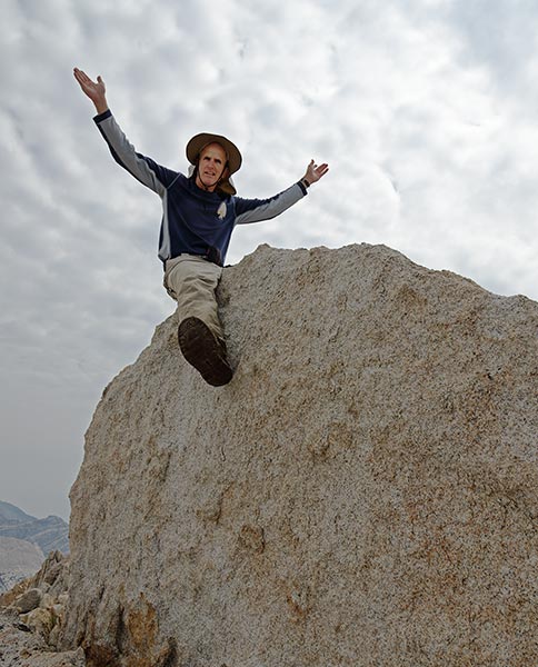
Tom Grundy's 2017 Sierra Challenge Page
Part I
The Sierra Challenge is a loosely organized 10 day series of long day hikes to usually obscure peaks. I have managed to do some or all of it a number of years, as can be seen in these trip reports: 2011, 2012, 2013 (just one big day), 2014, 2015 (7 days). This year I felt less in shape than I had for any of the ones in the past except maybe 2013. At least I didn't get sick the week before it started like I did in 2011. I don't ever expect to be completely ready for the Sierra Challenge and it will always hurt a bit (or a lot), but I had more foreboding this year than normal. Luckily I am good at persevering.
All the details of heights, distances, maps, links to some other trip reports, videos, and so on can be seen on Bob's page here:
Bob Burd's Sierra Challenge 2017 Page
Day 1 (Friday August 4, 2015), Third Recess Peak
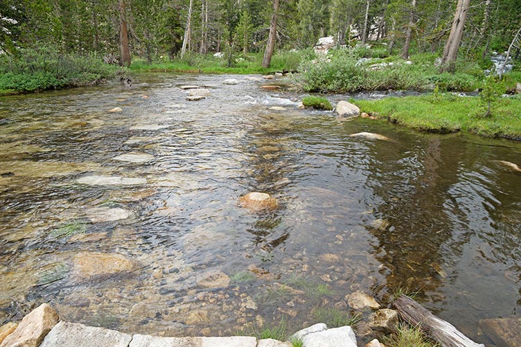
I drove up to the trailhead the night before and it rained hard for many hours that night. Fortunately it stopped before we started that morning. It was nice to meet up with some of the regulars and soon we were off past the pack station and then up a use trail towards Half-Moon pass. Almost immediately we hit a stream crossing. I didn't see any obvious easy way so I cast off on my own stepping on willow clumps. At some point this turned into a fail and I was up to my knees in a channel. Now that my feet were soaked I just splashed across the rest of the way and then headed on up the trail with the rest who crossed quickly (as opposed to those that took their shoes off). We mostly stayed ahead all the way up the pass where the second group caught up with us.
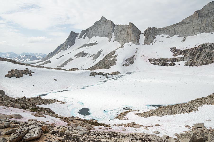
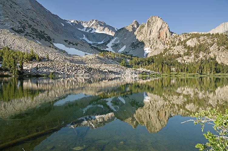
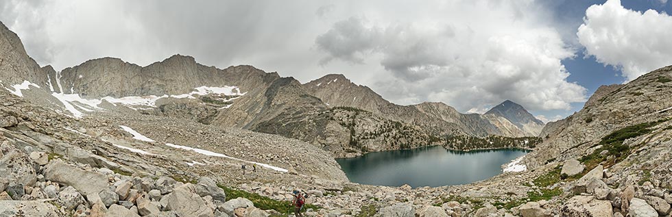
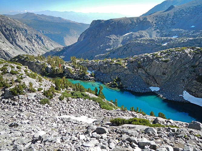
Golden Lake panorama
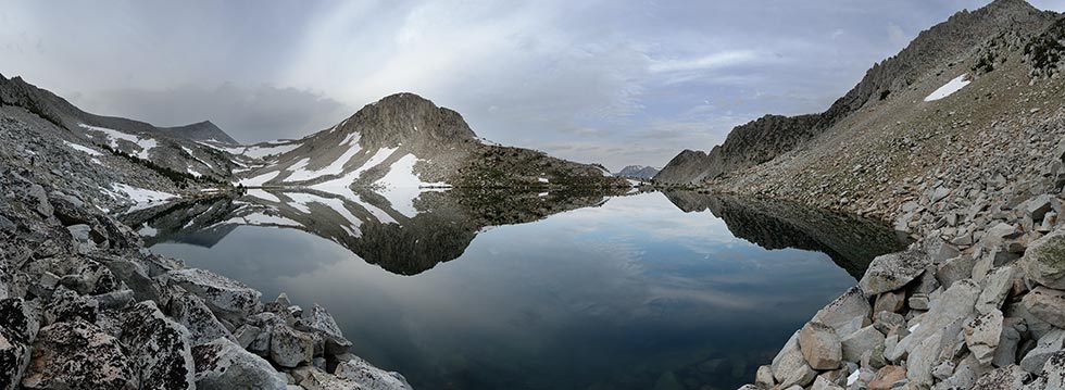 |
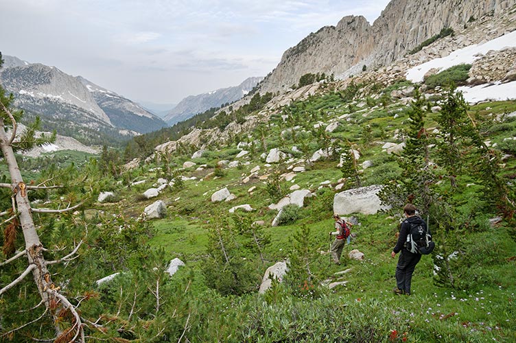
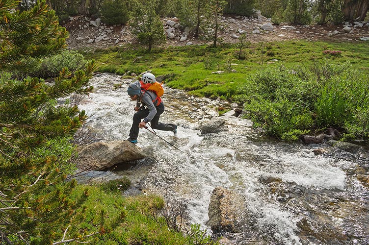
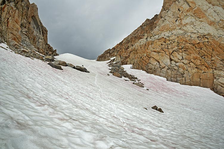
We dropped down and skirted around Golden Lake before descending to join the main trail that goes over Mono Pass. This trail was still pretty wet and continued down with a number of side stream crossings before we had to cross Mono Creek to head up into Third Recess. We looked about for a dry crossing for a bit before I just waded across in my wet shoes. Once again this gained me a bit of time on those that took their shoes off. They caught up again though where we crossed the outlet of Third Recess Lake. Above that we had to start crossing snow. We stopped at a trickle to fill up water before heading up a rock rib and then across more snow and up steep talus to the ridge up to the peak. This is where my energy left me and I just slowly plodded uphill aided greatly by my trekking poles. I think everyone close to me pulled ahead or passed me here. I still made it up to the summit before anyone left. There I was glad to get off my feet and eat a summit cookie or 2. We got quite a crew up there considering how far it was.
Kristine and Jim head down from Golden Lake
 |
Zack Jumps over a stream
 |
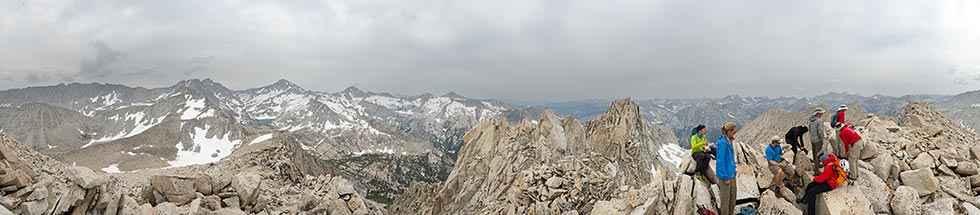
on top of Third Recess Peak
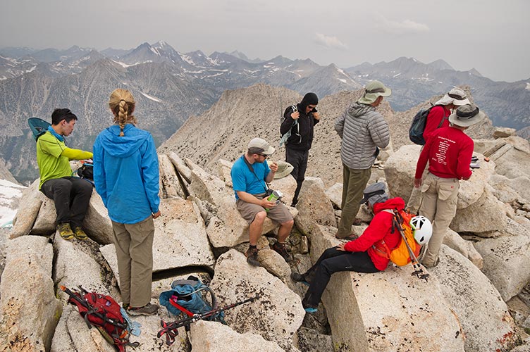 |
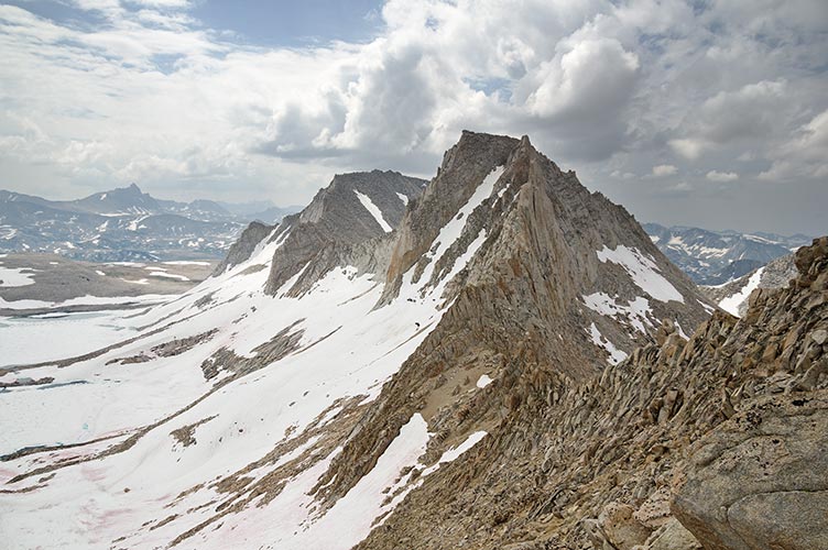
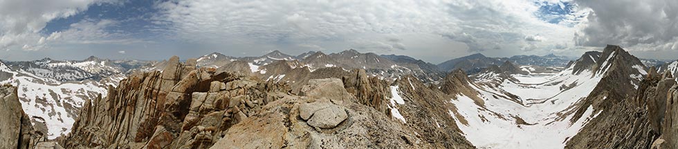
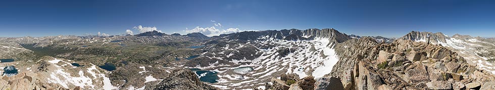
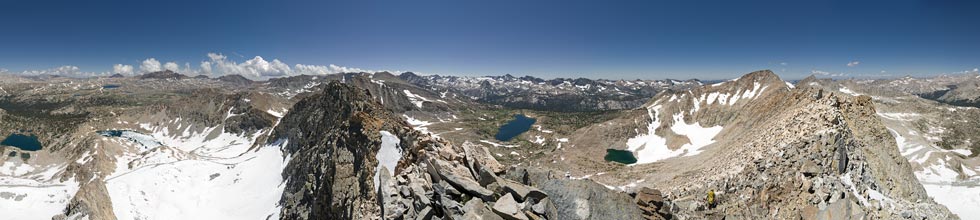
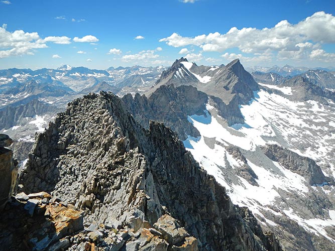
Third Recess Peak summit panorama
 |
I didn't leave with the first group, but didn't linger long either. The descent started off on mostly loose gravel and sand which was quick and fairly pleasant, especially with my Evolv boots and Altra 4-point gaiters. Then we hit a steep snowfield and I gingerly moved onto it before discovering that it was nearly perfect for boot skiing. In fact there was a lot of really good boot skiing on the Challenge this year.
We passed a few people heading up and then I continued on down with some more snow sliding. That didn't last long and soon I was hiking along the trail. Most people were ahead of me but I caught up at the tail end of the stream crossing. This time I took off my boots and waded across. The crossing was ok, but the mosquitoes were pretty vicious while I tried to clean and dry my feet and put the boots back on. Then the plodding on up the trail continued. Matt caught up to me while I was eating a cookie on the pass and we continued down from there. We mostly followed the use trail and I managed to almost keep my feet dry on the stream crossing. Somewhere in there it rained for a bit and I got to test out my new Columbia Titanium Outdry raincoat (it worked). I was also testing out a Columbia Omni-Shade shirt, but it was mostly cloudy all day.
Day 2, Bearpaw Peak
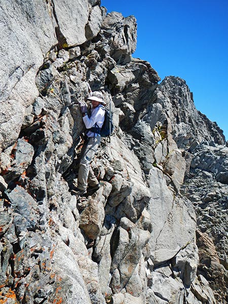
Once again I slept at the trailhead for acclimitization and so I could sleep in as long as possible. Today we headed up the Pine Creek trail. I wore my Altra running shoes and just planned on wading through creeks if I had to. The first Pine Creek crossing was on an underwater log and the second was on a long series of underwater stepping stones. Then we continued on up towards Granite Park. Some people opted for a more direct traverse towards the Royce Lakes, but I opted to stay on the trail a bit longer. This was probably a quicker way since it put us slightly ahead of the main group (we were slightly ahead when we split too, but I was probably slowing down by then). We did have a number of stream crossings before we were just on the snow up to the col to the highest Royce Lake. There we saw the rest of the group coming off of a cornice to get down to and cross (or skirt) the mostly ice covered lake. We diagonalled up to Bearpaw Peak. It had a small summit block but plenty of room just below the summit. Most people left before I did.
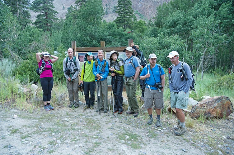
some of the crew at the start
 |
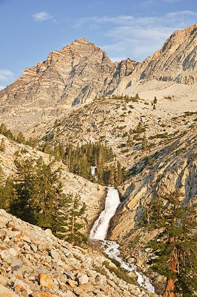
falls and Peppermint Mtn
 |
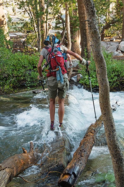
crossing the submerged log
 |
looking down at the upper Royce Lake
you can barely see Bob crossing the lake and others coming down the slope on the left
 |
Feather Peak and Royce behind it with Humphreys to the left
 |
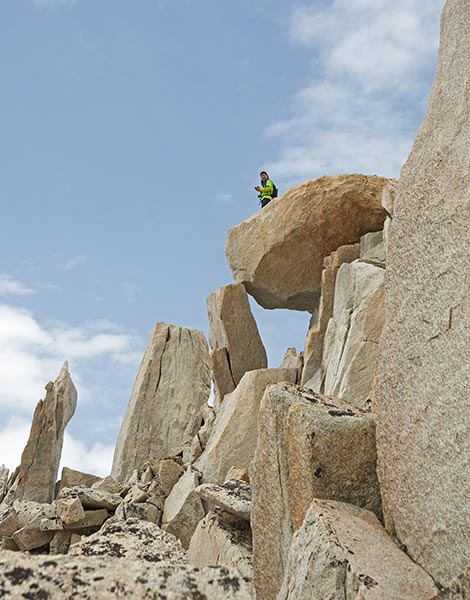
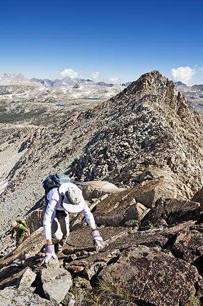
Robert on a not the summit high point
 |
Robert on the summit of Bearpaw
 |
Bob rides the summit of Bearpaw
 |
Mason on the summit of Bearpaw
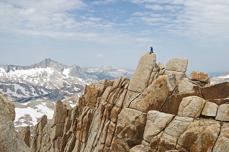 |
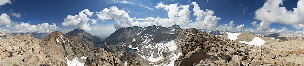
360 degree panorama from near the summit of Bearpaw, the actual summit is to the left and Feather Pk is to the right
 |
I decided to drop off to the North in the hope of making a descent down to Granite Park and a traverse back to the trail. I met a group of backpackers looking over the descent and then headed down it. It was intimidating but I decided to go for it. Steep boot (or running shoe) skiing at its best. I did fall once in a steep part but was able to stop almost immediately. Once into Granite Park I traversed around back to the trail. There I met some people that had seen me going down. They had commented to each other "he either really knows what he is doing or is a complete idiot". I replied "maybe a bit of both".
overcontrasty pic showing my tracks down the snow - it felt a lot steeper than this looks
 |
As usual the trail out seemed to be a whole lot longer. The mosquitoes seemed to come in waves and there was an even better opportunity to test out the raincoat. I tried to maintain an old-man shuffle jog down the trail for a while but couldn't keep it up the whole time. I did make it back before dark.
underwater stepping stones
 |
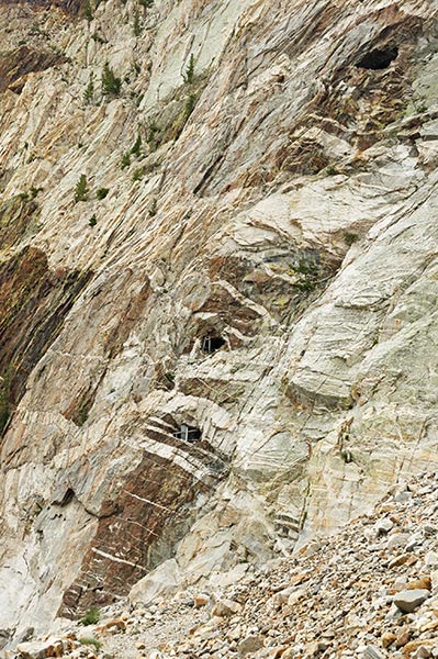
some windows into the Brownstone Mine
 |
Day 3, Four Gables
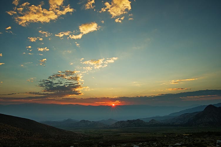
This day was to start from the Horton Lakes trailhead. I didn't think my truck would make it there, so the night before I drove up as far as I could. The road to the Buttermilks was actually pretty awful but the part right after that was recently worked on and much better than it used to be. Then things got not so good. I white-knuckled my way for a while and then finally had a crisis of confidence. It wasn't that a section stopped me so much as there was a flat spot I could get off the road and I really didn't want to have to back down some nasty rocky section or a place with deep ruts that would high center me. So I slept there and then got up an hour earlier to hike up to the trailhead. While I was getting ready I could see a headlamp walking up the road. It turned out to be Robert and we hiked up the road together picking up JD where he had parked for the night. We made it to the trailhead just before 6 but waited a few minutes for Bob and some others to drive up for the official 6:15 start.
sunrise over the White Mountains
 |
This is the only Challenge Peak this year that I had done before, but the previous trip I had come up from Humphreys Basin and I was interested in checking out the upper Horton Lakes and East approach. We powered up the old road/trail to the first Horton Lake. There was a fair bit of brush along the side of the trail and I was glad to have long pants. At the lake we lost the use trail on up the drainage and did a bit of bushwhacking and casting about before we found it again. Sometimes the trail was very well defined and at other times it nearly disappeared. This was a beautiful little valley up to another lake. From there we headed steeply uphill and then cut around a ridge and up a steep slope towards the steep headwall. There are some most impressive cliffs up here. I stopped to put on crampons for a section of steep snow but probably should have just kicked some steps and stuck to the rocks. Then we headed up a steep gully and some scrambling up to the top of the plateau. From there we traversed along the rim to the high point, 4 Gables. It really isn't much of a peak except for the massive cliff down the east face.
looking up to Gable Peak with Bob and Michael
 |
Horton Lake reflection
 |
360 degree panorama from where we first got onto the plateau, the actual 4 Gables summit is to the middle right
 |
Kristine convinced us all to continue around to the South to make a loop for the descent. This involved a bit of elevation gain on a traverse before dropping down again. I tried to stick to descending snow where I could and thus managed to keep up with the group for the most part. It seemed like a much more pleasant descent route than route up. We passed some other people heading up this way. Once again there was some good standing glissading and some lakes that looked inviting but very cold. I was tempted to slide down the snow off a little snow cliff into the water but not that tempted. If I had my drysuit it would have been awesome though.
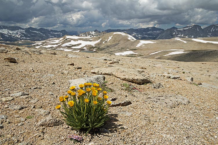
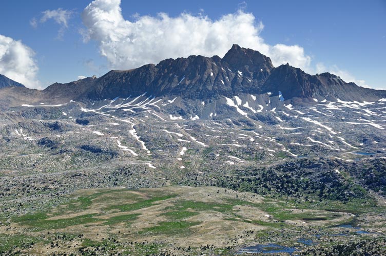
alpine gold flowers and Humphreys Basin
 |
I was intrigued with the idea of penguin slides off the snow slope into the lake
 |
we went up from the upper right snowfield left of the lake
 |
After most of the descending I fell behind on the trail next to the creek and hiked most of the rest of the way out by myself. Fortunately for me they were still waiting for me at the trailhead and gave me a ride back to my truck. This also saved me from the awful idea of hiking down to Grouse Mountain to pick up a bonus peak.
Day 4, Glacier Divide Peak, bonus: Wahoo, extra peak that didn't count: Paine Peak
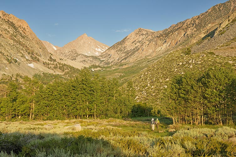
Most of today's participants were heading off to other peaks (mostly Humphreys), but I decided to stick with the program. Bob, Alberto, and I headed up Piute Pass making decent but not great time and then followed the trail that headed towards Snowtongue Col. Rather than heading up the col we went up the NE buttress of Wahoo peak. This had some pretty good scrambling and was a peak I had considered climbing before so it was nice to finally do it. We didn't see the summit register, but later Scott found it. From there we had a nice "sidewalk in the sky" traverse up to Paine Peak on the actual Glacier Divide. Then we traversed West passing some false summits up to the day's peak. We saw a helicopter landing in the basin and later learned that it was part of the search for and rescue of Julia who had gotten lost the day before and spent the night out.
360 degree panorama from Wahoo - Humphreys mid left, Piute Pass center, Snowtongue Col is the saddle on the right above the snow,
the challenge peak is about behind Bob
 |
Mt Humphreys from Wahoo
 |
Bob and Alberto scrambling from Wahoo towards Paine Peak
 |
360 degree panorama from Glacier Divide, south is slightly right of center
 |
I was a little behind them on the descent and I tried to contour around to the East rather than drop down the S side. I got stymied by a steep scary snowfield and dropped down a lot before continuing to the E. We met up again heading up to Snowtongue Pass. On the descent of the pass I saw Scott heading up. Once off the steep rocks of the pass we made good time on the snow. The descent from Piute Pass was tedious as usual but I was able to keep up with Bob. In fact it looked like he was limping a bit on the road back to the parking lot, so maybe that is how I kept up.
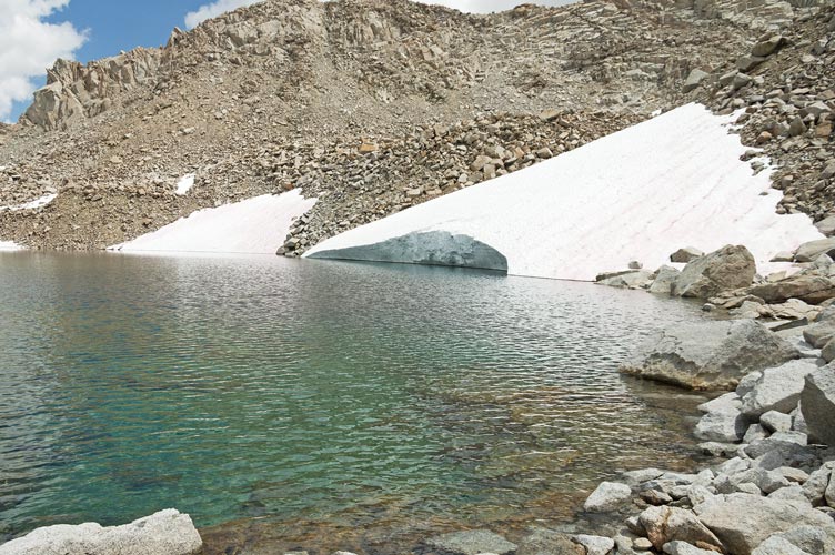
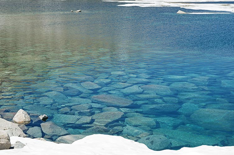
cold blue lake water
 |
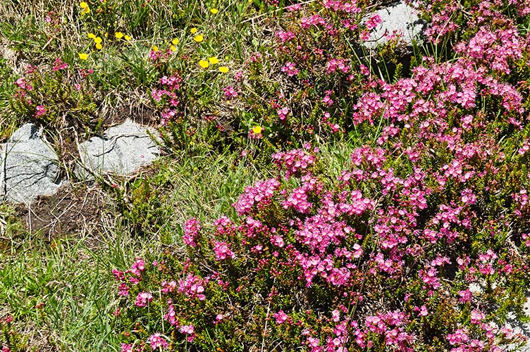
heather flowers
 |
Day 5, Mount Williams, Bonus: Norman Clyde and Firebird Peaks
At the start we were unsure if we would be able to cross the creek so a large number crossed the bridge and bushwhacked up the E side. We met a few who had crossed up higher, so it took about the same time. This trail goes up a lot. I had sort of erased that part from my mind. Also I forgot how beautiful Finger Lake is. Most of the others were going to Middle Pal. I caught up with JD below the scramble up to the Firebird ridge and we weren't very far behind Bob. I got onto the N face of Norman Clyde a little higher than Bob did and eventually caught up to him as the scrambling got a little more technical. We had to cast about for a decent passage but eventually made it to the notch between Clyde and Williams. There was a gendarme in the middle of the notch so we dropped down through a hole and around on the SW side before climbing up to the other side of the notch. From there we traversed out onto the N face of Williams and zigged and zagged ourselves up to what we thought was the top. Until we looked along the ridge and checked the GPS. We weren't very far away but we had to do a descending traverse on a ramp down the SW side and then climb up to the summit. None of it was all that hard, but it wasn't casual either and the route finding and loose rock kept us on our toes.
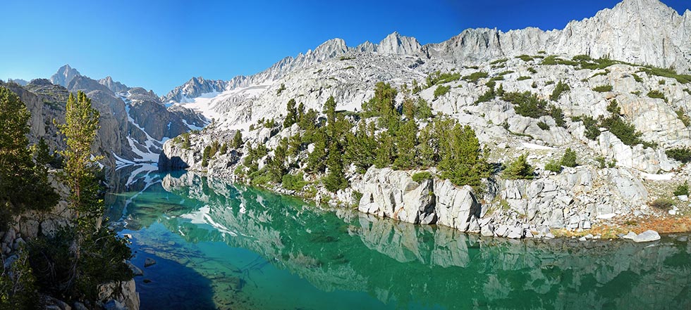
Finger Lake Panorama - the Thumb? on the left, Middle Pal in the middle, right of that Norman Clyde, then Firebird Ridge
 |
looking down at Finger Lake
 |
Bob on the worst part of the "descending traverse"
 |
Bob and "Ally" - college girl who needs tuition
 |
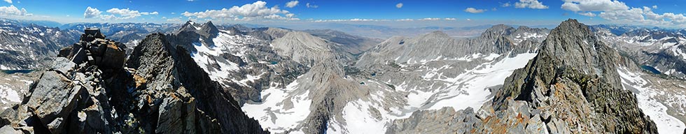
360 degree panorama from the summit of Williams - Norman Clyde on the right, North Pal and Sill on left, Firebird down low in the center
 |
After the usual register signing, summit cookies, and photos we headed back down. We hoped to see a clear path down the SW side to the notch but it wasn't obvious that anything would go. Reluctantly we reversed our path. I left Bob on the Clyde side of the gendarme and started up that mountain. I went up a bit and then traversed higher across the face to the east. Every once in a while I would run across a cairn. I don't know if this meant I was on the best path or not, but I managed to find a way across and then up onto the ridge. From there it was a short traverse to the summit of N Clyde Peak.
looking NW from Norman Clyde
 |
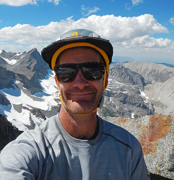
summit selfie on Norman Clyde
 |
The descent was a little more interesting. I didn't want to traverse all the way back to the Williams notch so I was downclimbing new terrain. Mostly this went ok, and once again there were random cairns along the way. Except some of them led to rappel stations, which aren't so useful when you don't have a rope. There was one technical move involving an undercling and some foot smearing. I think everything else was 4th class or easier. Eventually I made it back to where I had traversed out onto the ridge and I knew the worst of the technical route finding and climbing was over. I followed the ridge down and then traversed on up to the Firebird Peak summit. From there I was able to head nearly straight down to rejoin the path I had taken up. On the descent I tried to follow the snow a bit more. I got a little off trail a few times but managed to rejoin it again lower down. There were a few places where downed trees slowed me and the mosquitos attacked. I was trying to get back to the stream crossing before dark since I wasn't excited about doing it by headlamp or bushwhacking along the east side. It wasn't very light when I got to the stream crossing but a little looking around revealed a place I could tip-toe across some little birch logs and then climb into the branches of a tree to get across with dry feet. This sure beat thigh deep wading in icy black water.
looking up at N Clyde and Williams from Firebird Ridge
 |
I managed to hike for a while before needing to pull out my headlamp to confirm where the trail went. Then I started thinking about mountain lions when I saw some deer. I made it back by 8:50 for my longest day on the challenge this year. That night I was up way too late eating, showering, posting pics, and packing for the rest of the challenge. I think I left home after 1 am which didn't leave me much time to get to the Sawmill Pass trailhead and sleep before the 5 am start the next morning.
This report got too long and is taking too long for a single page so when I do finish it part II can be seen here: 2017 Sierra Challenge Part II
No material on this page may be copied or used without permission.