Tom Grundy's 2017 Sierra Challenge Page part II
This is part II of the 2017 Sierra Challenge Trip Report. Part I can be found here: 2017 Sierra Challenge Part I.
All the details of heights, distances, maps, links to some other trip reports, and so on can be seen on Bob's page here:
Bob Burd's Sierra Challenge 2017 Page
As previously reported I didn't get to sleep very early the day before - in fact it would be more accurate to say I got to sleep rather late this morning.
Day 6, Woods Peak
It isn't hard to see how I messed up setting my alarm (for 5:25 instead of 4:25). The upshot was I got a little more sleep, the downshot is I didn't really get time to get my stuff together. I heard people outside my truck and thought that it might be people going for a 4 am start. I checked my watch and was horrified to discover it was 4:40. I quickly got up and threw some food down my throat and got dressed.
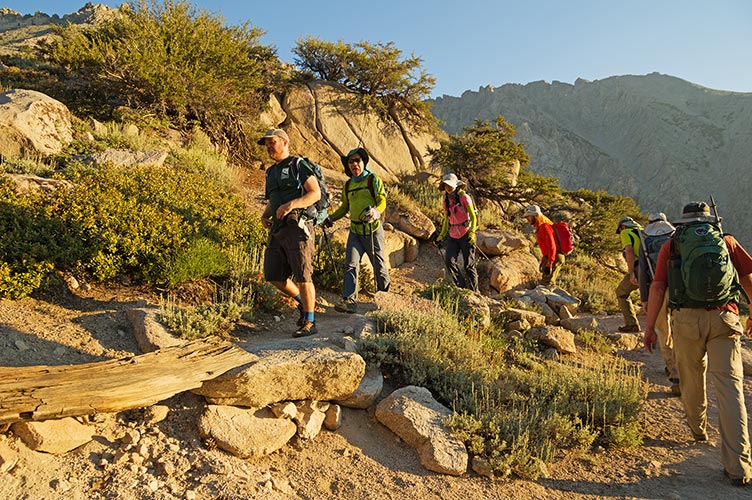
we had an early morning start - Mason, Scott, and Robert
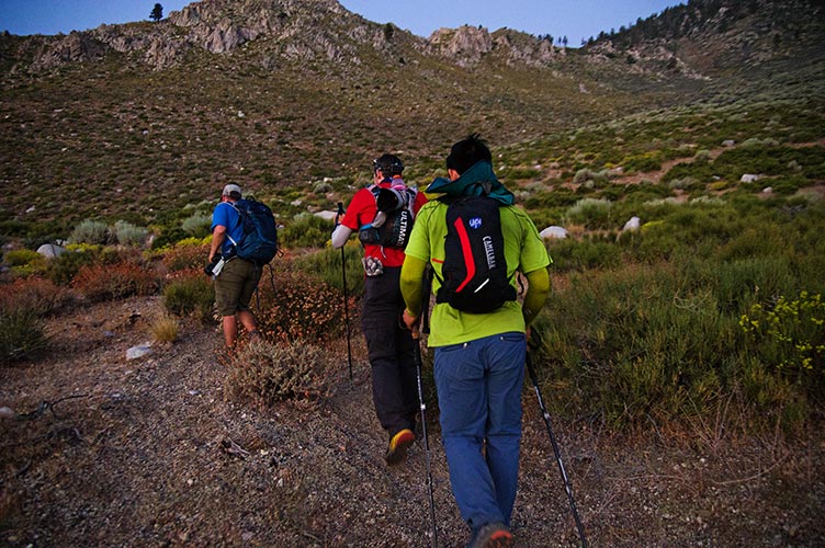 |
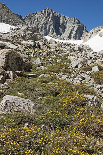
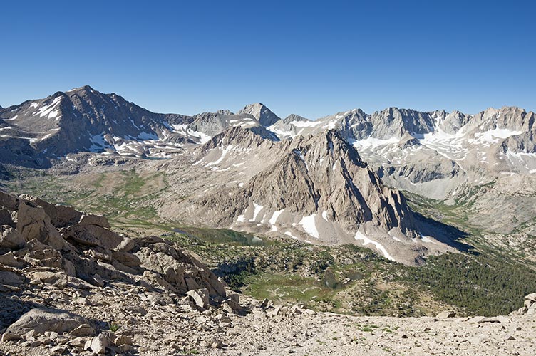
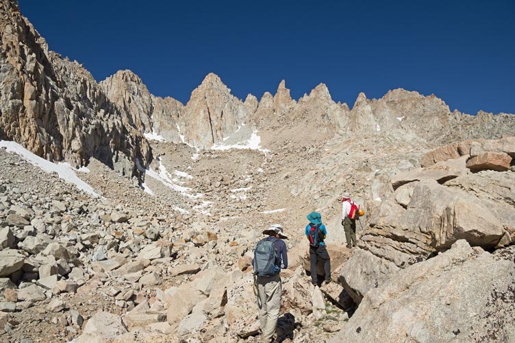
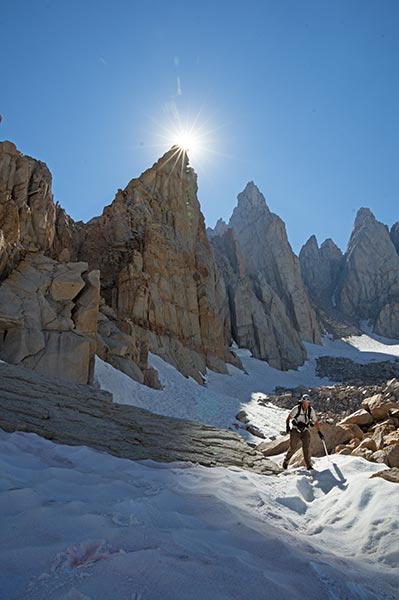
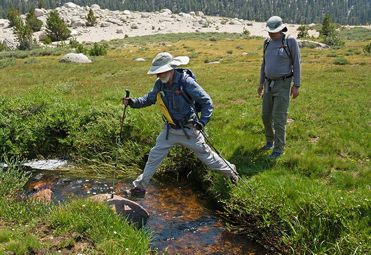
This pass starts very low and at first we were just hiking in the desert before heading up a long sandy switchback slog. At least the sun wasn't up yet. It came up before we got over the ridge into the canyon but not by much. It was nice to get a bit of shade and water as we hiked up and up. Michael and Iris caught up to us and set a brutal pace up the next round of switchbacks. I think we were all sweating by the top. At least soon we were hiking in new terrain for me. We caught up to some others where we would leave the trail and after a short break (where I took off some layers and was almost immediately chilled) we headed on up across the snow and cross country. Lots of talus down into the next drainage south where we went up over that pass and up and down to the base of Woods Peak. There we refilled water and then did a rising traverse up onto the ridge that would take us to the peak. The final bit involved some scrambling, maybe up to 4th class.
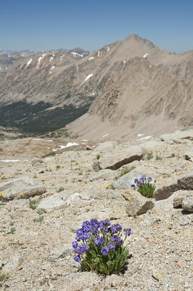
hiking up past some flowers
 |
Michael and Matt near where we crossed over to the west side
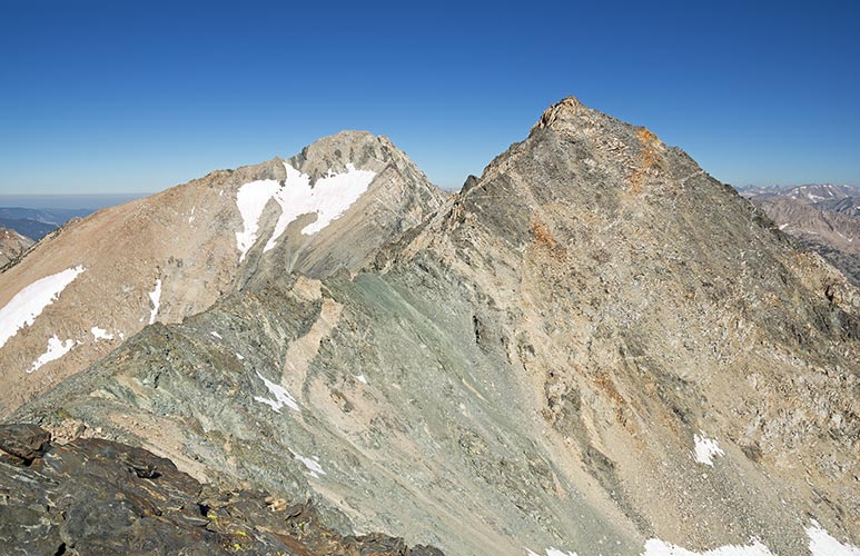
Woods Peak is on the far right
 |
Iris poses and Woods Peak
 |
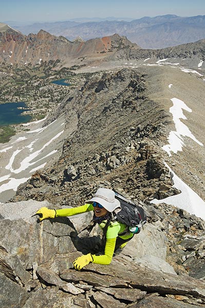
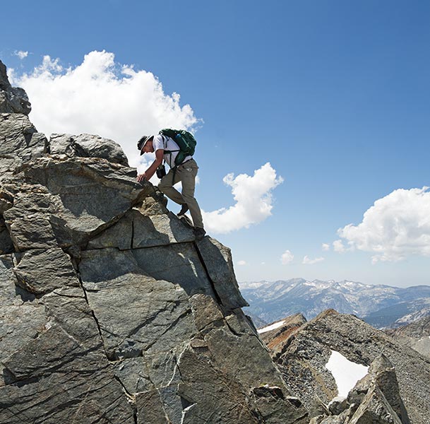
Iris scrambles up the steep ridge
 |
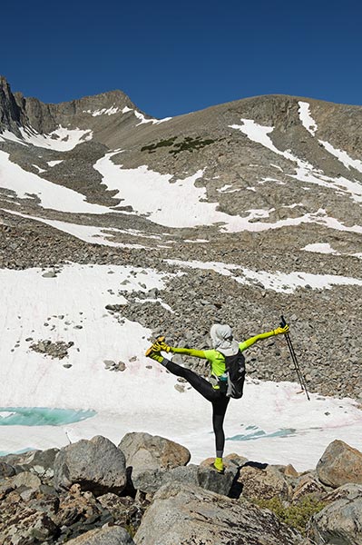
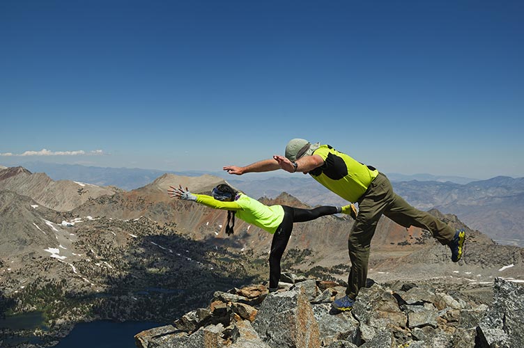
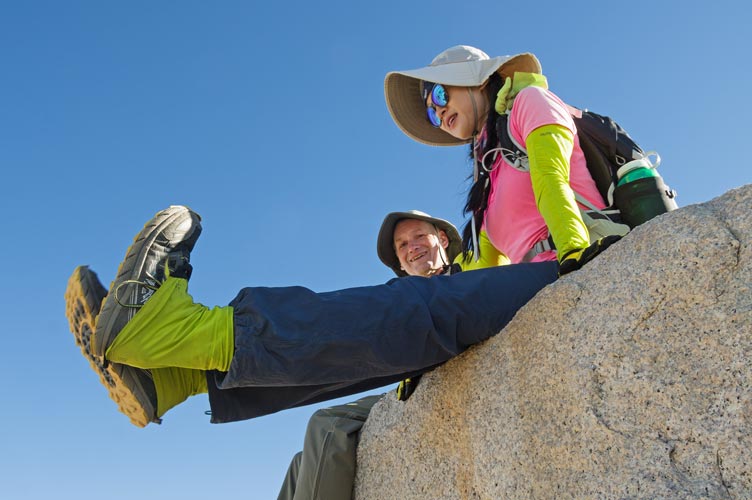
yoga posing on the summit - Iris and Michael
 |
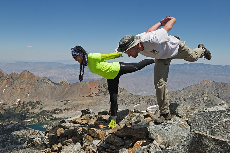
more yoga posing - Iris and Matt
 |
On the summit we enjoyed the views and constructed a summit register. We also did some yoga and acro shenanigans. I tried to do a handstand but my arms and shoulders were just too tired from using the trekking poles to get me up here. We tried to scope a better return path and decided to go for the actual Sawmill Pass. Since I had never been there I was glad to try it out.
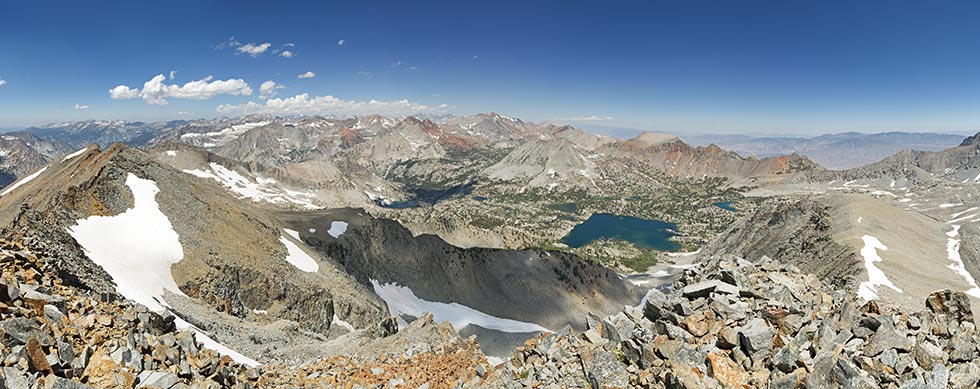
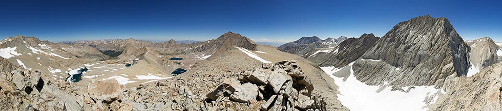
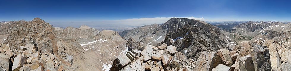
panorama facing southish from the summit
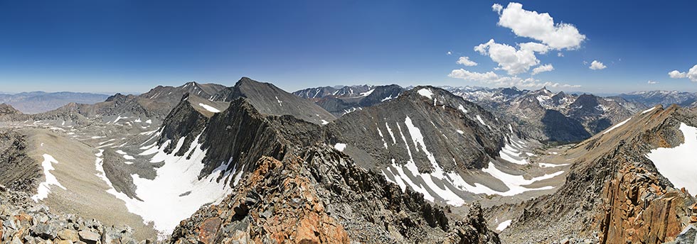 |
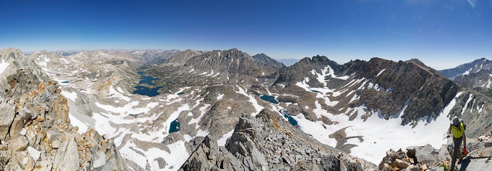
panorama facing northish from the summit - Sawmill Pass goes behind the low ridge on the right
 |
Matt scrambles down
 |
We saw JD and some others as we crossed a talus field. They had already done some peaks and were heading on to another that looked very far away. While crossing the talus I stepped onto a rock like thousands of other steps, except this time my foot slid off and I dropped down onto my chest and then spun off to the base of the rock. Since I was wearing my camera on the Cotton Carrier chest harness that means I landed on my camera. It spread the blow out on my chest, but hit the camera hard. Fortunately the Pentaxes are built like tanks and it seemed to shrug off the blow. I had some scrapes on my shin and bruises but otherwise seemed ok.
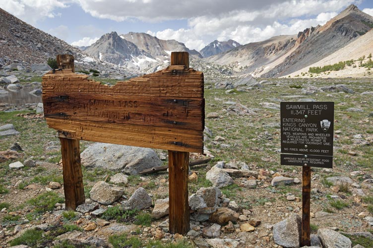
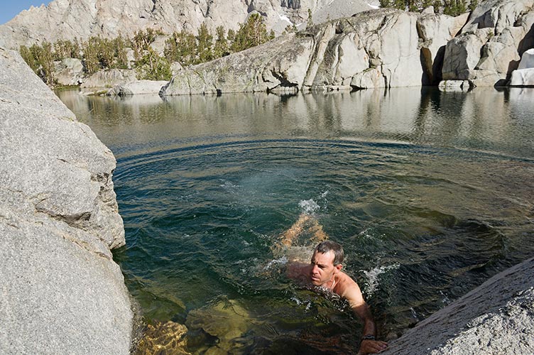
The traverse to the Sawmill Pass trail went fairly well and we didn't have to gain too much elevation before we were dropping down the other side. I tried to slide down snow where I could, but there wasn't all that much of it in the right place. Then we had a long long sloggy descent. As we neared a lake Matt said he was going to jump in and asked if we were interested. It was sort of cold and sort of late so we weren't, but then the sun came out and I decided to join and Iris did too. We quickly stopped and jumped in and out (it was quite bracing) and then redressed for the descent. The very long descent. I managed to keep up with the group which probably cut an hour or more off my time. I could barely keep up with Michael even while he was texting. Finally we made it back just before dark, another long Sierra Challenge day (some 23 miles and 9100 ft of elevation gain).
Sawmill Pass signs
 |
Matt jumps in the lake - sorry if this loads slowly
 |
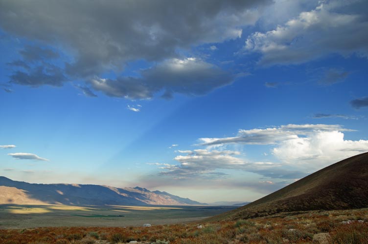
back to the Owens Valley - note stream of smoke to the south
 |
Day 7, Falcor / Snow Crown with bonus peaks Mt Gould and Nameless Pyramid
We started out at Onion Valley. It was cold but we warmed up quickly as we headed uphill and got into the sun. The moon setting over the Sierra was nice to see. I was thinking about climbing Nameless Pyramid first and then back to Kearsarge but it wasn't obvious that would work and looked like a long sketchy traverse back to Kearsarge pass, so I stuck with the plan to go up Gould first and then traverse to Snow Crown. Once again I wasn't feeling very peppy and lagged behind the lead group. They were still at Kearsarge pass when I got there, and by barely stopping I managed to get into the lead group again. I sort of kept up all the way to the summit - of Gould - almost.
some of the crew heading up the Kearsarge Pass trail
 |
Nameless Pyramid and the moon - it looks pretty pyramidish from this side
 |
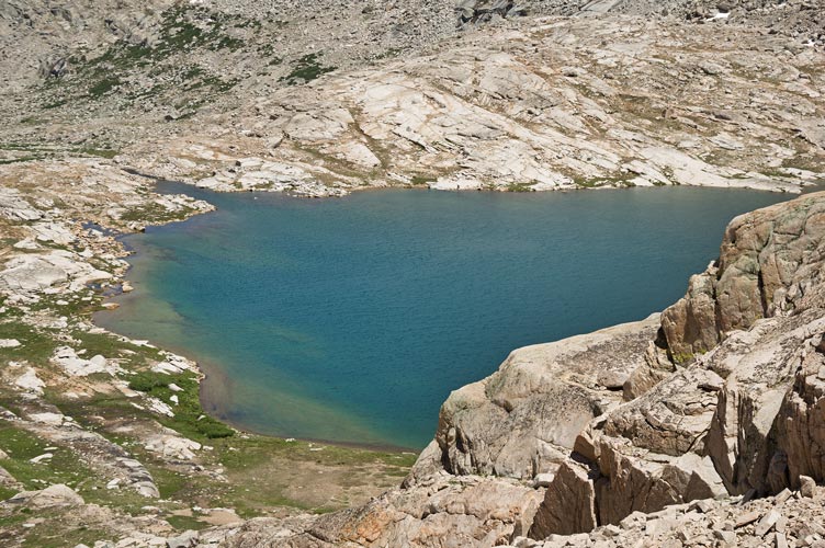
looking down at Pothole Lake with spike-topped Nameless Pyramid on the far side
 |
Michael and Iris on top of Mt Gould
 |
I realized I had made a miscalculation on the amount of water I had and where I could get more. I was up on the ridge without much. I stopped on the flank of Gould to hack some hard snow to put in my water bladder. This set me back a bit but I managed to keep the lead group within sight and then took a slightly better line up Falcor to gain some distance. I was able to get to the 12,828 ft summit while everyone was still up there.
Mount Falcor and Mount Rixford from the ridge from Gould
 |
panorama northish and eastish from Falcor. Rae Lakes is mid left Dragon Pk mid right and Gould right of that
and Nameless, Snow Crown, and University behind Michael
 |
I hoped to traverse back to Kearsarge Pass, but a steep hard snowfield forced me to descend enough that I decided to cut across the basin to the base of the slope up to Nameless Pyramid and head up that. It sort of worked, although it was slow going, especially as I wasn't moving uphill very fast. As I got up higher I could see people collecting on Snow Crown far above me. They were waiting to see how I did on Nameless Pyramid. I zig-zagged up the last series of ramps to the base of the Summit Block and changed into my climbing shoes and left my pack there. Then I headed up the last bit. It was mostly pretty easy with just a few 5.7 slab moves on a steep block about a meter wide - so I could sort of squeeze both sides to increase my grip. Going up wasn't that hard, but I was a bit nervous for the descent. There was a rap station on top and I definitely would have used it if I had a rope. I didn't have a rope. So I carefully backed down off the top and worked my way down to the bigger holds and then the base.
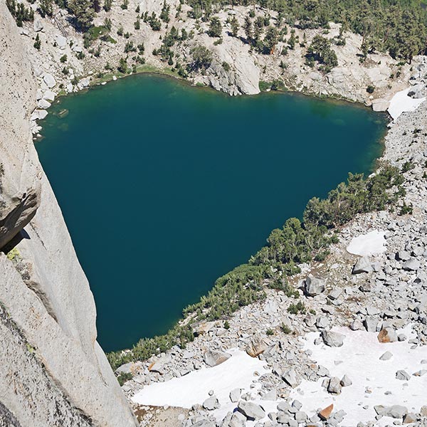
Heart Lake from near the top of Nameless Pyramid
 |
I had to drop down a little and then scramble up to the Snow Crown summit. It wasn't that far but I was moving slowly (and still grabbing snow whenever I got the opportunity). Everyone had left by the time I got up to the summit (there was one spicy bit to get up the last bit from the east). I read the register and ate my summit cookie and took pics. Then downclimbed back to the east and headed down.
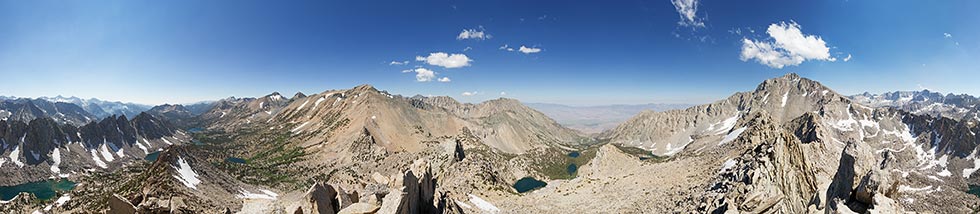
360 panorama from Snow Crown. University Pk is to the right, Onion Valley center right, and Kearsarge Pass and Gould leftish
 |
I walked down the steep summit plateau and then dropped off the side into a mostly decent scree gully with a few bits of ball bearings on steep slab. I was pretty happy that it went all the way down without a cliff and even more so to come across a small trickle of water. Then I got to Bench Lake and stopped to jump in. It was cold but refreshing. I followed the ridge down from the lake to another lake and the main Kearsarge Pass trail. From there I just had to keep moving. I tried to go quickly but that wasn't all that fast although I did almost take a digger passing someone with earphones that was trailblocking me.
Bench Lake was cold and bracing - maybe too bracing
 |
The next day's hike was out of Onion Valley again so I would normally have just stayed up there, but Ken was making barbecue down in Independence, so I drove down the hill. It was nice to get good food, hang out with everyone, and even get a shower. Lots of sleep would have been nice too though.
Day 8, Junction Pass Peak
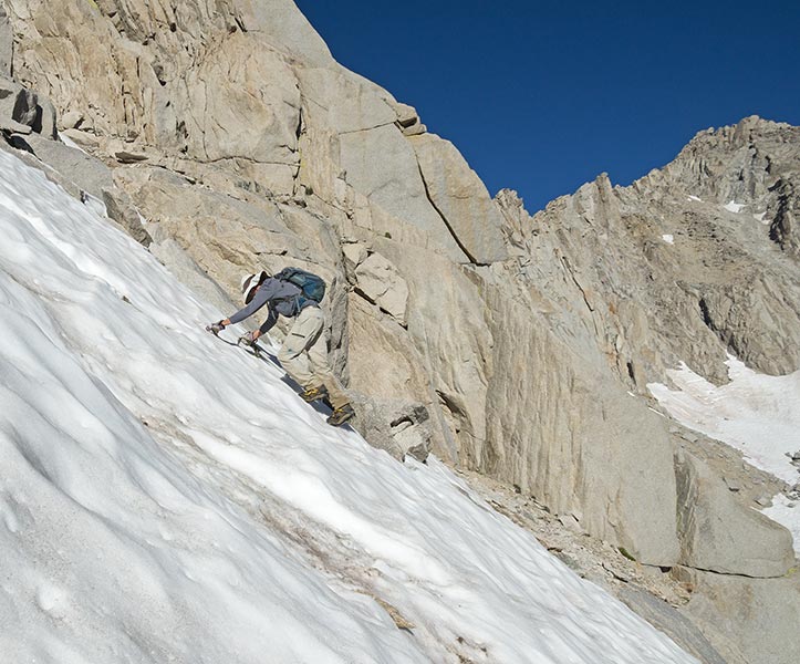
Anytime you go over University "pass" it is a long day. This time we were heading for Junction Pass Peak on the other side of Center Basin. We were all a little concerned with the snow conditions on the north side of the pass too. Michael had started earlier with an ambitious plan and as we approached the pass we could see him getting near the top. Bob stayed on the snow a lot and I tried to stick to the rock as my combination of running shoes and crampons wasn't super secure or comfortable. When I got to the last snowfield I put them on and headed up though. I soon realized that the harder snow was more secure than the surface softened stuff so I kept to the left side where the shade lingered the longest. I was not moving very fast and Bob's fresh legs left me pretty far behind. One advantage of that was I didn't have to worry about knocking things down on him as I started down the loose south side. I still wanted to move fast though so the next person behind me wouldn't send anything down my way.
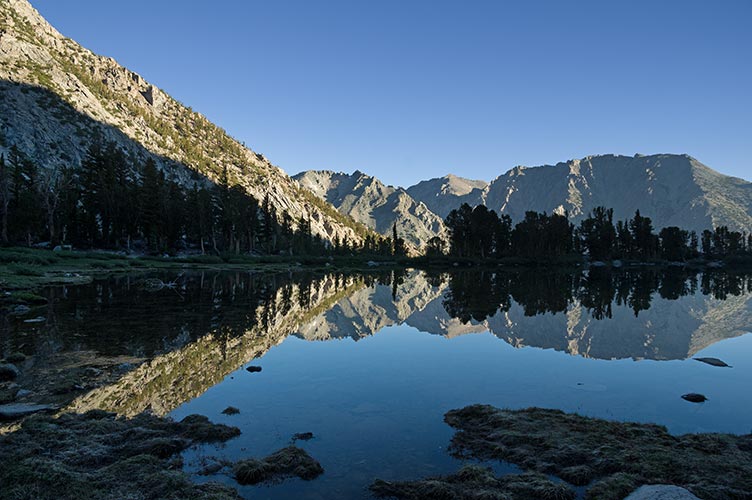
Robinson Lake reflection
 |
University Pass - the dot in the shadow on the snow below the pass is Michael
 |
Bob heading up the snow of University Pass
 |
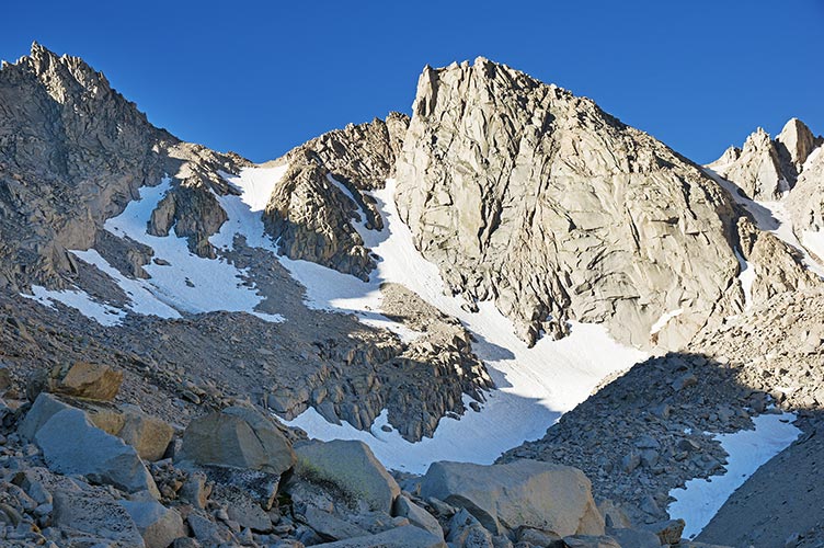
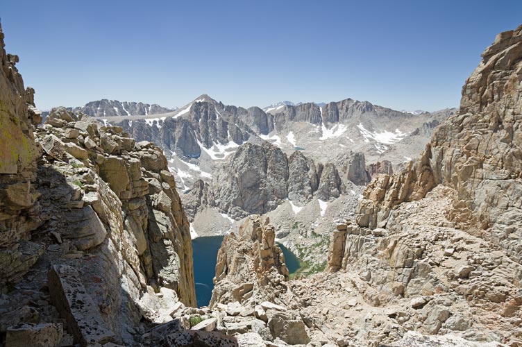
Center Basin from University Pass
Mt Keith on the left, Junction Peak in the center, Junction Pass Peak just down and left of that with 5 snowfields
just above the big snowfield rt of center is Forester Pass, Center Peak is in the middle below the horizon
 |
I cut left near the bottom of the descent and diagonalled down to Center Basin. There I went cross country for a while passing a number of deer and lakes and scenic meadows. Eventually I started seeing the remains of a trail and tried to follow that. I lost it when it cut back up a steep slope and ended up forging my own path (probably following Bob's steps) until I decided to cut back a bit myself to get off the steepest part of the slope. I re-encountered the trail and followed it from there up to Junction Pass. From the pass it was a short distance up to the summit. Looking over at Junction Peak I am not surprised I didn't see an easy descent on this side back when I did it.
sky pilot or polemonium flowers near the summit
 |
360 panorama from Junction Pass Peak- The PCT comes over Forester Pass and down the valley on the left,
Mt Keith is in the Center and Junction Pk on the right
 |
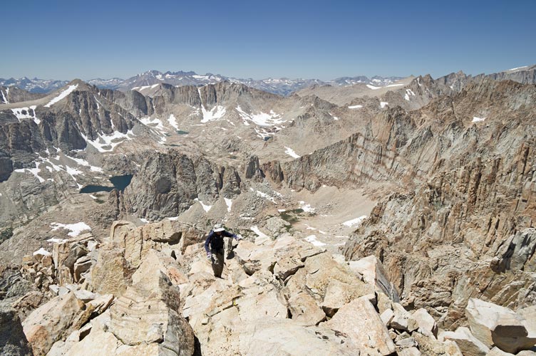
I didn't spend much time on the summit. I did a better job on the return of staying on the trail and passed Matt on his way up. I stopped for a cold and bracing dip in a lake and then continued back to slowly slog up on the east side of the scree gulley to University Pass. I was really feeling the days and miles and feet of elevation. The descent was a little exciting because the snow was soft enough that the crampons didn't really get much grip but steep enough that a slide would be unpleasant. I carefully worked my way down to a place with a decent runout, then I running-shoe skied down to the rocks. I tried to stay on the snow for most of the talus field and for any descent that wasn't too steep and had a survivable runout. This probably saved me some time. I even jogged a bit once I was back on the trail. I still didn't make it back to the truck 'til 7:15. Then I went down to Independence to be social and get a shower and then on to the next trailhead and some more food.
I jumped in this lake
 |
Day 9, Sharktooth Peak with bonus Tuttle Pass Peak and Middle Tooth
This was another trailhead I couldn't get to with my truck. I did make it most of the way with a bit of momentum up the sandy road. I parked next to JD and Robert and planned to hike or get a ride in the morning.
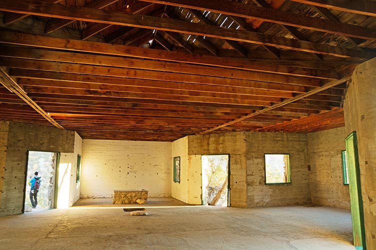
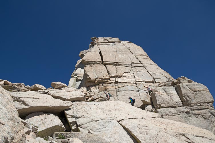
We were almost packed and ready to start walking when Bob and Michael drove up. We were happy to get a ride. The trail started on the old road up to a stone building - previously an ashram? It was steep and the pace was not slow. We stopped briefly to check out the building and then continued on up and up and up. There is an awful lot of rock up here for anyone willing to hike in. The trail tried to hide but usually someone found it or a cairn pretty soon. Soon after Alberto turned off to go up Langley the rest of us went up a steep side valley next to a waterfall. This involved some scrambling and lots of scenery. Then we got into a rather extensive talus field. That was somewhat unpleasant. Finally we got to the snowfield up to the couloir we planned to head up. It looked pretty gnarly with a big bergschrund and steep snow and rock. There didn't look like much alternative either.
JD and morning light on the cliffs as we start out
 |
there is a lot of rock up here for climbers willing to hike for it
 |
inside the ashram
 |
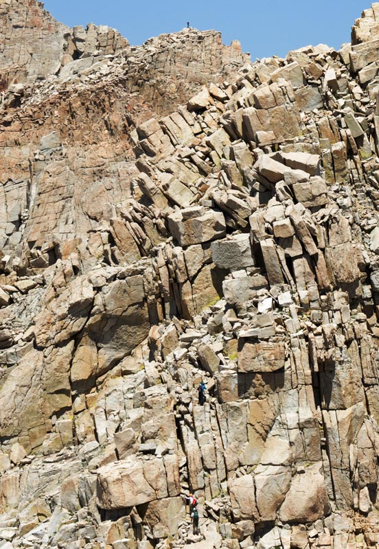
Bob, Robert, and JD contemplate the talus ahead
sharktooth has the step on the right side and we went up the snowy gulch 4 notches to the left
 |
Bob heads up towards our couloir amid spectacular scenery
 |
The others put on crampons but I just kicked a few steps and then bypassed the 'schrund on some rocks. I mostly stayed on the rocks to avoid the steep snow and putting on my crampons. There were no stopper moves going up the couloir but it was pretty continuous heads up travel especially trying not to send anything down on those below. Bob and I got to the top quite a bit ahead of the others and headed off south to climb a bonus peak (we called "Tuttle Pass Peak"). This was a little more involved than we thought with lots of traverses to link it all together. The summit register didn't have a lot of entries. One was Peter Croft who had traversed all the way from Lone Pine Peak. We could see the others heading up the bonus peak to our north (we called "Middle Tooth") and we headed that way.
looking back from near the base of the couloir you can see how far we came up and 3 little hikers coming across the snow
 |
Bob plotting a way up the couloir
 |
Bob taking pics on top of Tuttle Pass Peak
 |
360 panorama from the top of Tuttle Pass Peak. There is a fire behind Langley
 |
we retraced our path and then headed up the next peak. This had a lot more scrambling, mostly 3rd class with a few bits of fourth and maybe a move or 2 of fifth class if you were too lazy to backtrack to find the path of least resistance. I tried to scramble quickly and didn't take any pics on the way up. By the time we got up to the top of what we called "Middle Tooth" Robert, JD, and Matt were working their way down towards the notch before Sharkstooth. We didn't spend much time on the summit and soon followed them. We had to drop down to the west quite a bit to get down into the gully. Then we followed a ledge around the next ridge and to another gully to head up. We went up here but the others had traversed another notch to the north. I think our path was better since we got to the top only right behind them.
Michael on top of Corcoran and Robert, JD, and Matt below him climbing up middle tooth (all dots at this scale).
 |
zoomed in a bit more to possibly show Michael on top of Corcoran and Robert, JD, and Matt below him climbing up middle tooth
 |
Bob coming up the last bit to the summit of Middle Tooth
 |
we climbed down into this couloir and then traversed around the right rib
 |
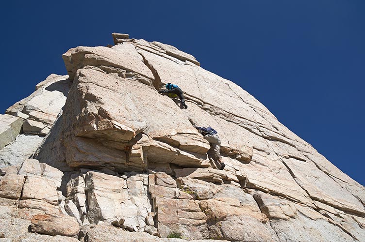
Sharkstooth was supposed to be 4th class, but we looked around and didn't see anything that looked that easy. JD explored up a handcrack a bit but it did not go all the way up. Eventually after finding nothing else I headed up a crack system that looked like it would go. First it was off-widthy (but low angle with lots of knobs - some of which I was able to break off), then it went into a nice squeeze chimney. Exiting the chimney was probably the crux. Then there was a delicate ledge traverse around the corner to a short crack in a corner and another traverse to a few face and crack moves to the top. I was wearing my boots, so that effects how it felt. I am guessing somewhere around 5.6. Bob, Robert, and JD were following me up but JD backed off. Matt was happy to video from the base, although he was hoping he wouldn't get any footage of falling. Unfortunately Bob forgot to bring up one of his summit registers so we just took a few pics and then headed carefully back down. Some parts were easier (like the squeeze chimney) but others were less secure feeling.
the top of Sharktooth was intimidating. JD tried the right crack but we eventually went up the left crack/chimney
 |
Robert and Bob follow me down (I had already made it back to my camera)
 |
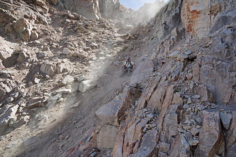
From the top I had scoped the descent gully to the north and I was pretty sure it went all the way down to the snowfield. It looked ugly, but it looked like it would go. JD and Robert wanted to continue on up to Corcoran and the rest of us started down this scree-talus gully. We took turns moving as it was nearly impossible to not send down a rain of rocks and gravel. Some larger than bowling balls. Fortunately there were sheltered places to wait out the rock-rain. We were all very glad to get back to the snow. I skied a good bit of it. Here we saw Michael's footprints (he had gone up Corcoran) and we mostly followed them as long as there was snow. Matt stopped to jump in a very cold pool and Bob and I continued down and across the waterfall hoping for a nice long sandy descent. It was a long descent but mostly rocky instead of sandy. Still I think it was quicker. Then we did our best to stay on the trail and move quickly. When we finally were able to see the trailhead and see Michael waiting Bob started running. My Evolv Maximus boots are good on rock and snow, but they are not good for running, especially with a pack and the state I was in. Still I was only a few seconds behind Bob when we got back. It was nice to have a ride back to my truck and a relief to get through what was one of the hardest days in terms of large amounts of elevation and technical travel. It also pretty much insured my getting the yellow jersey since I was the only one who had climbed all this year's challenge peaks and Mason was 1/2 a peak behind in terms of total challenge peaks (he had done some alternatives from previous years including one of the 2 out of Sawmill pass for 1/2 a point).
we took turns moving down the loose gully to avoid getting hit by rocks
 |
Matt descending from the ridge
 |
Day 10, Ash Meadow Peak, Bonus Trail Peak or Peak 10,820
I had hoped to get up to the start in the daylight and also planned to take some night photos. Instead I got up here later and just ate some food and went to bed. I was tired.
Todays outing was mostly just a long distance without any technical scrambling or great elevation gains. Fortunately the fire south of here was not nearly as large as it had been the day before and the wind wasn't blowing our way. We cut cross country to a trail and then followed it to the junction with the PCT and then followed that until it was nearly to our peak. Then we cut up the slope and were there. Matt and Jim Burd beat us by missing the PCT cutoff and heading down the hill and across the valley. This added elevation loss and gain but cut out a lot of distance as the trail made a big loop. A number of us opted to continue a bit farther for a bonus peak - Trail Peak - or maybe it is Ash Meadow East - or Peak 10,820. This was another fairly small bump along the ridge but it had a satisfying little rocky top.
Then we all headed back along the trail to the trailhead. Back there we had a pile of calories and drinks to work through. Yum. Thanks guys. I set up my slackline and everyone got a chance to try that. Then it was time for the drive back to Bishop and a much needed shower, bed, and lots of rest. Once again I was very glad to only be driving back to Bishop and not way down south or over to the west side.
I think most of us took pics of this lone tree
 |
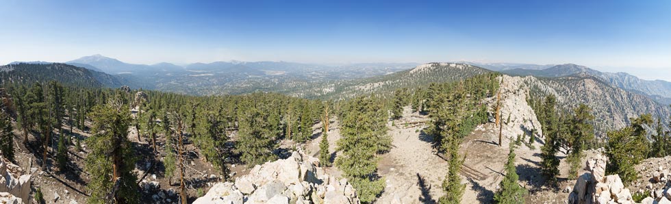
panorama looking S through W to N from peak 10,820 it really is different terrain compared to the day before
 |
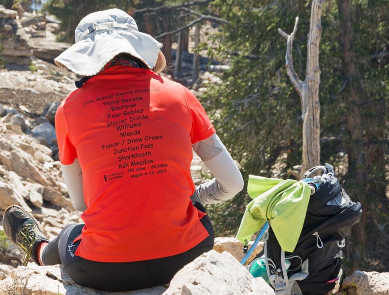
Iris models the list of peaks for the 2017 Sierra Challenge
 |
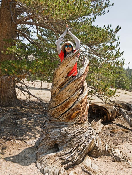
Iris tree poses in a tree skeleton
 |
Jim crosses the last little creek on the return under Michael's watchful eye
 |
Bob takes a well deserved rest after getting back
 |
This year I ended up with the Yellow Jersey (and a distant second place for king of the mountain Polka Dot Jersey with 19 peaks). I add it to my collection of virtual jerseys with the Polka Dot Jersey from 2011. Congratulations to Scott Barnes for the Polka Dot Jersey, Michael Graupe for the Green, and Zachary Moon for the White, and Matt Yaussi for the Blue (most lakes jumped into) and everyone who even tried to take part in this most excellent suffering. Thanks again to Bob Burd for making this happen.
Gear and Strategy
I had more of a mix of gear this year. I wore long pants many of the days, this helped for mosquitos and bushwhacking and I could mostly just pull them up for stream crossings. I usually started off with arm warmers which are nice because you can just pull them down as you heat up. For shoes I had a mix - 2 pairs of altra running shoes - one waterproof, one not. I tried to match them to the expected hiking - waterproof for snow, the others for dry conditions or when I knew I'd be wading. The altra 4-point gaiters worked great until I broke them - they really aren't made for thousands of feet of scree and talus descending. I also had some Evolv Maximus boots. Both pairs had delamination issues so I saved them for days I expected to need to kick steps and climb rocks. The Leki trekking poles were key in keeping me moving as well as making the boot skiing much easier and more pleasant and stream crossing safer. I could easily fold them up and stow them in my pack for full on climbing. I had a very nice lightweight Columbia raincoat and I also tested out a Columbia Omni-shade cooling t-short some of the days. It was nice to be able to just grab a dry backpack when one got soaked in the rain (I used a Macpac bag and a CAMP one). I also carried an old spot-tracker so that if I didn't return people would have an idea of where I was. I probably didn't do as good a job of putting sun screen on as I should have but unless it was dark or I was wearing my helmet I had my Tilley hat on and I always kept a tube of Joshua Tree lip sunscreen handy. Taking a headlamp along was a must, although I only really needed it 2 days this year.
I carried my pentax k-3 dslr camera with 16-50 lens for most of these days and it is a bit of a brick. I usually had it strapped to my chest with a cotton carrier harness. This made it possible to access it quickly whenever I wanted to take a photo. I did have to move it for serious rock climbing though and usually stowed it in my pack once it got dark. I only took a small waterproof point and shoot for the Williams Peak day. It was nice to travel lighter and more compact, but I missed it for a few photo opportunities.
For food I had a mix of sandwiches and various bars and gels and so on as well as summit cookies. I probably should have made a better effort to bring more real food on the trips, especially over the first few days when I was going home every night. I tried to down a protein shake when I got back to the trailhead but otherwise I had some pretty poor dinners some nights.
I definitely should have done a bit more training ahead of time. That is always the case, but it seemed worse this year. I also should have made a better effort to get more sleep. (for instance more planning and packing before the start of the challenge would have helped). On a day to day basis I mostly tried to just keep up with the lead group up the main challenge peak. Then if I felt ok I'd maybe do some bonus peaks. I also tried to keep up with people for some of the descents. I am not naturally that fast of a hiker over level ground or on descents so this was both hard and saved a lot of time.
No material on this page may be copied or used without permission.