I particapated in the Sierra Challenge again this year. I also did it last year in 2011. This year felt harder. It will take me ages to post up pictures and stories - it is a bit daunting. I think I will just start with day 1 and see how far I can get before I burn out.
I am sick of messing with this, so I'll post it - 9/5/12. I am sure there are mistakes and things I left out, not to mention heaps of pics - oh well, that's all for now.
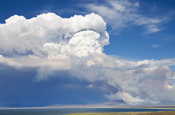
Things really started the night before when I drove up to the Bridgeport/Twin Lakes area. On the way I stopped to take pics and try to take some time-lapse pics of the a wildfire and the resulting clouds on the other side of Mono Lake. After Bridgeport I had to find a camping spot. Unfortunately with all of the concession campgrounds in the area the forest service has closed off most camping. I was tempted to camp in front of the "no camping behind this sign" signs, but instead I found a sweet spot and crashed.
| |
|---|
 |
|---|
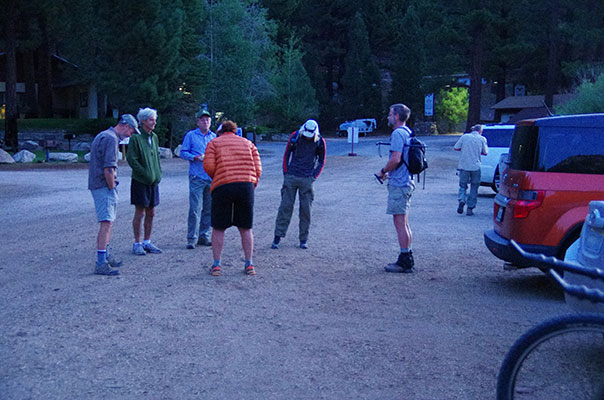
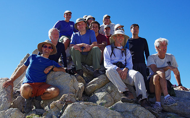
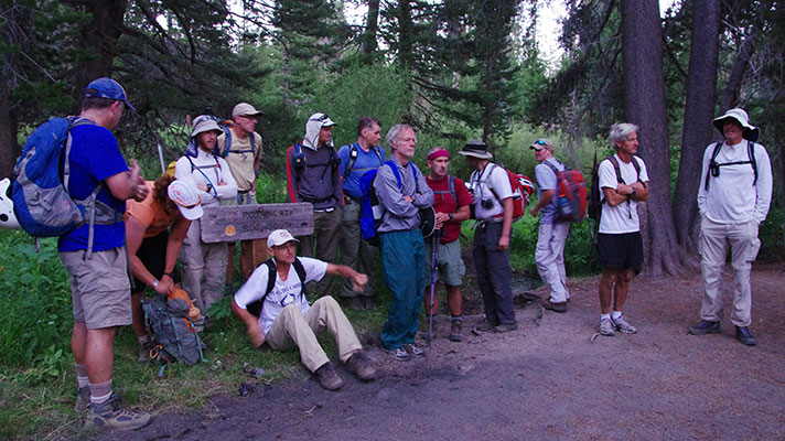
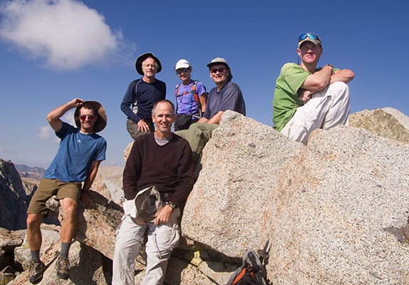
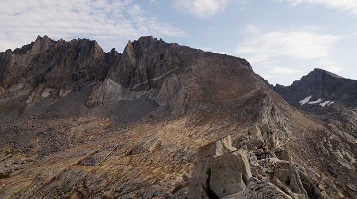
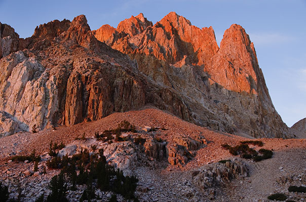
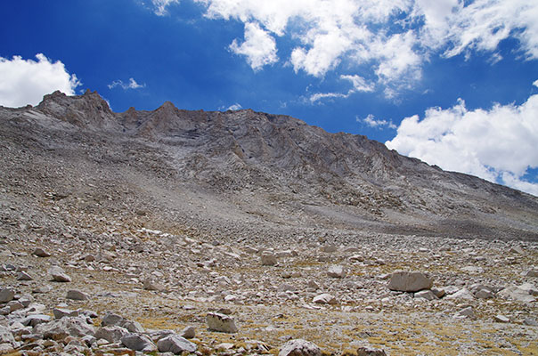
I drove up to the Twin Lakes parking and finished my last minute packing and said hello to lots of folks from last years challenge. Soon enough Bob was calling time - we took a group photo and then started off. We cut through the campground and then almost immediately started bushwhacking up a drainage. Mostly we were following a use (or animal?) trail. At one point a group of us got stuck in a bit of alder hell though. Luckily it was short lived. Groups kept joining and splitting as people chose various routes or stopped for water or food. I followed Bob up a long talus field almost straight up towards the summit of Eocene instead of the less steep and more consolidated ramp others took. Still, it wasn't too bad and it was good to get used to this sort of ascent.
 |
|---|
 |
|---|
 |
|---|
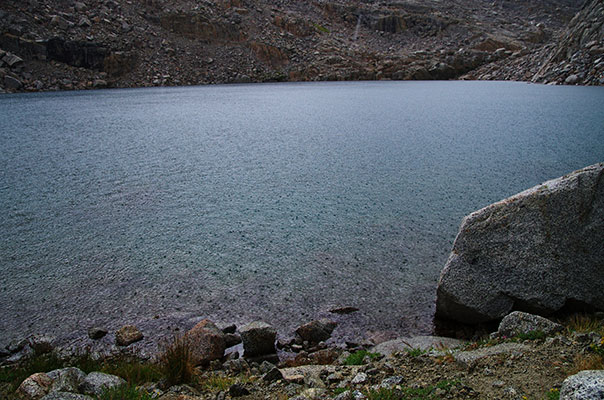
There were a number of people on the summit. Most opted to head down to the west to go back via a different route. Instead of dropping down the more gentle ridge we went straight down the steep part. This was a bit sketchy with so many people on a rather loose steep slope, but nobody got nailed with falling rock. I cut off a bit left near the bottom which might have had a bit more scrambling. From there we dropped down to a lake. Some people headed back from here and others (including me) headed up towards Kettle Peak. We were able to skirt the large sandy slope near the top going up and an enjoyable scramble took us to the summit. The Incredible Hulk looked less impressive from above, but still a nice chunk of rock. On the descent we were able to plunge step down the sand for a while. Bob and Jonathon took a shortcut to the North of the lake while Michael and I headed to the safer S. side. There we met up with Laura, Tom, and Karl for some of the hike out. After passing below the impressive face of the Hulk the trail deteriorated down the slope before rejoining the trail we had used on day 1 last year in the valley. This trail was just as long and tedious as I remembered but soon enough we were through the campground and back to the cars.
 |
|---|
 |
|---|
 |
|---|
There were still plenty of people back at the trailhead and more trickling in. I waded into the lake with my clothes on to de-salinate and cool off and then sat around talking for a while before heading to the Whoa Nellie Deli at the Mobil to continue sitting around talking and now eating. Then I drove to the Minaret Vista to join others in sleeping high (9,000 ft).
spot track for 2012 Sierra Challenge - day 1 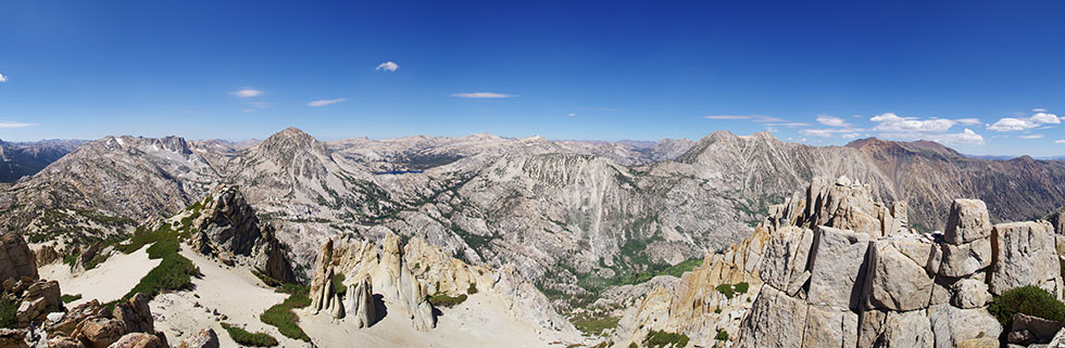 |
|---|
 |
|---|
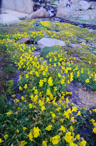
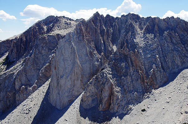
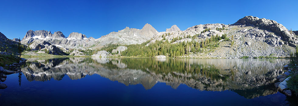
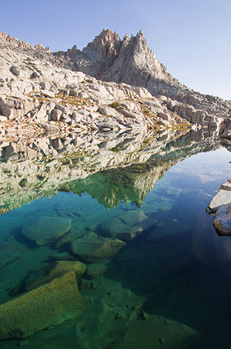
Hiking from the Agnew Meadow trailhead we quickly passed a large number of downed trees and then down the dusty trail. Once it turned and started up towards Shadow Lake things got nicer. Of course I had to stop to take some pics at the lake and then rush to try to catch up. From Ediza Lake we headed up a gully towards the south side of Leonard Minaret. Sean was already high on the Minaret, but not on the summit. We picked a likely route and headed up. Some of the others were trying a more direct route but were turned back - the advantage of not being in the lead let me cut right and up above them. A lot of the rock ledges sloped down towards space. Without a decent hold it was sort of sketchy and the possibility of a large mass of rocks sliding down on this plane kept me thinking light thoughts. There was a nice hand rail arete to traverse up to the summit where Sean was eating canned seafood. We were joined on the summit by Jonathon, Bob, Michael, Adam, and later Kevin T who came up from the north. Ron made it to the base as we were coming down but didn't summit.
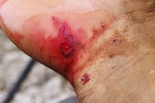
After descending Leonard Minaret, Sean and I headed up towards Turner Minaret. First I used a caveman ice-axe (sharp rock) on a traverse across a small but steepish snowfield and then almost straight up the face. It kept getting steeper but good jugs (big holds - like jug handles) led us onward. It wasn't particularly hard climbing, but we both agreed we weren't looking forward to downclimbing it. I was planning on putting on my climbing shoes. From the summit of Turner we traversed down on the west side towards the col with Jensen Minaret. At one point during this traverse my foothold (a rock about the size of a cinder block) blew off of the wall dropping me. Luckily I had a good handhold with my left hand at the back of a arm width block. This meant as I dropped onto it I scraped up my arm just below my armpit - an injury which was to continue to be annoying for the rest of the challenge whenever my pack straps scraped it - especially when I was sweating. However since the alternative was probably dying I was ok with getting the scrape. From the notch the climbing up Jensen was mostly 3rd and 4th class with a few more spicy 5th class moves with lots of exposure. We descended back to the notch and from there descended down the east side and headed north as we descended. It was probably no harder than 4th class and mostly 3rd. We were very relieved not to have to descend the way we went up. From there we made good time (translation - I made good time and Sean went rather slowly) back past iceberg? lake and down to Lake Ediza. On an engineered log crossing my walking stick stuck between 2 logs and was wrenched out of my hand - then it fell into the river/stream. It rotated in an eddy a few times before heading downstream where Sean was able to pluck it out.
Somewhere by Shadow Lake we ran into Pat and Kevin P who had climbed Banner (I think). Soon it began to rain but it was somewhat welcome as it cut the heat and the dust on the trail.
 |
|---|
According to Bob, just climbing Leonard was 18 miles and 4500 feet of elevation gain.
spot track for 2012 Sierra Challenge - day 2That night I got a fresh veggie spaghetti dinner and a shower in Bishop as well as a supply of green bean cookies (thanks Julie) before heading rather tiredly up to North Lake.
As we started from the parking area down the road towards the actual trailhead (blocked by another campground) I noticed that everyone else was carrying an ice axe. oops. I ran back for my axe and rummaged around in the truck 'til I found my "snow tool" then I hurried back. By now I was hopelessly behind and I hammered up the trail to catch up. After a mile or so I started passing people. I finally caught the lead group when they returned to the trail from a wrong turn. Despite catching the leaders, I was unable to actually keep up with them but I did make decent time to Lamarck pass. I dropped down the far side with Michael, Tommey, Jonathan, and Adam. Adam and Jonathon headed to Mt Mendel while the rest of us headed towards Mt. S.J. Gould.
 |
|---|
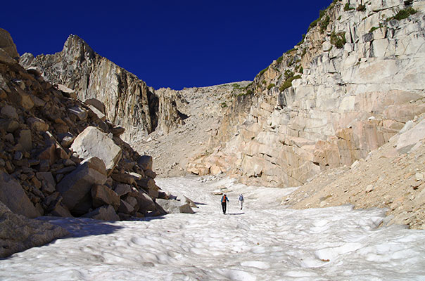
The talus was uneventful but crossing the bottom of the glacier was sort of cool with various meltwater channels and rocks on pedestals. I also saw a few pieces of some sort of aircraft that must have crashed in the area. A wheel and possibly a door. Michael took a higher and more direct route and got ahead of us. As we neared the upper glacier I saw Sean descending and Bob and Pat getting off route up an ugly looking chute up to the col between Mendel and Gould. We headed up the loose rock and onto steeper but more consolidated rock towards the summit. The weather was starting to look less savory but we continued on to the summit before noon. We didn't find a register but enjoyed the view. I think I saw Adam on the summit of Mendel. Then we headed down a slightly more direct way. I got a rock about the size of a softball bounced off my head, but it wasn't going very fast. It would have made more sense to bring a helmet than an ice axe though. We made decent time down to the lake where it started raining. I tucked under a rock and put on my raincoat. The others headed up towards the pass ahead of me. Bob caught up to us near the pass, he had to backtrack down the chute and then head up the way we had gone while Pat headed back without the summit (but drier). There were a few distant rumblings of thunder near the pass but we all got over it before the lightning moved closer. After the summit the faster people took off running while I went into "old man shuffle" mode. It was faster than walking but not by much. I was getting cold but didn't want to stop. I saw a weasel which looked to be appreciating the rain about as much as I was. I did take the time to put on my balaclava though - which helped. When I got a pebble in my shoe I was barely able to untie and retie the laces with my cold and wet fingers. Once I got down to the trees there was less wind and I was able to warm up somewhat. Bob was waiting in his car at the trailhead and I got a nice ride back to the parking area.
 |
|---|
According to Bob SJ Gould was 15 miles and 6,700 feet of elevation gain.
spot track for 2012 Sierra Challenge - day 3Today's challenge featured 2 half value peaks. We headed up the trail a bit and then soon started up a hill. I followed Pat who had scouted this area a few weeks earlier. We headed up a little too far south and got to do a bit of scrambling but joined up with some others as we crossed the ridge. We crossed a lovely basin with plenty of water, plants, and flowers and then headed up across bare rock and then a heap of talus towards the first 1/2 of the challenge peaks. From the summit it looked pretty sketchy to traverse directly along the ridge to the other half of the challenge so we dropped back down to the east. I cut down following some others onto a steep snowfield. It was a little scary to drop in but it had a good runout and the snow was pretty soft. From the bottom of the snow I cut around the bowl and started up towards the next peak. The crux was avoiding the soft loose sand. The top had a nice scramble. From there I joined Bob and others in heading towards a bonus peak with a 5.6 summit block. It looked pretty easy but the footholds were too low and the hand jam in the crack was flaring and sharp. We all made it up and down with some spotting though. Then I headed the "wrong" way towards another fairly close bonus peak despite the building clouds. From there I returned to the drop off near the 5.6 summit block that Bob went down but decided to go back down the way I came up. When I got to the bottom it was starting to rain. I refilled my water and put on my raincoat under a monstrous boulder. Then I continued back. Unfortunately the rocks were less grippy when wet, especially when there was a lot of lichen. As I crossed over the ridge there was starting to be some electrical activity, but it was still far away. I then threaded my way down the slabs and finally to the trail. I stopped for a few pictures on the way back but then the rain picked up. When I got back to the truck and pulled out my umbrella the sun came out briefly. I tried to dry stuff out but I didn't make a lot of progress before another round of rain. I did manage to cook dinner and prepare for bed during a dry lull though.
 |
|---|
 |
|---|
According to Bob, this day involved 10 miles and 4,300 feet of elevation gain.
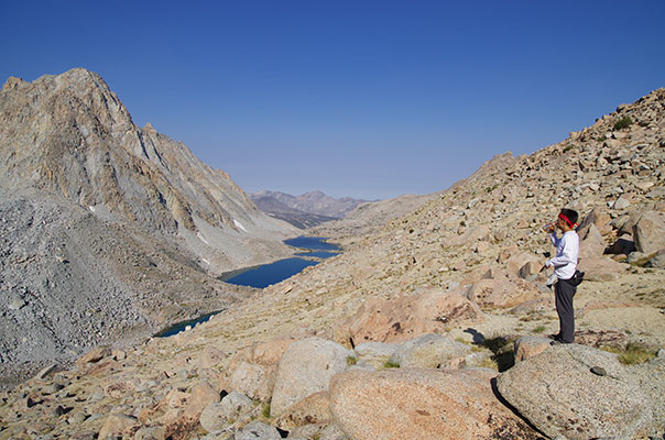
spot track for 2012 Sierra Challenge - day 4This was to be one of the big days. We had a 5 am start and I stuck with the lead group. We took an old more direct trail in the dark with a few errors and then blasted up to Bishop Pass. There we took a semi-high route across the top of Dusy Basin towards Thunderbolt Pass. There we dropped down a bit and then started traversing across the basin. Every once in a while we would come across a cliff to be negotiated but it went fairly quickly. We went fast enough that Jen had sweat dripping off the end of her braids. From the col we headed up the bonus peak 12,698 ft, which involved enough scrambling that I stowed my camera. I was also having trouble with my lens hood falling off, so I took that off and stowed it in my pack. There was some nice scrambling up the ridge to the summit of the peak. Some people from Cleveland named it "Shaker Heights" back in 1956 or something like that - the previous summit register had leaked and was full of mush. We dropped down a somewhat ugly chute on the N side and then proceeded up towards the endless talus slope of Barret Peak. Here the others kept a faster pace than I was capable of. Bob and Michael passed me on their way down. I finished up with the talus slope but there was still a lot of scrambling to get to the summit. It felt like I was spiraling up the peak but finally I got to the top. I didn't stay there long because clouds were building. Once I hit the scree on the descent I made decent time. Then I dropped down into the basin rather than trying to traverse high. As I left the lake at the bottom the rain started. By the time I got back to Thunderbolt pass it was raining hard. Soon I caught up with Andrew and we continued back the rest of the way together. The rain eased again in Dusy Basin and we made our way up towards Bishop Pass. There were signs of truly torrential rain and hail as we descended Bishop pass amongst a sea of Mule-poop soup. We managed to find the cutoff trail again and made it back out to the trailhead as the rain stopped briefly. I took advantage of the lull to pack up. It started raining again as I left and the rain was really dumping as I headed down the hill. I couldn't even see Basin Mountain or Mount Humphreys. There were also some places where fresh sand was washed across the road. I later heard that the area got 2.3 inches of rain. In Bishop I attended the Moosie-Q barbecue and enjoyed a variety of delicious edibles including fruit salad, barbecue, salad, and pie. It was a nice change of pace from Ramen and bars - thanks Laura. All too soon it was past time to head down the road towards Big Pine Creek. Had I more time I would have stopped for a soak in the Keough hot ditch, but I just pressed on to the trailhead and crashed in my truck.
 |
|---|
 |
|---|
According to Bob, this day involved 18 miles and 5,800 feet of elevation gain.
spot track for 2012 Sierra Challenge - day 5  |
|---|
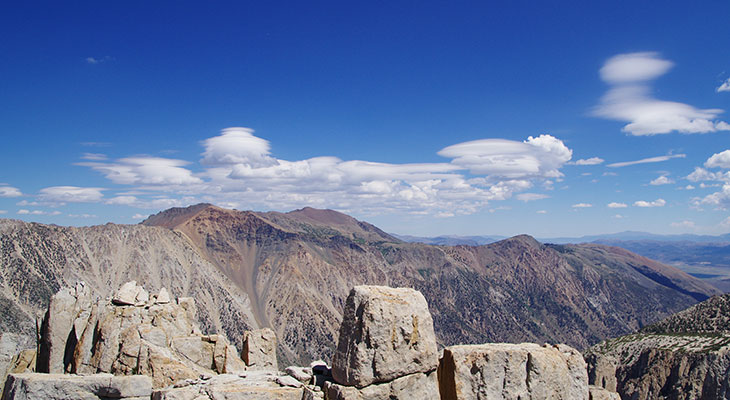
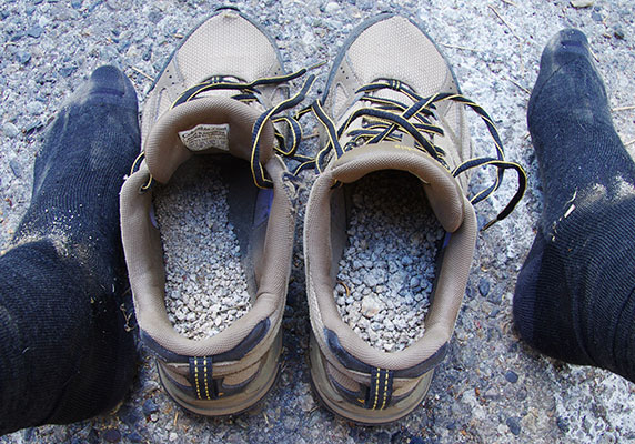
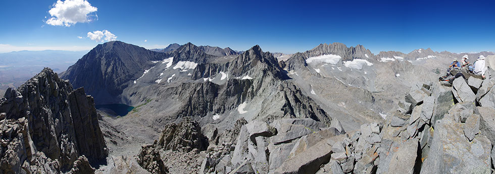
This was supposed to be an "easy" day, but I was pretty tired. I decided to head up the trail to gain some altitude rather than attacking the slope immediately. We headed up with a nice sunrise over our shoulders. At the top of the slope where the trail headed down towards Willow Lake we cut up and left on the talus. Jonathon wisely headed straight up the talus while others contoured around. Eventually we were up on the plateau and then had a long hike up pretty decent stable talus. Unfortunately I was tired and moving slowly. As I got up onto the final ridge to the summit I cut too low around a gendarme but soon enough I joined a group up on top. The views were spectacular with the peaks of day 9 from last year to the south and the southern palisades to the west and so on. I spent a fair amount of time on the summit before heading down to the North. I popped over the top of Little Kid with Karl on the descent and then we picked a scree gulley to head down. It sure was long and would probably make a fantastic ski descent in that season. There was a fair bit of slogging at the end and my shoes were pretty much filled with sand and gravel - so much so that it was more like walking on the beach than having something stuck in my shoe. When we finally got back to the parking lot I dumped them out and had a cup or 2 worth. We all took a short but refreshing dip in the creek and I rinsed and washed a bunch of my clothes. I was also able to dry out a lot of stuff. It was a nice temperature up there and I had little desire to head down to the hot lowlands. Eventually though we headed down and then to the start of the next day's "fun". It was a long bumpy road to the Taboose Creek trailhead and the sleeping wasn't so good with the warmer temps.
 |
|---|
 |
|---|
According to Bob, this day involved only 7 miles and 5,300 feet of elevation gain.
spot track for 2012 Sierra Challenge - day 6This was an early day with a 4 am start scheduled. I got up around 3:15 and got my stuff together. We started off fairly fast but when I was in the lead we kept things to a nearly sane pace. Unfortunately the trail seemed to be composed of loose baseball to softball sized rocks for much of the way. I don't know if this is a result of pack train use or construction, but it doesn't make for very pleasant human walking. Sean went ahead at the first stream crossing and I was somewhere in the pack at that point. The light was very nice as the sun rose. I tried to take some pics w/o slowing down. I fear I didn't do such a good job at either of these goals. We got to the pass in 3:15 (at 7:15) - not too bad for going from 5,400 to 11,414 ft. From there we had relatively low grade downhill for a bit before we cut off on an old trail towards the Kern. Here we lost Tommey somehow. At the Kern crossing Bob stashed some drinks and Jonathan headed off towards a different peak. James and I lost Bob where he stopped at another stream crossing but we kept on. Soon we realized our error and cut up the stream but he was gone. We debated our position on the map and ended up going cross country. It turned out our path was fine and eventually we saw him ahead of us on the final talus slope. We weren't really moving that quickly at this point but managed to continue on to the summit in decent time. We spent a bit of time up there and then headed back. We passed Michael just a short way down from the summit. We cut back the way we came up and soon were back at the river where we briefly soaked our feet. I managed to keep up with everyone up to the pass, but once they started jogging down the trail I was left behind with a long slog back to the parking. Back at the truck I did a quick roll in the creek for cooling and cleaning and then headed towards Independence for a subway footlong with some of the others. Then there was the drive back up the road to the next trailhead at only 4,300 feet. It wasn't very cool.
 |
|---|
 |
|---|
Originally Bob said this was 28 miles and 10100 feet of vertical, but according to his gps it might have been more like 24 miles. Still, a big day and possibly my first day w/ over 10,000 feet of up.
spot track for 2012 Sierra Challenge - day 7
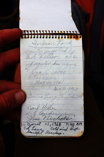
As stated earlier this trailhead was at 4,300 feet out in the desert. We started at 5 am to get across the flats before the sun came up. Despite appearances it wasn't very flat and we were pushing uphill on a sandy trail for a while. Around sunrise we turned the corner into Sawmill Canyon. There was a lot of impressive looking rock in this canyon. Unfortunately the trail dropped down a bit into the canyon but generally it was a good trail through trees and past a loud mouth brook and some meadows. I filled my water bottle at one crossing but scooped a lot of floaties so I dumped it out. Unfortunately the next water was a lake that was completely empty and I was a little worried. The next lake had plenty of water though. From there we headed up a long talus slope. At the top we turned the ridge only to discover we had more talus to head up. I went completely over the top of the peak while others cut around behind it. Then we had to drop some 400 feet before a nice scramble up to the summit of Indian Rock. The first group was heading down while we went up however they missed the summit register which had gaps of up to 10 years in it and also featured Carl Heller's signature which tied in nicely with my plan for the next day - the east ridge of Mount Carl Heller. There was a bit of rain during the descent, but not enough to really soak anything. I took a different route, probably dropping down too far west and then having quite a way to go back down to the lake. From there it was just a matter of moving on down the trail. I stopped at the last water to refill and soak my feet. I wasn't slow enough to get complete shade at the end, but there was enough cloud cover so that it wasn't a big problem. I barely jogged a bunch of the sandy downhill but still didn't get back 'til just before 6 - the last one by a long shot. I missed the others at some restaurant and then decided to drive as close to the next trailhead as I could before it got dark. The drive to the George Creek TH was a lot longer than I had thought with some ugly sandy sections I was scared I'd bog down in and some nasty bumps. Mostly it was just a long long crappy dirt road though. When I was unable to make it up a sandy bumpy uphill I found a level spot to park and verified with my gps that I was only .5 mile from the end of the road. Then I cooked some food and went to bed. Once again it was warmer than I would have liked.
 |
|---|
According to Bob, this day involved 19 miles and 8,100 feet of elevation gain but I think there might have been more elevation with the drop down before the peak. I think Pat said 8,700 or so.
spot track for 2012 Sierra Challenge - day 8The George Creek thrash was scheduled to begin at 5 am. That meant that I had to be walking up the road a good bit before that. I had nearly made it to the trailhead when I was picked up by Pat with a car full of challengers. It turns out the road from Manzanar was washed out so that I did come the best way - even if it was pretty ugly.
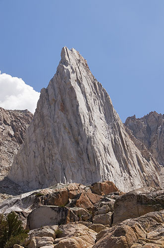
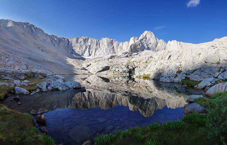
George Creek has a bad reputation as a nasty bushwhack. Some of it is deserved although I was mostly able to avoid the worst of it by following people who seemed to know where they were going. I also wore long pants and brought a long sleeve shirt in case it really got ugly. Mostly it involved indistinct use trails through brush with occasional stream crossings, scrambles up and down loose scree slopes, and walking on downed logs. At the turn off to Mt Carl Heller Sean, Jen, and I turned off. Almost immediately the going got better with slabs, open forest, and "clean" talus. We saw a cool old camp area with old bottles and cans on the way up. We stopped at the lake below Carl Heller to take some pics and a small break. Then almost immediately after we started again I stepped down on a little slab edge like hundreds of other steps that day but my ankle rolled and I dropped onto my elbow. OUCH. It was hard to tell how bad it might be, but it didn't feel particularly good. I tightened my boots and continued on but I had to be careful of every step. Luckily there wasn't very far before the scrambling started. I wasn't as much slower with the scrambling but I was still a good bit behind the other two. This was good when a block dropped down the gully they were in near the top but otherwise was frustrating. I did manage to make it up a few minutes behind them. Mount Whitney was engulfed in clouds and there were a number of ominous dark clouds behind. I thought it would be easier on my ankle to return back down the E ridge rather than drop down to the west and then return up over Vacation Pass. The others agreed to do this. Soon after we started down it started to rain. It wasn't a very hard rain, just enough to get me to put on my raincoat and to wet the rocks making them more slippery. Still, the downclimbing went ok. Once I was off the slabs I pulled out my trekking pole/cane and continued to hobble on. The others waited for me every once in a while which was nice. Once we were back in the George Creek gorge Rick caught up to us. He seemed to have a better knowledge of the trail so we mostly followed him. At some point the others got well ahead of me so I was on my own for navigation. I only had a few wrong turns and some nasty slips and eventually made it out of the canyon at 3:50. Sean and Jen were still at the trailhead and I got a bumpy ride back to my truck. Then I had a long bouncy drive to the Shepherd Pass TH. There I was planning to take a dip in the creek but instead just cooled my now swollen ankle in the water. I was so tired I didn't bother taking a picture of it although Sean mentioned with surprise how big it was.
 |
|---|
 |
|---|
According to Bob, this day involved 10 miles and 7,300 feet of elevation gain, but that might not have been for Carl Heller.
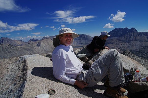
spot track for 2012 Sierra Challenge - day 9For the final day we had another 5 am start to beat the heat and the afternoon thunderstorm potential. I was slowly growing more and more exhausted from the long tiring days and lack of sleep. I packed a number of caffeine rich gels to help keep me going. I don't know how well they helped, but I did keep going. I wasn't able to keep with the lead group, especially once it got light enough to take pictures, but I did manage to get to the pass while they were still there. From the pass people headed off in different directions but I went with Bob and Michael up Tyndall West, the final Challenge peak. We picked our route from a distance but somehow I forgot the complications and expected the top of the long talus slope to be the summit plateau - how wrong I was. We still had some down and over and up and downclimbing and then more up to go. Jonathon passed us heading down on the final uphill. Then we crossed the summit plateau to the final little ridge. There we enjoyed the chocolate Jonathan left (thanks) and read through the sparse register. For the descent we went straight down the north side. I am not sure if this was better or worse, but it worked. Once down on the flats the others sped away from me. I decided that Polychrome was worth climbing as one of the only peaks in the area I hadn't climbed and not too far out of the way. Unfortunately I was moving slowly. Bob passed me heading down when I still had a long ways to go. On top it started raining but since it was sunny too I wasn't so worried. I consoled myself with some tasty jerky and then headed down. There was a lot of down and with my ankle I tried to keep some level of control - which meant somewhat slower. Still I made it back down a little after 7. Then I headed to Independence to meet up with the others. I got a shower and we sat around talking and eating chips and peanuts - hardly a nutritious dinner, but it did fill me up somewhat. Then on for my first decent night's sleep. I woke up at 5:15 but somehow managed to go back to sleep 'til almost 7 am. ahhh.
 |
|---|
According to Bob, this day involved 26 miles and 8,700 feet of elevation gain. Throw in a few more for Polychrome.
spot track for 2012 Sierra Challenge - day 10I came in a distant 4th for the yellow jersey (fastest time). Really the only reason I came in as well as I did was because I did all the peaks. I was a close second for the polka dot "king of the mountain" jersey with 17 peaks. (Sean had 18). I didn't really contest it because of the hard days and bad weather not to mention my hurt ankle.
I used 2 different packs - the small Aarn pack with front pouches for most days and a more standard Camp pack for days when I knew I'd be scrambling a bunch (the front pouches get in the way for harder climbing). I prefered the Aarn pack to the other because I could easily access my water bottle and food and anything else from the front pocket without stopping. It also supported my camera better since the front pouches have stiffeners to transfer the weight to the hip belt.
I attached my dslr to either a mostly empty front pouch or the shoulder strap with a cotton carrier. Once I had adjusted the rotation required to release the camera this worked fairly well. There were a few downsides. One is that w/o another case around the camera it was vulnerable to getting crunched into rocks and covered with dust. I managed to avoid the rocks mostly - and the carrier did prevent the camera from swinging out into things like it would if it was just slung around my neck or over a shoulder, but it did get dusted when I was following people down a dusty trail. If I was leaned forward enough sometimes the camera would rotate around and potentially release itself. The other downside was that the lens hood was somewhat loose and would rotate when the camera moved. It dropped off on its own a few times so I took it off and put it in my backpack so I wouldn't drop it down a cliff or into a boulderfield. Unfortunately some time on day 4 it fell off somewhere and I never saw it again. They are handy and expensive little pieces of plastic. One nice thing with the camera here was that it was easy to deploy it for taking pictures - especially important for trying to keep up with the pack heading rapidly uphill. Had I not had a Pentax I would have had to take my camera off and wrap it up in my pack at the first sign of rain. Instead I got to test the water resistance. It seemed to work although there was some condensation inside the top LCD panel the day after the first real soaking - that could have also been due to the 100% humidity levels inside my truck cab as I tried to dry all of my wet gear. I also took an extra battery for the camera although I never had to switch during the day. This might be partly because I hadn't turned the shake reduction feature back on so it used less battery power until I noticed it - but I also got a few shakier images during that time. Despite carrying the camera ready to deploy except for a few times when it was fully dark or when I was rock climbing I take as many pictures as I usually would - the pace was just too demanding for really working a scene and I would have had to run ahead repeatedly to get pictures of the other participants from anything but behind them. Sometimes I couldn't even keep up let alone get ahead.
My clothing consisted of a technical t-shirt and shorts most days- I was pretty Prana-ed out. I also brought a long sleeve thin wool top and lightweight OR raincoat and some nylon wind/rain pants and liner gloves and a balaclava. The raincoat saw a lot of use and the gloves and balaclava saw some, mostly in the mornings and on summits. I took a thermawrap jacket for the first few days but realized not only that I wasn't wearing it, but it was getting wet and heavier. I did wear long pants for the George Creek day and despite the heat they were well worth it. I also brought a long sleeve shirt for that day but didn't ever need it. I also had a cowboy sort of canvas hat. This helped keep the sun off and I dipped it in creeks when it was hot.
My Inov-8 Roclite 190? (I am not sure of the number anymore - it has worn off) were the perfect boots for the Challenge except mine were so worn and patched up with seam grip I didn't trust them to last. I did wear them for the first 2 and last 2 days - days with lots of scrambling and then after I twisted my ankle because I thought the higher tops would provide some support and compression. For the other days I wore a pair of running shoes some days, a pair of too heavy approach shoes one day, and a pair of light hikers that I found in the Agnew Meadow parking lot the rest. It was nice to have a few different pairs to rotate out when the others got soaked. This year I was blessed with a number of pairs of nice new socks mostly from Wigwam - thanks. It was a pleasure to have cushy clean socks for nearly every day. I tried to rinse them after each day or 2 to keep my truck from stinking even worse although the string of wet days did not help.
For food I had a wide assortment of bars and gels and gummy things and beverage enhancers collected mostly during the OR show and through the Yogaslackers. It was nice to have some variety although the only thing I really got tired of was the very acidic gummy things that started hurting my mouth. They should make slightly basic or at least pH neutral gummy chews. I can get vitamin C in other ways. I found the Honey Stinger waffles and Beef Jerky particularly nice and the Journey bars were a nice change from the sweetness of most other things. I didn't really keep track of how much I was eating. Every morning I'd throw a few more things into the pack and every evening I'd remove all the empty wrappers. I did notice that I was using more and more caffeine gels in the last few days though. Last year I mostly had PB and J or PB and honey sandwiches - I would have liked to have more sandwiches this year - maybe one or 2 each day, but sometimes the variety was nice too.
While I don't think I had the heaviest pack, it certainly wasn't the lightest. In fact on day 3 Tommey just had a 20 oz water bottle and an iphone (as well as long pants and long sleeves and a bandana). When it started pouring he just ran down the trail to stay warm and to get out of it sooner. I think my camera weighed a good bit more than what he carried that day. On other days he took a fanny pack or a small backpack. Most people had either a large camelback sort of pack or a small day pack. I usually took a single cane style trekking pole. Sometimes it stayed in the pack and sometimes I used it a bunch. I was especially glad to have it on day 9 when I twisted my ankle and on the few days where I got to slide down snowfields. Others used 2 poles or no poles at all.