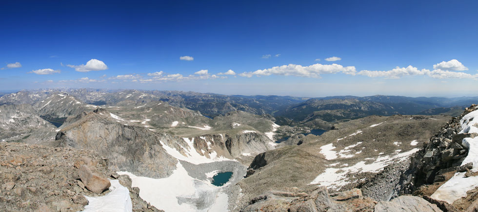
panoramic from the summit looking north
 |
Tom Grundy's Wind River Peak hike Page
We needed a break from climbing, so we decided on a hike into the Wind River Range on what was supposed to be a 28 mile lolipop loop with a side hike to summit Wind River Peak, the highest point in the Southern Wind River Range. We left from the Bruce parking area and headed up the Middle Fork trail. Soon we passed Popo Agie falls. The trail continued for 10.5 miles passing into the Wilderness area. Unfortunately we also passed through a few mosquito clouds, although usually they weren't too thick.
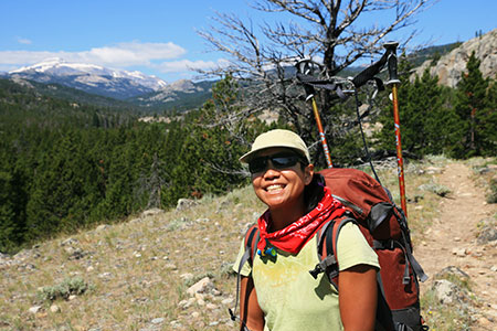
Julie with Wind River Peak behind her on the hike in
 |
We turned onto the Pinto Lakes trail for 4 miles before turning south on the cutoff trail. We passed a nice gorge and then turned south again on the Ice Lakes trail. Immediately we crossed a creek on a lot of rocks and were amazed to see foot long trout in only a few inches of water. It was tempting to try to spear them with our trekking poles. Soon we cut cross country up to the west towards Wind River Peak. We stopped near a small lake around 6:30 after hiking maybe 17 or 18 miles. So much for a relaxing day.
before sunrise near camp
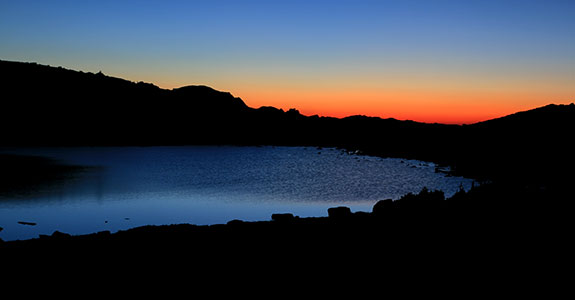 |
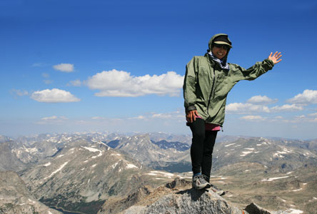
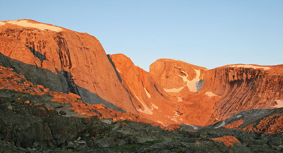
I got up before sunrise the next morning in the hopes of getting some nice photos. There was a bit of frost on things, but also no mosquitos out. It was a worthwhile trade. I walked farther than I thought I'd have to in order to get a better view of the cirque and Little El Cap we could see from camp. There were some impressive walls that probably don't see very much climbing. After I returned we had breakfast and loaded up Julie's pack and headed up towards Wind River Peak. First we had to pass a false summit, which took a remarkably long time. Then up the snowfields and talus to the summit of Wind River Peak. It was pretty windy, but there was some shelter behind the summit and spectacular views. After taking a lot of pictures and eating a bit, we headed back down. Unfortunately the snow slopes weren't quite steep or slick enough for proper standing glissades, although we tried. Back at camp we had lunch and packed up and headed back towards the Ice Lakes trail.
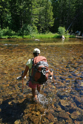
We continued south past more lakes and alpine scenery over a pass and down past Tayo Park. Finally we waded across the chilly middle fork of the Popo Agie River and set up camp.
Julie on the summit
 |
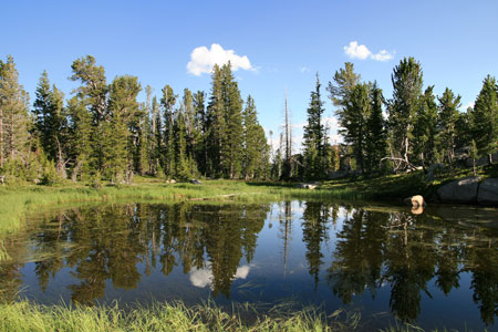
reflections in a small pond along the Ice Lakes Trail
 |
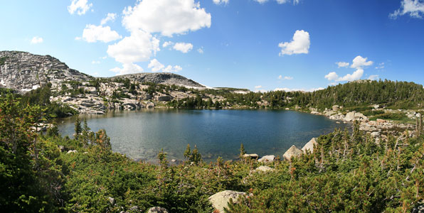
another scenic lake
 |
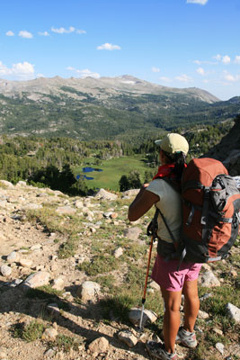
Julie looks over from a pass
 |
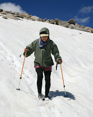
Julie glissades
 |
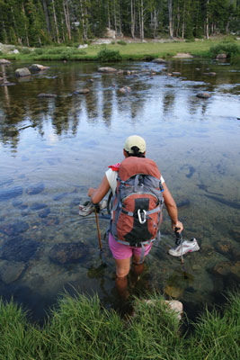
Julie wades across the river
 |
and back the next day
 |
That night I didn't put on all my clothes as it was not as cold. Unfortunately it got cold later, but I was too cold and groggy to completely take apart my pillow and put it on. I managed some sleep, but not enough. When it warmed up in the morning I went back to sleep. Eventually we got up and packed up and headed down the trail. Another 4 miles to the split and then 10.5 back to the trailhead. We passed 2 groups of llama packers on the way out. We also were side-swiped by a thunderstorm. Enough to make us put on raingear, but not the full pounding it looked like we were going to get. I think the total mileage turned out to be more like 40 than 28, and thus a bit more of a hell-hike than a relaxing break. Still, the scenery was nice, and it was good to get off of my arms and onto my legs for a bit.
Link to Spot Adventure page (map/aerial photo with track)
Morning view of a cirque and Little El Cap (Wind River Peak is behind the false summit on the left)
 |