Tom Grundy's 2011 Sierra Challenge Page
This trip report is not completely complete, but Bob wanted a link, and I have made quite a bit of progress here: I apologize for any mistakes I might have made.
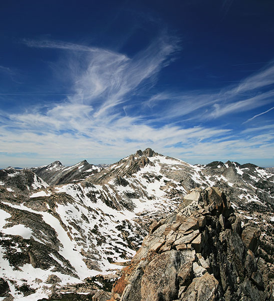
This year I participated in the Sierra Challenge - a series of 10 long day hikes to mostly obscure peaks in the Sierra Nevada Mountains from August 12 to August 21. I was reasonably fit from some long dayhikes and hikes into the Sierra and also reasonably acclimated so I had a chance of keeping up. Each day there was a designated challenge peak. You could also do alternative Challenge peaks as well as various bonus peaks. Just doing the 10 challenge peaks would entail 168 miles of hiking and 53,400 feet of vertical gain, but I did quite a bit more in my quest for the polka dot "king of the mountain" jersey. There were also green and white jerseys (outside of my age range) and the yellow jersey for fastest time (outside of my speed range). To stereotype the typical Sierra Challenger, they were tall, white, and male. Generally they were either mid 20-s to lower 30s or mid 40 and up. There were some exceptions, but not many. Michael D took a bunch of photos for what will hopefully become a photo essay in Backpacker Magazine. That will be fun to see. If nothing else the challenge got me into a lot of spectacular Sierra backcountry and onto some obscure peaks I probably never would get on otherwise. In fact in 10 days I probably saw more of the Sierras than most people would see in a month of backpacking.
Spot Track for the entire 2011 Sierra Challenge
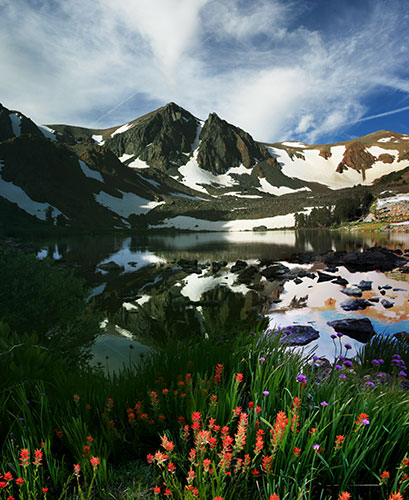
Day 1 Ehrnbeck Peak - 11,240 ft.
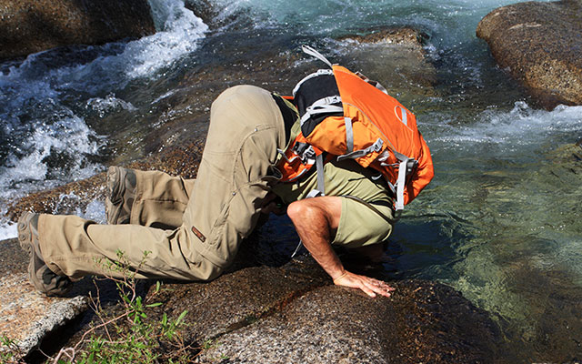
The first day we left from the Twin Lakes trailhead (near Bridgeport) at 5 am. It was still dark and we motored up the trail at a furious pace. There was a pretty good crowd and I managed to stay with the lead group for about an hour. Once it began to get light I was losing ground due to taking some pictures and just being slower but caught up again with a stream crossing. From there I managed to mostly stay with the lead group. There were quite a few mosquitos at higher elevations, but at our usually fast pace they weren't really a problem except the few times we stopped.
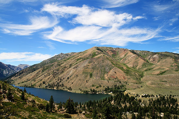
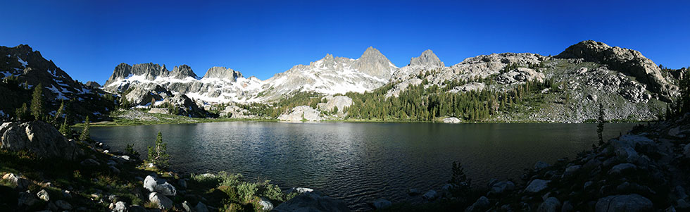
Peeler Lake and Crown Point were quite scenic on the way in
 |
Eventually we cut cross country and made it up to the summit of Ehrnbeck. On the way back down I detoured down a steep snowfield and then up to Hawksbeak (11,134ft) and then Center Mountain (11,273 ft.) Once I made it back to the trail the trip out seemed to take forever. I finished at 6:30 pm. Just doing Ehrnbeck was 24 miles and 6,000 feet of elevation gain. With the 2 extra peaks I got another 2,000 or so feet of elevation and a few more cross country miles.
scenic view westish from Hawksbill Peak
 |
Spot Track for Sierra Challenge day 1
Peeler Lake and Crown Point were still scenic on the way back from Ehrnbeck Pk.
 |
Day 2 Tamarack Peak - 11,778 ft.
This morning and the rest of the challenge we started at 6 am - at least it was getting light by then. The hike up to Tamarack was relatively short, but still had a lot of elevation gain. When we got to the base people split off in all directions depending on their footwear and if they had ice axes or crampons. It would be cool to see a sped up plot of everyone's position as the group zipped up tp the base and then split in all directions before converging on the peak. I opted for the talus to avoid the steep snow up a nice looking couloir (I didn't bring the ice axe or crampons this day). The group seemed to rejoin on the summit. After Tamarack I headed NW to Crater Crest - not much of a peak but it had a nice view, and the crater was curious. I got a bit lost in the woods on the return before joining the trail which got pretty hot and dusty near the end. It was nice to be able to jump in the lake after the hike (I did that the night before too, but it was much colder that evening and more of a hygienic necessity rather than a pleasant cool dip). The round trip distance for Tamarack was 13 miles and 4,600 ft of elevation. I probably only added a few miles and not much elevation to that total, but the bushwhacking did slow me down a bit.
Spot Track for Sierra Challenge day 2
Tamarack Peak
 |
Looking down on lower Twin Lake from the trail - it sure looks inviting
 |
Day 3 Cold Mountain - 10,301 ft.
I camped out next to Ted up in Tuolumne. Unfortunately between the Sierra Challenge and his work we didn't have much time to catch up. It was nice to be relatively near the start the next morning though.
Some of us left from near the Tuolumne visitors center and others took advantage of a shortcut near pothole dome. We rejoined near the falls and continued down the trail. I headed down the river with Bob before cutting up slabs with a bit of scrambling towards Wildcat Point with a few others. The view down into the Grand Canyon of the Tuolumne was very nice, but it was a bit smoky. From there we headed cross country to Cold Mountain where a number of the others were. Then I traversed down around a high point and on to Elbow Hill. Karl cut down to the Pacific Crest Trail before heading up to join me there. We hiked back on the PCT and then took the shortcut past Pothole Dome (which I should have summitted as a bonus peak). Karl gave me a ride back to my truck. The hiking distance for just Cold Mtn was 20 miles but I probably saved a few by hiking back on the shortcut. I am sure I added more with the two extra peaks as well as a bit more elevation and bushwhacking.
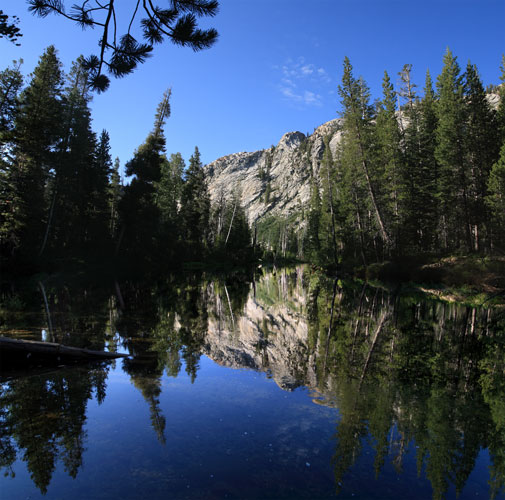
Tuolumne River reflections
 |
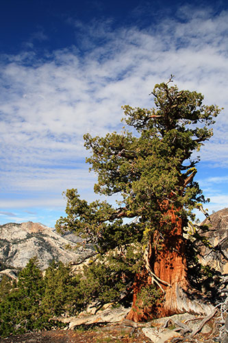
I've always liked the squat Sierra Junipers
 |
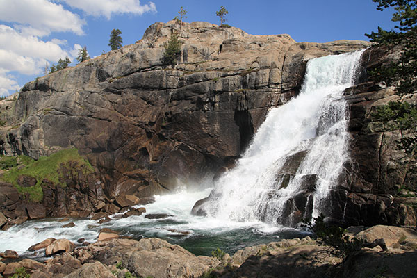
Tuolumne Falls
 |
Michael D cools off in the Tuolumne -ahhhh
 |
Spot Track for Sierra Challenge day 3
Tuolumne River reflection in the morning
 |
Day 4 Waller Minaret - 11,711 ft.
One advantage of starting early is being able to drive to the trailhead, although I needed my pass to get out without paying. The first hour was pretty unremarkable but then things got scenic. I lost the crew hiking past Shadow Lake when I stopped to take some pics and they passed a turn before I caught up again. It took a while to figure out which way to go, but I spotted them again on the far side of Ediza Lake and pretty much caught up when we put on crampons for the snowfield. When we passed the crest it got a lot cooler. The scrambling up Waller was a bit confusing in the route finding but not all that difficult (some solid class 4?). From the summit Sean and I tried to find a way down the S side but gave up when it looked too steep. I pretty much kept up with him on the return (he was probably going slow) until I ran into Chris and talked to him for a while before making it back to the parking lot. I stopped at the Mill Pond park for a dip and to cook dinner. The official distance for the days jaunt was 18 miles and 4,600 ft.
Shadow Lake, I almost lost the crew taking this
 |
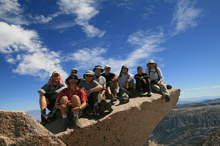
Everyone is busy on the summit of Waller Minaret
Adam with the summit register, Bob with his new GPS,
Jonathon with binocs,
Sean with his summit sardines, and me with my camera
 |
Sean's report on Sierra Challenge day 4 - Waller Minaret
(He has reports for many of the days, but this one has a few pics of me, so it is extra special)
Spot Track for Sierra Challenge day 4
Ediza Lake - I finally caught sight of the others on the far side. Waller Minaret is the peak to the left of the big left center notch.
 |
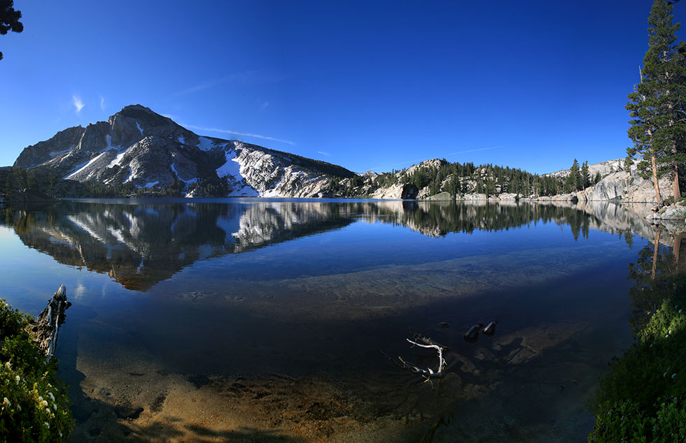
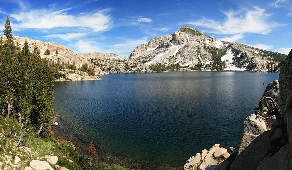
Day 5 Matthes Peak - 12,960 ft.
We started from the North Lake trailhead and took about 2 hours to get to Piute Pass. The snow had receded a lot since my previous trip up this pass. The last snowfield had a huge dent in it presumably where they had sanded it or otherwise prepared it for stock. From there we continued down the trail for a bit before cutting cross country. We had one exciting river crossing - a big jump from rock to rock. Then we cut up towards the ridge taking a snow couloir and a large snowfield up. From there a fairly short hike/scramble brought us to the Matthes Peak summit. By the time I had gotten there some people had already left and I saw them far below on a different snowfield (the race for the Yellow Jersey between Bob and Michael G was close). I headed down to the SE and after dislodging a rock which landed on and bounced off my calf giving me a good scare I headed back up over some unnamed peaks and finally up Goethe. I was moving pretty slowly at this point. Then I headed down a ridge and over another unnamed peak to the summit of Muriel. The descent to the NE from Muriel involved a steep snow gully. At first I was ok sliding from suncup to suncup but where it narrowed it had been in the shade longer and was quite hard. I had to self arrest a few times before I decided that crampons were my best bet. With them I tromped down to where the angle lowered. I made it to Piute Pass at 7 and back to the car at 9:30 in the dark. The distance for just Matthes was 22 miles and 5,200 ft. I added at least a few miles to the distance and probably a few thousand feet of vertical too. Luckily we were leaving from here the next morning so all I had to do was cook a bit of dinner and crawl into my truck to sleep.
the rock I am standing on here rolled off a ledge onto the back of my calf and foot.
 |
Spot Track for Sierra Challenge day 5
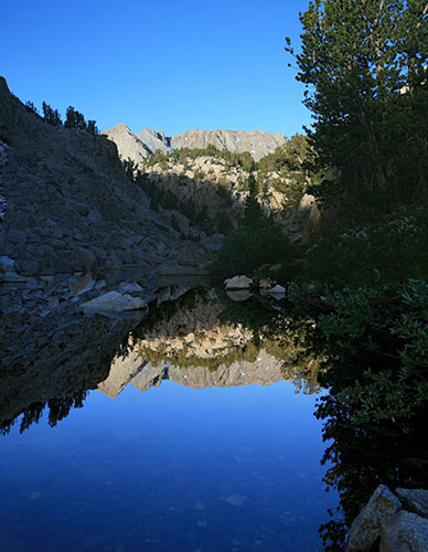
Piute Lake on the way in
 |
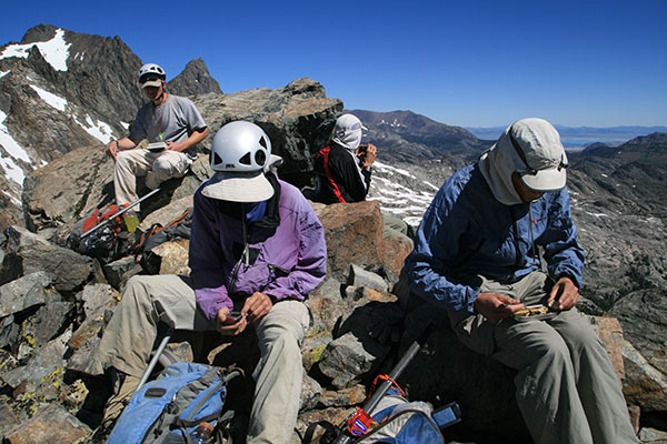
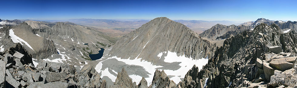
Day 6 Mt. Tom Ross - 13,253 ft.
A fairly large crew started up the trail from North Lake towards Lamarck Col. From there most of us cut along the ridge and scrambled up to the summit of Tom Ross. This was an enjoyable scramble with enough variety to keep it interesting but not hard at all. A fairly large group assembled at the summit. From here I went on to the summit of Lamarck with JD. As usual the descent seemed much longer than the ascent. I did draft behind Sean for a few quick boot skis on some snow as he returned from climbing Darwin and Mendel. The distance for Mt Tom Ross was 13 miles and 5,100 vertical feet. I might have added another mile and at least a few hundred more feet for Lamarck.
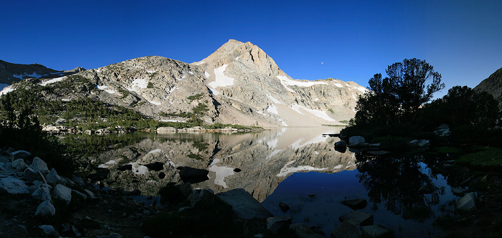
reflecting pool on the way up to Tom Ross
 |
A bunch of us on Mt Tom Ross
 |
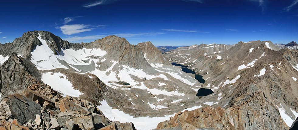
Darwin Basin panorama from Mt Tom Ross. Mt Darwin, Mendel, and Gould from the left.
 |
Spot Track for Sierra Challenge day 6
Day 7 Round Mountain - 11,188 ft.
Round Mountain is a fairly uninspiring peak because it is much lower than the high sierra peaks. The hike seemed to have a lot of up in it though. There were only 4 of us heading out from the trailhead this morning, the rest either took a break or went for another route or another peak. Once we got up onto the plateau it was a fairly pleasant hike across meadows and sage flats towards the summit although I don't think I always went the best way.
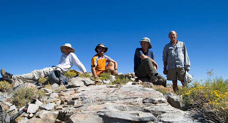
Bob, Tom, Michael G, and Jeff on Round Mountain
 |
I also went up Sugarloaf on the return. I was pretty low on water before I got back to the stream to refill. I also felt pretty tired for some reason. Bill was busy getting 5 peaks this day and tieing things up in the race for the polka dot jersey. I wasn't going to be able to coast to an easy victory after all. The distance for Round Mtn was 16 miles and 5200 ft of elevation. I probably added a mile and 800 feet for Sugarloaf - it felt like a lot of up anyway, but I was getting tired and thirsty at that point.
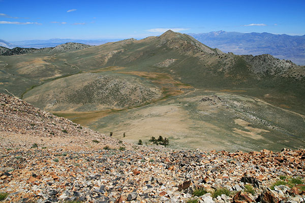
Round Mountain from Sugarloaf
 |
Spot Track for Sierra Challenge day 7
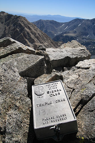
Day 8 Buck Mountain - 12,841 ft.
Buck Mountain is a big pile of talus. Rather than climbing up the steep and sandy looking side I went up Temple Crag first (the only summit I repeated for this Challenge) and then went up the SW side of Buck - that wasn't actually too bad as I was mostly able to stay on the solid rocks and avoid the loose scree. From there I went down to Mt Alice and then down the W side of that back to the trail. I did quite a lot of scree boot skiing on the descents. This was quick and relatively easy, but not so easy on my boots. That evening I joined many others and took a shower in Bob's hotel. We also went out for barbecue or burritos for dinner. The drive to the next trailhead was longer and rougher than I expected, so I turned around and parked near the turnoff to camp. The official distance for this day is 12 miles and 5,100 ft, but I added some more for Temple Crag and a little for Mt Alice.
Temple Crag summit register - 12,999 ft
Buck is behind to the left
 |
Spot Track for Sierra Challenge day 8
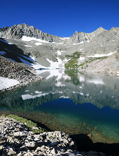
Day 9 Ed Lane Peak - 13,577 ft.
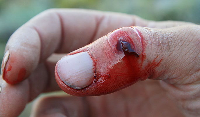
This morning I was running a bit late and the walk to the trailhead was longer than I expected so everyone had left by the time I got there. It wasn't clear where the trail went anyway, with a lot of cattle trails and vestigial dirt roads. My map had the trail on the other side of Birch Creek, but it definitely wasn't there. I followed footprints as best I could and eventually caught up with some people bushwhacking up a hill. From there I could see some others on a trail and eventually I made it over to the trail. This was relatively easy going except for the fact that it was hot in the sun and there was one thick swampy willow/rose thicket. Finally we got to the gorgeous Birch Lake. From there some opted for a snowfield but I went up the talus. Eventually I made it up the Thumb along with a few others. From there I traversed along a snowfield 'til I started postholing and then headed up the ridge. This was mostly a quite nice sidewalk in the sky. Eventually I cut off to the right to pass some false summits and passed some of the others coming down off the summit. From the top of Ed Lane I decided to head south to try to climb Birch Mountain too. This involved some easy scrambling and one dicey move (I think Sean found a better way a little to the east of where I went). Then I had a long hike up to the summit of Birch Mtn. From there I dropped off to the SE and down a steep gully east. Once I was out of the gully it was pretty quick travelling until I slipped and among other things gashed open my thumb. That slowed me down a bit. After a while I got onto a steep slope covered with prickly brush. That wasn't much fun but it was better than the not so steep slope covered with even more prickly brush I got to next. As it got dark I was slipping through a willow thicket when I grabbed a handful of rose bush. ouch. That was when I took out the headlamp. For the most part the going was a little more open after that and eventually I crossed a few barbed wire fences and hit the road. I was able to follow that back to my truck without having to backtrack from the trailhead. I got back shortly after 9 pm. This was a long one with 16 miles and 7,300 ft of elevation gain for Just Ed Lane. I probably added a few miles and brought the vertical up to 9,000 or so with my additions. From there I drove down to Whitney Portal for the last day. One advantage to showing up around 11:30 pm is you can often get a decent parking space. It seemed that there were people departing at all hours of the night and morning though.
Spot Track for Sierra Challenge day 9
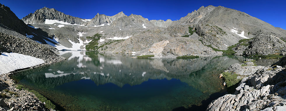
Birch Lake with Ed Lane Pk and the Thumb
 |
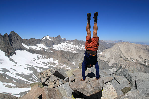
Summit handstand on The Thumb
 |
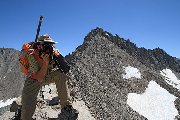
Michael D the one-armed photographer snaps some pics on the Ed Lane ridge
 |
Ed Lane Peak summit panorama - Birch Lake and Birch Mtn. in the center and the Thumb on the far left
 |
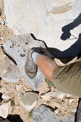
I injured my thumb on the descent
 |
Birch Lake w/ the Thumb and Ed Lane Peak panorama
 |
Day 10 The Miter - 12,770 ft.
For the last day Laura had picked up Whitney Zone permits for us. This was nice. Once again I ran around like mad trying to find the group before they left, but this time I found them. The Whitney trail is long and fairly boring for much of the way. We overshot the point to leave the trail and had to backtrack a few switchbacks. It was quite windy passing Consultation Lake. From there I headed up the talus while others went up a snowfield. For once I think the talus was easier and quicker. I got over Arc Pass shortly after Bob and caught up with him while he was scoping the ascent of the Miter. This was a fairly straightforward scramble to the summit (once we were on track). I was pretty tired after this peak and considered heading back from here, but rumour had it Bill was climbing a bunch of peaks this day, so I needed more peaks too, a lot more. I climbed Mt McAdie next. I saw that Laura and Sean had climbed this and Marsh peaks, but I didn't know which peak was Marsh Peak - it turns out it was one of the ones along the ridge to the north. This ridge looked pretty rough and I heard it was 5th class. Still, I probably should have tried to traverse it rather than drop way down into the basin before climbing back up towards Discovery Pinnacle. This looked like a big mountain from the S, but was only a few hundred feet above the Whitney trail to the N. I went down to the trail and then proceeded to climb Mt Muir, and all the rest of the peaks on the way up to Whitney - there were a lot of them, and at over 14,000 ft, I didn't have a lot of breath - and I was tired. Eventually I topped out Whitney. Originally I planned to head down the mountaineers route, but since I didn't really know where the lower bits went I opted for the trail which I knew I could follow in the dark. I was cruising down the trail in an old man's jog shuffle when I decided to head down the slope on big slabs. I cleverly met the trail below the split and continued down a few big switchbacks before realizing my error. This probably wasted at least 30 minutes of valuable twilight as well as a lot of energy and motivation. By the time I got back on track and over the pass it was pretty dark. I brought out the headlight to avoid missing a switchback or slipping over the edge. From here it was a long cold (windy) slog down the switchbacks. Eventually I stopped to put on another layer. The last hour was a lot warmer, but I didn't feel like stopping again to take the layer back off. Surprisingly there were still people heading both directions on the trail. I stumbled back to Whitney Portal at midnight and crawled into the back of my truck to sleep. I was pretty beat at this point and it is a good thing I didn't have to do more than stumble down the trail. Driving, delicate scrambling, or tough route finding would have been bad. This was another long day with 14 miles and 6,600 feet for just The Miter, but I added a lot to that both in distance and in up.
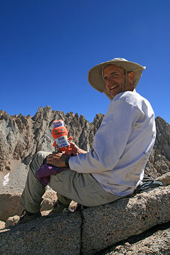
Bob and friend on the summit of The Miter
 |
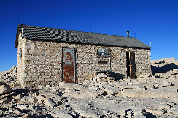
The Mt Whitney Summit Hut
 |
Spot Track for Sierra Challenge day 10
My final push had brought me to a total of 29 peaks which was one ahead of Bill and enough for the prestigious (virtual) polka dot jersey. Bob and I were the only ones who did all 10 Challenge peaks (Michael G dropped out for the last 2 days due to injury- he had been slightly ahead of Bob for the Yellow Jersey - I was a distant 3rd by virtue of doing all the peaks but ended up a distant second after M dropped out).
I didn't see a lot of wildlife during the challenge, but I saw a garter snake each of the first 4 days. I also saw some deer, a scorpion, the usual birds, a pika or 2, and a few marmots. Actually I would have expected to see more marmots, but I didn't.
I mostly wore t-shirt and shorts for everything with a long underwear top on cooler mornings and evenings or when it was windier. I usually tried to take it off before we started in the morning though to save me from having to stop to take it off when things warmed up later. A few times I put on my thermawrap jacket and on a few of the lower elevation hikes I didn't bring it. I always had rain pants and a raincoat but I never used them except for once putting on the pants when the mosquitos were bad. I also took a buff for my head and a pair of gloves which often got used in the morning and in windier conditions. When I had to bushwhack or the mosquitoes were thick I regretted not having long pants - the rest of the time it was fine. The real star of the show were my Inov-8 roclight 288s which were light, waterproof, and climbed well. Unfortunately all of the adventures of the last year have taken their toll and they now have some holes in the sides that allow sand to get in between the layers. Lightweight scree gaiters would have been nice too. I worked my way through all of my nice backpacking socks and started using a pair of thin socks combined with ankle running socks - that worked remarkably well. I also often took an ice axe and sometimes crampons if we expected a steep snowy pass. The final bit of gear I took was my Leki wanderfreund pole - Some days I used it a lot, others it rode in my pack, but if I ever really turned a knee or ankle I'd have been very glad to have it.
For food I usually took 2 or 3 peanut butter and jelly or honey sandwiches as well as some bars and some U or Nuun to flavor the water I scooped out of streams and lakes. I mostly got away with one small water bottle but occasionally used a second platypus style water container if I expected a long go without water. Sometimes I got surprised and ran low on water - then I packed snow into my bottle and the second container and even put that inside my shirt to facilitate melting. A pocket knife, headlamp, small first aid kit, and compass and map rounded out my gear. I also took my spot tracker and an mp3 player and my dslr camera. It was nice to listen to books, NPR programs, and music when doing the long slogs back to the trailhead. My pack was probably a bit heavier than most. I used an Aarn pack with front pockets which was nice for getting things easily while still hiking but not so great for climbing and steep scrambling. I think it was a bit warmer than a normal pack too which was mostly fine. I found myself putting almost everything in the front pockets and nothing in back but the raingear. I had to try to put more heavy stuff in the back to even things out.
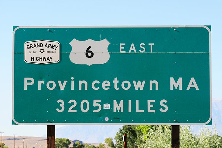
Sign at the start of Highway 6 - I have a long way to go.
 |
The morning after the challenge I began my trip to the east coast for a wedding. I stopped to take a few pictures at Manzanar and my truck refused to start - it turned out that the ignition lock had died. I had to get it towed back to Lone Pine and a new lock installed - which took them a while to get. Basically I lost most of the driving day. The next day I had a blowout on Route 6 in Nevada - during the hour I was putting on the spare about 5 cars passed. That wasted more time. I put in some long and tedious driving hours and did make it east in time. My legs were no longer tired, but they were pretty stiff and my ankles and feet were swollen. I also had an awful lot of scratches on my shins. The day after I arrived Hurricane Irene showed up too. Luckily we didn't get more than a lot of wind and rain and no power for a few hours, but my brother had to rent a car and drive over 7 hours through less than optimal conditions to get to Rochester and an airport that was still operating (he HAD to be back for work).
Bob Burd's official 2011 Sierra Challenge page