On Tuesday June 22 I got up early (after sleeping through my alarm somehow - probably related to going to bed too late after slow evening of packing and cleaning) and quickly grabbed the last minute things and headed up the hill to Mammoth. I managed to make it through the entrance station before 7, but it was close. Then down down down to the backpacker parking by Devils Postpile. There I met up with Kristine and Robert and finished packing (putting the food in Kristine's bear cannister and shoe-horning it into my pack) and then we were off. At least it was pretty cool for the early uphill stuff, and then as the temperature rose at least we were in the shade, and then as we got into the sun, at least there was a breeze. The breeze also kept the mosquitos from being much of a problem. Sadly my pack felt very heavy. I think this was a combination of the fact that it wasn't all that light and I had some adjustments off so too much weight was on my shoulders, especially my right shoulder. Also this was my first overnight in a long while, and I was weak. I also was developing a blister on my right pinky toe for no apparent reason.
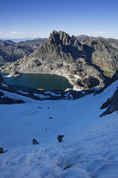
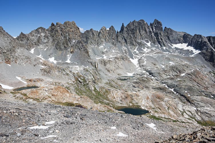
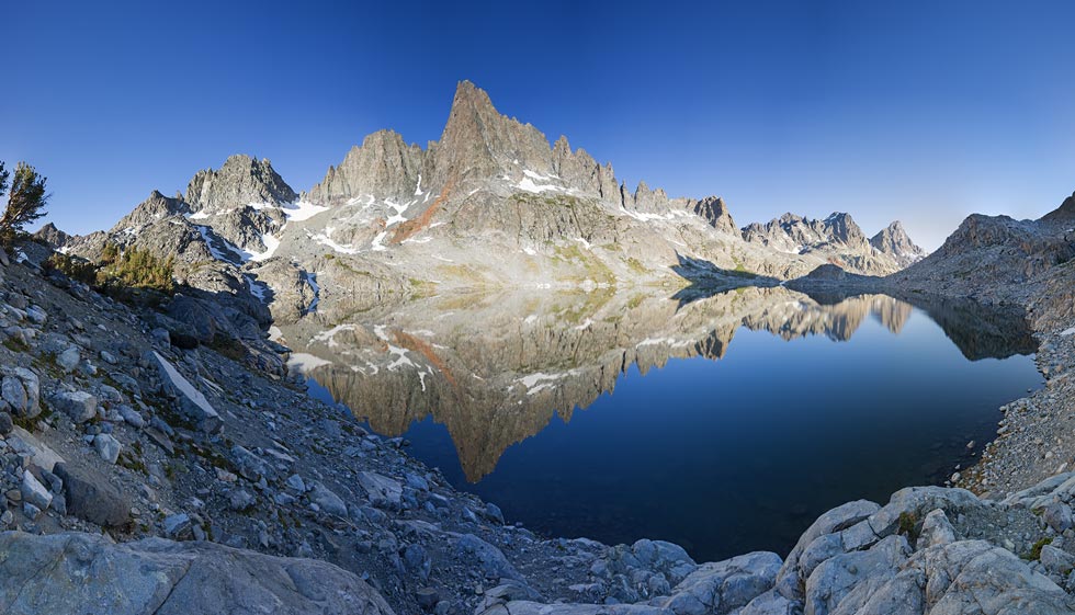
Despite the pain, we made decent time arriving at Cecile Lake and setting up camp before noon. The wind had picked up a lot - which made tent wrangling a bit of a pain, especially for Robert who had never set his up before. It did mean mosquitos were a non-issue though. The snow levels were comparable to what we saw in mid September 2019 - there were a few little patches that were gone in 2019, but the big snowfields were actually smaller in June of this year - a very low snow year. I suspect before the snow next winter there will be a lot of fresh loose material that hasn't been out from under snow or ice in hundreds of years.
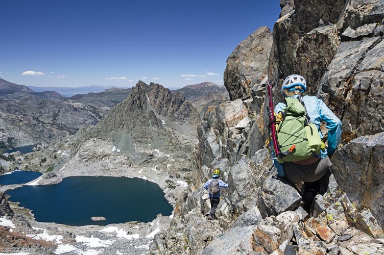
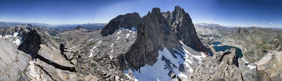
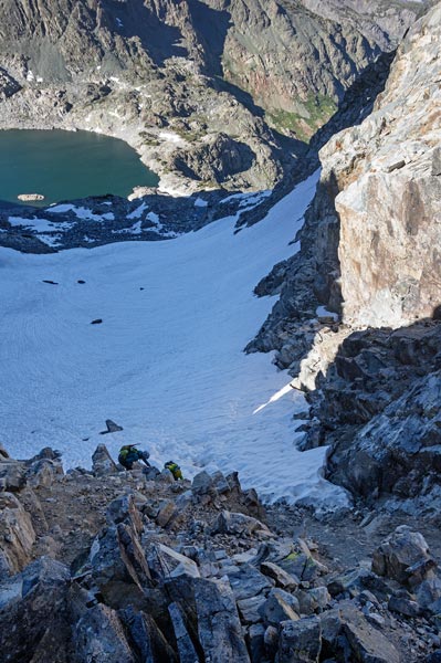
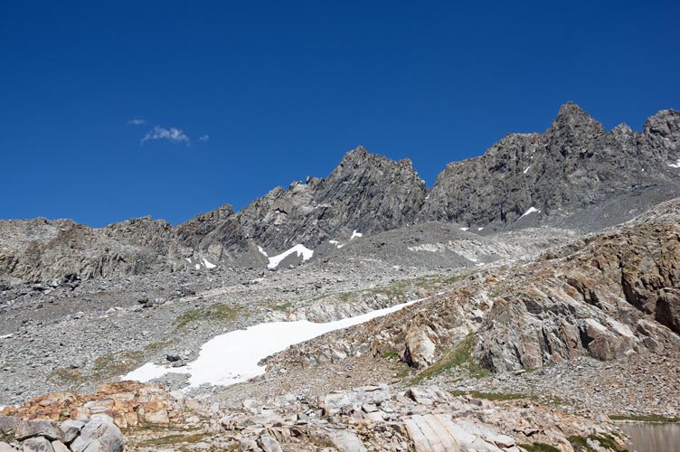
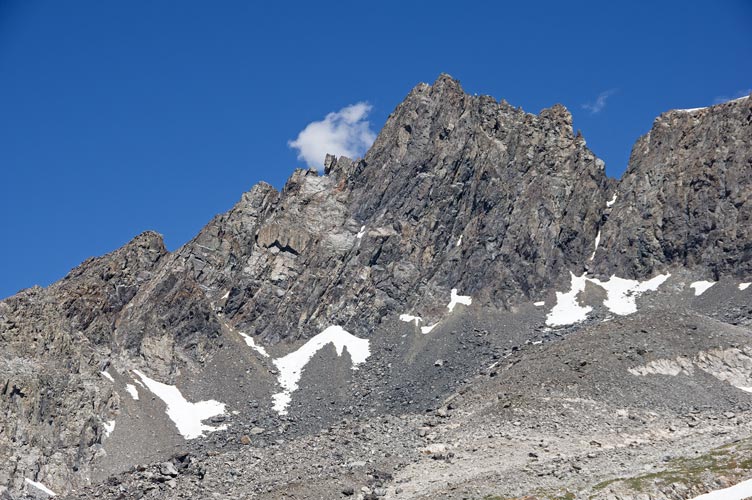
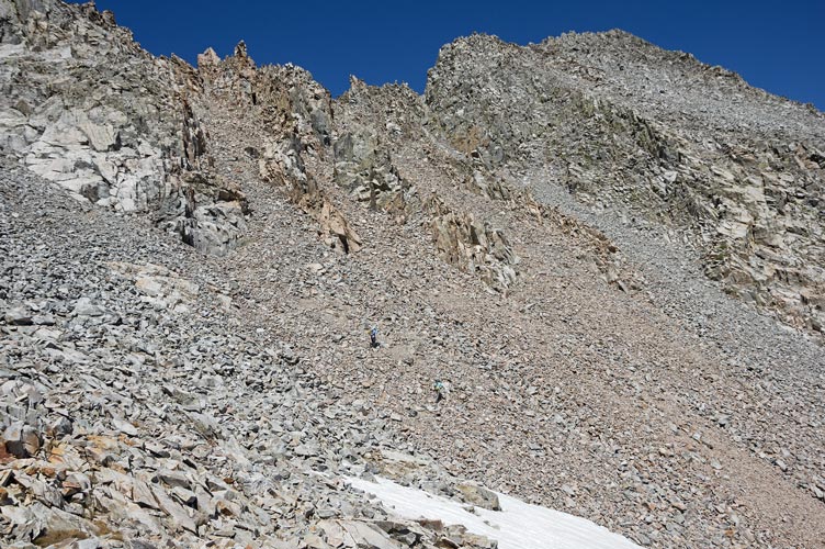
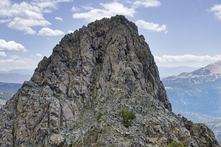
Once we had camp set up and ate some lunch we headed up towards South Notch. The snow was soft enough that we didn't need crampons. The biggest difficulty was the last 30 feet or so where the snow was melted out and the rock/soil was very steep and loose. I traversed onto the rock on the side and scrambled up that. Partly because I was below the others and wanted to be out of rockfall range and partly because I think it was easier. From South Notch we headed east to Kehrlein Minaret. I wasn't really paying attention and didn't know the beta anyway and soon we found ourselves on the steep south face. This was a dead end and we back-tracked onto the NW side where we worked our way across some slabs (with cracks) and down a bit before scrambling up to the summit. The views were most excellent and I even had a summit cookie.
| |
|---|
 |
|---|
 |
|---|
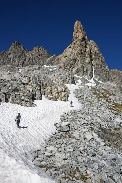
We dropped back down from Kehrlein and then headed for Starr Minaret. We hoped to be able to drop down east somewhere and then do Pridham and Riegelhuth Minarets before returning to camp. We kept looking over the edge to the east, but nothing looked like much fun. Normally I think the gulleys would be steep snow this time of year, but they all had portions of rock. Somewhere along here I stepped on a surfboard of rock that shot off downhill and I fell backwards basically landing on my left ring finger. It felt like the last joint bent backwards or got jammed. This hurt a lot and started swelling and didn't bend very well. We headed up Starr Minaret for more views and summit cookie crumbs and then back down. None of the ways down to the east looked very palatable, so we thought about climbing Adam Minaret. Eventually we decided that it would be better to descend S Notch in the daylight when we could do it without crampons (plus I at least was tired and a little concerned about how well I could scramble without my left hand).
 |
|---|
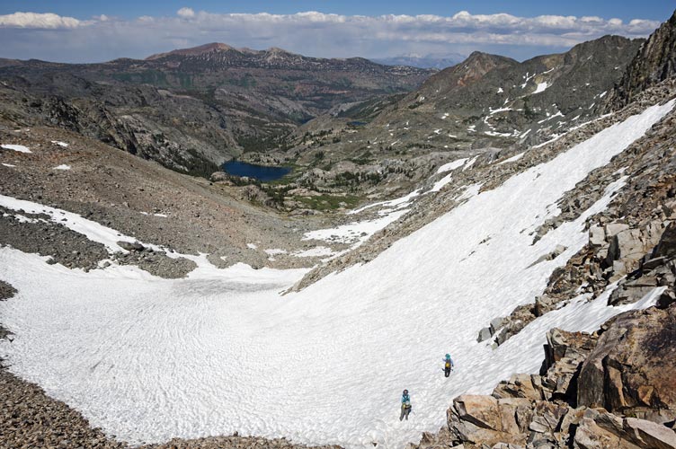
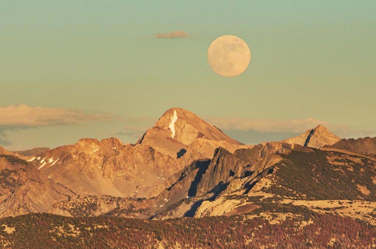
We carefully worked our way down to the snow in S Notch and then more quickly descended back down the snow and then back to camp on a mix of snow and talus. We had a little bit of sun when we got back to camp but it wasn't very worm except during the few lulls in the wind. It wasn't enough to encourage me to jump in the lake. We cooked up dinner (potato flakes, soup mix, and dehydrated beans for me) and then went into our tents about 9 - about when it got dark. Except it never really got dark dark because there was a nearly full moon. I was a little cold this night, although not enough to keep me from sleeping.
 |
|---|
 |
|---|
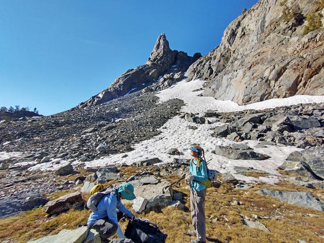
Wednesday morning the 23rd I got up around 6 - the others got up earlier or about the same time - and had a breakfast of oatmeal. Then we packed up and headed off towards Neglected Peak. This peak is one of the last to be climbed in the Sierra, and we had relatively little information about it. Something about a 5.7 bit that could be rappelled and some 5.2 and 4th class. We brought a rope and a very light rack plus some gear to bail off of if we had to. This meant our packs were a little heavier than we wanted, especially Robert's but better to have the gear than to need it and not have it.
We traversed around Cecile Lake to the outlet and then dropped down and skirted around below the Minarets and high about Iceberg Lake. Then we climbed up onto the bench below Leonard Minaret and traversed North between the cliffs above and the cliffs below. We then cut into the gap between Leonard and Waller Minarets and went through that "pass". I could see no good way to scramble up or down Waller Minaret from this side, so it is good that Sean and I didn't continue to try to scramble down this way back on day 4 of the 2011 Sierra Challenge.
 |
|---|
 |
|---|
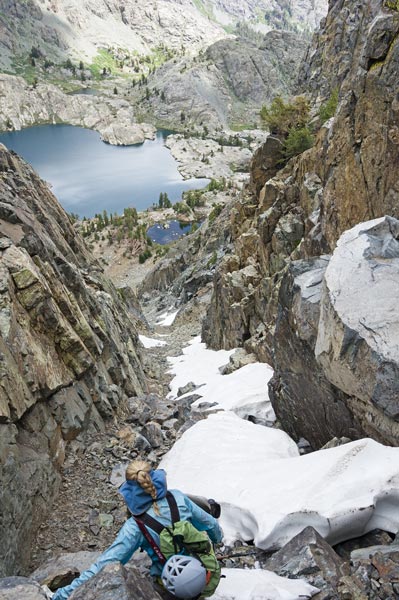
The descent on the West side wasn't all that easy either, steep rock, loose talus, a few little snow patches, and a few steps of scree. It seemed to take ages to make it down to a lake where we took a break and ate some food. Then we had a little bit of easy cross country travel towards the S ridge of Neglected peak, but soon we were back to talus and loose rock. We thought we could head up a chute onto the ridge - hopefully past some of the difficulties - but as we got closer the chutes looked less and less appealing. We decided to head down and get on the ridge lower. As we headed up towards the S Ridge, the wind picked up a lot - enough to make walking in a straight line difficult, especially for Kristine who weighs a lot less than the rest of us. It was pretty demotivating. On the ridge we found a little bit of shelter to put on a layer and I switched from my hat to my helmet mostly so my hat wouldn't blow away.
 |
|---|
 |
|---|
 |
|---|
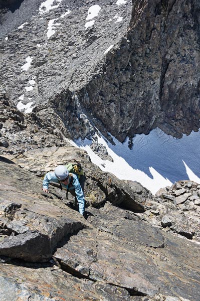
We slogged up the ridge and then where it got steeper tried to cut around on the west side - it was a cliff over there so we continued up the ridge. Then we got to the first big notch in the ridge. We dropped packs and looked around for a way down. It looked like a ramp down on the west side so I packed my trekking poles into my pack and scrambled down. Unfortunately it ended with some sketchy looking down climbing. I probably could have made it, but it is unnerving downclimbing when you can't see the whole way down because it gets steeper under you. The wind (which was less here) and my sore finger didn't help. Kristine's motivation had dropped the most, followed by mine. Robert still had some stoke but it was waning with our waffling. Mostly there was a lot of uncertainty, we were all tired, and the wind was a wildcard. After staring at things for a while (at least an hour) we bailed.
 |
|---|
We headed back down the ridge through the zone of wind, then headed towards Ritter Pass. The last steep uphill to the pass was a lot of loose crap including rocks in the large microwave size range. We tip-toed and side stepped and treadmilled our way up to the pass and down the loose crap on the other side to the snow. That was pretty nice travel in camparison, but it was still a bit annoyingly sun-cupped. Did I mention slow travel was the theme of the day? Below the snow things went relatively smoothly although it soon got steeper than was comfortable. We picked our way down between 2 waterfalls to the relatively flat ground above Ediza Lake. From there we had relatively easy travel across the basin before hiking up and over the ridge to the outlet of Iceberg Lake. There we got to walk on a trail for a bit. It wasn't a great trail, but what a difference even a poor trail makes in travel speed. This somewhat trail went to the outlet of Cecile Lake and then we worked our way back to camp along the talus and discontinuous trails. It was a remarkably long and tiring ~7.5 miles with only about 4500 feet of elevation gain (at least according to Strava). I seemed to always be a bit behind the others - partly because my gear was a little more fiddly - Aarn pack and so on, but mostly because I was just a little slower with the possible exception of very technical terrain. I definitely take more photos when I am a little ahead of everyone.
 |
|---|
 |
|---|
 |
|---|
 |
|---|
 |
|---|
That night I started out with a dose of ramen and then followed up with a couscous meal (leftover Expedition Oregon food, thanks Andy). Kristine had checked the weather forecast - 50% chance of snow from 8-11 and then 50% chance of rain and thunderstorms. That was a bit worse than the forecast for Thursday when we started - 20% chance of afternoon thunderstorms. We decided we would pack up in the morning and investigate 2 more Minarets on the way out. I headed up to the morraine to see if the moon was rising (it was) with an added bonus of cell reception. When I got back my fingers were cold and it was time for bed. This night I was warmer and woke up in the middle of the night to go to the bathroom admire the full-moon lit scenery. I was also running a little warm so I took some layers off. For some reason it took ages and ages to go back to sleep, and then I was the last to get up.
Thursday, 6-24-21 As mentioned, I was the last to get up - around 6:10, and was running behind for breakfast, packing up, and leaving. The others headed up the hill to get into the sun and to get cell reception while I finished up. Eventually I packed and crammed almost everything into my pack and headed down.
 |
|---|
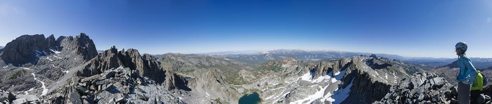
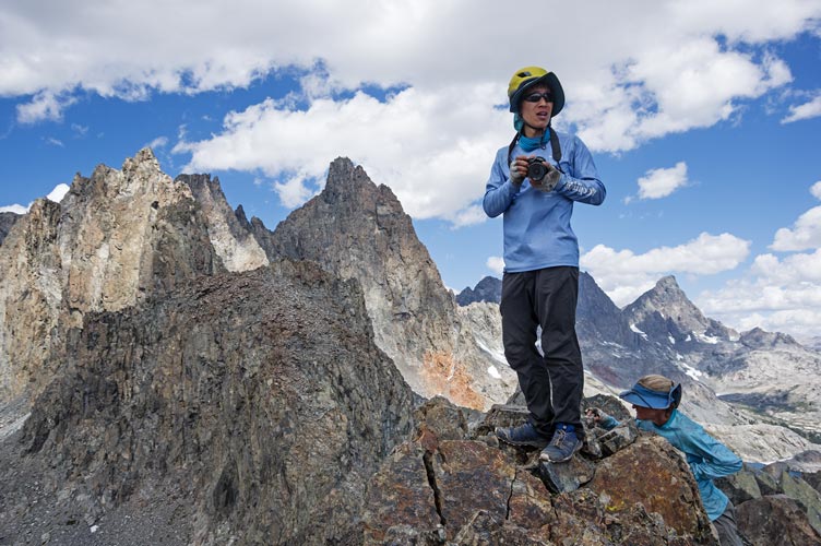
We worked our way down to Minaret Lake and then around the SW side to the gully up between Riegelhuth and Pridham Minarets. We dropped our packs there and headed up - sadly I didn't have a "summit" pack, so threw some stuff into a stuff sack and fastened that onto the back of my Cotton Carrier camera holster. I also got Robert to carry my ice axe in case I needed it. This worked fairly well although it flopped a bit when I bent over downclimbing and it wasn't easy to get things out of it. Then we headed up, at first on the snow, then switching to the rocks when it got a little too hard and steep for comfort. We stayed to the right for a while but then Robert and I headed up more directly while Kristine stayed in the gully to the right. We got to the saddle first since Kristine had to head downhill a bit to get back to us. We stashed ice axes and trekking poles here and then headed to Riegelhuth. This was supposed to have a 4th class way up, but also a 5.6 or so way. Robert probably headed up that while Kristine looked to the SW side and I traversed a little to the NW or maybe just straight W side. I followed a ramp/ledge up and left and then scrambled up into the bottom of a wide chimney (more like the bottom of an elevator shaft). From there I did one laybacky move and then scrambled up to the right a bit. This got me up above Robert and I made sure it went to the top before climbing down (mostly the same way) and bringing helping Kristine up. We regrouped on the top looking for more than a busted plastic tub of a summit register (Kristine forgot to bring up one of the ones she had) as well as enjoying the view. Then we carefully climbed back down the way I had gone up. There were more clouds than previous days, but it certainly didn't look like the forecast had suggested.
 |
|---|
 |
|---|
 |
|---|
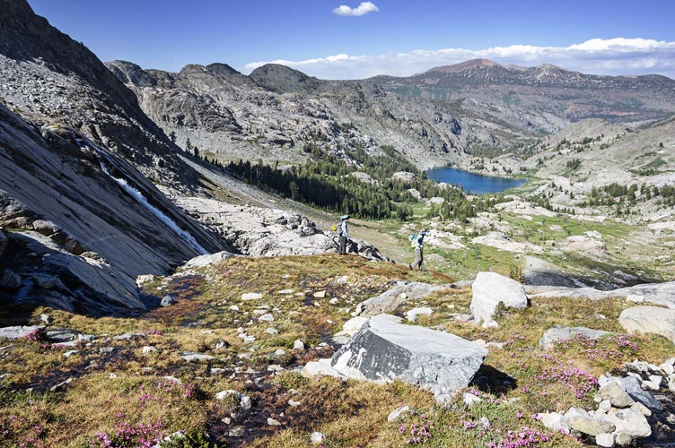
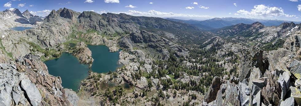
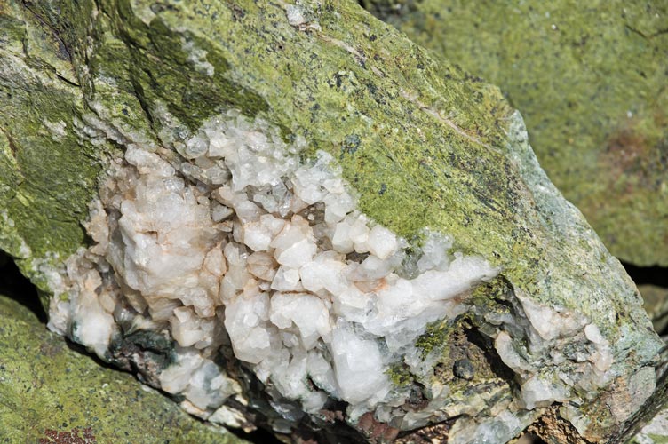
We collected our gear and headed up to Pridham - this was more of a walk up on mostly solid talus and we left a register there and enjoyed the views. We also decided to climb one more bump - Peak 10,213 - a list of John peak East of Minaret Lake. The descent was mostly uneventful with a few steep bits near the top - one where a big rock threatened to fall off it's perch so I held it while Kristine went behind a corner - it fell about 2 feet and stopped there. The snow at the bottom was quick, then we carried our packs the rest of the way around the lakes and stashed them for the last bump. It was a fun little scramble over some epidote rich rock to a bit of a flat topped dome with more excellent views. It took us less than an hour out of our way, and then we strapped on our big packs and headed down the trail.
 |
|---|
 |
|---|
 |
|---|
The hike down was a little hot and there were times that it was threatening to get buggy, but as long as we were moving it was ok. Fortunately where we stopped there was enough of a breeze to keep the mosquitos away. As usual the trail down seemed a lot longer than I remembered although my pack was riding better and my little toe blister was merely an annoyance. Kristine however was having trouble stemming from her pack and the collarbone break from last year. She had to stop a few times to stretch things out. This offered enough relief to keep moving, but didn't really fix things. Eventually we began to see people in "normal" clothes without packs as we got closer to the trailhead and then we just had to hike up the hill to the backpacking parking. This was pretty much full because they hadn't started running the shuttle buses yet. Lots of big people in big vehicles driving too and fro. We re-sorted any gear we were carrying that wasn't ours (in my case some food and a bear cannister), changed shoes and clothes, and headed home.