Tom Grundy's Clyde Minaret Page
Clyde Minaret is another climb that I have wanted to do for some time. I have been haphazardly ticking off the Minaret summits, but this is the highest one and it has one of the "50 crowded classic climbs" up it. Iris was up for an adventure, so we went.
9-12-19 I picked up the permit in the afternoon in the Mammoth Visitor Center on the way back from hiking in Yosemite. I didn't really know exactly what trailhead made sense or where exactly I wanted to camp, but I thought I was getting the right permit (the names of the trailheads don't seem to correspond particularly well to where they are or where the trails go). That night I packed a bunch before Iris arrived and we finished packing much later than was optimal. Iris would be wearing my Aarn pack and I would be carrying the Dana Designs beast.
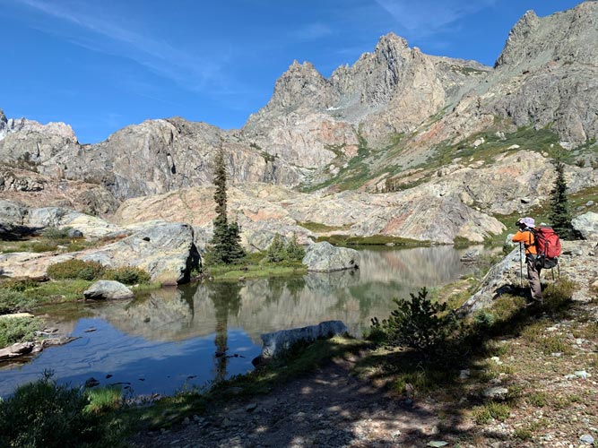
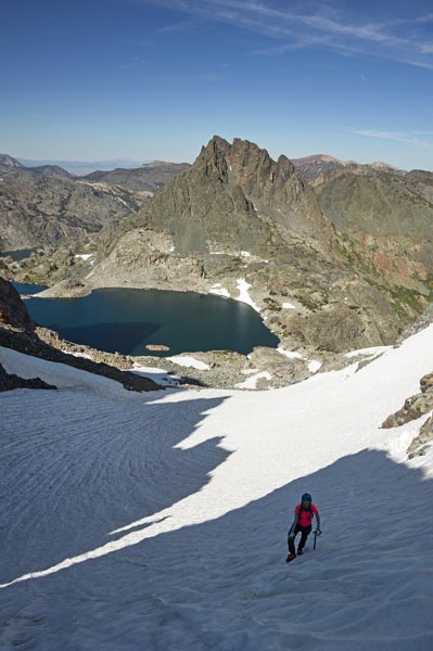
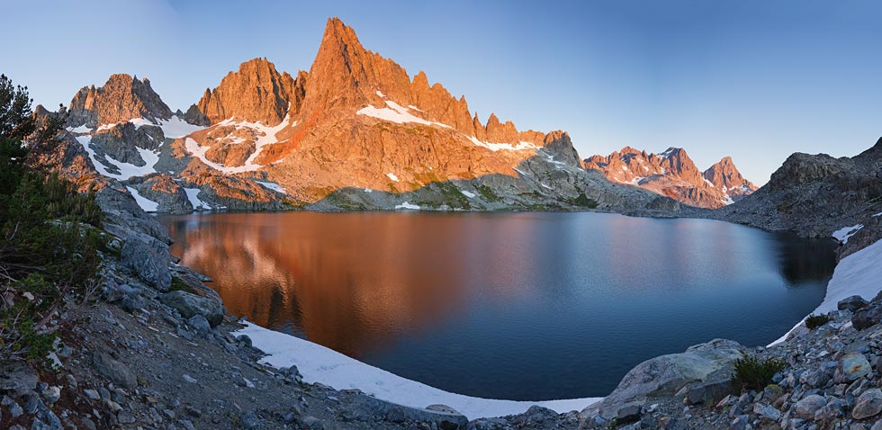
We got up early the next morning so we could drive to the trailhead (later in the day you need to pay for and take a shuttle bus with the added penalty of there maybe not being a bus when you hike out). The trailhead we used was at the Devils Postpile Ranger Station. It was painfully early after a late night and cold, but at least it got us going early and avoiding the worst of the mosquitoes. Soon we were hiking uphill and warming up. Our packs were pretty heavy with climbing and camping gear plus the bear cannister, but we slowly gained altitude and views as we made our way up to Minaret Lake. This lake is pretty spectacular and we considered camping here for the views and somewhat sheltered sites.
almost to Minaret Lake and the views are getting good IPP (Iris Phone Photo)
 |
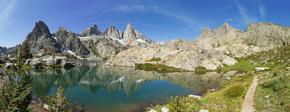
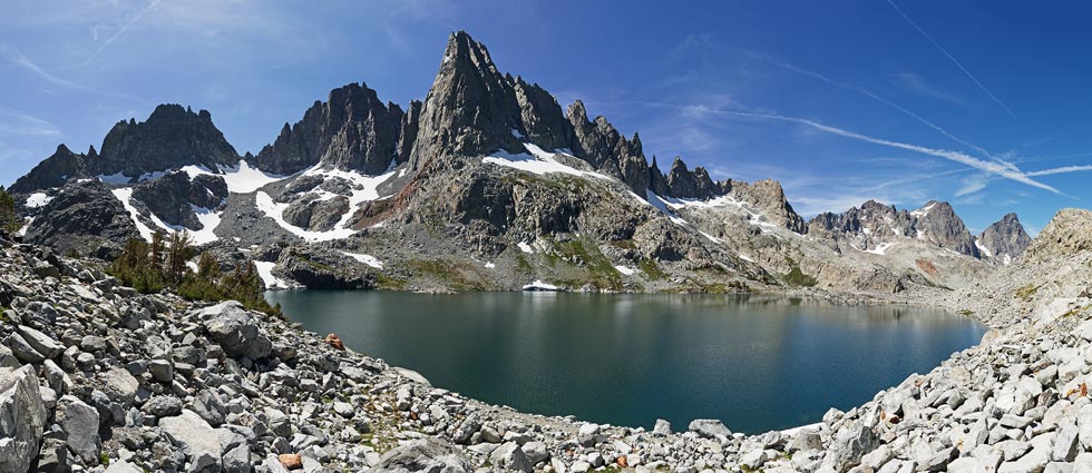
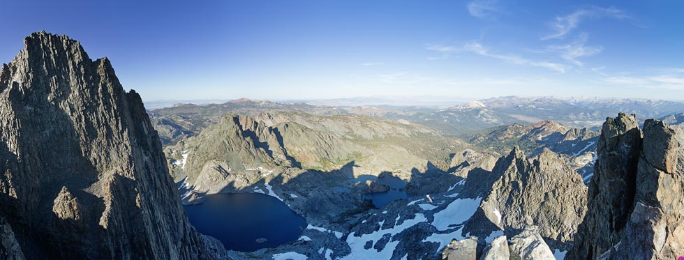
panorama at Minaret Lake
 |
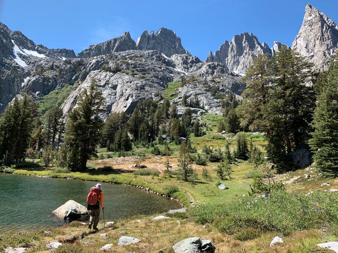
hiking past Minaret Lake IPP
 |
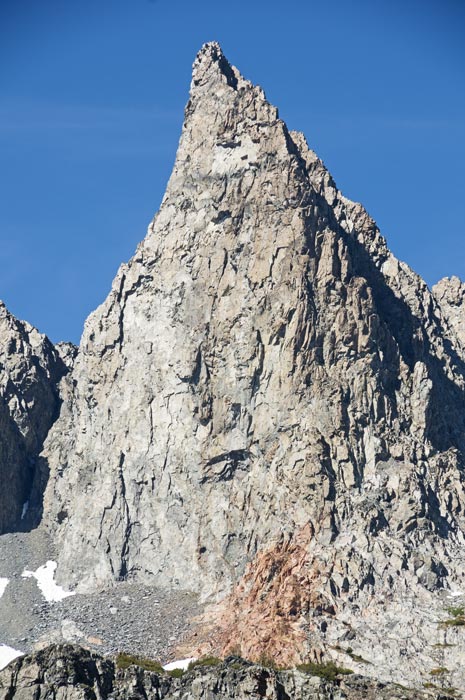
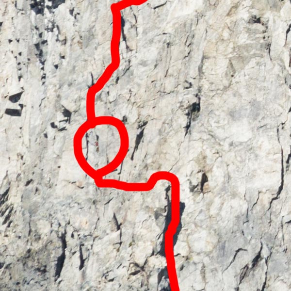
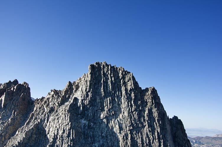
Clyde Minaret from by Minaret Lake
(mouseover for approx route path)
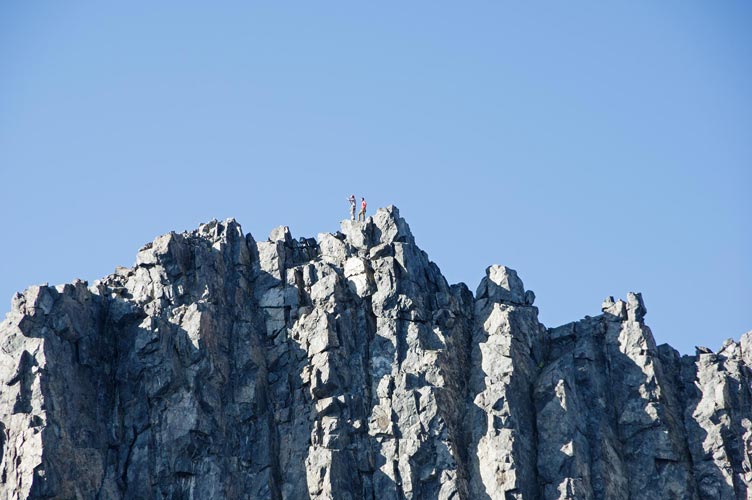
there is a climber in the circle
 |
zoomed in you can see a climber (barely) in the circle
 |
We decided to press on up to Cecile Lake for different views and to be closer to the objective. This was probably the right choice. The trail up to Cecile was a lot less obvious and featured a few loose and steeper bits but wasn't hard to follow. There we found a spot and dropped off most of our gear before heading up to check out the approach and hopefully get up a peak or 2.
panorama at Cecile Lake, Clyde Minaret is the tallest, Ken is to the left of it
 |
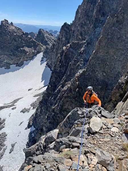
We headed around the lake and up the snowfield to the col between Ken and Kehrlein saddle AKA South Notch. We watched a party of 2 slowly make their way up the SE face of Clyde - we later learned this was Eric and Donatas. From there we headed around the south to the southwest side of Ken Minaret and then traversed over into a bit of a gulley up to a window looking out at Clyde and Lake Cecile (first I went too far left to a sub peak with a nice view. Then we traversed right and up the ridge with a little casting about for the easiest way. We had Bob Burd's trip report to help guide us, but mostly we just had to find what we were comfortable going up. There was a bit of a stem corner and a crack right at the end. We didn't spend long on the summit and carefully worked our way down to the talus. It was starting to get dark by the time we got to S Notch.
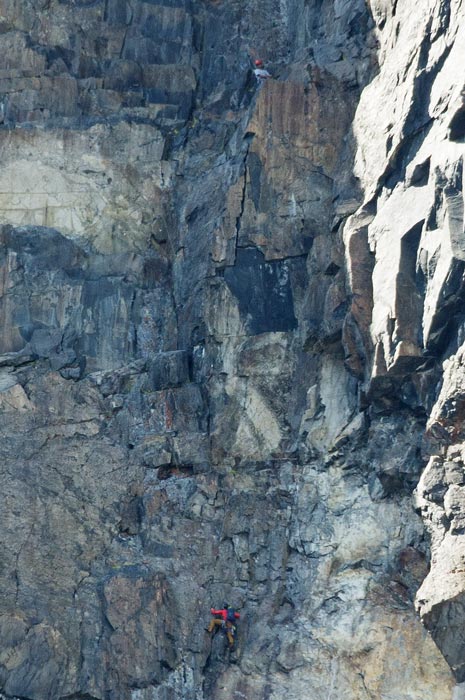
climbers high in the SE face
 |
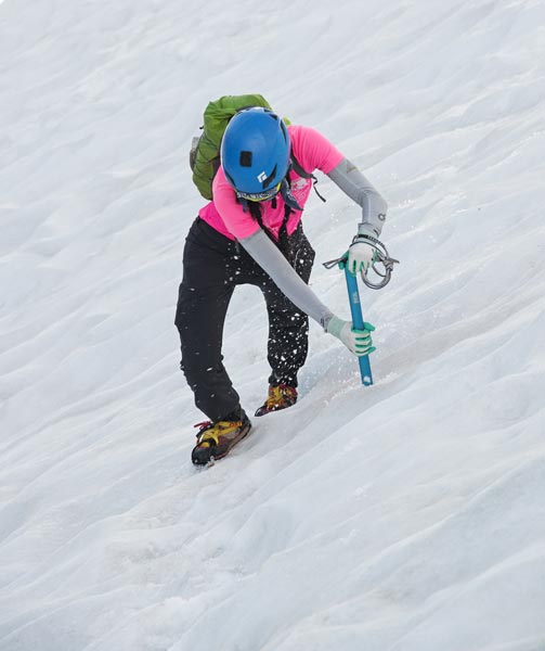
Iris coming up the snow
 |
Iris almost to South Notch
 |
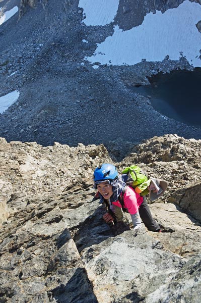
I have almost made it to the summit
just the hardest parts to go IPP
 |
Iris makes the last moves to the top
 |
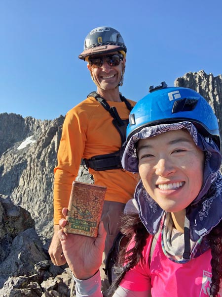
summit pic with tobacco tin register IPP
 |
view over to top of Clyde Minaret
 |
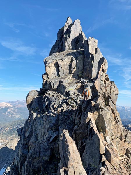
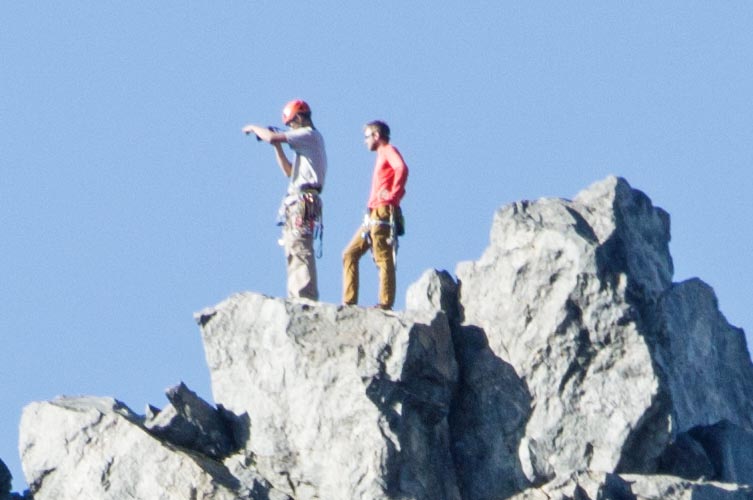
zoomed in to the top of Clyde Minaret you can see people
 |
and really zoomed in you can see Eric and Donatas
 |
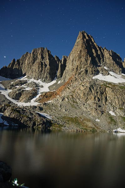
Ken Minaret summit panorama
 |
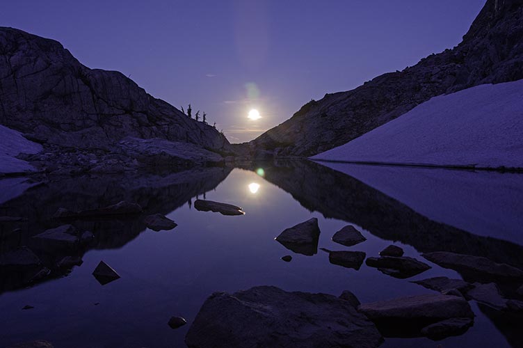
The descent on the cold snow was a little slower, but we were able to follow a vague set of tracks down to lower angled snow and then back to camp. The nearly full moon rise over a small meltwater pool was pretty magical.
Iris descending the snow
 |
moonrise above a meltwater pool
 |
Iris washed up in the frigid Lake Cecile that night
 |
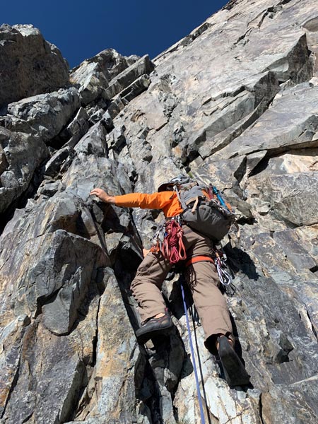
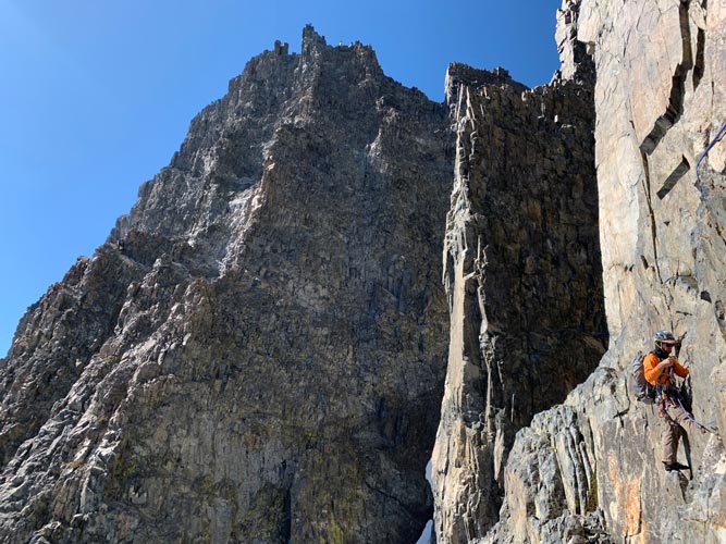
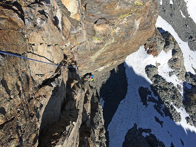
9-14-19 We didn't get as early a start as we would have liked - late nights and lack of sleep were taking their toll, not to mention some of us wanted warm beverages and breakfast (extra cheesy grits for the win). By the time we were heading up to the base of the climb we could see another party ahead of us. Sometimes it looked like they were moving quickly, but other times not so much. We ended up waiting a bit before we started (off to the side to avoid any rockfall) and then headed up. The climbing was cleaner than I expected, but that doesn't mean there wasn't any loose rock. For the most part the rock itself was solid and almost glassy and slippery. The loose rock came in the form of various sized blocks perched on ledges. I don't know if some of the bigger ones could be easily moved, I carefully avoided them. Having a big pack didn't help the climbing, but the hardest part was rated 5.9+ so well within my limit even with extra warm clothes, food, water, 2 ice axes, crampons, and shoes on my back. Instead of dropping down for the first traverse I just cut straight across - which was harder than the drop down to a big ledge, but still probably only 5.7 or so.
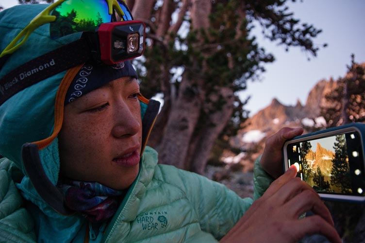
Iris taking a pic in the morning
 |
Minarets in the morning
 |
starting up the first pitch IPP
 |
the crux was a clean dihedral IPP
 |
I traversed high to avoid dropping down along the ledge IPP
 |
most of the way through the traverse IPP
 |
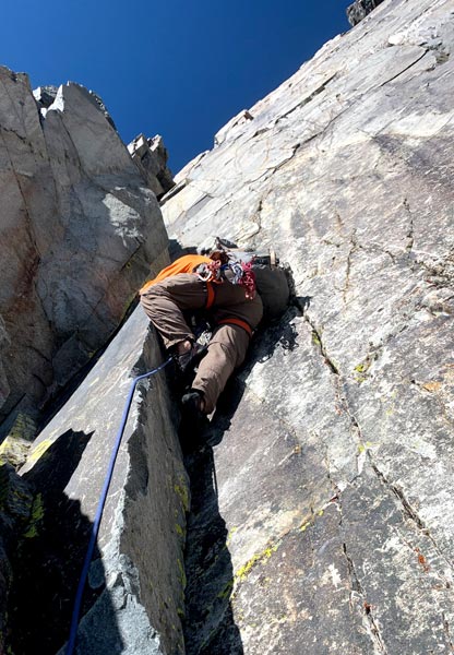
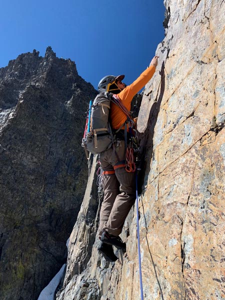
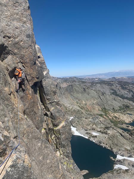
We made reasonable progress up and stopped to wait a few times to avoid running into the other party. I also set my belay a little early once and then had Iris lead the last bit to the normal belay ledge after they party ahead was gone. We ended up using a few different belay spots for similar reasons. At some point on the upper wall they managed to get ahead and were no longer in the way. The traverse down and over to the dihedral was some of the harder climbing, but it was easy once I made it to the dihedral. I ran it out going up the dihedral quite a distance before placing gear - less rope drag plus a near direct toprope for the traverse for Iris. For the first half of the climb we were in the sun and things were nice and toasty. Higher up the sun went past the edge of the minaret and we were in shade and a bit cooler. It still wasn't bad and we were somewhat sheltered from the wind in a big dihedral for a few pitches.
following Iris up onto a ledge
South Notch is almost visible at the top of the snow IPP
 |
the downclimb to another traverse IPP
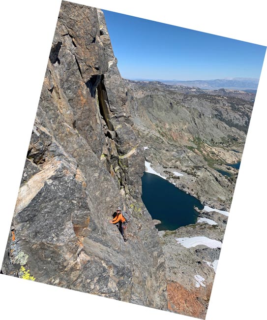 |
heading up the dihedral IPP
 |
Iris higher on the dihedral
 |
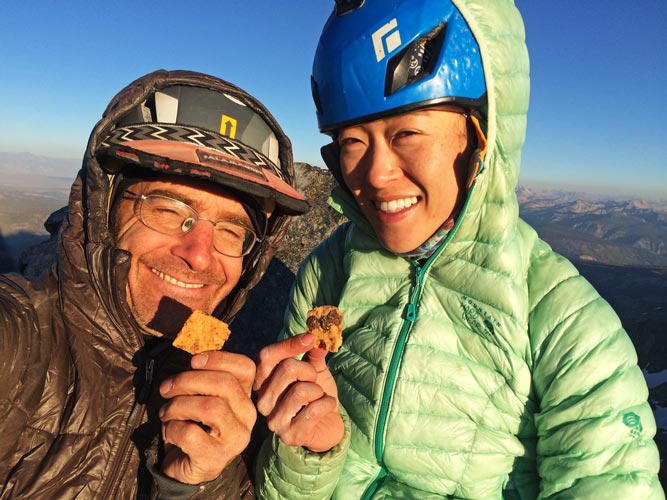
Once we were off the main SE face there was still a fair bit of climbing to go. This was mostly easy scrambling with just enough 5th class climbing to keep the rope on. We finally made it to the summit fairly late in the day. The view is quite spectacular, but there was a chilly breeze. We headed down shortly.
Clyde Minaret summit cookies
 |
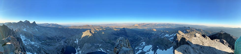
Clyde Minaret summit panorama IPP
 |
Iris had been up and down the so called "rock route" before, so I hadn't spent a lot of time figuring it out. For the most part I think we followed it correctly, but I wasn't sure we were on the best part. At least we were able to do the hardest bits before it got dark. Once it was fully dark the big-picture navigation was harder. Still we managed to find the traverse around skiers right and traversing across and down the face above the snowfield. This is the part I should have scouted out better from camp earlier. We ended up going down the rock to the lowest point.
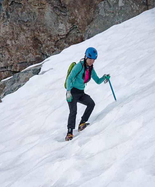
Here things could have been ugly - but we had a pair of crampons and ice axes. The moon had also come up so when we turned off our headlamps it was easy to see how far the snow went - somewhere around 200 feet (I hoped), but feared it was a little more. The plan was to set an anchor and have Iris single rope rappel with the crampons and her ice axe to the end. If she was still on the snow she would kick and chop a nice ledge before fastening the crampons onto the rope for me to pull up. Then I would take down the anchor and climb down with my axe and crampons. At that point we would chop a bollard and or use an ice axe for an anchor and repeat the exercise until we made it to the rocks. Fortunately a single rope just made it to the rocks, so we only had to do it once. It still took a long time. Then we carefully and laboriously worked our way down the steep rocks to the outlet of Lake Cecile and then around the lake back to camp (with a few more snowfields to cross just for fun). Getting off our feet and putting hot food into us was a good thing. In retrospect with a little careful scouting we might have been able to figure out a way down to the S and around the W and S end of the lake which might have saved some time and effort - or maybe we would have been cliffed out and had an epic.
9-15-19 We slept in and then hiked up to the base of the climb to see if the ice axe we saw the day before was still there (it wasn't). We poked around hoping to find some dropped gear with no luck and then headed back to camp to pack up and hike out. Despite the slightly lighter packs, the hike out felt tedious and slow. We did make it out before we needed headlamps though, and since the weather was changing (cold front coming in), mosquitos were much less of an issue.
As a bonus I think I've now climbed 13.5 of the "50 Classic Climbs of North America" or maybe 12.75 as well as a few adjacent climbs. I would like to climb some more of the Minarets, but the traverse seems quite daunting.
No material on this page may be copied or used without permission.