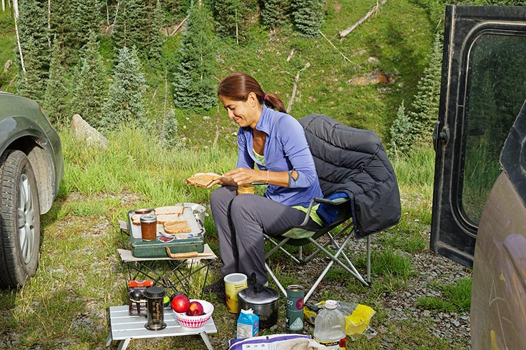
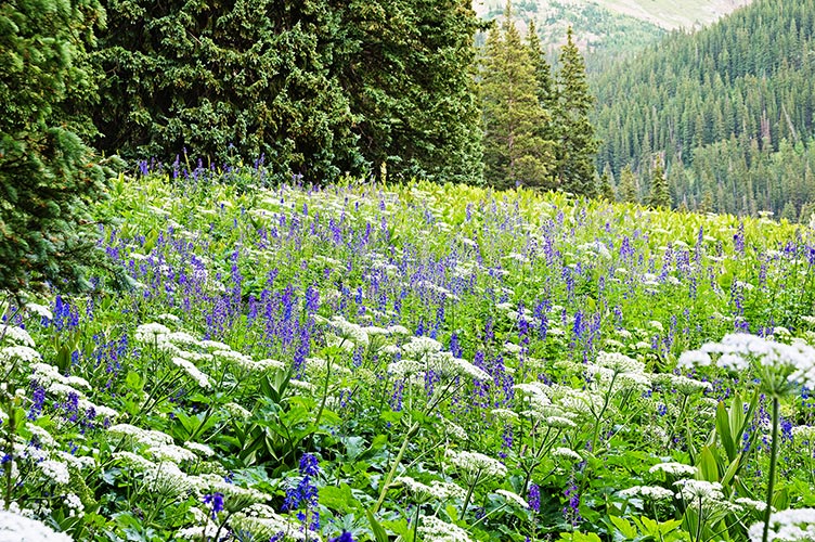
July 26th - 27th, 2016. The first thing we had to do was get to the trailhead. As usual that was a bit of a drive with the last bit on dirt roads. We opted to spend the night at the trailhead and hike in the next morning for an overnight. I wasn't sure if this would be a 2 night trip or a one night trip so we packed for 2. The hike in was slow with lots of pretty wildflowers and some wild strawberries. It also rained a bit - Nalumon put on her raincoat and that was enough to keep me from having to. The trail was uphill (like all the approaches) and sometimes quite steep. It was tempting to stop by Navajo Lake but we had time and I gambled on finding a spot up closer to the start of the climbing. I wanted to be able to do all 3 in a push and starting closer would be one way to increase my chances. Nalumon was tired and doubtful so I was a little worried I wouldn't find anything. Fortunately there was a nice spot away from the trail near the start of the north buttress. This was a little flowery meadow with a few signs of old camping and a lot of marmots. They were a little too inquisitive and I lobbed a shoe at one that tried to chew on my tent. We were around 12,000 feet and as a cold wind picked up I feared I made the wrong choice with a less warm sleeping bag (but I was ok). I had an early start planned for the next day so we went to bed early.
| |
|---|
 |
|---|
 |
|---|
 |
|---|
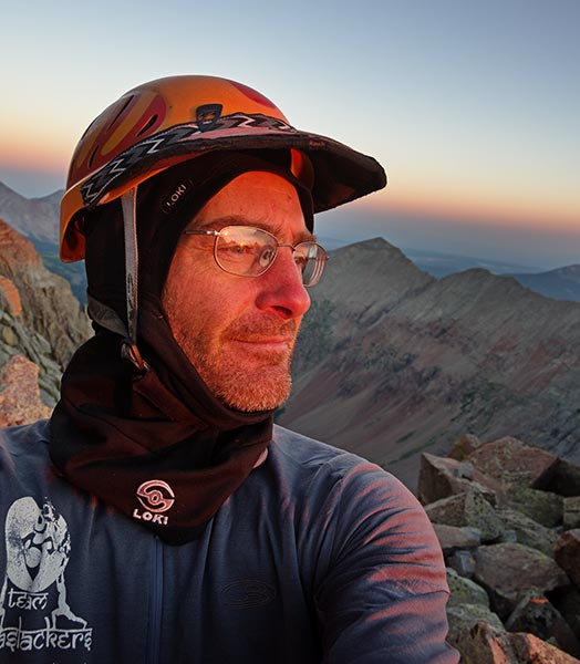
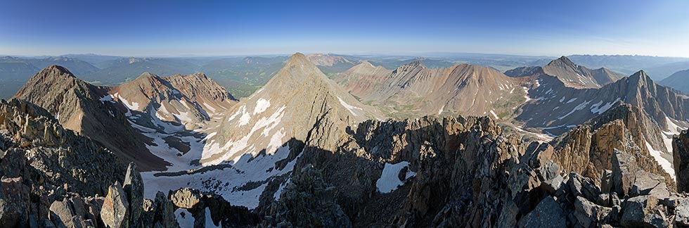
7-27-16 This was going to be a big day so I got up early and was off up the slope in the hopes that I would get to the climbing about the same time it got light. I was actually a little too early and the days were starting a little later so I had to climb by headlamp for a while. The route description was pretty elaborate and I tried to follow it, but for the most part I just went up the buttress trying to follow the path of least resistance and most solid looking rock. This worked and I made steady progress upwards. I could see at least one party behind me by their headlamps. The climbing (4th class) was hard enough to be interesting and give me an excuse not to red-line my effort but not so hard as to be scary or slow me down much. It wasn't always clear how I would get past some section ahead but the instructions and intuition seemed to work fine. I topped out nearly at the 14,159 ft summit of El Diente and took a short break for some food and photos. El Diente doesn't qualify as a true 14er in that there is not enough of a drop between it and the higher Mount Wilson but it was a lot more work than some of the others.
 |
|---|
 |
|---|
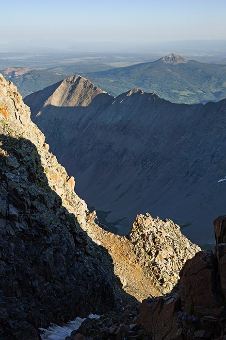
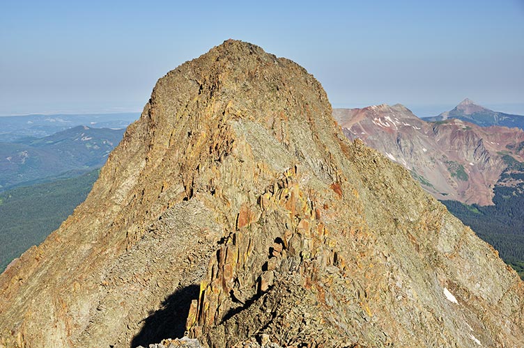
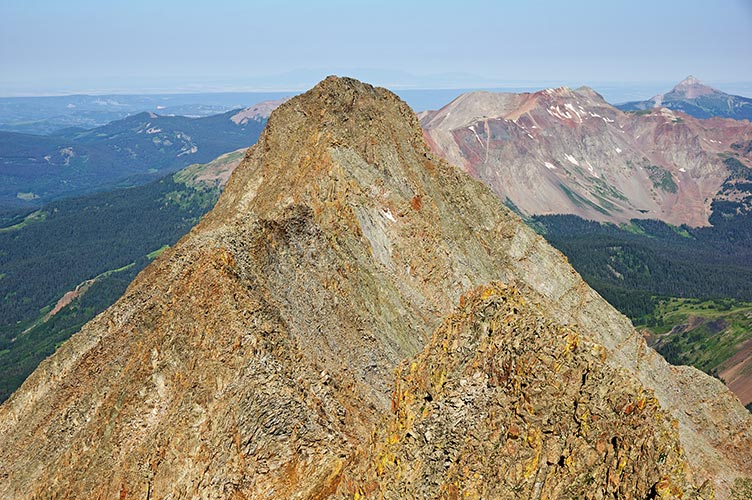
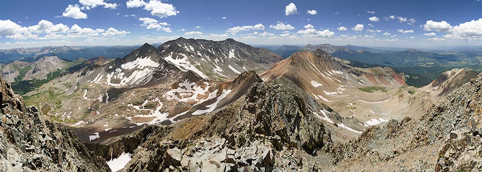
There was a mile long ridge between El Diente and Mount Wilson with at least some 4th class scrambling so I figured I'd better get on it. I passed someone heading towards El Diente soon after I started but then I was on my own for a lot of scrambling down and around gendarmes and along sidewalks in the sky. I had to keep changing my hat, arm warmers, and gloves based on the sun and wind to stay comfortable. It took longer than expected to get to the final climb up to Mt Wilson at 14,246 feet. Once again I took a food and photo break before heading down. I briefly considered trying to climb Mt Gladstone on the way to Wilson Peak, but it looked like some backtracking and more effort than I really wanted to expend.
 |
|---|
 |
|---|
 |
|---|
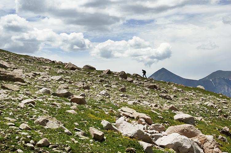
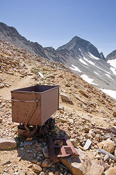
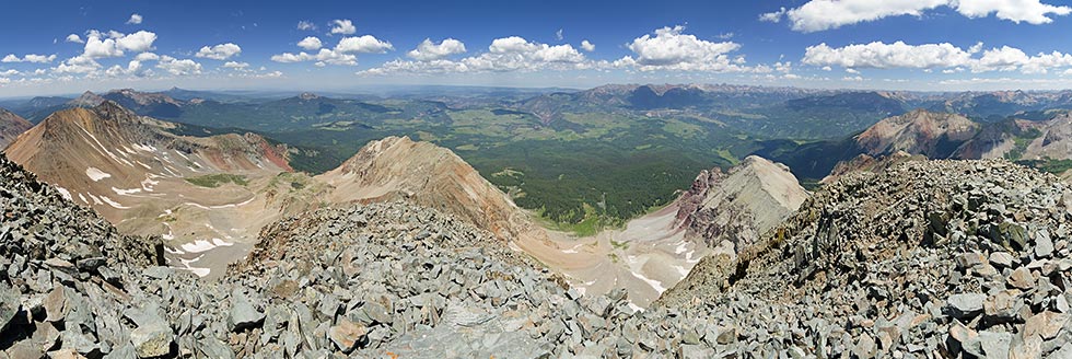
The descent from Mt Wilson was a pain with a lot of tedious large talus downclimbing and traversing. There were numerous places where it looked like it was about to get easier but then didn't, some short sections of trail, and cairns all over the place. The good news was you could go down nearly anywhere, the bad news was nowhere was obviously better. I probably should have detoured off to the right near the bottom to take advantage of a long snowfield glissade but I went down the rather obvious trail instead. At the bottom I decided it looked like the weather would hold out for another peak. I got some water and headed right up the other side soon reaching the trail diagonalling up towards the Rock of Ages Saddle. I detoured up from some interesting old mining ruins towards the trail above to the next saddle and from there met some people turning around because the trail was too sketchy. I was tired but the trail looked fine compared to what I had been up earlier in the day so I continued on traversing across a steep bit rather than dropping down and having to climb back up. The trail traversed up and to a false summit with a pretty steep descent and climb up to the final summit. I was quite tired by now but still made good time compared to the group fresh up from sea level. The 14,017 foot summit was pretty hard on them although one had a little oxygen bottle that he said was awesome. I managed to get a bit of cell reception on the summit but it was weak and spotty.
 |
|---|
 |
|---|
The descent seemed very long but didn't actually take all that long. I was very glad to have trekking poles. Back in the valley I contoured around to our campsite and pretended to be a marmot chewing on the tent 'til Nalumon jumped out to chase me off. We debated hiking out that afternoon or spending another night and after a bit of a nap decided to pack up and head out. I was feeling pretty beat and Nalumon realized that if I was carrying a full pack and had climbed 3 14ers that day and we were going downhill she could hike just as fast as I could - maybe faster. I was feeling pretty beat and besides there were photos to take. We made it back to the cars before it got dark to end a very long and tiring but satisfying day.
 |
|---|
Summary of July 26 and 27, 3 14ers - one with a star, about 19 miles, 7200 feet of elevation gain up to 4th class, wild strawberries, marmots galore, a golden sunrise, and one tired Tom.