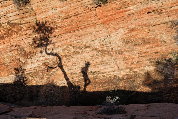
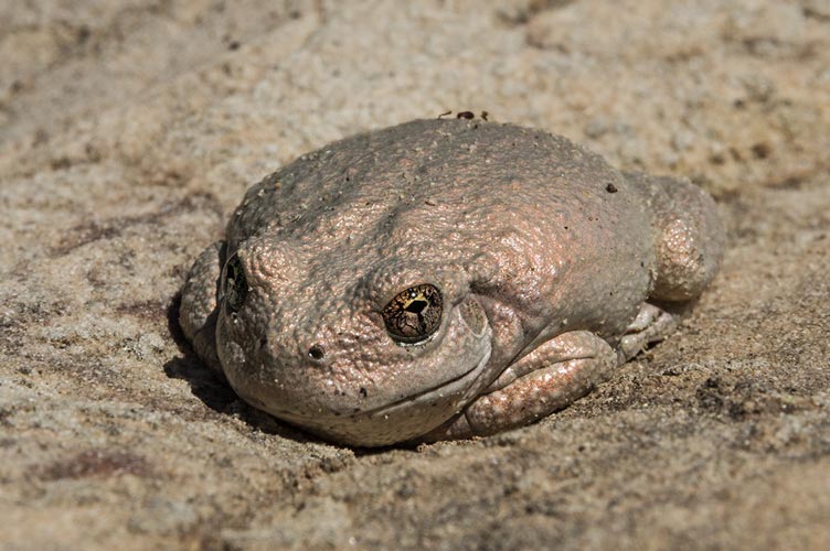
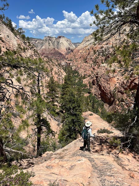
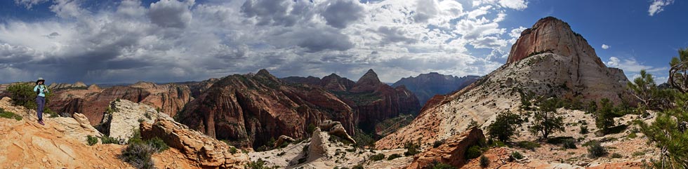
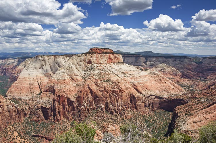
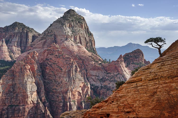
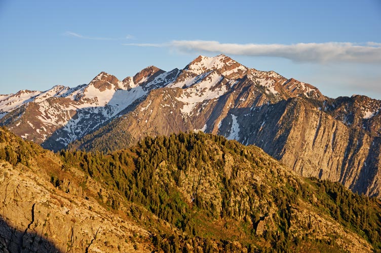
6-04-2023 The plan for today was Mountain of the Sun. That meant another early start to get a parking place near the overlook trail. We started off up Pine Creek before cutting west out of the drainage and past some petroglyphs before dropping into the start of spry canyon to turn north up over another pass where we stashed water before dropping down into the steep and messy maybe Lodge Canyon. We followed this down to where we were able to get onto a ramp that cut back up south towards the saddle between Twin Brothers and Mountain of the Sun. There we saw a really pretty golden frog (canyon treefrog) sitting in a little fold of the rock in full sun and not particularly near any water. Then we scrambled on up to the summit - with once again amazing views perched on the edge of Zion Canyon across from the Patriarchs.
| |
|---|
 |
|---|
 |
|---|
 |
|---|
 |
|---|
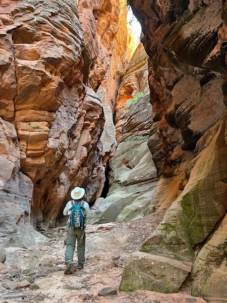
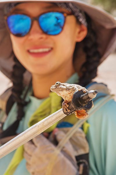
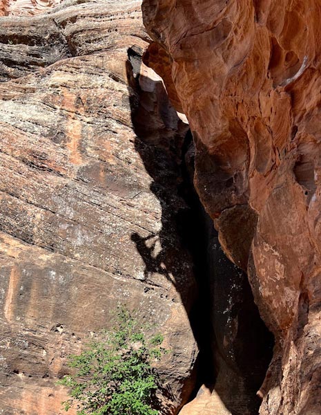
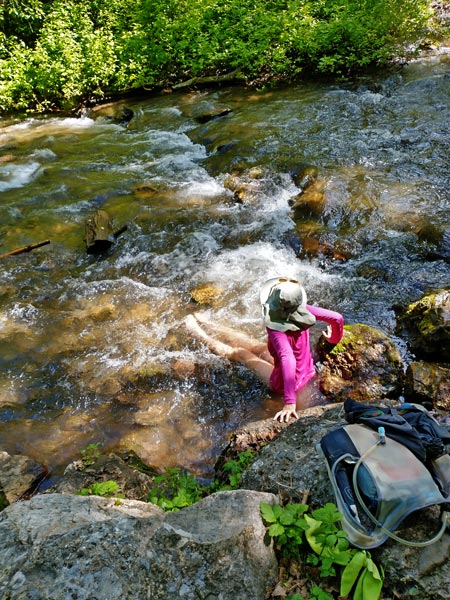
After descending we considered going up Aeolian Point, but it didn't look so easy, so instead we explored into a deep and cool slot chasm. We should have stashed beverages in there. Then back into the main canyon where we saw heaps of frogs above and in a few pothole pools. We spent some time communing which also involved Iris scooping one out of a pothole with her trekking pole and then admiring it before it leapt from the pole onto her side - screaming ensued and I so wish I had been recording video.
 |
|---|
 |
|---|
 |
|---|
The hike back up to the saddle was tedious and sweaty. We stopped in the shade when we could and took a break when we got to the top. From there to the next saddle wasn't so bad and it was a short distance up to Bighorn Peak. From Bighorn we decided to head up to Shelf Point with great views (and a bit of a preview of some of tomorrow's journey) before dropping back down through some slickrock wonderland past a deep chasm and up to Mind's Eye. We descended SE from there back to the Element. For some reason our usual shower outhouse was jammed with picnickers, kids, and so on. We waited for the crowds to thin a bit before washing up and then headed back to camp for a rather large pasta stuffing, but not sleeping as early as would be best.
 |
|---|
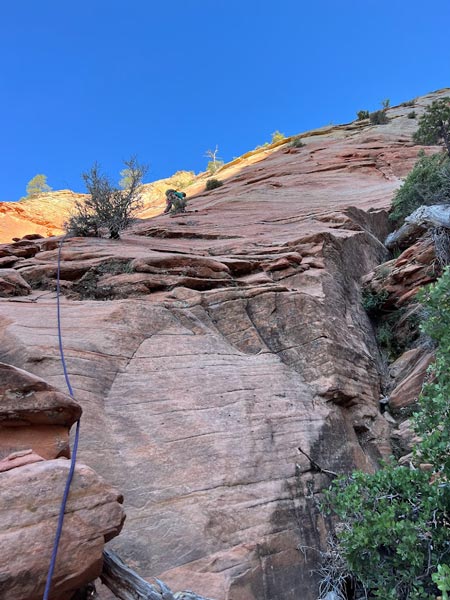
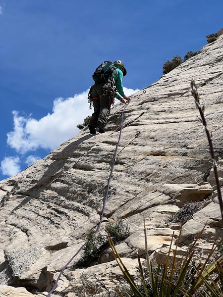
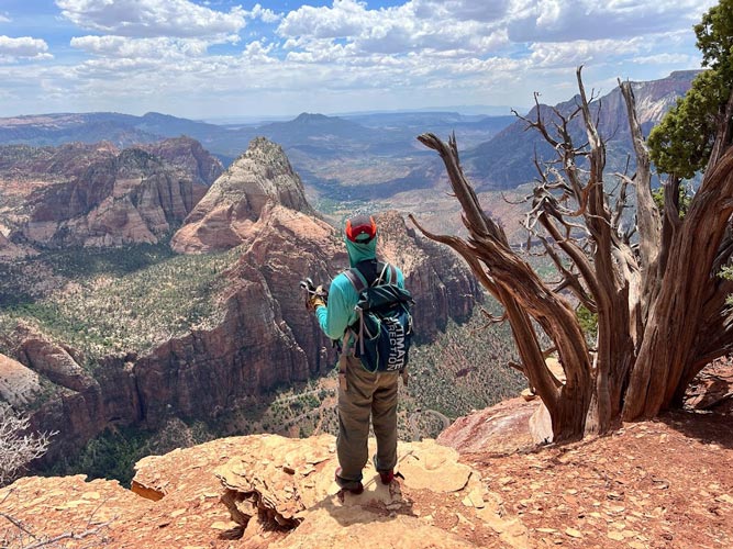
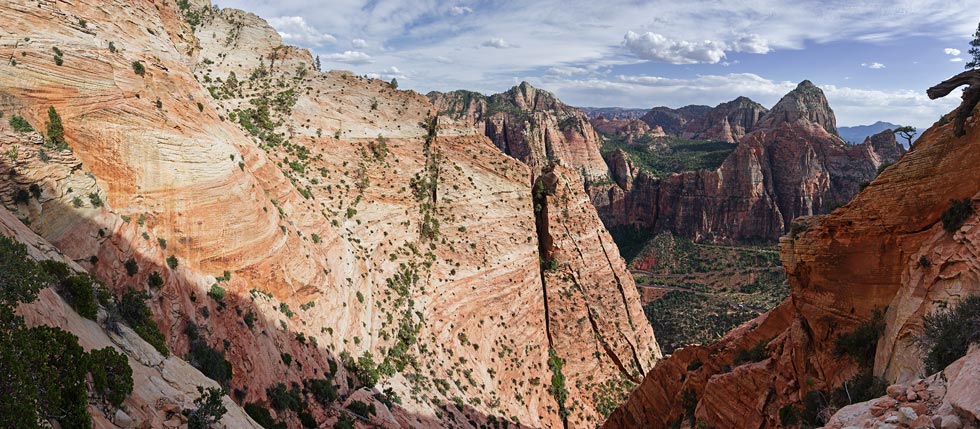
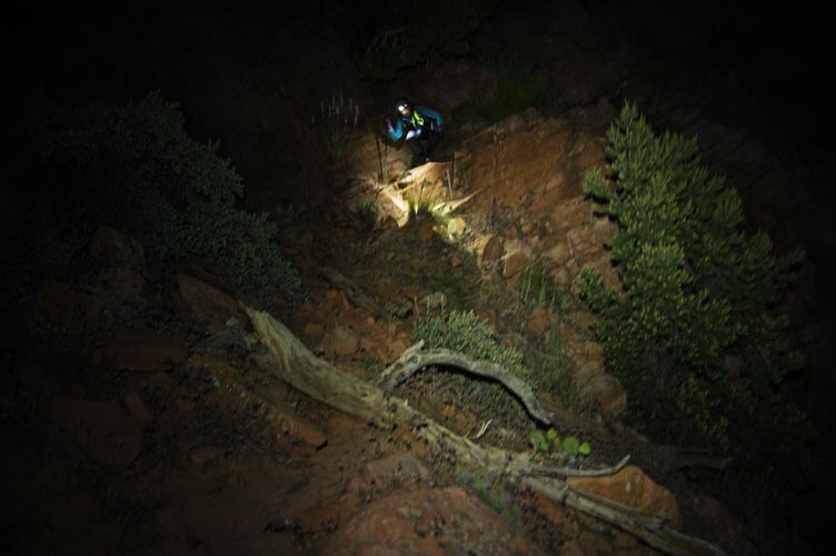
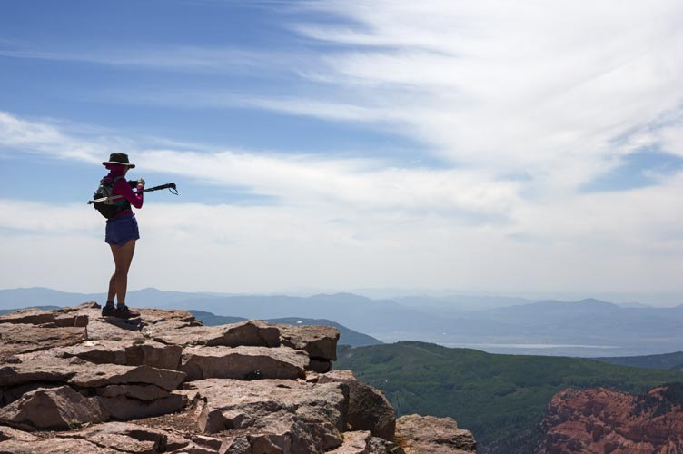
6-04-2023 4:50 came too early (as it usually does) and we packed quickly and headed into the park. We got a spot but parking was getting a little crazy before we left to hike up the overlook trail and then turn right and work our way up the slabs. We cut left trying to follow the easiest route across the steep slabs. It seemed that a little higher or lower usually looked better. Oh well. We were higher than most of the tracks we had, with a little interesting scramble to get into the first gully. We dropped down at the far side of the gully and then traversed around to a hoodoo where we stashed our first water bottle and rested briefly in the shade. Then we worked our way up to the next gully where we had to drop a few hundred feet and traverse over to a rising gully which we followed up to the last obvious place to get out on to the slabs by a huge dead tree trunk. There we stashed another water and pulled out the rope.
 |
|---|
I free soloed up with my ruby slippers trailing the rope. I was planning on slinging some bushes but they seemed to be barely able to hang on with their feeble roots in between some bedding flakes let alone hold a fall, so I just went up trying to follow the easiest path. I was somewhat constrained by trailing the rope in that it would catch on these bushes that wouldn't hold me if I went back and forth too far. Eventually I made it to the tree and the end of my rope. I anchored myself to it and brought Iris up. She had to take a somewhat more direct and more difficult line, but had the benefit of a top rope.
 |
|---|
From there one route description suggested traversing left and others suggested up. In hindsight we should have gone left, but I went up trailing the rope again - I slung a little tree and Iris put me on belay. There was more sketchy loose rock and less than desireable holds before I made it to another tree and brought Iris up again. At least she was able to more or less follow my line up this. Then I threw the rope over my shoulders and we scrambled up and left around a few pinnacles to bypass the 5.7? chimney. We went a little too far left, but made it work. I trailed the rope up a more sketchy part to a tree, and then Iris went from there up to the tree at the start of the climbing.
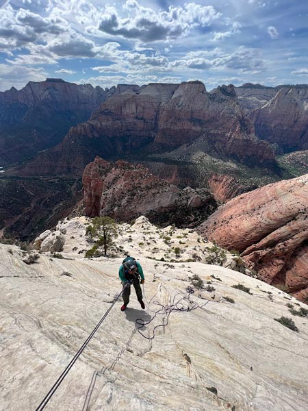
It was a relief to see massive glue in ring bolts. We changed into climbing shoes (ouch my feet seem to have expanded) and I led off up the bolts. This was much less harrowing than the earlier scrambling although it might have been technically a little harder. We did 3 pitches this way and then scrambled up to a slung pile of bushes at the top of the technical climbing. There we took off our climbing shoes and left the climbing gear and headed off traversing on the north side of the final summit headwall. We went all the way across the N face and then turned the corner and scrambled up to the final plateau where we walked back west across a surreal landscape of little trees and cactus to the high point. As expected the views were pretty spectacular, although with the wooded plateau there was no one point with vistas in all directions. All of the previous peaks we had done looked a lot smaller from this perspective. We sat in the shade eating and resting a bit before looking over various overlooks and then headed back down. Despite being a technical climb, there were bighorn sheep signs all over up here with tracks and droppings everywhere you looked. We followed the way of the sheep back down to our climbing gear and set up to rap.
 |
|---|
 |
|---|
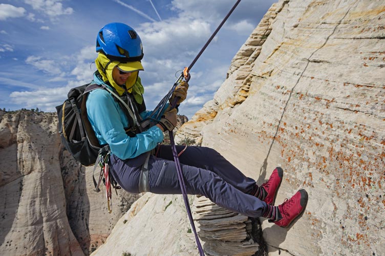
We beefed up the bush anchor and Iris rapped back to the top of the 3rd pitch (although all her weight was on the old anchor cords and webbing). Then I took down the anchor supplement and scrambled down to her. The raps were tedious because the angle was pretty low and there were plenty of bushes and other things to snag the ropes on. The final rap was a bit of a rope-stretch with a 70 M to get back to the slope - although we could have stopped on a ramp higher or threaded the rope through one or even 2 of the massive ring bolts if we didn't make it down. There we coiled up the rope and drank a Mountain Dew Code Red to pep us up before scrambling back down around the little pinnacles. We took a much better line down and then stayed skiers right all the way down to the level of the first tree anchor (with rap slings on it). The traverse around the corner and to the tree was easy. We beefed up the old slings here using a piece of blue webbing from N Guardian Angel as well as my own slings for Iris to do a single rope rap all the way back to where we had stashed the water and start climbing. Then I pulled up the rope and rapped partway down before pulling the rope and managing not to stick the rope or pull a loose block off a ledge above me. Then I scrambled back down to Iris and the worst of the technical scrambling and climbing was over. We still had plenty to go though.
 |
|---|
 |
|---|
 |
|---|
 |
|---|
We worked our way down and then back up out of this gully and back down to the hoodoo with the stashed water. We drank some more and refilled our little bottles and then headed back along the slabs. We dropped lower across the gullys which was probably easier - but maybe by now we were just so much more desensitized to walking on steep slabs. We slowly made our way back observing a wedding party at the overlook down below. As we got farther east and above the overlook the slabs were less steep and we made better time with a few steep bits right at the end. We made it to the overlook about sunset and back to the element soon after that. We backtracked up the canyon a bit to our favorite showering outhouse and then to the visitor center to refill our water supply and then back to the BLM land to cook dinner and stay up too late. As far as gear goes, I would bring some extra webbing to leave on trees for rapping and 7 or 8 alpine draws plus gear to anchor yourself to a giant staple anchor. I brought a few nuts, tricams, and 2 small cams. I could have placed one of the cams or a tricam in a spot that I thought would hold, but it was on the section with bolts, so I didn't bother. Definitely bring sticky rubber approach type shoes - and maybe climbing shoes depending on how you feel about climbing up possibly 5.7 slab with a few holds. I thought the sketchiest part was going up left of the gully before the bolted climbing although trailing the rope might have limited my ability to wander along the easiest line. Props - or maybe you need a mental check - to Sean and anyone else who free solos this whole thing.
6-05-2023 Today we slept in a bit and had a slow morning before heading out west to Hurricane where we got some more food at a Wal Mart and then went to the library where Iris worked (mostly out in the element) and I caught up on internetty things. Then we had barbecue that night and went to the Gooseberry Mesa? area to camp. The dispersed camping here isn't quite dispersed as there are numbered spaces, but we got number one. The advantage was it was close, the disadvantage was a bit more traffic and dust going by it. In any case we got a good night's sleep.
6-6-2023 Another work day for Iris, so we headed back to the lovely Hurricane library. I typed up most of this, recharged batteries, and did more internetting as well as barbecue sandwiches. We camped at Hurricane Cliffs.
6-7-2023 Another rest day with library time.
6-8-2023 Iris dropped me off by highway 59 and I followed a track from John Kirk working my way up through some mud-rock cliffs generally following a rock choked gully up to the final cliff headwall. I went up through a semi break in that to the east and then cut back to the high point. The views were most excellent. I could see Iris and the element down below at the parking lot for a bike trail. I avoided the sketchiest mud cliff by skirting it to the west to drop down a steep slope instead of a cliff. Then cut cross country to the parking lot.
 |
|---|
Back at the lot we had lunch and I did a bit of stretching/yoga in the shade of an information kiosk while listening to an audiobook. In the late afternoon we got in a little library time to recharge devices.
 |
|---|
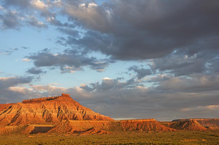
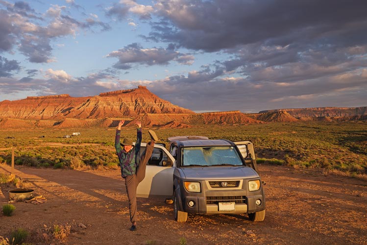
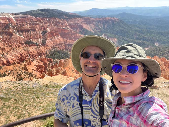
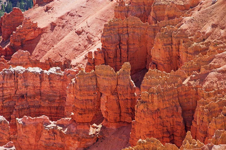
6-9-2023 We went back to Hurricane where I explored the little museum there - it featured a lot of very local information on the settler families, the building of the irrigation canal that made Hurricane possible, and other facets of early settler life as well as various native artifacts and bits and pieces that people had donated including the remains of a wedding cake from 1907. Fortunately other people came in shortly after I did so they got the "guided" tour. Iris went in later and was not so lucky as she was overwhelmed and smothered with information until another group came in. We went up a few little bumps this day (Hurricane Hille and Cinder Cone)Then we plotted our next day's adventure and headed back to Smithsonian Butte near Zion. We were there a little early which helped us get a space no problem, but meant we were in the hot longer than we wanted (a little pain) and attacked by some sort of little flying evil insect (no-see-ums?) which was pretty horrible. Fortunately they eased up as the sun set. We packed up for the next day and went to bed early.\
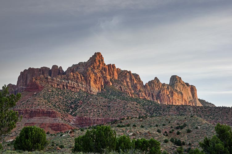
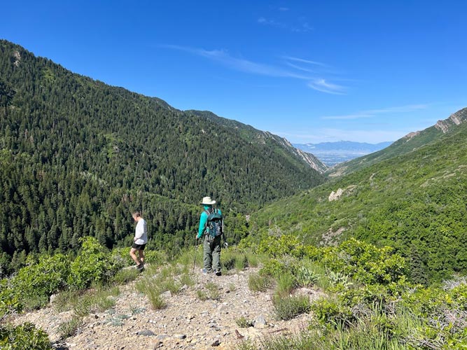
6-10-2023 This was going to be a big day. We got up at 4:30 and headed to the trailhead. There we finished packing up and drinking tea and headed off just as it was getting light. The trail starts off threading its way through some fancy houses before it hits the Zion boundary and we left it. From here on out we were not on any formal trails although often there were social trails to follow. I had downloaded a lot of tracks, but other than a few places they did not really go the exact same way.
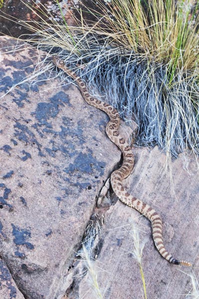
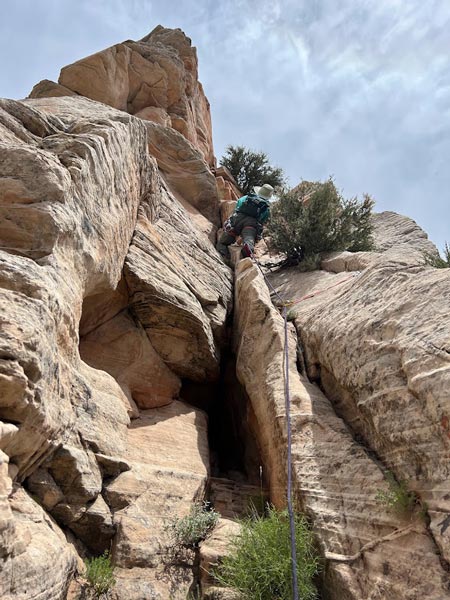
We followed the path of least resistance as best we could up towards the plateau below Mount Kinesava. On the way some of the time we were following social trails or at least footprints and we passed one rather chilly and sluggish rattlesnake. At the Plateau we stashed a water bottle and then headed up to the notch between Kinesava and West Temple. This had a fair bit of scrambling up a ramp, but nothing very hard. We took a break at the notch and stashed another water bottle and then scrambled up to Peak 7,085 on the ridge towards W Temple. There was one bit of stiff scrambling up a corner with a tree but the rest wasn't bad (maybe we were desensitized to steep sandstone by now). We took another break on the summit of 7,085 and briefly joined a family zoom call. Then we had to descend to another notch before heading up the intimidating looking ridge. Here there was some more serious scrambling with some steeper slabs in a corner (we opted to avoid the finger crack on the ridge and cut left to a corner/chimney - we went up the first of 3 semi options, and then cut into the middle one. We descended the middle one, and that probably is the most secure/easiest). I tied off and threw down a bit of rope as a handline for Iris to have for the last bit of this ascent. Then just piled the rope over my shoulders and headed up to the climbing pitch.
 |
|---|
 |
|---|
We put on our harnesses and Iris used climbing shoes but I just continued with my ruby slippers which I wore the entire day. We also stashed one more water bottle here. The pitch had 3 bolts and I also placed one small cam before the first bolt (.4 bd camalot I think, a .3 might have been better) the second bolt was a bit pulled out. There were a few other options to place gear but I didn't bother up to the 2 bolt anchor with cord rap setup. I belayed Iris up and she went up to the plateau above where we left the climbing gear.
 |
|---|
The hike across this level of the plateau was a bit of a slog with a lot of manzanita and little oaks and cacti and some flowers. We saw no sign of sheep up here, so evidently they are much better at slabs than stemming. There was a steep use trail switchbacking up the final ramp onto the upper summit plateau and then we bushwhacked through manzanita and little trees to approximately the high point as marked on the map and peakbagger. Then we returned to near where we came onto the plateau and found the register - the plastic part was very deteriorated and there was a glass jar with the older register. I built a little rock house for the plastic remains and then we walked over to some solar powered radio antennas that had been brought up with helicopters. There was a bit of a view off the SE side and we sat on a concrete pad with a bit of shade to eat a sandwich. Then we headed down.
We did a single rap down the climbing section. The cord looked ok, but we backed it up and I bounce tested it before Iris cleaned our gear when she came down. We perked ourselves up with a Mountain Dew Code Red and then did another rappel down the chimney. There were 2 anchors going down this, but I thought the 70 M rope got us down to some easy enough scrambling. Sadly Iris slammed her bad knee into the rock while scrambling down this. Then we pulled the rope and stowed our climbing gear back in my pack and headed down. The scrambling back to 7,085 was slow but not that difficult but the last bit back to the notch towards Kinesava was somewhat difficult. We went a slightly better way I think - avoiding climbing through a little tree in a corner.
We had hoped to climb from the notch up to Kinesava, but it did not look very easy to get there. When Sean did Kinesava and then went on to West Temple he said this was the hardest route finding and he had to do some detouring. So we headed down the way we came up looking for a way to cut the corner back up to Mount Kinesava. We dropped down to just above 6200 feet before we were able to follow a loosely ducked loose slope up towards the route up.
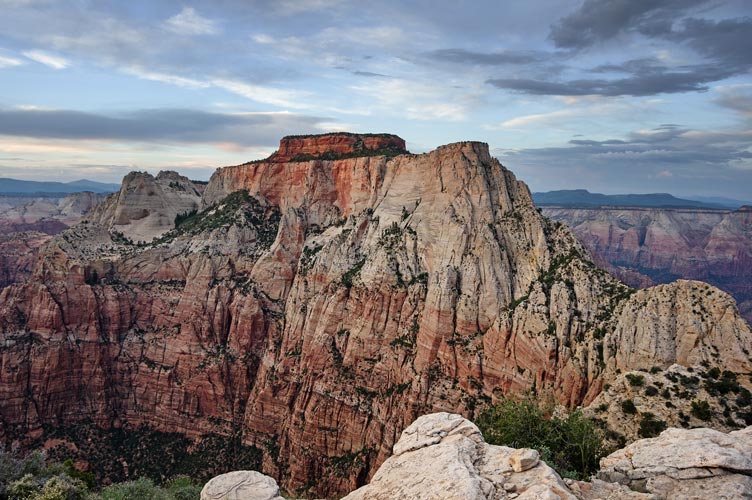
Once we were on the Kinesava route we left our climbing gear and empty water bottles (and a little water) and headed up. The scrambling was a little harder than up to the Kinesava - W Temple saddle, but there was enough traffic that it was pretty easy to follow. Then we walked across the sandy plateau and scrambled up the final summit pyramid. The views were very spectacular in all directions. While on the summit the sun dropped down through a gap in the clouds and set behind the Signal Peak Massif to the NW.
 |
|---|
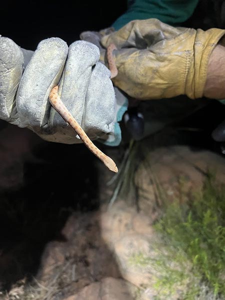
We retraced our steps back down and across the plateau and back to our stashed gear. It was getting dark by now and we put on our headlamps. Somewhere down here I saw a cute little snake - probably a baby gopher snake. As it got dark we followed the path until it sort of dissipated with a yawning abyss dropping off into the dark below us. I checked the gps track and saw most went down a little bit behind us, so we backtracked and found a steep chute to descend. Below that the tracks sort of spread out and we followed whatever paths we could find heading back to the corner of the plateau. This was a lot less straightforward than we expected. I was checking my gps regularly and was alarmed to see that the battery had gone from about 50% where we picked up the climbing gear down to 33% in a very short time - evidently the phone decided that turning on the wifi and running the battery down was a good idea. I put it back into airplane mode lockdown and it only dropped a few more percent over the next few hours back to the car.
 |
|---|
 |
|---|
Eventually the slope leveled out as we neared the corner of the plateau and we walked around a little looking for the stashed water here. After picking it up we were able to follow a pretty good path for a while down the ridge. Then we were just sort of following whatever path we could find heading more or less the correct direction with a lot more uphill than I thought we would have to do. Then we followed another pretty good trail down the ridge before that disappeared and we headed cross country towards the park boundary. We crossed that following a wash under the fence and then followed that until we were close to the trail and popped out of the wash across the desert to the trail. Once we were on the trail it was just a matter of heading down it back to the trailhead. It was still pretty warm even though it was almost midnight. We were pretty tired of being on the move at this time, and I was ready to get out of my ruby slippers which had taken a pretty bad thrashing on this trip. I wore a hole through the outside edge of one shoe - these would be so much better if they were made of dyneema or even nylon canvas instead of flimsy cotton.
We got back to the parking area late - around 12:10. There we changed shoes, drank a protein shake, and packed up. Next up we drove into the park to get water and wash up. Then we drove up past Lamb Knoll to sleep in the BLM area there. We ate sardines and corn chips on the way up. It was much cooler up here and sleeping felt a lot more cozy.
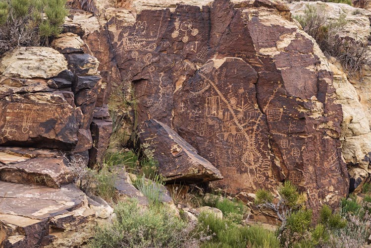
6-11-2023 After the long day and late night we slept in a bit and had a relaxed pace morning. We drove into the park for cell coverage and ended up cooking lunch at the Wildcat Trailhead. Then we went back to Lambs Knoll and repacked our climbing gear and went out for a little climbing. We did the "Australian route" and I did a few others including a fun overhanging 5.11 jug haul. Meanwhile the no-see-ums were attacking Iris so she ran back to the car for long pants. That night we headed out from Zion and started north on I-15 turning off to spend the night by the Parawan Petroglyph site.
 |
|---|
6-12-2023 Iris had a work meeting this morning so we had breakfast before that. Then we checked out the extensive petroglyphs including ones from white settlers from the 1840s to 1990s or so (maybe even more recent? hopefully not). It started sprinkling as we walked back to the Element. By the time we got to the dinosaur track site it was raining hard. I took Iris' little travel umbrella and went and looked at one but was having trouble keeping the umbrella from getting destroyed in the wind. I definitely would have spent more time here had it not been pouring. We headed back to I-15 and turned north.
 |
|---|
There were some torrential rain cells making for some scary driving with worries of hydroplaning and sudden near zero visibility. At one point there was over an inch of sleety hail piled up under the windshield wipers. We made it to the SLC area and a friend's house by 6. There we spent the next few days taking advantage of plumbing - yay, actual showers), worked (Iris) and caught up with writing this, relaxed, and played Dominion.
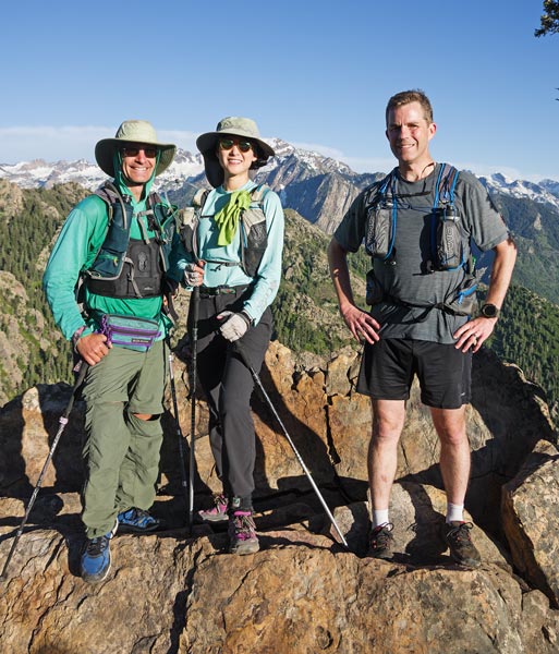
6-15-2023 We went for an after work jaunt up Mount Olympus. The forecast was for rain in the morning, and then we thought that those of us who worked could get off earlier in the afternoon - this was not the case. We didn't start hiking until rather late, but it was still pretty hot as we started up the rather steep trail in the sun. We were all sweating (or panting in the case of Crusoe the dog) and welcomed the stream crossing as a chance to cool off a bit. We pushed on up to the saddle and then the final trail with a bit of scrambling on slippery quartzite up to the 9,026 foot summit. The views were quite nice - especially to the south where the higher Wasatch peaks have quite a bit of snow on their north faces and to the west out over the city and the Great Salt Lake.
 |
|---|
 |
|---|
It got dark on the descent so Ian who didn't have a headlamp ran ahead to make it down before it got truly dark and Iris and I continued at a safer pace with the light of our headlamps. It took a bit longer than expected, but was a pretty nice hike and it got us to the top of a nice peak and fulfilled the last green square I needed (to fill in the peak every day grid) until September. All in all a worthy day.
 |
|---|
6-17-2023 On Saturday morning we headed up to hike (or run as the case may be) mount Aire. The winter gate was still on the road about 1.5 miles short of the trailhead, but we decided to just go up the road on foot. We were joined by Ed and Ian and Crusoe. They went ahead faster than us. There was a lot of up on the road and especially on the trail, but it was mostly pretty good footing and someone had recently trimmed back a good bit of the brush and scrubby oak branches (thanks whoever did that). It was pretty green and lush but I think the wildflowers haven't peaked yet. The views to the south and west were particularly nice. It was a bit of a surprise to look down on I-80 from the summit. We headed back down and met Ian and Crusoe who had come back up to meet us and we took the pipeline trail down instead of hiking down the road. This resulted in a steep descent back to the road slightly below where we had parked at the end. On the way back up to the car we stopped to soak our legs in the shockingly cold creek. This was a little traumatic while we were in the water - especially for the toes in my case, but shortly after getting out felt pretty good.
 |
|---|
 |
|---|
Over the next few days I went to the Outdoor Retailer show in SLC, it was much smaller than previous iterations in SLC that I had been to and a number of the big companies were not there either because they were protesting Utah's poor track record with protecting the environment and cultural heritage or because they didn't feel that it was necessary to be there anymore (or some other reason), but it was still cool to see some of the new products that are coming out and talk to the people developing them. I ended up with a bit of swag by the end and bought a few items I had been wanting or that were at a really good price. That did make the Element a bit more crowded for the ride back - but also gave us more insulated storage with a new small igloo cooler that fit in with the milk crate platform system.
6-22-2023 Iris was still working but the OR show was over, so I went for a jog/hike up a series of little bumps north of the capitol building. This ended up being a little more tiring than originally planned, but it was probably good exercise to try to jog some 11.5 miles and about 2500 feet of gain in the sun. The views were quite nice and the flowers were pretty good too. After recovering from that a bit I walked to the Temple Square area which was undergoing a lot of construction/renovation. I went through the LDS history museum which had a lot of original artifacts and a not surprising quite complimentary story of the early church. I also went in the tabernacle building which featured quite good acoustics and a woman practicing the organ.
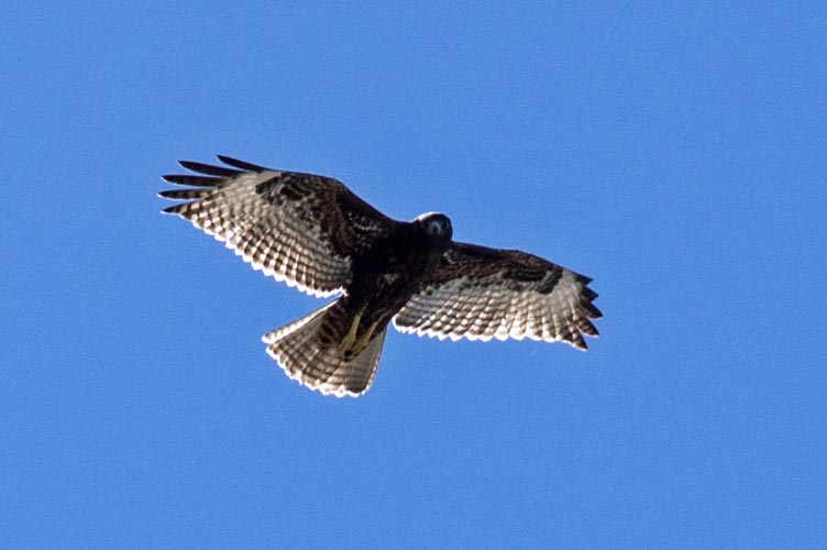
Originally we were going to stick around the SLC area for the weekend and then Iris was going to fly out for work, but that got cancelled, so we went back to Ian's Friday and played Dominion and then Saturday the 24th we headed back - with a nice stop at Brian Head - an 11,307 ft peak along the way. There was a big snowdrift over the road within one mile of the summit, so we parked and walked. This was nice, as it would have felt a bit like cheating to drive the whole way, and we needed to stretch our legs. We also got to enjoy the sweet smell of a lot of little flowers and see what I think was a golden eagle and various other critters. We were pretty unsure of where to camp for the night with the hope of one more bump the next morning. We decided on Mohawk Hill - which meant that after driving through Vegas and the CA agricultural inspection delay (they looked in the back and probably just gave up - it was a mess back there) we drove through the mine right of way and up a gravel road into BLM land. There we found a flattish spot above 5,000 ft to spend the night.
 |
|---|
 |
|---|
 |
|---|
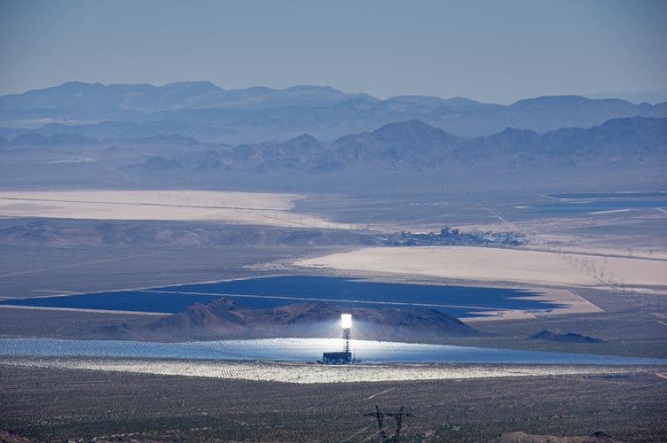
6-25-2023 We slept in a bit and then after a breakfast of leftover oatmeal fortified with fruit and nuts we hiked up Mohawk Hill, this had a bunch of antenna towers on top and also had a view down onto the Ivanpah concentrated Solar plants, I-15, and the Mountain Pass Mine (a rare earth element mine that in the 60's to 80's dominated the world's production of REEs but then went bankrupt after Chinese production came online - it is in operation again - maybe not very economically viable, but as it is the only REE mine in the US it is a strategic source). After a brief stop near the summit we walked down the access road which was paved in parts but was steep and had enough gravel on it to make it pretty treacherous. Fortunately we had already climbed the nearby much higher Clark Mtn or we would have wanted to climb that. Then we drove back to So Cal with fairly heavy traffic and a stop at the outlet stores by Barstow.
 |
|---|
 |
|---|
This was a month long trip in the HotElement and served as a nice test of it as an adventure base camp. There were things I really liked and things that weren't so great. First the good - we had a big air mattress across a platform over milk crates in the back - this almost always resulted in a comfortable sleep platform with enough room to sit up in the back. The back tailgate or a little table made a nice cooking platform. We had a daisy chain all around the back with lots of stuff hanging off it to keep them out of the way. We still had too much stuff to really put it all inside when we were sleeping - this meant we stuck at least some stuff outside every night - usually water bottles, dirty clothes, camp chairs, and backpacks if not more stuff. A rooftop carrier would have let us put more stuff in there but probably hurt our mileage a bit. We did bring some stuff for canyoneering and boots/ ice axes/ crampons for hiking in snow and backpacking gear that we ended up not using, but otherwise we used most of the gear we brought - day hiking, climbing, hot and cold weather clothing, cooking gear, food, work clothes for Iris, lots of camera gear and a little laptop for me... It would be a lot easier if we didn't like doing so many different things, and we didn't even bring any boating, skiing, or biking stuff.
Things I didn't like so much. The front wheel drive Element does not have a whole lot of clearance (and I am only slowly getting used to what clearance it has) and it is pretty weak in going uphill with poor traction - the front wheels just spin. My loaded down truck does much better getting up hills and I have a better feel for what it can get over and what is ok to hit (the trailer hitch) and what isn't (everything else underneath). I also don't like the fact that we do have to move things around to sleep - slide the seats forward and put something into the space that leaves. Still this wasn't that hard to do - especially when one of us did that while the other cooked. We never had to deal with much rain while sleeping - so we didn't have to close windows and have no ventilation inside. The addition of the cooler that fits in with the milk crate platform will help, especially for shorter trips where we can start with frozen stuff in it, It would be even nicer if it was an electric cooler for longer trips. The back door lifts up to provide just enough room that I don't hit my head on it, but the struts don't lift it high enough on their own, so if I didn't lift up the back the last few inches by hand I bonked my head on it. This happened more often than I liked.