Tom Grundy's 2023 Utah Trip Page Part 1
Iris had some time off, and possibly the need to be in SLC for work, so we decided to combine this into a roadtrip/worktrip.
I drove down to YL May 24, On the 25th we packed up the Element and headed up I-15 through Vegas and camped in the desert that night.
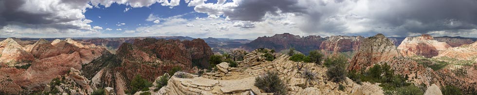
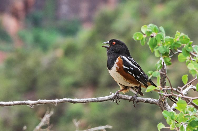
5-26-2023 We got up and did the long slow drive to the trailhead for Moapa Peak (a 6,471 ft DPS peak). Some said the road to the TH was 4wd or at least high clearance required so we were a bit nervous how far we would get. It took a bit of careful driving to avoid the ridge in the center of the road in some spots but maintain speed in a few sandy spots and the front wheel drive is amazingly bad at uphill traction, but we made it. Then we headed up the trail - with an almost immediate backtrack to get back to cell phone coverage to take a call.
The trail up was only really a suggestion of a trail much of the time, but there were a few cairns and it mostly went where it seemed like it should go - and we had a gps track to follow. We tried to stay in the shade along the edges of washes, but soon we were just cooking and sweating in the sun going uphill. At least there was an occasional breeze up higher.
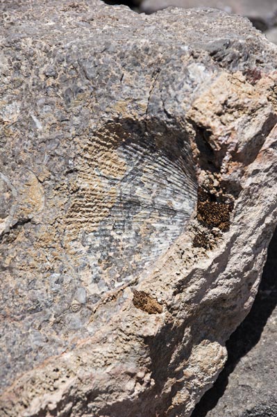
brachiopod fossil - there were a lot of fossils in the limestone
 |
The route cuts left and ascends a ridge almost to the summit ridge and then cuts back right beneath a massive cliff and then up to the summit ridge before turning back left and ascending the "knife edge" ridge up to the summit. We passed 2 others heading down in the shade before the knife edge. They worked at a mine in Goldfield and this was the last peak of their little peakbagging vacation. The so called "knife edge" wasn't all that sharp, but you wouldn't want to fall either direction. We spent some time on the summit with decent cell service and a cool breeze and then headed back down. After returning to the trailhead we drove back to the highway and then turned off to hopefully rinse off in the Virgin River - it turns out the river was more of a chocolate milkshake of mud than something you would want to rinse off in, so we rinsed with drinking water before driving on towards the Virgin Peak trailhead. This time the element (and my driving) weren't up for the challenge, so we parked in a wide spot of the road to camp for the night.
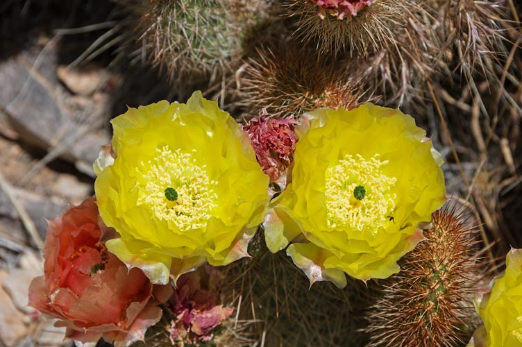
yellow cactus flowers looking at you
 |
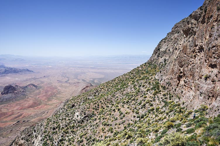
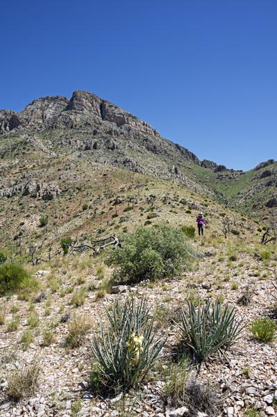
Iris traverses below a cliff band
 |
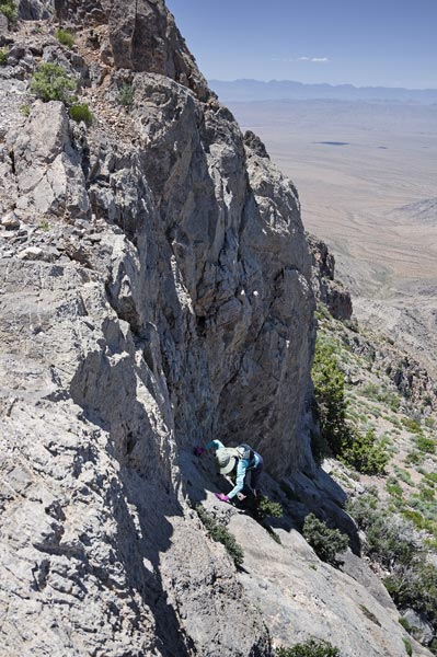
Iris scrambles up onto the ridge
 |
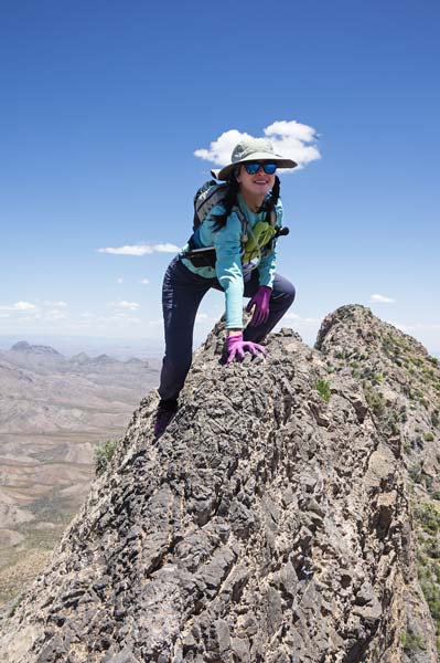
Iris on the knife edge ridge up to Moapa
 |
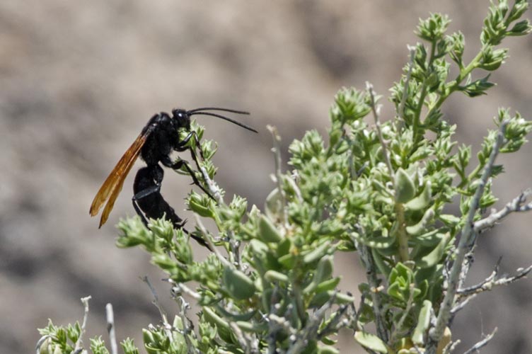
tarantula hawk near the summit
 |
Strava track for Moapa Pk. 05-26-2023
5-27-2023 We got a pretty early start and were able to hike in the shade almost all of the road section (that we probably could have mostly driven with a jeep, but definitely not the element). Then there was a bit of steep uphill onto the ridge - this was hot and sweaty, but there was a bit of breeze on the ridge. The ridge was long and had a number of false summits near the end, but it was mostly pretty easy going and the views were nice and there were a lot of wildflowers. Much of it had burned a few years ago which meant not much shade, but also not very many trees in the way. We took a few breaks to cool off and snack when we got shade.
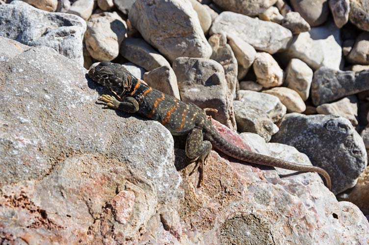
great basin collared lizard (female I think)
 |
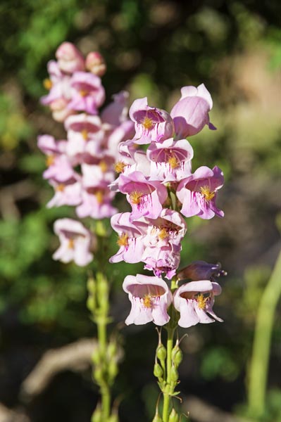
Palmer's penstemon flowers
 |
globe mallow? flowers
 |
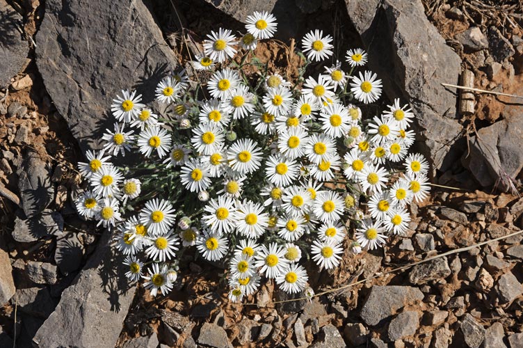
daisies
 |
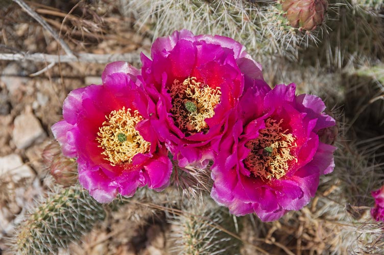
cactus flowers
 |
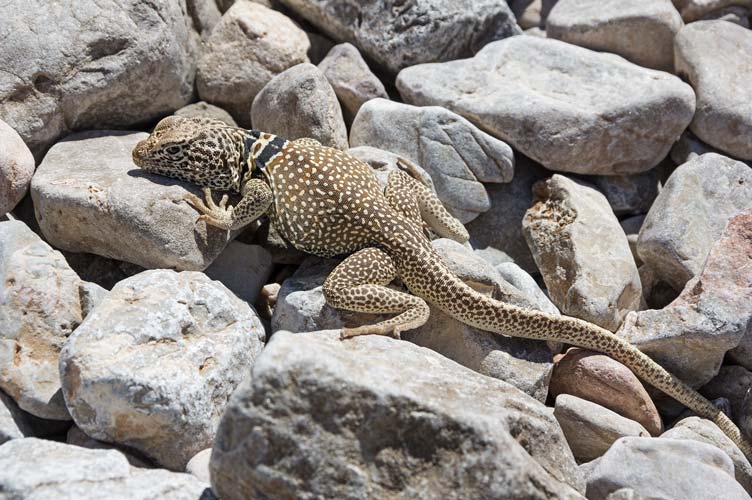
another great basin collared lizard (male I think)
 |
The views from the summit of Virgin Peak (8,071 ft tall and another DPS Peak) were quite nice, and we briefly contemplated doing a bonus peak, but reports were that the descent from that was very brushy, and we were tired enough. The descent went a bit easier as we were heading downhill instead of up. We rinsed and did the long drive back to the highway. There we got water, ice, and gas (we should have headed farther for gas - we were mislead by the prices reported online) and headed on through a bit of Arizona into Utah. We camped off a smaller road on the way up towards the N side of Scrub Mountain. By the time we had cooked dinner it was pretty late - we changed our clocks to Utah time and went to sleep.
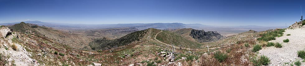
panorama on Virgin Peak with Iris coming up the ridge from the south - Moapa is the ridge hitting the horizon center left
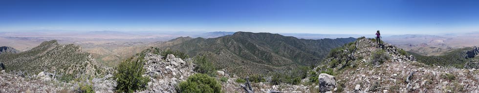 |
Strava track for Virgin Pk. 05-27-2023
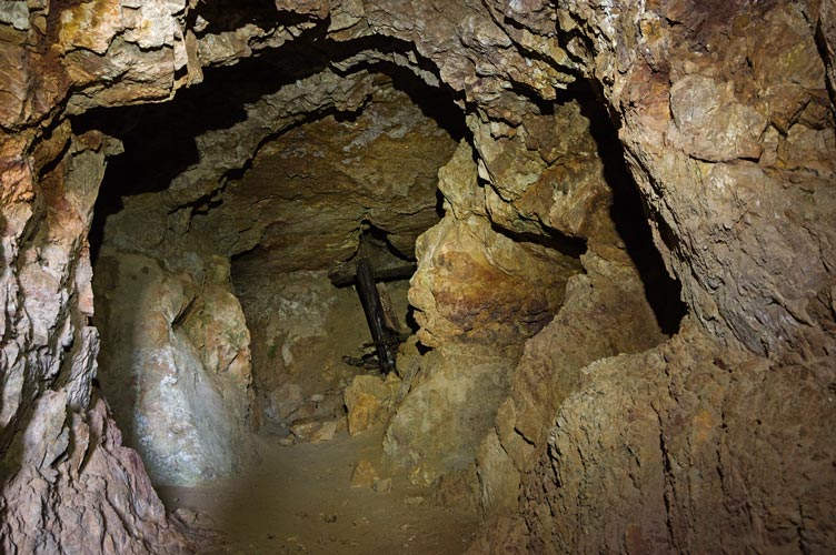
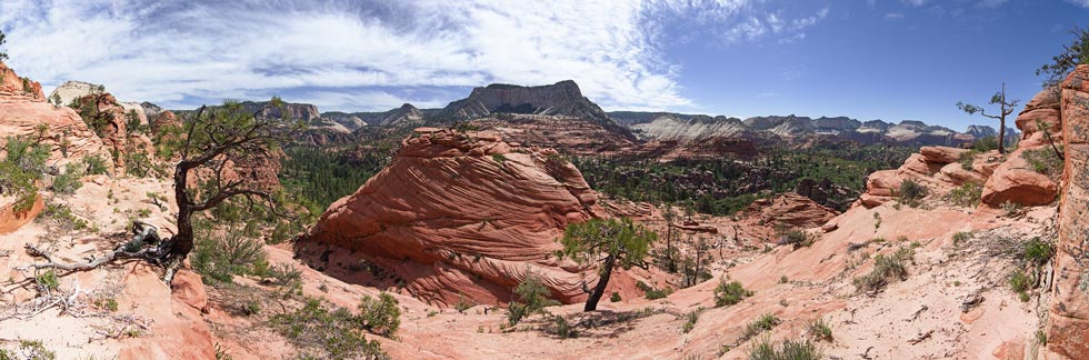
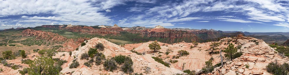
5-28-2023 We slept in a bit getting up at 7 Utah time, and drove up the road a bit to a parking area for rock climbing here. Instead of climbing we hiked back down the road a little and then up another road past some mining and on up a lot of brushy ridges to Scrub Mountain - there were telecommunication towers and a road up here from the other side. We sat in the shade and had lunch and then decided to try to head down to the west (we came up from the NE). It wasn't entirely clear from the topo map or satellite images if this would work, but we thought it would. So off we went - it was a little dicier than we hoped with a few little cliff bands to scramble through and a few more spots ahead that we couldn't really see from above - and then we came around a corner and could see that the route went - we would be able to make it down this way. phew, we weren't looking forward to hiking back up and over the peak again. We went down a long way and then made it to a road we followed up and past a little mine that I investigated - nice and cool inside. I don't know what they were mining, but it looked like the ore was along the contact between 2 carbonate layers. (poking around online it looks like they were mining copper, gallium, germanium, and a bit of silver in the area - mostly in oxidized iron rich brecciated pipes. But maybe the smaller mines in this area were just going for copper, lead, silver, and zinc) There were some old abandoned looking mines in the area as well as some more active looking claims.
panorama from Scrub looking south
 |
panorama from Scrub looking north - we came up the ridge on the right and went down on the left
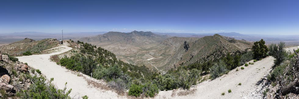 |
Iris near the bottom of the ridge/slope we came down
(behind and above her)
 |
inside the mine
 |
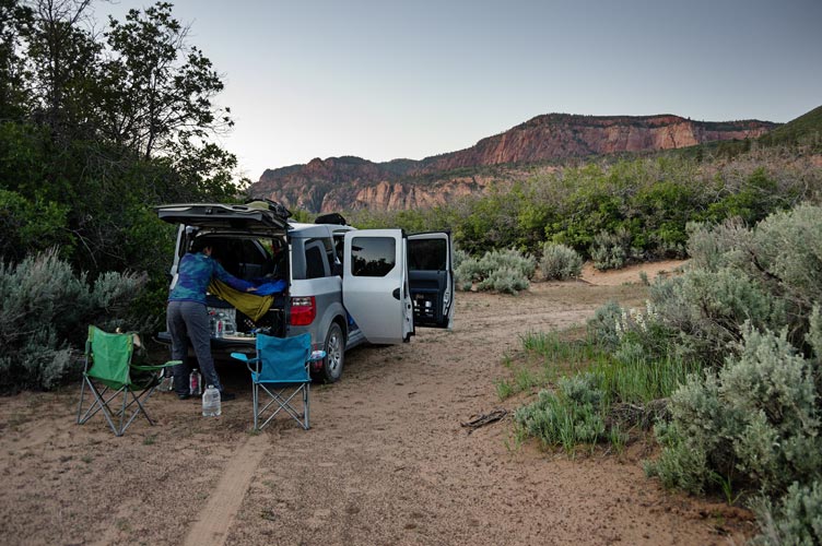
It was hot back down by the vehicle and we drove back to where we had camped to rinse off before driving through the outskirts of St George and then up to the western edge of Zion where we camped on BLM land just outside of the park. We had heard that the main SW entrance to Zion had closed the day before because of overcrowding and wanted none of that, but we figured as long as we got a parking place at the trailhead early enough we would be ok for our planned peaks.
setting up the Element to camp on BLM land outside Zion
 |
Strava track for Scrub BM. 05-28-2023
5-29-2023. We got up early - 4:30, it was still dark, but we packed up and drove to the trailhead where there were a few suspected vehicular sleepers (one got from the back into the front and drove off while we were getting ready). We loaded up with too much water (unfortunately all of the water sources other than springs in Zion are suspected to be contaminated with cyanobacteria and are not safe to drink even with filtering, boiling, or UV treatment). That meant we had to carry all of our water. I had over a gallon in my pack.
We left before sunrise and it was chilly - I wore my windbreaker/raincoat and Iris wore my fleece so that either of us could wear it if we needed to later. We passed some cows - what they were doing in the wilderness part of a national park - I don't know, and then heard some weird noises from both in front of and behind us. Then we saw it - a turkey running and gobbling towards the other source of the noise - pretty funny to see it running with its head outstreached making a weird gobbling noise. We would gobble at each other from time to time for the rest of the trip. We also saw a deer that morning as the sun came up. We passed a turnoff to go down to the subway canyon but continued on the trail to the overlook. The overlook views were nice, but we still had a long way to go.
tree shadows and cross bedding on the cliffs of West Northgate Peak
 |
I take a picture from the overlook N Guardian on the right (Iris pic)
 |
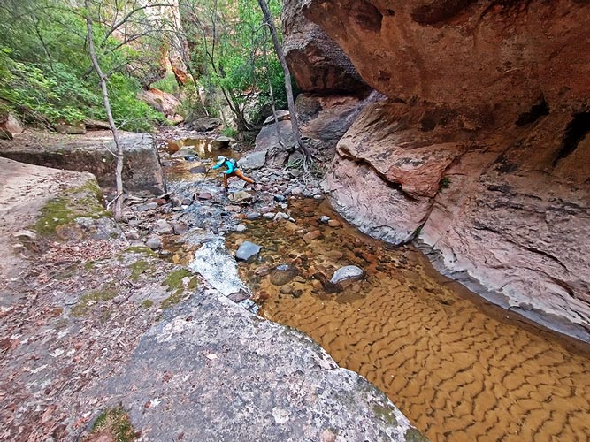
We dropped off down from the overlook on a use trail that gradually spread out into multiple trails - some heading towards N Guardian Angel - others maybe the way we wanted to go. We did get lured too far left and downhill into the canyon when we really wanted to stay on the ridge for a while - maybe the canyon would go - or maybe we would get cliffed out, so we went back up the slickrock to the proper route and followed that down the ridge towards the stream crossing. Navigation was a mix of going the obvious way, following the occasional path and footprints and a few cairns, and looking at the GPS tracks. Eventually we made it down to the Left Fork of North Creek - the creek that eventually flows into the famous Subway Canyon. I had come down this along with other Zion exploration with Anthony long ago ( in 2007). We rested a bit by the creek and enjoyed the cool. I stashed a 64 oz water bottle a little upstream in the creek and we wetted our clothes a bit before trying to figure out the exit on the S side.
Iris crossing the creek
 |
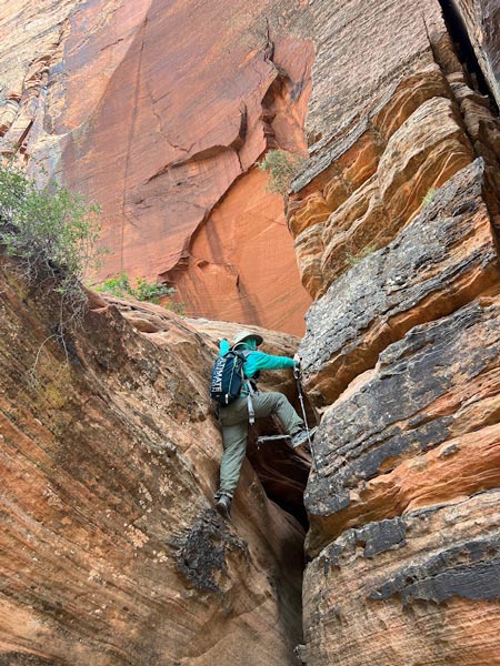
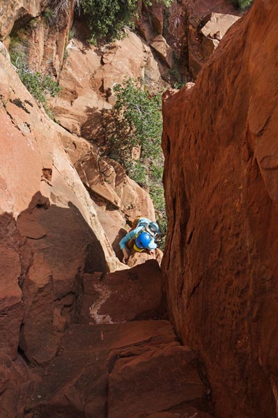
My first foray up a canyon ended with some very lightly traveled steep mossy rock that I could possible avoid by crawling along a slot-ledge. I could see a rap sling a few feet above me. I went back down and we took the more traveled and dry route a few feet to the right. This was definitely the way to go and we worked our way up this canyon until we were able to exit onto a steep slope with a bit of a trail up out of this canyon. Then we worked our way over to a small stream. I jumped across nearly landing on some copulating frogs or maybe spadefoot toads? that flopped about and into the pretty gross looking water. We worked our way up the wash walking on the sand where we could but avoiding the gross water and squishy mud and also trying to avoid the worst of the brush and cactus. Finally we made it to the slickrock which was less of a pain to deal with, but you had to avoid loose rocks and cliffs instead of brush, cactus, grass seeds, gross water, and mud.
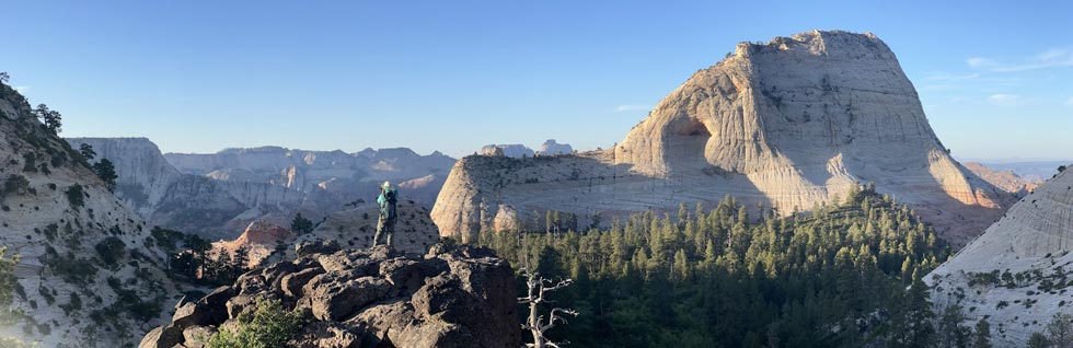
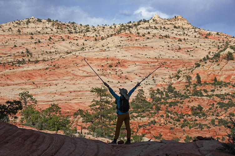
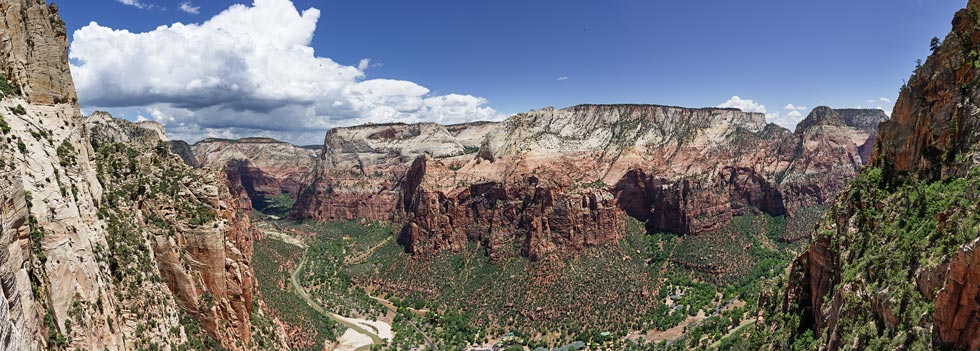
As we ascended above the tree tops the views opened up incredibly. It looked like the sort of place a dinosaur would call home with rock pinnacles, canyons, slickrock, cliffs, and peaks all around us. We continued up towards S Guardian Angel eventually getting to the start of the NE ridge where we left a smaller water bottle and changed into our ruby slippers - Evolv Cruzer sticky rubber approach shoes. These were just the ticket to make the pretty steep slabs feel much more manageable plus ours were both red - hence the ruby slippers.
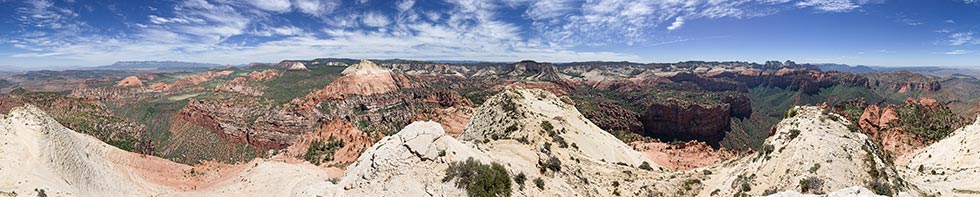
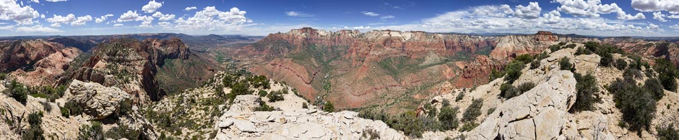
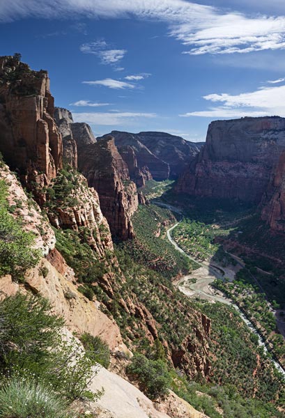
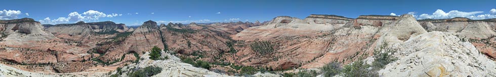
Zion backcountry panorama on the way up to South Guardian Angel
 |
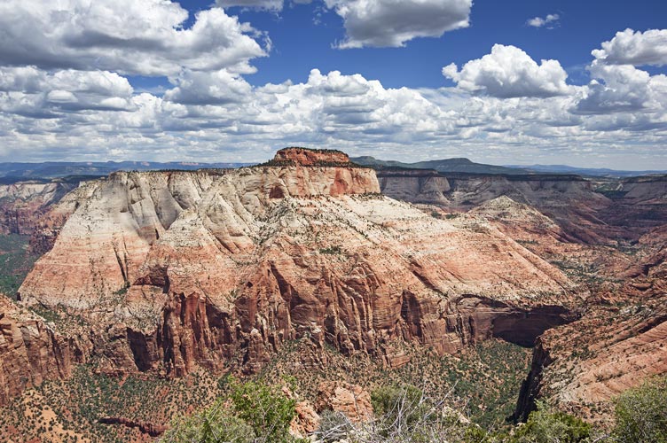
The route up was for the most part an easy scramble with a few steeper or looser sections to command attention. I thought the hardest part was the final steep slope right before the summit. On top we had decent cell reception, so we took advantage of that as well as the stunning views and cool breeze.
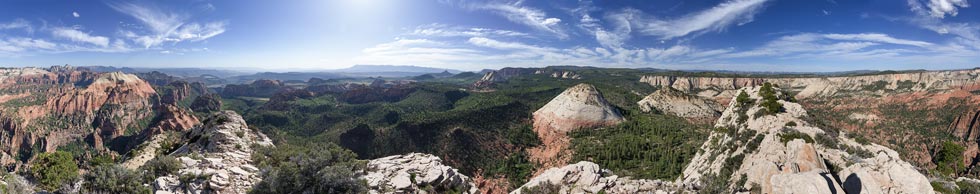
panorama from the summit of South Guardian Angel - N Guardian Angel is center left
 |
The descending the slabs was mostly easier with a few steep pucker inducing moves. In general I think we took a slightly better line on the descent. Back at the shoes we changed and headed back down - once again probably taking the same or a slightly better line all the way back down to the creek. There I recovered my stashed water and we wetted and cooled ourselves before the dirty hot ascent back out.
vertical panorama near the left fork of North Creek crossing
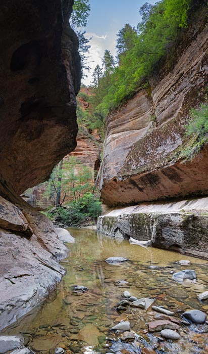 |
vertical panorama with down in the middle of the creek canyon
 |
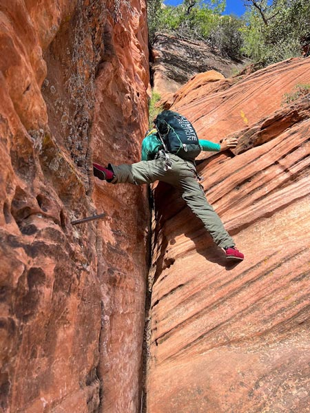
We traversed over to the start of the N Guardian Angel route and once again stashed some stuff (poles, shoes, water) and put on the ruby slippers. We traversed back and forth up the cross bedding to the start of the more serious ridge - either 4th class or up to maybe 5.5 depending on who you talk to. I climbed up using a hand jam but Iris didn't like the reach and traversed right over to an easier slope at the beginning. Then we headed up taking the path of least resistance except where I traversed over to booty some slings and 'biners left on a tree where someone rappelled. The scrambling on this peak was a little more sustained and harder than S Guardian Angel, but we made it work. The traverse across the top from the lower E end to the summit at the west end took longer than expected, but from a distance we could see it was about the same length as the climb.
panorama from the summit of North Guardian Angel - S Guardian Angel is pretty far left
 |
Once again there were stunning views from the summit, improved by the lower angle of the sun. It was impressive to look south to what we had climbed earlier in the day. The descent went easier than the climb and soon we were back changing shoes and hiking back up to the overlook. From there it was just a matter of walking back on the trail, and we made it back just about sunset. There were no other cars in the lot, so we took advantage of the shelter in the outhouse to rinse off the copious sweat, grime, and grit before heading back out of the park to camp. It was a long day and sadly much later than I would have liked by the time we were eating dinner and ready to sleep.
Strava track for S and N Guardian Angels - Zion NP. 05-29-2023
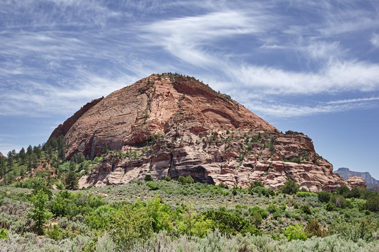
5-30-2023 We slept in a bit before driving up the road to find a bit of reception with Iris' phone. She had a few work things to do and I researched the plan for the day - originally we were going to climb Pine Valley Peak, but it sounded like a sort of scrappy climb that still required a rope unless you were extra brave, so instead we decided on Tabernacle Dome - this was a fun scramble with a little bit of water chute climbing plus a steep slab with the usual great views and reception on top. We employed a length of webbing on the descent as a hand line for Iris.
Tabernacle Dome - we went up about the center of the rt bottom buttress and then the ramps up the center
 |
climbing up a water groove on Tabernacle
 |
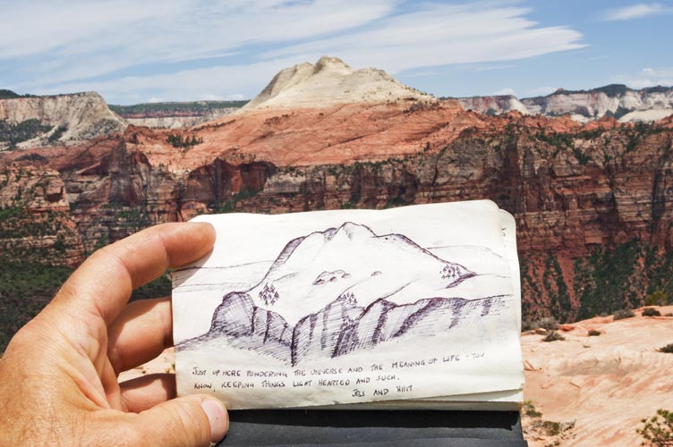
picture in the Tabernacle Dome summit register - of S Guardian Angel
 |
panorama from the summit of Tabernacle Dome
North Guardian Angel is left of center, S Guardian Angel is barely right of center, West Temple and Kinesava are mid right
 |
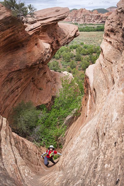
Then we went to Lamb's Knoll where we hiked up to the top and also explored a little bit of a slot canyon and looked at some of the climbing routes. There is a nice parking and picnic area here with outhouse and some tent camping spaces. It is used extensively by the guides in the area. We rinsed in the corner of the parking lot and then drove off down towards the hopefully not quite as crowded main area of Zion. We had some trouble finding where we could park to sleep down here, but eventually found a sort of legal spot - it was on BLM land anyway. We planned to get up early, so weren't so excited about how late we went to sleep. oh well.
Iris on the summit of Lamb's Knoll
 |
Iris in a Lamb's Knoll slot canyon
 |
Strava track for Tabernacle Dome and Lamb Knoll - Zion NP. 05-30-2023
5-31-2023 We got up at 4:30 again but made better time to the visitor center - there was already activity there as we filled up our mostly empty water bottles before heading out up the road and through the tunnel to park right after the tunnel in one of only a few spaces. The spaces were all taken in the next 15 minutes as people parked to hike the overlook trail for sunrise. We had other plans and headed up Gifford Canyon in the other direction. After a little more than a mile we turned right and headed up the steep slabs taking advantage of the differential weathering of the cross bedding to zig-zag up the slightly lower angled rock. Then we followed a bit of a use trail up a ramp to the left and around a big bowl. Near the top of the bowl we left a water bottle in a seeping spring.
Iris follows a ramp out of Gifford Canyon
 |
We dropped down into the canyon between Gifford Peak and Destination Peak with a detour to avoid a small cliff. The canyon was nice and cool for a while with some water of various quality trickling down it. Then we came out into Hepworth Wash and turned right. Mostly we kept to the bottom of this wash on sand or grass. We cut the corner a little bit to head up the drainage between G2 and Bridge Mountain. There we saw some tadpoles in pools above a little trickle ramp waterfall. Every once in a while a little tadpole would get washed down the ramp to the next pool.
This drainage was a little more of a pain to head up with more brush and trees in the way. We made our way up past the older route up Bridge Mtn going up a long ramp and then the headwall - it looked pretty serious and almost everyone reported using a rope on it. Things got pretty loose with a lot of sand with loosely embeded rocks in the slope. Maybe it was all held together with cactus roots (some of it was not held together at all). I mostly stuck to the left wall under some very impressive cliffs (of G3) where there was shade. At the top of this slope we took a small break at the saddle and stashed some water in the shade of a tree.
Then we headed up towards Bridge Mountain via the route described by Sam Grant and later followed by Stav and others. It featured 2 distinct cruxes, the first in a bit of a chimney and the second either in a more secure but harder chimney-ish feature or a less difficult but a bit more exposed ramp. I think they were both easier than the worst of the Guardian Angel scrambling with a lot of easy but somewhat tedious scrambling in between. Once again the summit featured amazing views, a cooling breeze, and cell service. Also some work calls for Iris.
Iris on the upper crux of Bridge Mountain
 |
shuttle bus far below turns off of Zion Canyon Rd
 |
East Temple from Bridge Mountain
 |
panorama from the summit of Bridge Mountain
West Temple is left of center, East Temple is mid right, G2 is just left of mid left
 |
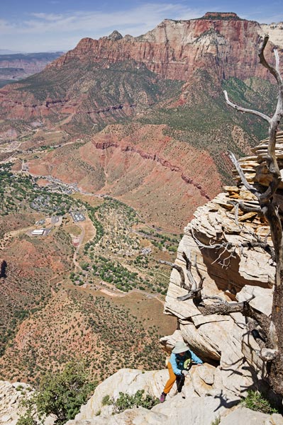
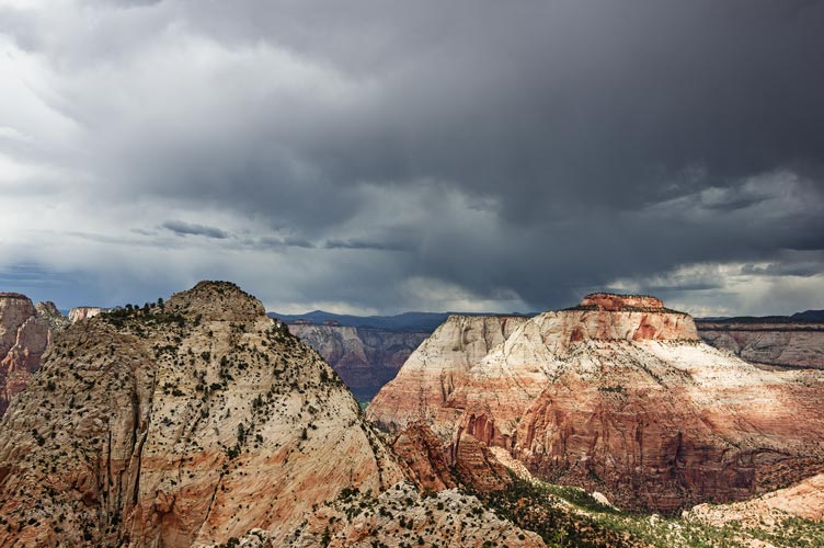
We worked our way back down with a little more trouble descending the cruxes. Back at the saddle we ate some more food and Iris stayed to take some work calls while I tried to hurry up and down G2. There were a few little scrambling bits on the way up and some loose sand. On top I could see that there was definitely weather off to the NE - fortunately the clouds were not coming from that direction, but it was still disconcerting to see lightning arc down behind East Temple (quite a distance behind it, but still...) I did not tarry long on the summit and made quick work of the sandy part of the descent - and probably pretty quick work of the rest of the descent too with a brief pause to regain my bearings after conking my head onto a dead branch. I made it back down in under 20 minutes.
Bridge on left and East Temple on Right from G2 - note weather
 |
panorama from the summit of G2 Mountain
Kinesava and West Temple are just right of center, Bridge Mountain is mid right, East Temple is just right of mid right
 |
Iris was still making work calls, but she was able to get away when I started talking about lightning (which was hiding behind Bridge Mountain for her). We made better time down the loose slope but maybe didn't take as good of a line down the drainage back to Hepworth Wash. Then we retraced our path lamenting the lack of shade in the side canyon, but we did get some relief from the clouds. We considered climbing Gifford Peak, but neglected to research it when we had coverage, and we were pretty tired by now, so we went and got the water and then headed down around the bowl and picked our way carefully down into Gifford Canyon. The travel was much less technically demanding in the bottom of the canyon, but the soft sand was tiring. We made it back to the parking area just about sunset and drove east with a stop to rinse off in an outhouse before exiting the park and finding a place to park on an old abandoned section of roadway.
I scramble up a little cliff band in the canyon
 |
Iris celebrating making it up to the pass
 |
Strava track for Bridge Mountain and G2 - Zion NP. 05-31-2023
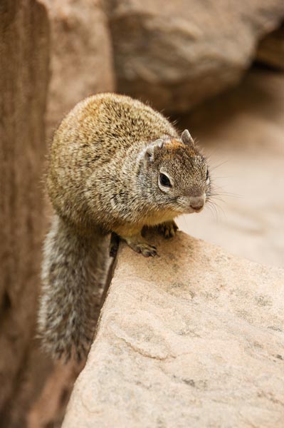
6-01-2023 We were pretty tired from the previous day so we had a relaxed pace morning. This meant by the time we were heading into the park it was full on tourist time. We waited in line to get into the park, and then again to get through the tunnel (they send RVs through 1-way at a time because they have to drive in the middle) and then there were no parking places at the visitor center. I was in hell. Eventually I drove back up the road past the intersection to find a place to park. Then we walked back to the shuttle bus and rode it back to the visitor center. There we took the shuttle bus up to the end of the line and walked up to the start of the narrows. The narrows were closed because the water flow was too high (they open it at 150cfs and it was around 400 I think). There were people everywhere and little ground squirrels trying to beg or steal food. It would be a good place to play "hurl a squirrel".
ground squirrel
 |
By now it was fully overcast with a few sprinkles. We had a picnic lunch on a rock above the river and then hiked back. We took the shuttle down canyon with stops to hike up to the hanging gardens and the upper and middle emerald pools (which were far from emerald, but were nice). The bridge across the river at the lodge was closed so that meant that we had to hike from the bridge upstream adding quite a bit to the walk. We were concerned about the weather for the next few days - since it rained a little this day and was threatening 20-30% chance of thunderstorms every afternoon. That made it hard to plan out what we were going to do - especially if it was climbing a peak or walking in a canyon - 2 things that could be made very unpleasant or hazardous by thunderstorms. We headed back to the visitor center and rinsed our dirty clothes in the river and refilled our empty water before heading west to camp at Smithsonian Butte. We got there pretty late so ended up not far from some other people.
I do not heed the warnings (Iris pic)
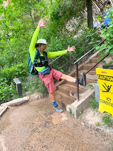 |
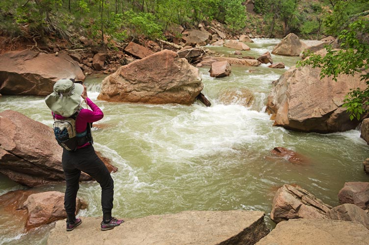
Iris taking pics of the river
 |
I do not heed the warnings take 2 (Iris pic)
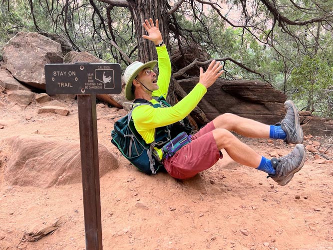 |
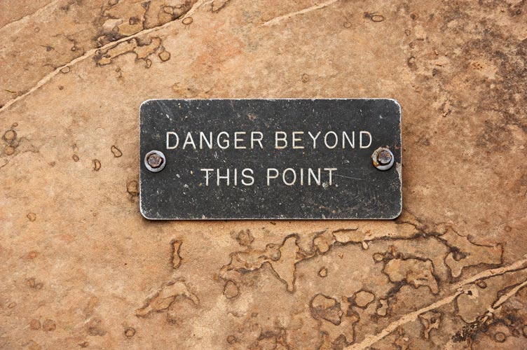
danger sign - approaching an overhanging cliff top
 |
towhee
 |
Iris' Strava touristing in Zion NP. 06-01-2023
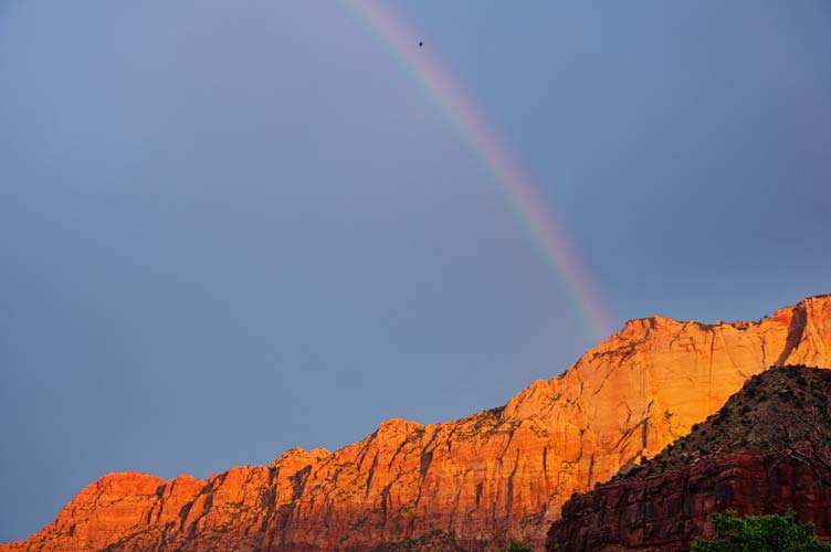
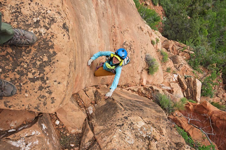
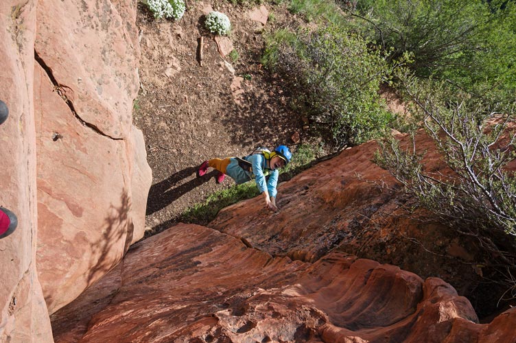
6-02-2023 We got up early again - needing to get a spot in the visitor center lot. There we hemmed an hawwed a bit about our plan - Lady Mountain. There was a bit of a dramatic sunrise complete with a rainbow and a bit of rain. Eventually we decided to just go for it. We took the shuttle bus up to the Court of the Patriarchs and then crossed and walked up the sandy trail from there (once again the bridge at the lodge being out was a pain). It was pretty much done looking like rain by the time we left the maintained trails and headed up the old Lady Mountain trail. This was built in the 20s and followed a steep improbable path up to the summit. They carved steps into the sandstone and drilled holes for supports for cables and ladders (Supposedly they used some 2000 feet of cable and carved 1400 steps and had at least 2 ladders). The park pulled most of this out in the 60s as it took a lot of work to keep it safeish and they were probably sick of rescues (and there were a few more serious accidents). The steps and holds that remained made for very enjoyable scrambling, although no users would complain if a bit of the brush was cut back - I need some ultralight titanium and aluminum clippers to carry with me. I found the section from right before the first crux to the second crux to be especially enjoyable - sort of like what I imagine the path up to Cirith Ungol into Mordor would be like. The first crux was getting into the start of the chimney like slot - I imagine it would be a lot easier without a camera strapped to your chest. It had very little exposure for the hard part - and the top was pretty trivial if you are any good at stemming - which I am. The upper crux was easy at the bottom but featured one harder move - sort of a mantel - but made much easier by the remains of a steel bar sticking out of the ledge you are going up onto - it is a bit small to be a great handhold, but it is solid. I ended up standing on it and Iris grabbed my foot as it was easier to hold. On the descent we used a length of webbing for Iris to descend.
rainbow over West Temple
 |
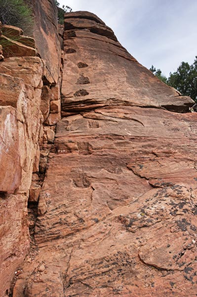
carved steps up Lady Mountain
 |
Iris scrambling up those carved steps
 |
the first crux on Lady Mountain goes up behind this flake
 |
Iris on the first crux on Lady Mountain from above
 |
I stem my way up the second crux (Iris pic)
 |
Iris mockingly holding onto a rebar "piton" for her life below the second crux
 |
bolt and link above the second crux
 |
view up canyon, Angel's Landing is below the horizon just left of center
 |
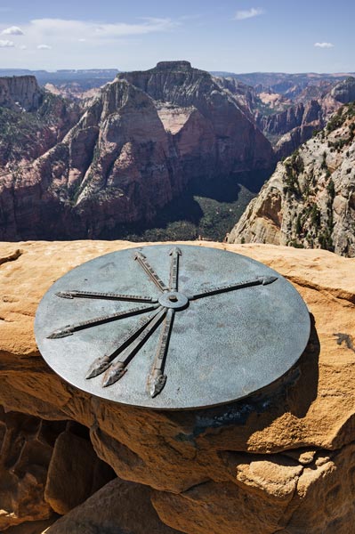
Above the second crux it was mostly just walking up a steep overgrown path. Sometimes we got off route but the addition of painted arrows, carved steps, and metal hardware made it pretty obvious when we were on route. We worked our way up to the summit where there is a sundial like metal disk with arrows pointing to a few other peaks. We did the usual pics, summit cookies, resting, eating, and phone use before heading down. I was hoping to also tag the nearby Jacob, one of the patriarchs, but I didn't find any beta or see any likely route that wouldn't be 5th class. Without a rope for at least descending it wasn't going to happen even if it was sooooo close.
"sundial" mountain pointer on top of Lady Mountain
the far arrow is pointing at East Temple
 |
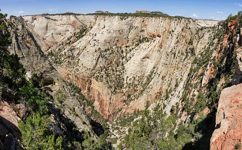
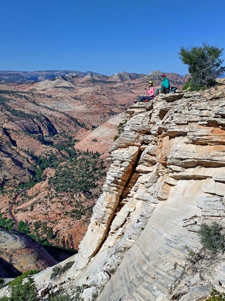
panorama looking down NW from the Lady Mountain summit plateau
 |
We headed down making short work of the cruxes although sort of cooking in the sun until the clouds built up to relieve us. Back on the modern trail we took the longer but new option of the lower emerald pools trail. By the time we got there it was raining, but still pretty pleasant and refreshing. Beyond the pools things got crowded and Iris was hoping to make it to the lodge before the cafe closed at 5. Despite jogging a good bit of the way back (when we weren't completely traffic jammed) we waited so long for the next shuttle bus that we missed the food service by about 30 seconds. They did have wifi at the lodge, but not very fast. Then we headed back to the visitor center for more water and then got burgers and gas in town before heading back through the tunnel to the east side.
panorama looking up and across Zion Canyon from the descent off Lady Mountain
 |
trying to get past the crush of tourists on the main trail (Iris pic)
 |
All in all this was a much more enjoyable day than I expected - partly because the weather wasn't a problem, in fact the cool clouds and rain helped keep us from overheating and weren't an issue on the steeper parts. The other thing was this was a cool historical line up a huge formation. Sort of the next step up from Angel's Landing except without the hordes or the access control and the chains are gone. I agree with Sean's statement about how it is a little sad what has become as mankind has regressed a bit. "Back when fun was allowed to be dangerous, tourists staying at the Zion Lodge could cross the river and climb the face they saw from the lawn via a series of carved steps and a few ladders, protected by bolted cables. No guides, ropes, or waivers were required." As you can tell from the fact that Zion had abrogated control over Angel's Landing to Booz Allen to profit from even entering the lottery for a chance to hike up something mildly risky the public has an interest in doing something like this. But they took out the cables and most of the hardware leaving only a bit of metal, carved steps, and painted arrows. This is the bigger badder alternative to Angel's Landing that since the semi-removal by the park service now requires a little bit of skill and or gear to get up. As someone with that skill and gear I appreciate the solitude, but it is a little sad.
Strava track for Lady Mountain - Zion NP. 06-02-2023
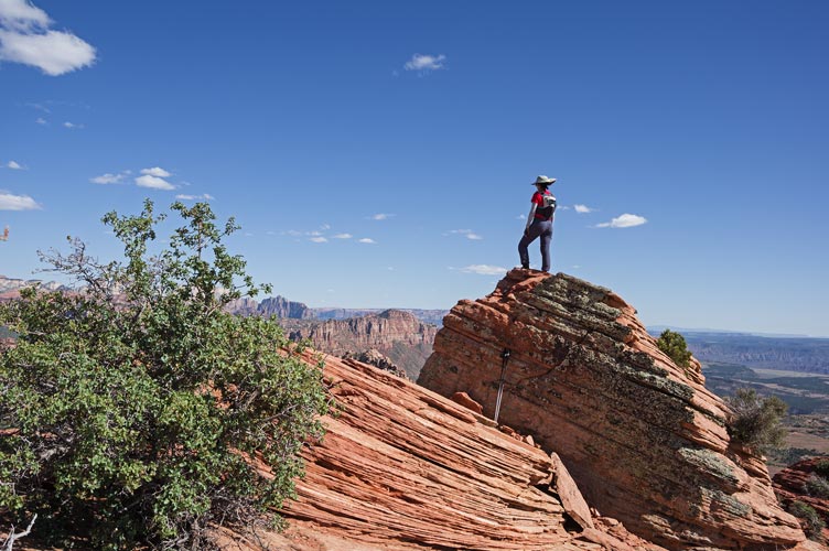
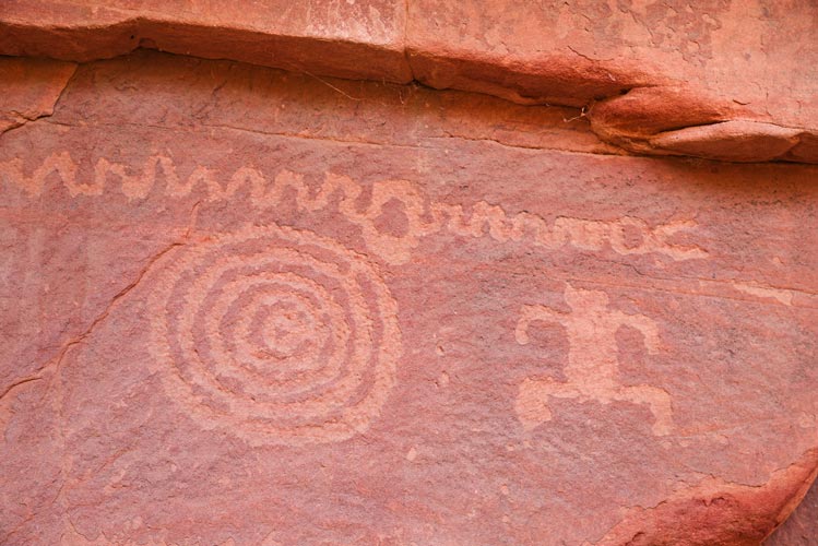
6-03-2023 We got up and into the park pretty early to park at the "petroglyph canyon" where we loaded up our climbing gear and hiked off to climb "led by sheep" up Aires Butte. One other party showed up to climb this, but we were ready to go first and they followed us up. The climbing was barely more sketchy than some of what we had scrambled already, but the occasional bolt and anchors were welcome. I wore my ruby slippers but Iris wore her climbing shoes. We went up to the actual summit but could not find a register. Then we perched on the rim and had a snack and relaxed before a family zoom call. Then we rapped back down and walked up the ridge to S Ariel Butte just to the south. Then we walked back to the element and loaded up a picnic and some mending to hike back into the shade of the petroglyph canyon to take some pics, have a picnic, relax, and sew my sun shirt "baby blue" and Iris' ruby slippers. On the way out we stopped to scope out some climbing areas, but they were cooking in the sun, so we got to camp a little early to wash up and have dinner and get a bit more sleep, plus the moonrise was cool to see as it passed between the horizon and the low clouds.
Aires Butte summit cookies
 |
on the edge of Aires Butte
 |
panorama from the summit of S Ariel Butte - Aries Butte is 2/3 to the right of center
 |
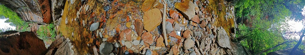
petroglyphs
 |
Strava track for Aires Butte and S Ariel - Zion NP. 06-03-2023
That is enough for part 1 of the Utah Trip, you can continue on to the 2023 Utah Trip Part 2 here
No material on this page may be copied or used without permission.