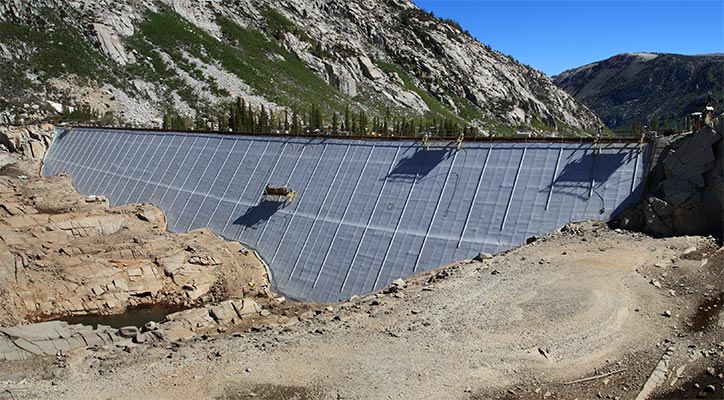
Once again the mountains called, so I went. This time I started from South Lake which was mostly empty due to some dam work. By the time I got to Long Lake I was mostly on snow. I had the skis on and was skinning well before Bishop Pass. Once I made it up to the pass I stashed most of my stuff and headed up Mount Agassiz.
| |
|---|
 |
|---|
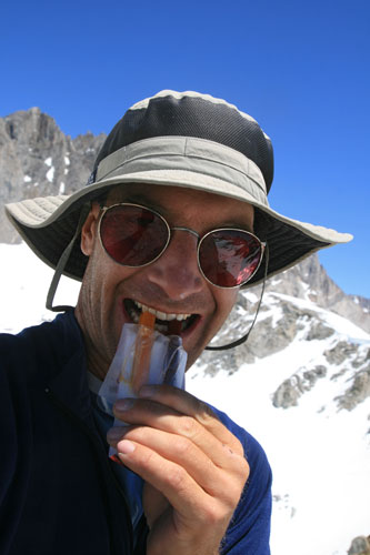
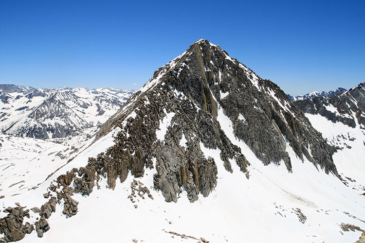
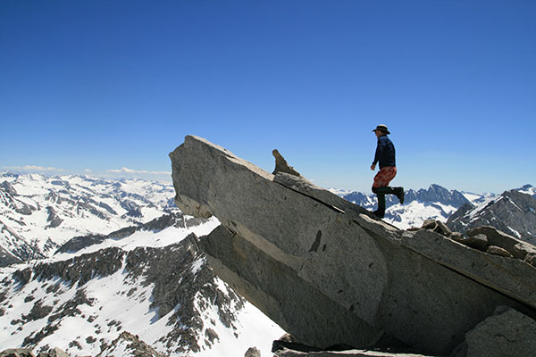
The next morning I got a pretty early start so that I could stay up on top of the frozen snow rather than slog through the soft snow later. I headed towards the Thunderbolt Pass to follow the ridge towards Isosceles Peak. The travel was pretty nice with good styrofoam snow that was easy to tromp along with crampons. This turned out to be a tactical-navigation error as the ridge was steep on both sides instead of the mellow easy travel on the south side that I expected. I went up and down along the ridge for the rest of the morning. I stashed most of my gear and headed up Isosceles peak. This isn't a very significant peak, but it looks very nice from the NW side. The actual 12,321 ft summit was quite hard to reach requiring a downclimb and passing a tenuous looking arch and then some easy 5th class climbing back up to the diving board summit. There weren't very many entries in the register - maybe only 4 or 5 in the last 5 years. I celebrated the summit with some highly processed pseudo cheese and meat grease sticks. The salt and grease hit the spot but I realized I probably didn't have enough water with me for 2 peaks. By refilling my bottle with snow whenever there was room I was able to stretch it a lot though.
 |
|---|
 |
|---|
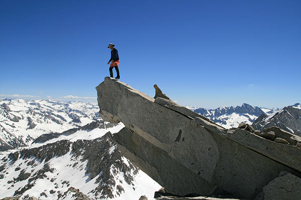
After Isosceles Peak I headed south and went up Columbine Peak. This was more difficult than I expected as the snow was starting to turn squishy and the biggest rocks on the ridge mostly pointed out blocking my way. Finally I reached the impressive 12,652 ft summit. If you saw it in a movie you'd think it was fake with 2 long spikes of rock jutting out into the air. I was unable to trigger my camera from the summit with the weak remote, so I started the timer and ran. I didn't make it the first time, but the second time I did. I certainly didn't want to run up the length of the block at full speed because overshooting was not a good option. For the descent I stayed on the SE face for most of the way and that proved to be an easier option. Back at my gear I rehydrated and ate the rest of my lunch before I got my ski gear on and dropped down the N side of the ridge into the Dusy Basin. As usual it was scary dropping over the lip but actually not that hard in the forgiving soft snow. Once I got down to the lake below Isosceles Peak I booted it back up to camp. During this time I saw a group of 4 people pass by my camp and head towards the Thunderbolt Pass. Most of them had snowshoes but at least one was sinking into the snow a fair bit. These were the only people I saw on this side of Bishop Pass for the whole trip.
 |
|---|
 |
|---|
 |
|---|
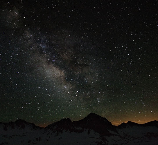
That evening there wasn't much wind, so cooking and eating dinner was pretty mellow. It also wasn't very cold so I could use more of my clothes for a pillow instead of wearing them all (I even had to take off a layer to keep from sweating). The stars were very nice so I took some pictures.
 |
|---|
 |
|---|
For the last day I headed north up over an unnamed peak 12,916 and then down and back up 13,085 foot Mt. Goode. I post holed and fell over at one spot and popped my knee out of whack momentarily. Luckily it popped right back and didn't seem to give me any more problems. This incident did make me very wary of the steep and treacherous snow. The north side of Goode drops off steeply (it looks like a good climb), but I skied down the SE flank. It was still steep at the top, but it was pretty soft and forgiving. I had one bit of gravel I had to walk across but otherwise I was able to ski all the way down to Saddlerock Lake at about 11,150 feet. Near the end I had one rather dramatic wipeout when something grabbed the back of a ski and spun me around and flipped me over. Luckily I wasn't going very fast and the area was at a relatively low angle (which meant more sun cups - my suspected culprit). From the lake I was able to hike and ski down to Long Lake before I switched back into my comfy boots and walked the rest of the way out. There was noticeably less snow than on the hike in, especially on the lower lakes. After I switched footwear I saw a lot of day hikers and fishermen.
 |
|---|
Back at South Lake I walked around on the bottom of the lake a bit (lots of old fishing sorts of trash) and headed back downhill. Once again I was able to wash off the trail grime. This time it was by wallowing in McGee Creek which was a lot more bracing than the hot springs were (although it was hot and dry enough that soon I was toasty again).
 |
|---|