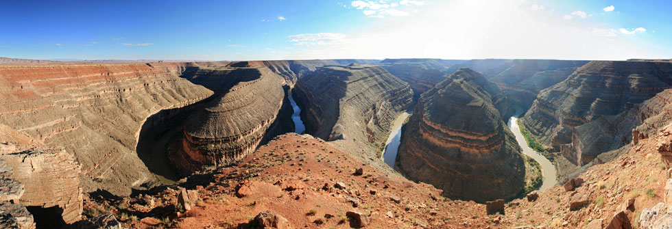
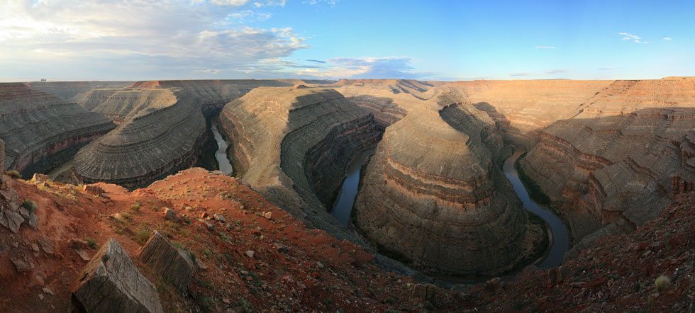
Goosenecks of the San Juan from the overlook (classic incised meanders)
 |
Tom Grundy's San Juan River 2010 Page
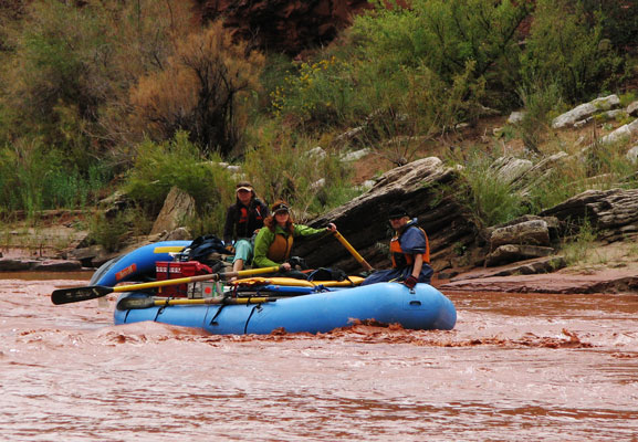
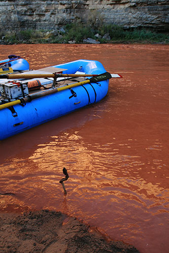
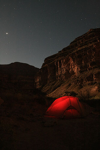
Thanks to Dawn, I got a chance to go on a San Juan River trip Sept 22-27, 2010. I drove down from Devils Tower and met up with everyone the night before at the Goosenecks Overlook (and admired the classic incised meanders). We spent the night there and then drove to the Mexican Hat put in. We started inflating and rigging the 3 larger oar rafts, 2 inflatable 1 person kayaks, 1 inflatable 2 person kayak, one old school hard kayak, and my packraft. All these boats were for 13 people. While we were rigging the boats it started to rain. Then it started to rain hard. Soon there were red mud falls across the river and red streaks along the sides of the river from upstream inflow. The water level also started to come up, and one rock that stuck out at least 3 or 4 inches was completely underwater by the time we started. The stream flow went from about 680 to as high as 7000 cfs the first few day we were on the river (this is according to the instantaneous data from near Bluff, the daily averages only got up to around 3800 cfs - the peak was on the 23rd according to that data). There was the usual monkeying around with car shuttling, parking, packing, etc. This was of course made more of a pain by the fact that it was raining and starting to get cold. Finally we were all packed up and set off down the now very red and silty river. At times it seemed like we were paddling in a river of paint, and if it splashed on your glasses it made visibility really poor.
Dawn rows on the first day (Kurt and Laura ride)
 |
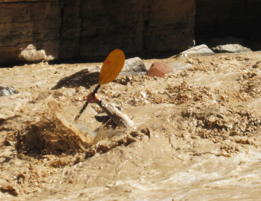
Soon we hit the first rapid. I wasn't expecting much based on what I had heard, so when I was suddenly hitting 2 foot lateral waves and holes, I was rather surprised. I managed not to do a packraft backflip, although it was a close thing in one long hole that I surfed backwards a bit before escaping. I pulled over to empty my bathtub (I didn't bother with the spray skirt for this trip), and was surprised to learn that 2 others had flipped ahead of me. After that eye-opening start, things mellowed out and the sun even came out briefly when we stopped for lunch. Speaking of lunch, this wasn't a TMF trip and we weren't eating bars and cold semi-rehydrated food. We had a number of large coolers with things like steaks, fresh fruit and vegetables, multi-burner stoves, and a charcoal grill. In fact these trips are often billed as "float and bloat" trips. I did my best on the bloating, especially as it is hard to save leftover food, and it just pains me to waste food, especially when it is so tasty. At our lunch spot we were wondering what some rather large animal tracks were (dog and mountain lion were the likely guesses, but we mostly ended up with dog as the answer (and looking at pics later that is the answer I think)).
We stopped to camp around mile 37 (we didn't start at mile 0, maybe at mile 27). That evening after eating a heap of meat (steaks), it started raining again. I retreated to the tent, and I think most others did too. It rained hard for a long time, and the river level came up a fair bit. The next morning the level was back down, but then it started coming up again. By the time we left it had come up at least a foot. That morning we saw an inflatable kayak floating down river. Phil jumped in his hard kayak and chased it down and got it over to the side. Kurt paddled it for most of the rest of the trip, then the ranger took it.
Lots of stuff was wet this morning, so we didn't get a very early start (but most stuff got dry before it got packed up, which was a lot nicer than packing it wet). We didn't go particularly far this day, down to Honaker camp (around mile 44). We did pass through the Goosenecks which we had camped out above the night before the trip (see panoramic images at the top and bottom of this page).
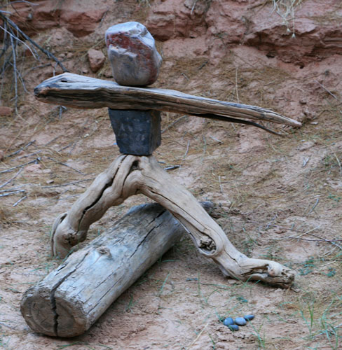
This stick was completely gone before we left
 |
Larry made a stick man
 |
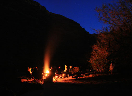
hanging around the campfire in the evening
 |
For day 3 we had a layover. The water level had gone down a fair bit leaving muddy ripples along the shore. We weren't in a big hurry to do anything, but eventually a group of us hiked up the Honaker trail up to the top of the cliff. The views down to the camp were very nice. Where we turned around there was a long sidewalk heading out to a point with a nice drop off on each side. It looked really cool through Dawn's wide angle lens. When we got back to camp it was pretty hot. The silty river water was cold though, and hanging out under the umbrellas also provided cooling shade. That evening we played around with some acroyoga and headlamp poi. It was also sarong night, so we all had to wear sarongs.
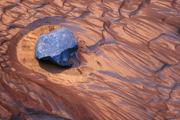
exposed silt and rocks
 |
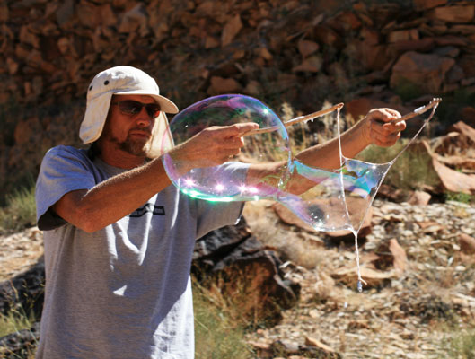
Kurt, the bubble master, blowing bubbles
 |
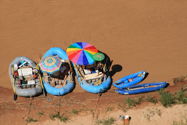
Kat under the shade umbrella
 |
Dawn points the way down river
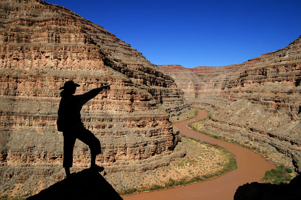 |
our rafts down below
 |
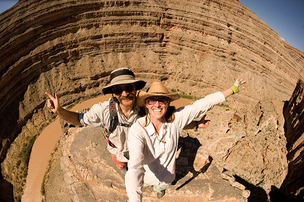
Tom and Dawn at the end of the catwalk (DK pic)
 |
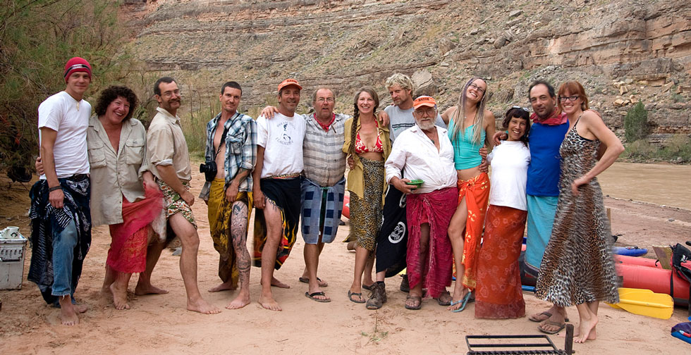
Sarong night - Winter, Laurie, Tom, Jason, Phil, Larry, Laura, Kurt, John, Kat, Raechel, Nick, Dawn (DK pic)
 |
Late night tent photo
 |
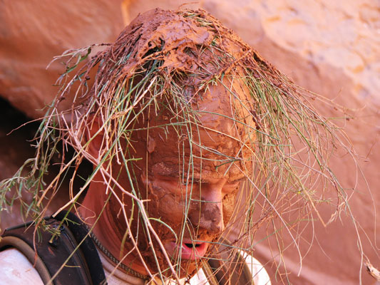
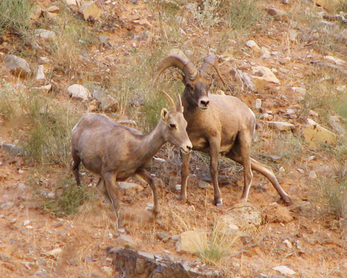
On day 4 we headed back down the river. At one stop with some really thick mud Winter morphed into "Primitive Man". It was pretty hot in the sun, but it was easy enough to cool off with some silty river water. At lunch we saw a bunch of bighorn sheep, including the male who was busy herding his harem around (and doing other things with them too). We ran Ross Rapid this day too, but it wasn't much with this water level. That night we camped at False Johns.
Primitive Man
 |
bighorn sheep
 |
The biggest rapid of this trip was Government Rapid. From what the others said, it is usally a bigger deal, but at this water level it wasn't so scary. Some canoes ran it soon after we got there. I ran it middle right and then carried my raft back up and ran it middle left. I took on a fair bit of water, but it wasn't as bad as I expected. A week or so earlier some friends went down the San Juan and said there was a canoe pinned in Government, but by the time we went down it was gone.
Raechel and Nick in Govenment Rapid
 |
I disappear into Govenment Rapid (Phil pic)
 |
After a late lunch on the shady side we crossed the river to check out Slickhorn canyon (about mile 66). Unfortunately the water wasn't particularly clear, but it was still cleaner than the river. We hiked up a ways to where we swam and jumped in a pool, took a lot of photos, and then headed back down to the river. That night we camped right after Grand Gulch on some nice rocky ledges.
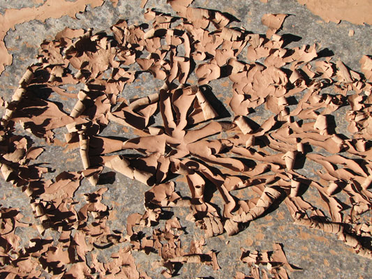
mud flakes from drying silty water
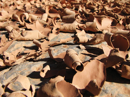 |
more mud flakes
 |
moonrise and canyon
 |
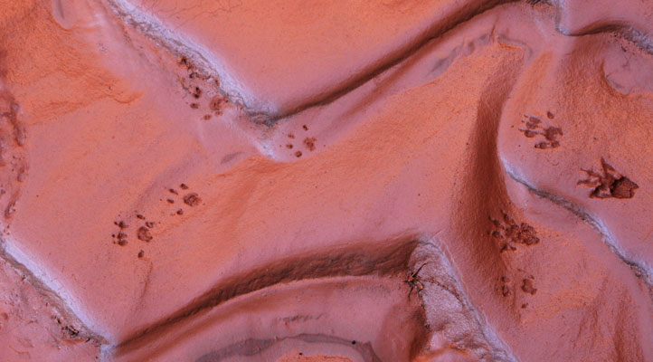
footprints (or paw prints if you prefer)
 |
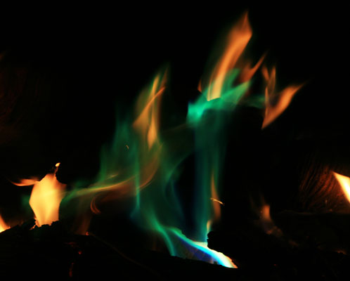
mysterious green flames
 |
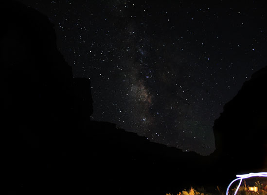
Milky way from our last camp
 |
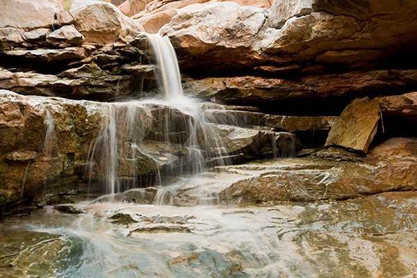
Grand Gulch waterfall
 |
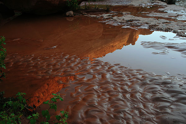
Grand Gulch reflection
 |
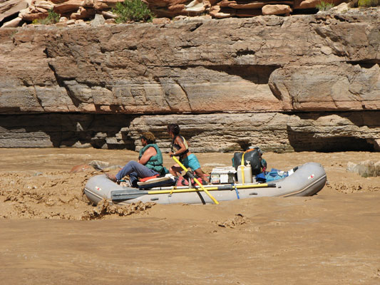
The last day involved a lot of fairly monotonous paddling down a river without much current and a lot of silt and sand bars to dodge. This wasn't too hard for the smaller boats, and if they did run aground it was easy to get out and push, but the big rafts were another story. They weighed a lot, so when they ran aground it often took a lot of little boaters to help get them back into the channel. Still, it didn't happen very often and the scenery was very nice, with some tall sandstone cliffs coming right up out of the water in some places. All too soon we were at the Clay Hills takeout. This was some 56 river miles from our put in. There we unloaded the rafts, unrigged them, cleaned them off, rolled them up, and packed everything into the 3 vehicles we had shuttled to the take out. This took a while. Then we drove back to the put in to collect the rest of the vehicles. We had dinner at Mexican Hat and then drove back to Flagstaff. The next day we finished up unloading and sorting gear to take it back to the outfitter. This trip report seems somewhat incomplete, but I am sick of working on it, so I am posting it. If I got our camp locations or anything else wrong, it was because I mostly typed this up from memory .
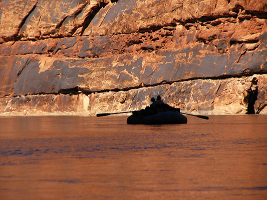
Dawn rowing silhouette
 |
The next week most of us assembled to for a slideshow and movie premiere. It was cool to see how different people had very different photos from essentially the same trip.
Goosenecks of the San Juan from the overlook
 |