I had been resting up house-sitting for a while and needed to go big - both for training for the Sierra Challenge if I was going to do it, and to just get out. The plan was for a big day-hike/scramble on July 12th.
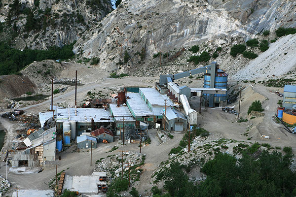
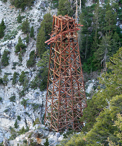
I didn't get to the trailhead quite as early as I planned, but still was underway past the gate before the sun rose. The first big chunk of this hike was up an old mine road. I considered trying to take my bicycle but I am glad I didn't because a good bit of it was large - toaster oven to microwave sized angular rocks. Soon it went past the Pine Creek Mill - the processing area for the ore from several area mines. This was an important source of Tungsten, especially during WWII. This area is still protected by a caretaker and dog, so I couldn't explore (I think they could restart it if the economics look good). I continued up the trail past a few big tramway towers.
| |
|---|
 |
|---|
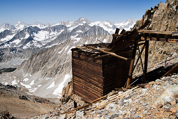
Much higher there was a vent sticking up in the air. It had a ladder on the side so I went up and looked in - another ladder went down inside it into the ground. It was tempting, but I didn't go in. There were a few more holes and shafts. Most of them barred shut. Then I headed up the side of Wheeler Ridge in earnest. Mostly I could follow the roadway, but sometimes it was covered by avalanche debris or snow. There were some interesting minerals here and I restrained myself mightily from picking up lots of rocks to carry along for the day. Finally I got to the top and the tramway loading structures. It wasn't exactly clear where the mine entrance up there was, but there were a lot of workings.
 |
|---|
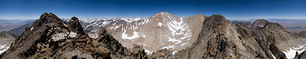
Then the going got difficult. The bit up to the top of Broken Finger wasn't too hard, but the route finding wasn't always straightforward and there was a lot of up and down and around the little ridges and gendarmes. From the top of Broken Finger (13,080 ft.) I could see that this was going to continue for a while.
 |
|---|
The route finding and scrambling was rather slow going and tortuous for the next few hours, and there were definitely sections where I didn't take the best route. I crossed the contact onto the lighter granite and continued on. Finally I made it up to the summit of another peak along the ridge. I think this was Twelve Flags Peak (13,468 ft.). From here it was a fairly easy descent to the col towards Mt Morgan, and that was an easy but tiring (I was pretty tired by now) slog. Mt Morgan is quite tall at 13,748 ft with nice views in all directions. By now it was getting pretty late so I didn't stay long, but instead headed down towards the final peak for the day, Little Lakes Peak. This was a long scramble down a ridge to the col and then up to the summit at 12,782 ft. It was definitely getting late and I headed down to the south. This was a lot of loose talus and scree and I was moving slowly rather than sliding and hopping quickly. Did I mention I was tired? I was, mentally and physically. I made it down to the lake and the trail shortly after sunset. This is where the genius of my timing came in - it was a nearly full moon, so it wasn't pitch black. I had to use the headlamp a few times for stream crossings or when the trail tried to lose me in the woods, but otherwise I could walk out by moonlight. It was a long walk. Luckily I had some PK Dick stories to listen to on my MP3 player. Still, it was a long hike. I made it back to my truck a little before midnight - an 18 hour push. Good training, but maybe a bit more than I really wanted that day. According to the spot track it was only a bit over 10 miles, but I know it was a lot more - the spot track doesn't notice switchbacks among other things. Here is the spot track though...
Pine Creek to Broken Finger and Mt Morgan hike spot track
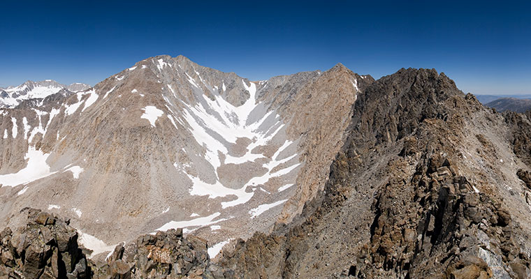
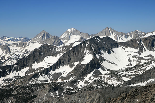
Another nice thing was the view over to Mt Merriam, Royce, and Feather Peak which I climbed in a previous trip. You can see the view here:
 |
|---|
 |
|---|