This trip to New Zealand is a continuation of the YogaSlackers TAO (Tour of Asia and Oceania). I went to Hong Kong , Thailand, New Caledonia, and then New Zealand with a variety of friends both old and new. Among other things a goal was to get back to the YogaSlacker's fundamental roots - Yoga, Slackline, Acro, Adventure, and Conditioning.
New Zealand is a place I have wanted to visit for a long time. With under 5 million people in an area the size of California with mountains, forests, rivers, cliffs, glaciers, caves, fiords, etc. it is easy to see how it is an adventure destination. I was there from Jan 7, 2016 to Feb 13.
My trip to NZ started out with a whimper and too long in the Auckland airport (overnight). Unfortunately we had left the security area in the international terminal and the domestic terminal shut down at night. One guy helpfully told us the wifi password for one of the first class lounges but my pathetic old droid couldn't really connect anyway. When we got to Queenstown the next day I was a little groggy to say the least.
South Island is even more wild than NZ as a whole with under 1 million people in a vast and rugged island. It is truly an adventurers' paradise although most people would happily do away with some of the sandflies, rain, and excessive wind. For others that just adds to the attraction.
Nalumon picked us up in Queenstown and drove us to Ivor's (one of Sam's instructors when he was here 9 years ago) house near Wanaka. There we based for a few days while waiting for Donatello and some people to arrive and to purchase a vehicle. Donatello is a camper van - named after the teenage mutant ninja turtle. It is owned by Sam and Tash who live up near Auckland but kindly allowed us to use it for the duration. Brock flew into Auckland and drove it down. The other vehicle we purchased was a minivan - seating 8. During this time we did a little climbing and bouldering and picked a heap of cherries from an orchard gone wild when they flooded a valley with a dam. By a heap I mean over 20 lbs not counting we each pretty much filled up while picking them too. YUM.
| |
|---|
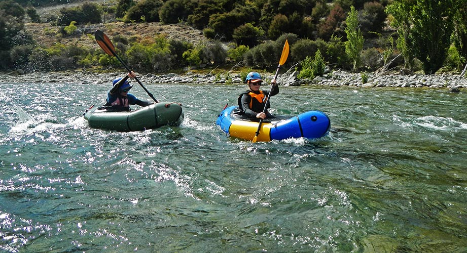
Our first planned mission was a packraft trip so we did some practice runs on the Hawea River - this was a few drops through manufactured holes in a whitewater park and then mostly class 2 stuff down to the Clutha River. It took a while for 2 groups to make the run (with 2 Alpacka packrafts, a NRS packraft, and the Hala SUP which I paddled). The water level was definitely rising and when we went back up to do some runs in the whitewater park the water was a lot higher and there were people surfing the waves there in kayaks and on surfboards. We ran it a few times. After running the first wave I went back up to try to surf it - this worked for a while 'til it flipped me and kept recirculating my raft. A kayaker dislodged it and I swam out to it with my paddle and jumped in to run it through the second wave. Everyone got a chance to run the waves with a few mishaps including a broken paddle and another stuck boat - this time rescued by a surfboarder who picked it up while surfing - impressive. I think we all missed the warm waters of New Caledonia and Thailand.
 |
|---|
 |
|---|
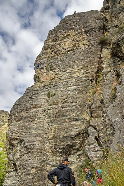
On the way towards the Southland to paddle we stopped at Wye Creek to climb. The approach was a bit more than we expected up a long steep road and trail (ambitious drivers could make the road), but it was quite scenic and followed an aqueduct at the top. There we climbed a number of things at the main wall. I accidentally sandbagged Sam on Aratika thinking it was a 3 star 18 when in reality it was a 23 - I did tell him it felt hard and pumpy though and I was right about the stars. I also led a fun (and easier) roof on the Proud Monkey Wall. It was quite scenic but unfortunately I don't think I got a pic of it. There was a nice sunset on the way down including a sun ray illuminating a peak.
 |
|---|
 |
|---|
 |
|---|
The next day featured some unpleasantness - or perhaps more accurately the continuation of some unpleasantness. There had been some difficulty with group dynamics in New Caledonia and then it was getting worse in NZ. I was not aware or party to much of the things going on, but I think a fair bit stemmed from the expectations vs reality and the difficulties of traveling and planning things with a large diverse group of adults. The end result was the group was split apart - not particularly pleasantly at the time. I think this worked out ok in the end, but was a bit of a mess at the time and required re-doing a bunch of the things we had already done (like getting a vehicle).
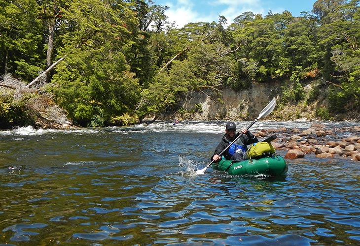
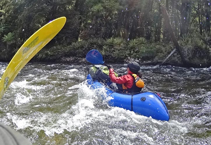
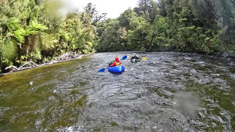
We went to Te Anau where we saw Andy who had a lot of ideas for missions for us (a mission is an adventure into the wilderness in this case). The weather in Fiordland is rarely that good and the forecast was not promising. We continued with our plan to packraft the Wairaurahiri River from Lake Hauroko to the coast and trek back. We were joined by Caleb who was visiting NZ from N Dakota. Once we met up with Ivor at a campground plans changed again and we decided to try to bring everyone by using Ivor's Ducky and having a jet boat bring the paddling gear back. The trip started out with a boat ride on the aptly named Namu (Maori for sandfly) across Lake Hauroko to the Teal Bay hut. There we inflated the boats and set off across the last of the lake and down the river. This river is known as New Zealands longest waterfall since it is so steep.
 |
|---|
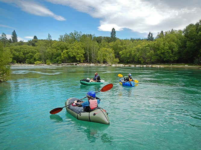
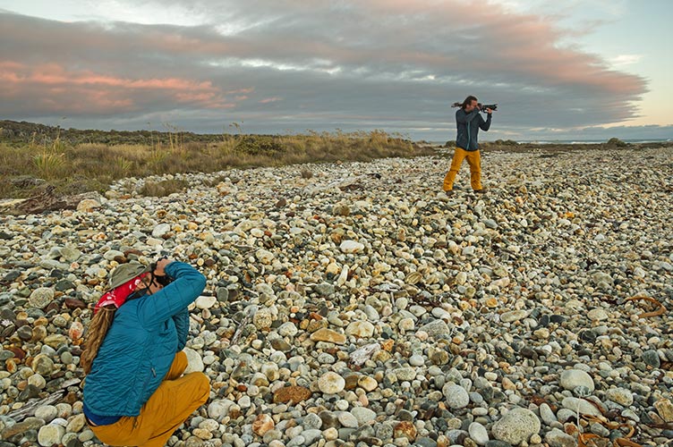
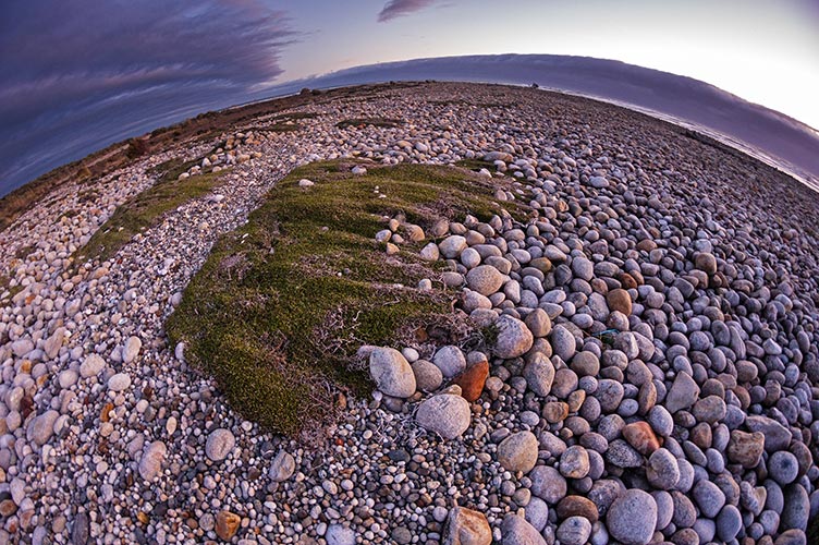
The river was nearly perfect for packrafting. Narrow enough to easily see both sides and often the bottom with clear water. The jet boats clear any logs that cross the whole river and there are plenty of class 2 rapids to keep things interesting but also lots of calmer areas to stop. There might have been a few class 3 rapids, but if so you could sneak an easier line. We did pass one jet boat heading upstream. Fortunately we were partway down the rapid and it waited at the bottom. Since boats heading upstream have the right of way had it just headed up the line we would have had to scramble. I didn't see any fish in the water the whole time, but there were diving birds. Also the water was colder than I would like but that is to be expected in this area. This was ok when the sun was shining but when we were in the shade and the wind picked up things got a little chilly. I really missed having a dry suit (Sam had an ultralight one), but even a more solid PFD (I had an inflatable) or other insulation would have helped. A few people swam either from the rapids directly or by being surprised in one of the powerful eddy lines. I think we were all getting a little cold when we got to the hut near the shore. There we pulled out and set things out to dry as best we could. We didn't have a lot of stove fuel so we cooked up a heap of cheesy pasta on a fire. That evening we walked down to the Southern Ocean for sunset (it faded into clouds). As always the wind was blowing pretty hard and it was cool to see the plants growing in the lee of rocks. It rained that night.
 |
|---|
 |
|---|
 |
|---|
 |
|---|
 |
|---|
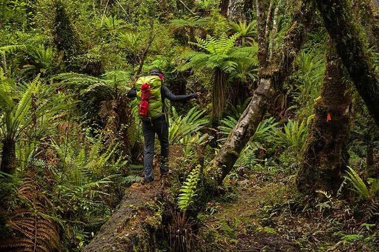
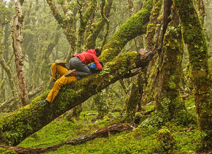
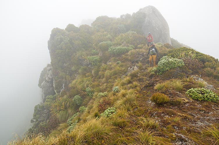
In YogaSlacker style we didn't start particularly early for our long trek back to the Teal Bay Hut (Sam, Raquel, and I) or more leisurely hike along the coast trail for everyone else. To make matters worse we stopped to take pictures regularly. By the time we got up to the top of the Hump Ridge Track where we started bushwhacking it was dinner time and drizzling. We cooked up some tasty hot ramen under a rock before heading off N on the ridge. Once we started through the wet tussocks my feet got soaked. By now we were well in the clouds and visibility was often under 100M. This resulted in a weird illusion where what appeared to be a giant hill or pond was actually a fairly small bump or puddle. We spent a bit of time trying to decide which way to go down a slope only to realize that it was about 20 steps. When we were supposed to follow the ridge it wasn't that hard to navigate but at some point we needed to leave it to traverse to the next track. With a combination of paper maps (that didn't quite show this section), photos of maps, compass, 2 gps receivers, and a little luck we made it.
 |
|---|
 |
|---|
 |
|---|
 |
|---|
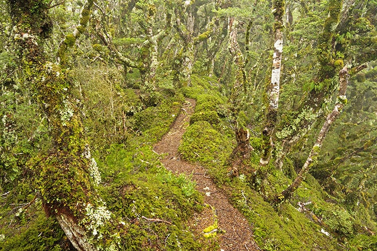
This "trail" was really just a post with a marker every 100M or so. It headed up over a whole bunch more humps before finally dropping down into the trees as it got truly dark. The trees here were festooned with spanish moss which looked almost like snow in the dim light. From here it was headlamp work and Sam did a good job of finding the markers and the trail as we dropped almost 1000M in a few K. This was slow going between the dark, rain, waist deep ferns, and roots and mud. I was glad to have the Leki trekking poles but went down a few times anyway. It warmed up as we dropped elevation but the going never got easy. We made it to the Teal Bay hut at 12:30. Fortunately nobody was there so we were able to noisily start a fire to warm and dry things and cook some food before going to bed.
 |
|---|
 |
|---|
Not surprisingly we didn't get a particularly early start the next morning. We then hiked the remarkably long and slow hike back to the dock and road. It started heading almost straight up the hill to the ridgeline and then followed that up and down for ages. I should have packed more water. When we did get views out through the trees it was pretty scenic but there were also a lot of clouds obscuring things. When we finally dropped back to the lake shore of the last bay we were thoroughly tired of hiking through the woods so we just continued back along the shore. The footing wasn't always the best, but there were better views and more light and it was nice not to have to look where every foot step was going. We got back to Donatello around 8:30 or 9 pm and headed back towards civilization to try to get reception. There we discovered the rest of the crew minus Ivor and Caleb were at a hostel - we headed that way and ended up sleeping in Donatello in town. It was during this trip that my infuriating (it itched like mad) and persistent fungal rash I got in New Caledonia finally started to give up for real. It still itched for a while but no longer seemed to be expanding and the raised and discolored parts were subsiding.
 |
|---|
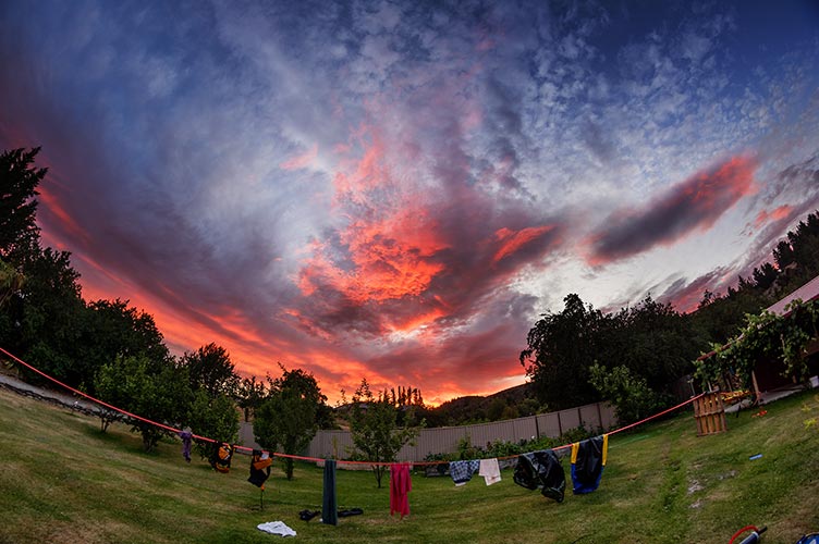
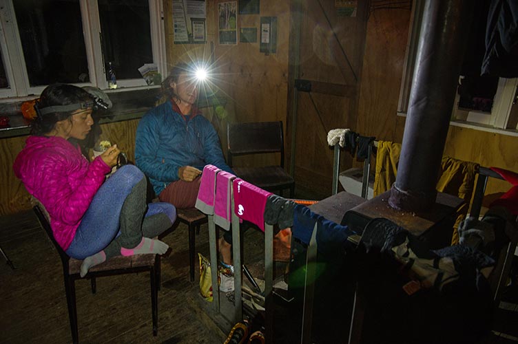
Once we reassembled we poached some showers (for some of us), ate some food, and headed back to Te Anau for an epic of gear explosion/packing, vehicle buying, laundry doing, and so on. This is where I started seam gripping my camping mat. It might be the end of its useful life as every few days there would be a new leak along the end of one of the seams. Not surprisingly this didn't improve my sleeping.
We followed this up with a day in Te Anau where we set up slacklines and hung out with Andy and family among others. The playground equipment there is still a little dangerous and fun - for example there was a giant steering wheel you could grab like a cyr wheel and it would spin around and drop you on your head (if you let go). I even let Keegan convince me to jump off the pier into the rather chilly but refreshing Lake Te Anau. That evening we headed south towards Clifden.
The story is continued on the New Zealand TAO tour South Island part 2 page.