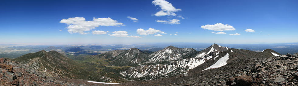
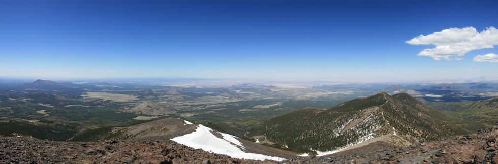
panoramic from Mt Humphreys summit looking N through E to S
 |
Tom Grundy's Mount Humphreys 2008 Page
I had been wanting to do an all human powered ascent of Mount Humphreys for some time. After some scouting bike rides up Schultz Pass and the Waterline road earlier this year I figured it would be possible in a day, but the rides really tired me out and there was still a lot of snow up there, so I was a bit worried. I had a few days without much physical activity, so I decided to go for it the next day. I packed a few things the night before and set the alarm for 5:55 am. On June 8, 2008, I almost woke up early before 5 and had a semi-dream that it was too cloudy and so I went back to sleep. A little after 5:30 I woke up again and realized that no, this was Arizona in June, and it wasn't cloudy. I got up and shoveled some calories down my throat and headed out shortly after 6 am.
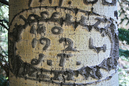
It was cool and clear and the traffic was light. This made for pretty pleasant bicycling, and I made good time up to Schultz Pass. From there I continued on up the Waterline road making fairly good time. It was particularly pleasant and nice in the stretch of aspens just before the inner basin. There was also some interesting old grafitti from the Mexican and Basque sheepherders here. Shortly after 9 am I made it to the inner basin trail. There I refilled my water bottles at the spring and biked up the trail. This trail is steep, and made my legs sore, but I was still going faster than the hikers I passed. I stopped and locked up my bike when the quality of the path deteriorated enough that it was a pain, although I probably could have gone a quarter mile or more before the "no bikes further" sign. From here at around 9:30 and 9800 feet I'd be on foot.
84 year old aspen carving
 |
THE SNOWFIELD after the return (looks pretty mild eh?)
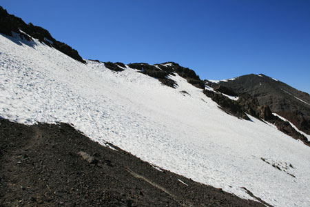 |
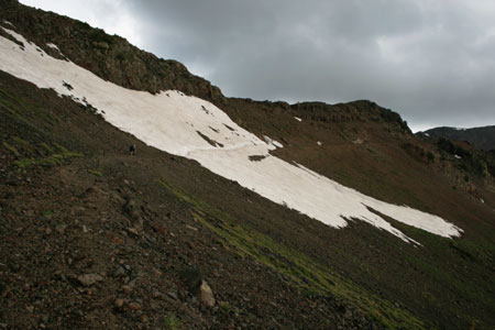
It felt good to get out of the saddle, but soon I started to have snow to contend with. Since it was still fairly early, the snow was hard enough to stay on top of, although my shoes were pretty slick and didn't edge well at all. Soon the trail started playing hide and seek under the snow, and I tended to stick to the clear southish facing slopes, but finally I had to take to the snow heading up the hill. It felt a bit like I was kicking steps with clown running shoes - not too easy. There were some tracks, but most of the ones I could see tended to be people sliding down. Every once in a while I would pass a tiny patch of trail, but mostly I was on the snow. Amazingly enough I hit the junction with the Weatherford trail dead on. There was a 30 foot section of snow-free trail and the junction sign. Then it was back onto the snow.
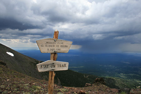
I continued on up with a few patches of clear rocks and the occasional bit of trail or sawn trunks until I finally hit the saddle to the south of Agassiz peak. The Weatherford trail was here, and I continued on up. Here I passed 2 more hikers, and things were going well until I hit THE SNOWFIELD. Now, normally I am not that bothered by snowfields on hikes, but I was wearing the clown running shoes with waxed soles. I would have headed up the talus and along the ridge (with a quick tag of Mount Agassiz) except that is forbidden. I grabbed a sharp rock in case self arrest was needed, and headed on trying to kick steps. The surface had a lot of scoops and runnels, but with diligence I didn't slide much. Finally I got across THE SNOWFIELD(s), and was able to head downhill to the saddle with the junction with the usual route up Mount Humphreys a little after noon.
View to the summit from a false summit
 |
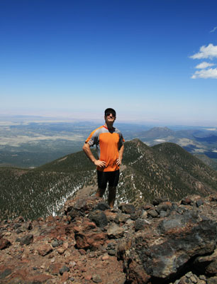
I made it, Mt Agassiz and Flagstaff behind me
 |
another self timer pic, view looking eastish
 |
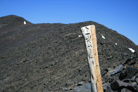
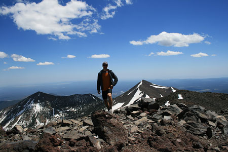
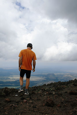
I knew there were a lot of false summits on the ridge up to the summit, so I wasn't too frustrated by them. My legs were pretty tired, but I didn't really start to feel the altitude until around 12,000 feet. It was nice to not be huffing and puffing. Finally I got to the summit around 1:15, which easily beat my 2 pm turn around time. I even had time for some potatoes and to take some pictures. The elevation here is 12,633 ft, 5,633 feet higher than where I started. My day was half over, but it was the hard half.
The descent to the first saddle went fairly quickly, but then I had to go back uphill, luckily it was fairly brief. THE SNOWFIELD was a lot easier to cross due to a combination of the snow being softer and someone else having crossed it and kicking the steps deeper. However with the wet snow, my feet got pretty wet. After the saddle, I headed down into the snow trying to pick the clearest line that went my way. This is where the shoes finally worked better. They were like skis, and I managed to slide down a lot of slopes quite quickly, however now my feet really got soaked. Finally I was out of the snow, but not on the trail heading down into the inner basin. Somehow I ran into the trail and it was on the wrong side of me, but it turned out to be a different trail. From there I quickly met up with the original trail and got back to my bicycle just after 4:30. Needless to say, the bicycle descent went a lot faster than the ascent.
I went zooming down the road wearing my fleece top and bottom. It was a bit chilly, but really it was just my feet that were getting cold. I warmed up briefly on the short uphill section to Schultz Pass. From there I decided to stay on the road in the interest of time and also because I was pretty tired and I was scared I'd wipe out on the Schultz Creek trail. I finally got hot again (except for my feet) on the hills in Flagstaff. I made it back around 6:15, so just over 12 hours from the start. I was sore and dehydrated, but pleased to finally make the trip.
I was pretty sore that evening, and tired and sore the next morning, but otherwise I seem to have survived. Maybe I am even getting into shape.
panoramic from Mt Humphreys summit looking W through N to NE
 |
Take 2 July 5, 2008
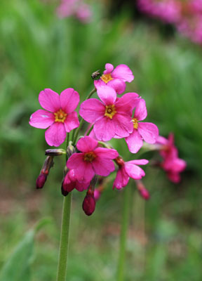
The previous trip was so much fun (and I needed to continue to get into shape), so I went again. This time I was on my way by 5:20 am. I wanted to get an earlier start because with monsoon season, the chance of nasty weather after noon or so was pretty high. It was mostly cloudy when I got underway, but since it was also warmer, this was appreciated. Once I hit the dirt road, it was easy to see that it had rained relatively recenty. There wasn't much wind, and I made good time up to the spring. From there it is a really steep road, and I got tired pretty quickly. Once again I was glad to get off the bike and onto my feet. The trail was a lot easier to follow without heaps of snow in the way, and I made much better time with drier feet. There were also a lot more wildflowers, including in places that were covered in snow on the previous trip less than a month earlier. Of course one does expect a lot of melting to occur in Arizona in June, even above 10,000 feet. The snowfield was down to a shadow of its former self, with much better steps kicked into it. After the junction with the west side trail, there were a lot of hikers and dogs (this was the Saturday of the 4th of July weekend). I continued on up to the summit, arriving just before 11:30.
Some of the wildflowers
 |
Too tired to get into position in time
 |
On the Summit, I ate lunch and took a few pictures and headed down before noon. It was cloudier and hazier than last time. I could see it was time to head down, as there was a storm cell off to the west heading this way. There were still plenty of people heading up though. About the time I got to the snowfield it started a combination of rain and hail. I pulled on my raincoat and continued rapidly down. When I got to the saddle southeast of Agassiz peak, the precipitation was picking up a lot, as well as some electrical activity. I packed my camera in a plastic bag and put on my long underwear top and fleece. It was still cold, and my feet and legs got soaked as I tried to squeeze between soaked plants and stay out of the stream/trail. There was one pretty close lightning strike (I am guessing up on the ridge .25 to .5 mile from me). The crack of the thunder came in between some of the flashes, so it wasn't far away. The echoes of the thunder rolled around the inner basin nicely. The cold did refresh me a bit though, so I made good time going downhill. The precipitation had pretty much stopped by the time I got back to my bicycle, and I coasted downhill rapidly. I stopped at Schultz tank to warm up in the sun and finish my lunch, then I went down the Schultz Creek trail and back to Flagstaff. I got back at 4:20, 11 hours after I started. I certainly wasn't fresh, but I wasn't as tired as last time either.
Definitely time to be heading down
 |
THE SNOWFIELD on June 8
| |
The much melted snowfield on July 5 (people dots for scale)
 |
I also went up Mt Humphreys in 2009, see report here:
Mount Humphreys ascent in 2009
A report of a previous climb of Mt Humphreys can be seen here:
Mount Humphreys ascent in 2004