Tom Grundy's Muir Pass and Mount McDuffie Page
Jeff and Jim were hiking over Lamarck Col and then through Evolution Basin, over Muir Pass, and out over Echo Col. We joined them for some of the hike up towards Lamarck and then I joined them later at Muir Pass.
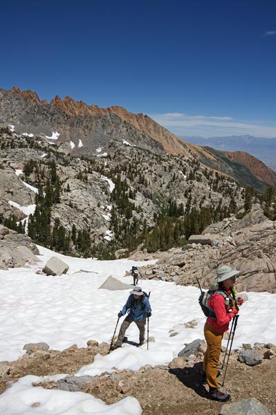
2023-7-22 They started hiking this day and Iris and I joined them for a bit of exercise in the mountains. The Sierra Challenge was coming and we really hadn't done much mountain adventuring since the Utah trip earlier in the year. I blame laziness, work, bad weather, and lots of snow and high water. In any case, we started up from North Lake making slow progress up the trail. Jeff was flagging, so we traded packs for a bit - he had a pretty light pack for a few days hike, but it was much heavier than my trailrunning pack and probably a little overloaded for the support it had. The trail was pretty clear to the Lower Lamarck Lake but we did wade across the outlet stream that was flowing over the usual crossing logs (although we probably could have found a dry crossing had we looked harder). Then there was on and off snow above that although the going was mostly pretty easy. We parted ways at around 11,500 feet and Iris and I headed up towards Granite Peak at 12,082 - a high point without a lot of prominence between the Sabrina Basin and the Lamarck Lakes Basin. We worked our way across the valley and then across a bit of snow and up the steep talus to the summit.
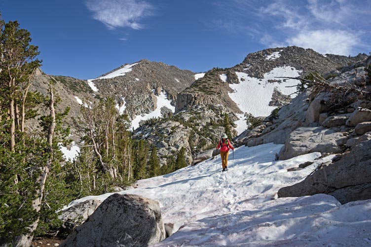
hiking up the snow above the Lamarck Lakes
 |
Jeff and Jim start up across the snow on the way to Lamarck Col
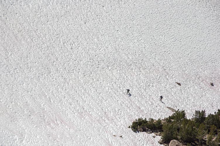 |
As expected the views were most excellent, and looking south there was a lot of snow in the Sabrina Basin and since we were looking south at the N slopes it probably looked even snowier. Then we headed back down - going pretty slowly as the uncertain footing and downhill slope on the steep talus and scree and then the snow was not good for a weird pain in Iris' foot. I was able to standing glissade down some of the snow, but the suncups made it not so great. We crossed the creek below Lower Lamarck Lake at the outlet - it took some balance on unstable logs but we kept our feet dry. The mosquitoes were fierce back by North Lake and I ran ahead to unlock the vehicle so Iris could just jump in when she got there.
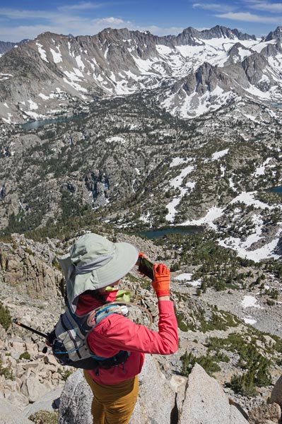
Iris takes pics from Granite Peak
 |
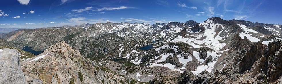
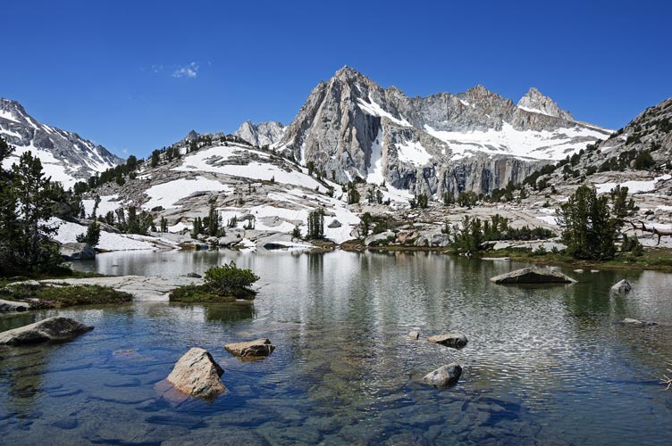
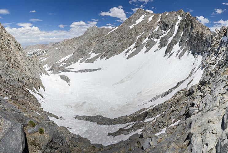
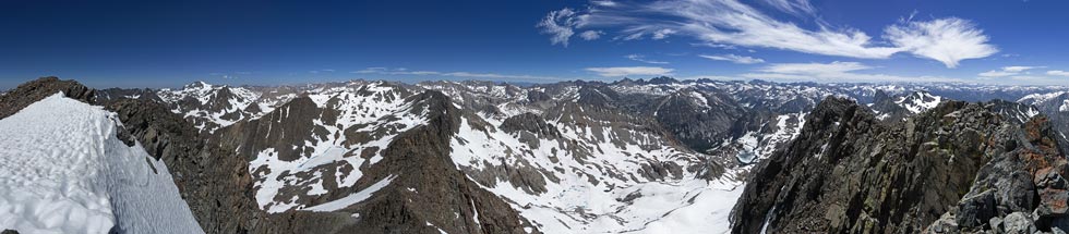
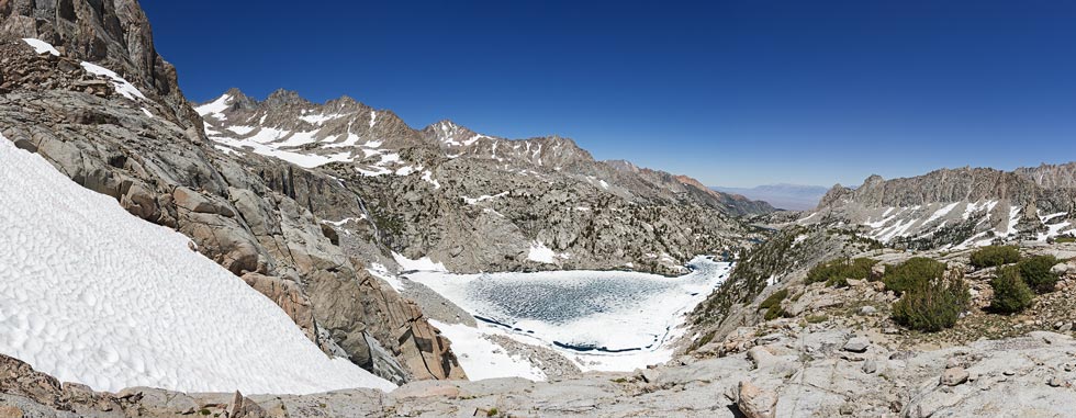
panorama from Granite Peak - Sabrina Lake far left, Echo Col about center
 |
Fishgut Lakes with Echo Col right of center
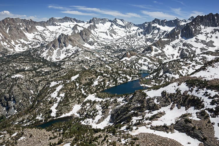 |
Mount Emerson left of center, Piute Crags are reddish on right, and Lamarck Lakes
 |
Iris coming down the snow - Granite Peak left of center
 |
Strava page for Granite Peak
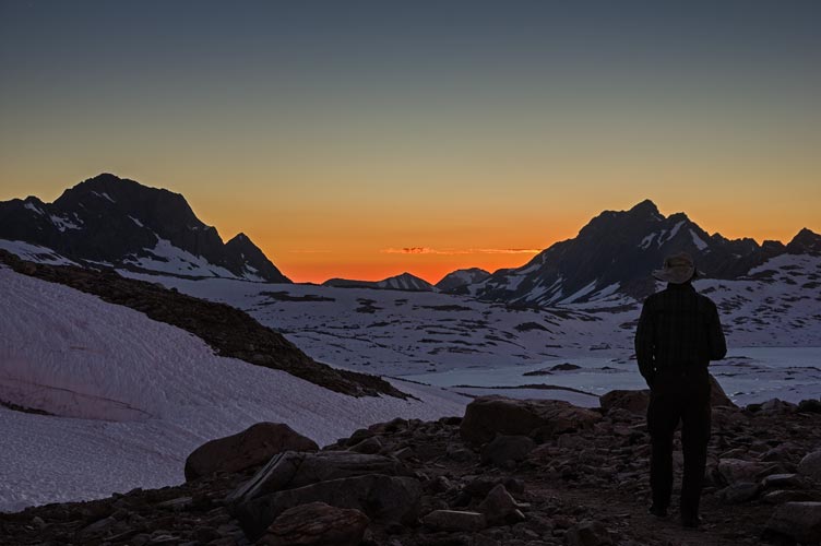
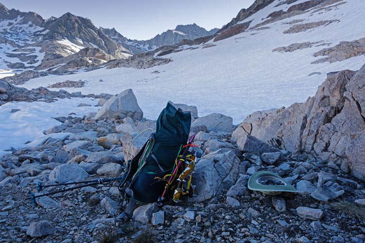
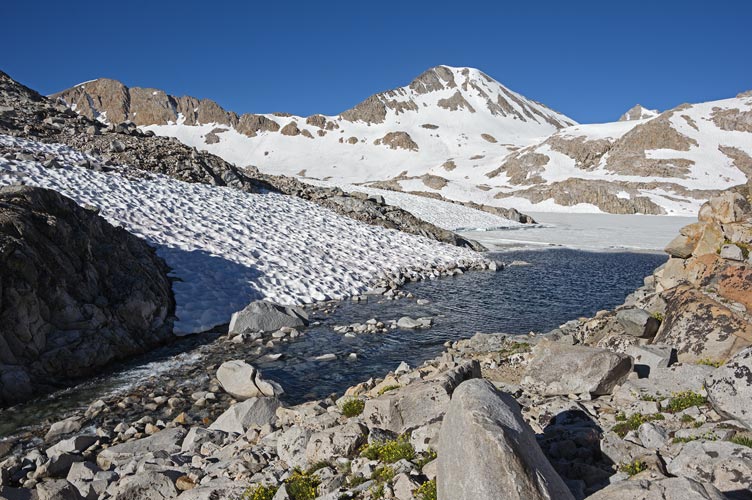
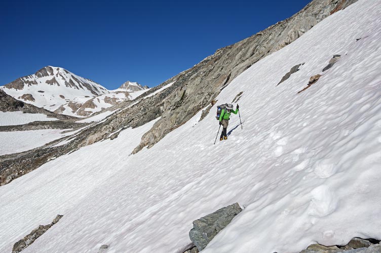
2023-7-25 I started hiking at a reasonable hour with a fairly light overnight pack (bivy sack, jetboil, 2 days worth of food, and not a lot of clothing - estimated weight ~25 lbs). There were a few mosquitoes after Blue Lake but the wind kept them mostly at bay. I took off my boots to wade across on the underwater stepping stones after Dingleberry Lake and after that the hiking was probably more on snow than off snow. Fortunately it wasn't very soft yet. There were a few stream crossings that were a little exciting - my foot slipped in on one, but my Keen boots were still mostly waterproof and although the sudden cold felt like my feet got wet, they actually stayed dry. I went around on the N and E side of Sailor Lake which was probably a mistake and required some jumping and balancing and stepping on barely underwater rocks to get past. Then it was onto snow up past most of the talus and along the shore of Moonlight Lake which was about 1/3 clear of ice. From there I stayed on the west side of the drainage or right up the middle on snow up to Echo Lake. Here I filled up on water in the ice free section along the shore and put on my crampons at the end of the snow free shoreline. I traversed around the east side of the lake and then crossed out over the frozen lake to get to the steep snowfield up towards Echo Col. The snow was starting to get soft on top, but it was quite solid underfoot and I avoided the small patches of open water and cracks.
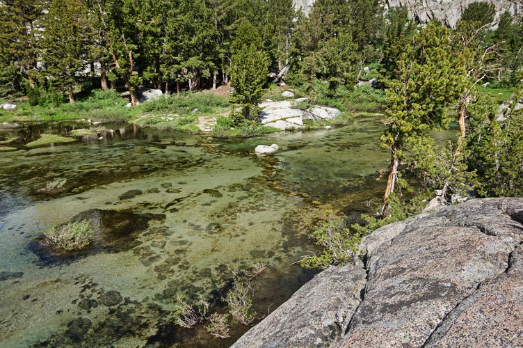
underwater stepping stones to cross the creek above Dingleberry Lake
 |
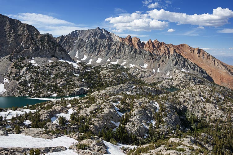
Picture Peak above Sailor Lake
 |
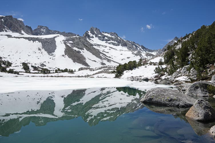
Echo Peak reflected in Moonlight Lake
 |
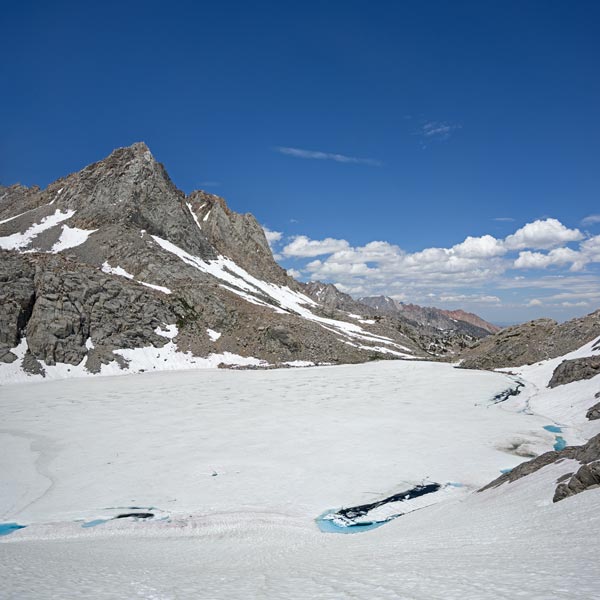
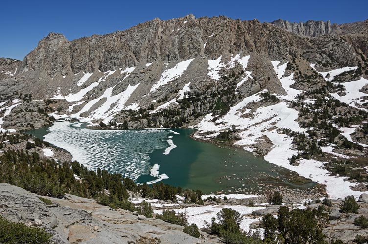
Picture Peak and a mostly frozen Echo Lake
 |
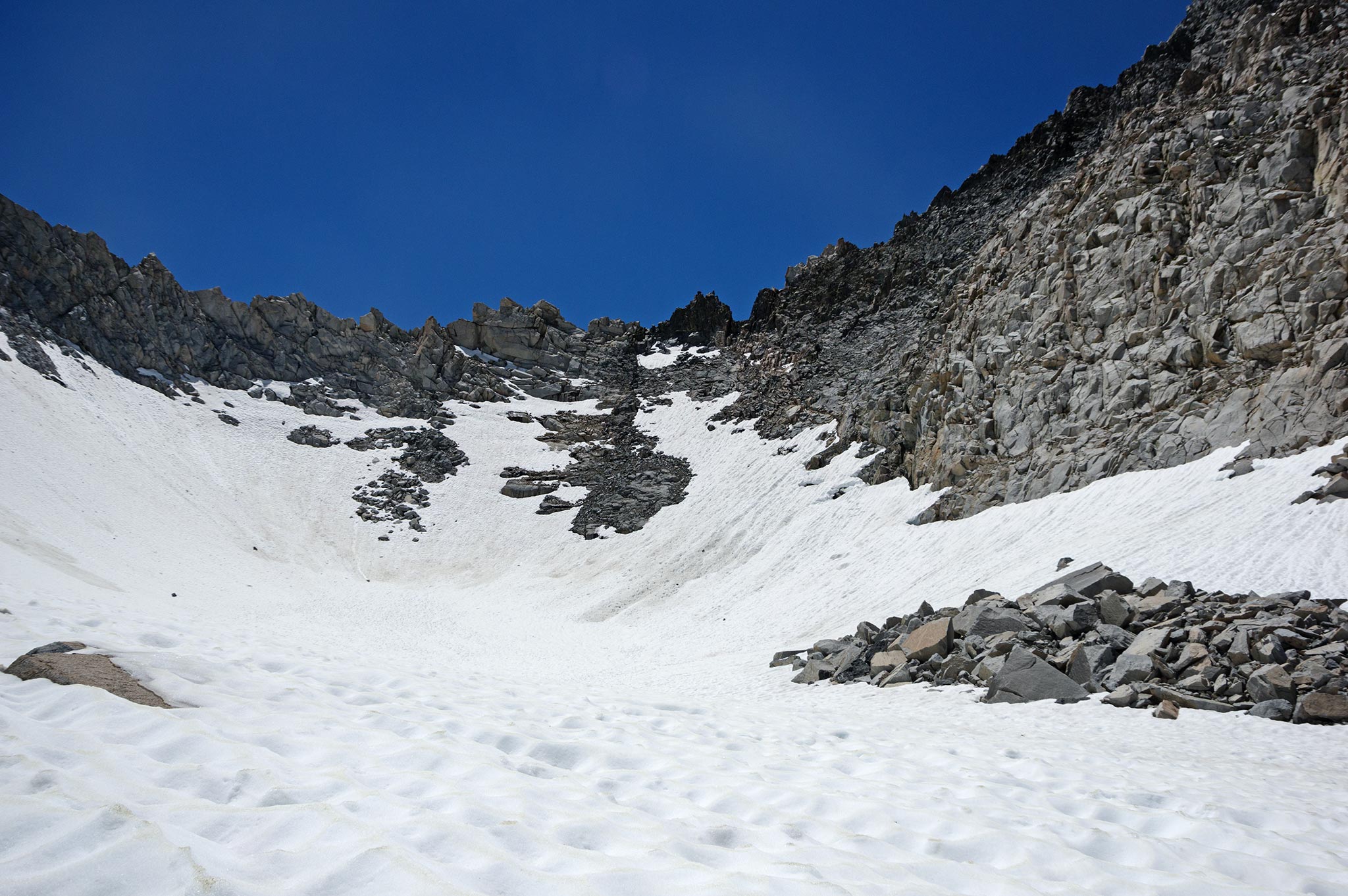
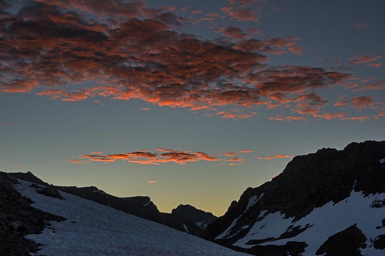
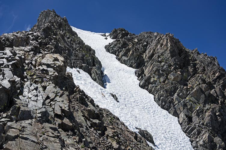
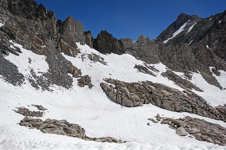
I went up the snowfield and then crossed a bit of talus and back onto the snow up towards Echo Col. I transitioned onto the rock fairly low down and went up the rock to the col. There was a lot of snow on the S Side of the col and I was able to glissade down after the first 40 feet of down climbing. I worked my way down and right aiming to cross below a distant cliff. This mostly worked out although in my effort to avoid going down and back up I probably wasted a bit of time if not energy. The snow kept getting softer and there were some pretty horrendous sun cups and runnels through here. It was a bit tedious, but I kept moving along working my way down to descend the talus and cross below the cliff, Then I traversed towards Lake Helen crossing to the west of the little peak above its outlet. The stream crossing at the outlet looked doable, but traversing across the massive snow bank a little downstream was even easier. Then I followed the fairly limited footsteps along the JMT/PCT towards Muir Pass. By now the snow was soft and sloppy and it was quite tedious slow going. I pushed on sometimes following footprints, sometimes on solid ground but mostly on snow. I was definitely past ready to be done by the time I got to Muir Pass and the Muir hut. There were a few southbound hikers there that left shortly after I arrived and I thought I saw Jim, Jeff and Miles (he hiked in to join them the day after they hiked in) up the hill. It was them and they came down shortly. I changed out of my by now wet boots and stuck everything out in the sun to dry (and a solar panel to charge my phone). I could see Mount Ithaca not far to the west and I was absolutely dreading attempting to do it as a day hike on day 5 of the Sierra Challenge in a few weeks.
Echo Col is the squarish notch in the dark rock right of center
 |
view N and E from Echo Col
 |
panorama S and W from Echo Col
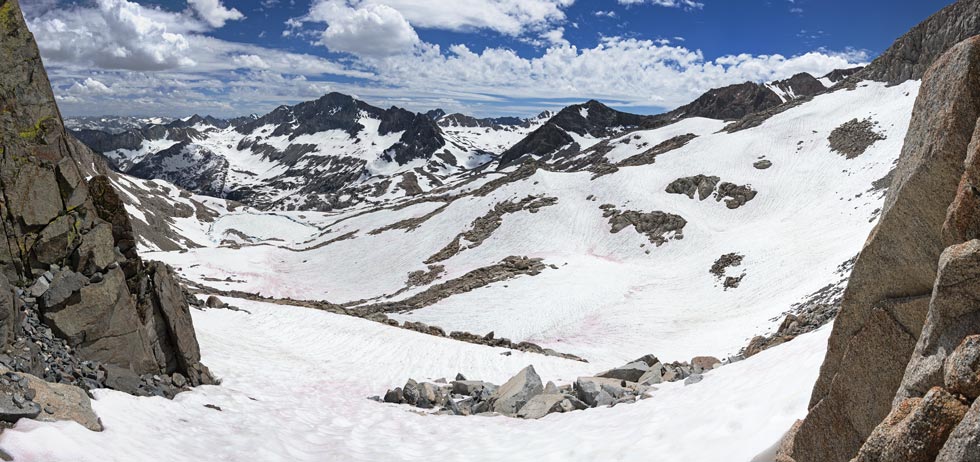 |
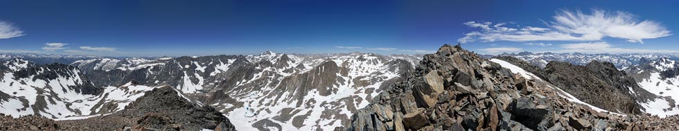
panorama looking across upper LeConte canyon towards Black Giant right of center
 |
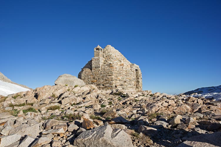
We had a relaxed evening complete with augmented ramen noodles for me - sadly I lost a bit when the jetboil boiled over (augmented with dehydrated lunchmeat, green onions, peppers, and peanuts). A few other through hikers joined us in the snow free island around the Muir Hut including a late arrival heading North - a Belgian with a light pack moving fast - I later realized he was Karel Sabbe enroute to a supported FKT (Fastest Known Time) of the PCT - 46 days, 12 hours and 50 minutes (averaging somewhere close to 50 miles a day - although not on this section)(the linked video sort of zips through the high Sierra section since he was less supported through there although the video at 21:58 shows a bit of the sunset at Muir Pass). After sunset it was much warmer in the hut than outside, but Jim mentioned serious snoring, so we both camped out in the open south of the hut. I did wear almost all of my clothes and was worried about being cold, but once I was inside the bag in the bivy sack I was warm enough.
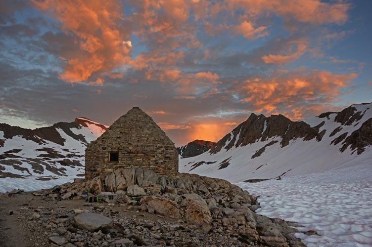
Muir Hut around sunset
 |
Jim and the view out over Wanda Lake at sunset
 |
Strava page for Sabrina to Muir Pass
2023-7-26 We got up pretty early - and fortunately the sun hit Muir Pass early. This made it much easier to eat breakfast and pack up in a somewhat timely manner. Jeff and I were planning to head to McDuffie, Jim and Miles were going to go over Echo Col and camp somewhere on the other side.
sunrise was nice too
 |
Jim, Elliot, and Jeff as we got ready to go
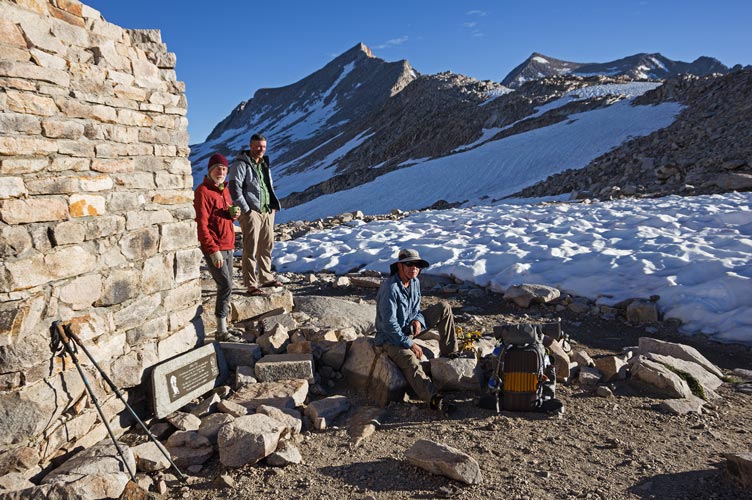 |
leaving the Muir Hut
 |
We put on crampons (fortunately I ignored Jim's satellite text that said crampons were unnecessary) and headed around the bowl south of Muir Pass. We stashed some gear (stove, bivy sack, and sleeping bag for me, lots of gear for Jeff) and then went past a frozen over lake and over 2 passes towards McDuffie. We dropped down a steep snowfield off the first pass using ice axes and facing into the slope. That was the steepest snow we were on all day. The second pass was more gradual but also higher. From there we got our first view of the distant McDuffie. It looked steep with what looked like a nearly vertical snow slope near the top. We hoped that the usual case of things not being as bad as they looked at a distance would apply here too and headed down across the valley and up towards the Black Divide Ridge. Once we made it to the ridge south of Black Divide Peak we followed it south towards McDuffie. Soon we ran into some difficulty.
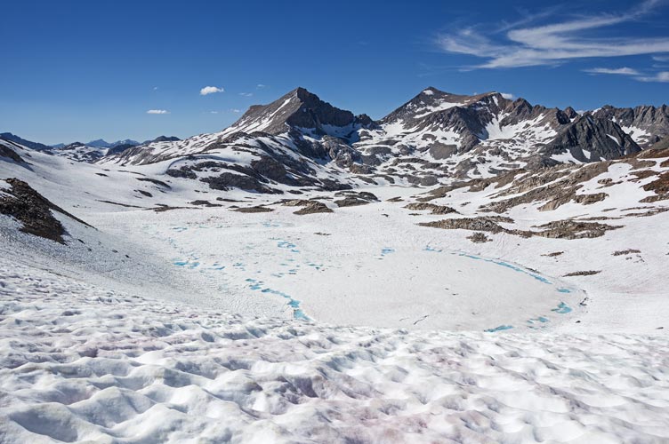
mostly frozen lake
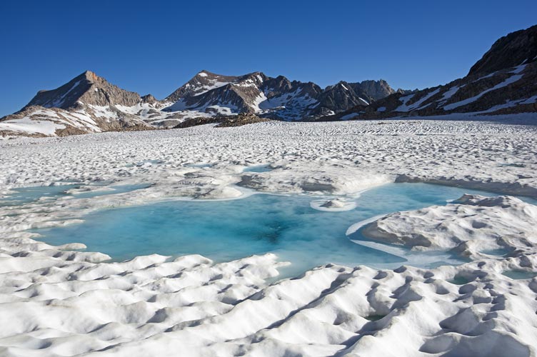 |
Jeff descends steep snow
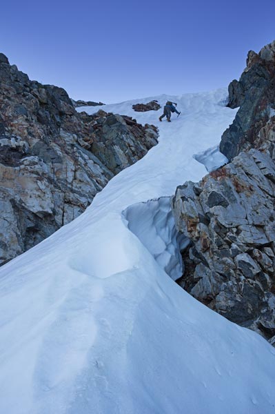 |
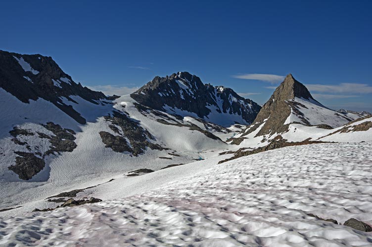
Charybdis beyond another frozen lake
 |
McDuffie in the center - still far away
 |
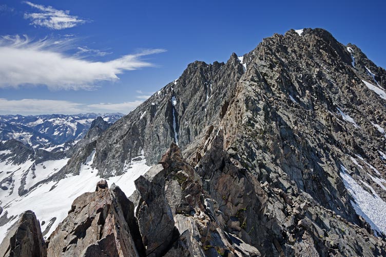
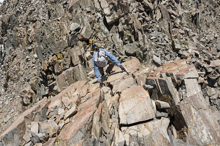
The ridge itself was composed of lots of loosely stacked blocks. This is pretty common, but this ridge was steep enough to make it rather scary. So first we dropped down on the east side and traversed a series of lower ledges before scrambling back up and over the ridge. I could see a cairn down below on the west side and one of the route descriptions described coming up a gully on the west side north of the peak and traversing below the ridge. So down we went. Down at the cairn I spotted another maybe cairn farther down and headed down to it. There seemed to be a way to traverse south at this level, except there was a steep snowfield with bad consequences below it. We carefully climbed up between the snow and the rock and went up and south following whatever path seemed best between the ridge and steeper terrain down below. Passage was always possible somewhere, but it was slow and not always easy and we were not particularly looking forward to coming back, especially if we were stopped from making it to the summit. Finally we made it to easier ground along the ridge up to the final headwall. Fortunately there was a hard 3rd or easy 4th class way to go up the rocks left of the snow so we didn't have to take turns with both of our ice axes to go up and down that. Then there was an easy traverse over to the true summit. McDuffie is a 13,282 ft tall peak on a number of lists including the SPS list and Western States Star Peaks, so it was nice to make it to the summit. The Citadel - a peak from the 2022 Challenge looked positively tiny far below.
ridge up towards McDuffie
 |
final ridge up to McDuffie
 |
summit of McDuffie is far left, the ridge we came up is left of center
 |
summit of McDuffie is center right, center is westish
 |
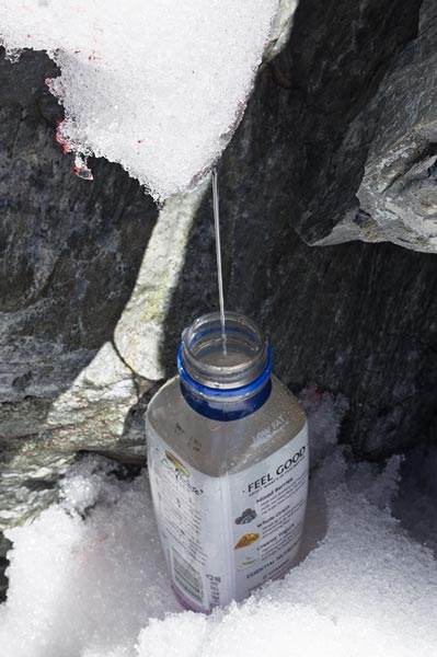
We had summit cookies, took pics, signed the register, and enjoyed the views - for a little bit of time - before heading back down. We mostly just reversed our path up except we stayed below on the west side of the ridge and never traversed over to the east side. This worked out a little better. Once we were back on the snow it was getting soft, but was still ok walking, especially downhill. We were low on water so stopped at a spot where it was running off the bottom of the snowfield. It took a few minutes to fill up a water bottle under this trickle but the stop was needed anyway. The downhill snow went pretty quickly, but we were tired for the uphill parts. By the time we made it back to our stashed gear it was late afternoon and we were tired. It took a while to load up our packs and leave here and we didn't go too far towards the outlet of Lake Helen before we stopped at a nice little rock island surrounded by snow and near an open creek for getting water. This spot had pretty good late sun which we took advantage of until it set.
Jeff descends the final summit ridge
 |
refilling water from a snowmelt trickle
 |
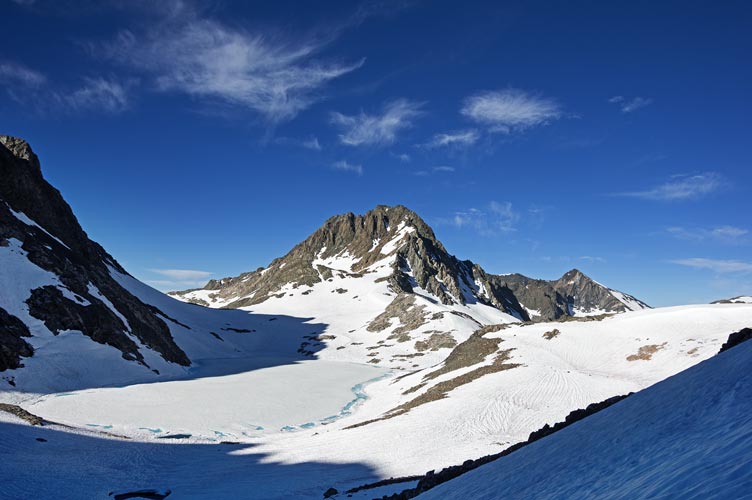
frozen lake below, Muir Pass on the left
 |
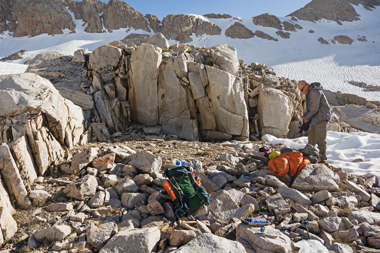
where we camped that night
 |
Strava page for McDuffie
2023-7-27 Our site might have had good evening sun, but it did not get good morning sun. This made getting up and moving a little slower than we might have with better sun (and warmth). At least the snow was crisp with good crampon conditions - and pretty good without crampons too. Jeff had steel crampons and could keep them on to cross sections of rock and gravel but my aluminum crampons couldn't handle that so after I took them off I kept them off. We crossed the snow below Lake Helen and after going around the little peak there we were able to follow the footprints across a steep snowfield to the base of the cliff to traverse below. From there we headed towards Echo Col trying to find the best route. Once we got close to the Col we could see the footprints again - way up high traversing over to the col. We went up some talus and then followed the most excellent steps up to the bare ground of the col.
pack almost ready to go, Echo Col left of center
 |
Lake Helen outlet, Solomons center right, Ithaca right of that
 |
Jeff cuts across the snow slope, Solomons on left, Ithaca right of that
 |
Echo Col from the SW - the square bottom notch in the dark rock left of center
 |
We descended to the snow, and then slid and plunge stepped down to more level terrain. Then we dropped down to Echo Lake and followed the tracks across the edge of the lake and along the shore to the outlet. We stopped here briefly, but the wind was was cold so we didn't linger. Then we opted to head up and left to take the ridge down between Hungry Packer and Moonlight Lakes. This might have been a bit slower than the alternative, but there were less navigational challenges and much lower chance of post holing since we were mostly on rock. From the toe of the ridge we dropped down left to cross the stream from Hungry Packer Lake where it was completely covered in snow. Then we headed downstream to pick up the trail where it wasn't covered in snow. Jeff ended up wading across the creek wearing shoes to avoid having to stop to put on shoes in the mosquito rich environment. I took mine off, but suffered a few bites getting them back on. I did catch up pretty quickly though. Once we had passed Blue Lake we were able to talk to Jim on the radio - and got him to delay heading back until we got down about an hour later. As usual the last bit of hiking past Sabrina got tiring, but we made it.
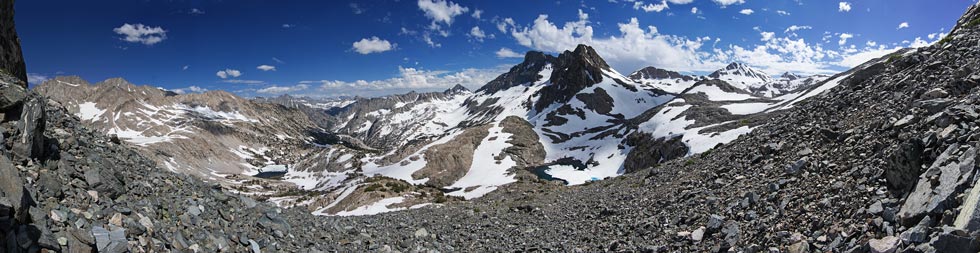
panorama from the ridge looking over Hungry Packer Lake
 |
looking down over Moonlight Lake with Donkey and Baboon Peaks behind
 |
Strava page for hike out
No material on this page may be copied or used without permission.