Tom Grundy's June Peak Bagging 2015 Page
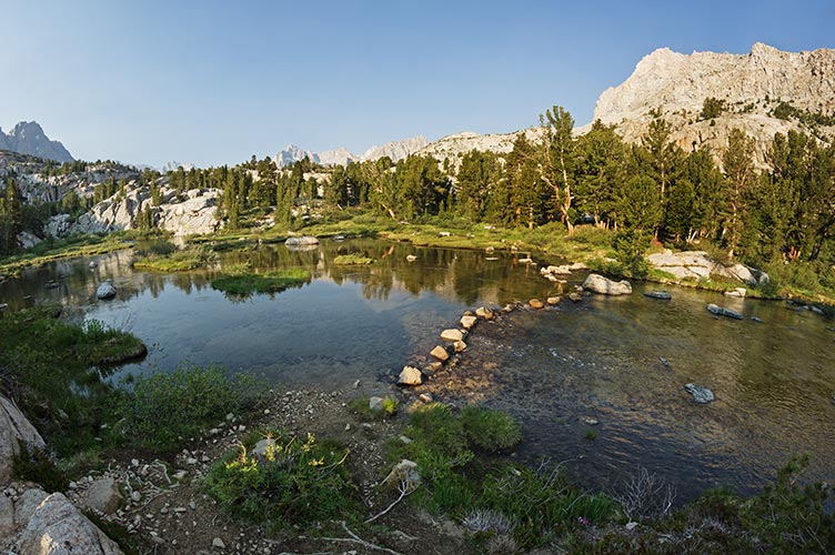
Silver Lake and Carson Peak - the night before
 |
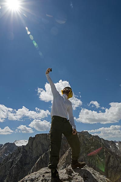
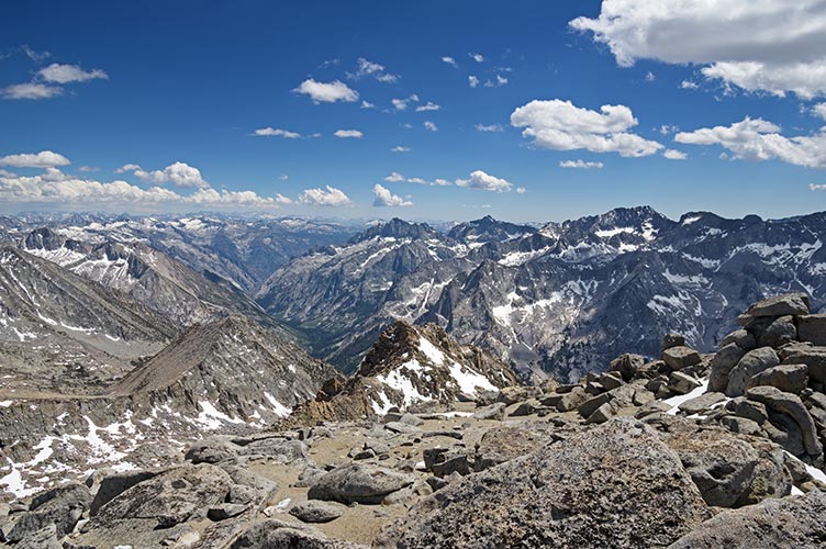
Electra
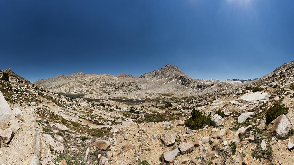
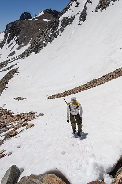
While Liz and some other ladies were climbing Banner and Ritter peak JD had some long day hike plans. I joined him at Silver Lake (actually I got there the night before for some evening pics, he got there the next morning). We started hiking about 5:15 am as it got light enough to see. I was hoping that with all the running and a rest day things would seem easier. I guess they were easier than day 2 of the Sierra Challenge 2014, but we were also probably going slower. We hiked up past a few pretty empty lakes and then took a short detour south on the PCT before turning off up to Davis Lake. From here we went off trail up over a pass. Luckily the snow was mostly pleasant for travel. From the top we could see our destination - a long way off. We dropped down into the giant bowl with a little bit of pleasant snow boot skiing and a lot of less pleasant somewhat loose talus. Then we traversed around below Roger and an un-named peak and finally crossed the lake outlet below Electra. Then we headed up the slope to the summit.
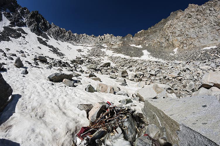
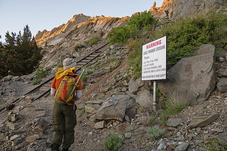
JD at the tram crossing
I assume the tram was built (and is still used) to move supplies etc. to the dams and power plants up the drainage.
 |
From the shore of Waugh Lake - the pass we are heading to appears just next to the foreground ridge on the left... plenty of distance to go
 |
JD at the top of the snowfield heading up the pass
 |
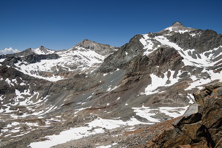
Electra off in the distance (left peak) from the pass
 |
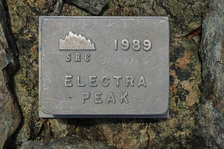
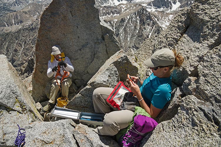
Electra summit register
 |
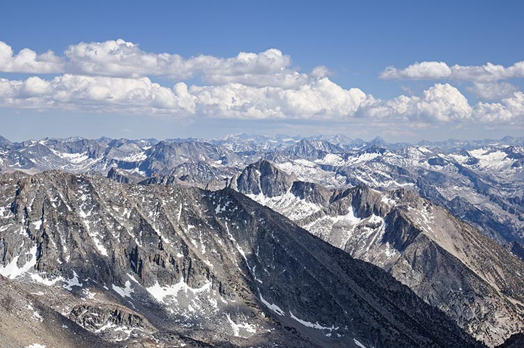
As usual there were some most excellent views down onto the back side of half dome one way and Banner and Ritter and on down the Sierra the other way. A few clouds were blowing up into storms, but luckily none over us or upwind of us. We decided to glissade down, but the snow was so soft I post holed to mid-thigh. We had to do a sitting slide to keep from just sinking in. BRRR. Then we had miles and miles to return. The traverse under Rogers peak was particularly unpleasant compared to the approach for some reason (it just seemed a lot looser), but we made it. Once we were close to Davis Lakes, we stopped to wring out our socks. Then continued on. It was definitely getting on towards the end of the day as we did the little PCT section. Waugh lake seemed long, but the section from there on seemed even longer. It didn't help that the sun set and we needed to turn on our headlamps. We could see the lights down by the parking long before we made it back. It ended up being a 17 hour push - and then we had to drive to Bishop and get some food. Needless to say we weren't psyched about getting up in a few hours for another long day. We decided to scale back the plans for Sunday.
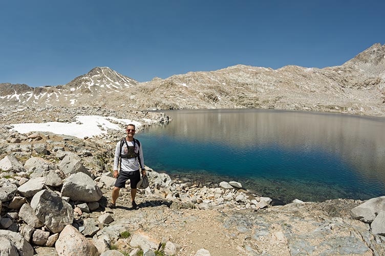
Gilbert
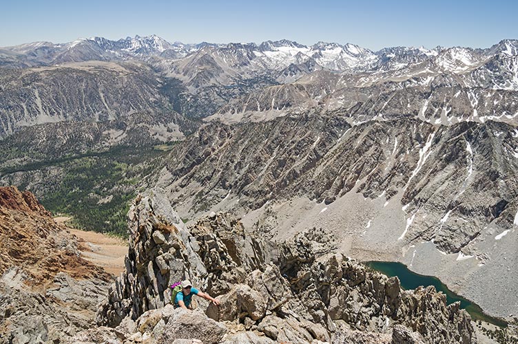
I was pretty pathetic at packing the next day, but I think I managed to get everything together for 2 nights. Then we headed up to S. Lake and started on up to Treasure Lakes. A week ago the logs across in between the lakes were not suitable for crossing (the one submerged when I stood on it resulting in one wet foot). So we bushwhacked around the SW side of the lakes and on up towards the S side of Gilbert. There was a little bit of snow to avoid and a lot of boulders to cross. Then we saw a sneaky ledge system that we hoped would save us from endless boulders. It did, and the views were nice, but I don't know if it saved us a lot of time. We headed almost up to the summit of the peak E of Gilbert and then dropped down into the bowl on Gilbert's SE side. From there it was more uphill on talus with some snow dodging (we wanted to keep dry feet after the day before). Finally after a few false summits we were on the top.
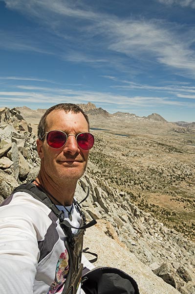
JD selfie on top of Mt Gilbert
 |
Our original ambitious plan of Ski Mtneers - Thompson - and on to Gilbert looked nearly impossible, but perhaps the supposed 3rd class off Thompson is more obvious from that side. The views were spectacular all around, especially down the spine of the Sierra all the way to Whitney.
looking down over LeConte Canyon from the SE end of the summit ridge
 |
zoomed in a bit looking south from the summit all the way to Whitney
 |
The descent was generally easier because going down somewhat loose scree is just so much faster (and more fun as long as it remains predictable). We were able to find our sneaky ledge (after just a bit of looking about) and soon were back to the boulders. Back at the Treasure Lakes the log crossing had been built up (so I totally sandbagged us - sorry JD). We contemplated the reason for so much uphill when we were going back down the trail, and then were back. We had a bit of trouble getting in touch with Liz, but eventually found reception and she headed on up to meet us at the N Lake Campground with fresh Pizza. YAY. That night we all went to bed early to try to get more rest.
Emerson
We got up before 6 and had breakfast and packed. I think we were moving up the trail around 7. The rock was still quite cold when we started up. Fortunately the trickle of water coming down the route mostly stayed in the back of the crack. We had a 30m rope and 3 cams and some tricams and a set of nuts and some long slings. I led the first pitch - well, I went first and did place a piece right before the crux. Then I brought up JD and Liz. We scrambled for a while and then I "led" another section and brought them up. From there we scrambled the rest of the way, although there was one somewhat sketchy section with snow down in a lower angled chimney.
We were passed by an Italian guy while taking a snack break. Then we headed on up to the final ridge to the summit. This is a pretty nice section to climb varying from a sidewalk in the sky to maybe a skinny tilted roof top. It is a lot of fun, although Liz thought it was almost "too much" fun. Needless to say we didn't go quite as quickly as I might have by myself.
Liz coming up onto the spectacular final SE Summit Ridge
 |
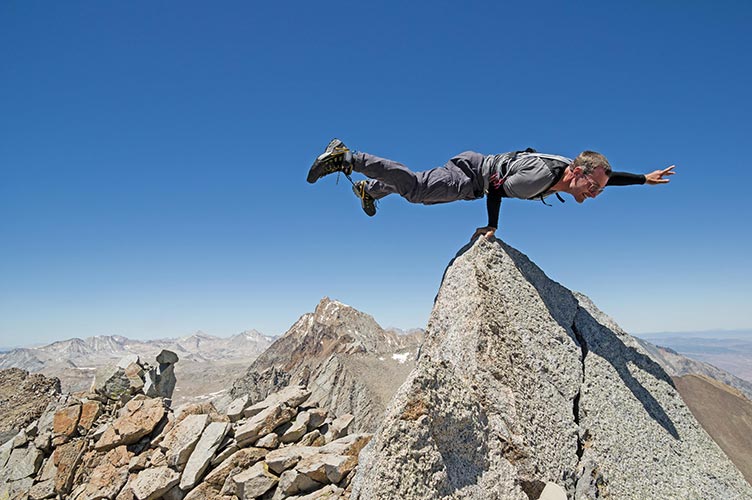
posing on the Emerson Summit - thanks for taking the pic JD
 |
Liz posts her summit success online while JD packs up his harness
 |
We spent a bit of time on the summit eating and taking pics, then it was time for the mostly tedious descent. A lot of this was almost good for scree skiing, but instead it had sections of ball bearing gravel over slabs and shifty larger rocks. Once we hit the trail we just had to return to camp. This was a lot easier than the week earlier when I was pretty destroyed from jogging over the pass to Hutchinson Meadow and back. Unfortunately JD had to return to work. Liz and I stayed another night with plans for more peaks the next day. I had plans to get some star shots with the fisheye lens, but instead I went to sleep early(ish) and slept through the night.
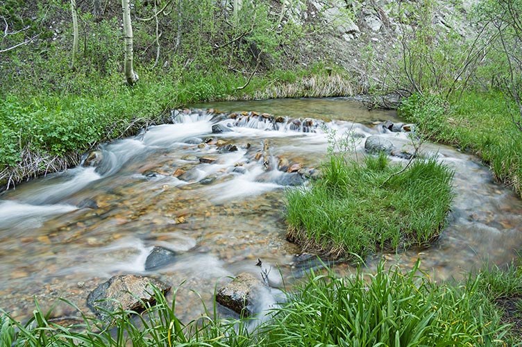
N Fork of Bishop Creek - long exposure in the evening
 |
Sky Haven
We started off up the water pipe towards Green Lake. I wanted to re-route a stream into the pipe to see where it went, but the stream was already dry. It really is a drought year, especially compared to the heavy snow year of 2010/2011. We continued past Green Lake and on up the switchbacks onto the high plateau. From there we dropped down to some springs, that were dry (I was hoping to get some water there). Instead I stopped at the next snowfield and put some snow into my bladder. Then there was an almost dry lake, and I got some water there.
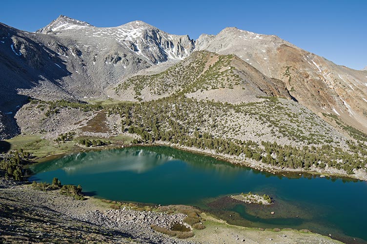
Green Lake
 |
From the distance it looked like we should go up to the right of a shoulder, but as we got closer it looked like going left would be fine (and then we needed to go left). Most of the way up this was true, but then we hit the ridge and the other side was loose scree and rocks. Fortunately it wasn't hard to cut back onto the original planned route. Then we had to follow the ridge up over or around a bunch of sub peaks and along the final ridgeline to the true summit. This went slower than we wanted, but we had nice views and made it eventually. The views into the Palisade basin were most excellent.
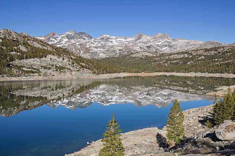
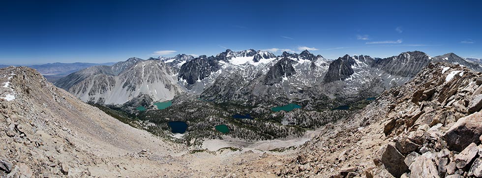
Sky Haven Summit Panorama to the south
 |
Rather than return along the ridge and traverse up to Cloud Ripper as was our original plan, we descended down to the NE down an endless talus slope that mostly wasn't fine enough for pleasant scree skiing. Then a short traverse brought us out of the boulder field at the base and we traversed through the mostly open woods until we hit the trail. We followed this back up to where we had left it at the "springs" and continued on past Green Lake and back to the car. Then back to Bishop.
The next day after a leisurely breakfast we went to Pine Creek for some sport climbing and Liz continued on to Yosemite while I returned home.
"trail running"
Much of my effort lately has been at trail "running". I put this in quotes because most people would not consider it running. I have never been a good runner, in fact once someone remarked that if I was a running animal they would put me down. In a burst of stupidity, ambition, midlife crisis, or something like that I agreed to run a 100K trail race with Sam and Raquel this year. That means I need to be able to actually cover that much ground. Luckily I don't have to actually run the whole distance, but I do want to make it before the cutoff. Sometimes I think "no problem, I just need to keep on moving, and I'm good at that" at other times I think "no - way, I am just too darn slow". The latter is usually after some exercise where I think - would I really want to or be able do that 6 times in a row? Or after my latest long push - could I do that again but faster? Now usually there are a number of factors that I hope will make the actual event more plausible - like it will be at lower elevation - under 10,000 ft, I'll be carrying less (I have mostly been carrying my dslr along with me plus more clothes, water, and food than I will need in the race - since there will be drop bags and aid stations along the way, there will be others to run with - which usually helps me keep my pace up, and I have also done a bunch of trips involving off-trail travel, which can be much slower. But, the race also might sport over 17,000 ft of elevation gain and loss, which is a lot for any day, not to mention the 100K - 62 miles. In any case, earlier in the year I did a fair bit of "running" along the canal paths near Bishop. Lately I have been taking it to the mountain trails. I by no means run all of these, sometimes I walk up hills and cross country or even relatively level ground. These trips have included:
Biking to and up into the White Mtns a bit
biking to and doing the Druid Stones Loop
biking to and going up past the Druid Stones Loop
Biking to and going up past the Druid Stones Loop to the double track on Coyote Flat and summiting some peak up there
up to Bishop Pass and back
up to Treasure Lakes - over Mt Hurd, up to Ruwau Lake, over the saddle to Chocolate Lakes, and back (with more bushwhacking due to losing the trail)
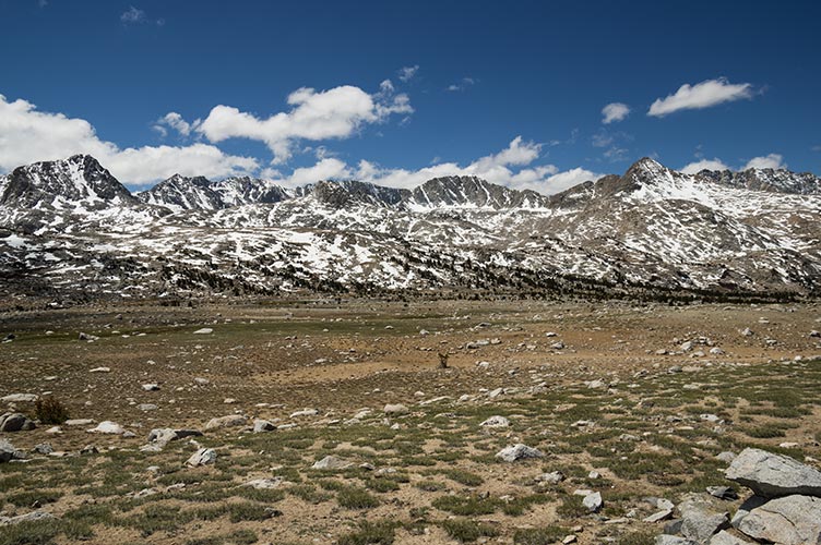
Over Piute Pass to Hutchinson Meadow and back
Over Piute Pass to Pilot Knob and back
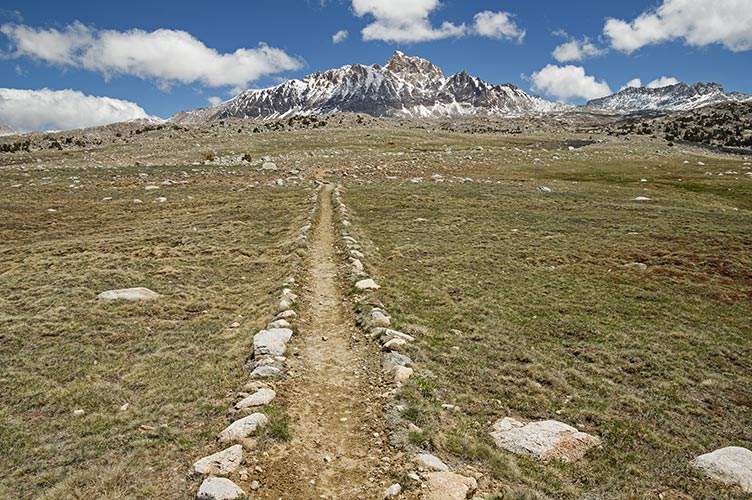
Up past Sabrina Lake and over Echo Col to the JMT/PCT over Muir Pass down past Evolution Lake and then up Darwin Bench and over Lamarck Col and back to the truck via N Lake
Humphreys Basin trail and Mt Humphreys
 |
Glacial Divide
 |
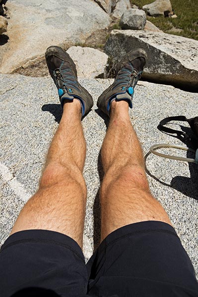
tired legs - at Hutchinson Meadow
 |
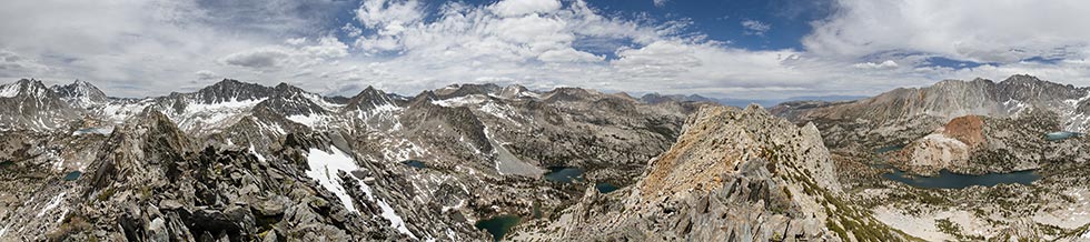
360 degree panorama from the summit of Mt Hurd
 |
Pilot Knob summit selfie
 |
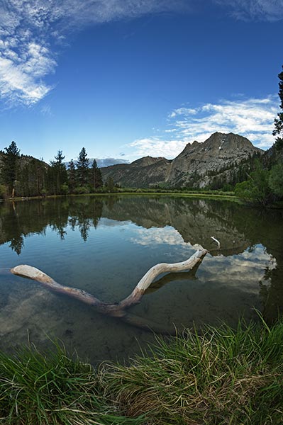
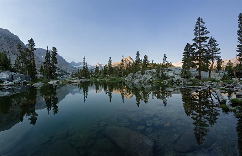
Blue Lake morning reflection - a hint of smoke in the air lengthened the morning light time
 |