Tom Grundy's Charles River pack raft Travels Page
On June 11 the forecast wasn't for lots of rain (like it was for a bunch of days on either side), so I decided on a little pack rafting trip. I packed up the boat and jogged off to the east. I followed the zig zagging Sudbury path through Wellesley to Waban Arches where the aqueduct goes over Waban Brook. I inflated the raft and put in here around 10:40. There was one section I had to pull myself through some brush on the short way to the Charles River, but soon I was heading downstream on the "mighty" Charles. It was very green and there were a lot of loud birds flitting about. I saw a number of creatures on this trip including 2 deer, muskrat, beaver (maybe a large muskrat), turtles, some fish (including a minnow that jumped onto a lily pad), and lots of birds, swans, ducks, geese, orioles, goldfinch, heron, and many more... I also saw 2 people in kayaks and some fishermen in motorboat.
Waban Brook (where I put in)
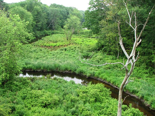 |
where I put in under the aquaduct
 |
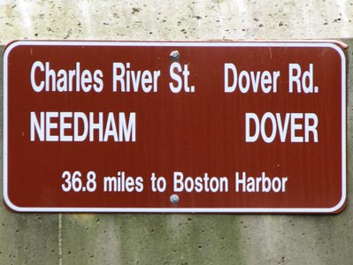
One nice thing about boating the Charles is that most of the bridges have a sign saying what roads are on it (they often change name as they cross the river) and the distance to the harbor. This way your progress or lack of progress can be followed. Unfortunately a few of the bridges didn't have signs.
The first bridge I passed
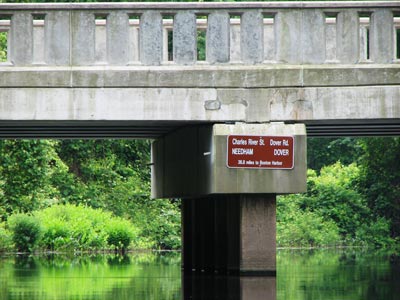 |
Bridge sign
 |
Some of the bridges were nicer than others (Central Ave/Centre St)
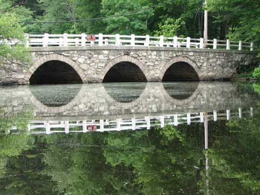 |
There was a small dam after the Willow Street/South Street bridge. I portaged on the right carefully avoiding the sea of poison ivy. I think we went on the left with the canoe. Below the dam there was a nice current for a while, and a very low head dam that I ran right down the middle (the dam was under a foot high, and lower in the middle). The water level seemed to be a little higher now than during our November run, and of course everything was a whole lot greener. There had been flooding this spring though, and there were some high water marks that were quite high. Soon enough the current slacked off and it was back to more like paddling a long skinny pond than a river.
I was getting a bit tired of paddling and running behind schedule so once again I took the long ditch shortcut to avoid about 6 miles of meandering loop. Some day perhaps I'll boat that stretch, but not today. There were a few spots along this path where I had to dodge around downed logs, but I was able to do it without getting out of my boat.
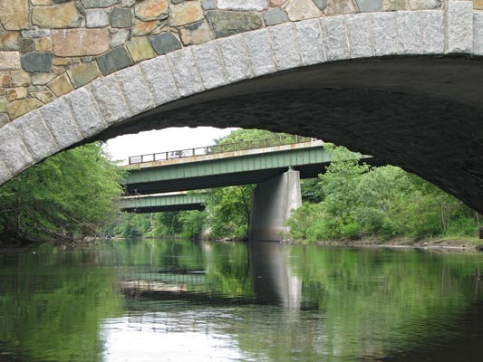
Some of the bridges were nice old stone arch bridges. For the most part these seemed to be holding up quite well, but some of the concrete ones were horribly corroded with exposed and rusted out rebar reinforcing. The last bridge I passed under did have some rather alarming large looking cracks between the stones in the arch though.
The front part of the Greendale Ave. bridge is corroded concrete,
the back half is stone. The distant bridges are I-95
 |
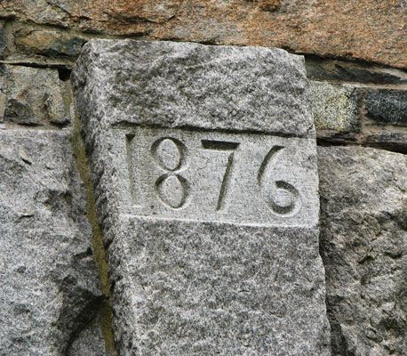
The old 1876 arch part looked like it was in good condition
 |
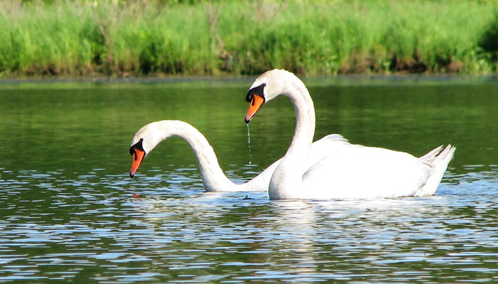
Swans
 |
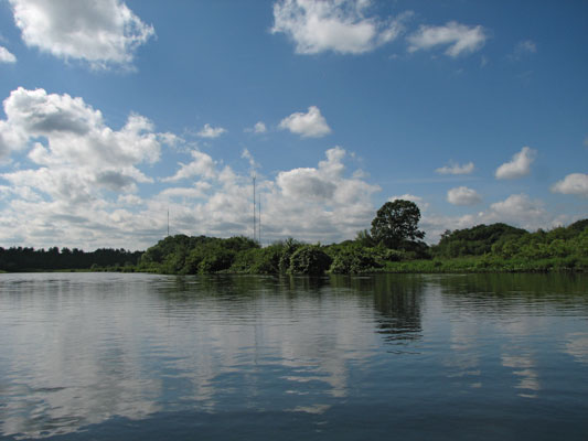
This is about as far as we got in Nov 2008 before we turned back
(note distant antenna towers)
 |
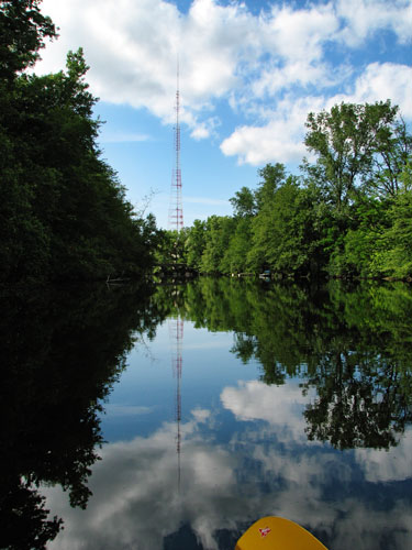
Getting closer to the towers
 |
and finally passing one
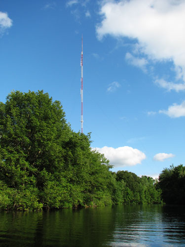 |
Once back on the Charles I was faced with a stretch of unpleasant upwind paddling. This was the area where we stalled out and turned back to take out in 2008. I didn't have any ice problems this year though, in fact the sun came out and it got rather warm. I could see the tall antenna towers in the distance that I had to paddle to, and they looked very far away. Luckily with a few bends and trees along the bank the headwind decreased dramatically. After Cutler park things began to get more urban along the river and the smells of a Chinese restaurant reminded me how long ago my sandwich for lunch had been. I finally reached the Eliot/Central street bridge and took out in the park there before the next dam/waterfall. I deflated and rolled up my boat, pulled apart the paddle, packed up, and set off jogging back to the house. My legs were pretty stiff, so I wasn't setting any speed records, but I still made it back in time for dinner. I think I paddled a bit over 10 miles of mostly flat water and jogged around 5. My shoulders and back were pretty sore.
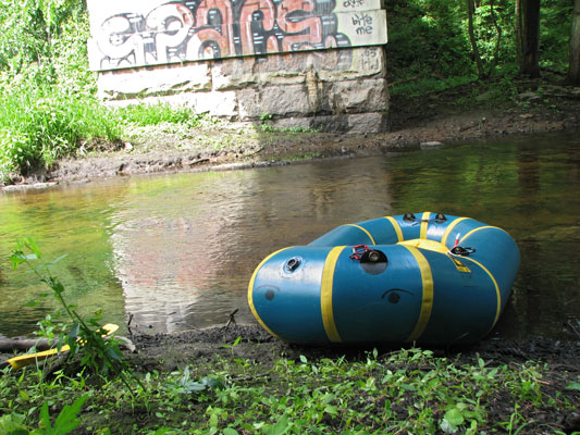
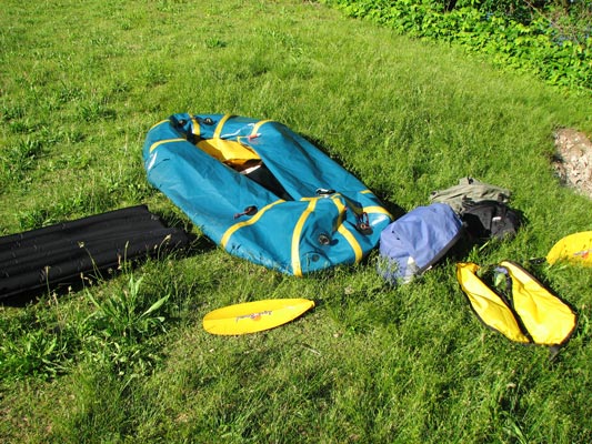
takeout still life with semi-deflated boat
 |
Spot Adventure page of this trip (although it missed some of the positions at the end) Spot Tracker adventure page of this trip
It was a whole lot warmer than my previous trip on the Charles in November 2008. attempted canoe descent of the Charles, 2008
Wikipedia has a useful list of crossings Wikipedia list of Charles River crossings
paddling in Maine
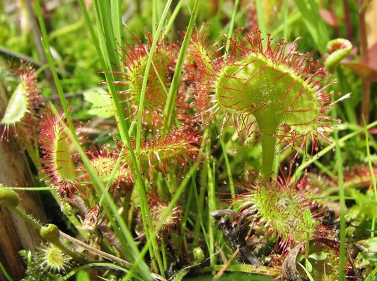
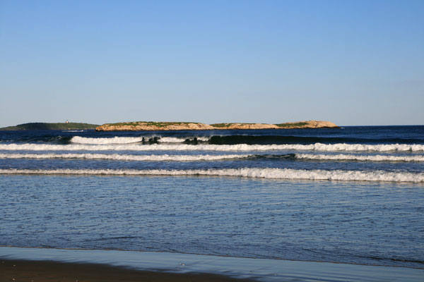
On Tuesday June 8th I paddled a bit on Winnegance creek near Bath, Me. This is a tidal estuary creek that was dammed up at about the high tide level so it was flatwater, more like a lake with a long tail. A lot of the vegetation was pretty boggy, with floating rafts of plants. I even saw some sundew carnivorous plants. Unfortunately I didn't take the spot tracker. I didn't quite get to the end of the still water section before I turned back. The final stretch across the wide open section was into a rather stiff headwind. Emi and I also walked out to the coast in the Morse Mountain Conservation area. It was pretty scenic.
sundew plants
 |
Maine Coast
 |
paddling on the Concord R.
A few weeks later I also went paddling with an old wrestling friend from Haverford on the Concord River. I was in my packraft and the others were in Kayaks, which really illuminated the downsides to a packraft on relatively flat water (they go slowly and don't coast or track very well). Still, it was nice, and it is a lot easier to get the packraft to the put in. Maybe someday I'll post some pics of that trip.
The spot adventure page for that trip is here:
Spot Tracker adventure page of the Concord R. trip