Tom Grundy's Black Canyon Travels Page
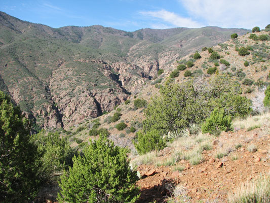
Black Canyon as seen from the hike up
 |
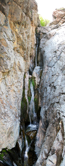
an early waterfall
 |
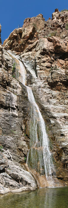
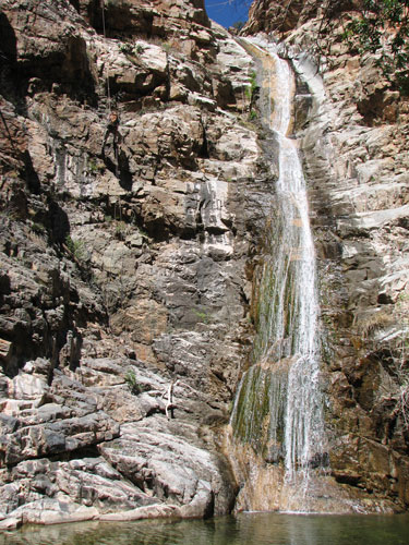
a long waterfall
 |
On May 8, 2010, JJ, Wade, and I drove down near Cottonwood to descend the Black Canyon there. We got up painfully early to leave Flagstaff around 6 and got hiking up the trail by 7:42. We hiked up a fairly nice but rocky trail through scrub and manzanita with nice views behind us of the Verde Valley, the Sedona area, the Mogollon rim, and the San Francisco peaks. There were also a fair number of wildflowers. A few hours and 2000 feet higher we started down Black Canyon creek in a lovely ponderosa pine forest.
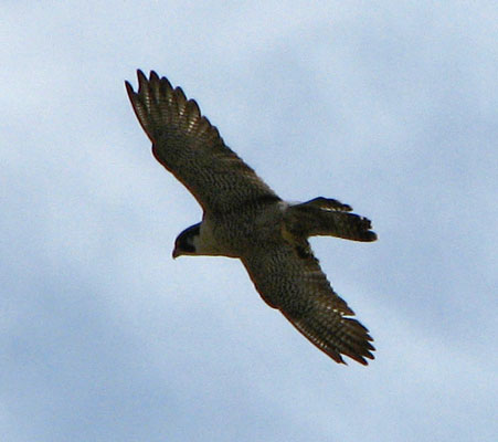
Soon we were out of the forest and the canyon dug down into the basalt with channels, falls, and pools. We were able to avoid the water with some scrambling and rock hopping though. This went on for quite some time and we passed a number of drop offs and waterfalls without having to get the rope out. There was a peregrine falcon couple that wasn't happy to see us and flew around voicing their displeasure for some time. Another obstacle that began to show up was patches of poison ivy that were just starting to leaf out. Sometimes it took some effort to distinguish them from the vine maple and the just sprouting Virginia creeper. I did some fancy stepping to avoid it, but I think I was successful. It was getting hot in the sun now and Wade and JJ took a dip to cool off, but I feared that soon we would have to get into the water and I didn't want to freeze myself any more than I had to. We rapped one long (over 100 feet) waterfall and then continued down. Finally we came to a pool that was unavoidable. JJ and Wade jumped in, but I climbed down and eased myself in to keep my glasses dry (and because I am a wimp). Unfortunately at this point the camera was packed in the dry bag so the pictures stop. There were some more swims which were really cold. At first it was refreshing, but then I started shivering. Luckily there were some sunny rocks to play lizard on. One of the pools had no good downclimb and no anchor points, so we all just jumped. Luckily the water was clear and we could see that there was nothing to hit. In the one pool the landing zone wasn't so obvious but I was able to downclimb and then scope a safe landing spot while swimming. We were all glad to finish with the cold water and get warmed back up.
Unfortunately the last bit of the hike involved rather painful catclaw and cactus infested bushwhacking. I was especially at a disadvantage here because I didn't have trekking poles and I was wearing shorts. I got separated from the others, but we all made it back to the road eventually. I would suggest zooming in on the aerial photos to pick a trail just after where a major drainage comes down into the creek bed. The round trip hiking time was about 10.5 hours, although we slowed down a lot when we started getting cold from the water. One guide says the distance was 8 miles and another 13 miles. I am inclined to believe the longer of the two but it is hard to say with the circuitous path, especially for the bushwhacking. The next day it looked like my legs had been attacked by mini cats. They were completely covered with tiny scratches, although I only had a few deeper ones.
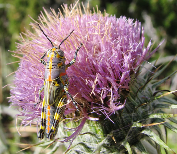
Rainbow Grasshopper (Dactylotum bicolor)
 |
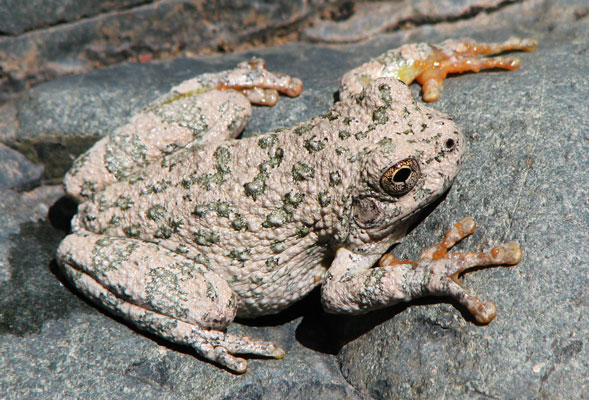
we saw a lot of canyon tree frogs (hyla arenicolor)
 |
this falcon wasn't so happy to see us
 |
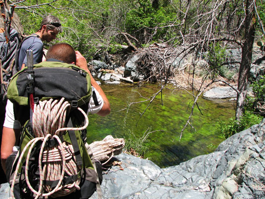
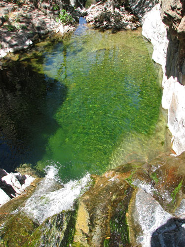
JJ and Wade admire a green pool
 |
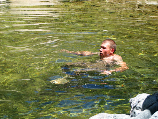
Wade swims to cool off
 |
JJ (upper left) raps past a long waterfall
 |
the pool where we had to start swimming (I think)
 |
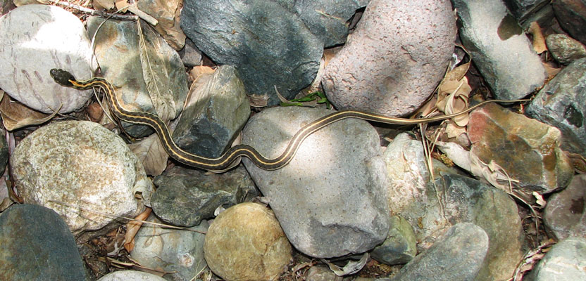
garter snake
 |
My spot adventure track for this trip
Todd's Hiking Guide page for this trip