Iris had some time off in November, so she wanted to do a desert trip. Bob had some ideas out in the Turtle Mountains and surrounding area, so a plan was hatched. We also decided to try out using the element - which has a lot more headroom and thus space than the truck. On the way down to S Cal on the 3rd we stopped so I could climb up peak 3310 in Red Rocks State Park. This didn't take that long, although it was a headlamp ascent. I am guessing I missed out on a few views, but at least it was cool. We stopped to pick up the element as we went through LA - late enough to miss the worst of the traffic.
Iris had to work Friday so I transfered stuff and worked on setting up the element hopefully taking advantage of what we had learned using it during the Sierra Challenge. We had planned to leave that evening, but work went late. We didn't even leave early the next day.
11-5-2022 We drove out past Palm Springs and filled up with gas (the element has a relatively small tank compared to its fuel economy so range anxiety is a bit of an issue) and then headed out to the trailhead for the Orocopia Mountains High Point. This is a DPS (Desert Peak Section) list peak so gets a fair bit of traffic. We weren't able to get all the way to the 4wd trailhead, so we parked in the wash before a steep loose bit. Then we hiked up following a mostly ok trail. The desert here looked like it had gotten a fair bit of moisture recently with little green plants and even some flowers. We got up to the summit just a little before sunset. The view down to the Salton Sea was pretty nice as was the sunset. It got fully dark on the way back and we had some headlamp time. Our shower water was not very warm, but at least we had a little shelter from the wind in the wash and I found enough wood stuck in the wash to have a nice little camp fire that night. We also had reheated leftovers for dinner which was a lot easier to cook.
| |
|---|
 |
|---|
 |
|---|
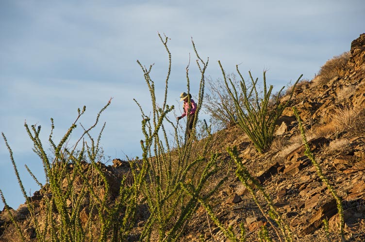
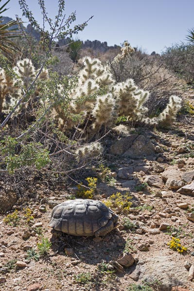
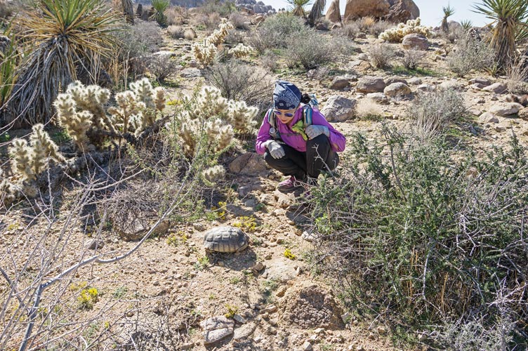
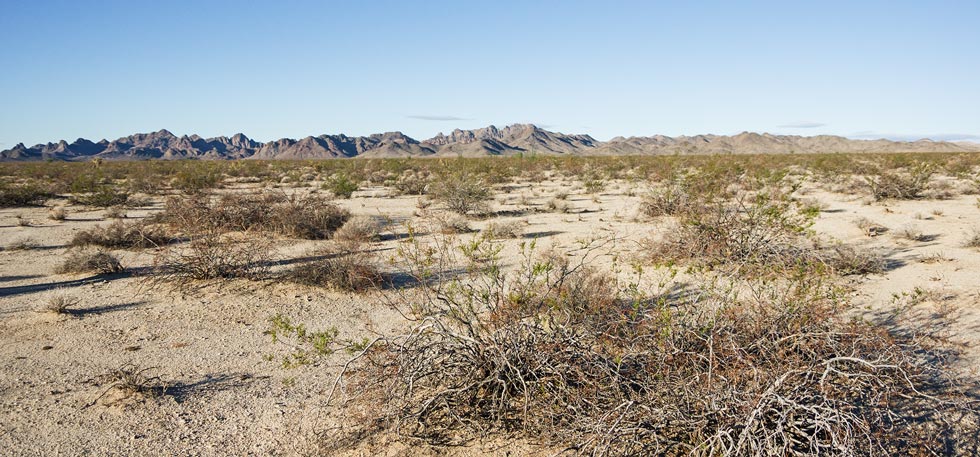
11-6-2022 The time changed, but we didn't. We did not get up early or pack fast. Then we drove slowly out and across the highway into Joshua Tree National Park. There we parked at a campground and set off cross country mostly up washes towards Eagle Peak. We were vaguely following some tracks from peakbagger, and trying to avoid cacti and rougher terrain. I backtracked down some washes and back up another to try to avoid going up and down between each wash. I don't know if that was easier or quicker, but it got us to the drainage we wanted to go up. I didn't see it, but Iris heard a hissing and saw a tortoise. I guess it made the hissing sound when it tried to hide in its shell. We were both pretty excited to see one as I hadn't seen a live wild one in ages and Iris had never seen one in the wild. This one was pretty good sized too - maybe a foot long. We took a bunch of pics and then headed on. The desert here was pretty green too with little yellow flowers on the ground.
 |
|---|
 |
|---|
 |
|---|
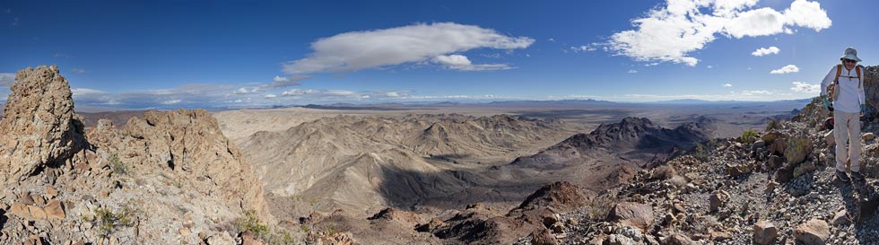
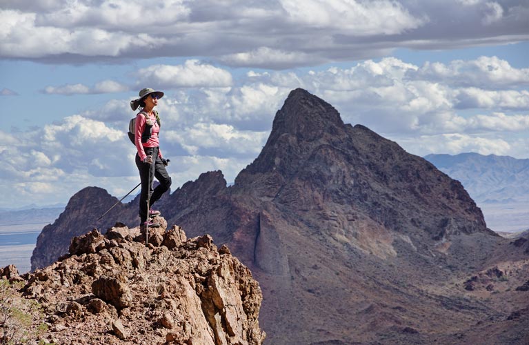
Soon after the Tortoise encounter we started uphill in earnest. Fortunately it was still coolish at first, although as the gully got tighter things heated up. At the top of the gully we saw a person - and another - and more. I think there were some 15 people resting on rocks there on the way back from Eagle Mountain. I think it was a club trip. We talked a bit and then headed on towards the peak. At this point we had a few ups and downs to go but nothing too bad. We just tried to avoid the worst of the hostile plant life and big rocks. Sometimes we even found use trails. The summit was just the highest point - not an impressive pyramid or anything, but the views were nice. We had the usual summit cookies and took pics and then headed down.
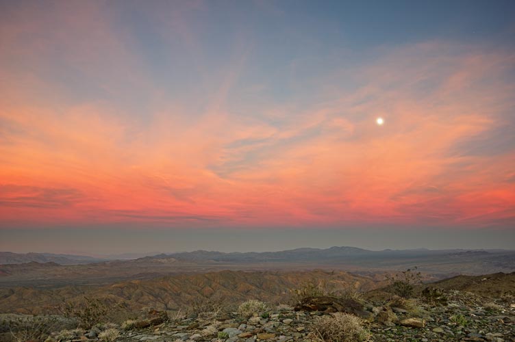
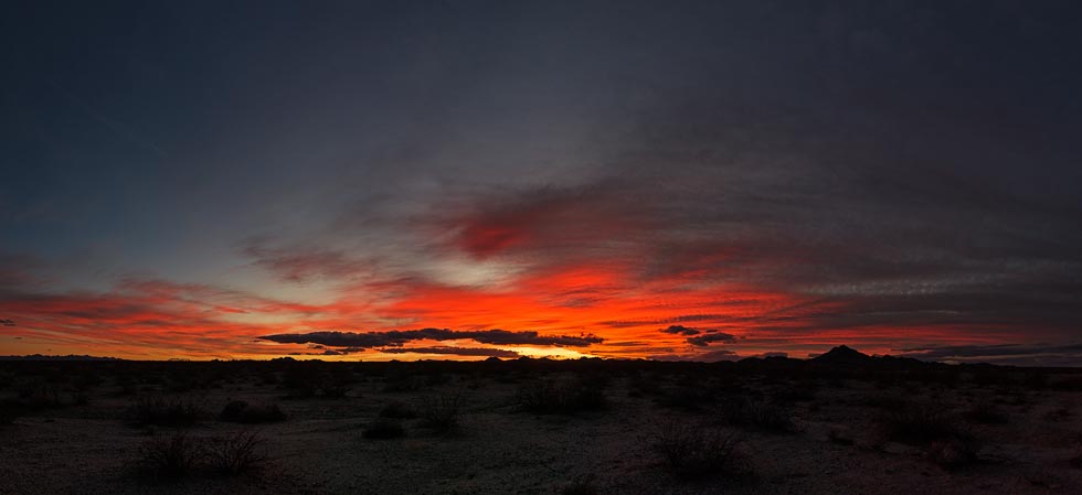
The descent took longer than expected with lots of slow careful stepping down loose rocks. The nearly full moonrise over Eagle Mountain was nice as was the sunset. The solar heated water was nice and warm and we drove a little up a dirt road across from the visitor center for a wash. Then we had a long drive to meet up with Bob and Karl almost to Needles. Iris had an important work call the next day so we scoped out cell reception a bit before joining them.
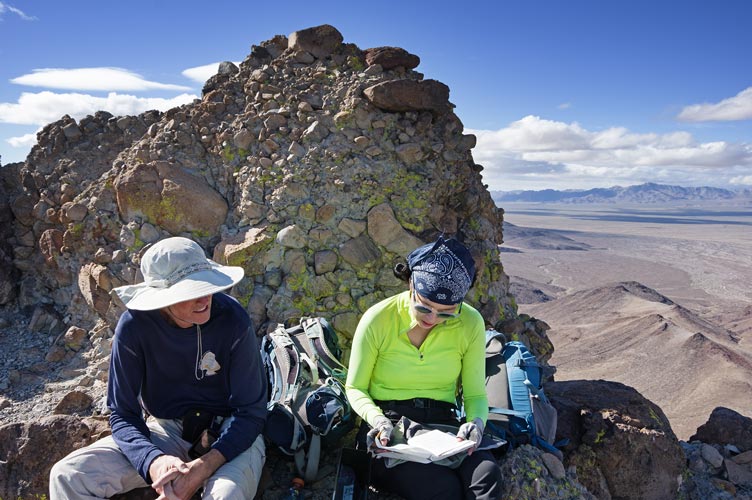
11-07-2022 Iris had to work a bit today and Karl was worried about his knees so he went for a bike ride and Bob and I did a four bump loop while Iris set up the Element as a mobile office and got to work. Our bumps were all LOJ peaks ( List of John ). Peaks 2220, 2700, 2460, and 2736. They were enough of peaks to be worthwhile with enough of a drop between them that they felt like distinct peaks, but they weren't all that special or difficult either. Some did have pretty big summit cairns (maybe claim markers?) but we didn't find any summit registers. We made a big loop and then returned to the jeep.
 |
|---|
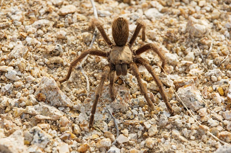
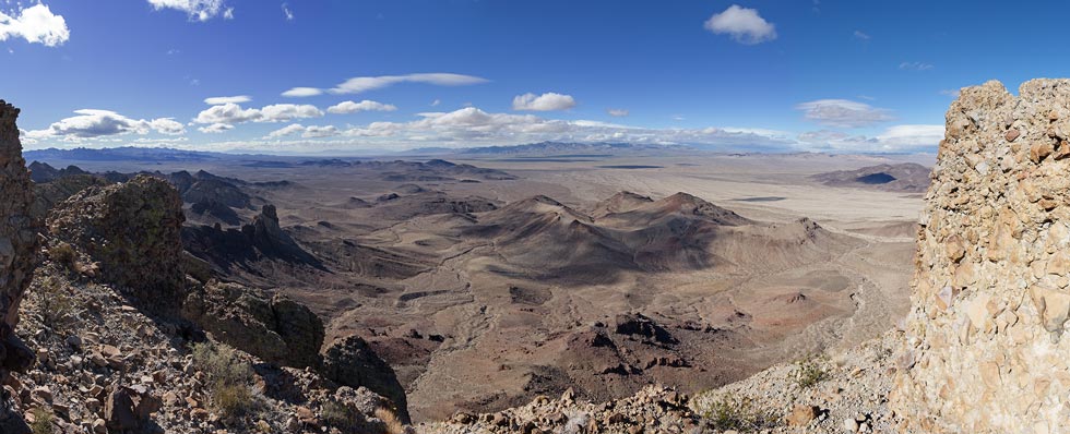
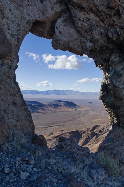
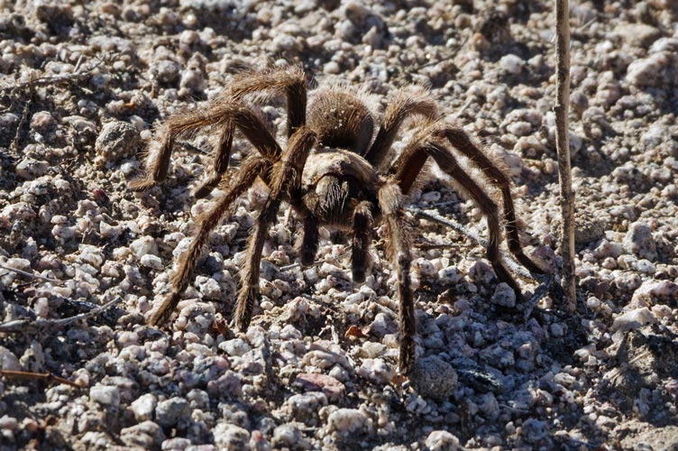
We still had plenty of time even with the short days so we drove back past Iris (still working) and decided to do a point south of Big Chief Benchmark which Bob has already done and Karl did that morning. That would have been a more worthy goal, but it wasn't special enough that I needed to go do it. The peak (2650) we planned to do was in the wilderness so we couldn't drive that close. As we got near the closest approach on the gas pipeline road we saw a sea of cholla and got a little worried. Fortunately they thinned out a little where we wanted to hike. Our plan was to follow the high line between drainages out to our peak avoiding the worst of the cholla and lots of up and down in the drainages. This mostly worked. After the first 3/4 mile or so the cholla really thinned out. This made hiking so much nicer. We tried to take the most efficient route - sometimes failing, sometimes making good route choices. The final steep bit up to the peak made it feel a little more like a worthy destination. I am guessing this peak gets visited very rarely, sadly we forgot to bring a register. Then we headed back. We saw a tarantula walking along and I tried to get some decent pics. I was just catching up to Bob when I had to stop to pull out a cactus spine that was going completely through my shoe sole. I was just barely catching up again when the hike was finished. We headed back to our camp spot (where the 4wd road headed off the pipeline road). The sunset and moonrise were pretty nice. Sadly my big lens were in the element and Iris was still not back from her post work peak.
 |
|---|
 |
|---|
 |
|---|
11-08-2022 The plan for today was to climb Stepladder Peak. Bob had done this twice before, but he thought the north peak was actually higher and so we were bringing a short rope and a bit of gear in the hopes we could get up it. (plus the rest of us had not climbed it). We parked where the road hit the wilderness boundary and headed a few miles across the desert towards the peak. It was generally pretty easy travel. We spread out a bit. I was looking for another tortoise - with no luck. After a few miles across the mostly flat desert we headed up a wash and then had to cut over a high point toward Stepladder. Then we went up much steeper terrain to the base of the summit rocks. The peak is composed of volcanic conglomerate - which makes for nice holds - if they stay in place. There was a pretty easy zig zag route up the steep face to the 2940 ft summit. We were puzzled because the s summit and the one marked on the map appeared to be the higher one - but quite a bit. Later Bob looked back on previous ascents and he had only said the N summit was the harder one, not the higher one. Karl headed down and the rest of us went over to the N summit to see if there was a way up it. I thought there probably was, but it wasn't worth the sketchy rock and effort since it wasn't actually the high point. We headed down going down a slightly easier drainage and catching up to Karl in the wash. I decided I wanted to bag a bonus peak so I hurried on towards it while the others retraced our route up.
 |
|---|
 |
|---|
 |
|---|
 |
|---|
I headed up a little too early towards a bonus peak (Pk 2510) and had to scramble a bit. I was still making pretty good time and got to the summit shortly after the rest of the crew passed way down below in the wash. I signed the summit register and built it a better little house and then started down. I went down a more direct way off the summit which ended in a little chimney - fortunately not too hard. Then I followed a wash down that unfortunately ended in a dry fall - about a 50 foot cliff. I probably could have been able to downclimb it but that didn't seem worth the risk, so I went back and down a still steep but not cliffy slope. Back on track I followed tracks for a little bit before losing them and then once I was back on the flats I tried to jog. The phone gps told me I was heading a little too far north with my dead rockoning so I adjusted south and eventually saw the vehicles. The others had beat me back, but not by a lot.
The weather was looking a little threatening as a large storm system moved into the area. Bob and I decided to go ahead to try to bag one more peak while Iris and Karl decided to head to our next camp spot. First there was a lot of dirt road driving and paved road driving as it rained. We were heading towards the Colorado River. We got a break from the rain for our next peak, but it was very windy. This was a pretty short walk from where we were able to park by an old gem club quarry. I'm not sure what they would find here, maybe opal. It was quite windy up on only 1213 ft top of Malo Benchmark. It was chilly in the wind but not actually very cold so when there was a break it felt warm.
Then we drove up a long dirt road towards the next camping stop. Iris and Karl had stopped a little short where the road went into and out of a wash. Probably a wise decision with the 2wd element. When we got there we spent a bit of time talking and eating dinner. It was too windy for a fire, and it started raining after dinner so we all just got into our vehicles. It rained off and on over the night but seemed to have stopped by the morning.
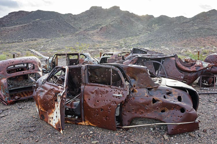
11-09-2022 Things were still wet and there were low clouds when we got up, but there was no more rain. Bob kindly gave us a ride a few miles up the 4wd road to the start of our hike with a detour to an old mining area and the old car corral there (they moved a bunch of old junked cars into a corral when they declared this area was wilderness). We had to re-create Tom Becht's legendary trip over the wilderness boundary barrier at the start of the hike (he was distracted by starting his tracking). Then we headed up the old road a little bit before leaving it and heading cross country up towards the first peak - Kelbaholt.
 |
|---|
 |
|---|
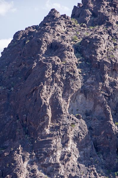
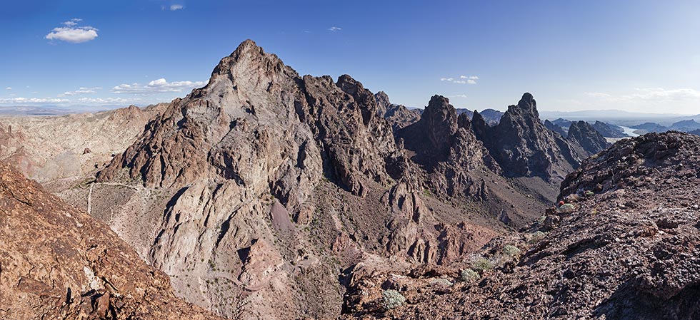
Kelbaholt was a pretty dramatic volcanic conglomerate peak with an improbable scramble up to the summit. It weaved a way up and around various cliffs and notches. We knew it went and had a track that sort of showed us where to go - combined with a few cairns and our skills at following the most likely route and eventually we made it to the summit. There was a Bob Burd summit register that was in 2 nested steel cans. Sadly they were left upside down with the larger one open to the sky and thus partly full of water. This meant everything inside was wet and icky. I was able to pour the water out and look at the register but we weren't there long enough to dry it out. I did put it back in the correct orientation but it is entirely possible it will rot or mold before it dries out. The views were quite nice and we took pics and ate our summit cookie and contemplated the next peak - it wasn't very far away, but it didn't look very easy to get to along the spine of the peaks. Instead we carefully dropped down back the way we came up and detoured around on the east side to a gully and headed up that.
 |
|---|
 |
|---|
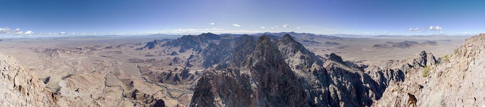
Once again there was a somewhat improbable series of ramps and cliffs and dry falls to negotiate up to the saddle. Then we realized that the next peak was not the nearly impossible looking one to the SE but the only somewhat improbable but slightly higher one to the SW. We scrambled up that and out to the end - that wasn't really the high point, so we backtracked to the high point of Peak 3687 and found a register there.
 |
|---|
After descending almost to the saddle we headed down below a peak without prominence and towards Fools Point. I headed up a steep slope a few feet south of the track, but that ended up being a critical error as the correct path was about 30 feet down a cliff face to the north. Rather than descending and heading around we piled up a few rocks and made a bouldering move up onto a ledge and then traversed around to the SW side of the peak and up. The scrambling wasn't very hard, but the rock was quite suspect and there was a good bit of exposure. I was not looking forward to going down this way and really hoped that we could get to the top and then find a better descent route. With a bit of zig-zagging and a few somewhat scary moves we made it to the summit - a Leaping Lizard Peak (a group of climbers / peak baggers based out of Lake Havasu that had put registers up on a number (18 I think) of difficult peaks in the area). This was Leaping Lizard Peak number 15.
I was somewhat distracted by concern over how we would get down so couldn't properly savor the summit. I scrambled down a few different ways and eventually located what I thought was the way that Bob and Tom had come up (it looked sort of like the photo and sort of matched the description). I went down first and then helped direct Iris' feet as she came down. She had more difficulty as she had trouble lowering herself completely on her left leg with her bad knee. Once we made it down to this notch the rest of the descent back to more secure ground was not bad. It was getting late and the days were short so we opted to skip the last peak on the itinerary. We weren't sure but it looked like we could head down NE from the notch north of Fools Point - so down we went dodging the occasional catclaw and steeper loose rocks. About 1/3 of the way down the gully opened up and turned a bit and we were pretty sure we would be able to find a way down. There were also some springs and a short section of flowing water here. We continued down following the wash or cross country - whichever looked easier and more direct. Once things leveled out we decided to try to follow the track back to the road. It turns out there was an old trail where we were hiking - it was pretty good and was well cairned but it was clearly old (probably made by miners) as there were occasional big bushes and cactus growing in the middle of the trail or that the trail went right through a clump of them.
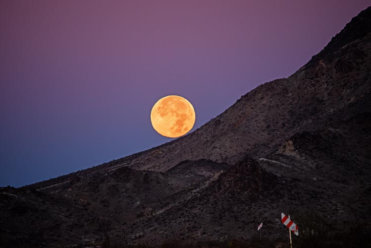
When we got closer we reached an old road (still in the wilderness) and more mining refuse. We cut the corner to make our path shorter and saved a few minutes and then we were back at the start - and walking on the road. Soon it was getting fully dark and we got a call from Bob asking if we were ok - and to look at the moonrise. It wasn't up for us yet, but there was a brighter spot behind the mountains to the east where it would rise in a few minutes - a nice orange slightly squished pumpkin. The road took us past another mining site and then eventually back to where we parked. We rinsed off and prepared some food to eat and then did the long dirt road drive out to 95, south for a long distance past the nearly $8 gas and to our next camp spot. As we crossed the aqueduct we could see them in the distance, but it took a little longer to find the right sandy road to drive up to get there. We knew that with a jeep and a tow strap we wouldn't get permanently stuck in the sand so it wasn't quite so scary driving. They had a small fire burning with some wood they had brought as well as some wood from the wash. It was windy but the warmth was appreciated.
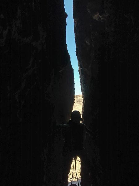
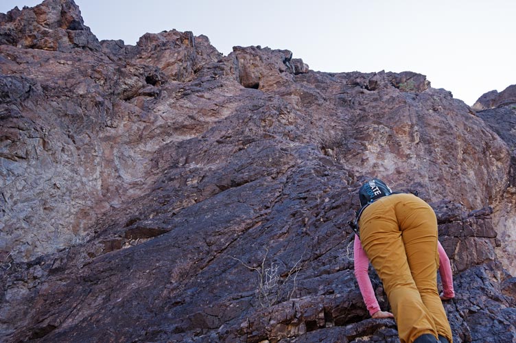
11-10-2022 We got up early but I was still a little late in getting everything ready to go - I blame my need to get all the climbing stuff together, although it could also be the late (ish) night around the fire and generally being a little slow in the cold morning. There were a few trip reports online so we weren't completely in the dark, but it is a little hard to know exactly how someone else's gear needs will correspond to our own. We did think we wanted 2 ropes for the descent and at least some wide gear and a bunch of sling material and definitely helmets. We drove towards the trailhead at the wilderness boundary and Karl stopped early to do some mountain biking (he wasn't planning on joining for the climb and wasn't willing to drive all the way up the 4wd road). This hike in started the same as our hike out to Turtle Mountain and Horn Peak in March of 2020 (last trip as the Covid lockdown started while we were out). When the old road kept going NW we cut cross country towards Castle Rock following another old road for a while (which we should have followed longer as Tom B and Iris followed it almost to the base of the Peak). Then we cut around the northwest side and started diagonalling up towards the N end where there was supposed to be a chimney. We passed under the impressive overhanging N / NW face and then came around the corner to see the chimney. It did not look pretty. Tom took one look at it and decided he had no interest. He headed down and across the desert to climb a Mesa to the east .The wind was blowing hard out of the north and it was cold in the shade. I continued around to the E side to rack my gear in the sun and stash my gear well out of the way of falling rocks. That is when I realized I had failed to transfer a few things from my hiking pack into my climbing pack that morning - my headlamp and another warm layer - oops. I headed back into the shade and got ready to go.
 |
|---|
I scrambled up a bit and placed 2 pieces while waiting for Iris to get set to belay. Then I went up. The rock was very suspect conglomerate but because it was a chimney you could mostly push the cobbles into the matrix and they would stay put - mostly. Sometimes just a touch would be enough to drop them off, or the rope would pull them out. Passing various chockstones required getting out of the more secure chimney, but also provided a place to stand once you got up. I went up and over a few chockstones and then set up an anchor in the back of the chimney where there was an old cord rap anchor (it was thinner than I would be happy to rap off of plus a little old and crunchy. This was the first of many old rap anchors we would pass and I tried to collect the old tat as we went up - there were some decent 'biners and a lot of cord and a few slings and pieces of pro that were no longer trustworthy for climbing. At least I was pretty sheltered from the wind here although there was no sun at all. Iris came up trailing the other rope. We fixed it and Bob started ascending it while I led my way up tunneling under some chockstones and carefully around some loose blocks to set up another belay a short distance above. I was sitting on a carpet of rodent bones and trying not to send anything down onto the 2 below. Iris climbed up and then we belayed Bob up since we figured it would be easier than ascending up the narrow passage. There was a pretty big area here on some chockstones but I was unsure exactly how to go up.
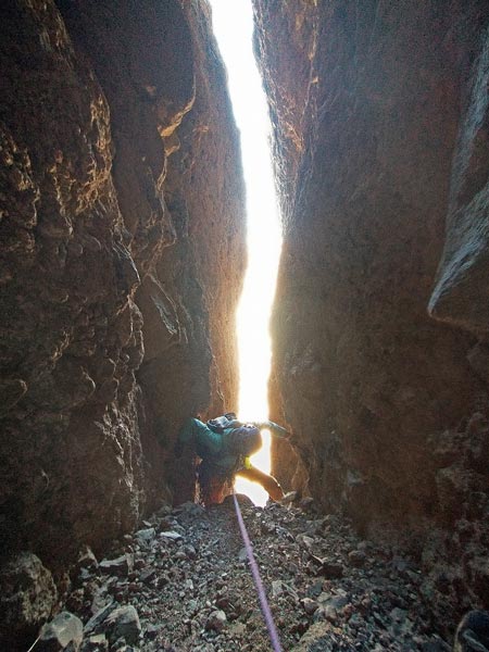 |
|---|
 |
|---|
There was an overhanging crack in a dihedral that looked like it would take pro - but it was a little suspect as all the rock here was. Another option was up the face on the north and then across above an overhang. I went up that way which was pretty easy climbing but pretty sparse on pro. I was able to place some stuff at the top of the corner before the overhang but when I managed to get up to look over it instead of a nice ledge it was a loose ramp. I could have headed up the chimney above this (north of the main chimney) but I was concerned that it would take us to a sub-peak separated from the main peak by a yawning chasm, so I carefully took the gear out and climbed down. I guess it was up the crack. This turned out to be not so bad. The rock was better quality and I was able to place a number of pieces that I thought would hold. I did have to move out onto the face on the left to get up the steepest part. Then I went up a pretty easy ramp/chimney under a chockstone and then up another overhanging corner - probably the hardest climbing but pretty secure with a wide crack and maybe avoidable but I was trying to make the rope run straight as rope drag was pretty severe by now. I was nearly at the top here and I set up an anchor utilizing a few cracks and a big knob on top of the chimney on the S side. I was also in the sun for the next 20 minutes and somewhat sheltered from the wind. I enjoyed the warmth and belayed Iris up. I was thinking about how to get the rope to not run under the last chockstone but she had tied in the middle and was trailing the other rope (with lots of drag) so that wasn't an option. After she made the last few moves up to the anchor she untied and scrambled on up to the summit while I fixed the second rope. I belayed Bob up on the lead rope while he ascended the fixed rope. This worked pretty well and soon he made it up and I took down the anchor and coiled the rope while he went on up to the summit.
 |
|---|
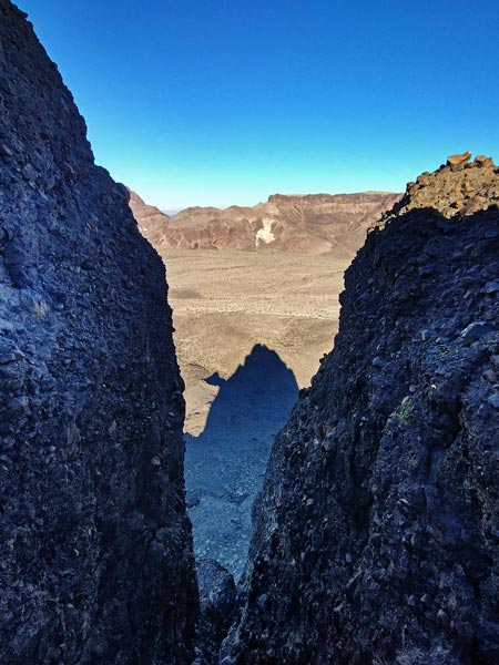
It turns out the summit was actually to the north of this chimney and it looked like the other chimney actually went almost all of the way to the top. I suspect that the first ascent party actually went up this way since it looked like easier climbing and they might not have been up for the crack back in 1970 (or maybe they had the gear and did it). It was pretty late by now so we didn't linger long on the summit. This was another Leaping Lizard peak - number 18 - the register was hiding behind a white painted rock. We went down to the SW looking for a rap anchor. Eventually we spotted it - faded and slightly shredded 1 inch webbing with a rap ring slung around a rock horn. We replaced the webbing with fresh black 1 inch webbing - 8 years is definitely too long for webbing to last in the desert. We had a 50M and a 70 M rope. That meant in theory we could rappel a full 60 meters if we re-adjusted the knot after we went down a bit. Hopefully that would not be necessary. I went down first. Usually I would throw the ropes down ahead of me but the wind out of the north was strong and they would have blown all over and probably wrapped around cobbles and caused all sort of trouble. Instead I set up the ropes on each side looped over slings like saddlebags. This didn't work as neatly as I would have liked and was a bit of a mess, but I slowly worked my way down untangling and clearing the strands as I went. The last 50 or so feet were overhanging and I was glad to have an autoblock. The rappel was about 45 meters so it was definitely a good thing we brought 2 ropes. The party before us had only one rope and had to rappel back down the chimney in 4 or 5 short rappels leaving gear and dislodging rocks every time they pulled the rope. Fortunately it never did get fully stuck. I untangled the last of the ropes and then pulled the ends under a nearby overhang. Iris sent plenty of rocks down while she was setting up and rappeling down so I was glad to be off to the side with a roof over my head. Getting the ropes out of the way was good too.
Back on the ground we coiled up the ropes and walked back around to the start to get our gear and repack. Then we went back down on the SE side of the formation. There seemed like an awful lot of cross desert travel before we made it back to the road but at least we had finished the descent with decent light. It was pretty much fully dark by the time we got to the road and I was avoiding all the dark plants in case they were cactus. The footing on the road wasn't so bad and the chance of kicking a cactus was a lot lower but I still made an effort to stay in or near Iris' headlamp bubble. The moon came up just about when we got back to the jeep. We lost the "road" once in a wash but made it back to camp. My scrounging in the wash for wood was a success and we had a warm fire that night.
logistics for people planning this peak - take 2 ropes, I don't think a single 80M would be long enough although it might be close. Double 50M would be long enough. Helmets are a good idea. The pro is a little sparse and a little suspect. Maybe a handful of nuts and .3 camalot up to as big as you feel like carrying, but I would for sure bring up to #2. I think I placed a ~ #2 tricam too. Also long slings to sling chockstones and decrease rope drag. I placed a few pieces more to redirect the rope around pinch points or decrease drag rather than to save me. I wasn't always happy with my anchors, but I also wedged myself in the crack while belaying. I think the last pitch could be avoided by going up the blunt arete/crack/chimney to the north but I don't actually know that for sure. The rap we did is NW of the saddle in the large summit plateau about 100-150 feet or more SE from the summit along the NW edge of the top. Bring some webbing (15'? or so) or some sort of bolting kit. The rock is pretty suspect and things might have changed by the time you get there or I could be wrong, it is adventure chossaneering.
11-11-2022 Today we were moving to Arizona. Fortunately we had enough gas in the tank to make it across the river where we filled the tank for about 3$ less per gallon (necessary) and also refilled some of our water bottles (not so necessary as it turned out). Then we drove north to where we met up with the others. We hiked in down a wash which included a short slot section complete with handline down a short slide that we played around on. It was somewhat tedious walking on the loose sand and gravel so we tried to stick to more solid ground when possible. We made it down to the lake and turned to corner to balanced rock. We thought there was a bolt ladder up this, possibly with a high first bolt. I had my stick clip as well as some other gear I thought might help. Sadly we didn't see any bolts despite a fair bit of looking including thrashing around in the brush on the lake side. We were disappointed but didn't see a safe way to climb it and so we headed back.
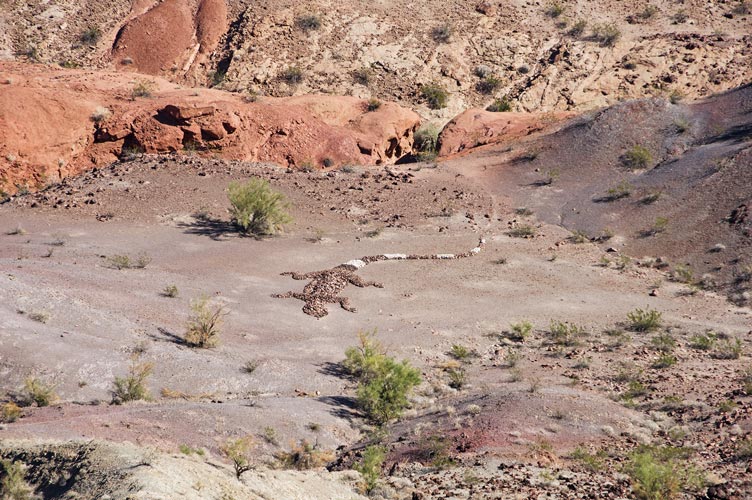
We detoured out of the wash and took a bit of a scenic route around to the north and west and up another canyon before taking the trail up Lizard Peak - this one had some Leaping Lizard influence also complete with a picnic table. We went down to the north from here and then took the steep trail back towards the parking lot. Down below there was a large lizard made out of rocks placed on the ground. I think it was more of a sculpture than a geoglyph. We detoured at the base to look at it before dropping back into the original wash and back to the parking. There was a water spigot here that let us fill up some more water bottles although it was pretty slow.
 |
|---|
Next up was some unfinished business - the Crab Claw. If I finished the trip report from the first time there in December 2021 you can see it here. Once again Tom and Karl were not interested in roped rock climbing. I led the 5.6 crack on the north side that I had scoped earlier. It had one little part that I didn't want to downclimb but the rest of it was pretty easy. This was another Leaping Lizard Peak - #7 I think. I brought up Iris and Bob and then we set up a rappel on the steeper south side. This had a beefy chain so I was able to set up a toprope and then climb up that side. It was a fun 5.9 ish overhanging crack up to a ledge and then a short but burly 5.11 overhanging wide crack to offwidth. I quickly grunted my way up this and then we packed the gear and headed back down. That night we had dinner at "Hanger 24".
 |
|---|
11-12-2022 We loaded up and drove down the wash/4wd road to where it dead ended into some private property. There we headed off cross country and following burro trails towards Tumarion Peak. We had seen this from a distance earlier and someone had mentioned it was one of their favorite peaks, so we were looking forward to a nice spiky summit - and another Leaping Lizard Peak. We headed down the wash for a while before turning up another wash. There was a pretty easily avoided dryfall on this wash - I chimneyed up. Then we had to decide if we wanted to head up a steep slope (2 Toms and a Bob) or around on lower angle (an Iris and a Karl). My hat blew off at the top of the ridge but luckily got stuck in a bush not too far down the slope. We were expecting some spicy scrambling but there were enough ramps that it was class 2 all the way to the summit block and that was barely class 3. On tope we found the Leaping Lizard register (#10) and enjoyed the views and breeze.
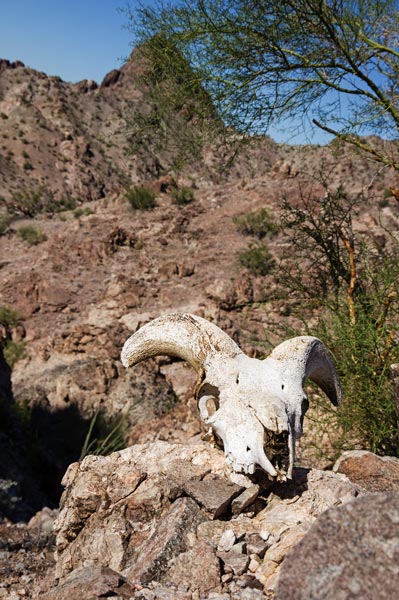
On the return we took a more direct path with more up and down and a bonus peak - Peak 1762. I found a bighorn sheep skeleton (or at least parts of it) with pretty big horns on the way. We could see down to a square mile inholding from the summit and scoped out the numerous old vehicles. We drove partway back to camp and stopped for an even shorter peak - 1260 on the way.
 |
|---|
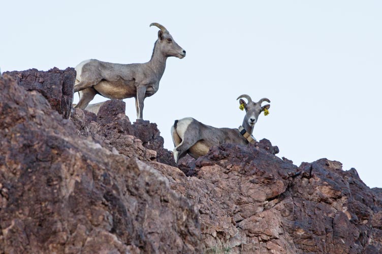
That afternoon Iris and I headed back to the exit to get to Crab Claw and parked there and hiked up the road to climb Shangri-La. That was a fun scramble just as Tom Becht had reported. We were hoping to head down the SW side to traverse over to Haystack but I wasn't sure that we could make it from above so we went back down on the NE side we came up. When we got back down the scrambling I hurried ahead to climb Haystack while Iris planned to go back to the Element and shower. I hurried up Haystack alarming a small group of sheep that were above me. When I got to the top I could see Iris driving the jeep around the S side of Haystack. I hurried down and was able to get there before the sun set to take a pleasant warm shower in the last rays of the sun. Then we went back to the Hangar to meet up with the others and eat. That night we drove west on I-40 to camp near the next trailhead. It turned out there was some sort of big RV/offroader get together there complete with fireworks and a band on a stage. Needless to say that wasn't what we were expecting. We went back across the road to camp in a small flat spot off the road. Not great for camping, but it was late and cold so we all just went to sleep.
 |
|---|
11-13-2022 We got up early, down to just us and Iris as Karl went home the day before and Tom B left early that morning. We drove through the remains of the party from the night before and then through a bit of a maze of OHV routes and down a wash/route to the trailhead at the wilderness boundary. There we loaded up and headed off down the wash. Soon we cut off towards a saddle passing a number of mining sites and then a spring complete with little tadpoles. Then we headed up over a pass with more mining remnants and down a road past the remains of a cable tramway that went high up on the west face. Then we turned left and headed up towards Gold Dome - this is the peak Iris had seen last year from a distance and wanted to climb - although Bob told her it was Tumarion.
 |
|---|
We worked our way up a steep gully picking what looked like the most likely route up to the ridge. Then we had to start scrambling up - mostly 3rd class with maybe a few 4th class moves up onto the ridge and then up the final summit ridge to the peak. I was wondering if one of the large summit cairn rocks was covered with white bird droppings or had been painted when Bob mentioned that many of the Leaping Lizard registers were behind white rocks - we excavated it out and found the remains of the Leaping Lizard Tribe register (#12) and an even older rusty can with unreadable scraps of rusty paper.
We scrambled back down and then cut south towards South Dome. We skirted west around some intermediate peaks - some looked like some pretty good climbing. Then up towards the N side of S dome. There we scrambled up onto a scoop in the face and then Bob went up a ledge heading up and left that turned into a crack at the top. Iris and I went around the corner to the right and scrambled up a ramp/shallow arete. Things got a little spicy as the angle steepened and the holds became more tenuous - both in size and relative strength. I stopped in a little hole to take off my camera and stow it in my pack - then up to join Iris on a ledge. Then we went up over a big block and a shallow dihedral that lead to easier ground. This was more or less where Sean Casserly and party had gone up with a rope - they reported 5.7 but I don't think it was that hard, just exposed with less than perfect rock. As we came up over the shoulder we could see Bob on top. Fortunately we didn't need the rope that was in his pack. We worked our way up to the top with one more exposed but easy move up a pillar to the summit - another Leaping Lizard Peak (#13).
 |
|---|
 |
|---|
The descent went much more easily despite Bob bonking his head twice on the overhang after the pillar descent. There was a chimney dryfall to climb down and then we got to where Bob had climbed up. We found a rap station with webbing and a ring and another lower down with just a sling. I figured I could down climb the crack/ramp and so we set up a single rope rappel - fortunate because we only had a few feet to spare at the bottom of the cliff. I loaded Iris' pack into mine and she took it down with her. Then I pulled up the rope in case I needed to abort the downclimb and climbed down. The crux was transitioning from the crack down to the ramp where the rock quality was pretty poor but it wasn't as bad as where we had gone up - probably solid 4th class. Once down to Iris and Bob I took my gear back and we scrambled down and around the last cliff back to the talus.
Our final peak for the day had been named "Havasuper" Peak by Stav, it is a long ridge. We headed up towards the S shoulder and then just scrambled up the steep ramp. This was a fun way to go with plenty of solid holds on a steep ramp that went up to the ridge. The ridge was wide enough to just walk along but the E side was very steep to overhanging at places. We worked our way up to the summit looking over at the previous 2 peaks regularly. Then we continued along the ridge until we hit a notch with an obvious descent (we considered a few other notches but they we couldn't see an obvious descent route on them.) Back down to a wash we went down that until we turned right and headed back up that wash until we got back to the wilderness boundary and the jeep.
 |
|---|
On the way out we could see that the huge group and party were almost all gone and they had done a good job of cleaning up the site - well done. Bob drove up the wash a bit for his shower and we parked with one side facing the sun and blocking the wind for our showers. Then we had a long drive back - Google reported a 2 hour or more delay on I-10 as it approached the pass between San Gorgonio and San Jacinto. It was down to about an hour as we got to Indio - so we stopped for dinner. A tasty burrito for me and Menudo for Iris that she quite enjoyed. Then the traffic had pretty much dissipated as we went back.
Bob Burd's Leaping Lizard Tribe Peak List