Tom Grundy's Split Mountain Backpack Page
Time for a backpacking trip. After getting the permit and packing up my stuff I headed towards the Taboose Pass trailhead to be ready for an early start the next morning. As I left town I picked up some Korean PCT through hikers that needed a ride to Independence. After dropping them off I got gas and headed back up 395 and towards the trailhead. The road is pretty rocky, nothing impassible by my truck but slow and tedious. When I got there I jumped in the back for some sleep. It was still pretty warm, but not unbearable and I was able to leave the back door and windows open for ventilation without being attacked by bugs.
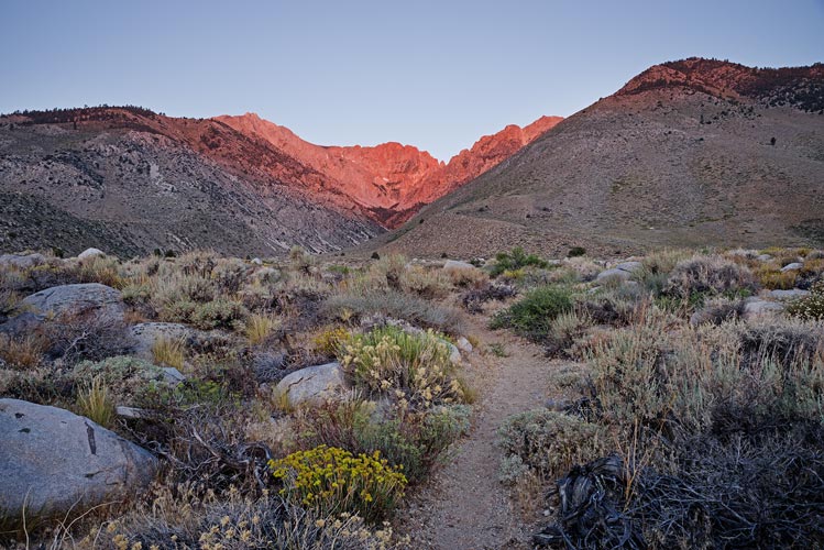
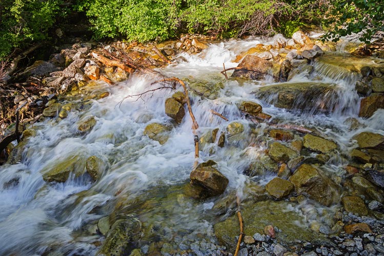
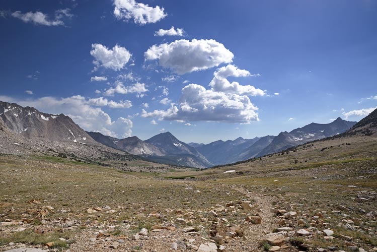
July 2, 2018 The alarm went off at 5 am. The sun wasn't up but it was light enough to see. I got ready and ate and drank a bit and was on the trail by 5:30. My pack was probably just a bit over 40 lbs (any time you have to bring the bear cannister it makes for a heavy load). I also had my brick of a camera bringing the total non-Tom weight with water to probably just under 50 lbs. I have previously only hiked this trail for the Sierra Challenge later in the year. At the start of July there were a lot more wildflowers down in the desert as well as all the way up the trail. I didn't get very far before the sun was over the Inyo Mountains trying to cook me. There was a bit of haze/smoke in the air from a wildfire but not enough to make much difference. I slogged uphill at a determined pace to the stream crossing. It was running a bit high and I thought I might have to take my shoes off to cross, but instead I spotted a line that only needed one more stone. I found a likely candidate and threw it in - success - the cube shaped rock made one more step. With my trekking poles I was able to work my way across with only a little wetness on one foot. For a while the trail was shaded under some nice trees, but soon I was back out into the sun again. The rest of the stream crossings weren't so bad and I kept powering my way up and up. I made it to the pass at 11:45 and moved a little to the side for another egg-tomato-bacon sandwich and a bit of a break. Then I left my big pack and took the lighter summit pack and headed up towards Cardinal Mountain.
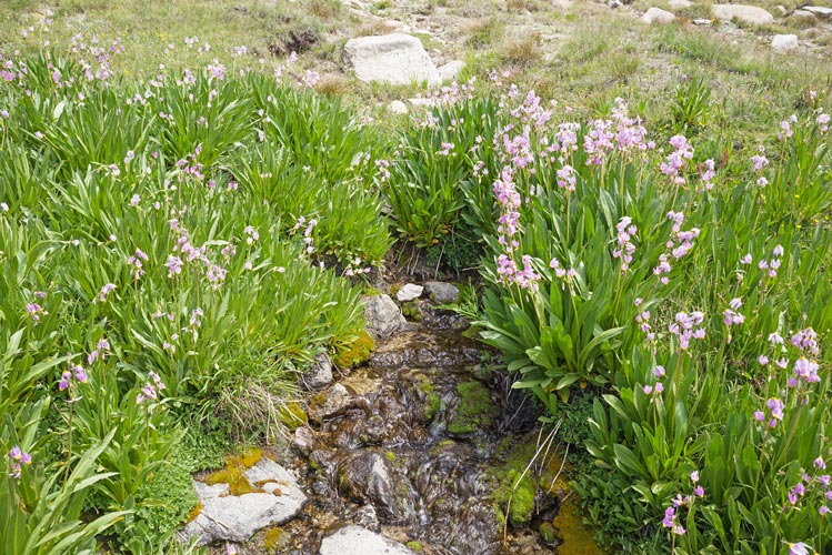
nice light and flowers at the start but it got hot quickly
 |
the first stream crossing
 |
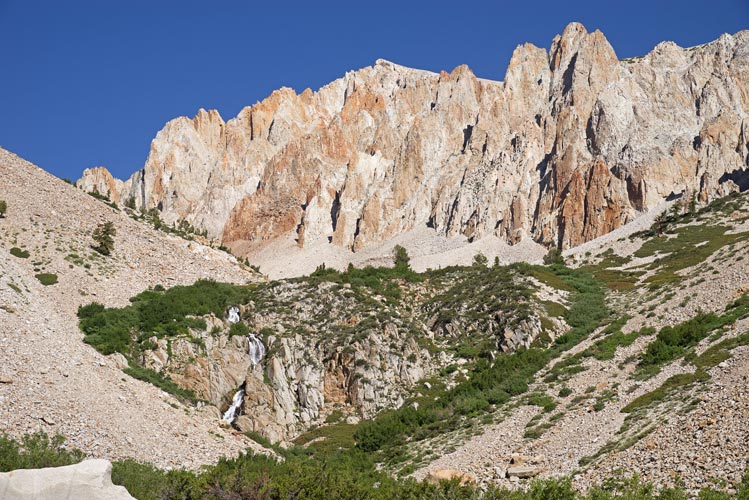
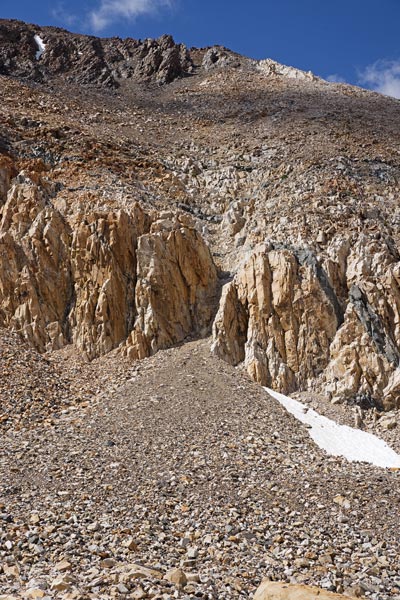
waterfall and cliffs a little past half way up
 |
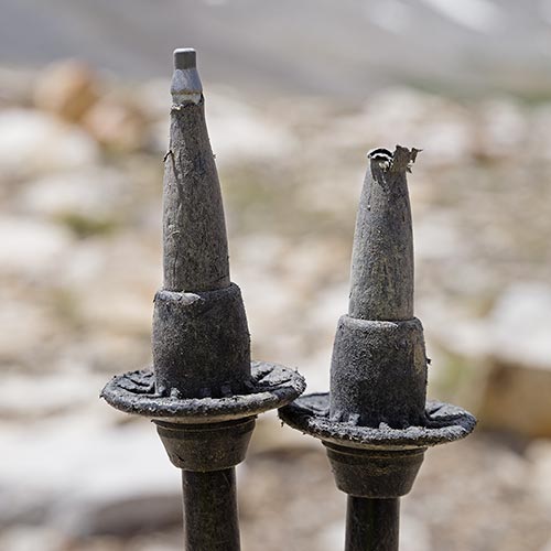
my Leki pole tips wore out on this hike - I lost both of the carbide tips by the end
 |
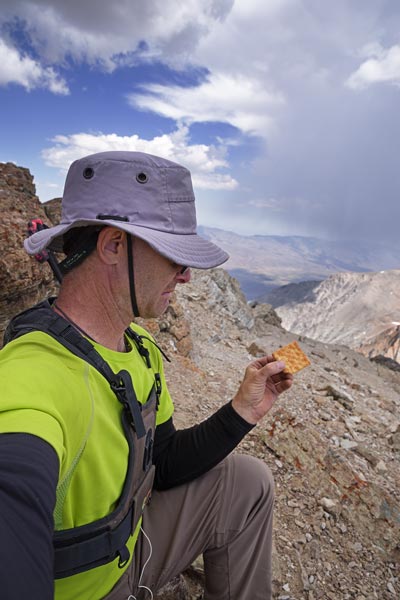
I headed up a ridge north of the pass and then followed the west ridge up to Cardinal. There were a few ribs to traverse past and a false summit but eventually I made it up. My legs were definitely no longer spritely as I had come from about 5500 ft to 13,397 ft with a heavy pack for most of it. There was some interesting geology at the top with some layered metasedimentary rocks (marble, schist, and hornfels?) as well as some intruded igneous ones. I spent the usual time perusing the summit register, taking photos, and eating. I was particularly dismayed to discover that what I thought were summit cookies were in fact crackers.
view down and across Taboose Pass as I headed up Cardinal
 |
I am disappointed to get a summit cracker instead of a summit cookie
 |
view south from Cardinal
 |
I headed back the way I came up but then veered down a gully that looked like it went all the way down - it mostly did although I had to delicately go down above a dropoff and then scramble a few feet at the bottom. I was glad to get back to my pack and headed down the trail towards the PCT. I missed the vague turnoff for the cutoff trail that headed towards the PCT north so I cut across the valley to pick it up where it headed downhill. It was getting faint in places but usually went where it made sense for it to go and I was able to follow it down to the valley. There it slowly petered out and I crossed the stream and found the PCT heading north. Here I started seeing people (before I only passed one party descending the pass). I also started seeing and feeling significant numbers of mosquitoes. In fact they were pretty plentiful and fierce before long. I pulled out a sheet of bug netting and wore it over my head and upper body to maintain sanity (and I was hiking in long pants). I had to gain about 2 thousand more feet on this trail before my planned camping area. At least once I got out of the trees the mosquitoes were no longer much of a problem. The sunset was pretty nice and pretty much over by the time I stumbled off of the trail and over a few ridges to find a place to camp.
looking back up at the gully I came down
 |
looking west heading down from the pass - Ruskin is on the right
 |
flowers and mosquitoes heading north on the PCT
 |
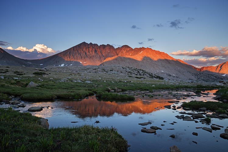
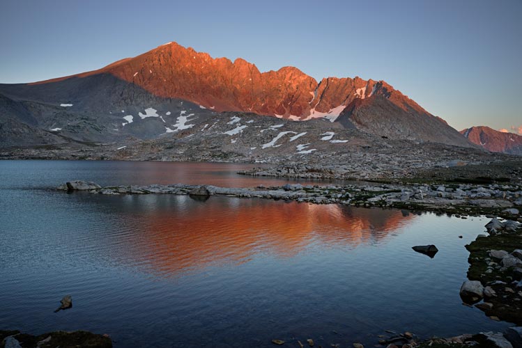
Split Mountain in the evening
 |
I was very tired but managed to set up my tent and cook dinner (spaghetti) before taking a few photos and going to bed. It has been a long time since I was that exhausted. I suppose the nearly 10,000 feet of elevation gain and 3,000 feet of down over some 12-15 miles took their toll, especially since about 8,000 feet of that gain was with a big pack.
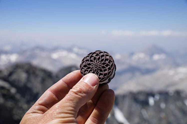
July 3, 2018 I did not get up very early and it took a while to get up, cook and eat breakfast (cream of wheat) and pack up for the day. Eventually I headed off around the lake and started up Split Mountain. Once again I was not moving fast, but I was reasonably steady and slowly made my way up the NW slope around some snow and up to the summit. Split mountain is another 14 er although the actual altitude is listed differently in different places - 14,065ft down to 14058ft are the usual range. I took a lot of photos, ate a real summit cookie and some other food and then headed back north towards the Split - Prater saddle. I made it down a lot faster than my ascent.
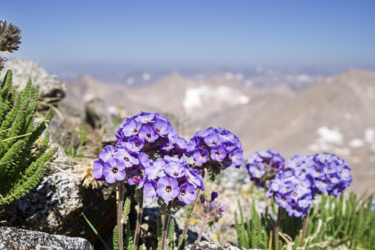
sky pilot flowers
 |
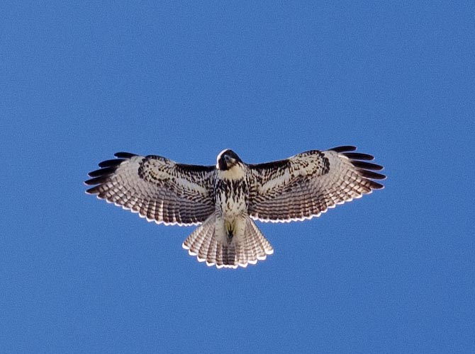
hawk flying over Split Mtn
 |
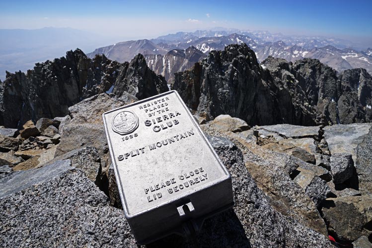
Split Mountain Sierra Club summit register
 |
summit cookie on Split Mountain
 |
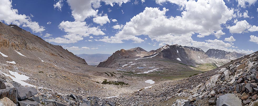
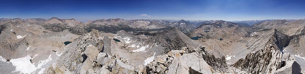
panorama from Split Mtn looking north. Prater is middle leftish with Bolton Brown behind it. Birch is the big peak to the right and the palisades are on the horizon on the middle left
 |
I was feeling a bit better on the ascent up Prater. This was uneventful but did feature a very short (2 steps) sidewalk with massive exposure on one side. I read through the summit register hoping to get some beta on the traverse to Bolton Brown. There was some, and plenty of people who did it, so I figured I could too.
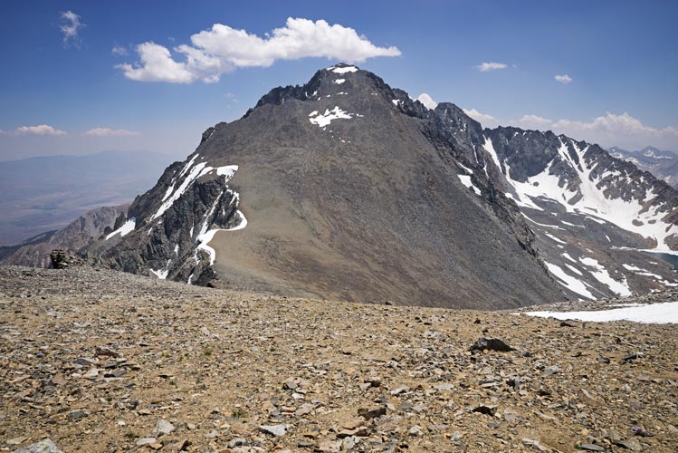
view back to Split Mountain as I headed up Prater
 |
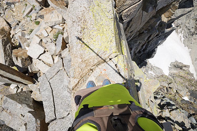
short sidewalk on Prater - falling left might be surviveable but a step to the right would be your last
 |
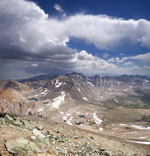
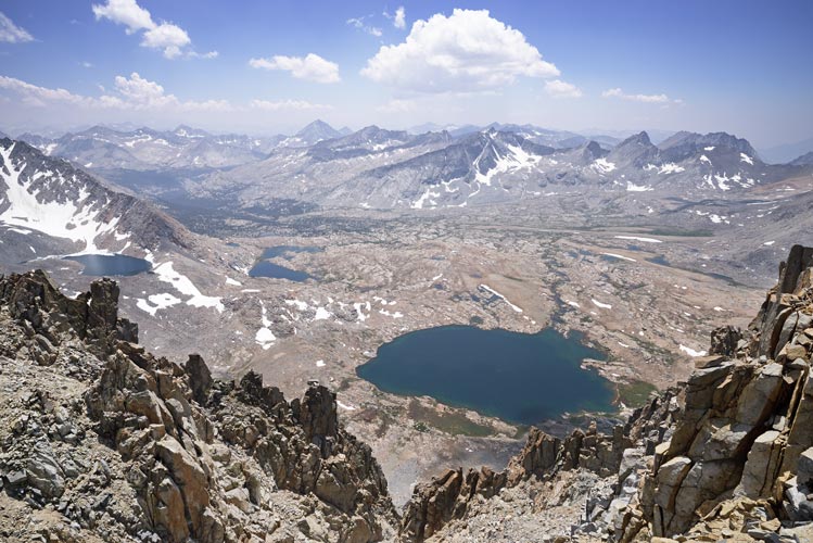
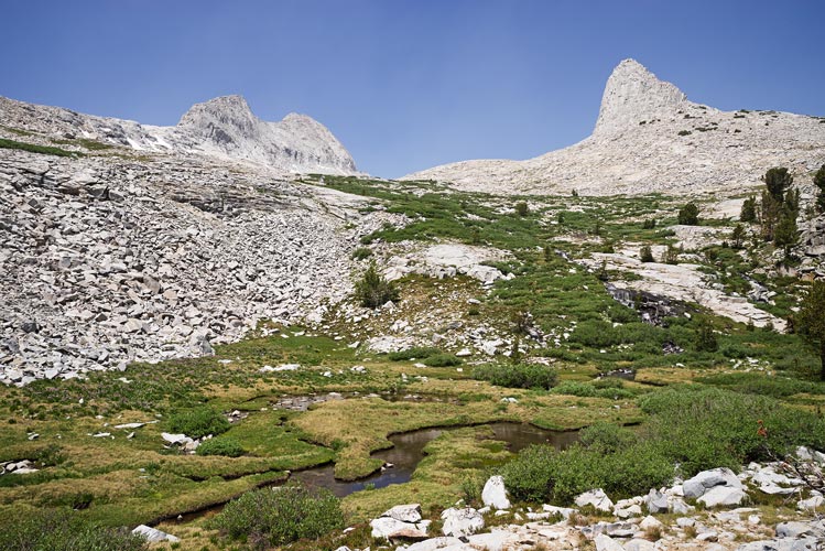
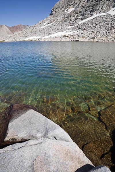
Upper Basin from Prater - I camped on the other side of the lake. In the center are Ruskin, Saddlehorn and the ridge to Staghorn, and Vennacher Needle
 |
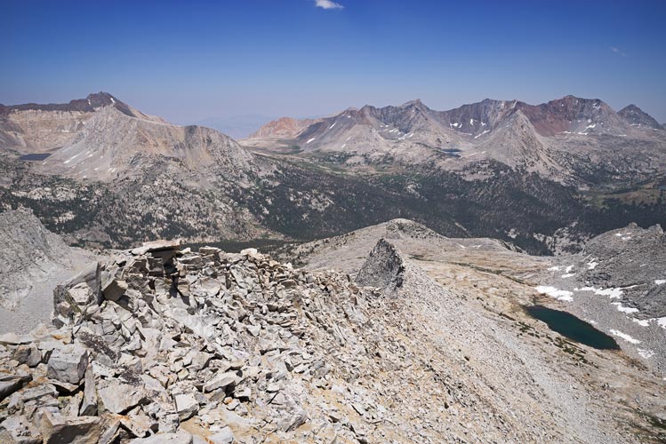
The traverse started with a little bit of scrambling, but it wasn't bad at all and I was wondering what all the fuss was about. Then after a long easy traverse on talus I hit the steep craggy bit. AH HA - that is what all the fuss is about. I scrambled along the crest over some towers and then saw I needed to head west a bit. Eventually I got to what I interpreted to be the ramp, but it turned into a steep icy chute, so I opted for climbing down around on the west side for quite a ways before I was able to pass the towers and get back on the ridge. The last bit to the summit was much easier after all that. More summit cookies, register reading, staring at the map, and taking photos followed. I also tried to get my phone to connect on all of these summits with no luck although a few times it claimed to have service.
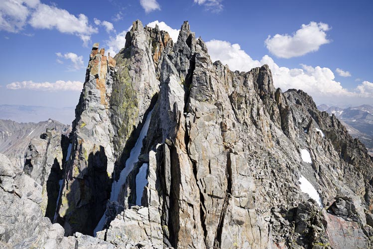
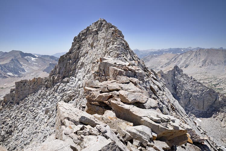
looking back at the spicy part of the Prater - Bolton Brown traverse
 |
These 3 peaks were my main goal this day, but I considered hitting a few more - but not for long. Instead I headed downhill. Lots of downhill on rocks and talus and a little snow and then along a nice stream that went back to the lake I was camped sort of near. I made it back while the sun was still shining on camp but I couldn't bring myself to jump into the lake. I did manage to rinse off the worst of my sweaty sticky joints though. It was much easier to cook dinner when I wasn't so exhausted (beans). After dinner I packed up and then took some more photos. I woke up around 11 pm to take some more night photos. Things went pretty well until the lens started fogging up from the dew so I started a long exposure and went back to sleep.
Split Mountain at sunset
 |
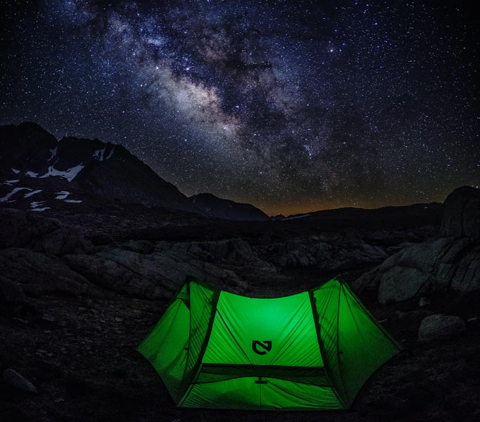
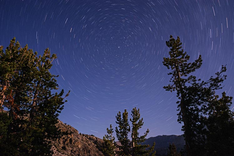
tent and milky way
 |
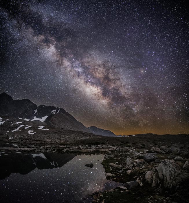
lake and milky way
 |
long exposure looking north as my lens got covered with dew
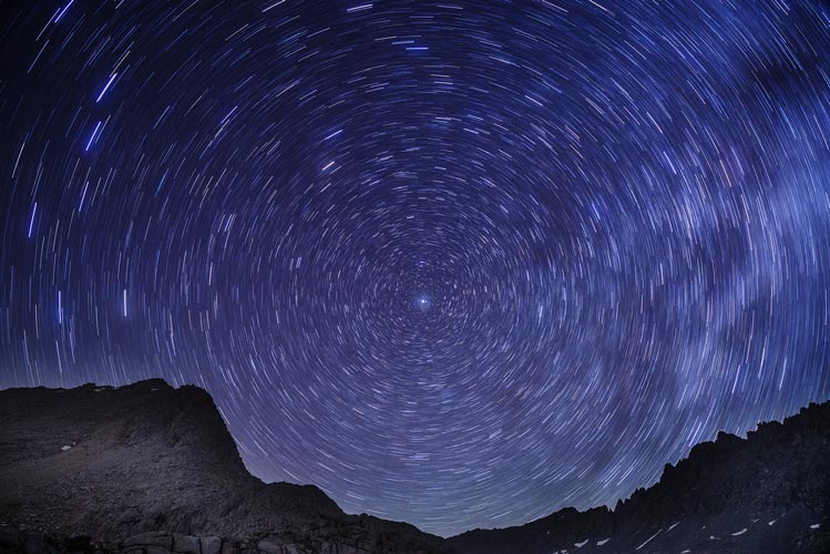 |
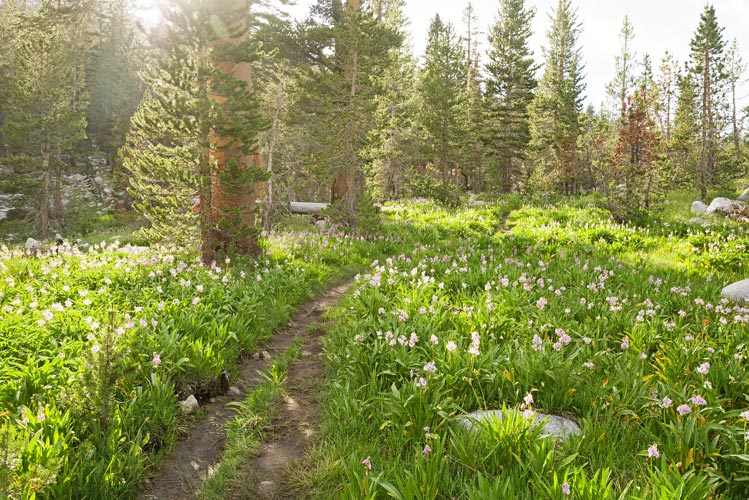
July 4, 2018 When I woke up everything was pretty wet. There had been a very heavy dew. I was in no rush so I took my time with breakfast and drying things out before packing up. I cut cross country sort of following the outlet stream from the lake towards the PCT. This was really pretty country with lots of water and wildflowers and enough of a breeze that there were no mosquito issues. Back on the PCT I headed south for a while before cutting off to the west up towards Mount Ruskin. I contoured along until I hit a stream and then I vaguely followed it up towards the e ridge of Ruskin. There I found a place to camp and left the big pack and headed off up next to a waterfall towards Mt Ruskin. Once again there were lots of wildflowers, especially Sierra shooting stars.
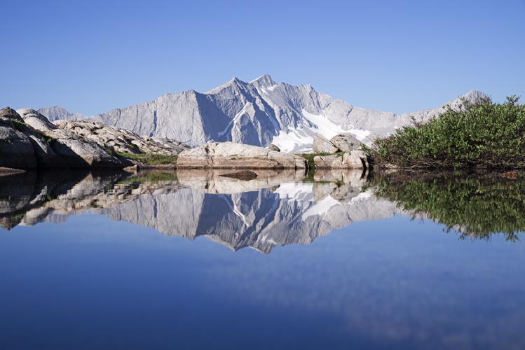
reflection of Vennacher Needle in a small pool
 |
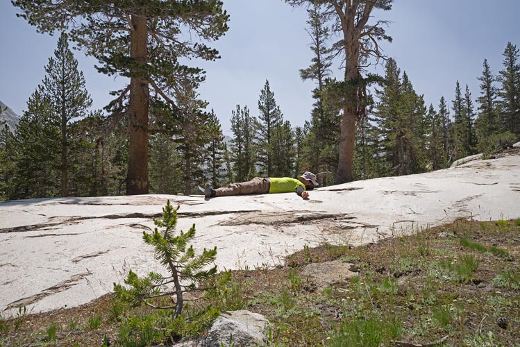
taking a rest on a glacial slab - beware the nap rocks
 |
Ruskin on the left and Saddlehorn on the right from near where I camped
 |
When I got to the steep step in the ridge I started scrambling. It was interesting but never impossible with enough ledges that you probably wouldn't fall very far if you did slip. On top of the step was a long rounded ridge that I followed up towards the peak. Eventually it became more of a sidewalk in the sky before getting a bit steeper again. I don't think it ever exceeded 3rd class or maybe a move or 2 of 4th class with the hardest bits at the step at the beginning and some moves a few hundred feet from the summit. On top I enjoyed the view down into the Lakes Basin as well as towards Arrow to the south and plenty of other mountains in all directions. It was somewhat hazy/smoky from a fire somewhere - enough to lower visibility but not enough to smell smoky.
looking down the ridge on Mt Ruskin
 |
looking up the ridge to the summit of Mt Ruskin
 |
360 degree summit panorama from Mt Ruskin - south is a bit right of center
 |
On the descent I diagonalled down the south side of the ridge vaguely following some footprints. From the base I went down to the tarn in the cirque and took a brief but lovely dip. The dip itself wasn't that lovely, it was too cold, but it was nice to warm up in the sun on the rocks and I really did need to rinse off. Then I followed the stream back towards where I left my stuff past lots and lots of flowers.
this is where I jumped in the lake - quite refreshing
 |
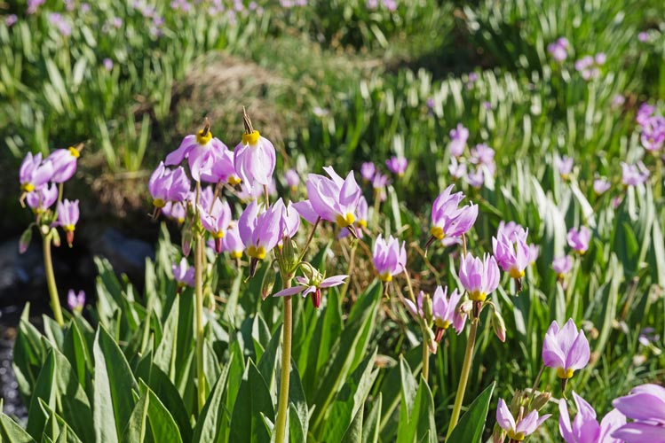
sierra shooting star flowers - my fireworks for the Fourth of July
 |
Once I got back to my pack I set up camp and cooked dinner (more spaghetti). Then the bugs were starting to come out as the wind died down so I retreated to my tent. It was in a lumpy spot but I was able to make a flatter sleeping area by packing things into the low spots. I woke up to take more night photos but the moon was coming up (the extra light sort of ruining star and milky way photos) so I just set a long exposure (that turned out to be too dark) and went back to sleep.
long exposure at night - made much lighter in post
 |
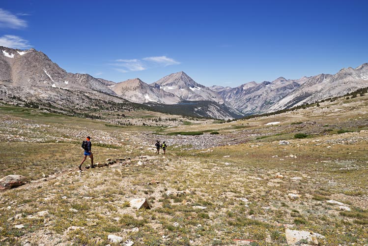
July 5, 2018 I was in no rush this morning either. I packed up at a leisurely pace and then headed back down the hill. Rather than take the trail back to the pass I just crossed the river and headed up the slope. This worked out pretty well with some nice wet steep meadows covered in flowers and pine pollen and a few springs. Eventually I ended up near the pass and cut over to the trail. I saw some runners come over the pass and put on some windbreakers before starting down towards me. As they passed me I recognized one of them - Gregory Wagner (who I climbed Middle Palisade and Bear Creek spire with). He had recognized my truck and was hoping to see me, but was surprised that I was backpacking. I took a little break near the pass for some food and then headed downhill.
spring with flowers
 |
runners head west from the pass
 |
It was quite windy up by the pass but less so as I descended into the heat. I stopped a few times where there was shade or water to cool off. The final bit of sandy trail out in the desert was particularly hot, but I doused some of myself before it so I was only getting hot for the last little bit. I got out around 4 for a nice hot rocky drive back to the highway.
rugged tree that provided some shade
 |
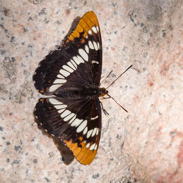
there were a lot of butterflies at the stream crossing
 |
No material on this page may be copied or used without permission.