Tom Grundy's Fall 2022 Sedona Area Page
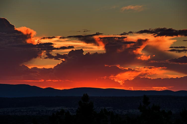
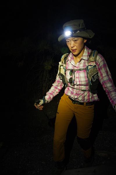
October 2022 and Iris has some time off coming up. We started by heading out the night of the 4th over Westgard Pass nearly to Pahrump. Sadly I was looking at the map when I saw a blur in the opposite lane out of the corner of my eye. Iris was driving and she said it was a mountain lion. Fortunately we didn't hit it. We slept a bit up a dirt road in a small clearing complete with a few bits of shot up stuff.
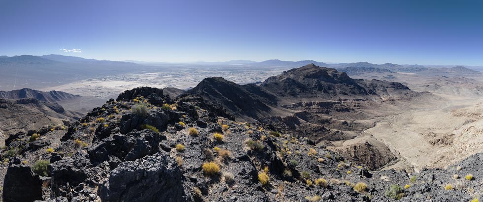
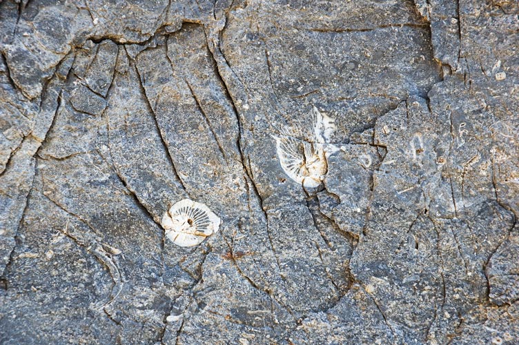
Oct 5, I got up early and jogged up the road and then headed cross country towards the Last Chance Range Highpoint. Mostly it was pretty mellow cross desert travel and uphill slogging with some steeper more interesting prickly limestone near the top with a few fossils in it. There was a register to sign and a view down over Pahrump as well as plenty of distant desert peaks. I headed back down, jogging slowly when I got to the road. Iris wasn't expecting to see me yet. She was hiding in the dwindling shade from the truck while working. Eventually we packed up and headed through Vegas and into Arizona to Kingman where we met Bob Burd for dinner. Then we headed up towards Hualapai Peak to camp. We had to backtrack a bit to get away from the "No Camping" signs but found a flattish turnout. It looked like this area had been hit by flash floods recently. It was pretty high elevation though, so nice and cool for sleeping.
looking down over Pahrump from the summit of Last Chance Range High Point - Mt Charleston is somewhere on the horizon on the left
 |
rugosa horn coral fossils
 |
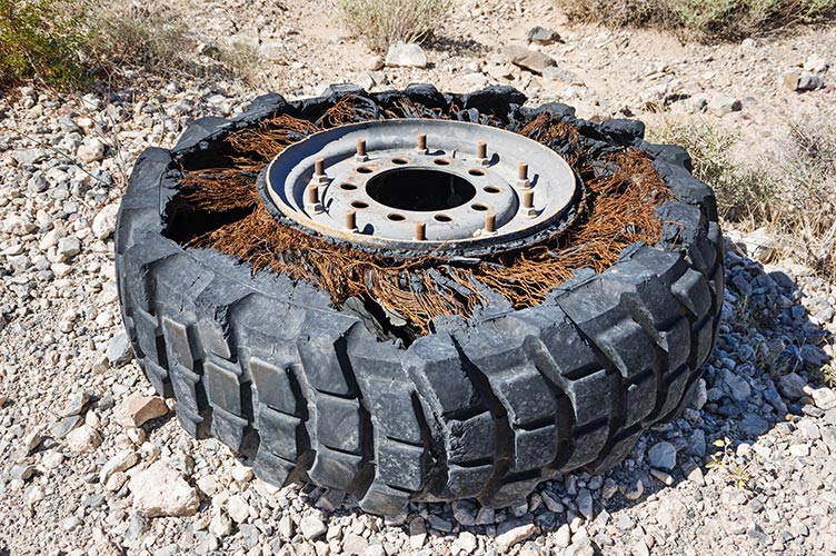
old broken tire on the side of the dirt road
 |
Strava Link for Last Chance Range Highpoint. 10-05-2022
Oct 6, I woke up before sunrise to the pitter patter of rain on the truck canopy. uh oh. Fortunately it was short lived. The next indignity was a series of dump trucks full of rocks pulling into the turnout. I guess they were working on repairing some of the flood damage. Bob was able to get his stuff together and headed out before us. He had already done the P4K (peak with over 4,000 feet of prominence ) in the region - Hualapai, but we hadn't, so that was our plan. We went up to the county park and paid the entrance fee and then followed Google Maps poor directions through the campground to get to the trailhead. On the way we saw an elk. There we parked and Iris spent an hour or so on the phone for work. Then we headed up the trail. This was a nice trail through the woods with mostly cool air. It was a pretty nice hike up and around Aspen Peak and then up towards Hualapai. In general other than a bit of uphill hiking in the sun the weather was delightfully cool this day - feeling like autumn rather than summer and a nice break from just being hot. The hike went through some burned areas and past some potential rock climbing.
Our route followed trails and old roads up towards Hualapai, but they didn't make it the entire way. We Followed the social trail with a few cairns and a faint to pretty obvious path up through the rocks and dodging around some prickly plants up to the summit. The trip reports talked of scary moves up the final 8417 foot high summit, but with dry sticky rock it was pretty casual to walk around a ledge and up - with a bit of exposure, but not much difficulty. Many of the trip reports were in more wintery conditions - it would be a different story with wet and icy lichen and snow. As befits a P4k with over 95 miles of isolation ,
the views were most excellent and we enjoyed a bit of a break on top before heading back down.
looking towards Aspen Peak from Hualapai
 |
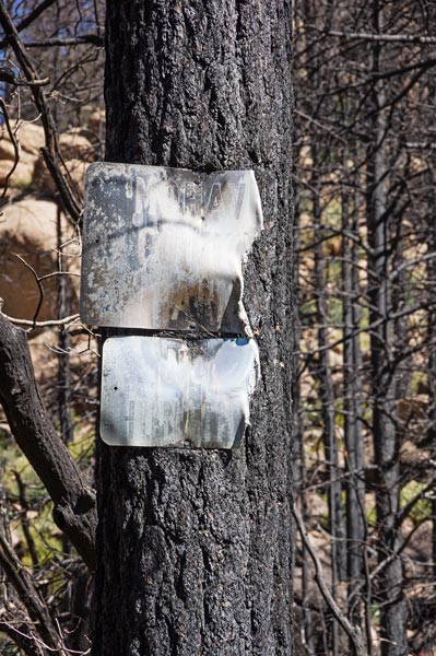
burned tree and signs
 |
We passed back through a burned area and then continued around clockwise on the loop trail before we headed off up towards Aspen Peak. Sadly we had to backtrack a bit, but the trail was mostly straightforward at least up to the saddle and from there it was still pretty easy to follow with a bit of looking about and scrambling over boulders up to the 8167 foot summit. Then we headed back down and continued around the loop and back to the truck.
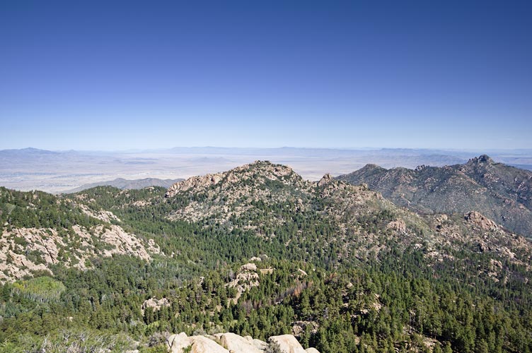
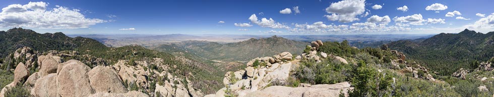
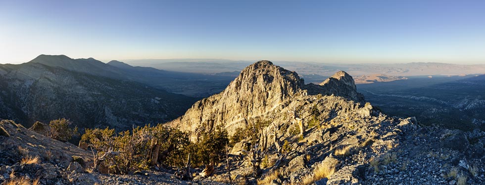
360 degree panorama from Aspen Peak - Hualapai is on the far right
 |
Strava link for Hualapai and Aspen Mountains. 10-06-2022
We drove back down cutting the corner to get to I-40 where we foolishly filled up with gas not realizing that somehow gas prices were out of how they normally used to be and gas was actually cheaper in Flagstaff and even cheaper in Sedona. Then we headed east stopping too meet up with Bob for a drive up ascent of Jolly Place Peak followed by a rinse. Then on to Flagstaff where Will and Eric joined us for a Thai Dinner (Eric was coming from NM and would be hiking with us for the next week, Will lives in Flagstaff). I was a bit late to meet up with the others to go to our camping location because I stopped for gas (foolishly it turns out) and then google directions decided that instead of going where I wanted to go it would route me to somewhere 100 miles away (it actually did this twice, fortunately I knew the area well enough that I didn't fall for its tricks, although it did slow me down).
We spent the night at the so called "dispersed" camping area although it would probably be more accurate to call it "concentration" camping. They have closed off a lot of the dispersed camping in some of the most popular areas and limited it to a few location - thus concentrating everyone into smaller and smaller areas with the not surprising increase in impact - at least in the smaller area, more like a few parking lots to camp in. I was amazed how many people were camping in the allowed areas - probably a combination of limited and expensive housing options and #vanlife. In any case we found a place with room for 4 vehicles and slept there. Fortunately not that close to the people that seemed to be up all night.
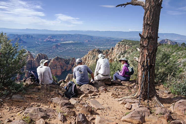
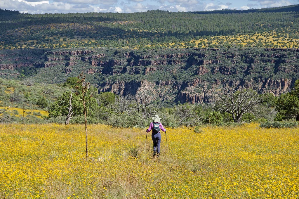
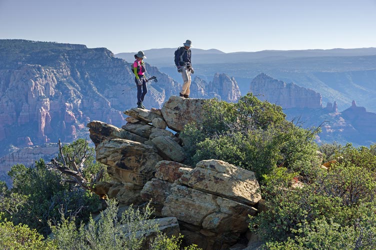
Oct 7, 2022 - We got up early and headed down the hill (complete with traffic stop to get past a construction area) to the Wilson Mountain Trailhead (near the parking for going to the Waterfall climbing area). There we headed up the trail towards Wilson. This started out in the shade but soon we got a bit more sun and it got steeper. We had to dual job of watching our footing and watching for poison oak. It was avoidable, but you had to pay attention. It felt a little steamy in the sun, especially as we were used to dry desert air. Once we made it up to the first plateau we were met with a lot of yellow flowers. We detoured out to a little bump that was marked on peakbagger and had a nice overview before continuing up the trail. We left the trail near an intersection to bushwhack up to the 7122 ft Wilson Mountain summit. This was a little rocky bit with more nice views. Then we went south on the trail to an overlook that had nice views down to Sedona and a number of peaks in the area.
crew on the Wilson Mountain overlook above Sedona
 |
looking down from near the overlook
 |
Iris in the flowers on Wilson Mountain Bench
 |
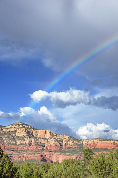
After we returned back to the trailhead, Eric, Iris, and I walked across the road and went down to Oak Creek for a refreshing and quite worthwhile dip. Then we drove to another "concentration" camping area up Loy Butte Rd. Eric got taken quite a bit out of his way by the google directions bug before he realized it wasn't taking him the right way. Once we had a camping location we piled into the jeeps to take a 4wd loop. This was somewhat marred by the large number of various off-road vehicles and the fact that we were just doing a loop rather than going somewhere to get a peak or go climbing or something. 4wd for the sake of 4wdriving is a lot less interesting to me than using it as a tool to access areas that are otherwise hard to get to. There was a bit of rain and a rainbow and we had a big dinner of bison macaroni and cheese. There was a fire ban, so no camp fires that night. It also wasn't that cold so sitting around a table in our chairs wasn't so bad.
Rainbow over Bear Mountain
 |
Strava link for Wilson Mountain. 10-07-2022
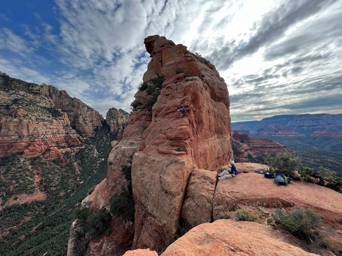
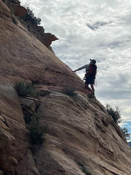
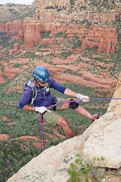
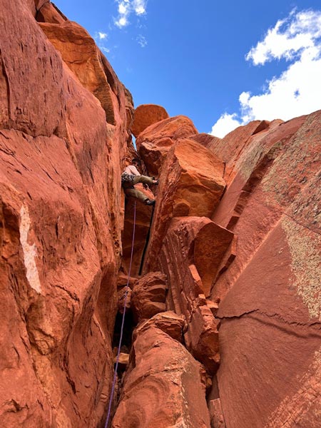
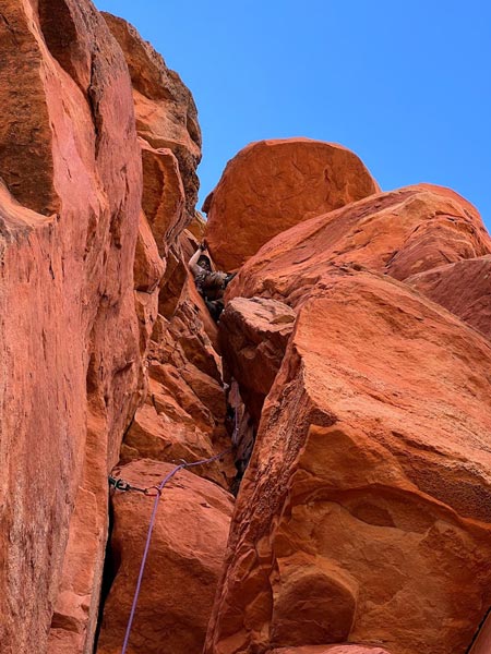
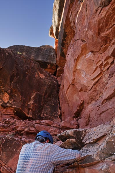
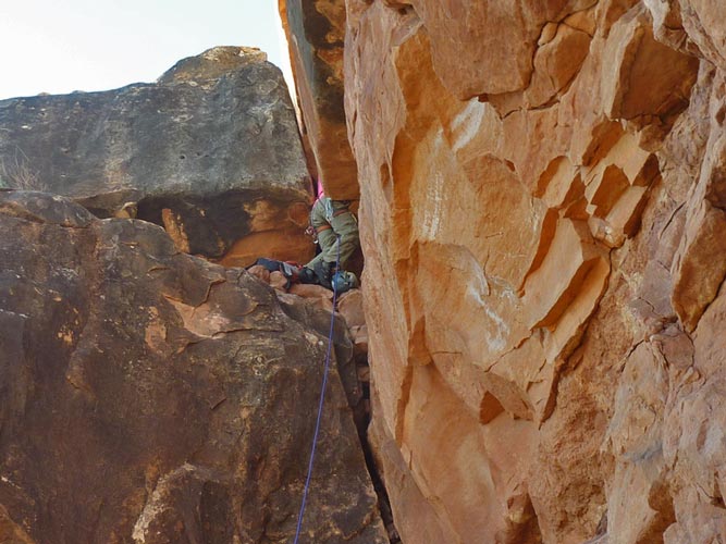
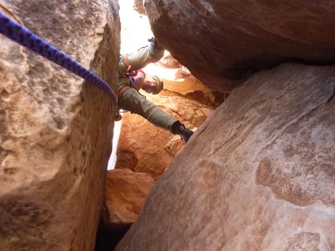
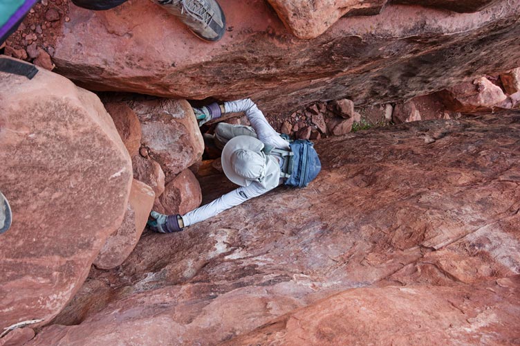
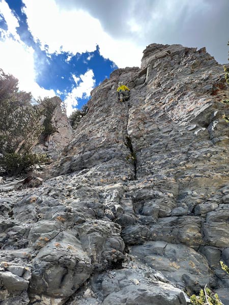
Oct 8, 2022 Today we planned to climb The Fin. There are actually 2 "fins" in Sedona, but I managed to find a bit of beta on climbing The Fin online. That was helpful since it allowed me to not bring a whole lot of extra gear and made route finding a lot easier. There was a small parking lot for this approach next to a much larger closed off parking area, but fortunately it was not full (and never appeared to completely fill up during the day) We headed cross country probably not taking the easiest path, but it wasn't far. Soon we were heading uphill and even had some scrambly bits up to the base of the ramp. Here the scrambling got a little more interesting with some definitely 3rd class if not 4th or low 5th class. We were able to go up it all to the top of the ramp and the start of the real climbing but decided that we would use the rope for the descent. The climbing wasn't hard, but the gear was sparse and not very reassuring, so I went slowly and carefully. I tried to place gear to protect the followers as well as myself but there weren't that many options and rope drag was bad enough as it was. I used the rap anchors to bring up everyone else and then led the harder next pitch. It had one section of pretty blank slab fortunately protected with a bolt. Then I spent a bunch of time trying to build a decent anchor before bringing up the rest of the crew. We left the rope there and scrambled up to the summit.
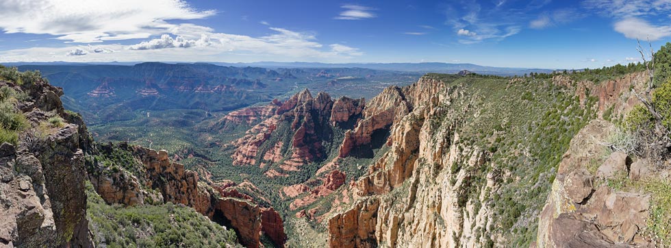
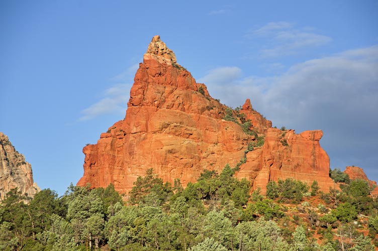
view of The Fin from Munds Mountain - the ramp comes down from the notch on the left
 |
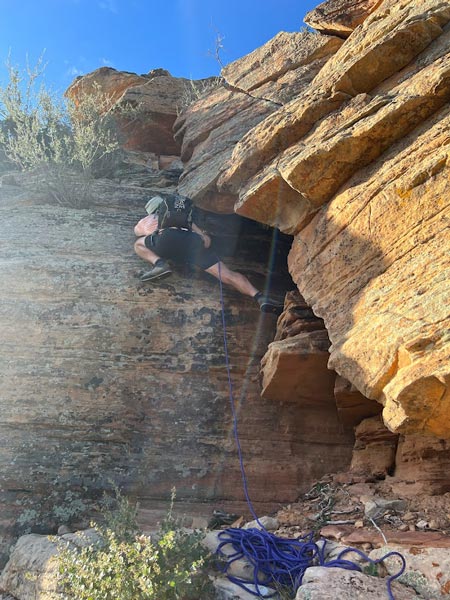
I head up the first pitch on the fin while Bob belays (Iris Pic)
 |
I clipped the bolt on the second pitch on the fin (Iris Pic)
 |
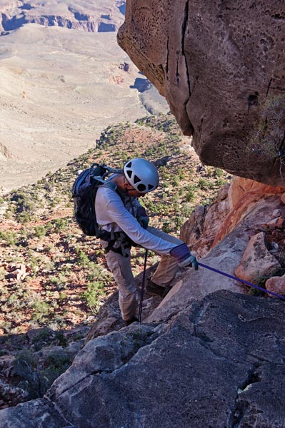
We returned to the rope and rappeled twice back to the start of the climbing and then scrambled down a bit and set up the short rope on a rappel down a steep section of the ramp that I untied and downclimbed while Bob went ahead and set up the rappel from a tree to drop off the lower side of the ramp skipping some more downclimbing. We opted to try a different descent and went down and right from the ramp (we had come up from the down and left side). There was a rock arrow pointing down a ridge as things started getting steeper. Tom and Bob got ahead going down left near the toe of the ridge and it looked like they got cliffed out so the rest of us went right down the toe where I could see it made it down past the cliffs. This worked out but set us up for a bit more bushwhacking and a longer walk back to the car. Bob and Tom did some interesting lowering with webbing off a tree to make it down a short cliff and beat us back to the parking lot. We all agreed this was one of the most enjoyable peaks of the trip
Tom B starts down the first rap
 |
Next up we hiked from the same parking lot up the trail and then cross country following a vague use trail to the summit of Brins Butte. This had more nice views and then we went back across the trail and up another use trail to the highpoint of Brins Mesa. Bob wanted to improvise a descent down the canyon from here and I decided to join him. The others headed back via our route up. There was a bit of steep bushwhacking and some moments of uncertainty if we would get cliffed out but it worked and soon we saw some footprints in the wash. We followed it back to overlap with where we had hiked back from The Fin before cutting out of the wash to the trail.
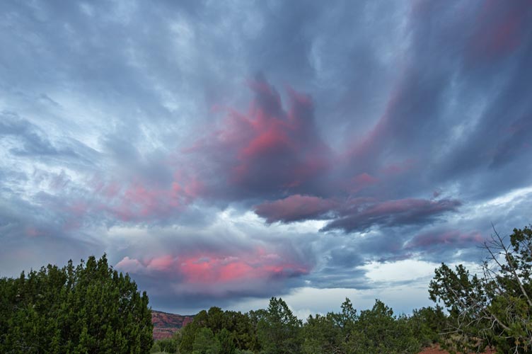
the sunset never really went off, but it was nice
 |
Strava link for The Fin and Brin's Mesa. 10-08-2022
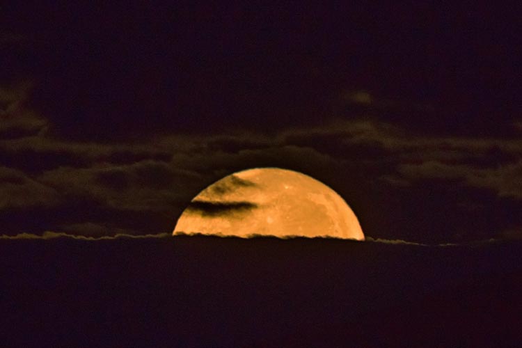
I was hoping for a full moon setting over red rocks, but the clouds had other ideas
 |
Oct 9, 2022 We returned back to the same trailhead, this time heading up past the mitten looking formation to Morning Glory Spire. This one was on my radar as a possible destination back when we visited in February 2022. It turned out to be as good as promised with some steep scrambling up to a very satisfying summit. The only real downside was I scraped a small hole in my pack when the part where my camera was hit the side of the chimney. I did take the rope up this part and set up a toprope and later a rappel for the others.
Morning Glory Spire from near the trailhead
 |
Morning Glory Spire from the base of the mitten - we went up to the highest trees and then left
 |
I head up the crux on Morning Glory Spire (about where I caught my pack) (Iris Pic)
 |
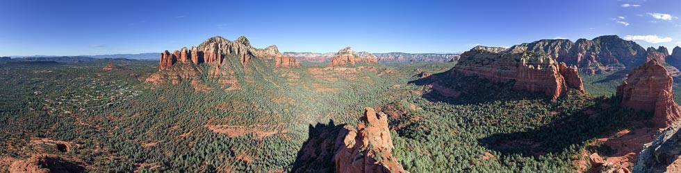
Morning Glory Spire summit panorama - Brins Mesa is center right, The Fin is hiding far right behind the mitten formation
 |
Strava link for Morning Glory Spire. 10-09-2022
After Morning Glory Spire we drove the jeeps up the long and bumpy (no way my truck would make it) Schnebly Hill Road. There we bumped out more 4wd roads and hiked up Munds Mountain where we spent a fair amount of time wandering around looking for a summit register. Then we drove almost to the summit of Schnebly Hill before heading N on I-17 and stopping to hike up Smith Butte before dropping back down through Oak Creek Canyon (and the construction traffic delay). We stopped to take a jug shower or dip in Oak Creek at the Wilson TH before going out for Mexican on the way back to camp.
view down from Munds Mountain
Morning Glory Spire mid upper left, The Fin mid upper Right
 |
Strava link for Munds Mountain. 10-09-2022
Oct 10, 2022 We thought we were getting another early start but this time the severely constricted parking lot was full - fortunately we had Jeeps so were able to drive over the barrier rocks keeping regular vehicles from accessing even the easy start of the 4wd road. There was plenty of parking along this road. Then we walked back and headed up Capitol Butte. This is a 6355 foot high P1k looming over western Sedona. The trail up had a few 3rd class sections, unless you take a variation like Bob and Tom did into 4th class territory. The views from the top weren't as spectacular because it has a somewhat rounded top. Still, not bad. There were a number of things left up near the summit. Maybe it is a vortex.
Iris and Bob get to the summit of Capitol Butte
 |
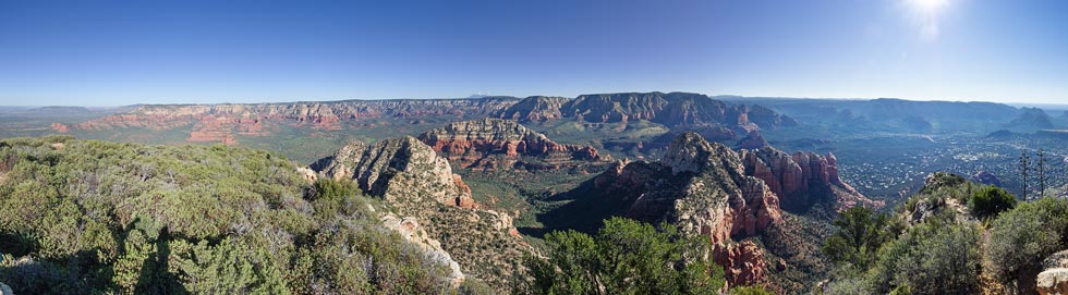
panorama from the summit of Capitol Butte
 |
Strava link for Capitol Butte. 10-10-2022
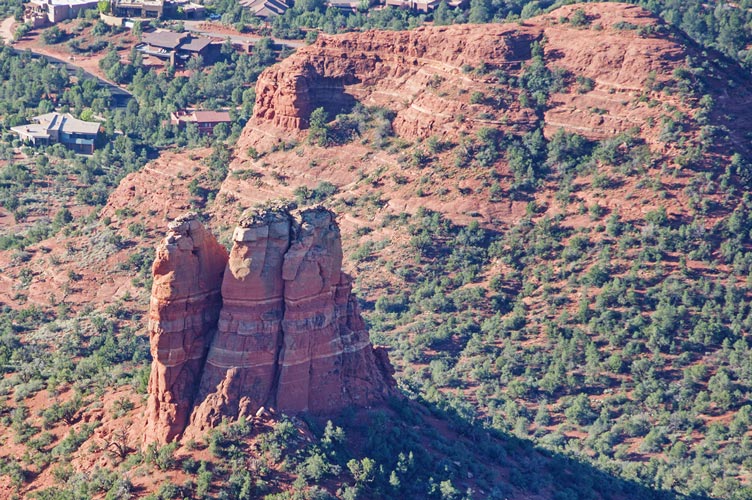
view down to Chimney Rock from Capitol Butte - little Sugarloaf is top right
 |
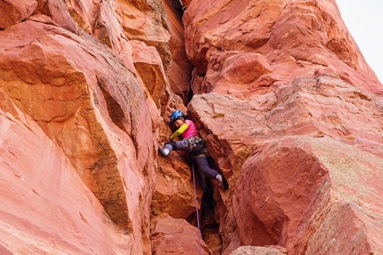
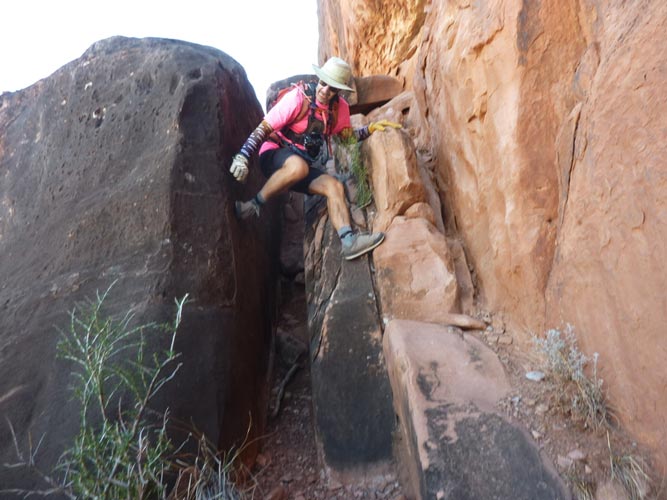
Next up was a peak we had been eying on the way up - Chimney Rock. A short hike up from another small parking lot to the base of a one pitch chimney to the top of a tower. I was a bit nervous because some of the trip reports said large gear was necessary and my largest piece was a #10 metolius cam. At least I had that - previously I thought I had a much more pared down rack. The climbing was rated 5.7+ so well within my abilities, but offwidths are always a bit intimidating and having a plus sign in the land of sandbags can mean a lot more than half a grade. In any case I was able to get enough gear that it wasn't too scary plus I could stem a lot of it although the crux was a flared corner that was too tight to fit my helmet through on my head. I took it off and dangled it below me for this section as I grunted my way up making only a few inches of progress with each convulsion of my body. Iris got sort of stuck in this section when she followed it and ended up with a few scrapes on her back as well as on her tailbone. I never saw the bolt that was supposed to be on this pitch, but I am not the only one who didn't see it. I was able to set up a belay in the shade just below the summit to bring up Iris and then I fixed the rope she trailed and Bob followed on toprope and with ascenders on the fixed line. We rapped off of chains down into what felt like a furnace on the other side. I think I actually would have been ok with nothing bigger than #2 camalots, but it was nice to have some larger gear.
I head up the chimney on Chimney (Iris Pic)
 |
I am almost to the crux on Chimney Peak (Iris Pic)
 |
Iris in the chimney on Chimney Peak in between where I am in the 2 pics above (Bob took the pic)
 |
Strava link for Chimney Rock. 10-10-2022
Next up we did 2 short hikes - Little Sugarloaf and Sugarloaf Mountain. On the latter we had some trouble with a full parking lot and then saw a tarantula on the descent. Then on the way back towards camp we stopped to hike up Windmill Mountain. This took longer than expected and had a bunch of loose rocks and cacti hiding in long grass to keep us on our toes. We made it back to the road just as it was getting dark for a very full day.
Strava link for Little Sugarloaf. 10-10-2022
Strava link for Sugarloaf Mountain. 10-10-2022
evening view from Windmill Mountain hike
Capitol Butte in center, Chimney Rock and Little Sugarloaf down and right
 |
sunset from Windmill Mountain hike
 |
Strava link for Windmill Mountain. 10-10-2022
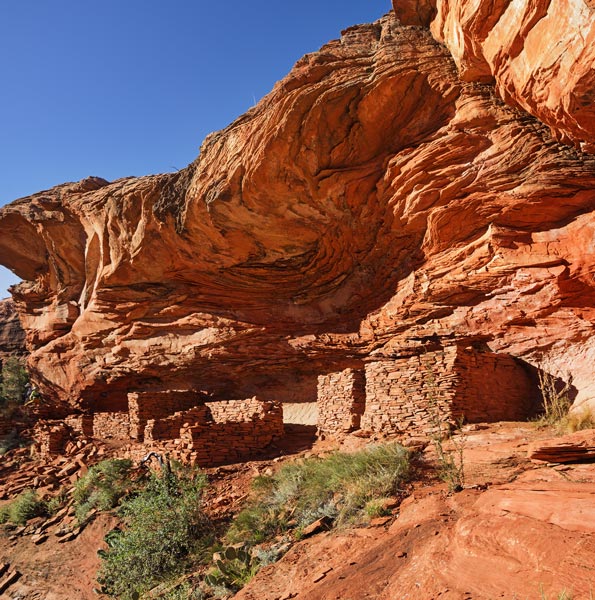
Oct 11, 2022 We packed up our stuff and drove (with some navigational errors) to the Loy Canyon Trailhead. There we hiked up the trail before cutting cross country on a use trail up Loy Butte. On the way we passed some pretty excellent Native American Ruins in various states of decay. It was getting hot by the time we got to the top but there was a bit of a breeze up there. The descent went more quickly and then we drove to a little overlook bump and then up through the Oak Creek construction up to Flagstaff.
Loy Butte ruins
 |
Strava link for Loy Butte. 10-11-2022
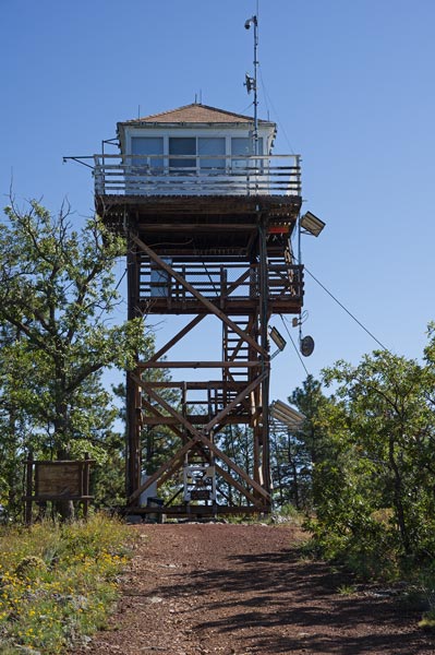
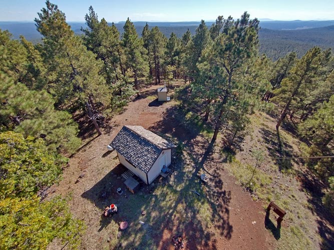
Oct 12, 2022 I dropped Iris off at the airport early and then drove back down through the Oak Creek construction to join Bob and Eric for a hike up to East Pocket Knob. We originally planned to access this from above, but it would involve about as much 4wd driving time as we would spend hiking so we opted for the hike. We took a little bit of casting around after crossing Oak Creek to find the trail but then rapidly made our way up the switchbacks through and old burn scar up to the rim. There we walked along up to the 7196 ft high point of East Pocket Knob near a fire lookout tower. After descending we made our way back up through the Oak Creek construction and to Woody Mountain. Another hike up through the woods to the base of a fire lookout. We thought Eric was behind us and waited for a while but he passed us and was ahead on the way back down. oops. Then I left the others and went back to Flagstaff.
Pocket Knob Lookout
 |
Strava link for Pocket Knob. 10-12-2022
looking down from the tower steps on Woody Mountain
 |
Strava link for Woody Mountain. 10-12-2022
Oak Creek Canyon from the air - Wilson Mt is above the triangular shadow on the middle left
East Pocket Knob is center right? (Iris Pic)
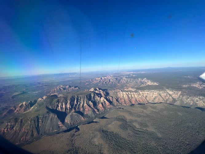 |
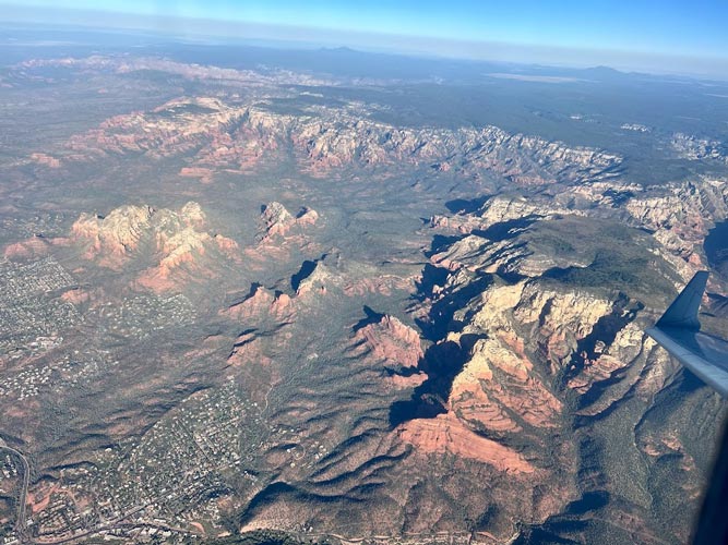
Sedona from the air - the fin is near the center with a spiky shadow pointing at Brin's Mesa
Morning Glory Spire is left of Brin's Mesa with a vaguely sea dragon shaped shadow
Sugarloaf Mtn is a red spot left of it almost surrounded by houses
Chimney rock is center far left, Capitol Butte is right of that
the overlook from Oct 7 is in front of the winglet (Iris Pic)
 |
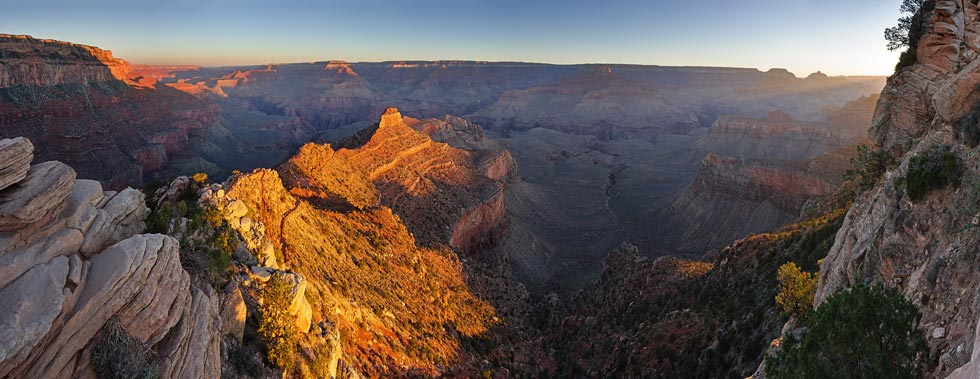
Oct 13, 2022. After not enough sleep I got up stupidly early to drive to the Grand Canyon. I made it there in time but the trailhead was only open to shuttle busses so we hiked in from an overlook parking area. It looked like there were a few cars parked there, but maybe they belonged to rangers or packers. We dropped over the rim and started down towards O'Neill Butte with a stop at Ooh Ahh point to admire the view and the nice light. I had scoped O'Neill Butte on our hike down into the Canyon earlier that year and wanted to do it with a rope and a little gear so this was my chance. We traversed around to the N side of the butte and stashed most of our gear before scrambling up. We roped up for the short dihedral into a weird squeeze chimney hole feature. The entrance was interesting because it was so tight and because my legs just dangled out the bottom as I started worming my way up. Then there was a short walk to the last difficulty - an airy boulder move - or a more difficult but also more secure move protected by a hand jam. I opted for the latter and then belayed the other 2 up the airy boulder move. From there it was a short walk up to the summit. We only had a short rope so we opted for 2 short rappels down the part we climbed up plus one more at the beginning of the harder scrambling that I downclimbed. Then we packed back up and hiked back to the rim walking right past some pretty unconcerned bighorn sheep and a lot of hikers.
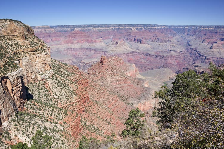
panorama from Ooh Ahh Point, O'Neill Butte is in the sun left of center
 |
Bob and Eric get their gear on before the 4th class bit
 |
Eric and the start of the climbing
 |
I head up into the squeeze (Bob pic)
 |
I belay above the squeeze (Bob pic)
 |
Bob rappelling down
 |
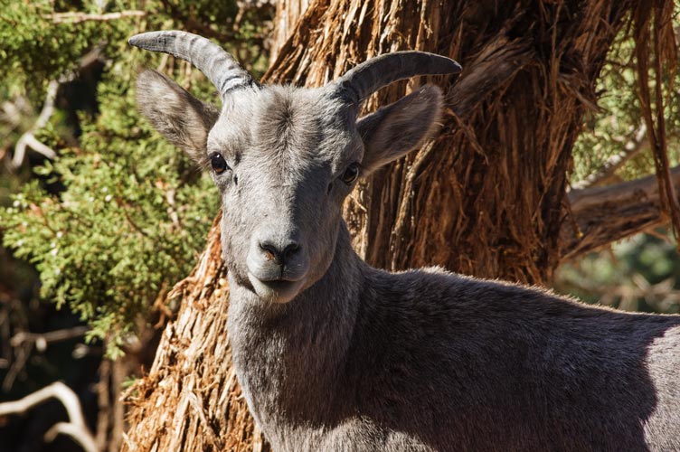
a young bighorn sheep, pretty unconcerned about hikers
 |
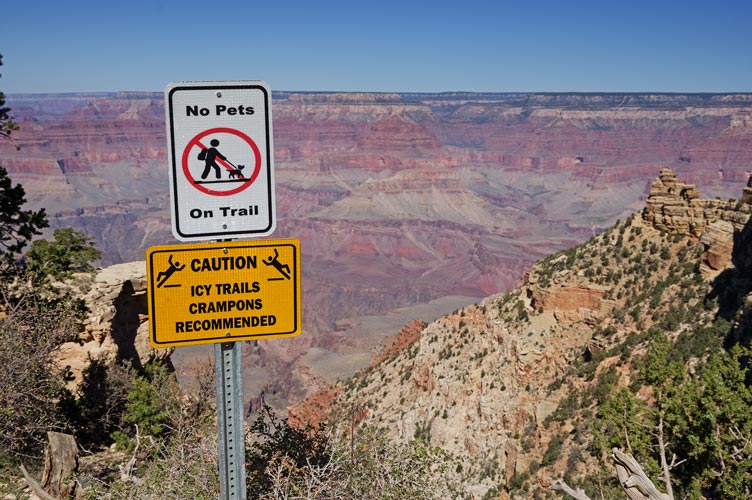
warning signs at the top - no need for crampons yet
 |
Strava link for O'Neill Butte. 10-13-2022
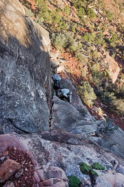
We drove over to the top of the Bright Angel Trail where Eric opted to stay and Bob and I headed down to climb the Battleship. We dropped down the Bright Angel Trail quickly past the water spigot and the 1.5 mile guesthouse. We left the trail at the next west switchback and started following a series of anastomosing social trails out towards the saddle to the Battleship. This took longer than expected because it wasn't always fast walking and the path went in and out of a lot of gullies. Once we hit the saddle the trail was a little more obvious - or maybe there were just less competing trails - but we still had to look around from time to time for the path or cairns. We wrapped around on the SE side and then cut back up onto the improbably steep side. The route worked its way back and forth on ledges and up through slots on ramps up to the summit plateau where it was a short walk over to the high point and the nearby ammo can register. I took off my camera and pack to air out my back and rest my shoulders and the bite valve got pinched against the ground dumping an alarmingly large amount of water onto the rocks. Fortunately I still had some (I obviously took too much) and there was a spigot on the way back. I was going to go out to the NE end of the formation to take pics, but the way dropped down a bit too much so I opted for lazy and soon caught up with Bob on the descent.
view down to the Battleship from near the rim
 |
one of the lower slots
 |
Bob scrambles up an upper slot
 |
I scramble down the last moves (Bob pic)
 |
The return to the Bright Angel Trail went a little bit faster except for one section where I cut up too high and had to down scramble some ledges. Back on the trail we were able to make much better time although Bob got a lot ahead of me when I stopped to get some water at the spigot and despite power walking and gaining ground I didn't quite catch him until the very top where I took a shorter path up some steps instead of the longer ramp. We rested at the top a bit and then decided to do one more drive up peak. On the way there I realized I didn't have my camera with me and so left the others to go back to get it. I was not happy about my stupidity, but I was quite happy to see it was still sitting on the rock I left it on when I got back. Then I headed out of the park stopping for a nice hot jug shower in an outhouse just outside the park. I drove down to I-40 and then took a detour on old route 66 and then cut north on roads that were ok but longer and slower than I wanted up almost to Mount Floyd. When the going got a little too rough crossing a wash I carefully turned around desperately trying (and succeeding) in not getting stuck and headed back a little to a place I could level the truck out. Then I went to sleep. I was originally planning on getting some star pics here as it was quite remote and the stars were spectacular, but by the time I got there the moon was rising. It was surprisingly cold and I burrowed into my sleeping bag for warmth.
Strava link for The Battleship. 10-13-2022
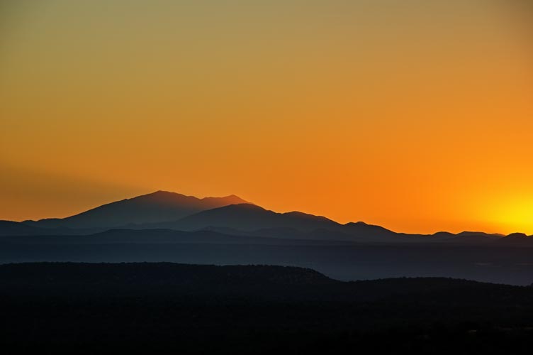
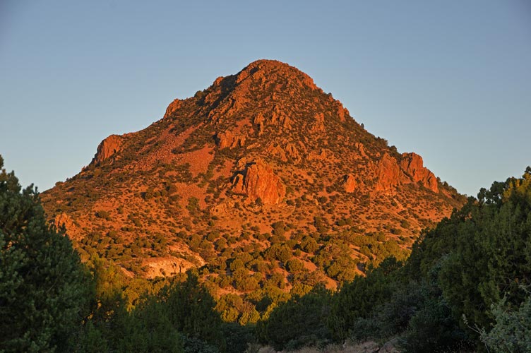
Oct 14, 2022 I got up quite early and quickly dressed and packed up before jogging on down and soon up the road towards Mount Floyd. Mount Floyd was a P1K that rose abruptly from the surrounding hills. There were a few other nearby peaks, but it was the highest and caught the morning light nicely. The sunrise turned the sky to the east a nice color and streamed past the San Francisco Peaks on the horizon. The road came pretty close to the peak, but the last short distance was quite steep and a little loose. I tried to keep to the bigger more solid rocks and I probably should have kept to the steeper but even more solid almost cliff sections. It seemed to go slowly but soon I was rounding the slope onto the summit area and heading over to the massive summit cairn. I climbed up this and then spent a bit of time looking for the summit register - according to a trip report it was buried in the side of the cairn on the NE side. Eventually I did find it hiding there about 3 or 4 feet up.
sunrise lit the sky and peaks to the east
 |
Mount Floyd in the early light - I went up the leftish side
 |
standing on the massive summit cairn
 |
The descent started out fast on the solid rocks but then felt slow as I carefully worked my way down the looser talus. In reality I think I was making good time and once I hit the road I was able to jog most of the way back to my truck. Then I had a long tedious dirt road to drive before a bunch more of the old route 66 before I was back on the highway.
talus slope on Mount Floyd
 |
Strava link for Mount Floyd. 10-14-2022
I drove straight to the Las Vegas airport and then picked up Iris and we headed out of town towards Mount Charleston. I had scoped out a little peak on the way, but Iris had a better plan - Macks Peak - a 10036 foot P1K near the end of a road that allowed dispersed camping. The road was a little bumpy and slow, but the truck could handle it. We were expecting a full on campground near the end, but were confusing it with another location. We turned around and parked and started up Macks Peak pretty late in the evening. Almost immediately we left the old closed off road heading up the drainage and followed a faint trail up a side gully and then up a steep loose slope. We gained elevation quickly which kept us warm as the sun and temperature dropped. The final ascent up to the summit was up a steep and sometimes very slick limestone ramp and in other places it was covered with loose scree. There was a hand line that was probably a polyester rope good for 2 or 300 pounds. The summit was pretty satisfying with a nice view, bristlecone pines, and golden sunset light. That also meant the sun was setting. After the sunset we headed back down - this time the loose scree was more fun and the slick limestone was more of a pain.
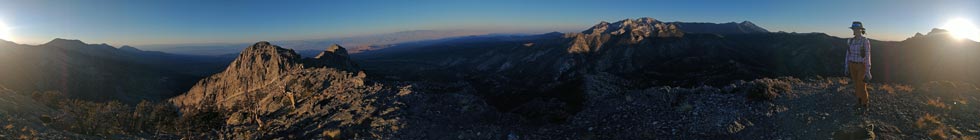
panorama from Macks Peak
 |
360 degree phone panorama from Macks Peak
 |
Iris hiking in the dark
 |
Once we were down the steepest part we continued on to a saddle where we turned on our headlamps before continuing down the way we came up with some detours to take advantage of loose scree for the descent that was no fun on the ascent. Back at the truck we leveled it and then cooked dinner. This was the coldest night of the trip so far and we were glad to have some shelter from the wind while cooking and even more in the back of the truck.
Strava link for Macks Peak. 10-14-2022
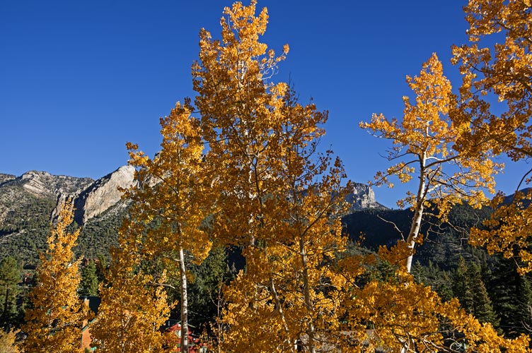
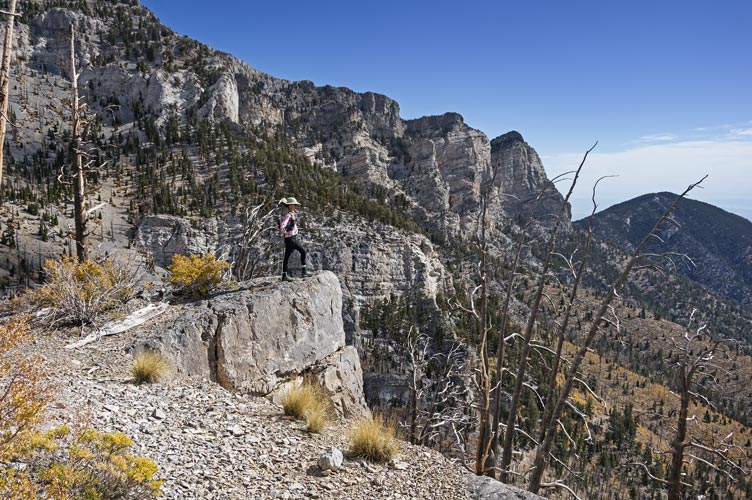
!0-15-2022 We got up early as we planned a long day. It started with a slow bumpy ride on the dirt road and then up and over a shoulder of the mountain past where we parked when we did the Mummy Traverse in November 2020. There were plenty of cars and people in the parking area when we got there. It took us a while to get everything together and actually depart. We planned a big loop going widdershins or counter-clockwise. We could have walked on the road for the first part but instead took a trail - this probably had a bit more up and down and might have been slower, but it wasn't on the road and the bright yellow aspens were pretty nice. It was before 8 am, on a Saturday, but someone felt the need to run a noisy wood chipper down below on the road (another advantage of the trail). Soon we passed the other trailhead and headed up the aptly named "Trail Canyon". We were not the only hikers, but it did not feel crowded at all. We hiked up through aspens in various stages of fall color through bare branches up and up until we detoured off the ridge to tag peak 10961'. Near it there was an old precipitation guage with a geocache and an explanation of how it worked.
aspens in the morning - we went up to the ridge far left I think
 |
Iris on an overlook - Mummy Mountains behind
 |
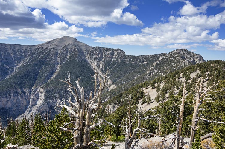
Mount Charleston in the distance
 |
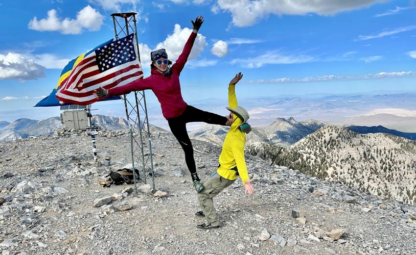
We continued along the path bypassing another bump with no prominence that looked like a pain to get to (steep cliff) and then scrambled up to Lee Peak at 11,289 feet. Then Iris skipped Rocketship Peak but I went up there - it had a big flat rocky summit with one little perfect 2 foot Christmas Tree growing on it. Then we met back up at the Devils Thumb - a 40 or so pinnacle of rock that we planned to ascend. Except it didn't look so very good between loose rock and steep sides. I went 2/3 of the way up a crack on the S side before deciding I didn't want to downclimb what was above me - potentially loose and steep rock. If I ever come back maybe I'll bring a rope, but otherwise it will remain unclimbed by us. The trail continued on traversing along some cliffs before making some big switchbacks up towards the summit. Here we were passed by a group of 15 or so backpackers, the most people we saw all day. Finally we made it to the 11,916 foot summit of Mount Charleston - a p5K (actually 8,000+ feet of prominence) that was clearly the highest thing in the area. We posed for some pics on the remains of a summit tower and doing some acro before heading down.
about as far as I was willing to go on the Devils Thumb (Iris Pic)
 |
posing on the summit of Charleston (Iris Pic)
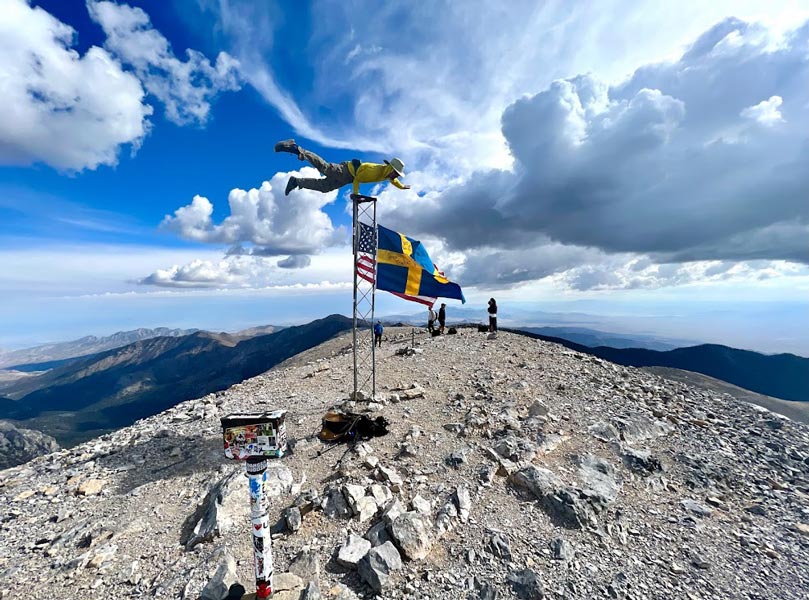 |
doing flag by the flags on Charleston (someone else took pic on Iris' phone)
 |
It was running a bit late so we didn't detour all the way to a plane crash site - although we did look at part of the wing that was closer to the trail. We were pretty annoyed at the trail going up and down as it traversed along the side of the ridge - we maybe should have just stayed on the ridge proper and picked up another little bump. Then we passed into a large burned area. This area burned in the 28,000 acre Carpenter Canyon fire in 2013 which was started by lightning. There were lots of charred tree skeletons, some in pretty contorted shapes. Fortunately by now it was somewhat cloudy and not too hot as there was not much shade. In fact there was a storm dumping rain down below us - that I was a little concerned about until I could see it was moving away from us.
When we got to where the trail dropped off the ridge we had another choice - head back or detour out to Griffith Peak. We opted for the latter adding a few miles and maybe 500 more feet of elevation gain onto our day and pretty much ensuring some hiking in the dark (which we were probably going to get anyway). The trail to 11,060 foot Griffish Peak was pretty straightforward. I even left my pack hanging on a tree to save some weight. The delay of pulling a few things out of my pack and hanging it up slowed me down enough that I barely caught up to Iris as she got to the summit. We didn't stay long and soon we were back at the trail down where we saw a group that had been in the parking lot when we left - they were backpacking, but it still seemed odd that they had taken all day just to get up here. They were planning on camping in the one little grove of trees remaining from the fire - insufficient wind block but the best they could do as they prepared for a cold night out. We headed down trying to make good time, but the trail was not always stable and Iris' leg was pretty tired after a long day. The trail seemed to switchback forever but in reality we were dropping elevation pretty fast. Sadly things got too dark for decent pictures as we dropped past the golden aspens and cliff bands. We were hiking a bit slower now and glad to have our trekking poles as we made our way past the last of the trail complete with all sorts of barriers and signs to keep people on the trail back to the parking lot. There we heated up some water (the water that had been on the dashboard was not very warm anymore) and then washed up in the restrooms with drains in the middle of the floor. Then we drove back past our Mummy Mountain trailhead and eventually found a flattish spot in a dispersed camping area. Dinner was chips and sardines.
Strava link for Charleston Loop. 10-15-2022
10-16-2022 we got up at a more relaxed pace and had a warm breakfast of oatmeal. Then we drove to Beatty where we got surprisingly not that cheap Nevada gas (but still cheaper than CA gas) and had a picnic lunch before heading past Lida and up some dirt roads towards the next peak. For a while they were recently graded and decent with just a few rocky bits to negotiate, but then the road got steep and loose and I backed up to park at a wide switchback. We walked the remaining miles up to Blue Dick Peak. The summit was not particularly sharp but it was a 9289 foot P2k so the views towards the horizon in all direction were quite nice. We cut a few of the road bends on the descent and soon were heading back to Bishop to stop at the Mountain Rambler for Erik's farewell get together as well as to talk to a bunch of other people we knew there.
I take pics on the summit of Blue Dick Peak (Iris Pic)
 |
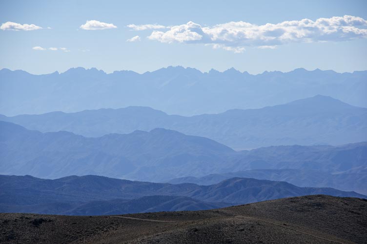
mountain horizons out to the Sierra Nevada (the Palisades)
 |
Strava link for Blue Dick. 10-16-2022
No material on this page may be copied or used without permission.