Tom Grundy's Picacho And Other Peaks Page
12-31-2020 to 1-3-2021 Sheep Hole Mountains High Point, Pk 3680 (aka Sheep Poop), West Maria Benchmark, False Maria, Big Maria Mountains High Point, Signal Peak, Castle Dome Peak, and Picacho Peak
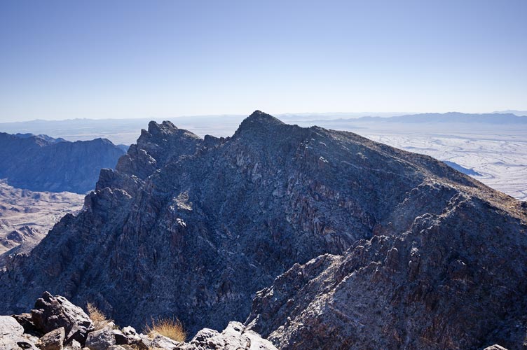
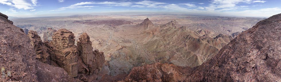
Sheep Hole Mountain High Point
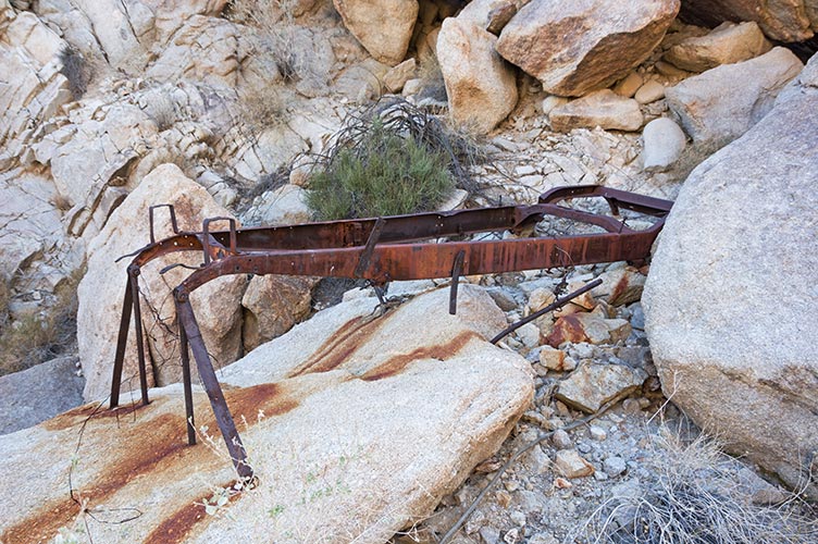
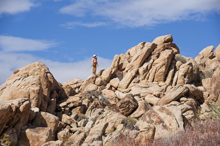
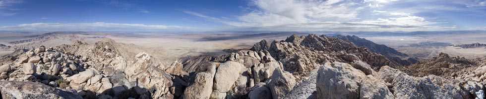
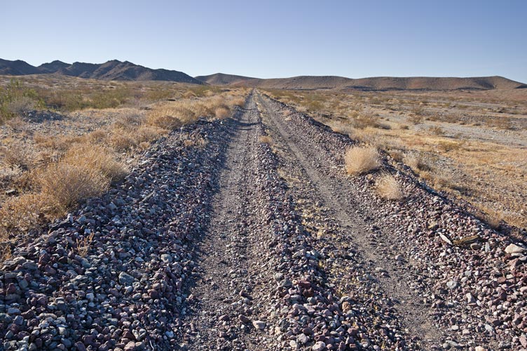
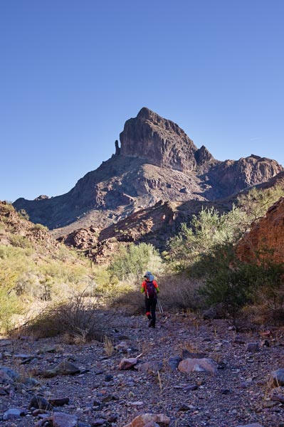
Over the long new year weekend we planned to do one peak way down south, so figured we might as well do a bunch down there. We started the night before driving to the radio tower below Sheep Hole Mountain High Point and sleeping there. The next morning we got up earlyish and headed up. We passed some mining activity and what looked like a truck frame bolted to the rock (presumably the engine provided some power for something) and then continued up the wash. Navigation was a combination of what looked interesting or easy, the electronic track we were following, and cairns. The time to get to the summit was pretty variable, but it turned out our scrambling and talus skills made short work of the large boulders near the summit. We enjoyed the views, cookies, and sandwiches and headed back down.
truck frame bolted down at a mine site
 |
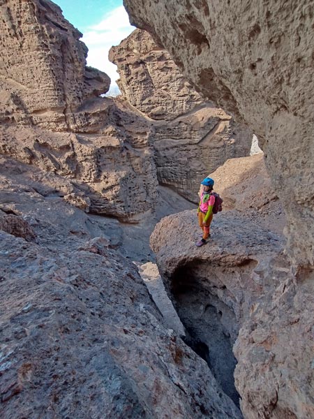
Iris scrambling up the canyon
 |
Iris on a ridge
 |
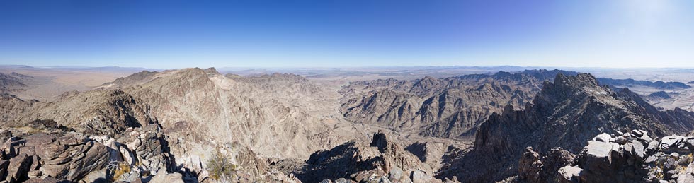
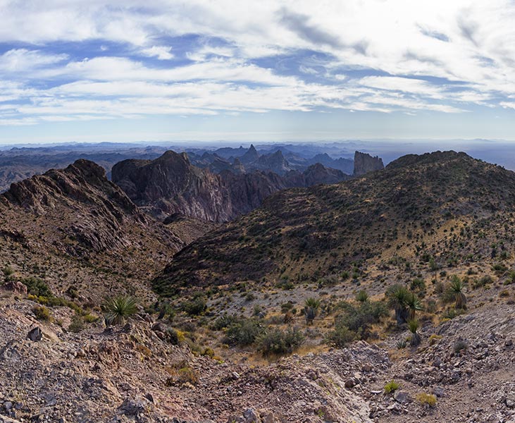
360 degree Sheephole Mountains High Point Summit Panorama
 |
Iris' Strava page for Sheep Hole Mountain's High Point
Days are short this time of the year, but we still had a lot of time. Fortunately the aerial photo of the area was cached in my phone and we were able to use that to navigate to fairly close to another peak. There was a bit of a maze of ORV and dirt roads, but we got to the end of one near an awesome campsite and headed off across the desert. This was a shorter peak and we mostly just followed the ridge up to the top. We were pleasantly surprised to find a register here, although we put the notebook inside the rusty cans we had brought for the purpose to augment the deteriorating plastic container. then we headed down a gully back to the truck. On the way we were treated to a nice sunset, even if our view to the southwest was obscured by the peak. It was fully dark by the time we were driving out and I mis-judged the depth of a little water course and got my truck stuck (the trailer hitch hung up on bedrock leaving the back tires without any weight on them in the little dip. sigh. Out came the rock hammer and the jack. We were able to jack up the back wheel and pile rocks under it as well as dig out a trough for the hitch to move in. Then I backed out a bit and took a different track and angle across the wash (as I had done on the way in). Back on our way we headed to the base of another peak - this involved a long sandy dirt road and a little bit of a drive on an old railroad grade - minus the ties and tracks. The grade wasn't bad - but it was hard to find a place to get off it. We celebrated the end of the year by going to bed later than we wanted to, but well before midnight.
looking towards the Sheephole Mountain High Point from the side of peak 3680
 |
sunset on the way down from the peak
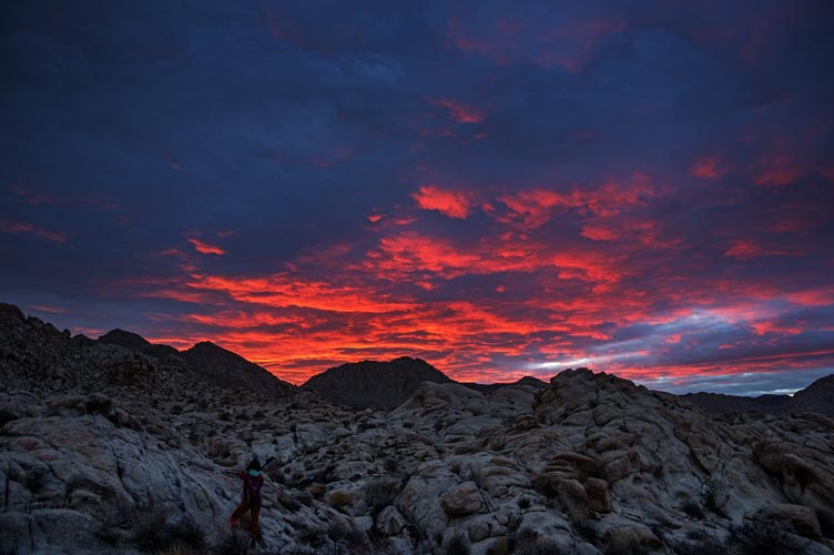 |
Iris' Strava page for Sheep Poop Mountain
West Maria
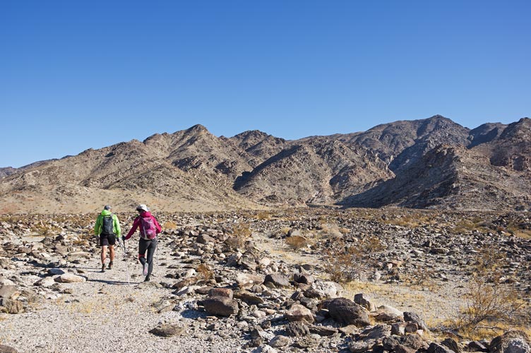
1-1-2021 We planned to hike a peak early in the morning before meeting up with Tom at 9:30. This meant we were up early early and on our way just after it got light enough to not need headlamps. There was a short walk across the desert before starting up a canyon. One advantage of being in the canyon was it blocked most of the cold north wind. As we neared the top we cut right onto the ridge - and into the wind. It was cold. Iris forged ahead while I went completely over the ridge into a little shelter and put on some more layers. On top it was cold and windy - and we were a little behind schedule, so we ate our cookies and posted a pic and headed down. We went back into the canyon a little earlier in the hopes of wind shelter and back to the truck. From there we went to our meeting location with Tom arriving with only a few minutes to spare. Fortunately most of the road to the meeting area was in a lot better shape than the road we had driven in the previous night.
morning view as we started up West Maria
 |
canyon sunrise on West Maria
 |
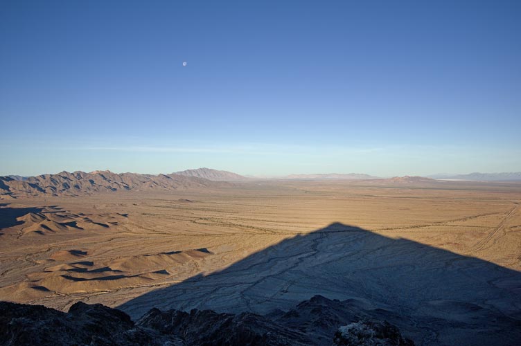
the shadow of West Maria
 |
the railroad grade "road"
 |
Iris' Strava page for West Maria BM
Big Maria - or Maria Mtns High Point
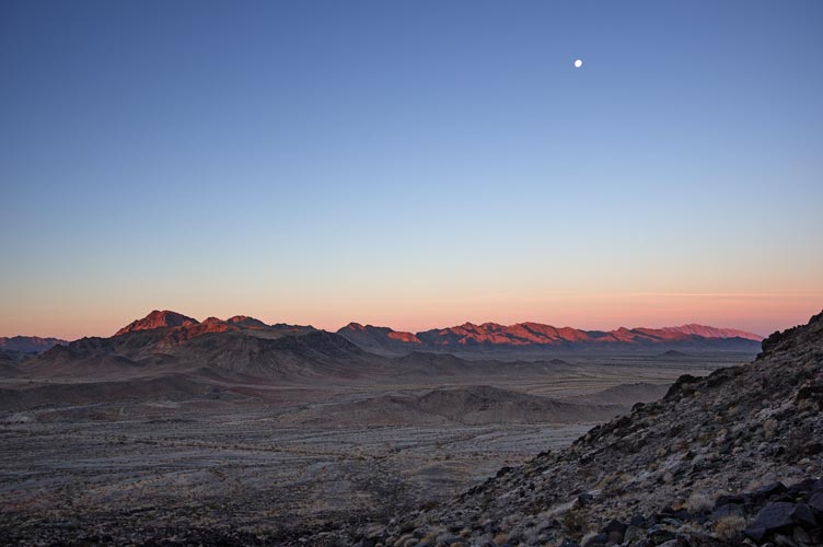
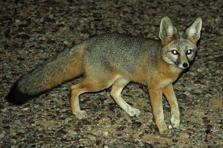
We loaded into the Jeep and up to the start for the next hike - Big Maria. First we went up a wash into a canyon and then up a steep slope. Once we hit the ridge we turned right to False Maria - which is a foot or 2 lower than the high point. From there we reversed course past where we hit the ridge and on up to the Big Maria Mountains High Point at 3381 ft of elevation - lower than my back yard, but we started down near 1200 feet. The descent was not that fast because of somewhat loose rocks that were big enough that you didn't want them to slide. Once we got down into the canyon we made better time. After we got back to the truck we drove up the road to a place where we could shower, then joined Tom at a nice flat area a little closer to where we would head the next day. That night there was a little fox that was circling around in the hope of a handout (I think). I tried for a while to get a decent picture. We were also treated to a nice moonrise over the distant mountains.
heading across the desert towards Maria Mountains
 |
scrambling up the gully
 |
panorama from False Maria (highpoint is middle left)
 |
view towards West Maria (center just below horizon) from False Maria
 |
view towards False Maria from Maria Mountains high point
 |
kit fox near camp
 |
Iris' Strava page for Big Maria Mountain
Signal Mountain
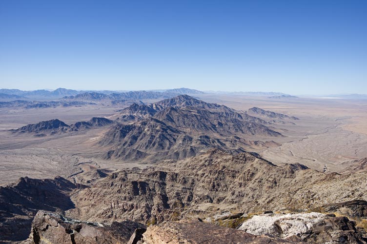
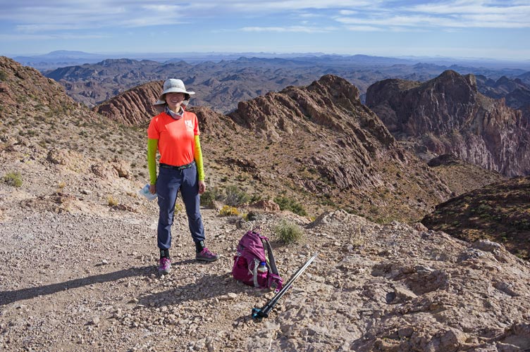
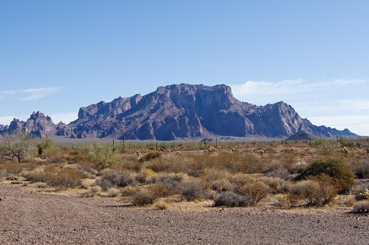
1-2-2021 We had a big day planned so we got up early and on our way before light. We headed across the Colorado River into Arizona and then got much cheaper gas before heading past Quartzite and many many RV campers to the start of another rough road. There we loaded into the Jeep for a pretty rough road to the next trailhead in the Kofa National Wildlife refuge. Kofa comes from the "King of Arizona" mine and the refuge was created to protect the endangered bighorn sheep - which have since recovered. Signal Peak turned out to have a trail, this was a pleasant surprise. Even a pretty bad trail is a lot easier to follow and faster than bushwhacking and cross country travel. We enjoyed the Sonoran desert scenery with saguaro and steep sided peaks made of volcanic rocks. I pushed the pace and we made it up to the summit in 1:10. The views were most excellent, especially the toothy peaks to the SE. If we had more time we would have climbed Ten Ewe peak too, but we were on a tight schedule. On the way down we passed 2 fairly large groups coming up, fortunately we were able to move off the trail to let them by. Back at the Jeep we bounced back down the road to the truck and headed south.
Iris on Signal Peak
 |
360 degree Panorama from Signal Peak - center is westish
 |
cropped from above view to the SE
 |
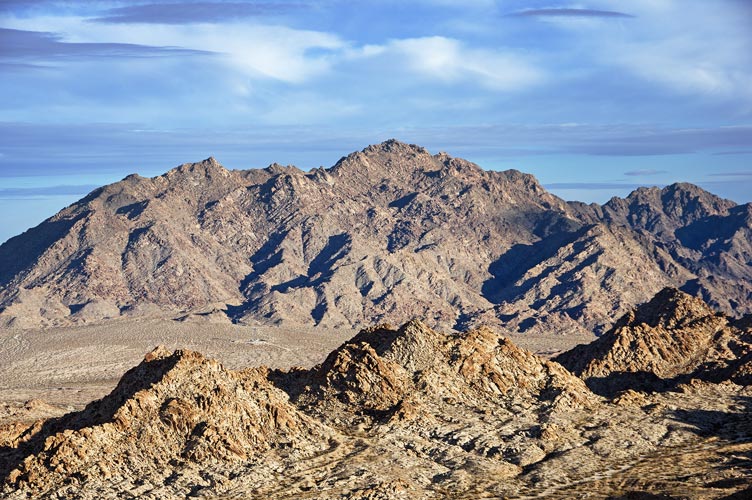
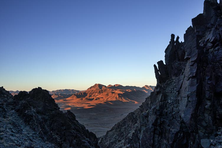
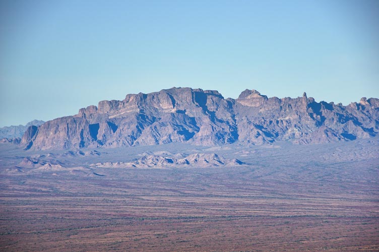
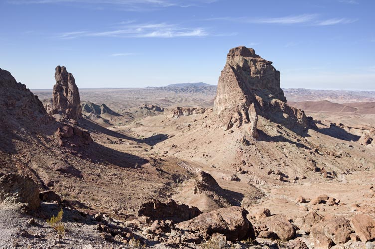
distant view of Signal Peak
 |
even more distant view of Signal Peak - from Castle Dome Peak
 |
Iris' Strava page for Signal Peak
Castle Dome Peak
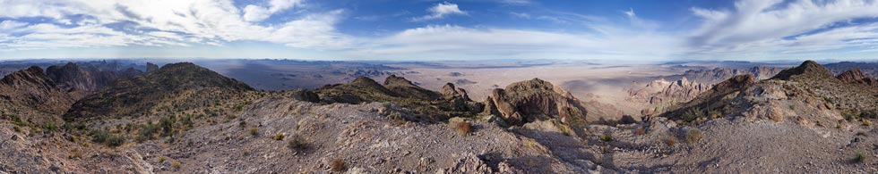
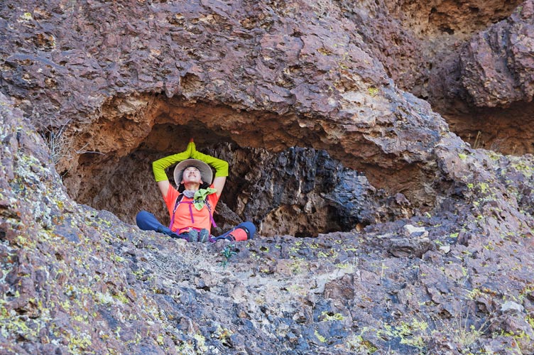
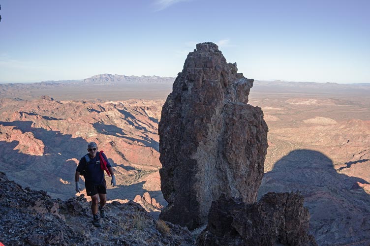
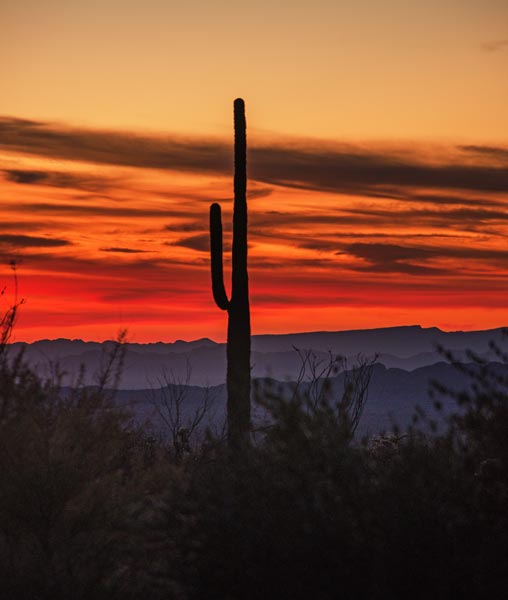
Castle Dome Peak looks quite impressive from a distance - a large vertical sided bump on the horizon. The first road we attempted to take towards Castle Dome Peak was blocked by no trespassing signs - I think it was part of the government dirigible program to catch infiltration from the south - probably mostly looking for drug running. The place we were going to leave the truck had lots of no parking signs and no photo signs etc - more government stuff - I think this was a weapons testing area. We found another place and headed on up the Castle Dome Mine Road. Once again we were thwarted, this time by the road being closed due to private property at the Mine Museum. We found got info online and from someone at the museum - turn north a mile or so back on the road. The coordinates were correct (about 33.02974, -114.20243 , it is the only track heading north off the road near this location) - and we followed the new track across the desert. This track didn't show up on the aerial images, so it must have been new. I wonder how well this "road" will handle some bad weather - it was quite dusty and crossed a number of washes before passing another closed off road back the way we wanted to go and finally rejoined the road we had been on past the private property. It was definitely the most rugged part of the approach drive and I fear it will get worse as weather and traffic impact it - no problem with a Jeep and I heard a Subaru made it, but I would have been hesitant in my truck. We made our way to the trailhead and set off up the wash. The first part of the hike is across the desert and in the sandy wash. Eventually we left the wash at a small side canyon and headed up towards the peak. Most of the elevation gain is at the end of this hike as we headed up the steep slope up towards the vertical cliffs. Fortunately there is a path that winds around the vertical cliffs. Shortly after passing the first cliff something went pop in Tom's foot - or maybe his ankle. He was unable to put weight on his toes without pain. He decided with trekking poles and careful foot placements he could still continue on up. We slowly made our way up to the base of the cliff and then moved around clockwise (as looking from above) to where a spire split off from the main peak. We went up to the notch with the spire and realized it was quite a cliff on the other side. Then we saw the route cut back right up a steep slope with a few holds and then followed an improbable series of ramps and ledges up to the summit. It was remarkably easy going for how steep the face was. We abruptly popped out onto the summit ridge and realized we had actually been hearing voices as there was a couple up there planning to stay for the sunset. We signed the register and the usual cookies and photos before heading back down.
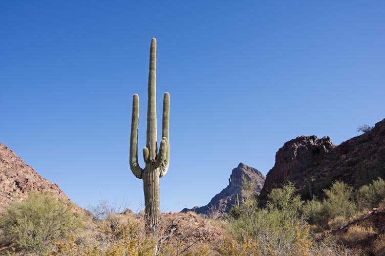
saguaro and Castle Dome Peak
 |
Iris hikes up the canyon towards Castle Dome Peak
 |
Iris as an iris in a rock eye
 |
Tom and the side spire of Castle Dome Peak
 |
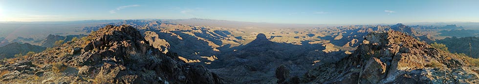
panorama from Castle Dome Peak summit, center is westish
 |
Downhill travel was easier for Tom and we didn't catch up to him (he got a head start on us) until the wash. By then it was getting pretty dark. I was slowed by trying to get sunset photos, but got back to the Jeep only a little bit behind the others. Iris drove the Jeep back and then we headed off to our next camping spot - back in CA. Google sent us on smaller and smaller farm roads until it had us bumping along the side of fields - that would have probably worked except the irrigation pumps and pipes blocked our path. We backtracked and made it to a decent road at the same Time as Tom coming from the other way - except he had already showered. We found a spot to camp, washed up, and had dinner.
Castle Dome Peak at sunset
 |
saguaro sunset
 |
my Strava page for Castle Dome Peak (Iris got zip-lined)
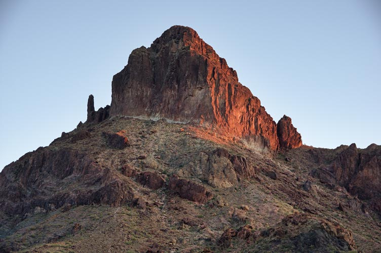
Picacho Peak
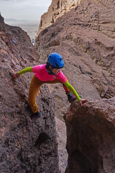
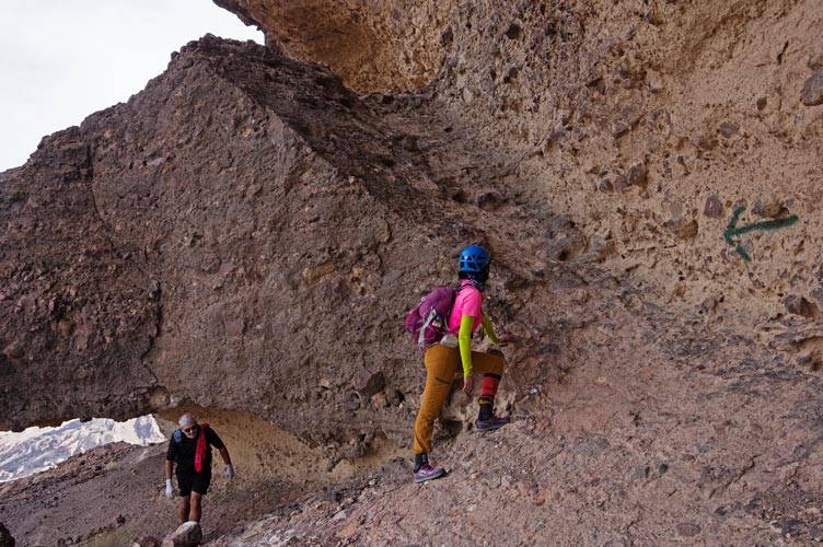
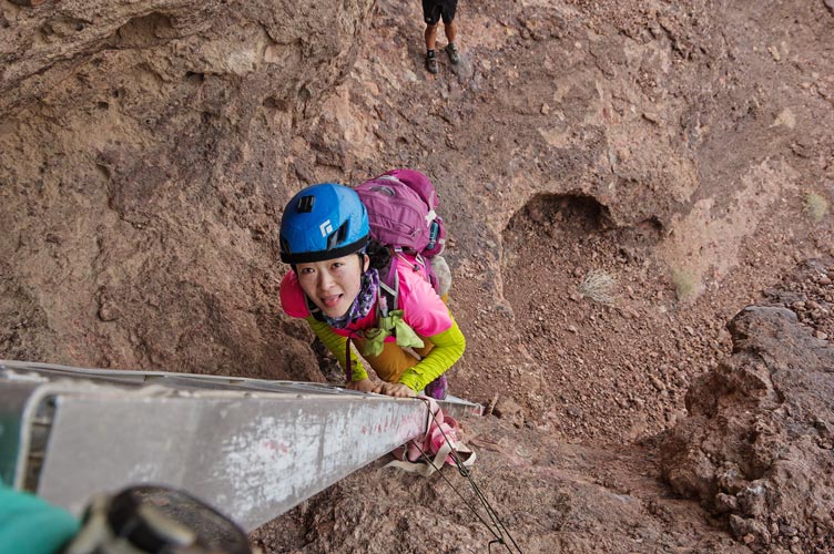
Our final peak for this trip was the most exciting - Picacho Peak - because it featured some scrambling plus 2 ladders and a rappel and climb. Iris had done this one before, but Tom was thwarted in his previous attempt (before he even got to try it), and I had never been here. We parked the truck and Jeeped in to the start where the wash was blocked by a small cliff - impassible to Jeeps, but not hikers. The approach is pretty short by desert hike standards, and at first we were almost glad to hike uphill to warm up. Soon we made it to the start of the scrambling. Tom left his poles here, but also started moving more slowly as he had to avoid weighting the toes of one foot. From the top of the first chute things got more interesting. This route follows an even more improbably series of ramps and ledges up to the summit ridge. Two short steep bits featured ladders that someone had brought up. The first would have been pretty easy but scary to get up by scrambling - at maybe hard 4th class, but the ladder was in the way. The second would have been on 5th class rock of dubious quality with serious consequences so we were pretty happy to have the aluminum ladder there. There was also a step across a pretty short gap (easily spanned with my legs, but once again some serious consequences). Iris was not very happy about this step across, but she made it.
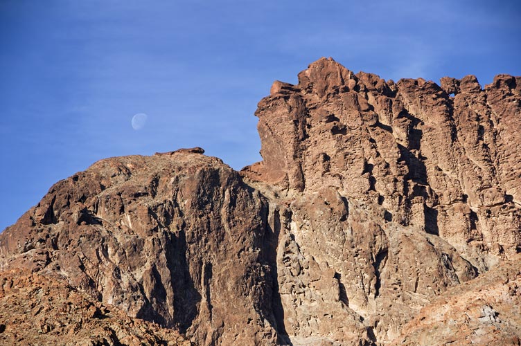
Picacho Peak top plus moon in the morning - the hole in the ridge is by the rappel
 |
Picacho Peak WSW face
 |
Iris making the step across
 |
ramps heading up the west side of Picacho Peak
 |
Iris on the second ladder
 |
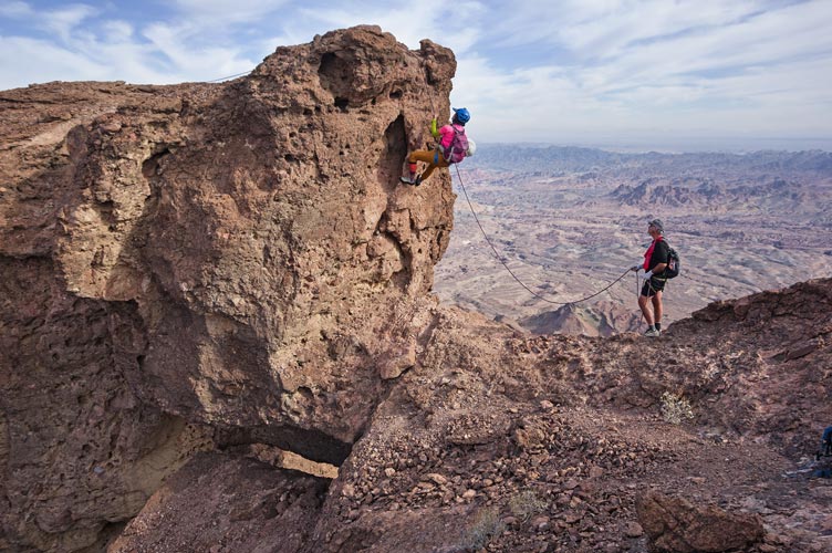
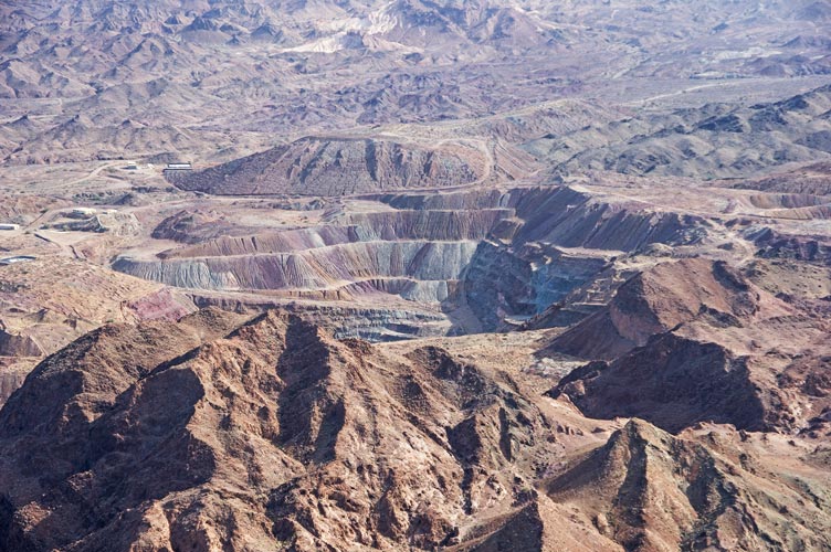
Once we were on the summit ridge, we made our way towards the summit. There was one scrambly bit up onto a huge block - maybe hard 4th class. I belayed Tom and Iris up this, and then set up the rappel. I had about 40 feet of rope as well as a 20 foot length of UHMWPE cord. This was enough to clip into the bolts on both sides of this bump on the ridge to set up the rappel (there was only one bolt on the summit side). From the bottom of the rap it was a short scramble up to the summit. The off road vehicles way off in the distance were remarkably loud. We also had a pretty good view of many other rock pinnacles, a gold mine, and the Colorado River.
Iris raps on Picacho Peak - note hole in ridge under block
 |
Picacho gold mine off to the SE
 |
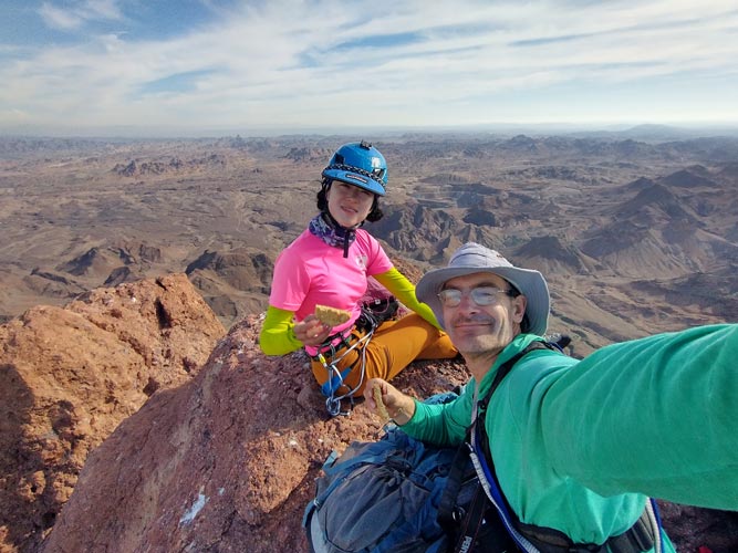
Tom and Iris on the summit
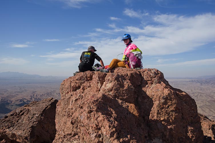 |
summit cookie selfie
 |
panorama from Picacho summit, center is NEish
 |
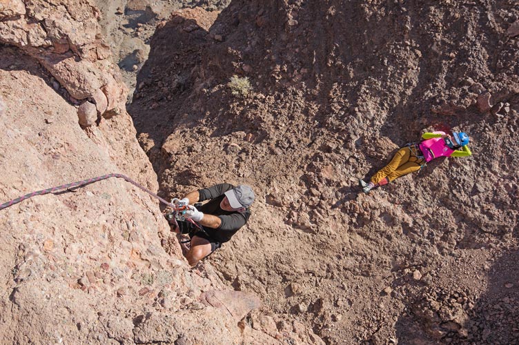
For the descent I self-belayed the fixed rope up the steep bit - maybe 5.8 climbing? - on somewhat dubious rock - I didn't break anything off, but the rock wasn't inspiring confidence. Tom used his ascenders to ascend, and Iris climbed with a top belay. Then we rapped down the other side. The only other hiccup on the descent was the step across which stalled Iris for a while before I set up a hip belay and she managed to sit down to get her feet across. Then we returned to the Jeep and headed back. We saw a few wild burros up on the canyon rim. Back at the truck it was still nice and sunny and warm which made the showering a lot more pleasant. The people that kept driving past were a bit annoying though. Then we had a long long drive west on I-8 through San Diego and then north to Orange County.
Tom ascends while Iris makes funny videos
 |
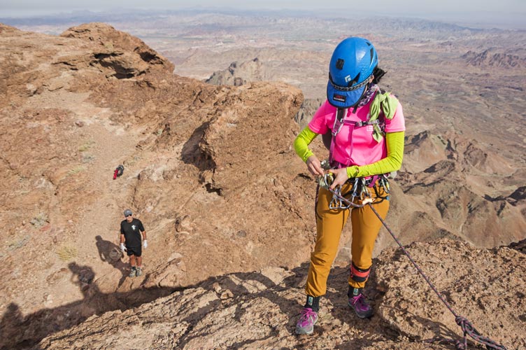
Iris prepares to rappel on Picacho Peak
 |
panorama looking N from Picacho Peak N end
 |
unhappy Iris contemplates the return step across
 |
unhappy Iris
 |
more peaks to the west
 |
Iris' Strava page for Picacho Peak
No material on this page may be copied or used without permission.