Tom Grundy's North Fork of Big Pine Creek Labor Day 2019 Page
Iris was part of a big group with a permit for the N Fork of Big Pine Creek over the Labor Day weekend, but they were to head in Saturday, and Iris had Friday off too. So we planned to head in Friday to provide another full day for climbing objectives. I tried to get a permit for Friday but failed (this area has become very popular), however I was able to get a permit heading in Thursday. Iris drove up after work on Thursday night and we planned and packed and eventually headed to the trailhead to hike in. By now it was Friday morning (2:44 or so). We hiked in a few miles and set up camp for a few hours of sleep. On the plus side it was cool hiking at night, on the minus side we couldn't see much outside the headlamp bubble and we were tired.
Later that day we woke up and headed on up the trail. We originally planned to drop the packs and scramble up Mt Winchell but we were running a bit slow and I was tired from lugging my huge pack with climbing gear even though Iris volunteered to take it some of the way (an advantage of being about the same height). The old Dana Designs Astralplane is a pretty comfortable pack - but nothing is really all that comfortable when it weighs over 50 pounds. So we headed up to 5th lake and set up camp just SW of the outlet, swam, rested, dinner, and to bed.
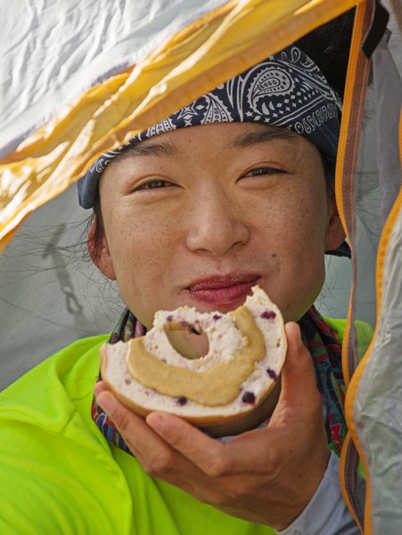
breakfast of bagel and peanut butter
 |
Second Lake with Buck Mountain on the left and Temple Crag in the middle
 |
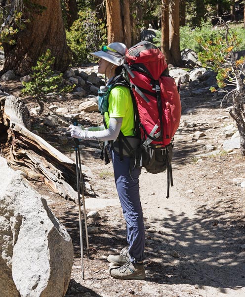
Iris and the big pack
 |
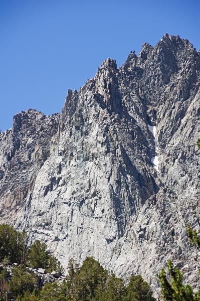
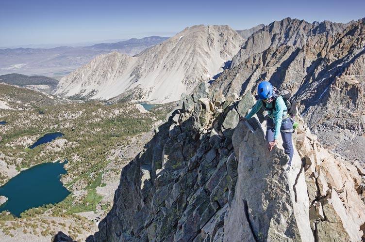
Two Eagle Peak "diamond"
 |
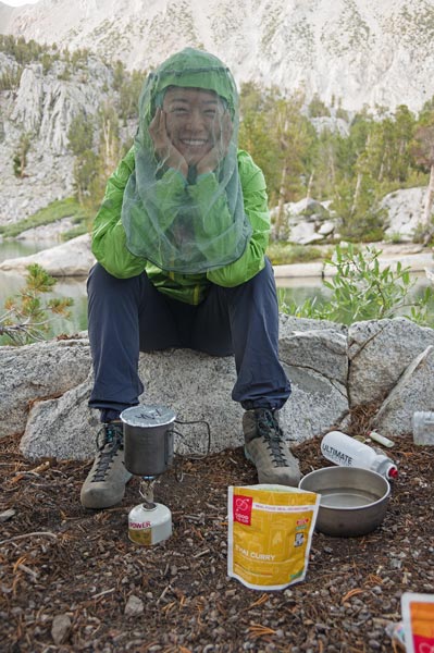
Iris cooks and avoids mosquitos
 |
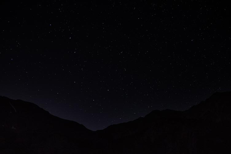
the dippers above the mountains
 |
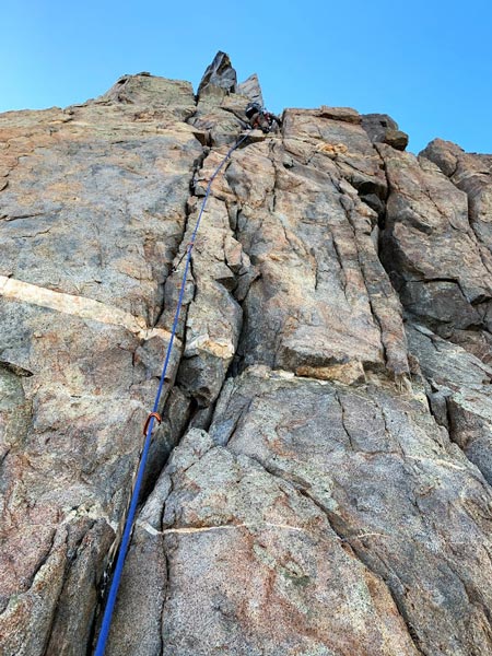
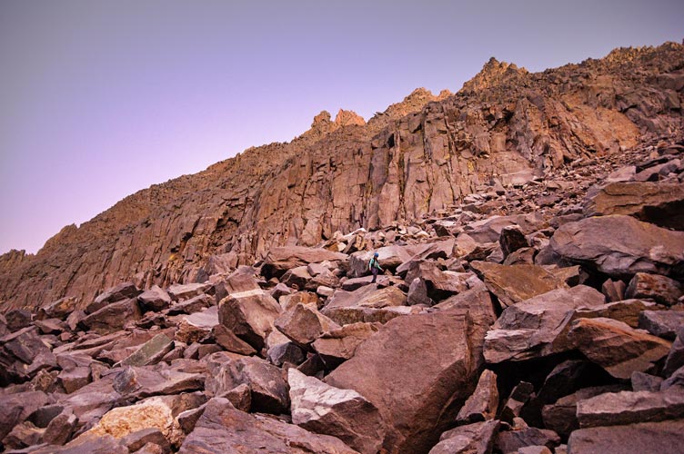
8-31 We got up around 6 and had a breakfast of cheesy grits and oatmeal and headed off to the day's objective, the Diamond on Two Eagle Peak. This is supposed to be a 10 or so pitch 5.6. We had some difficulties with the early approach with lots of up and down and brush to deal with but then got on track up the drainage and talus to the base. This route follows a vague ramp from left to right across the steep S face of the "diamond" and then the ridge up to the summit. There are plenty of other options for harder and more adventurous climbing available. It had some solid climbing interspersed with fairly easy scrambling or even just walking up the ledge/ramp. This made for some serious rope drag and I cut some pitches short because of it and sometimes we just grabbed the rope and walked along. Near the end of the ramp it looked like the easiest way dropped down a bit (30 feet or so) and then continued on up a ledge around the corner but we opted for a harder (5.9?) way straight up and right. This wasn't all that hard but there was some loose rock and I was wearing a pack plus the route finding wasn't always obvious although I did pass a fixed nut along the way - or maybe it was a bail piece. Iris managed to rip a hold in a crack off and fell on the steepest part. At the end of this pitch we were on the right hand ridge near the top of the "diamond" and we continued up to the top of it.
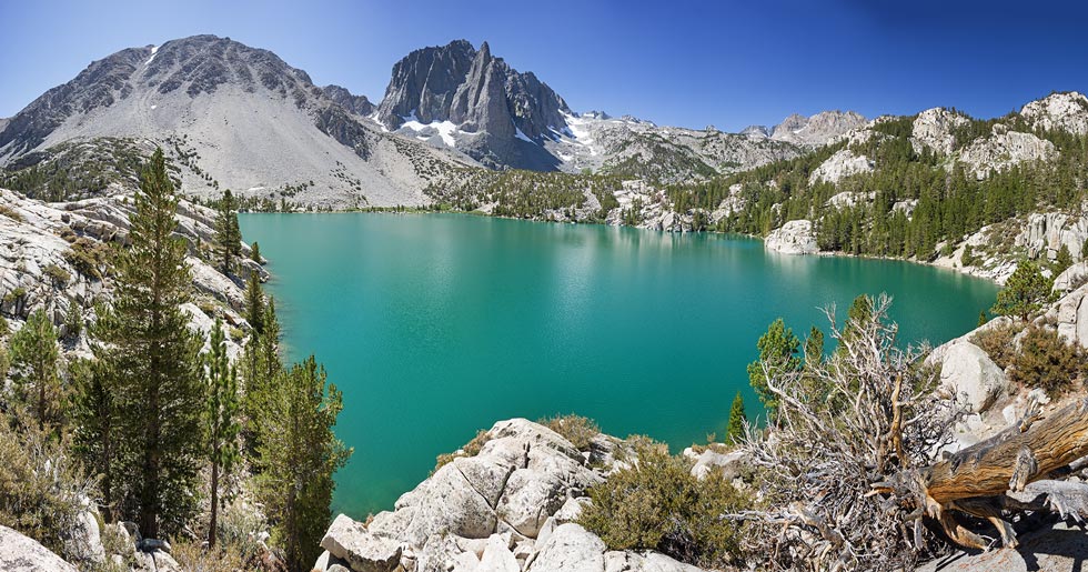
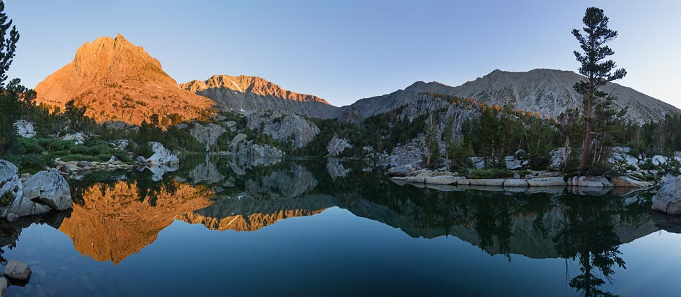
5th Lake morning panorama - 2 Eagle Peak on left, Cloudripper left of middle, and Sky Haven on right
 |
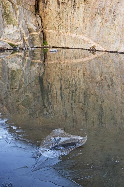
ice by a rock and reflection in the creek
 |
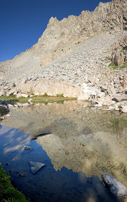
reflection of Two Eagle Peak
 |
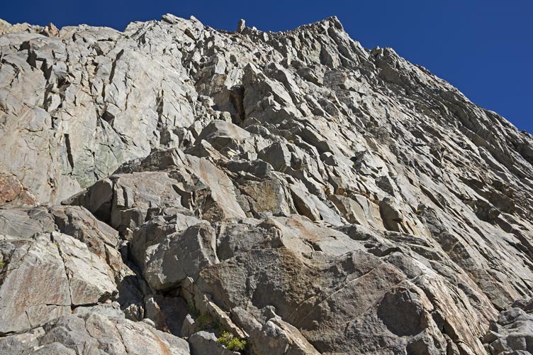
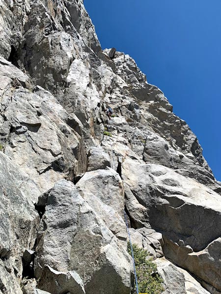
looking up at the ramp
 |
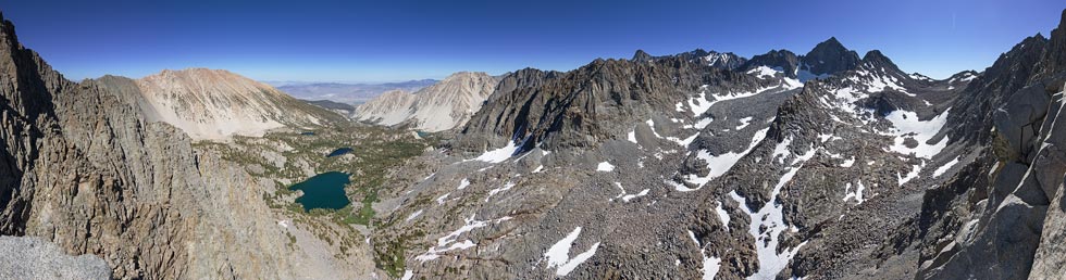
panorama partway up - 5th lake is the biggest one below, Sky Haven is on the left
Mt Sill pokes up behind Robinson just right right of center, Mt Agassiz is the biggest peak on the right, Aperture right of it
 |
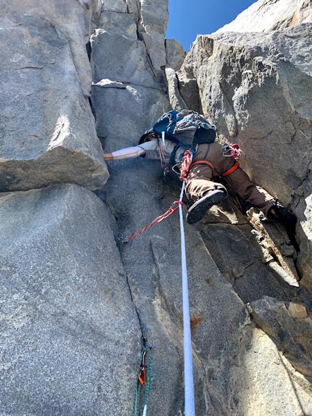
a lot of the steep steps in the ramp had chimneys (Iris pic)
 |
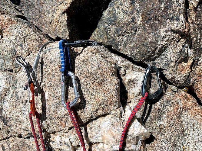
one of the anchors (Iris pic)
 |
I'm somewhere up that ramp in my camoflage outfit (Iris pic)
 |
more climbing (Iris pic)
 |
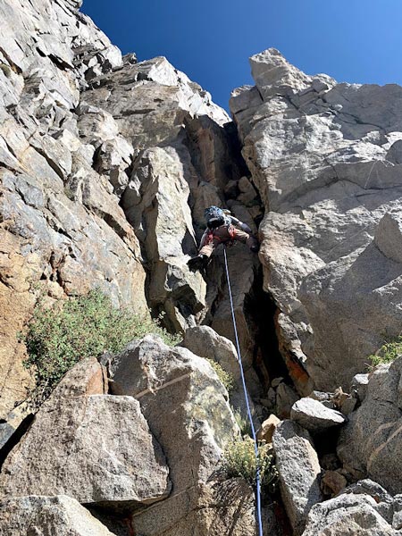
Iris climbs up into the sun
 |
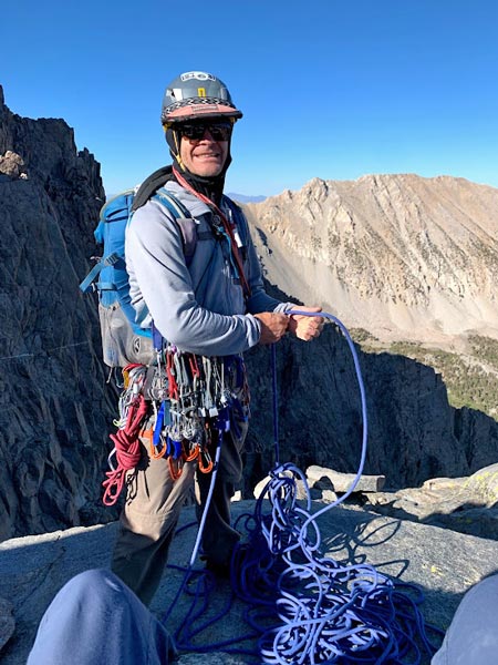
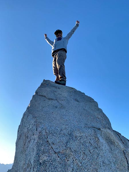
Here we stowed the rope and did some knife edge scrambling until we hit a tower. I didn't see any 5.6 way unless maybe dropping way down to the right, so out came the gear and I led a solid pitch up to the summit of this tower. We couldn't see what was beyond this so we pitched out a few more scrambly pitches (in hindsight we probably should have stowed the rope here) until it looked like more straightforward scrambling up the final headwall to the summit. We stowed the gear and scrambled on up arriving after 6 pm. The climb was definitely not over when we got to the top of the "diamond" formation. The summit block had a scrambly move (4th class?) and Iris elected not to do it. We enjoyed the views, summit cookies, and some food before starting down. We wanted to head down the E ridge, but in light of the time decided to take a route down to the North that we could see where to go and figured we would be on walking ground by the time it got fully dark. This was what happened and we continued following the drainage for a while and then cut up over a ridge to 6th lake. Sadly we had to gain quite a lot of altitude on the north side of 6th lake before we hit the trail. We followed this down as long as it was heading about where we wanted to go and then took a cutoff trail to the outlet of 5th lake and our camp. After dinner Iris took a cold dip in the lake to clean off, but I was not inspired. She claims it wasn't that cold (maybe because the air was so cold by then? or she is just a lot tougher than I am).
Iris scrambles along the ridge
 |
I head up the headwall after the diamond (Iris pic)
 |
I have too much gear - after the climbing (Iris pic)
 |
I stand on the summit block (Iris pic)
 |
Iris taking a summit cookie selfie
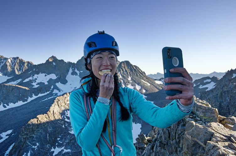 |
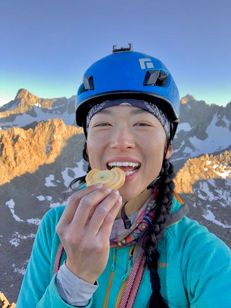
Iris summit cookie selfie (Iris pic)
 |
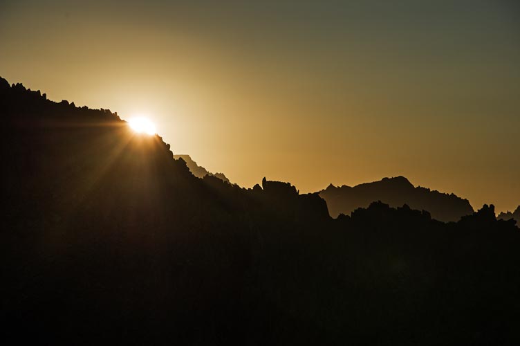
the sun sets behind Picture Puzzle Peak with Goode and Hurd? in the distance
 |
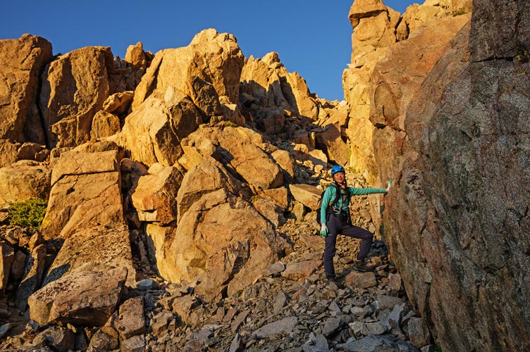
Iris says goodbye to the sun on the descent
 |
Iris into the talus below the cliffs on the descent
 |
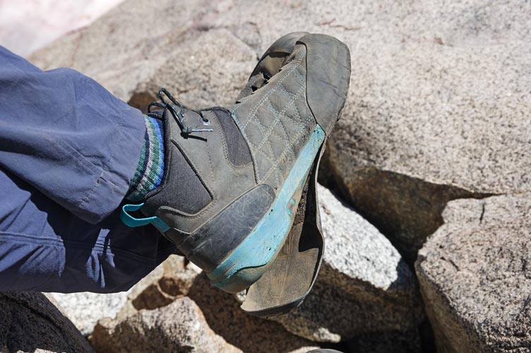
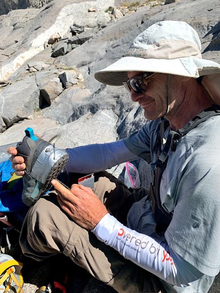
9-1 We didn't get a particularly early start because we were up late. We had a nice breakfast (more cheese grits and oatmeal) and then packed up and headed back down the trail. We set up camp near the junction of the trail to Sam Mack Meadow and then headed up that trail towards Mount Sill and the Swiss Arete. It wasn't an early start and we figured we might be hiking back down in the dark again. We stopped for some food on the slabs below the Palisade Glacier morraine and discovered that one of Iris' 5.10 approach shoes sole had delaminated from the middle to the heel and the other was loose in the middle. With some duct tape and safety pins we stuck the heel back on but it was not to be trusted for snow, scrambling, and especially side hill travel. We went the rest of the way up to the morraine to admire the glacier (much smaller than it must have been in historical time, but still impressive for the Sierra). Then back down to camp, a dip in the creek, and delicious Good 2 Go Indian and Thai food. That night there was a short sprinkle for which we were not prepared (gear was spread out all over). The sprinkle was over by the time we had packed up.
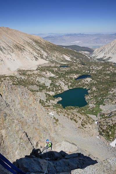
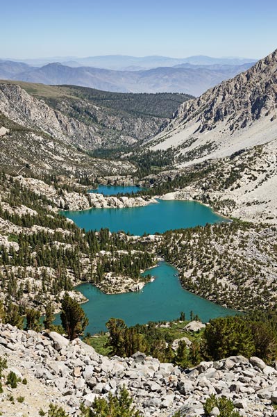
view down to First, Second, and Third Lakes
 |
delaminating five ten shoe
 |
I work on the shoe (Iris pic)
 |
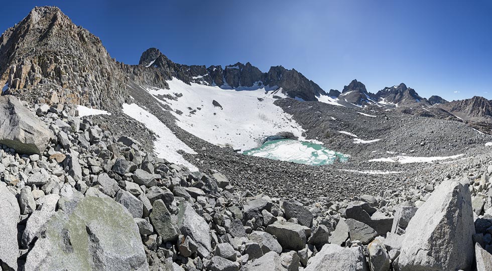
panorama of Palisade Glacier - Mt Gayley on left, then Mt Sill, Polomonium, N Pal,Thunderbolt, notch with tooth, Winchell, and Mt Agassiz
 |
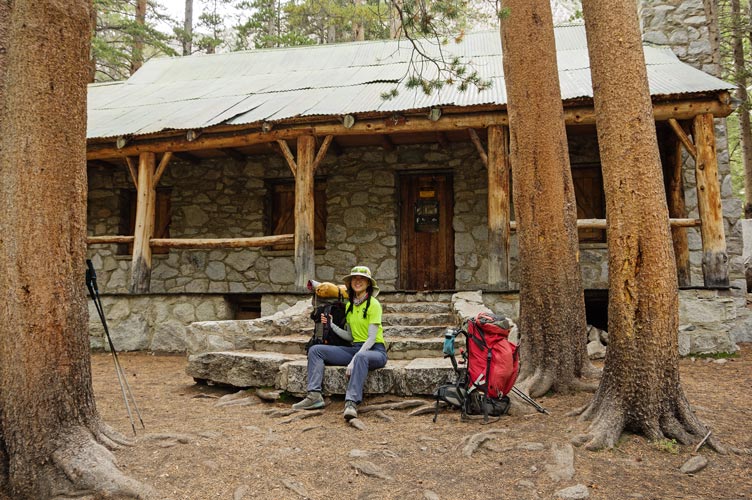
9-2 Because of the shoe worries we opted not to do anything this morning before hiking out. This turned out to be a wise move as it started sprinkling when we got to the Lon Chaney cabin and then after we left that it started raining in earnest. We put on raingear and continued down to the trailhead. Meanwhile Renee had started her 14ers push and was getting rained and hailed on up on the high Palisades (she was attempting a California 14ers FKT ). We even saw a few lightning bolts, but we were well down by then. We headed back to Bishop to spread things out to dry and pack for the next adventure.
taking a break at the cabin
 |
No material on this page may be copied or used without permission.