Iris was traveling all over the world but had a long weekend in the middle of it, so we decided to meet up with Bob and Tom B in Vegas. I headed out earlier and stayed later climbing a heap of obscure bumps in the area as well as a few more significant peaks.
2024-02-13 Packing took longer than expected combined with a few last minute things to do and phone calls. I didn't leave until dark - almost immediately getting pulled over for having a rear light out. Curiously the officer wouldn't let me out to look at it and the next day Bob said it was working (in fact I never saw it not working). As I was trying to get back into traffic the police car stayed on my tail essentially blinding me to anything behind, so I slowed down and he pulled out ahead of me and almost immediately pulled someone else over. I didn't get to our meeting spot until after midnight and just cleared out the back and went to sleep. I should have blown up the mattress a bit more, but it wasn't low enough to get me to actually expend the effort to inflate it more.
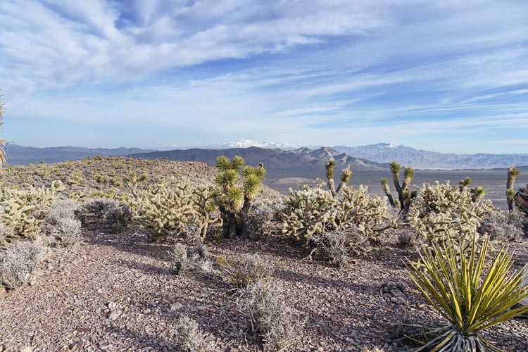
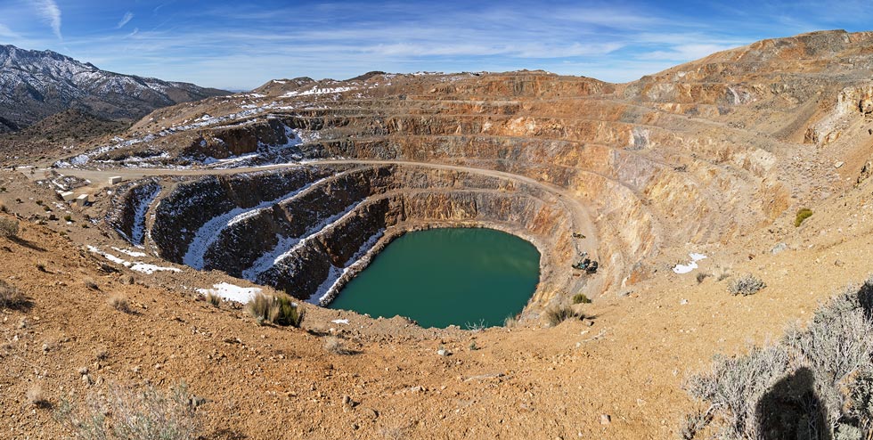
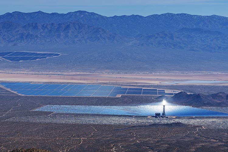
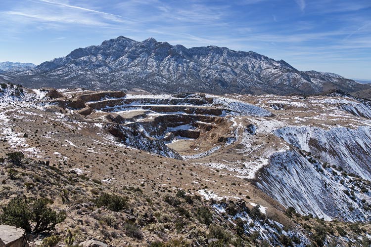
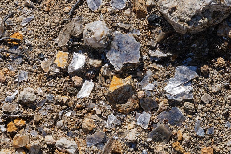
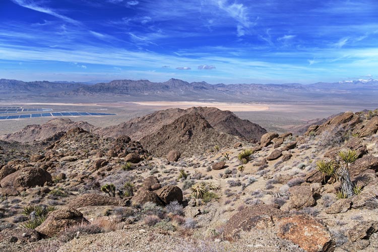
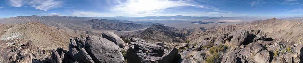
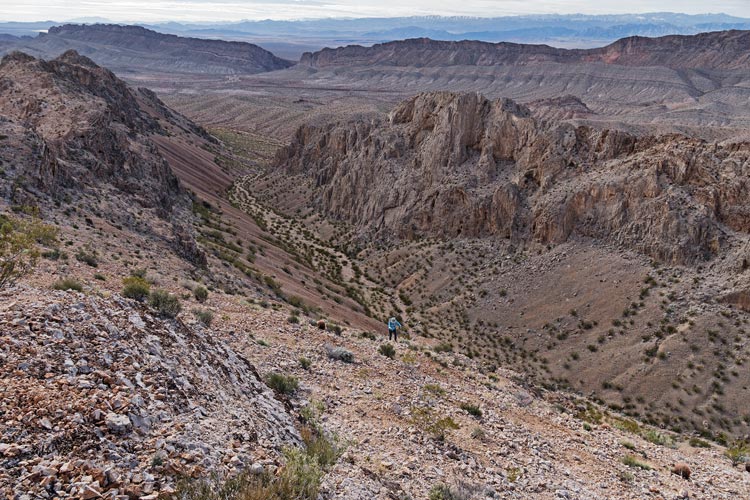
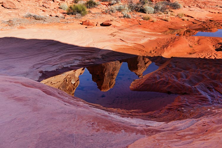
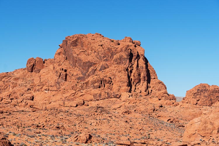
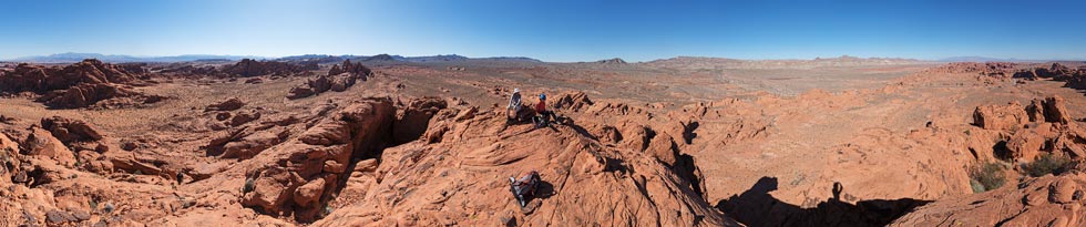
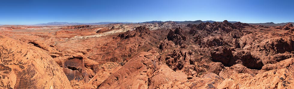
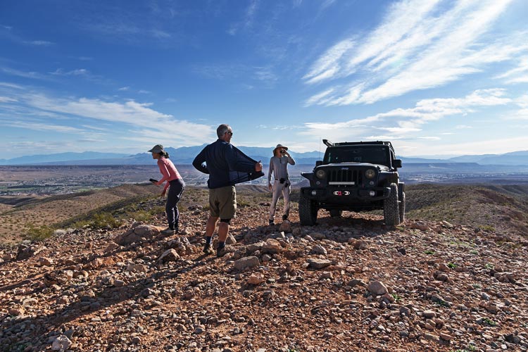
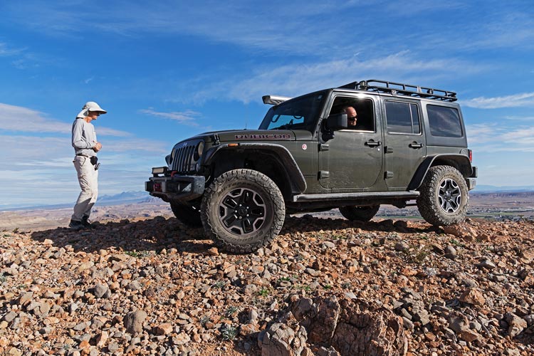
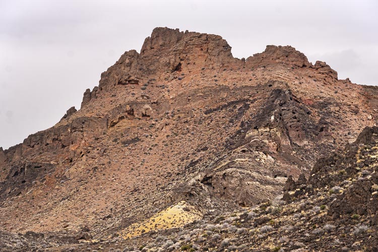
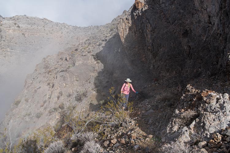
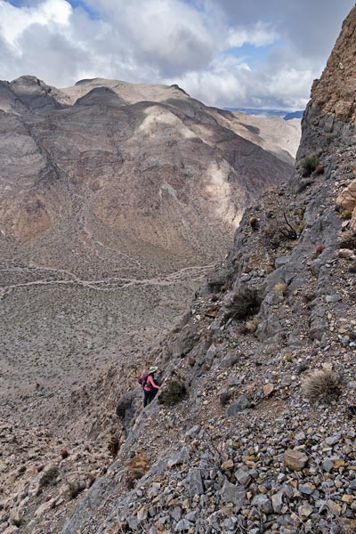
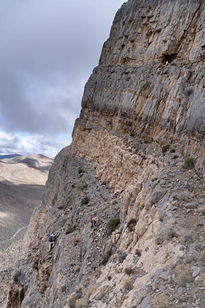
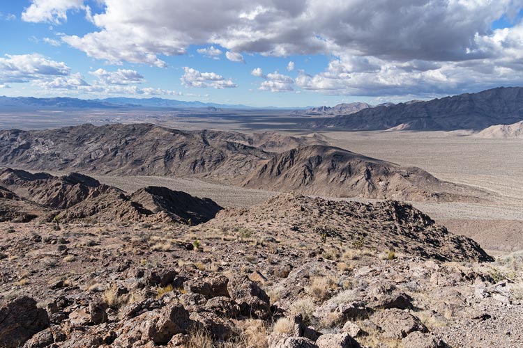
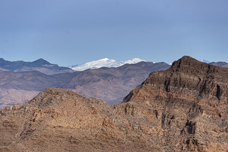
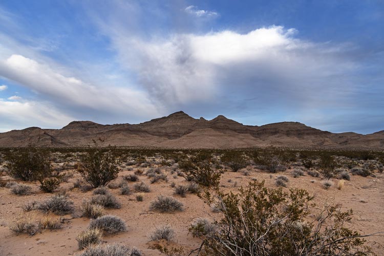
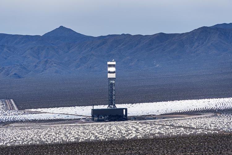
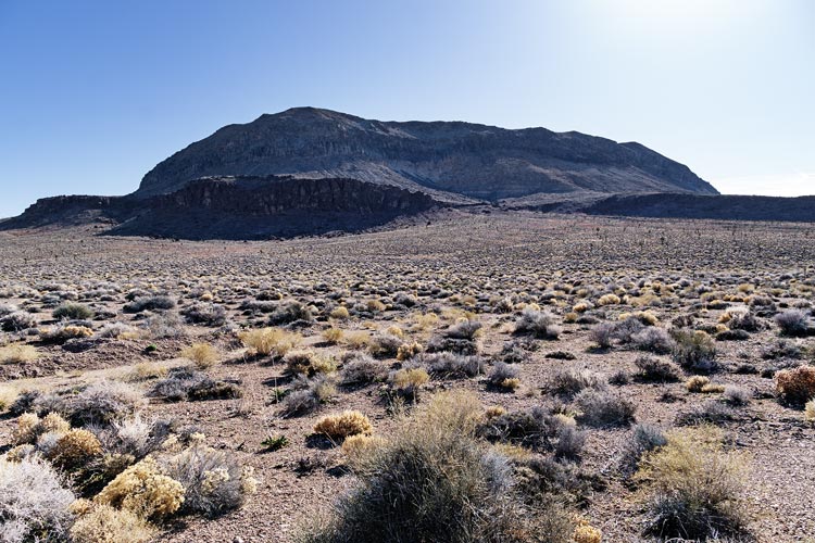
2024-02-14 I got up around 6 to be ready to go before 7. It was surprisingly humid and the sand was damp and there were even a few puddles. We headed off up the bumpy powerline road trying to decide if we wanted to take that the whole way over the pass or just pile into the Jeep and then return this way. After the first peak, a chilly start but we warmed up quickly up to peak 4858 AKA Spider Web Peak. We decided to leave my truck and Jeep it - a wise move as I don't think the truck would have made it the whole way. Next up was probably the easiest peak of the day - Bullock Hill - at 4984 ft, just a short uphill hike from the road. Then we continued up that road and made our way to the start of the hike to Colosseum Peak - near a pretty massive open pit mine that wasn't very active, but wasn't entirely abandoned either. There was a small lake at the bottom of the pit. We skirted the fence up the hill and past a second smaller peak and up to the 6141 foot summit. There was a bit of snow up here, but it didn't really get in the way - not as much as the prickly flora did. The views from this summit were pretty good with a snowy Mt Clark to the south, the sea of mirrors and towers of the Ivanpah concentrated solar plant to the SE, as well as numerous peaks off in the distance.
| |
|---|
 |
|---|
 |
|---|
 |
|---|
 |
|---|
A bit of internet searching revealed that this mining area was mostly for gold and silver that might have produced over 340,000 ounces of gold, first as tunnels in the mid 1800s up to WWII (closed because it wasn't strategic), then as an open pit starting in 1986 up to 92. In 2023 there was new funding to investigate reopening it both for gold and for rare earth elements - estimated to have some 800,000 oz of gold - or at least that is what they told potential investors.
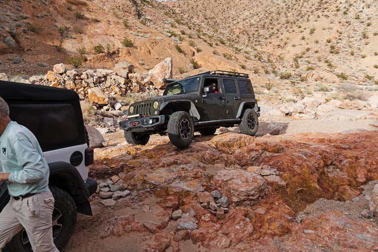
After Colosseum we returned to the powerline road and continued east to where we parked for peak 5095 - a peak with no listed ascents on list of John - there was an open mine shaft on the way and prickly grippy limestone on the summit. Then Bob returned to the Jeep while I cut across to ascend Keany Benchmark and the adjacent wilderness high point that he had already climbed. Then I dropped down to Keany Pass and we returned to my truck. There we drove back to I-15 and NE to the Nipton Exit where I left my truck and we took increasingly vague dirt roads or washes up towards Peak 4442. This involved a lot of ascending traversing on not so solid rock. We got up just about sunset. The descent went a little better following a drainage and or ridges down and back to the Jeep - just in time to not need headlamps. That night we slept a little behind Whiskey Pete's near Primm.
 |
|---|
2024-02-15 Today we headed across the highway and out east past the solar plants and then up Beer Bottle Pass. This had been fairly recently graded, so it wasn't too bad. It looked like it was part of an upcoming off-road race, the SNORE 250 (Southern Nevada Off Road Enthusiasts). Fortunately the race didn't start until after we were gone. We turned right at the top of the pass where it opened out onto a broad tilted plain. The original plan was to climb 4 peaks in a big loop but it looked like it might make more sense to do them as single hikes each and then that would allow me to continue on from one to get a higher peak that Bob had already done. So we drove on a 4wd track until there was a fence close to the peak. The Jeep did a good job on what might have just been a motorcycle trail. Peak 1486 or 4875 ft (depending on if you prefer meters or feet) was a pretty straightforward up and down. Then we drove on up a road towards some radio towers and stopped to head up 1583 - or 5194 ft. We went up the ridge which had a few blocky sections to dodge around and some little basalt columns at the top. We took a more direct and better route down. Then we parked at the radio towers a few hundred feet higher than the next peak which was down a long ridge. We headed off down the ridge complete with some downscrambling on steep slabs and boulders and more side-hilling than we really wanted. Eventually we passed the saddle and made our way back up to Peak 1317 or 4321. Then we reversed our course back up to the radio tower.
 |
|---|
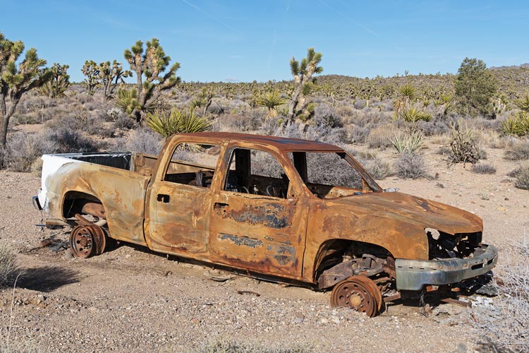
On the satellite image it looked like there was a roadway getting closer to the next peak, but it was just a motorcycle singletrack so we returned to park at the antenna towers and walked the track for a bit before heading up the steep slope. I was going to go on to another peak after this so I tried to get ahead - and did get to the peak before Bob, but was still there when he arrived. This was a bit of a pain because there were patches of snow in the shade and the wet rock was slippery. This peak was Calada Peak - at 5640 ft. Presumably named as the opposite of Adalac peak on the southern end of the ridge - and my next peak. But first I had to drop a lot of elevation on steep rocks, and then back up, and down and up and so on. The ridge didn't look nearly as sawtoothy as it felt. It took over an hour to get to Adalac Benchmark - a p1k at 5715 feet. Iris, Bob, and others had climbed this back in 2019. Once I got over the false summit on the descent I could see the Jeep far below. I tried to make good time, but it was not always easy terrain. Just before the Jeep I came across a burned out truck - the fire was hot enough to melt a lot of aluminum.
 |
|---|
 |
|---|
 |
|---|
Our last peak of the day was Beer Bottle Peak - rising above the pass of the same name. This was a short but steep ascent from the nearest powerline tower. We returned to Primm where we rinsed off in a rather abandoned old parking lot and then I headed to the airport and Bob headed into town. I picked up Iris and we joined Bob and Tom B at a Mexican restaurant. Sadly for Iris they did not serve Menudo every night, but they did keep filling up our chip and dips so we were plenty full of that. After dinner we filled up with cheap(er) Nevada gas and headed NE of town near the N Muddy Mountains to camp for the night.
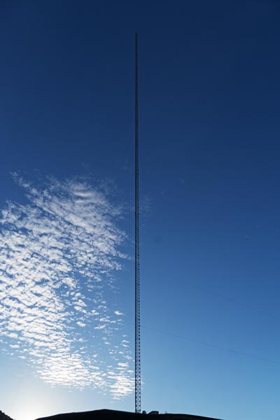
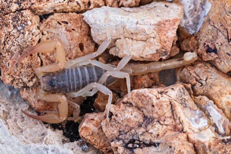
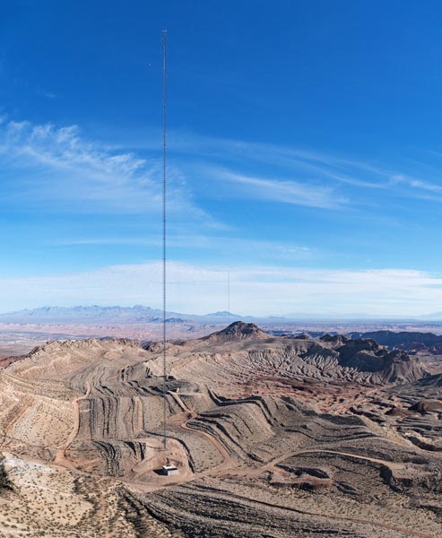
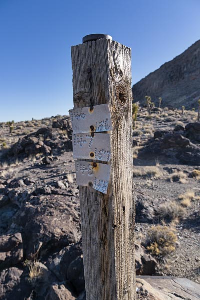
2024-02-16 We piled into Bob's Jeep and headed up towards the first peak. The closest road went to a large antenna tower and we parked just outside the gate up to the final hill. As we got out we all looked up and up and up to the top of the tower - it was a tall one, not on the highest point, but much higher than all the surrounding peaks. We joked that we should climb that, but as it would require trespassing, a lot of effort, and possible excessive RF exposure we passed. I bet the views from the top are pretty good though. It turns out this is the Entravision Tower supporting a TV transmitter and maybe the second highest structure in Nevada at 430 M (or maybe it is 426.7 M). In any case it was quite tall and visible from nearly every peak we climbed in the region - and the top was higher as Tom B pointed out regularly. We headed up the limestone ridge to our first peak - except we went up a false side summit and had to traverse over to the actual high point - oops. The grippy limestone was easy to walk up, but frighteningly sharp - like a cheese grater - and hard on footwear. We stopped on the summit of Glen Benchmark at 2982 ft to sign the summit register. I noticed a small scorpion (about 1.5 inch long) in the bottom of the jar - still alive. I don't know if it had been in there since the previous visitors in 2023 or had crawled in while the jar was open. In any case we liberated it before returning the register and descending.
 |
|---|
 |
|---|
Next up was California Ridge. We drove to another gate before another high tower (the Moapa Kemp Tower - at 401 meters, another TV tower). Then headed over to scramble up and follow a ridge past some bumps to maybe the high point - or maybe we needed to head farther down the ridge to another point or 2 that might have been the high point. In any case, we went up something labeled 3139 and it looked about as high as the other points, but maybe it wasn't. So, there might be one or more point left without our visit up there. The cliff on the east side was quite cliffy.
 |
|---|
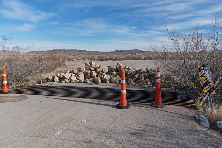
We headed back to the highway for a short jaunt north before more dirt roads through the desert first to Glendale Point and then on some worse roads around and nearly to the top of Peak 620 (2034 ft). There we headed down east to a paved road and across the highway and on some more bad roads up towards another peak with antenna on it. The road went all the way up, but there was a gate, so we walked the last bit up to Peak 2335. There was a giant concrete arrow on the ground below this peak - marking the direction for the airmail planes back in the 20s. We thought we were on the wrong side of a gate to get back on the highway, so we followed dirt roads north and NE and stopped to hike across the desert and then up a gully to Peak 910 at 2986 ft. Then back to the Jeep and on to the NE before cutting SE on the road to Moapa Peak and back to the highway. As we sped past a truck parking spot it looked like maybe the gate there wasn't locked - but we weren't sure. We headed back to the parked vehicles and Bob headed into town to pick up his wife who was flying in to referee a volleyball tournament. The rest of us headed S a bit to go to the next planned camping area, except the road was closed with a linear pile of rocks across it - no explanation why, but clearly they didn't want us driving down it. We thought about moving the rocks or other ways to get past, but in the end headed to the planned camping area for the next night (a well used parking/camping area off the Valley of Fire road). Tom B then scouted out how we could get from there to our next day planned peaks.
 |
|---|
 |
|---|
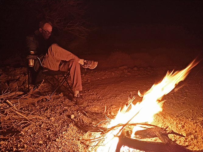
While Tom was off scouting and showering we showered and went on a quest for firewood. It took some looking but we found some in a wash that was sadly not that close. We shouldered a few loads back to camp. That night I used the fire to cook dinner. This worked pretty well, especially once I remembered I had a little mesh grill to roast tortillas on. The thrift store cookpot I was letting get sooty did not have a tight fitting lid though, so the tea the next morning was a little smoky tasting.
2024-02-17 Today and the next day we were joined by Bob Cable. We piled into 2 Jeeps and slowly went over lots of little drainages and back into the N Muddy Mountains. We parked off the side of the road and headed up over a false summit and a lower benchmark before finally getting to the high point of this pile of rocks - Ute Peak. There might have been a higher point farther along, but after we went to it we decided it was probably lower. We headed back but cut down a gully to avoid some up and down along the ridge. This had some annoying loose rock but provided an easier and faster way back to the Jeeps.
We ended up driving just a few hundred yards before parking and heading up Peak 2965 ft. A steep limestone bump - even steeper on the N side. We went back down the SE ridge which was a little more interesting.
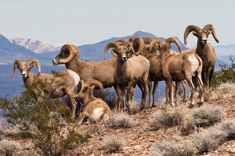
Next up was South Weiser Peak - but first some Jeeping to get to the paved road we had planned to camp along but were thwarted by the piled rocks at the interstate exit the day before. We were on some pretty weak roads for some of this, and the pavement was quite a change although we were not on it for long before we headed south on another dirt road towards the peak. On the way up we saw a group of bighorn sheep on an adjacent ridge. The last bit before the top had some scrambling with less than solid rock - fortunately it was in a bit of a dihedral so you could push out to minimize pulling it apart. The top featured a large pile of rocks and nice views, especially to the Valley of Fire to the east. We tried to pick out various peaks in that area including our goal for the next day.
 |
|---|
The next peak was another limestone bump - Peak 2963 we went up one ridge and down another. It had a bunch of large overhangs - almost caves on it.
Next up was Weiser Ridge - but first we had to get there on a series of not so great "roads" that were probably more ATV trails. The Jeeps made it up to the base where we followed a wash up towards the summit passing some impressive looking limestone cliffs. Then split where Bob, Iris, and I headed almost straight up the right slope to the summit and Tom B and Bob C went up to the saddle at the head of the wash and up the ridge from there. We beat them by a minute or so, but probably had a lot more scrambly and loose ground to cover. For the descent we went down the steep rock and then tried to follow sheep trails down the talus and scree back to the wash. The problem was the sheep trails were pretty faint and Iris was the only one to successfully follow them all the way down - perhaps because we were directing her from below where it was a bit easier to see the trails.
 |
|---|
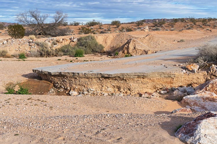
We decided to head back out the paved road - earlier we saw Jeeps heading that way, and we didn't see them return. This proved to have some "interesting" driving as the road was washed out in a number of places. Not enough to keep us from going through, but enough to cause some scouting and spotting. After getting through a number of washed out places we got to the rock pile at the interstate exit - from the other side this time. We tried a few side tracks that didn't deliver us through the fence and to freedom before careful examination of the satellite imagery suggested a solution. Drive up the wash and under the northbound I-15 lanes (stay to the left where there is more room to get through under the bridge), then drive up through a gap in the fence and head south in between the interstate lanes to where the road goes under it - and back onto the interstate. It was quite satisfying to get through as none of us was looking forward to going back the way we came.
 |
|---|
 |
|---|
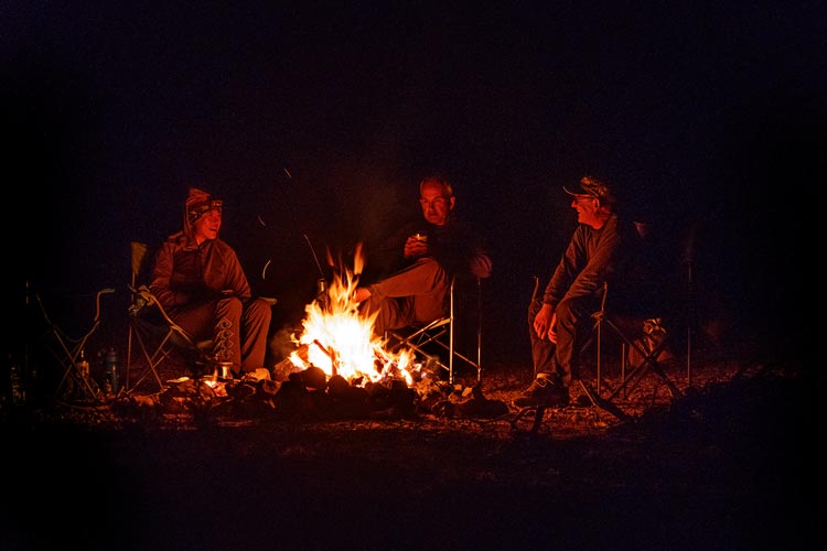
That night Bob B headed back to Vegas but the rest of us enjoyed another campfire, although the wood was getting harder to scrounge.
 |
|---|
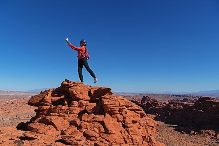
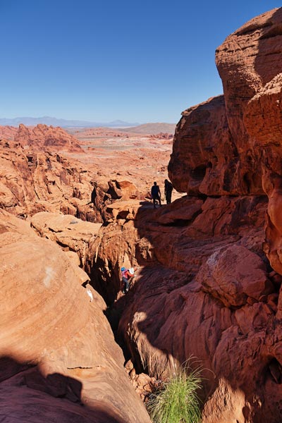
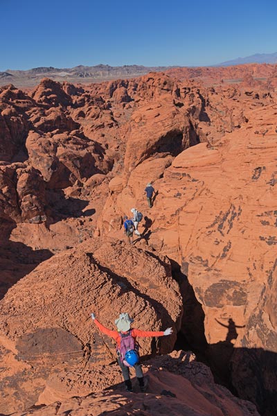
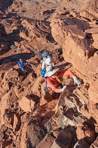
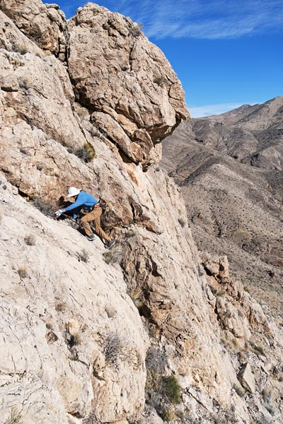
2024-02-18 Today we were going to Valley of Fire State Park to do some climbing/scrambling. The main goal was Peak 2395 which Bob had visited earlier but wasn't able to find a way up before it was time to leave (it was getting dark). Stav also visited this peak and decided it needed a rope. So we were here to get up one way or another with a rope and a fair pile of gear. We started at the White Domes parking area which was fairly empty when we arrived. We followed the trail for a few hundred feet before dropping into a wash cross country towards our goal. There was some water from the recent rains, but it didn't really get in the way as we followed washes and slickrock. We did take one wrong turn and then backtracked to get back on target across a large open area. As we got to the peak Iris was in the lead and found a way up to the shoulder where the main difficulties would begin. It wasn't clear what the easiest route was, but Bob scrambled up a solid 4th class ramp/crack to a large sloping bench. He found an easy way up from this and texted down that it worked. The rest of us followed, I had my fairly hefty pack full of climbing stuff. I should have left it on the bench but took it all the way to the top. We left a register there deciding it needed a name, not just a number and settled on SWATCH Tower (Stav Wasn't Able To Climb Here) which amused us and we figured Stav would get a kick out of it too.
 |
|---|
 |
|---|
 |
|---|
 |
|---|
 |
|---|
For the descent I set 4 big cams (#1 camalot up to #10 Metolius) in an undercling slot - the rock wasn't that great, but the gear was deep and redundant. Then the other 4 rapped down before I tossed down the rope, retrieved the gear, and downclimbed the way I came up - after a false start down a much harder crack/ledge system.
After succeeding on our primary goal we went on to climb "the Orphan" which involved a somewhat hidden and convoluted series of ledges, slots, and ramps. It was a pretty cool way to get up to the top of this formation. We relaxed on the summit a bit before heading down and then making our way back to the vehicles. At this point the parking area was in full tourist/instagram mode. We quickly loaded up and headed out.
 |
|---|
 |
|---|
 |
|---|
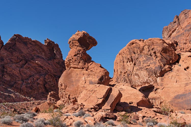
Next up was Balanced Rock. Iris and Bob had done this on a previous visit but it was close to the road and too good to pass up. It featured one solid class 4 or probably 5 move surrounded by class 3 scrambling. I headed up first and then set up the webbing as a handline. both Bobs and Iris also came up with Bob B heading down quickly to get a pic of the rest of us on top. Meanwhile I amused myself by mirroring the poses the instagrammers below were doing in front of the rock. I searched a bit on Instagram to see if I could find any - boy was that an exercise in frustration. Instagram's search is crippled to the point of near uselessness. There is so much wrong with instagram I don't even know where to start - it clearly is not designed for my benefit.
 |
|---|
Next up we drove to the Elephant Rock parking area and hiked cross country to the Red Baron - the only information we had was that it was supposed to be 5.3. There was fun 3rd class scrambling up to the final summit block that might have been 5.3. I went up and set up the webbing as a handline for the others. Then I dropped it down before downclimbing. The light was getting good by this time. We hiked back to the parking area where we relaxed for a while before Bob C headed off one way and the rest of us the other. Bob B dropped us off at the camping area and headed back to Vegas. We had another smaller fire this night.
 |
|---|
 |
|---|
 |
|---|
2024-02-19 Today was mostly a Jeeping day - partly to pay back Tom B who likes Jeeping more than harder climbing. I think he got his fill this day. We got closer before leaving my truck and Bob B's Jeep and piling into Tom B's Jeep. Then we headed into the area north of the Valley of Fire State Park - with some of the same sandstone geology, but not a park and mostly a playground for rugged driving known as the Logandale trails. There were some nice camping spots and lots of sandy and rocky roads and semi-roads if you like that stuff. The first peak of the day was 2231 ft. We could seee that there was a road to the top but it wasn't entirely clear how to get to that road. It appeared there was a way visible on the satellite images, but there was a section of rock that wasn't obviously driveable. So we went there and managed to get through. Then we drove up to the summit - 4wd low in a Jeep is pretty capable.
 |
|---|
 |
|---|
We headed back down and then through some sandy roads to park just south of the next one - Peak2215 - in the sandstone section. This was a short fun scramble up to the limestone capped summit. Next up was another mostly sandstone peak with a limestone cap - peak 2326. We were getting bogged down in the sand which seemed odd as it wasn't a whole lot different from sand we had driven in before. Iris said we were in 2wd, but Tom was thinking it was due to higher tire pressure. When we were able to drive in reverse but not forward he realized that we were in fact in 2wd.
 |
|---|
The next 2 peaks were drive ups also - with some extra bumpy dirt/rock roads on the way and some really steep uphills that we bypassed with switchback roads. The first was peakbagger only - Overton Ridge N and then Overton Ridge. Had we planned things a bit better we could have continued to our last peak down this road, but instead we backtracked to the sandstone section.
Next up was Momo peak - named by Stav, but Iris told us it meant something like cute and fluffy or soft in Chinese, and when she was very young she was absolutely overcome by a cute dog and all she could do was squeel "momo" and wiggle in excitement. This peak was not cute or fluffy, but it was pretty cool. We followed a somewhat meandering track up one slot and then backtracking up the intervening and then to another ridge and up. It was somewhat improbable but got us up. For the descent we tried to follow the main slot down. Iris and Bob went farther down than us Tom's (I could see what looked like a cliff below) and they were in fact turned back by at least one 50 foot cliff. We were able to get back to the route we took up fairly easily though and made it back to the Jeep. Then we headed down the main wash/road until we cut out on a pretty rough road that avoided a presumably impassable canyon up to the road heading east from Overton Ridge. This dropped back to the wash below the canyon where we parked for the last peak - the westernmost end of a large mesa. This was more like hiking in the badlands and we were able to go up ridges and through a break in the cliff ringing the top of the mesa.
 |
|---|
The driving eased up as we got closer to pavement and soon we were back at the other vehicles. Bob B headed back to Vegas and the rest of us went back to where we camped before. Weather was supposed to come in this evening and tomorrow and Tom B was heading home in the morning. I tried to pack up camp so we were rain-proof but it only barely sprinkled in the night.
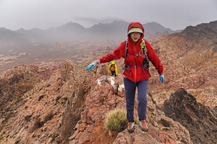
2024-02-20 It wasn't actually raining in the morning when Bob picked us up, but it was overcast and threatening. We drove up the dirt road towards the Colorock mine and parked where it seemed to deteriorate enough that walking would be quicker. We then headed up towards the N ridge of Colorock Peak. This had the added bonus of getting Iris into cell phone coverage in time for her work call. She mostly just listened in while hiking, but stopped when she had to talk. So we weren't setting any records. The weather got "soft" as they say in Ireland - not quite raining, but if you stay out long enough you will get wet. I put on my windbreaker which seemed to offer enough protection all the way up to Colorock Peak at 4239 feet. There it started raining a bit harder and we all put on raincoats. We were skittles - Bob in bright yellow with a green pack cover, I had blue, and Iris had a red raincoat. The rain eased as we descended and by the time we started up the next peak we took the raingear off.
 |
|---|
This peak was called Muddy Knife. It looked pretty impressive with a properly spiky top. Instead of following the steep ridge we cut across the west face and followed a gully up to the final headwall. Fortunately the spiky desert limestone was still plenty grippy even when wet. It was raining again as we got to the top with the added bonus of a cold breeze. We didn't linger long after signing the register heading down the opposite side to follow a steep gully (class 4 at the very top) and ridge back to the Jeep. Just as the water was starting to run down the raincoat and get my pants wet the rain eased and then we got back down. There were some nice colorful rocks in the wash near the bottom.
 |
|---|
 |
|---|
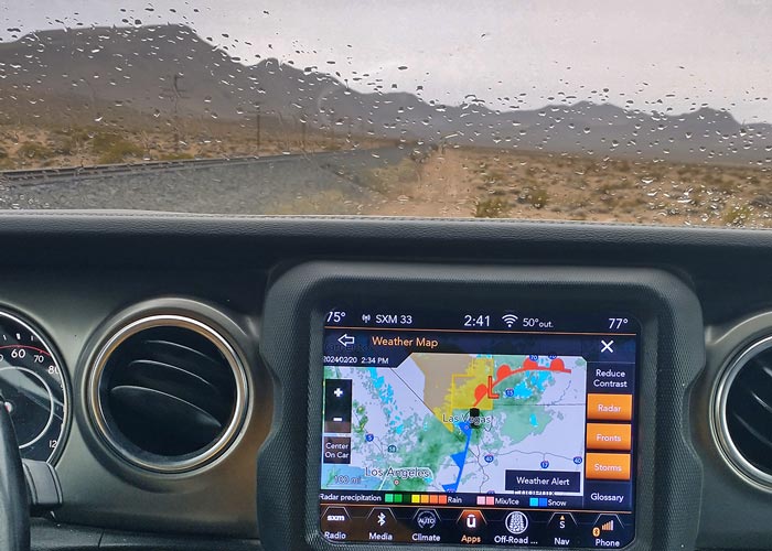
As we drove out we looked at the weather radar and could see the persistent atmospheric river of rain all the way from LA to Vegas and the rain picked up a bit. It was not very motivating to head out on a longer hike up something. We decided to move camp to the I-15/93 interstection area and reconvened behind the Love's truck stop. There we left my truck and did some scouting to the SW. The summits were obscured in clouds and the rain continued, so we ended up visiting a whole bunch of benchmarks that had been added to the peakbagger database. This was a pretty silly thing to do, but it kept us entertained as we navigated around along the roads and railroad in the area tagging various benchmarks. Iris was able to do a few more work calls while we drove around although she skipped a few of the farther walks. We also saw a lot of trash out in the desert including a surprisingly large number of dead boats. The last benchmark would have been an easy drive by, except the area was blocked off with concrete barriers. So Bob and I walked out to it - nearly 1.5 miles round trip. It was easy walking on old gravel and maybe once-paved roads, but on the return the rain picked up and we were walking into the wind. The water running off the raincoat started to soak my pants. ugh.
 |
|---|
 |
|---|
We headed back to the Love's to get some warm and hot water and then camped at the end of a spur road near there. It wasn't much fun as it was cold and wet and the gound was covered in mud, but we managed to tetris almost everything back into the truck or at least under it and not track too much mud in. Eventually we were warm and dry in the back.
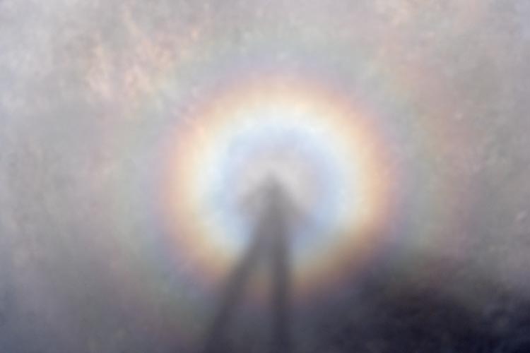
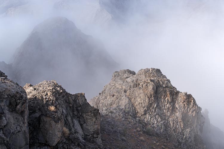
2024-02-21 The rain seemed to have finished in the morning, although it was still mostly overcast so maybe there would be more? The forecast was much better than the day before in any case. We left the truck here and took the Jeep up 93 past Dry Benchmark that Iris and I had done in Feb 2021. The destination was the Arrow Canyon Range. Then we left the pavement and the high speed trucks and headed up a rather bumpy road to a pass with a wildlife watering station. We parked there and got our first view of the steep limestone mountains. Bob informed us that his original plan had us coming down the steep slope from the pass across the valley. We decided it would be better to head up this as heading down steep stuff can be harder to find the way through - and if it didn't work we would rather find out at the beginning of the day. So we dropped down across the valley and started up a gulley. There was a lot of talus, but the sharper limestone mostly held together and at least some of the rock was re-cemented conglomerate that offered a lot of holds. Up we went. Near the top we entered a cloud which was pretty magical looking. I was able to get a picture of the specter (spectre?) of the Brocken from a little point I climbed just before the pass.
 |
|---|
 |
|---|
 |
|---|
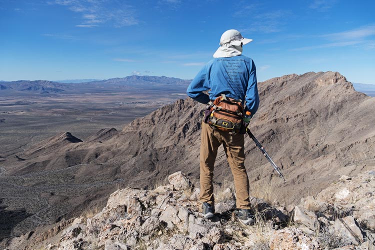
After climbing a pass that was higher than plenty of the peaks we climbed during this trip we headed down across another valley. From here we could see our goal - the 4082 ft Landfill Peak, and its impressive NW arete and W face. Bob originally planned to ascend the NW arete, but that looked a little harder than we wanted to tackle. The easiest would be a detour around to the south and up an easier slope, but it looked like we could work our way up the W face and then traverse S on a ledge and up another chute to the shoulder that way. So up we went. Fortunately the ledges did connect and where the scrambling was the steepest the rock felt pretty solid, and like most desert limestone, was very grippy. This wasn't the easiest way up, or the fastest probably, but it was pretty fun, and it is always satisfying to succeed when you aren't sure that the way is passable. Once we got onto the shoulder it was an easy walk up to the summit.
 |
|---|
 |
|---|
We opted for the much more likely descent down the E ridge - someone else had come up this way. It was long and there were some short cliffs to descend, but a way always appeared. Iris was back on a work call, so she was going a good bit slower. We were able to cut the corner and descend to the NW eventually and then headed up the canyon and went up the S slope up Cave Butte - at 3398 ft a much smaller peak that still had over 350 feet of prominence. Iris had waited at the mouth of the canyon to stay in reception until her call ended but then went straight up the E ridge and caught up to us on the summit. From time to time various jets roared overhead, unfortunately not close enough for good photos, but they were pretty loud - as they say in the USA - the sound of freedom. There were some that flew over quite close the day before in the rain, but I didn't have my camera with me at the time.
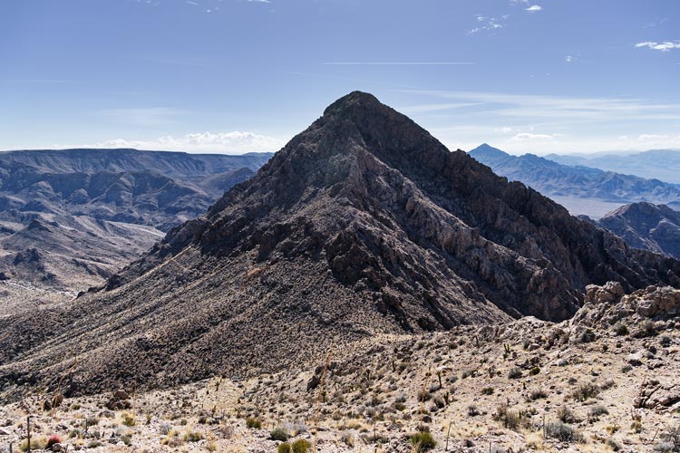
Next up was Marble Mountain - somewhere in the mass looming to our west. We dropped down and crossed the canyon and then headed up and up and up. There were a few sprinkles on the way but not enough to merit raingear or any other changes. Once we got onto a ridge we followed that around and then across the slope up to the 4139 ft summit. We could see the pass and the Jeep far below us but we still had to get there. We headed south down the ridge that then cut SW, we headed S down a gully that we hoped would go all the way down without any stopper cliffs. There were cliffs on the way, but we were always able to find a way to bypass or downclimb them. Still, we were relieved to make it down to the canyon we had crossed in the morning and then back up to the Jeep. It was only about 4000 ft of elevation gain all day, but it seemed like a lot more.
We headed back to the truck and then Iris and I stopped for Pho on the way to the airport. I was a little stressed about making it in time, but Iris has become a bit of a jaded and casual flyer. She made it to the gate a whole 5 minutes before her boarding group was called. I headed S out of Vegas and met up with Bob a little west of Jean.
2024/02/22 After Iris left it was back to just Bob and me. We were able to get started a little earlier in the morning and I had more space to sleep in the truck, but otherwise it was definitely a downgrade. We started out Jeeping up the powerline road and then turned north up a side canyon parking below Good Benchmark - the first peak of the day. We headed up the steep slope with a bit of scrambling up the cliffs at the top. This was a peakbagger only point, but sort of on the way to a higher point (Jashua Peak) that was the real goal. We headed up the ridge to that point next and then did a somewhat descending traverse back down to the canyon/road and the Jeep.
Then we backtracked to the paved road and almost to Goodspring before heading west on the Sandy Valley Rd up over the pass. Then we headed towards some unnamed summits north of the road. We went past a No Trespassing Sign and then parked and headed up the steep slope with some scrambling up to the top of the first peak - 5187. It had a pretty good summit and then we dropped down the north ridge looking down at some mining stuff below us. We dropped quite a bit before we headed up the ridge to the next point - 5482. More nice views from this peak. We sort of discussed trying to traverse west to another peak, but that looked like a lot of work and maybe some cliffs too. We headed down an adjacent ridge a little east of the one we came up past some mining stuff hoping to find a path or road down from this. No luck until a lot lower. As we headed down we saw some people down below by one of the mines. We eventually caught up with them. It turned out to be the owner and maybe adult kids? He was annoyed about our trespassing, but was pretty nice about it. He did mention that the mines were mostly for zinc back in WWI (I mentioned it was called Galena Canyon and asked if it was for lead). We were traveling much faster than them and figured it would be best to be gone before they got back down so we wasted no time piling into the Jeep and heading back to the road.
 |
|---|
 |
|---|
 |
|---|
We continued west past Whale Peak that we had climbed back in 2021 and then turned south on another dirt road past a shooting place. We parked on the side of the road and headed up the road a bit before cutting up a wash and then the slope to peak 1342(M) or 4403 ft (or maybe it is 4402 ft). It got pretty steep at the top and we dodged around some igneous cliffs to get to the summit. The next peak was just a bit down the ridge, except the ridge wasn't so casual. As we headed down we tried to find the easiest path - either on the ridge or one side or the other. It was pretty slow going, but nothing stopped us. We crossed a saddle and then had to go up 305 ft to the next peak 1293(M) or 4242ft. From this summit Bob returned back to the Jeep making a big triangle and I headed northish to get 2 more peaks that he had already done.
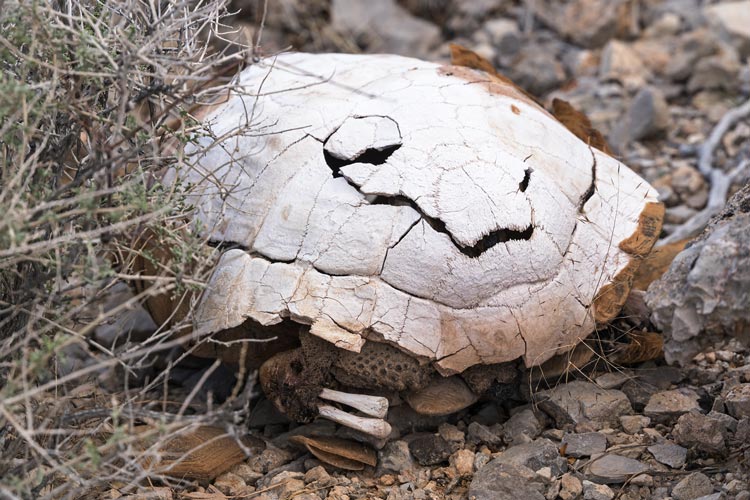
I headed down the slope and ridge making pretty good time until I came to a big cliff. I might have been able to climb down, but I figured it would be better to head back uphill a little bit and cut west into what looked like a less steep wash. There was a little scrambling to get down at the top but then it was a much better path. Still slow, but just 2nd class after the top. Once I made it down to the valley floor I was able to make better time across the flats straight for the next peak, aiming for what looked like a decent ramp up the limestone. There were some steep sections but the grippy limestone was pretty easy to get up. Unfortunately I was on the wrong ridge to visit some mines on the way up. There was a big cairn on the 3796 ft of Bonanza Hill with quite a few entries in the register over the years. I followed the NE ridge on the descent looking down on the mining infrastructure on the N side and even found a path for some of the way down to the saddle. I also found a somewhat mummified tortoise shell with a few legs partially intact. From the saddle I headed up the last peak Singer Mountain at 3694 ft and 315 ft of prominence. The descent from this peak was pretty mellow with a broad summit plateau followed by a bit of a road most of the way back to the Jeep. There were more mines and some building remains along the way. Bob had made it here quite a bit before me and was working on his trip reports.
 |
|---|
 |
|---|
We were stopped by a police car blocking traffic on the way back to the truck - we could see something going on at the intersection ahead, maybe an accident or arrest? When we were finally able to drive through it turned out to be a filming truck with a long camera boom, so we had to wait for them to film something. I rinsed off at the truck and then headed to the gas station and on to meet up with Bob at a parking area off the paved road SE of Jean. Bob had a few extra White Castle sliders he gave me to augment my supper. Maybe they are better when warmer, but neither of us were so impressed, but at least they didn't upset my digestion as much as they did Bob's. This was a good place to sleep, until the dump trucks started driving by around 3 am. Why someone needed sand or gravel that early is beyond me, but it didn't make for great sleep, especially as we were near a turn by a hill, so one direction we got Jake Brakes and the other direction we got full throttle. Curiously the trucks seemed to stop around sunrise. Oh well, you win some you lose some when vehicular living.
2024-02-23 We loaded into the Jeep and drove past the aggregate operation that the trucks were using. Then up a fairly bumpy powerline road to another paved road near another aggregate pit. We got off the pavement onto a dirt road that looked like it was pretty popular with offroad racers before parking and heading across the desert to visit 2 peaks in the SE end of the Sheep Mountains. As often is the case the first part was pretty mellow across the desert and low angle wash until things started getting steeper. The track we had followed the wash around and up the NW side of the peak, but we just cut straight up the ENE side - there were a few cliff bands along the way but we were able to skirt around them up to the summit of Peak 3990. It was quite windy up top and we did not linger. We worked our way down the SE ridge and then mostly followed pretty good sheep trails around and over the bumps and ridges over to peak 3694 - a much less obvious peak with no recorded ascents prior to ours (I'm sure miners or hunters had been up here, but no recorded peakbaggers). Then we headed almost directly back towards the Jeep going over one saddle on the way. As we were hiking across the flats I saw an owl pop off the ground and fly away. I saw where it landed and tried to get some pics - good enough to identify it as some sort of little burrowing owl before it flew farther away.
 |
|---|
 |
|---|
 |
|---|
Next we drove across the flat along at least some of the offroad race course (Mint 400?) heading for the wilderness boundary. There was a cherry stem following an offroad track into the wilderness and we hoped to drive in to allow easy access to 3 peaks. Instead the trail was more of an ATV/dirt bike path too skinny for the Jeep. We parked at the boundary and headed up one peak. Once we left the wash the main problem on this peak was the surplus of prickly plants. Not enough to stop us, but enough to make it slower going. The rock was granite/gneiss which was a change from the usual limestone. There were some false summits on the way up, but not too bad. This was peak 4637. We dropped down to the south to make a little lollipop out of our trip. That worked out better than our ascent - although maybe the looser rock would have been more frustrating on the way up. We decided we weren't up for a big loop of the 3 peaks here as Stav did, so decided on a peak we could drive closer to.
We drove up another of the many powerline roads in the area - this one had recently been graded - probably after the Snore 250 race. We drove up to McCullough Pass and then headed up the ridge from there. We started off following a motorcycle track that went straight up the steep hill, but then were on our own following the ridge up basalt talus to the plateau. We headed S on the ridge to what we guessed was the high point - there were a few to choose from for the summit of Peak 4288.
Bob was done at this point, but we had plenty of daylight left. He dropped me off at my truck and I drove up the road a bit and parked off the road at a wash. Then I headed up the west ridge of Sheep Shorn (a sub peak of Sheep Mountain) and then up Sheep Mountain. This was back in the limestone with some scrambling up through cliff bands. Sheep Mountain is 4184 ft tall with 986 ft of prominence. Bob had climbed it earlier. It also had a wind sock on the summit that was pretty tattered from the wind and sun. I headed back down to the saddle between the 2 and then headed down gully/wash from there. This went pretty fast with pretty easy work arounds for all the dry falls on the way down. Once I cleared the toe of the W ridge I tried to head straight across the desert back to the truck. I didn't have much cover where I had parked, but I rinsed off behind the truck anyway - fortunately nobody drove by the whole time.
 |
|---|
I met up with Bob at Buffalo Bills where we had dinner at Dennys and got lost inside the faux wild west interior of the casino (that is probably designed to keep you inside). Then we camped in the BLM land back behind Whiskey Pete's. The wind had died down and we were camped by a wash. There wasn't a ton of wood, but enough to have a nice fire for our last night.
 |
|---|
2024-02-24 We headed out to finish what we started - except coming in from the east side instead of the west side. First up was peak 4426. We drove up the 4wd road along the east side of the Stateline Wilderness and parked at a closeish place. Then we headed across the desert towards the peak - except I wasn't sure it was the peak. In any case, we figured it would be more obvious as we got closer - and it was. A smaller peak left of the one we were heading for. So we turned and went up a rocky gully that provided better travel than expected. As we got higher we realized the high point was left of the gully, not right of it as we thought from below - so we cut off left and up through some little limestone cliff bands. The top was the high point on a ridge. For the descent we headed down the east ridge - we weren't sure if it would go, but there was always a way down through the cliffs. Then back across the wide flat washes to the Jeep.
 |
|---|
The last peak was 3562 - a pretty small bump near the road to the north of the Ivanpah solar thermal plants. We went up the SW ridge and came down the E ridge. There was some scrambling, but nothing too hard. It was partly hazy and it looked like the solar thermal plants were starting to come on line as the sky cleared. Then we drove back to my truck and parted ways. Bob for the long drive back to the Bay Area.
 |
|---|
I headed back towards Vegas and stopped to climb Pleasant Peak. When I left the pavement I bumped along a rocky road past a number of places people were shooting things. Then around the flank of a sub-peak and to about as far as I felt comfortable driving - I probably took a wrong turn and was blocked by a little washout. I parked here next to some more shooters - and started up keeping to the roadway and trying to go quickly. The shooters were at least not shooting in my direction - they seemed to be working on some sort of quasi military scenario running around and shooting at various targets. They also had a pretty massive gun set up on a tripod - 50 caliber sniper rifle? It sounded like a cannon. I went up to the saddle and then up to the peak keeping to the other side of a ridge whenever possible. The peak would have been more pleasant with less shooting. On the way down they seemed to all be shooting at a number of targets - it was like popping corn if the kernels popped at 140 decibels. I made it back to the truck and headed out. I stopped at a goodwill outlet center and generally avoided the scrum of people searching for bargains by the pound. Nothing really caught my eye, but when I left the map said it was about equal to go through Pahrump or Vegas, so I headed through the former to take advantage of cheaper gas. It got dark a little after Beatty and I pulled off of the highway to the base of Mount Jackson for the night. It was much colder than it had been for other nights and I was glad to have a warm sleeping bag to burrow under.
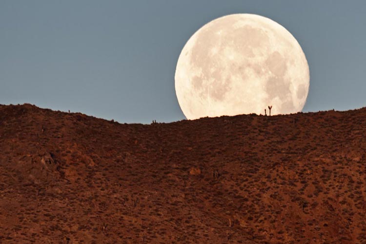
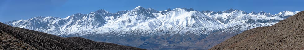
Desert Peaks with Bob + Pleasant. 02-24-20242024-02-25 I got up early and took pics of the moon setting. It was cold. I packed up and headed out towards Jackson. I vaguely followed Mihai's track up onto the summit plateau and to the cairn up there, and then over to the probably actual high point north of there - I couldn't tell, but some others wrote in the registers that this was the higher point. Then I headed down to the west from there. There were cliffs, but I could see some cairns and although I don't think I followed them the whole way down, I was able to scramble down through the volcanic cliffs. Lower down there were a bunch of mining claims. Then I headed back to the truck and drove back home stopping to take some pics of the Sierra.
 |
|---|
 |
|---|
 |
|---|
 |
|---|