Tom Grundy's Lonesome Miner Trail 2025 Page
April 2025 and a cold front is supposed to come through and Chris Kerth suggests a trip to Death Valley - I'm in. But then he reveals that what he really wants to do is the Lonesome Miner Trail. I hiked part of this train in 2020
with Iris and wanted to go back, except with more time to explore. Well, this trip would have the go back thing going for it, but it would be even longer and I suspected less time to explore and potentially bad weather - the forecast gradually increased from 20% chance of rain and snow on Saturday up to 60% by the time we actually left. So this failed on at least one count, but it had the chance to see some more of the trail and would be a great training hike.
We planned to start friday morning at 5:30 leaving one vehicle near the Pat Keyes trailhead and then driving to Long John Canyon to start (the LMT actually starts in Saline Valley, but that is a long rough car shuttle. I drove down the night before taking a variation on the google maps that was supposed to be a few minutes slower but actually less dirt road driving. That was a lie - not only was there more and worse dirt road driving but it ended up with me about 100 feet from where we were supposed to meet on the other side of a formidable irrigation ditch (dry - but no way I could cross it here). Evidently this ditch had been dug out since 2020 when Iris and I had parked near here. I walked around investigating a few possible routes that all looked to be solid 4wd before back tracking. Fortunately I found a place to cross the ditch without having to backtrack all the way to 395. I was setting up to sleep in the truck when Chris pulled up. I wasn't able to go to sleep quite as early as would have been best, but still managed quite a lot of sleep before the 4:45 wake up.
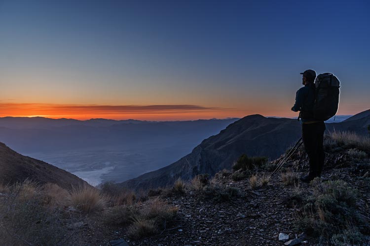
2025-04-25 As expected 4:45 came awfully early. I had oatmeal in a thermos and tea in another thermos and had cleverly packed all the clothes I was hiking in a bag so it was a pretty easy morning. The only real question was how much water to carry - we would hike past a "well" before crossing over the Inyo Crest, but didn't know if it had any water. I started with a little over 3.5 liters. We got into Chris' Jeep and were driving out when another vehicle drove up - we figured it must be another hiker - our best guess based on a register entry is it was Kim and Marc who were going out for a massive run - just another day for them. Their signatures were plentiful in the registers over the last few years, especially Kim. Marc has done a number of Sierra Challenge days and has also done plenty of big days in the mountains.
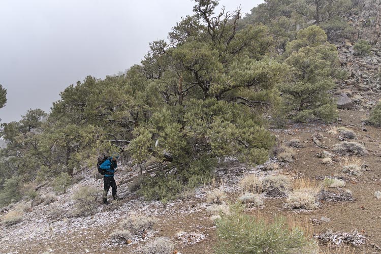
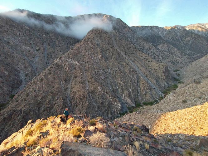
We drove about 10 miles to the road heading up Long John Canyon. Bob Pickering had reported a long detour to get past the same irrigation canal, but we opted to just park here at about 3700 feet. We might have been able to drive a bit higher, but getting my truck up there after the hike might have been tough. A sliver moon was just visible above a notch in the Inyos and Venus was above that. Chris gave me a Rockstar which I downed and probably contributed to a pretty good pace to start. We followed a road for the first few miles as the sun worked its way down the Sierra and across the Owens Valley. Fortunately we were shaded in the canyon. We passed the Long John Mine, but it was up the slope to the side so we didn't visit. Around 3.5 miles in at ~5700 feet we passed a bit of flowing water and then left the canyon floor and headed up a trail on the south side. We slowed down quite a bit at this point. There were a few places where the trail was hard to follow and at one point Chris just headed straight up the talus while I followed a faint trail traversing off to the right. We met back up on the ridge at about the same time.
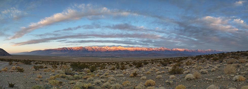
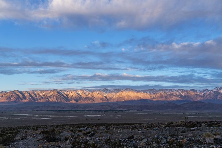
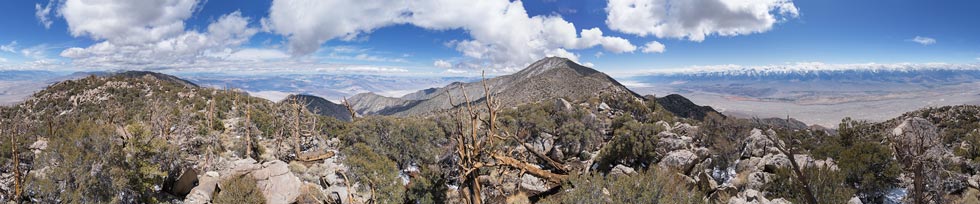
panorama across the Owens Valley to the Sierra
 |
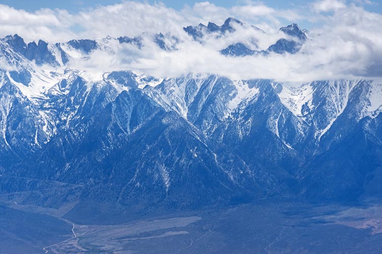
looking back at the High Sierra
 |
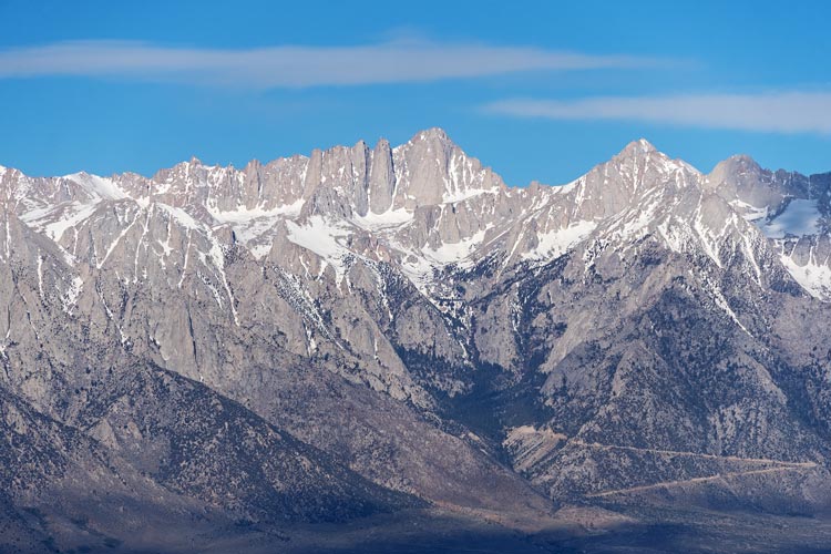
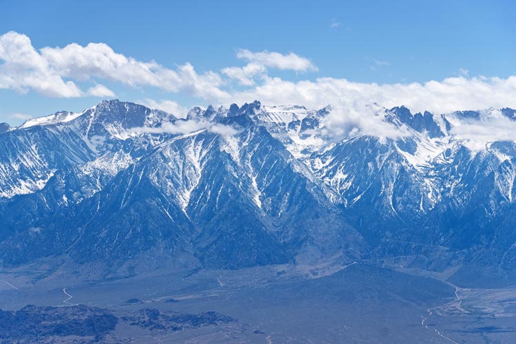
Mount Whitney
 |
As we got higher up out of the canyon and onto the ridge the views across to the Sierra and down into the Owens Valley got better. We also passed up into the zone that had pinyon trees. We were into the sun by now, but it was cooler at the higher elevation and there was a bit of a breeze. Closer to the crest of the range we passed the Burgess Well - it looked more like a mine shaft and had some snow down in the bottom but no visible water - I'm glad I wasn't counting on it. Another traveler speculated that the Inyos have much less water now that the Owens Lake is mostly dry and the Owens Valley has a lot less water. Here we were once again walking on 4wd roads for a bit - and you could drive up here if you had the time and the vehicle - it certainly would open up the possibilities of some easier trips and it would be nice to have the vehicle carry everything up 6000 feet. We topped out around 9300 ft and then dropped down the east side on an old closed road (we were in the wilderness now).
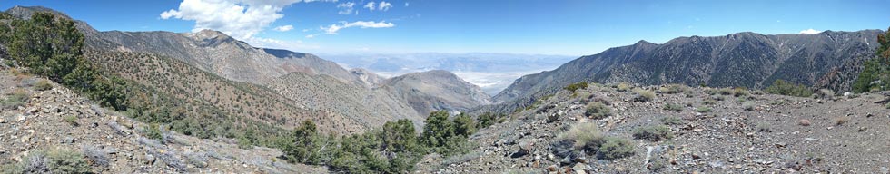
panorama in Craig Canyon
 |
We started down into Craig Canyon and then after passing a rocky slope on the left cut up the side and over the ridge into Hunter Canyon. I saw 2 bighorn sheep here running across the slope - I probably wouldn't have seen them except for the noise they made. We went down a lot through a cleft between some carbonate looking rock (potential for climbing, but a really rough approach) and down to the Bighorn Spring area. There were willows and roses and other water loving plants choking the canyon bottom as well as the remains of a steam engine and boiler. The steam engine was labeled "J. C. Hoadley & Co, Lawrence Mass". The internet says that this was active ~1872 to 1878. It looks like the original boiler broke so they attached a new boiler to the steam engine. Fortunately someone had cut a path through the plants to the stream and we went in to get water there. I was using a CNOC bag and platypus filter - it worked great, although all new filters work pretty well, so we shall see how it holds up. I still had a few liters of water when we got here - that seemed to be how it went for the whole trip. Certainly better than running out, but I could have saved a few pounds from my pack. This is where we joined the LMT - the complete route comes up Little Hunter Canyon from the east and over the ridge to drop down to the spring. It starts lower than we did ~ 1800 ft?, but is a shorter distance to here and doesn't go up and over a 9000 ft crest- more like 6000 ft.
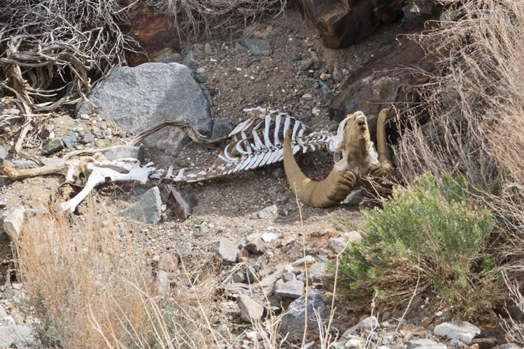
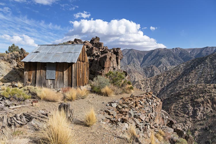
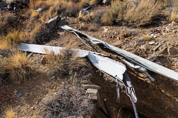
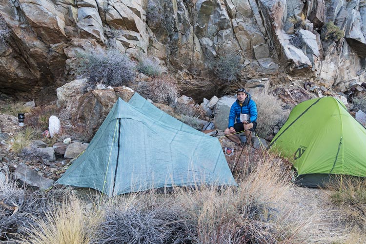
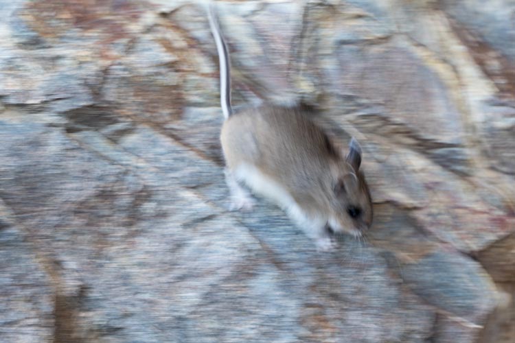
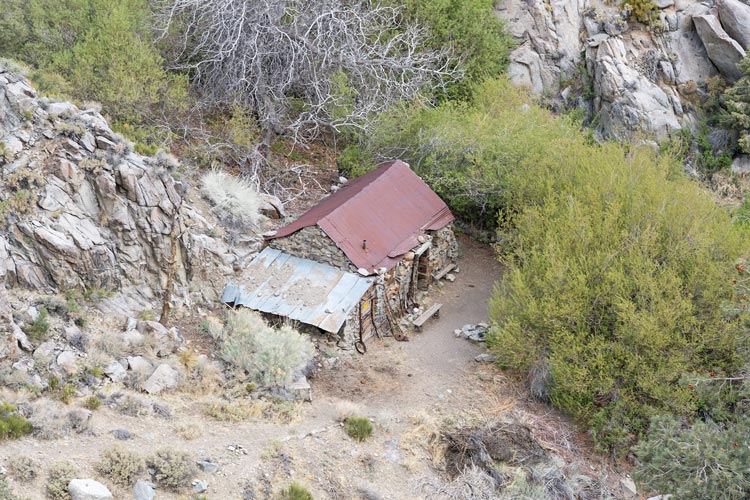
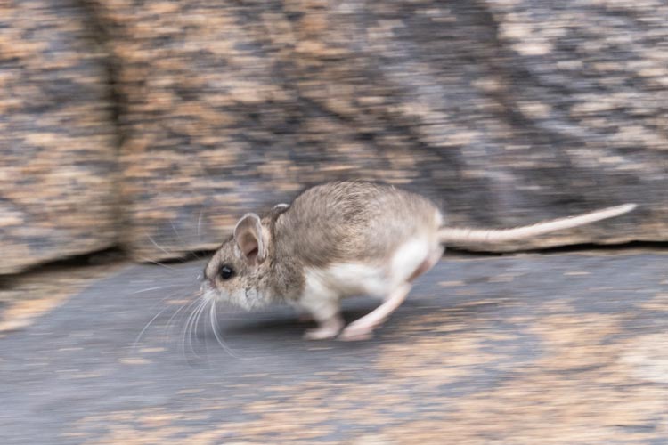
After looking at the mining camp remains and getting water we traversed above the plants in the canyon and I accidentally kicked a spiky cactus - I'd like to say it was hiding in another plant, but no - it was just by itself. I got at least one spine tip in my toe, and it hurt most of my toes and the top of my foot. We came around the shoulder and started up the trail to the Bighorn Mine. For a while it went up a dirty ridge that was eroding on one side - it almost looked like a dirt cornice - we tried to stay on the far side of the trail. Down below in the streambed I saw a bighorn skeleton, maybe the cornice collapsed on it. Higher we were back on rock and the trail was more obvious, although it also had plenty of plants and rocks blocking the way. We could see a rock retaining wall high above and eventually we got there. There was a flat platform and some mines and old stuff. We dropped our packs and continued up to another mine area with more ruins and a cabin. It also had some busted up helicopter blades - I'm sure there is a story about that. We took a look in the cabin - more nervous about hantavirus in light of the 3 deaths so far this year in Mono County. I do wonder what the actual risk is, but since it seems to be so rare but high consequence it is probably best to be conservative. Still, plenty of people spent time in cabins and summer homes and they didn't all drop like flies. Then we dropped back down to the flat platform to set up our tents and cook dinner. Of course while we were cooking there was at least one mouse running around - it was cute, but even if they only chewed stuff and weren't a vector for death I'd just as soon not have them around where I am camping. I saw plenty on this trip, not only where we stopped to camp, but out hiking in the morning or evening or when the cloud cover was thick.
bighorn sheep skeleton
 |
Bighorn Mine Cabin
 |
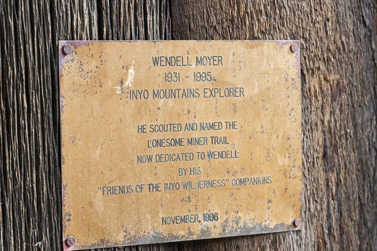
Wendell Moyer LMT plaque
 |
busted helicopter blades
 |
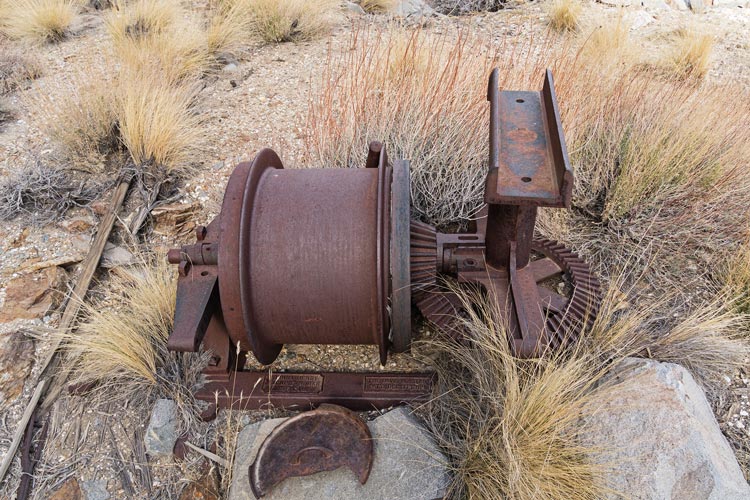
the Davis hoister
 |
Chris at camp
 |
the mouse didn't hold still
 |
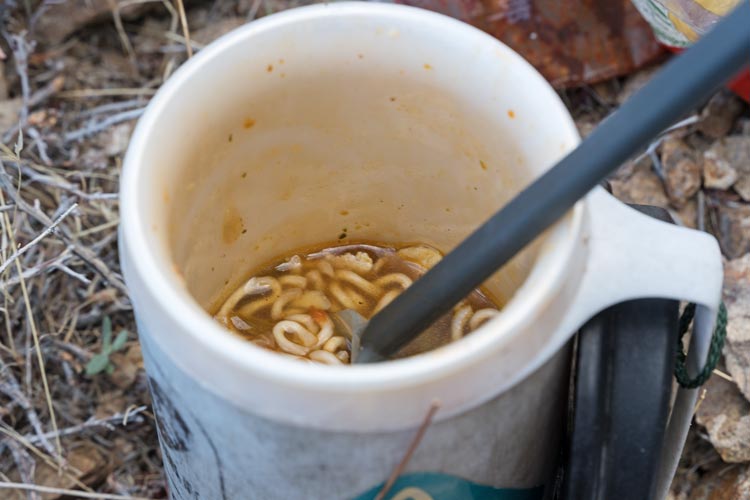
a mug of ramen
 |
Strava page for day 1 hike in Inyos. 04-25-2027
2025-04-26 We got up early again, before the sunrise. Venus was looking pretty bright to the east out over Saline Valley and Death Valley National Park. We got ready and packed up and then headed up the hill past the cabin and on up the slope. The trail cut farther to the left than we expected, but we opted to continue following the trail and that brought us up to the top of the ridge where there were some tools and some nice flat camping spots. We took a break there for some food and then started dropping down into Beveridge Canyon. It was much cooler feeling on this side of the ridge and we were descending. I put on gloves and another layer. Rather than dropping straight down to the Beveridge townsite the trail cut farther up valley and dropped down to Frenchies cabin. There we looked inside, thought about hanta, and got some water from the spring (conveniently flowing out of a pipe). Then we headed across the creek and down the valley going up out of the canyon on the S side to avoid lots of brush and then crossing and continuing down to where the stamp mill and outhouse over the cliff were. We looked at the stuff here at around 5600 ft and then started up the slope. There was a lot of up to be had and I was not doing so well at keeping up. Fortunately Chris likes to stop to take photos a lot and was patient with me. We were considering cutting cross country up the slope to a peak, but instead just followed the trail up to the ridge and then left our packs there to go to the peak. The cloud ceiling was just above us and it was snowing a little (mostly tiny graupel) when we got to the saddle, so we put on rain gear and left our packs under some trees. It didn't take us long to get out to the summit of Beveridge Point at 8308 ft.
heavily processed sunrise pic from near the Bighorn Cabin
 |
Frenchies Cabin
 |
another mouse in a hurry - in Beveridge Canyon
 |
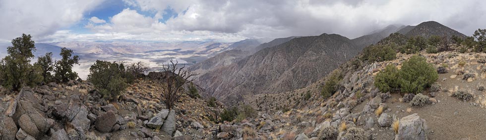
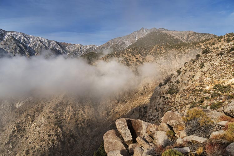
panorama from Keynot Ridge with Keynot Peak hiding in the clouds on the right
the Nelson Range (visited a few weeks earlier) is in the partial sun just left of center
 |
putting the pack on after Beveridge Ridge - it is beginning to look like Christmas
 |
We went back to our packs and then headed up the hill to the Beveridge ridge cabin. This one might be in the best shape of them all with quite a lot of artifacts in it. It looks like they did a bunch of work on it in the last 30 years or so - winching it back to square and replacing a number of boards and replacing the roof. We looked inside a bit and enjoyed the fact that the snow stopped and the sun came out. Then we headed around to the N side of the ridge and past a few mines towards the Keynot Mine Complex. In 2020 when we were coming the other way it was uphill and I was quite tired and it seemed a long distance. This time it wasn't long until we were looking down on the bulldozer and other modern (ish) mining equipment (last used in 1983 I think). We went down and looked at the stuff in the increased precipitation and then tried to follow the road N - but it dead ended at a sizeable mine tunnel, so we worked our way up on the N side of the tailings slope to the level with the ore carts and tracks. The tracks and mine entrance were buried by more tailings from above. Then we headed N on the trail past more cabin stonework and then down and around the shoulder to McElvoy Canyon. We dropped our packs here and traversed out to the point before the ridge seriously dropped off into Saline Valley - this was Keynot Point at 7742 ft. It had some survival equipment stashed there as well as a log book and some maps. I'd have looked at them more except it was snowing again.
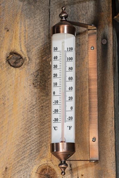
39 deg F in Beveridge Ridge Cabin
 |
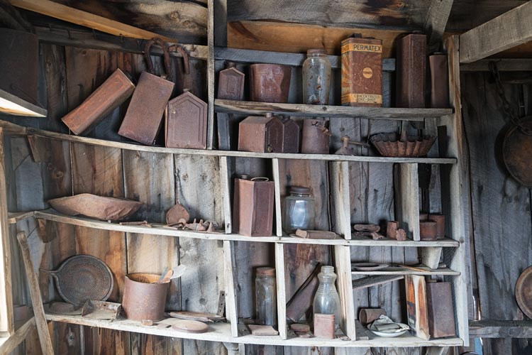
shelves of stuff in Beveridge Ridge Cabin
 |
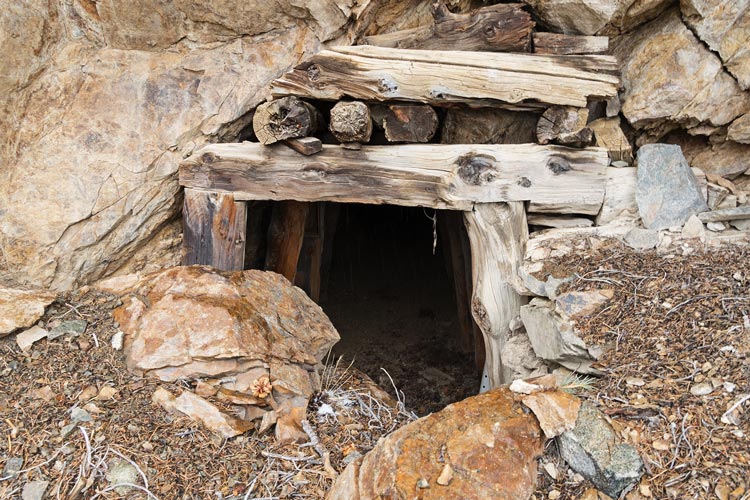
Keynot Mine #2 adit entrance
 |
We headed back and re-shouldered our packs and headed down into McElvoy Canyon - except first we had to head up the slope and then down and around a few ridges and past some large landslides that had pretty much wiped the trail away in places. Once we made it down to the canyon bottom it was getting dark and we were below the snow line into drizzly rain. We still had to get across the jungle of willow and thorns along the drainage. We traversed high above on the S side until finding a place to get across. In the effort I stepped down and caught my pant cuff on a rock and ripped it open. These pants are too long but the relatively tight cuff kept then in check. Without this they were getting underfoot. The next day I just tucked the end into my socks to keep them out of the way - which worked ok except more stuff got into my shoes. By the time we got to the ruins it was nearly dark. Fortunately the rain had tailed off and we set up tents. Then while I started working on dinner Chris went back to our crossing point to get water for both of us. By the time he got back it was starting to rain again so we retreated to our tents for dinner and the night. I spent some time trying to figure out how much up and distance we would have in the morning - it looked like nearly 20 miles and at least 6000 feet of gain. I was not feeling optimistic about doing it in a timely matter. It was a little colder this night, but not by much and at least I was plenty warm without even wearing all my clothes.
Strava page for day 2 hike in Inyos. 04-26-2027
2025-04-27 When I woke up in the morning I could see stars, although there were still some clouds in the slice of sky I could see. It was light enough to see by the time we were ready to go and soon we were heading up the trail. There was a short mine section that had a bunch of clothes and beekeeper stuff that belonged to Marion Howard who tried to keep bees when he was living here but had trouble with wax moths. He was a quite a character with 4 cabins spanning the Inyo Mountains and was active in the area from the 60s to about 1980. There were a few more mines and lots of quartz crystals along the trail here. We continued on up enjoying the sunrise as well as the clouds drifting around the mountains. Eventually we made our way up the ~2500 feet to the top of McElvoy Ridge. There Chris cut off to go to Peak 8060. I decided to skip it since I already went up it in 2020 and I figured I'd be slow enough without adding any extra distance or gain. I stopped to redo my shoes and then continued along the broad ridge to the west. The trail followed this ridge farther than I remembered and then traversed up and NW above Pat Keys Canyon with some snow in the shaded areas. It was quite cold and crisp - feeling like a fall day. After passing some sub-ridges the trail dropped down into the canyon and I lost it right at the bottom and had to search around for a place to pass through the plants and across the creek. There I got some water and then ate some food and refilled my water bottle before hiking down canyon looking at the arrastras and other remnants from the mining days. Then I found the trail uphill and followed it up and to the east. It went pretty far east and I can't help but think there is an easier way to just go more or less straight up. I followed the trail up onto the ridge where I lost it briefly but just cut NW until I picked it up again. Then I followed it west, stopping for more food after I had passed above the crossing far below (in case Chris took a more direct route he couldn't sneak past me).
glad to get into the sun on the way out of McElvoy Canyon
 |
Mount Inyo rising above the clouds
 |
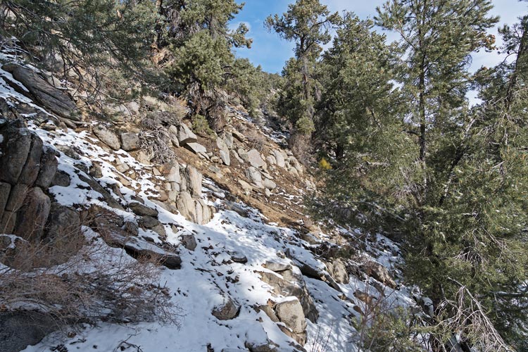
there was snow in the shade, but the sunny areas were mostly clear
 |
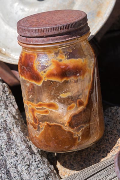
old peanut butter? in a jar
I've eaten plenty of old food, but I would have to be pretty desperate to consume this
 |
I followed the trail west along the ridge and on the S side and then across a high north facing sagebrush slope to the Inyo Crest at about 9500 feet. I continued a little farther to where Chris had planned a turnoff to go to peak 10080 to the south. It looked like there might be some trail confusion just before that, so I left my pack on an obvious rock next to the trail and planned for heading to the peak. It was about 1:30 and I hadn't seen Chris behind me yet and figured as long as I made it there before 2 I'd go for the peak. I turned on my phone and on the way got enough reception to text him my plans. I traversed along and up on the ridge and just before I went around the corner I looked back and thought I saw him by my pack - the telephoto confirmed this. I waved but I don't think he saw me. This wasn't very long after I left, so I was going to be quite a bit behind him if he didn't go for this peak. I later got a text that he was heading down. Meanwhile I headed up accidentally having to climb over one bump to avoid the thick trees and then once again having some trouble with the combo of trees and rocks on the summit plateau. The actual summit was an easy class 3 pyramid complete with a small summit and a register from 1980. I took pics of the fantastic view, signed the register, and headed back.
360 panorama from the summit of Peak 10080 (or 10115?) with Mount Inyo right of center and Sierra Nevada Rt of that
 |
Mount Whitney pokes above the clouds
 |
Mount Langley (left) and Comb Ridge (just left of center)
 |
I took a much better line on the return and made it back in about 1/2 the time it took to get up. This still left me about 1.5 hours behind Chris, and he hikes faster than I do. I reloaded my pack and started hustling down the trail - at least it was nearly all downhill. I mostly old man shuffled my way down the trail with a stop to dump out my shoes, eat, and reload my water at an old cabin foundation. I also recharged my phone a bit here, and I think this is where Strava stopped recording. Then I hurried down. Around 5:00 I was out of the trees and was able to see the truck far below and with the telephoto I could see Chris near it. I kept on heading down, but it was another hour and a half before I made it shortly after 6:30. We loaded into the truck and drove back to the Jeep where we said goodbye. Chris had a 6 hour drive to get back. I rinsed off my feet and had a protein shake before driving back home. Thankfully my drive was only an hour. I unloaded the truck, took a much needed shower, ate dinner, and went to bed. I was tired.
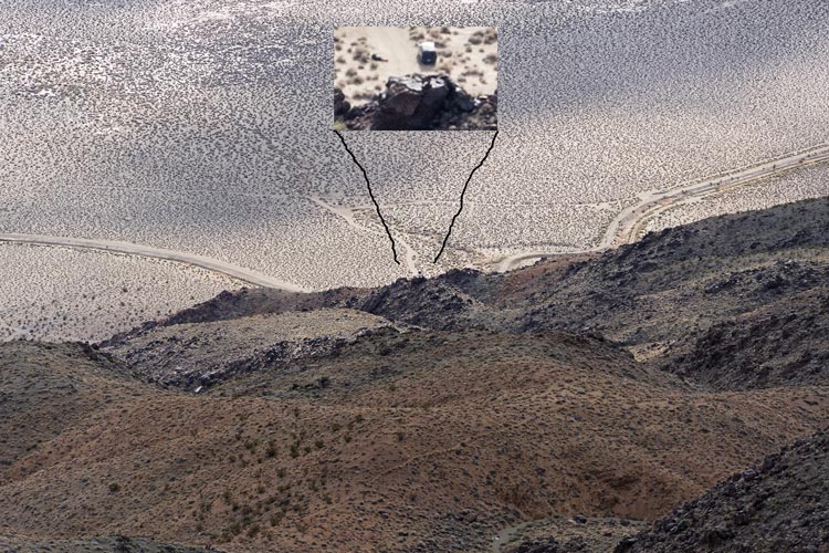
Chris next to the truck so very far below
 |
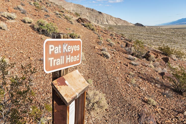
Pat Keyes trailhead sign
 |
Strava page for day 3 hike in Inyos - with zip line. 04-27-2025
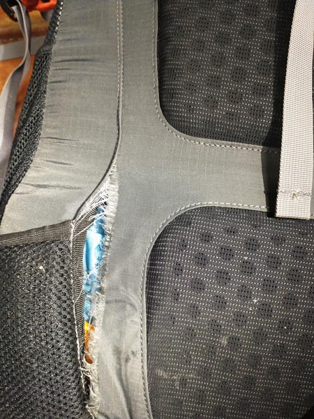
The next morning I was pretty sore, especially my legs and ankles - something to do with speed shuffling down 6000 feet with a pack. That day I managed to pop a .5mm cactus spine out of a toe. I also realized why I had trouble getting my hip belt tight enough - and it wasn't because I lost weight. I still want to go back with enough time to properly explore, but it was cool to see some more of the LMT and the Inyos and it was great training.
seam ripping out on my backpack hip belt
 |
Chris Kerth's Strava Page
Sean Goebels Inyos website has a lot of information
No material on this page may be copied or used without permission.