Tom Grundy's Devils Crags Backpack Page
After the success of the Washington peakbagging trip we planned to do a post-Challenge backpack into the Devils Crags area. There are 3 SPS peaks in this area as well as some other interesting peaks. The area isn't all that far away from home (only about 25 miles straight line), but it isn't so easy to get there. The week before the trip the weather was unsettled with afternoon thunderstorms over the mountains nearly every day. The weather was supposed to turn sunny for the trip, but as we got closer the forecast started to include some chances of rain. I packed my bigger and better raincoat, and a lot of food. I think my load was just a bit over 40 lbs with 5 dinners and breakfasts and 6 partial lunches (mostly sandwiches), and Iris carried a bunch of snacks. Chris was going to be carrying more of the shared climbing gear (eg a 30m rope) but most of his personal gear was lighter.
2025-08-28, We got up early and dressed for hiking and put our packs in the truck and ate breakfast on the way up to South Lake. There we met Chris and plotted climbing gear (some slings plus a handfull of nuts and some rap rings and a 30M rope). There was ice on the bear boxes at the parking lot. Then we headed off up over Bishop Pass and down the other side. For the most part we kept a decent pace and took some nice slabs to avoid the worst of the mule switchbacks down into LeConte Canyon. They have been doing a bunch of work on this trail for some reason (probably because a bridge got destroyed and for the mules). Some of the changes make sense and are actual improvements, some of them are just adding pointless switchbacks. I wish they would spend their very limited trail work budget and effort on trails that really need improvement instead of adding extra switchbacks to make you have to walk back and forth more instead of getting where you want to go. One of our early plans was to stop early on day 1 and climb Giraud, but that is still within dayhike range, and the weather forecast this day had a chance of rain and lightning.
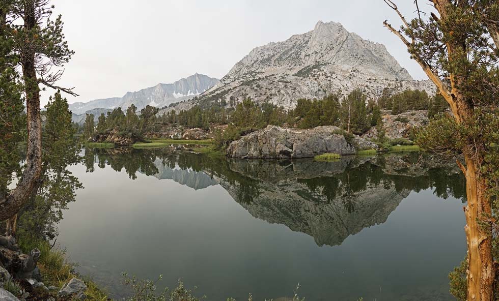
Mount Goode and Mount Hurd reflected in Long Lake
 |
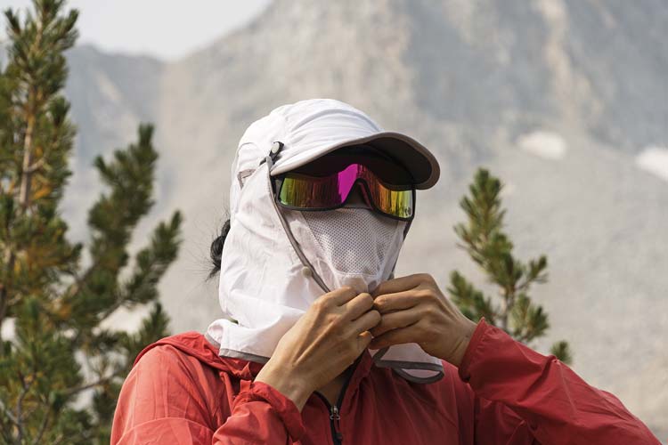
Iris gearing up for the sun
 |
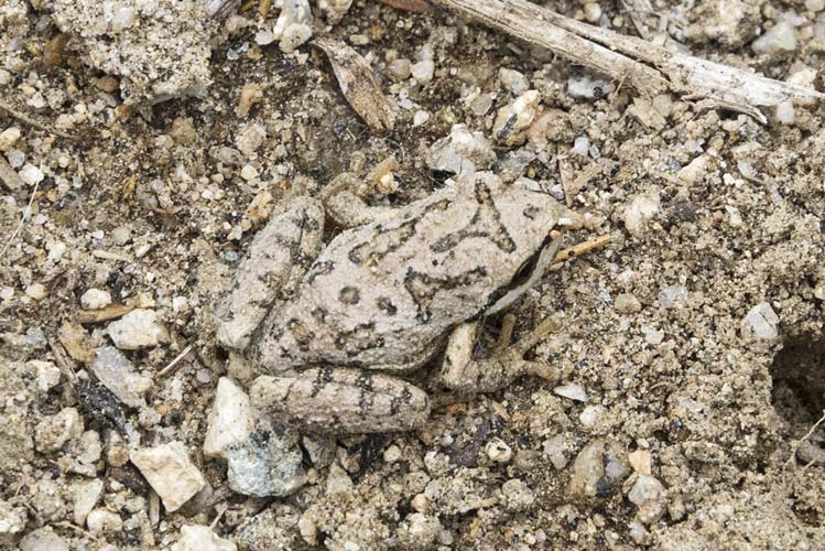
Pseudacris sierra or the sierra tree frog
 |
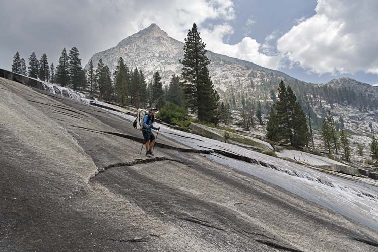
Chris heads down the slabs into LeConte Canyon
 |
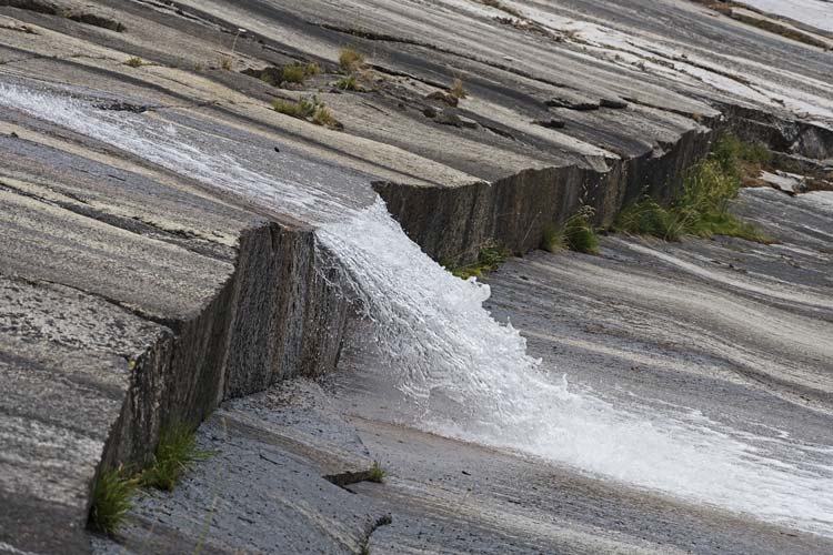
waterfall on the slabs
 |
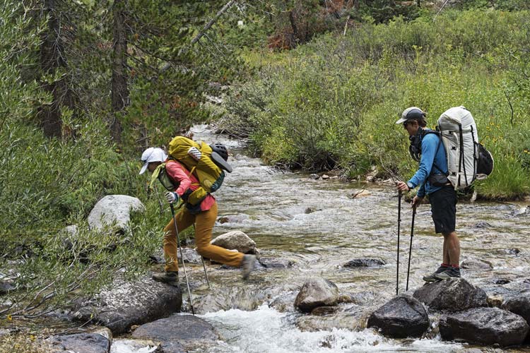
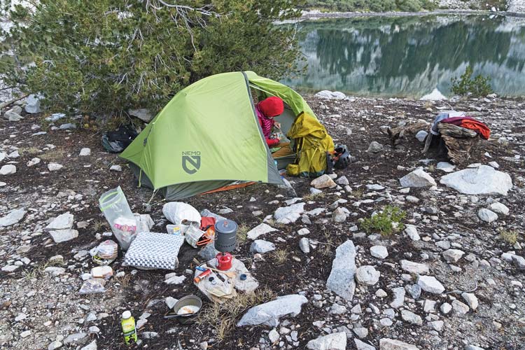
We got onto the PCT/JMT and headed south downcanyon. The trail here sees quite a lot of traffic and true to form we saw more hikers here. It wasn't long before we started eyeing a place to cross the river and head up the other side. We succeeded in finding a spot we could hop across on rocks and then got some more water and headed cross country. At first it was pretty easy travel in the woods but then we had to head uphill through the manzanita and chinquapin. I think we found a better line when we went up the Citadel in the Challenge in 2022, but maybe it was just a much lighter daypack combined with the power of bushwhack-amnesia. In any case we went up and up past the crunchy grabby pokey brush and into a lower angled forest and then finally up a chute and to Ladder Lake. By the time we got there the sky was a weird and scary mix of smoke and rain clouds and it in fact started to sprinkle a bit. We walked around the lake to a peninsula with some camping spots and started to set up camp - that is when it started raining in earnest. Things got a little wet but a combination of raincoats, haste, and throwing things under the thicker trees worked for the most part. Once camp was set up the rain stopped and we cooked dinner (enhanced ramen) under another tree as it got dark. We had hiked up over one pass and then bushwhacked up quite a bit and I for one was quite tired.
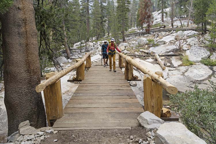
brand new bridge on the PCT/JMT
 |
crossing the middle fork of the Kern
 |
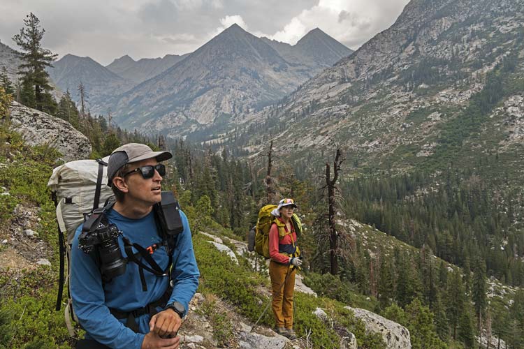
heading uphill - LeConte Canyon below, we came down the slabs above and left of Iris' pack
 |
camp in the morning
 |
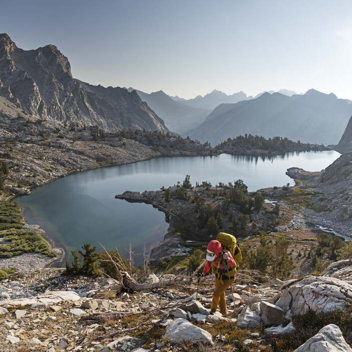
2025-8-29 We got up and had cheesy jalapeno grits for breakfast and packed up our damp camp. Then we started up the hill again. We had a big uphill and then a short bench by a lake before another uphill to the crest. We went over the steep crest and dropped down to a lake where we left our overnight packs and transitioned to daypacks for the hike up McDuffie. This involved a rocky traverse and then a rocky ascent. I had already climbed this peak with Jeff Moffat back in 2023 from the other side with a lot more snow. This would be the highest peak of the trip at 13275 feet and also an SPS peak as well as a few other lists. From this side the ascent mostly was a lot of talus with a bit of either scrambling or more talus and scree depending on what you felt like on the way up. Fortunately there wasn't much of a false summit and soon enough we were on top. There was a lot less snow at the end of August in a sort of normal snow year compared to mid July of a heavy snow year when I was last here.
Iris hiking up above Ladder Lake - we camped on the peninsula
 |
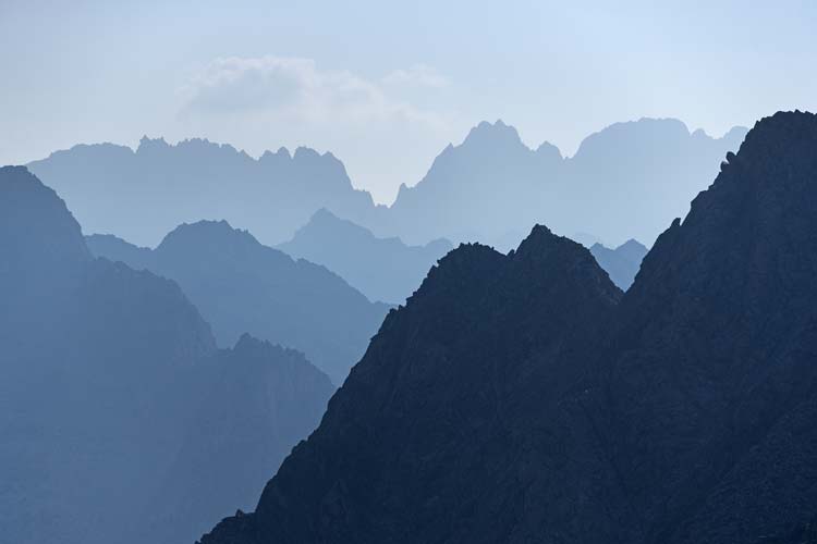
hazy mountains out to the distant palisades
 |
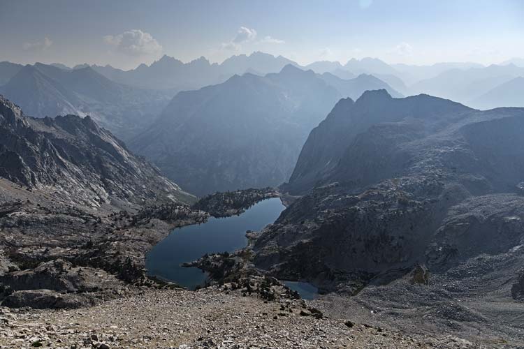
looking down at Ladder Lake and The Citadel
 |
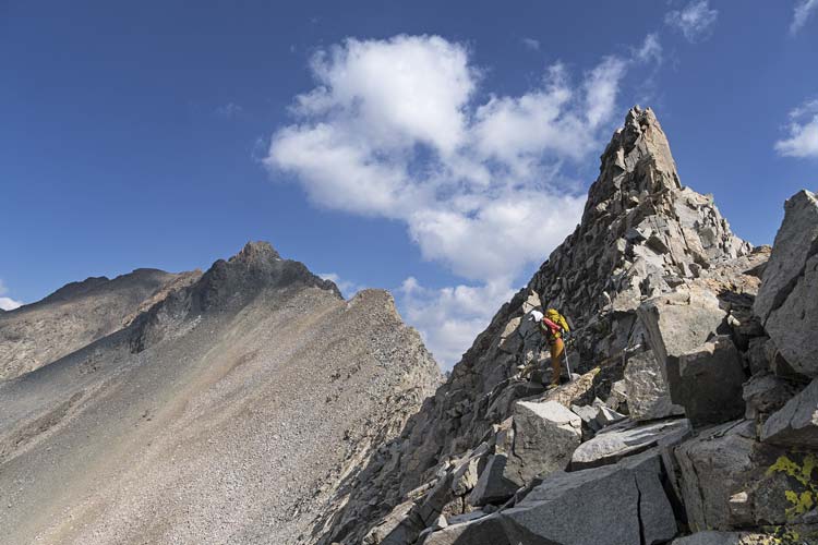
Iris scoping the descent from the steep ridge
 |
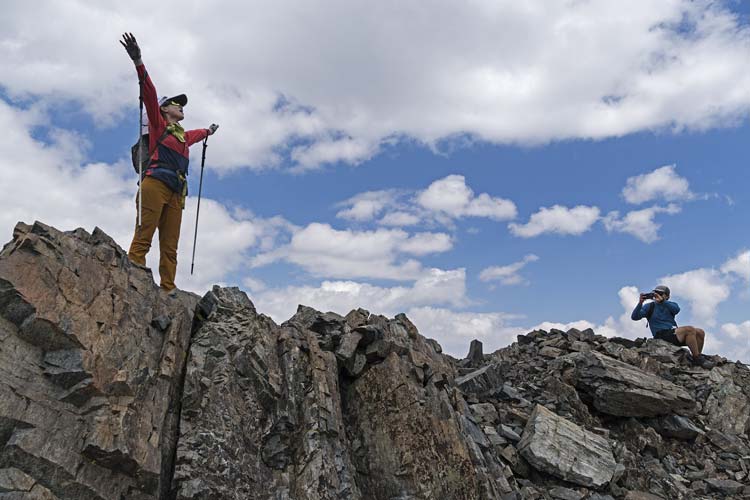
Iris celebrating McDuffie
 |
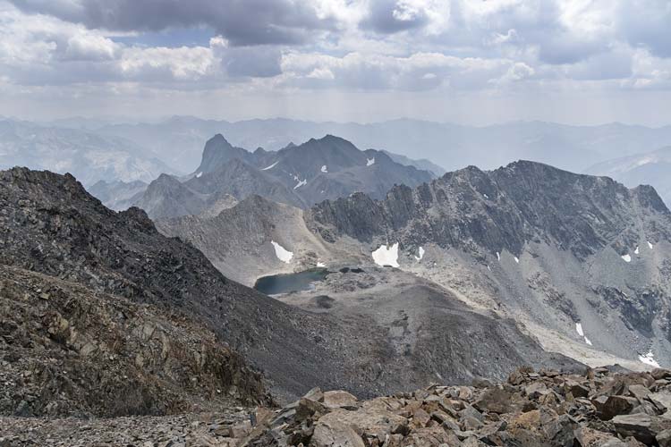
view southish from McDuffie with the Peak 12787 right of the lake and Wheel in the center
Devils Crag is the tall peak below the horizon on the leftish
 |
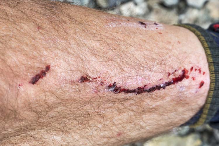
The descent went a lot faster although there was only a little bit of decent scree skiing and mostly there was a lot of loose mid-sized rocks (baseball to shoebox size). I think we all went down at least once before we made it back to our packs at the lake. Then we headed up over another pass between the ridge and Peak 12787. This peak previously was not thought to have 300 feet of prominence but according to the recent Lidar data it did. It also did not have any reported ascents on Peakbagger or Lists of John. We hoped to just climb up the ridge to the summit, but the view from McDuffie made that seem like a lot of work and maybe quite dangerous. Instead we would descend a bit and then traverse below the ridge and up to the summit. The descent was slow and tedious with lots of loose rock. Somewhere I stepped on a rock that slid and my other foot slid and my poles slid and I went down. I rolled at least once before I got my feet facing downhill and started clawing for traction to stop me before I went down the steeper bit below me. I stopped before that happened but not before scraping up my shin and a finger and breaking one trekking pole (none of the segments were broken, but the latching mechanism at the top wasn't working so it wouldn't stay extended - when I examined it more closely back home I could see that the top of the top segment was broken inside the handle). So I was down to 1 pole and had a bashed shin and mojo.
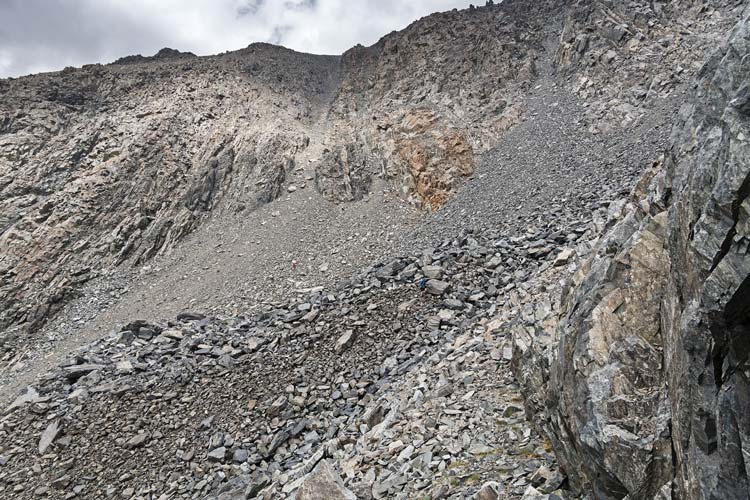
Iris in a sea of talus below the chute we descended and Chris in the bigger rocks in the center
 |
I bashed my shin
 |
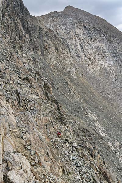
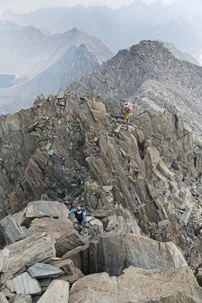
We stashed our big packs again and headed up the S side of the ridge. With a bit of scrambling we got onto the lower angled side of the peak and headed diagonally up towards the summit. The ridge was longer than we hoped and there was a bit more scrambling at the top. Iris spotted a register - placed in 1994? by Steiner Stenzel in what he thought might be a first ascent of Peak 12,787. We were the first people to sign the register after him. We returned to our packs and loaded up and continued down the loose descent. After this things were a bit easier as we headed across a more level area. Then it was back to steep morraine - this time we got up on top of it where there were mostly big rocks which were mostly stable. That got us up to another steep hill up to a plateau North of Wheel Mountain. We dropped our big packs again here and headed up a few hundred feet to the 12780 foot summit of Wheel Mountain - another SPS peak. People complain that it is more of a pile of rocks than a mountain, but at least the last bit we climbed up was decent - all the up to get there wasn't so great.
Iris scrambling up, we descended from the notch
 |
Chris and Iris scrambling up the ridge on bigger rocks
 |
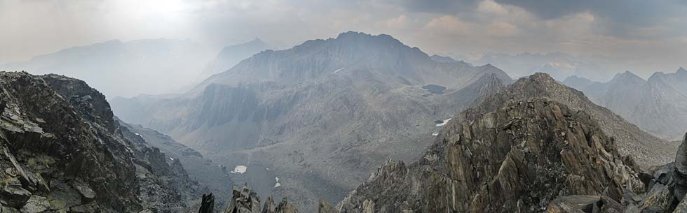
panorama from the Peak 12787, McDuffie is in the center
 |
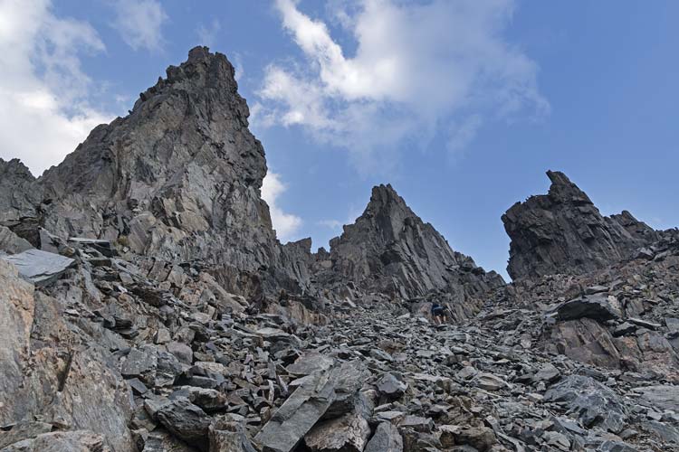
Chris scrambling up Wheel Mountain
 |
smoky vista from Wheel Mountain
McDuffie is in the center, the unknown ridge is to the left
 |
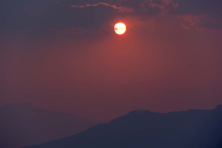
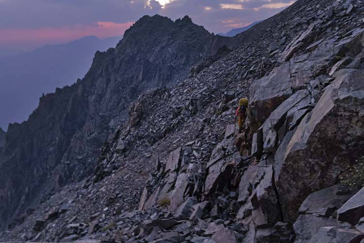
By now the sun was pretty low in a smoky sky - making for a very orange ball setting over the mountains as we headed back to our packs. We didn't have very far to go to the small lake we planned to camp near, but it turns out it wasn't very easy to get there. The first bit across the north to northwest slope was fine and I thought this took us to the ridge we were to descend, but I was wrong, we had to cross an unpleasant loose slope to the SW ridge before we could descend. During this crossing numerous rocks shifted under us and it got dark. Out came the headlights. When we did get to the correct ridge to descend it wasn't all that straightforward either. Once we got close to directly above our lake we left the ridge and descended south. While not exactly horrible, it wasn't great either with just a few patches of nice scree skiing and mostly loose larger rocks or hard packed dirt. Eventually the angle eased up a bit and I saw the reflection of the red moon in the water. Iris and I were both pretty beat by the day and very ready to be done hiking. We set up the tent and sadly (at least in Iris' case) did not take a dip because the "lake" was less than a foot deep, and mostly a lot less. It also had somewhat greenish water. Fortunately I was able to backflush the Platypus filter in the field. Dinner was a delicious home cooked and dehydrated chicken with vegetables and peanut sauce with rice noodles. We didn't get to sleep nearly as early as we wanted though. This day definitely qualified for the "30% more than we really wanted" description - or maybe 50% more.
smoky sunset
 |
cutting across the slope below Wheel Mountain - it was nearly dark at this point
 |
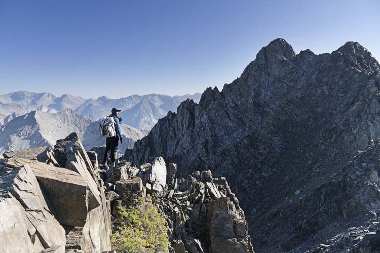
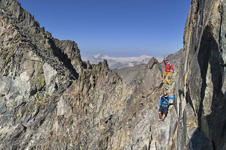
2025-8-30 We totally failed to make our planned 7 am start time this morning. Iris and I were pretty hurting when we woke up and she did her best to cold plunge in the little lake. Just a bit of walking around seemed to bring me to mostly full functionality. At least the air was a lot clearer. We headed up to Rambaud Pass and then up the slope towards Devils Crag #1. Near the top we stashed some trekking poles and then dropped into a gully to the notch before White Top. Then at the next notch (still before White Top) we cut across the SW slope through a gap and contoured around onto the ridge up to DC#1.
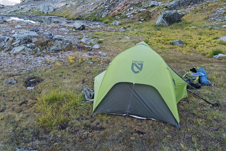
camp in the morning
 |
Chris scoping our line - White Tower is to his right
 |
cutting the corner towards Devils Crag #1
 |
view towards Devils Crag #1
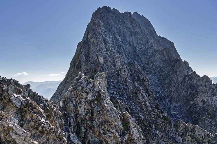 |
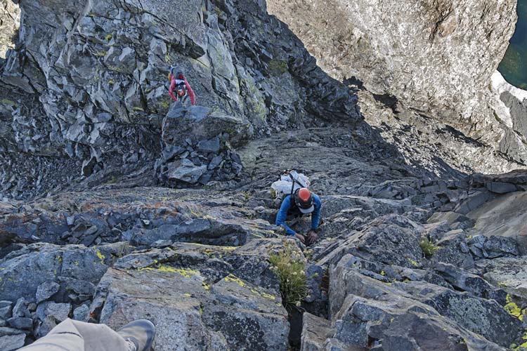
After the saddle we cut a bit right and headed up a shallow trough with a bit of a chimney move at the top and a pretty recent anchor around a huge boulder (there was an older anchor before the chimney move too). We continued on scrambling mostly on or very close to the ridge up past another low spot and through the "rabbit ears". The crux was probably dropping down past a knife edge - which was conveniently easily bypassed by building an anchor and rapping down the left side and then walking past it and climbing the ridge beyond on up to the summit. I left the anchor and downclimbed - probably only 4th class. We spent some time on the 12624 ft summit - possibly the most technically difficult of the SPS peaks. We had summit cookies and took a lot of pics. The aluminum register container had been struck by lightning numerous times and there were copies of some of the original register pages. I also scrambled over to a lower SE summit to take some more pics and eyeball descending and climbing to DC#2 (it didn't look casual).
scrambling up the ridge
 |
Iris channels Major Kong on the ridge
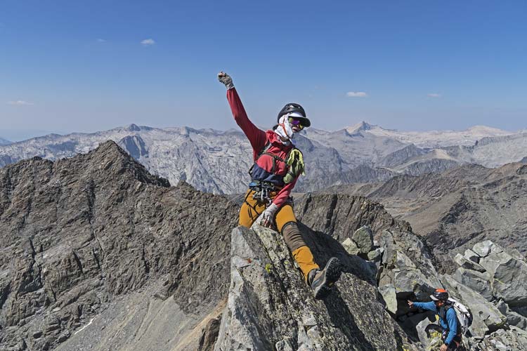 |
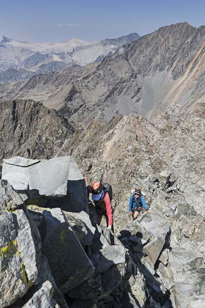
more scrambling
Wheel Mountain upper right
 |
Iris and the summit register
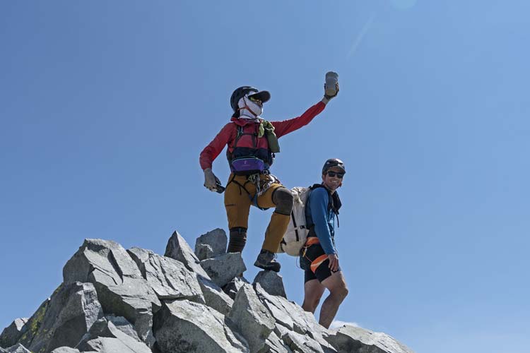 |
you can see the summit register has been hit by lightning
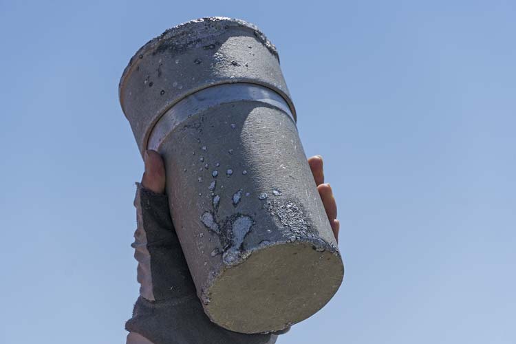 |
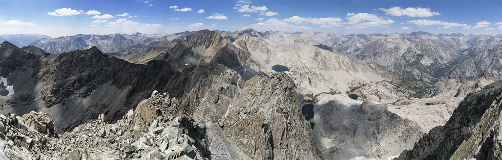
panorama from the summit, McDuffie is center, Wheel Mountain is left of it, Woodsworth is far left, Rambaud Peak is far right center height
 |
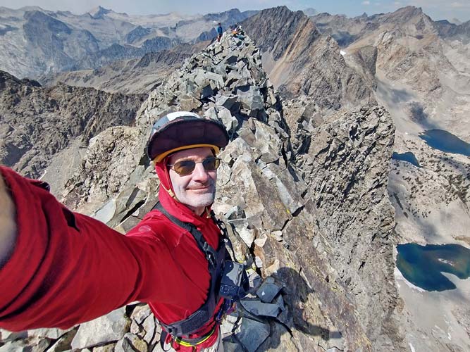
I'm on the ridge SE of the summit
 |
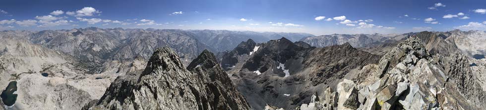
360 degree panorama from SE of the summit (which is rightish) Peak 11867 is center with Woodworth to the right, DC#2 and 3 are center left
 |
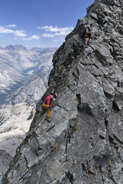
The descent was pretty much the reverse of the ascent except I belayed Iris and Chris up after the knife edge and we rapped down three times. For the second 2 raps we used a single strand of the rope to go farther and for all 3 I took down the anchor and downclimbed (except for the last anchor which was fixed good looking cord and I left it there). Then we headed up White Top - or as someone wrote in the register "how is this not named "White Devil"?".
downclimbing
 |
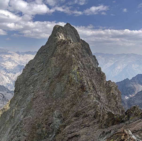
Devils Crag from the side of White Tower
 |
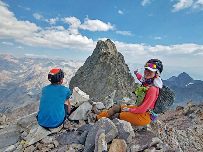
Iris and Chris on White Tower, Iris points to the glory of DC#1
Peak 11867 is above the snowfield behind Iris
 |
We then returned to the stashed trekking poles and back to camp. There was still plenty of daylight, but probably not enough time to do any more peaks without headlamps so we called it a day. Iris went on a fruitless search for a better lake nearby and then did her best to wash up and cold plunge in "Tom's Tarn". (Tom B had camped here when he did these peaks earlier). It was nice to get dinner and to bed at a much more reasonable hour.
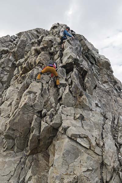
downclimbing from White Tower
 |
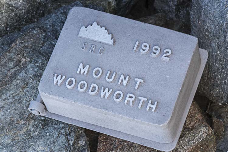
2025-8-31 Today we came a bit closer to our target departure time. We headed to the south and then around a shoulder and up through the talus and a gap in the cliffs up towards Mount Woodworth - named by the first ascentionist in 1894 for some guy camped in the valley below. Supposedly as late as 2006 the original register was still there which we searched a bit for but no luck. There was also a 1992 aluminum Sierra Register Committee register box. The smoke was starting to build down valley to the west but it was still clear here. We headed down to the SE towards another numbered peak - this was mostly easy going until the ridge got rocky. We dropped down a gully and cut back onto the ridge with a bit of scrambling. Then across the saddle and up the other side with a bit more scrambling to the summit of Peak 11867 (or maybe it is Peak 11871 as Peakbagger claims). Alas we found no register here - until Iris spied a small aluminum film canister way under a big rock. This summit and the flank of Woodworth were good places to scope the SW side of the Devils Crags and we did a lot of staring at them as well as taking pics. We also considered dropping down to the SW side of the Devils Crags from here and then up over the 8/9 col to get to our next camp. We abandoned that idea. The scramble back up and over the shoulder of Woodworth wasn't too bad and then we headed back to camp.
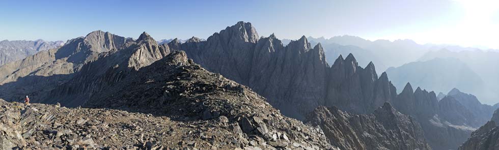
Devils Crags, Iris coming up on left
 |
Woodworth summit register
 |
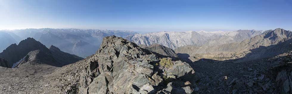
panorama from Woodworth, Peak 11867 on the left, Gorge of Despair below, Wheel on right
 |
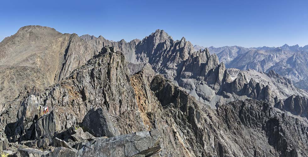
Iris scrambles up towards 11867, Woodworth on left, Devils Crags on right
 |
view from saddle between Woodworth and 11867
 |
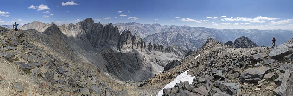
view from shoulder of Woodworth
 |
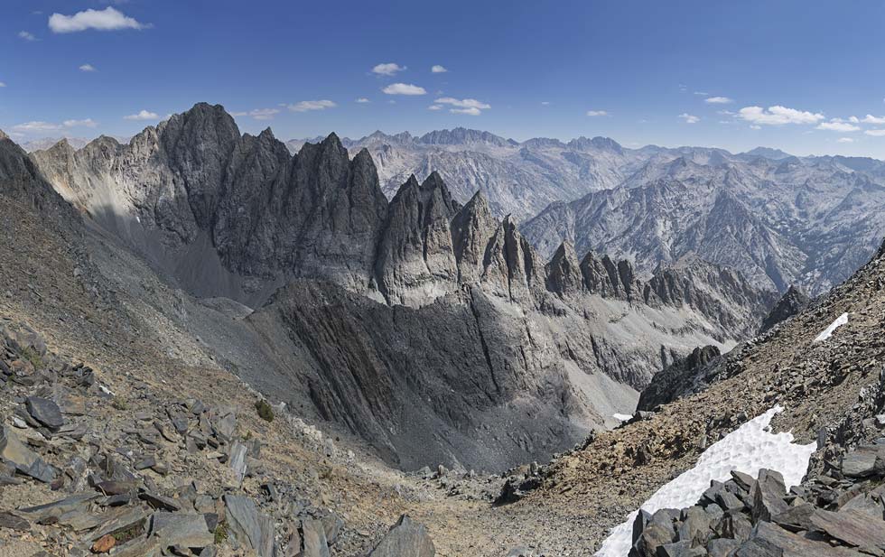
cropped in on the view from shoulder of Woodworth
 |
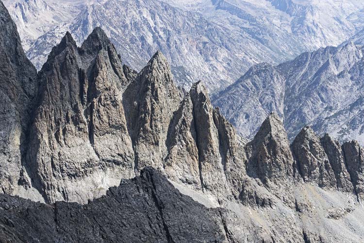
zoomed in on DC#5 to 12 (you can see some of 4 to the left too)
 |
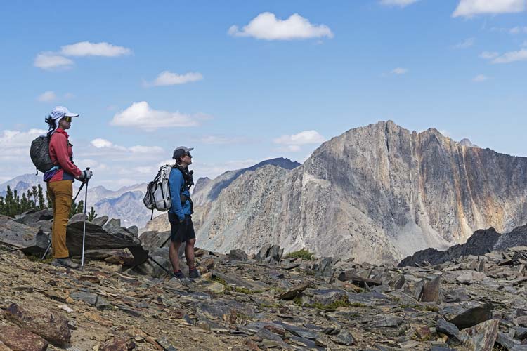
Iris and Chris scoping out the Devils Crags, Wheel Mountain on right
 |
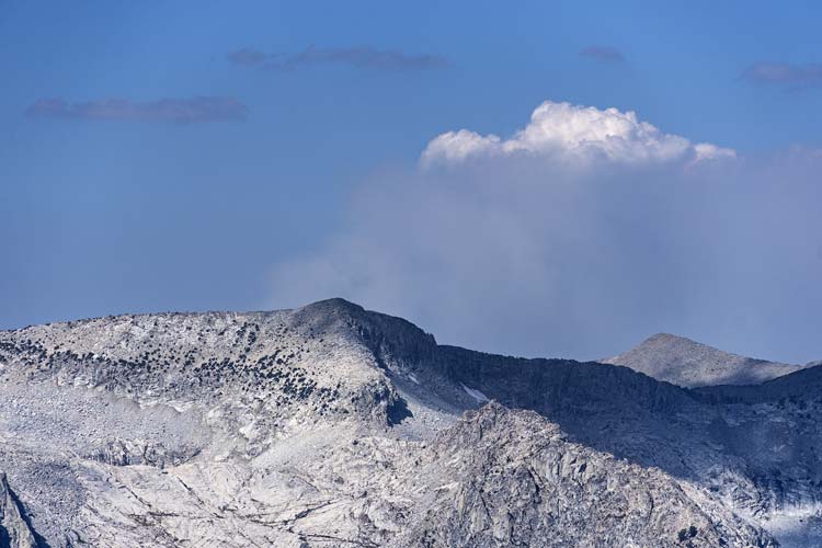
smoke from a distant wildfire to the west rises into the sky and starts making a cloud
 |
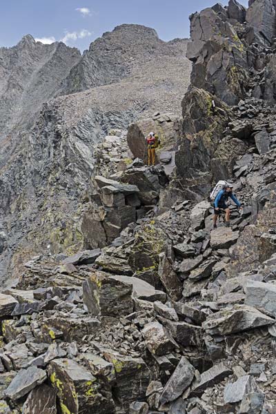
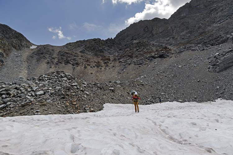
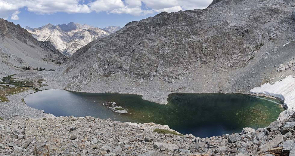
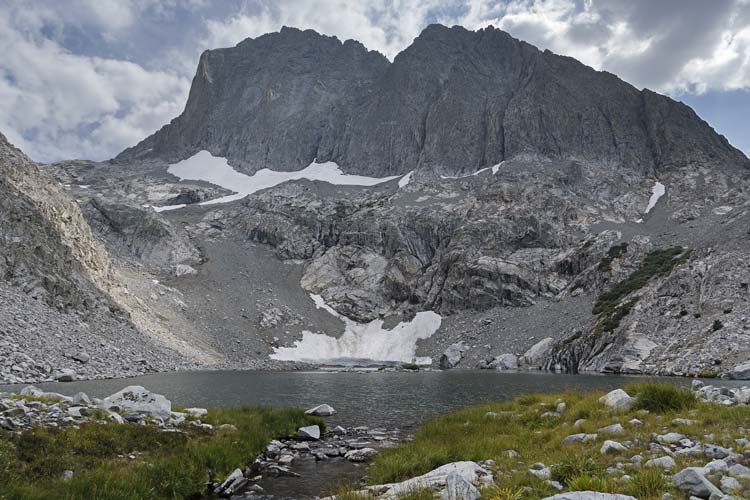
After packing up we shouldered the heavy packs and headed up to Rambaud Pass. The direct descent from the pass looked pretty bad with steep hard packed small rocks and some snow. The trip reports and some tracks showed a way to skirt around the worst of the dropoff below Wheel Mountain so we tried that - it mostly worked fine except when I was trying to put my phone back away and fumble-dropped it and it just started bouncing down the slope - really bouncing a lot and spinning through the air like a wheel in between bounces. I followed its passage below and saw where it landed and went down parallel to it and then traversed over so I didn't drop more rocks onto it. It still worked, and looks like only the screen protector got shattered (later - I pulled off the screen protector and stuck a new one on - no obvious permanent damage). The descent was still unpleasant and we dropped down to a long relatively flat snowfield that made for much easier travel than the morraine jumble of rocks on either side. Unfortunately the snow ran out and we just had the rocks for a while - following the low point and then a drainage down to a lake. Here we cut around the lake and found a bit of a use trail for a while and continued downstream until we took a right turn at another lake and started cutting south along a bench of sorts past another lake and finally to a nice lake (that I swam in when I did Rambaud before). Here we set up camp in a meadow next to some thankfully old bear scat. Then Chris went to do Rambaud Peak and at the last minute Iris joined him. I had already climbed it so opted to relax around camp.
probably the crux of the traverse down from Rambaud Pass
 |
on the snow below Rambaud Pass which is on the left
we cut over from the notch with teeth and down the lighter diagonal ramp
before dropping my phone and descending the talus
 |
lake down below that we hiked past later
 |
near the outlet of that lake, DC#1 above to left, White Tower to right
 |
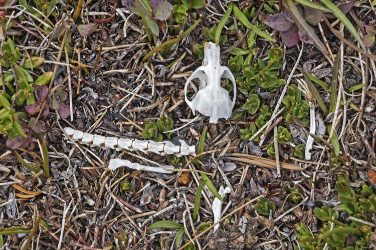
rodent remains on the alpine tundra
 |
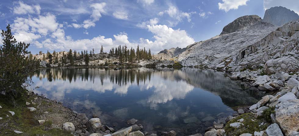
another scenic lake
 |
I stayed in camp and carefully timed a much needed dip. Just before the clouds cleared I jumped in, so the sun was out when I got out and I was able to dry off before the sun went away behind the Devils Crags. I also washed some clothes and started getting ready to cook dinner. When I saw Iris and Chris returning I really got going on dinner so that by the time Iris was done her dip I had a warm protein shake ready and soon after we had more of the peanut sauce-rice noodle concoction. There was a lot of discussion about our plans for tomorrow. We had Sean O's recent trip reports as well as the old Smatko guidebook and the Secor guidebook to confuse us. To give us more options you could access the notches between the summits from the SW or the NE using the 8/9 gap to get between the 2 sides and for more confusion Peakbagger and Lists of John had the summits marked in different places (PB was right possibly having been corrected by Sean, LOJ seemed confused, but I think this has since been corrected). The main goal was to climb #6 since it had over 300 feet of prominence, but to get there the easiest way was over 5, and to do that you had to get up to the 4/5 col - which from the SW side Sean reported was dangerously loose (he cut his arm going up) and the NE side still had snow in it... Still confused we slept on it.
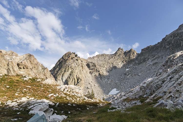
pass on the way towards Rambaud Peak in the center
 |
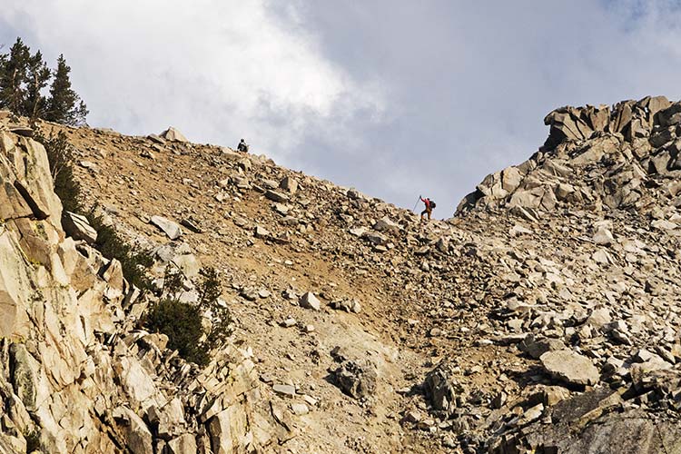
Chris and Iris on the pass
 |
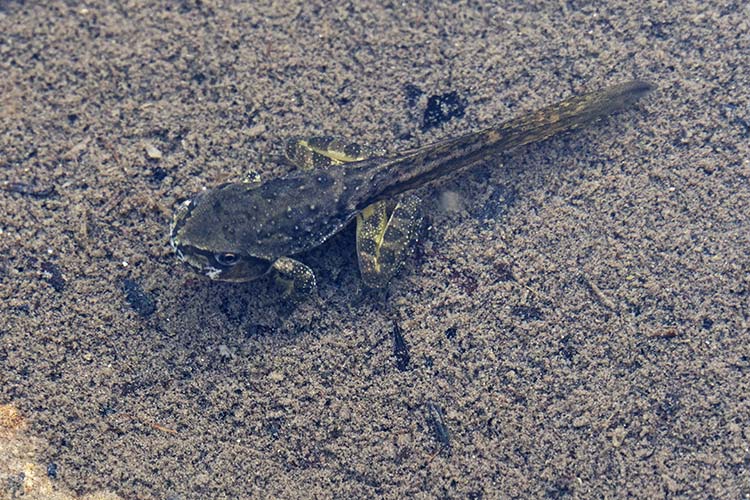
Sierra Nevada mountain yellow-legged frogpole
 |
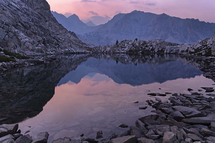
pastel sunset over our little lake
 |
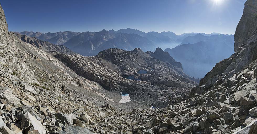
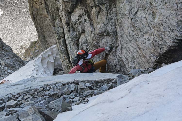
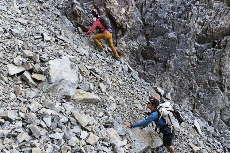
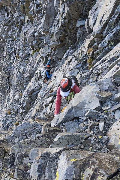
2025-9-1 Happy Labor Day. Today our labors would be to climb some Devils Crags. We started off heading up the slope out of camp up to the bench below the NE side of the crags. There we headed slowly SE looking at the 4/5 gully - mostly looking at the snowfield to see if we thought we could get by it. I was able to take a photo with my zoom lens and then zoom in on that and it looked like we could get by the snow. This was a relief because the 4/5 gully on the SW side was reported to be hard and sketchy, not to mention on the opposite side of the mountain. So, up we went past a mostly frozen little tarn and up to the couloir entrance. It wasn't too bad getting up past the snow, but then there was a chockstone to stem by and above that there were a lot of loose rocks just piled up ready to fall. We took turns moving through this area and then up to the 4/5 notch. Here we went up a chimney formed by a huge boulder in the notch and then started up towards DC #5 by cutting over to the west side of the peak and following ramps and whatever path we could find. We were heading for a notch which in retrospect probably would have worked - but with maybe some easy 5th class climbing to get there. Instead we dropped left on a ramp and then headed up another shallow dihedralish feature to near the top. There we cut out to the right and around to more broken rock that led to the summit.
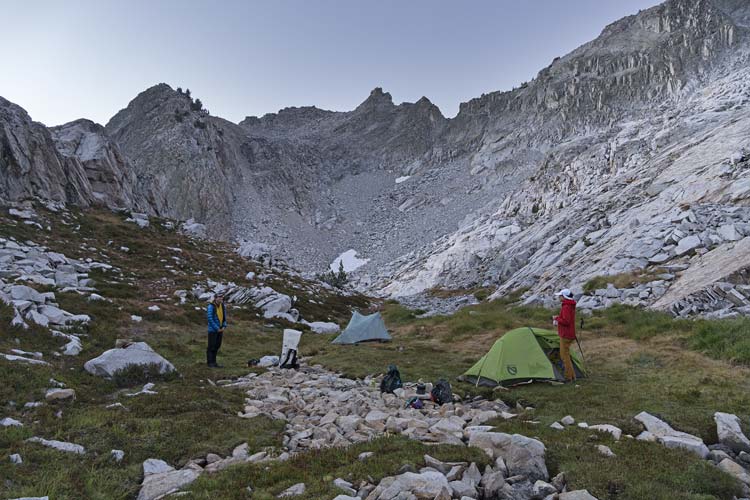
camp in the morning. We went up the slabs on the right
 |
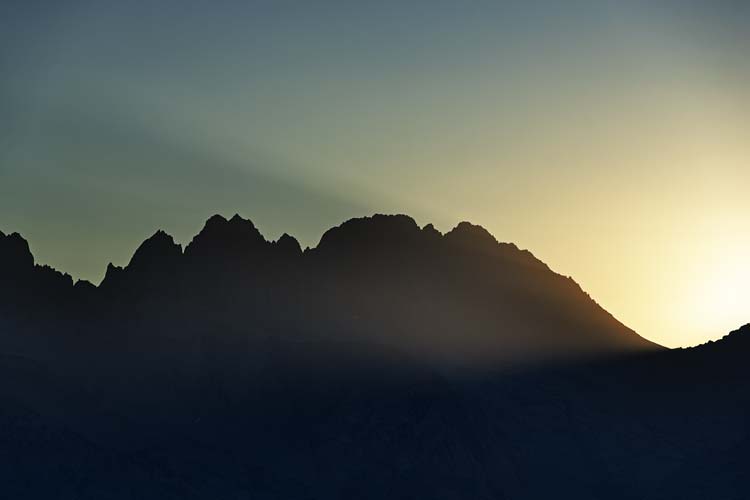
sunlight streams past Middle Palisade with Norman Clyde and Williams to the left
 |
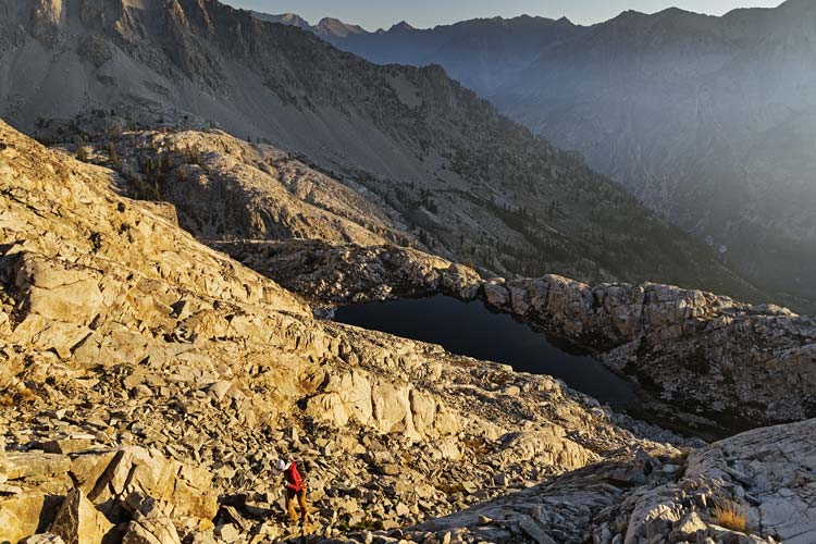
hiking up the slabs, camp was right of the lake
note smoke settled into the canyon
 |
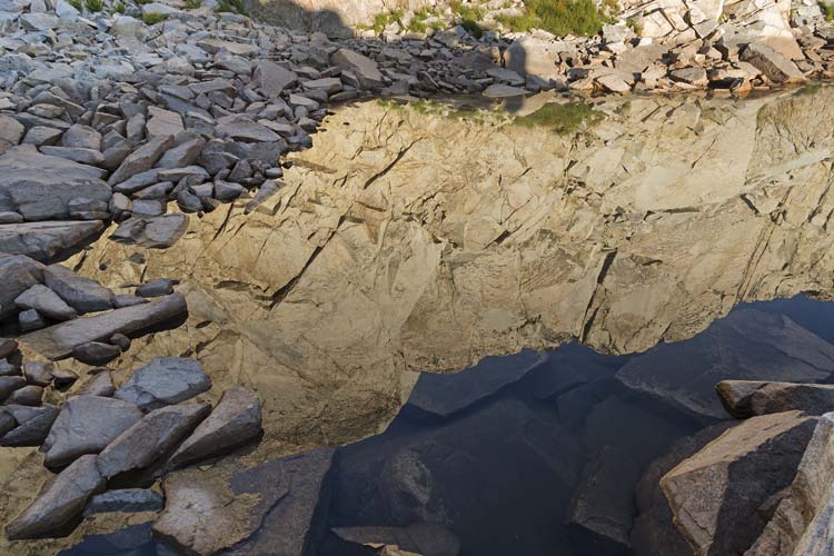
reflection in a small lake
 |
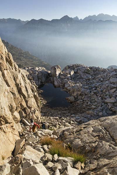
scrambling up above that small lake
 |
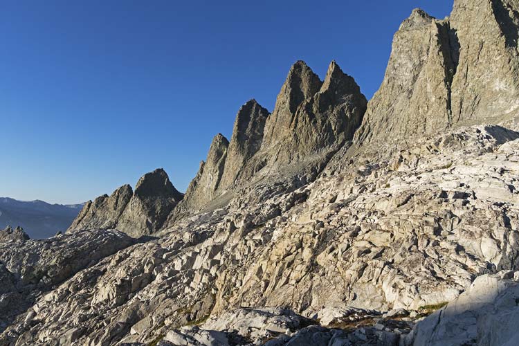
Devils Crags maybe 12 up to 4 with part of 3 visible
 |
Devils Crags 4 to 1
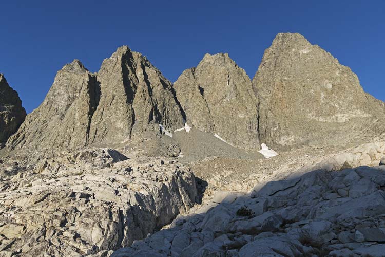 |
Devils Crags 8 to 3, we went up the 4/5 col
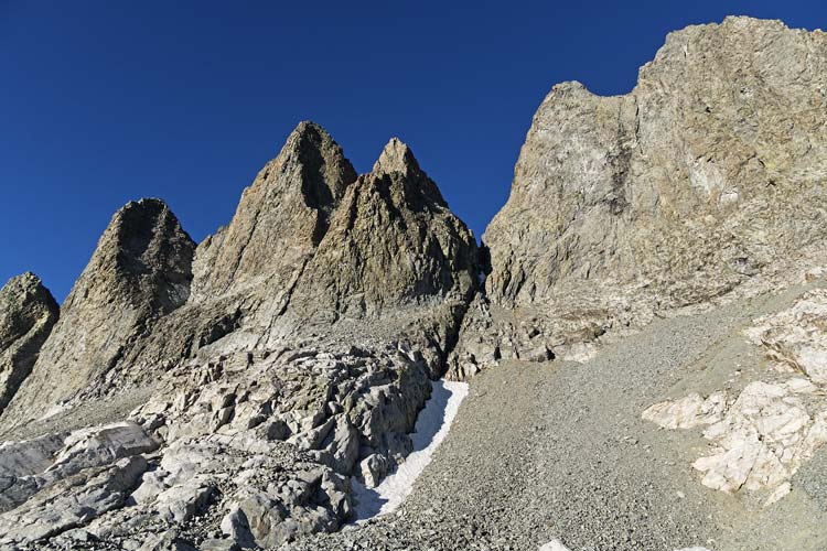 |
zoomed in on the 4/5 col and couloir to see if we could get up
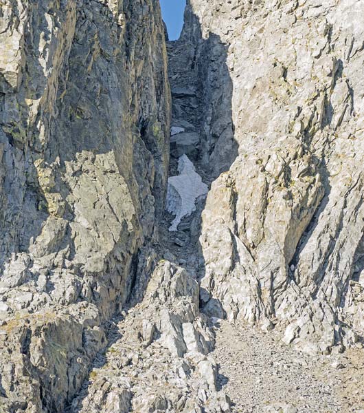 |
mostly frozen tarn on the way up to 4/5 col
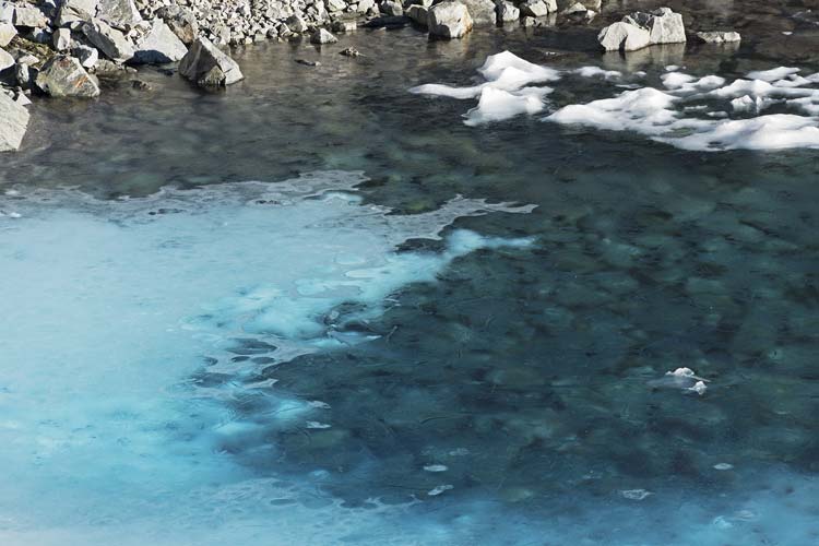 |
panorama from just below the couloir, Rambaud is the dark peak right of center
 |
Iris climbs the chockstone in the 4/5 couloir
 |
careful scrambling in the 4/5 couloir
 |
steeper scrambling up towards DC #5
 |
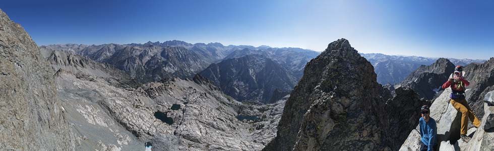
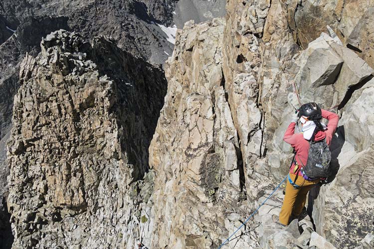
We signed the register and took pics and then started thinking about the descent, we dropped down to the south and I set up an anchor so the others could rappel and then cleaned it and downclimbed. Then we cut across the south side to the 5/6 notch and headed up from there. More scrambling ensued on up to the summit. This one had what looked to be a modified original register and despite the prominence, not a lot of ascents in the last nearly 100 years. Sean reported the descent down to the 6/7 notch was pretty spicy, so we returned back the way we came and then went up to the notch south of DC#5 that we were originally climbing up. I set an anchor here and the others rapped down past the sketchy downclimbing and then I cleaned it and climbed down myself. One part was a bit spicier as I had to avoid some loose rock and a hostile plant by taking a steeper line - that had more solid holds though. While Iris was climbing down she kicked a rock out of the way and it dropped down and dislodged a much larger rock that then went down into the gully to the SW. To descend the NE gully we carefully took turns while the others either held still or hid off to the side to avoid the falling rocks. Then we cut SE along the base of the cliffs heading for the 8/9 notch. Unfortunately we couldn't walk all the way right along the base of the cliffs but had to drop down lower to avoid some intermediate cliffs. Along the way I found a length of old webbing threaded through a nut just sitting on the ground.
panorama from the DC#5 summit, DC#6 is the obvious peak right of center
 |
Iris at the top of the rap from DC#5, we went through the obvious notch after DC#6
 |
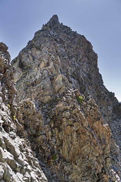
view up towards DC #6
 |
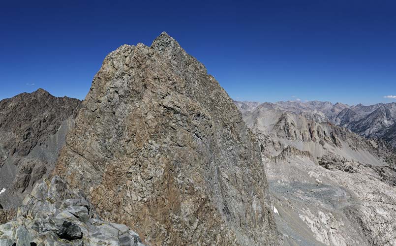
view from DC#6 looking NW
#5 is hard to pick out from the face of #4 and I'm not sure if it is 2 or 1 that appears highest above
 |
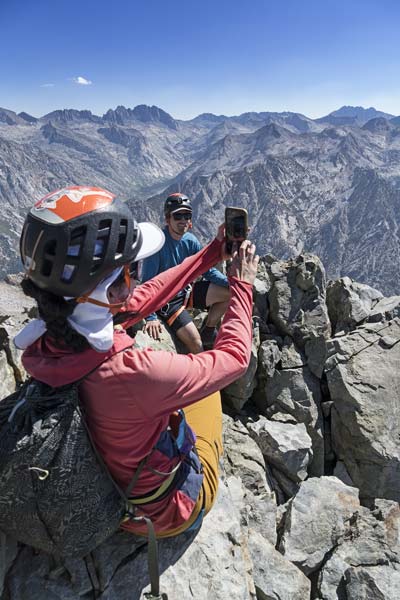
on the summit of DC #6
 |
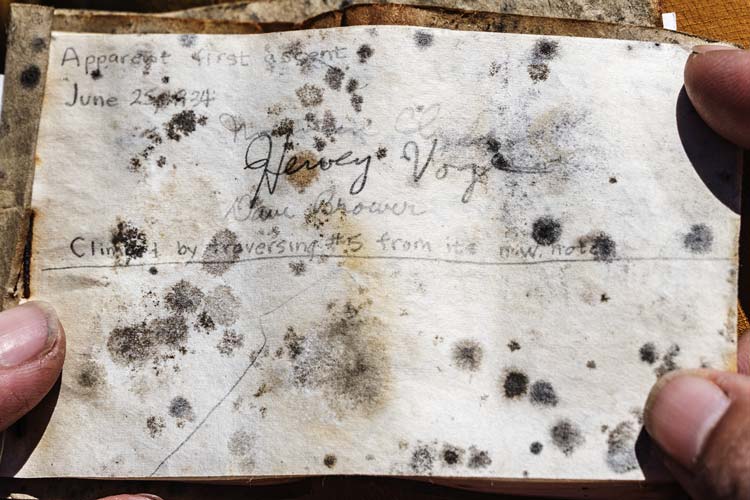
page from DC#6 register
 |
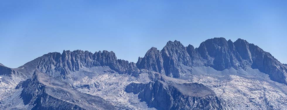
distant Palisades on the horizon - Palisade Crest on left half, then Williams, Norman Clyde, Middle Pal, Disappointment, and Balcony
 |
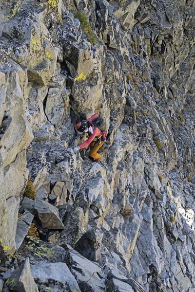
careful downclimbing
 |
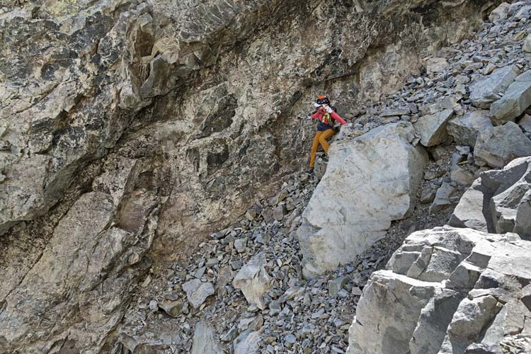
Iris descending the couloir
 |
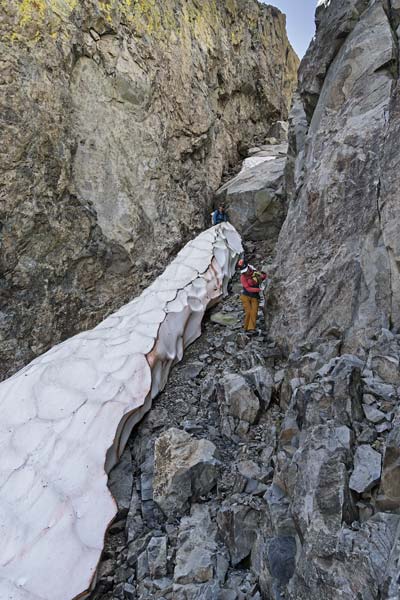
Iris goes past the snow and Chris is just below the chockstone
 |
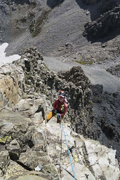
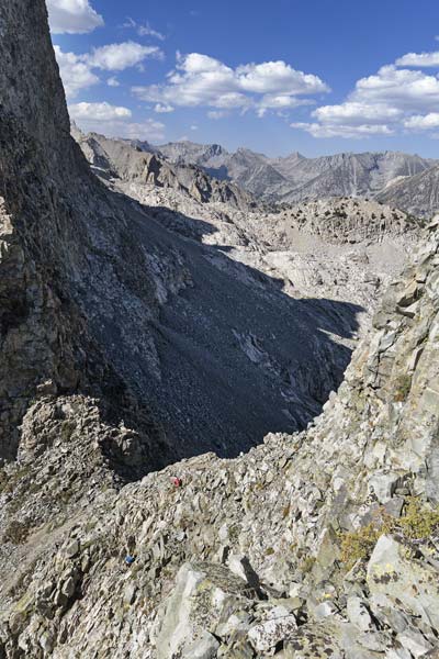
We made it up to the 8/9 gully which was pretty short and not so very steep. It still had plenty of rocks that wanted to roll down though, so Chris went up the gully and Iris and I climbed a rock rib along one side. We regrouped at the notch and read through the brief Smatko route descriptions. Chris wasn't feeling the scramble so Iris and I headed up and right towards what looked like a shallow dihedral on the south side of the NW arete or maybe we would go to the west side of the south or SW arete. In any case we followed an easy ramp up and across below the face and made it look so casual that Chris decided to follow us. Unfortunately it didn't remain quite that casual, but we were able to find a route up to the summit blocks and then traversed left under them until we could find a way up. The PVC slip clamshell register here was open and empty (later I heard from Richard Shore it had been full of register soup with only the pencil lead remaining when he climbed it earlier). We left a tiny slip of paper with our names in it and then headed down. Once again we set up a rappel for the hardest part of the climbing and used nearly the full 30 M of rope and then I cleaned the anchor and downclimbed carefully. Then we went back to the notch and back down.
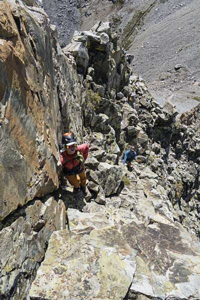
climbing up just left of the SW ridge of DC#9
 |
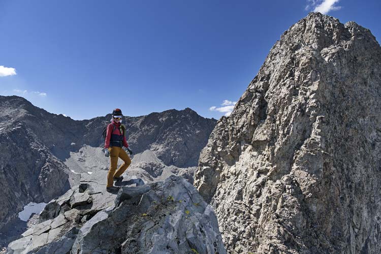
Iris on DC#9, the lower numbers are to the right
 |
rapping off of DC#9
 |
Iris and Chris descend to the 8-9 col
 |
Back on the talus we headed back towards camp. Chris quickly caught up and then went ahead to get a dip in and to have more time to pack his camp. Back at camp we packed everything up and then started back towards the trailhead. We opted to take the route back I used to descend when I did Rambaud in the challenge (as best I could remember). I think I mostly followed it, although I maybe did a better job of avoiding all the talus the previous time. We headed back along the bench and then followed above and left of Rambaud Creek until we could head over to a huge dead tree and some other trees on a shoulder. Then we headed downhill and right a bit and then dropped left past some other trees to a bench above some big rocks trying to avoid the worst of the brush. There we headed left and angled down through the forest towards the river through the thickening smoke and increasing dark. Somewhere in here it got fully dark so out came the headlamps. We continued downhill and left through downed trees until we hit the river. There we waded across. After we put our shoes on it was just a hundred feet or so to the PCT/JMT. We headed upstream looking for a place to camp passing a few sites that probably would have worked but didn't tick all the boxes and then found one by Grouse Meadows. We set up camp, got water, and I cooked up dinner of cheesy mashed potatoes with mini sausage bites while Iris iced her legs and rinsed off in the river. We watched the red moon set behind the ridge and went to bed.
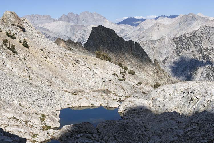
Rambaud in the cloud shadow
 |
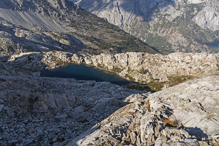
our camp is in the meadow right of the lake, Chris is by his tent
 |
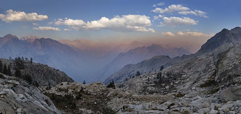
smoky air down in LeConte and Palisade Canyons
 |
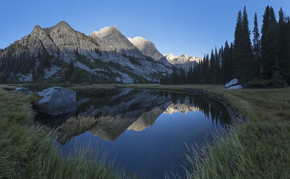
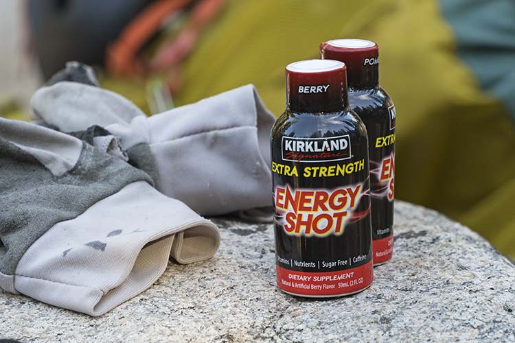
2025-9-2 The forecast today called for rain - when exactly and how much was less clear, but we wanted to be at least packed up and hopefully past the slabs before it started and we really wanted to be over the pass before any serious lightning. We got up in the dark and started pretty early, but not after taking a bunch of pics of the mountains reflected in the river in the Grouse Meadows. It was nice having fairly light (5+ days of food and fuel less) packs and to be on a trail. We passed plenty of other hikers on this popular trail (PCT and JMT). When we got to the bridge before the turnoff Iris and I each drank an "extra strength energy shot". This helped power us up the next few thousand feet and we made pretty good time and also managed to find most of the good slab switchback bypasses. Iris also put in her earphones and was listening to music, but the uphill pace was such that she couldn't really sing and get enough oxygen until the trail leveled off above.
mountains reflected in an oxbow of the Middle Fork of the Kern River in Grouse Meadows
 |
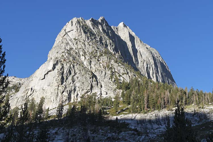
looking up at The Citadel
 |
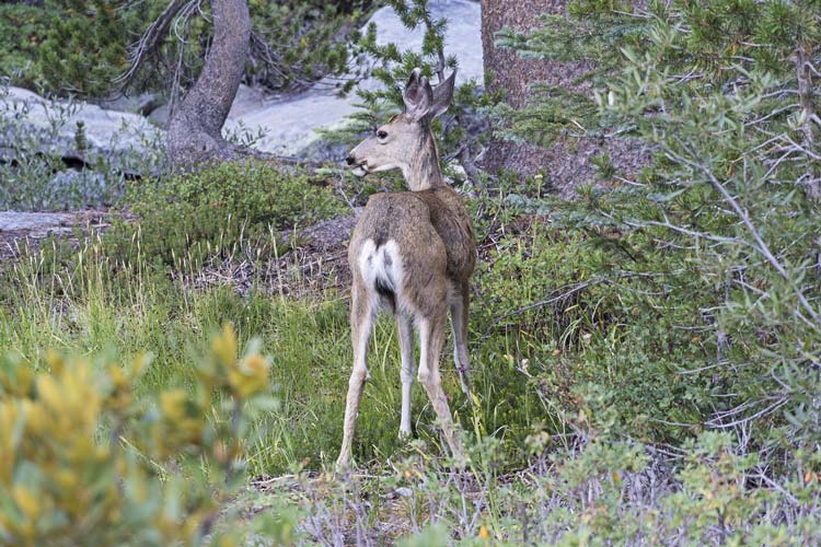
relatively unconcerned deer
 |
time to power up
 |
By the time we got above the steepest slope it was starting to cloud up and when we got close to the pass it started to rain. At first it seemed to mostly just be some scattered drops but when it got more serious we put on raincoats. That was the cue for the rain to stop and the sun to come out - for now. We could see ominous dark clouds to the South heading our way. We went up over the pass about noon and stopped briefly for a sandwich before we started down the switchbacks. This is when the lightning started and for a while there was a nearly continuous crack and rumble of thunder as it echoed from the Inconsolable Range to Mount Goode and back. It also started raining for real. Not enough to completely soak my pants, but enough to start dripping off the front of my hat. With the downhill travel Iris was able to serenade us with a mix of all sorts of songs from classic R&B to recent pop and Disney songs. We made it back to the parking lot and Chris loaded up for a long drive back home while Iris and I headed back to Bishop. This was a pretty grueling trip which took its toll on our gear and bodies, but we also managed to tick off some good peaks that aren't easy to get to.
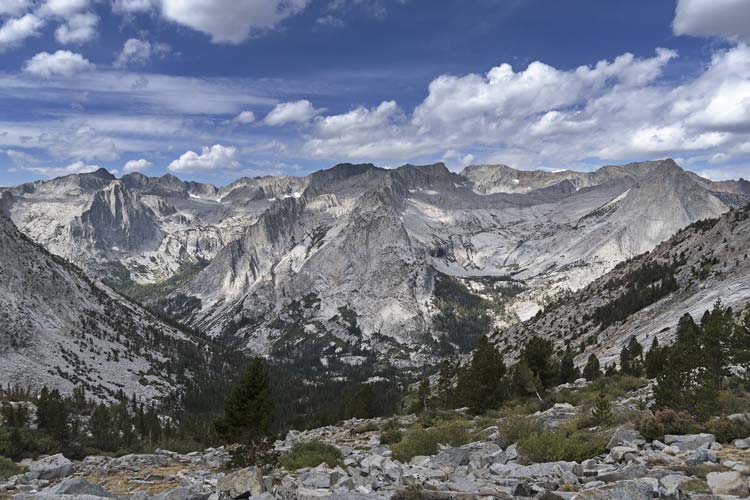
looking west across LeConte Canyon from above the steepest part
 |
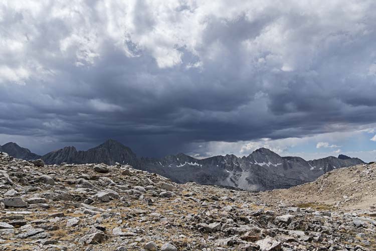
weather is coming - looking south over Dusy Basin from near Bishop Pass
with Isosceles and Columbine on the left and Giraud on the right
 |
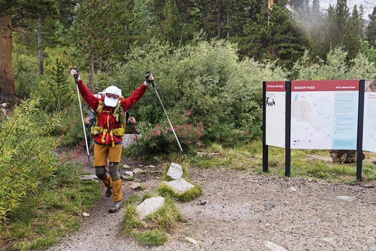
success! - back at the trailhead
 |
link to Strava page for Devils Crag plus 6 day backpack 8-28-2025
No material on this page may be copied or used without permission.