Tom Grundy's Zion National Park 2007 Page
This page is just part of my travels in Utah in 2007, to see the other parts, check out these links:
Indian Creek Climbing
Climbing by St George, and Escalante slot canyons
Buckskin Gulch - another slot canyon
Zion National Park
Next came Zion National Park, for more slots. Generally steeper, colder, and wetter with permit hassles. yikes. The canyons didn't seem to be as tight though.
Here we descended Spry, Imlay, Keyhole, Zion Narrows, Boundary, Pine Creek, Mystery, and Das Boot into the Subway Canyons. For some of these adventures we were joined by Julie. We also hiked up Angel's landing and did an "adventure" climb up Aunt Jemima (or Mrs. Butterworth) on Eagle Crag followed by polishing off a box of sherbet.
The start of the swimming in Imlay Canyon
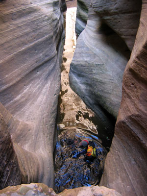 |
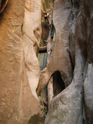
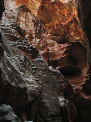
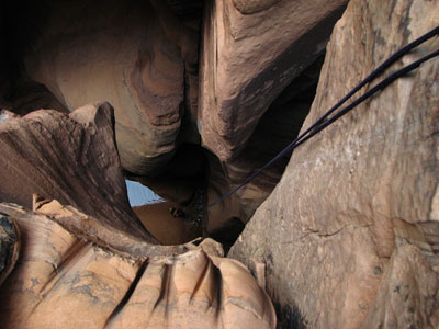
Imlay Canyon
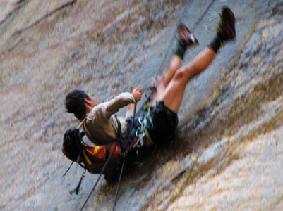
Imlay Canyon was the most technical one we did, it is rated 4B R IV - this means it is more technical, had swimming, was more dangerous, and longer. Of course we wanted to do it. Actually the water conditions we had weren't bad. We only had to boost out of 2 potholes, and hook out of 2 others. At low water, the keeper potholes are supposed to be formidable. Still, it was a long day, and without wetsuits, it would have been really grim. It had some really steep three dimensional twisty dark slots with many raps (we did the "sneak" route, which involved some 24 rappels and handlines plus some downclimbing). Often there was a rap into a pool which we swam across and exited onto a ledge where the next rap started - repeat again and again. It ended with a spectacular 130 foot rappel down into the Virgin River Narrows.
The Imlay trip started with a long hike up the west rim trail past Angel's landing - it wasn't bad in the cool shade of the morning. Then there was a few hours of bushwhacking over 2 passes followed by some slabby downclimbing into the Imlay Canyon. (over 3 hours of approach dropping us into the canyon just after rappel 19 (we thought))
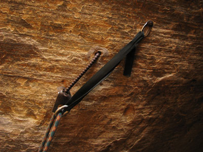
We took a 22 meter rope and a 60 meter rope. The 60 meter rope was only used for the final rappel. It was very nice to be able to do the shorter raps with the shorter rope. Constantly pulling, coiling, and carrying a longer sandy rope would have been a real pain. For those planning to do this canyon, taking a short rope is highly suggested, you might want to take a slightly longer one than we did if the water level is lower (we used the full length rapping into a few pools, and if the water level was a few meters lower, we would have pulled out the longer rope. Another technique we used to speed things up was using each other as counterbalances for the rappels. This also meant that could lower the descender if 1/2 of the rope wasn't long enough. Then the person on the bottom could counterbalance the person on top (note, this method does put more weight onto the anchors - not for use when they are questionable). While we were in the midst of the technical sections, we were mostly moving continuously. Round trip was 9 hours from shuttle bus to shuttle bus, but we took things pretty easy once we hit the Virgin River. We used 2 hooks (BD - talon) and aiders which we used to exit 2 pools using the mostly excellent bat-hook holes that someone else had drilled. We also took along a drill kit, some other hooks, and a stick clip which we could have used to clip anchor bolts or tat if they were within reach - we didn't use them, but if we needed them, it would have been nice to have them. The water was cold. Really cold. It is pretty easy to imagine some scenario where you have to do something difficult to get out of a cold deep pothole. If your frigid fumbling fingers drop a hook or something into deep murky water, you could get into trouble. Knowing how to ascend a rope (don't pull it 'til one of you is out of the pool), and having a plan to exit a pool before you get into it is always a good plan. Once again, we didn't have any troubles, but this canyon definitely has the potential to get serious - be prepared before you try it, and try to get info from someone who has done it recently. That said, it was a good adventure, and not to be missed if you are up for it.
Check out
Tom's Canyoneering Imlay Page - also check out the intro to Heaps and Imlay.
Tom's Canyoneering page has tons of useful info and maps. There is even more in his book.
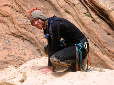
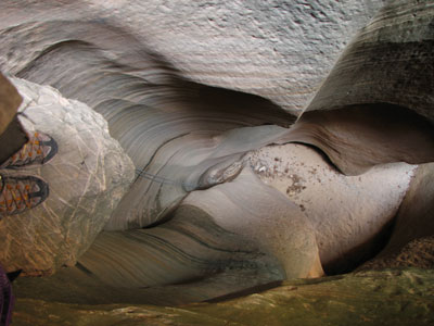
Hand warming in Imlay Canyon
 |
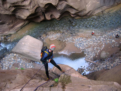
Rappelling from Imlay Canyon into Zion Narrows
 |
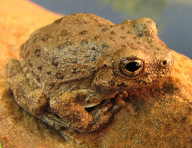
Canyon Tree Frog
 |
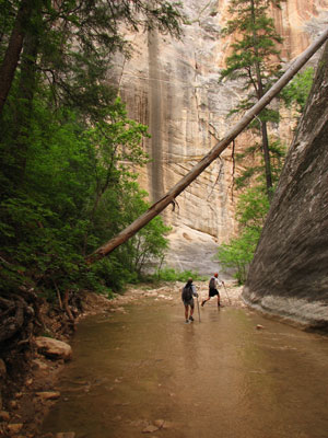
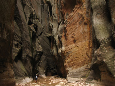
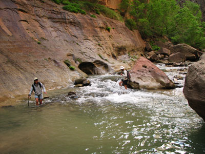
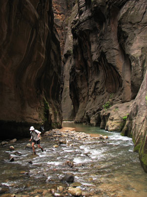
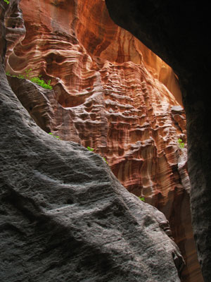
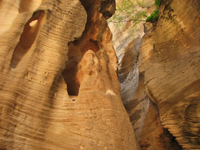
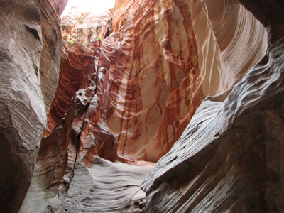
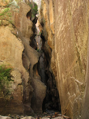
Virgin River Narrows Through hike
The Virgin River narrows is supposed to be one of the world's classic slot hikes. I have wanted to do it for over 20 years, so it was nice to finally get the chance. Anthony got up early and waited in line for about 2 hours to get us the permit, which is highly appreciated. It requires a car shuttle, which Anthony also arranged for us (with Anthony and I washing wetsuit socks and shoes among other things in trade - well worth it). This hike involves some 16 miles in and out of the Virgin River through a narrow deep chasm. The water level was pretty low (<40 cfs) and about 61 degrees, so it was pretty mellow and rarely over knee deep. Still, it was nice to have a walking stick for balance and to probe water depth. The water was particularly low for the first 9 miles or so before Deep Creek joined in and tripled the flow. We were joined by Julie "Canyon Queen" for the next few adventures.
Near the start of the canyon
 |
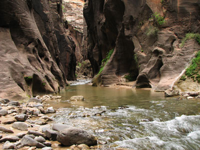
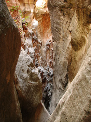
Soon it got steeper and narrower...
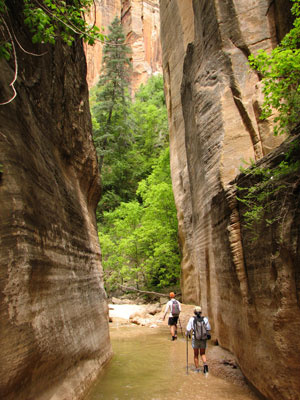 |
...and darker
 |
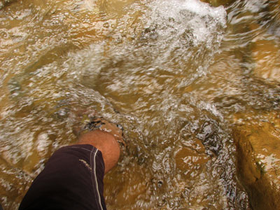
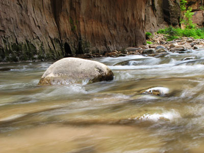
Some of the time the water would fill the entire slot, but more often we just had to wade back and forth across the river to walk on the bank. Once the river got a bit deeper and the rocks were more slippery, I put away the camera and took a lot less photos. I still got a lot, although with either direct sun and dark shadows or just dark shadows, it wasn't ideal conditions. A tall tripod would have been nice (except to carry). This is definitely not the place to be in a flash flood, but the forecast didn't call for any rain.
wading in the flowing water
 |
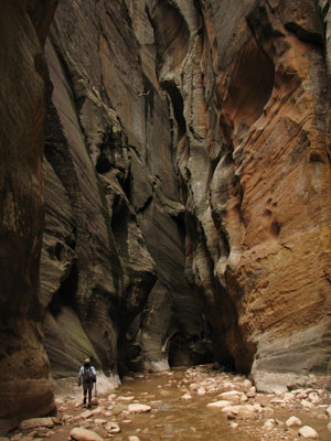
It really was scenic
 |
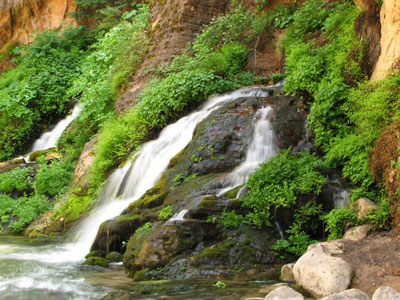
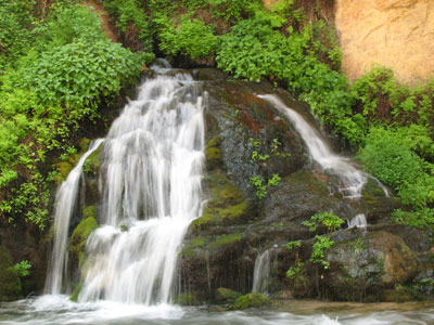
Big Spring had an impressive flow
 |
I tried to get long exposures without a tripod
 |
After big spring, we started to see day hikers who had come up from the bottom, and around Mile 13 where Imlay came in we started to see a lot of other people. (this was the Saturday of Memorial day weekend). We were impressed by how far some of the people had made it.
More silky flowing water - long exposure attempts
 |
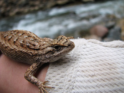
a very cold lizard we "rescued"
 |
wading in the narrows
 |
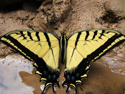
swallowtail butterfly (dead frog not shown)
 |
more narrows scenery
 |
The hike was beautiful, but the wading in the water got a little tedious. Still, it was well worth the effort, and I am glad I got to do it. I'd have taken even more photos if my Canon A80 hadn't died again before this canyon - dreaded E-18 error.
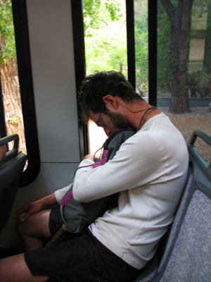
Can't stop the A-train
 |
Unless he's tired from waiting in permit lines
 |
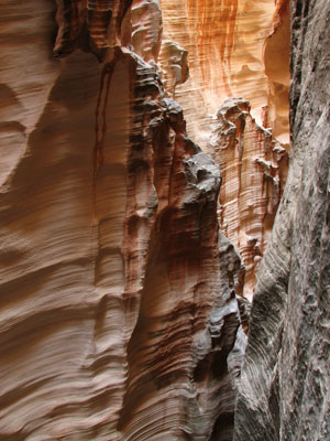
Boundary Canyon
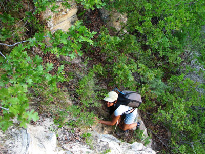
Next up was boundary canyon. This one involved a bit of bushwhacking to find the start. We were just walking down a brushy gully when suddenly it dropped off into a steep, dry slot. There was some really cool carved rock along with colorful red streaks on the sides. It was nice to not have to deal with a heavy wet sandy rope. We made a loop by cutting down boundary, then waded and walked down Kolob Canyon, then up the "MIA" exit, which pretty much sucked (steep, long, and loose). Then some wandering around dirt roads (not well marked on the map) to find the way back to our vehicle.
Rappeling in Boundary Canyon
 |
Boundary Canyon is quite steep
 |
The walls in Boundary Canyon were nice
 |
Boundary Canyon sculpted rock
 |
More Boundary Canyon sculpted and streaked rock
 |
With cool red streaks
 |
and scoops and huecos
 |
Kolob Canyon slot
 |
Some of the MIA exit joy
 |
Pine Creek Canyon
This is one of the most popular technical slot canyons. It parallels the tunnel and road and features a number of rappels, slots, and cold swims.
Julie in one of the cold cold swims
 |
The last rap in Pine Creek
 |
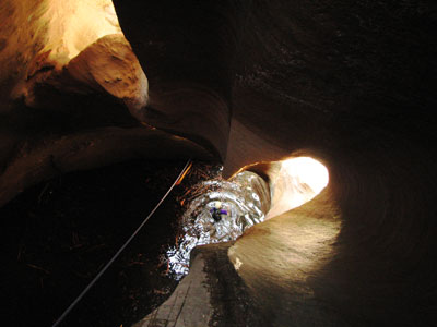
Mystery Canyon
This is another fairly popular canyon, although it either requires a long shuttle or a lot of elevation gain on the approach. The start of the canyon is pretty unpleasant loose steep "trail", but there are some nice slotty sections, and the end is quite nice, with clear flowing water and a rappel down Mystery Falls into the Zion Narrows. There was only some wading where we expected swimming near the end. Evidently the pools have been filled in with sand from a relatively recent rockfall that completely plugs the canyon higher up - this might prove exciting in a really big flash flood.
looking down a rap
 |
another confidence inspiring anchor
 |
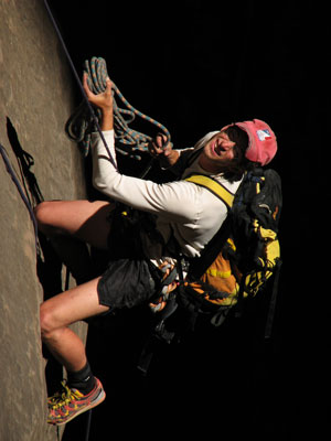
oh no, watch me, this is bad... Anthony entertains
 |
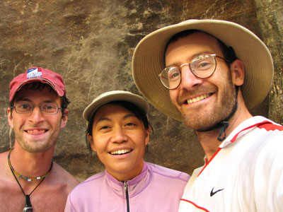
A-Train, Canyon Queen, and the Slotinator
 |
Anthony manages the ropes on a long rappel
 |
More to come...
Check out Zion Rock and Mountain Guides - these guys have way better beta than any other places we checked out in Springdale - they are people who do this sort of thing both for work and by themselves. They are also nice guys. If you need beta or gear, visit them (on the North side of the road on the outskirts of Springdale).