Tom Grundy's Wind River Mountains Climbing Trip (2010) Page
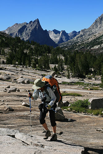
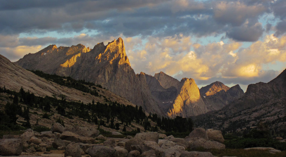
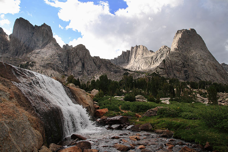
Dawn had a photo trip in the Wind River Range in Wyoming, so I met her afterwards in Lander for a climbing trip there. After a day of recovery for her and packing, we drove down the endless dirt road to the Big Sandy trailhead and started hiking in on August 15, 2010. Unfortunately our packs were rather heavy with 6 days of food (probably more like 7 or 8) and climbing and camping gear. This was a far cry from the TMF level of equipment and food too. We plodded up the trail with many stops to try to readjust how the packs were riding. We cut around the south side of Big Sandy Lake and on up towards Clear Lake where we stopped for lunch and to soak our feet before the final push up to Deep Lake where we set up camp. The approach hike was about 8 miles with many feet of elevation gain and I was feeling every one of them with my heavy pack. Dawn wasn't feeling so fresh either. As expected the views and the amount of rock were staggering.
A tired Dawn approaching Deep Lake
Warbonnet and Wolf's Head behind her
 |
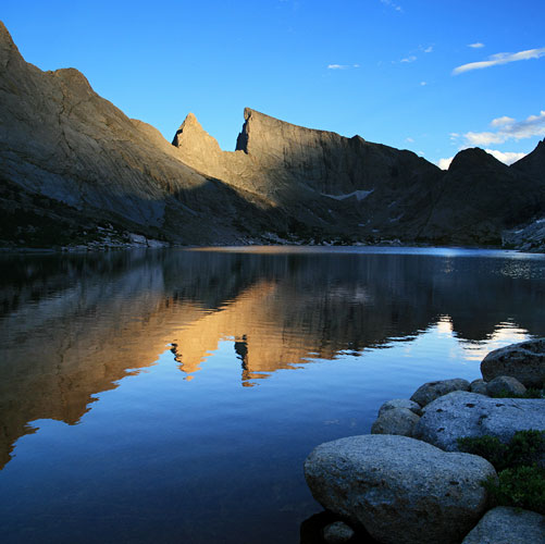
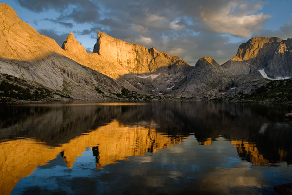
Deep Lake reflection
Steeple Peak is the brightest
 |
looking towards the cirque at sunset (DK pic)
 |
Dawn in front of Haystack
 |
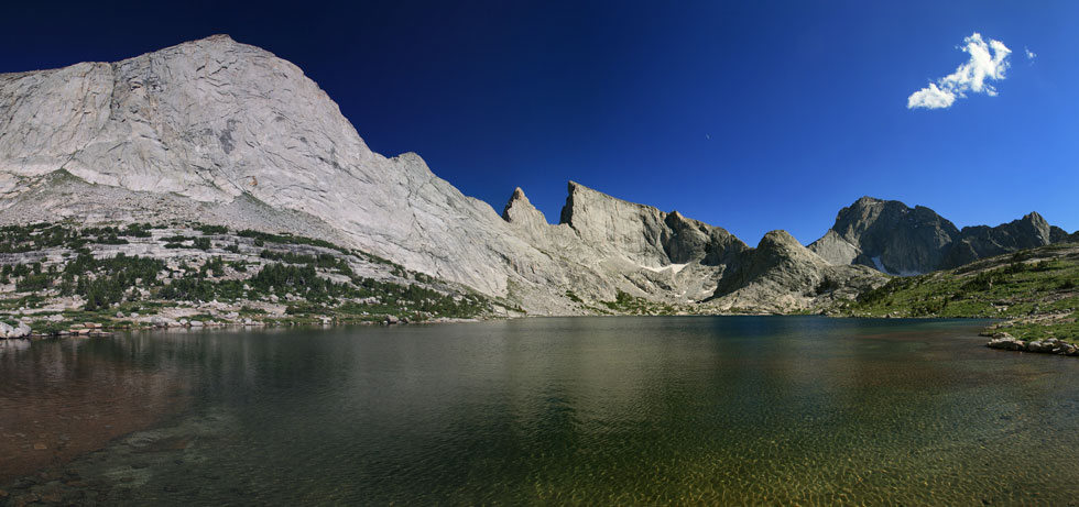
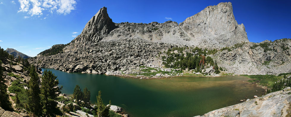
panoramic of Deep Lake from near our camp
 |
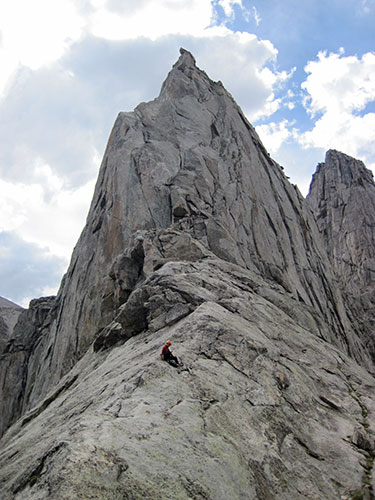
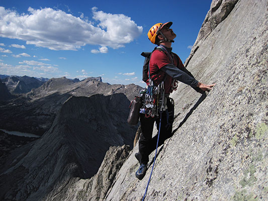
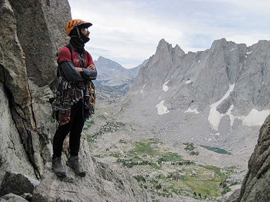
The first morning at Deep Lake was not the most auspicious with threatening clouds, but we decided to head to the Steeple anyway. The weather continued to look threatening, but nothing much materialized, so we headed on up. We swung leads on most of the climbs, although Dawn was clever enough to give me the more interesting and exciting pitches, which was what I'd have prefered most of the time. The climbing was mostly mellow with a few harder sections on good rock. This route heads up the north ridge more or less, then cuts behind a huge flake (for 2 pitches) and on up to the summit. The view down and out the other side of the flake was pretty spectacular. From the summit we could see that we were in a bit of a bubble with no rain for us, but plenty of spots around getting hit with a bit. We headed on down the south ridge and on down with a bit of route finding issues before the longish hike back to camp.
near the start of the climbing on the steeple (DK pic)
 |
I start up the bottom of the large flake (DK pic)
 |
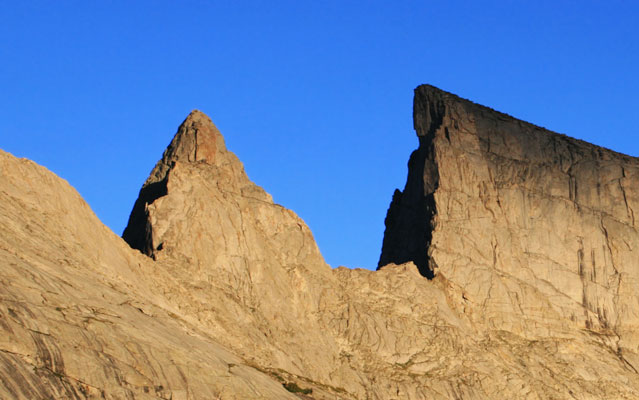
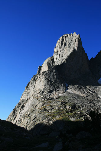
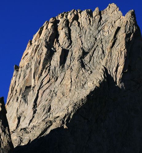
Steeple and East Temple Peak, with the lost Temple Spire hiding in front of the left side of E Temple
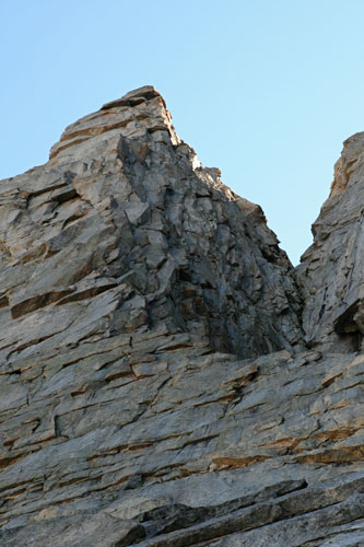
The large flake on the Steeple is visible below the summit
 |
Deep Lake again with Haystack, Steeple, East Temple, and Temple Peaks
 |
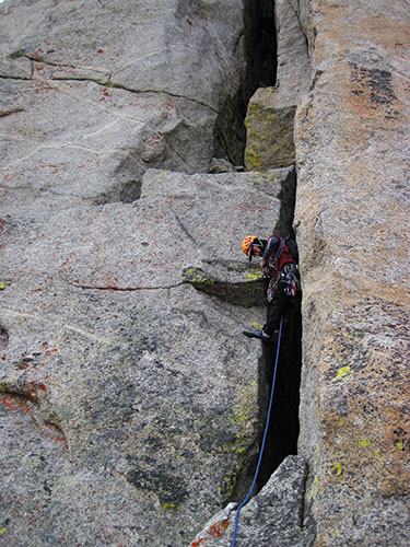
The next day the weather was looking better, and we headed back around the lake, this time to the Lost Temple Spire to climb the SW arete. This route was considerably harder than the previous climb (5.10b according to the Bechtel guide we had). Although I think I was mostly on route, I never really could tell. I knew things would be exciting when one of the pitches was over 30 M long (we only had one 60M rope to rap back down the route). After one particularly loose pitch we were at a dead end (as opposed to the chimney the topo said). There was what I assumed was a bail anchor of 2 nuts and some carabiners. Dawn traversed left under a roof and found a way up past the roof to the easy climbing. We summited late and began rappelling down past the chimney we were supposed to go up. Luckily the raps were relatively straightforward other than some monkeying with all our cords and slings to get past the >30M rap. We got off the tower just about the time the sun set, but still had a lot of scrambling to get back to our packs. We got there about the time it got truly dark. The hike back down the talus seemed endless and when we got to the first lake we were glad to take a break, drink some water, and admire the stars above and below in the lake (I know they aren't really in the lake and it is only a reflection). We finally made it back to camp around 11 pm. Stan Mish from Flagstaff was part of the first ascent team and we feel that we were "stan-bagged" on it.
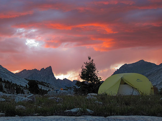
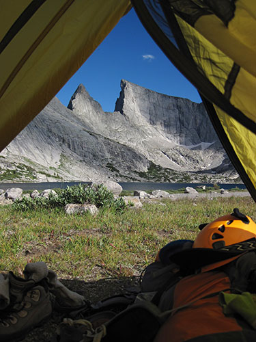
View from the tent (DK pic)
 |
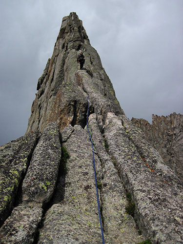
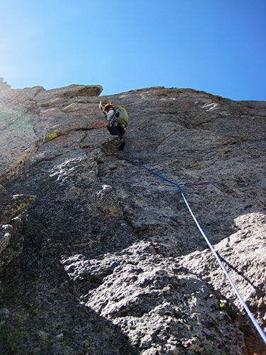
view up at the SW Arete of the Lost Temple Spire
 |
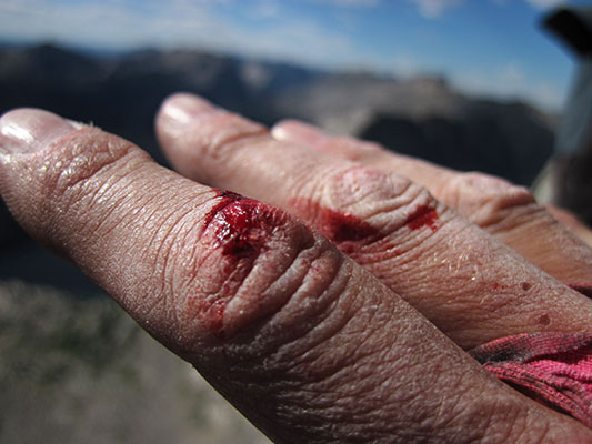
Lost Temple Spire was hard on Dawn's fingers (DK pic)
 |
high on the SW Arete of Lost Temple Spire (DK pic)
 |
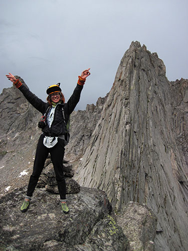
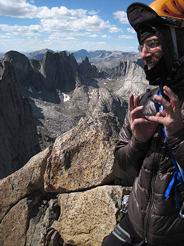
we made it - Wind River Peak behind us (DK pic)
 |
I hop off the summit block of the LTS (DK pic)
 |
When we got down to the packs (and camera) it was pretty dark
 |
Cirque of the Towers from Deep Lake in the morning. The SE ridge of Wolf's Head is just lit up by the sun, Warbonnet to the left (DK pic)
 |
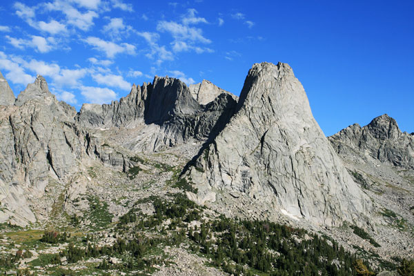
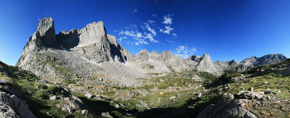
Cirque of the Towers
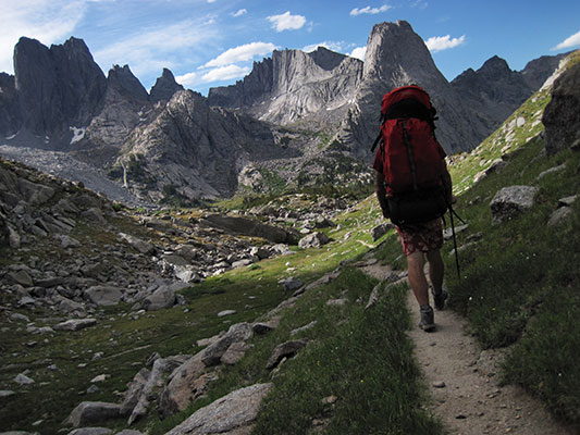
Today we planned to hike to the Cirque of the Towers. We packed up in a relaxed fashion and eventually started hiking. It was nice to have slightly lighter packs, and Dawn had figured out how to wear a jacket around her waist to protect against a jabbing part of her pack. Still, the hike up out of the Sandy Lake basin was brutal, and we missed a turn and ended up bushwhacking through the boulders a bit. By the time we did the climbers cutoff past Arrowhead lake we were pretty tired. We camped near Warbonnet because that was close and one of our objectives.
hiking into the Cirque (DK pic)
 |
Overhanging Tower on the left, then Wolf's Head (darker), and Pingora on the right
 |
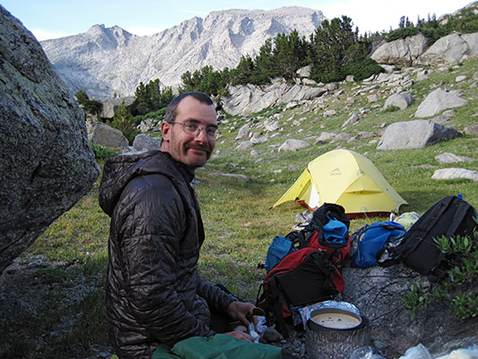
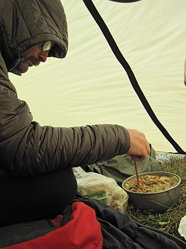
cooking delicious mush for dinner (DK pic)
 |
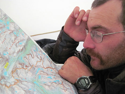
hiding in the tent studying the map (DK pic)
 |
The next morning the weather looked pretty iffy again. Rather than try Warbonnet we opted for the east ridge of Wolf's Head. We started by climbing up the gully/chimney between Tiger Peak and Pingora and then traversing over Tiger Peak towards Wolf's Head. The scrambling was more exciting than I had remembered for this part.
heading up to the top of Tiger Tower (DK pic)
 |
We simul-climbed the first part across the narrowest part and up the first ramp. Then we combined pitches, scrambling, and simul-climbing for the rest. At some point up the ridge it started snowing a bit. We could see it was snowing a lot harder in some other areas, but we didn't get a whole lot, not enough to melt and start running off the rocks. We did wait under a nice overhang for a bit with another group of three in front of us. By the time we got to the summit, the sun was peeking through, but it was still cold and windy. I took a short detour and scrambled up to the summit of Overhanging Tower from the notch on the descent.
Dawn on top of Tiger Tower w/ Wolf's Head behind
 |
I head up the first part of W H (DK pic)
 |
we made it!
 |
summit lunch with the nut tool for silverware (DK pic)
 |
taking photos as usual (DK pic)
 |
more tasty mush while hiding from the rain (DK pic)
 |
waterfall and Wolf's Head
 |
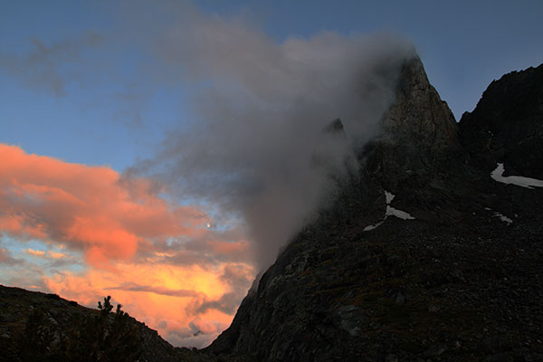
Warbonnet on a stormy evening
 |
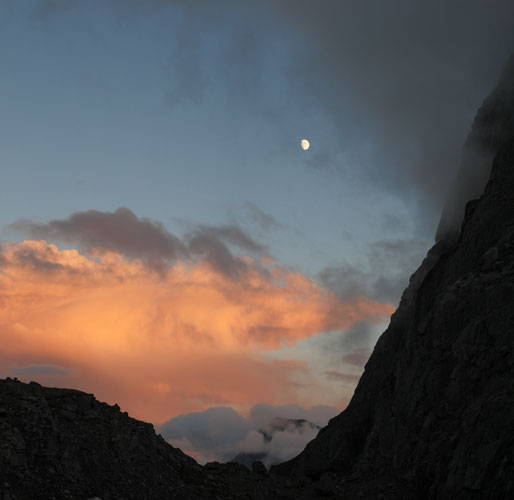
moon and pass and Warbonnet base
 |
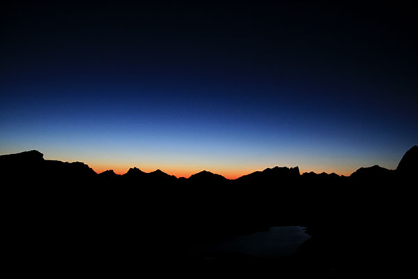
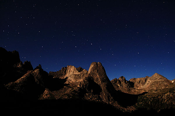
That night Dawn woke me up and told me to look up at the amazing stars and take some pics. I flopped the top half of my head out of the tent and looked up. Yeah Yeah, nice stars, except with the nearly full moon they were a bit washed out. When she realized what I was looking at she said no - look at the towers lit up by the moon. Ahhhh. Those were much nicer, so I balanced my camera on a flip-flop on a rock and took a bunch of pictures. Unfortunately it was windy enough to shake the longer exposures, but some give an idea of the magical view.
night in the Cirque
 |
For our last climb we went up the NE face left on Warbonnet. This is a peak I have wanted to climb ever since I first saw it, so it was nice to finally get a chance. We decided to try to contour around the E side and then up the SE side of The Plume to get to the base of the route. This seemed to be going well until we got sort of cliffed out and resorted to actual climbing gear to pass some rather exciting but easy traversing (the rock was pretty crumbly, but the climbing wasn't much more than 5.6 or so.) This got us to the long easy gully up to the start of the route. I don't know if one of the other ledges would have worked without having to bust out the rope, it looked like one of the lower ones went, but I couldn't say for sure. In any case we made it across the face and then easily up to the notch between the Plume and the rest of Warbonnet.
gear Dawn needed for Warbonnet (DK pic)
 |
Warbonnet
 |
NE face of Warbonnet w/ topo in red (description at end of page)
 |
I spent a fair amount of time staring at the cliff and the route description and the photos from the guidebook before deciding where to start and where I thought the route went. We sort of vaguely followed the description maybe, but we definitely didn't end up where the line in the book went (we were a notch to the south) at the top. See the bottom of the page for my description of our route. Some of it seemed harder, some easier, but generally the rock quality wasn't as good as the climbing by Deep Lake or on Wolf's Head. Still, it was a spectacular position. At the summit (12369 ft / 3770 m) we were joined by 2 guys who had hiked up from the South Side. The descent down the South side was long but easy with some interesting up to house sized talus at the end.
Dawn leading the second pitch
 |
all my plans had come to fruition (DK pic)
 |
we made it!
 |
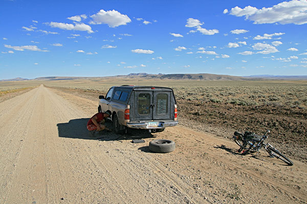
The hike out the next day was long and well, long. The dirt road was long too, and I got a serious flat that couldn't be repaired. Unfortunately with all the stuff in and on the truck I had to do a lot of unpacking to put the spare on (like removing the bike rack). Soon enough we were back on the road though, heading back to Lander before our next stop on the Wyoming climbing tour - Ten Sleep. All in all it was a great trip without too much mosquito bother. Despite the less than perfect weather we succeeded on all our climbing goals (we actually got quite lucky with the weather as it mostly hit when we were in camp or managed to skirt by us.
fixing the flat (DK pic)
 |
Panoramic of North Lake with Sundance Pinnacle and Warbonnet
 |
panoramic of the Cirque from above our camp
 |
Here is a link to the Spot track for the Wind River climbing trip
Route descriptions...
These are based on my memory and interpretations and could be completely wrong, so take it with a grain of salt and don't blame me if things don't appear to be the same to you.
Lost Temple Spire SW Arete We scrambled up and right to the lowest grassy bit and then walked up the ramp to the left to the base of the arete. We roped up at the gray dike of slightly more easily eroded rock.
P1 start just to the left w/ a right angling right facing overlap/lie-back with some slab moves.
mostly we tried to follow the topo from the guidebook (Bechtel)
P2 rt leaning dihedral (over 30 M) there is a flake that could be slung near the bottom that makes the top less than 30M
P3 5.8 hand crack getting easier...
I don't remember all the details, there was a stiff finger crack to a lieback move then up to a big ledge that sloped down to the left. We moved the belay down to the left then traversed left (see pic above) out to a finger crack that went up and jogged right (maybe we didn't go far enough) then up through a shallow dihedral that didn't look like it saw a lot of traffic. This ended under a roof where we were supposed to be at the base of a chimney, instead we traversed left under the roof 'til it was easy to pass over and up to easier ground. We ended up climbers left of the Chimney we rapped down that looked like the one we were supposed to come up. All the raps went with a 60M rope except the one from pitch 2.
Warbonnet NE face left (or at least what we climbed). Step one, get to the notch between The Plume and the NE face, we went across the middle of the E side of The Plume with 2 pitches of traversing, we might have made it across more easily if we had stayed a little lower half way across. Then it is easy cutting back up and right to the notch. From the plume notch 4th class scramble right and up about 200' to a large ledgy area.
P1, From there start up a leftish ranch about 2/3 to the left of this lower angle area. Then cut back right on a ramp that ends up being a crack past a couple harder moves to another left angling small dihedral (175', 5.8)
P2, up flake/ chimney with some difficult pro then up easier but looser flakes to left to a small platform (180', 5.9)
P3, up and right on flakes and cracks with a few overlaps and some looseish rock then leftish to the top of a towerish formation (170', 5.7)
P4, up right then up left angling right facing flake - fun 5.6 ~110 ft, probably should have continued with another zig to the right and up another left angling rampy flake to the base of the chimney which would have been about 170'.
P5, up chimney (series of chimneys with breaks and cracks on the sides) a little wet. 5.8 190' (would be less if you started at the chimney)
P6, scramble up the remaining 50 feet or so to the summit. Depending on how far you go in the previous pitch, can probably be 4th classed.
Descend to the south and then turn the corner east and drop down with a bit of angling northish across the talus to the climber's trail back to the cirque.
NE face of Warbonnet
 |
NE face of Warbonnet w/ topo in red
| |
The marked line on the topo is my best recollection of where we went. I think that P1 might have actually followed the crack below the marked line and the ramp up and left before that is hidden behind a ridge. 4a is where we stopped and 4b is the base of the chimney.