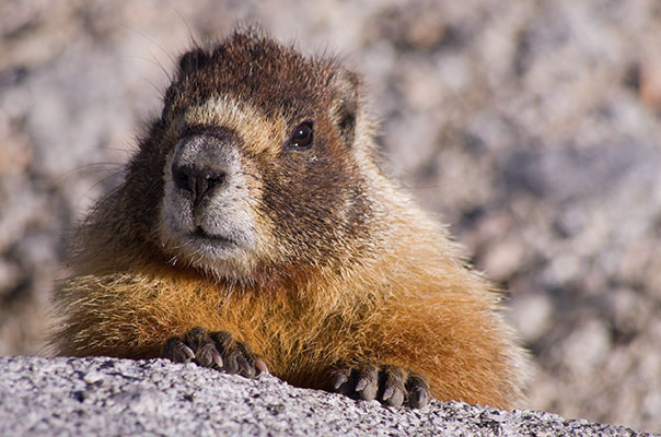
I planned another trip into the high Sierra in July of 2012. This time I was heading into the Mount Williamson area. After watching the fireworks in Bishop I headed down to the Shepherds Pass trailhead. Needless to say it wasn't very early when I got there. I got up on the 5th and packed up my stuff in the shade of the one pine tree at the trailhead. A little before 10 I hoisted my hefty pack and headed up the trail. At first the trail followed Symmes Creek and I was able to dunk my hat to cool off every time it crossed. Then it cut up the slope to the south and just kept going up for ages and ages. Finally it got over the divide into the Shepherd Creek drainage. Then it dropped down into this drainage - a tragic waste of elevation. At least there was some shade and water here for a bit. Unfortunately there were also mosquitos at the anvil camping area. I pushed on up the drainage passing the pothole camp and finally made the push up and over the pass. Shortly after the pass I found a place to camp. Luckily it wasn't next to a marmot burrow like the other tent there.
| |
|---|
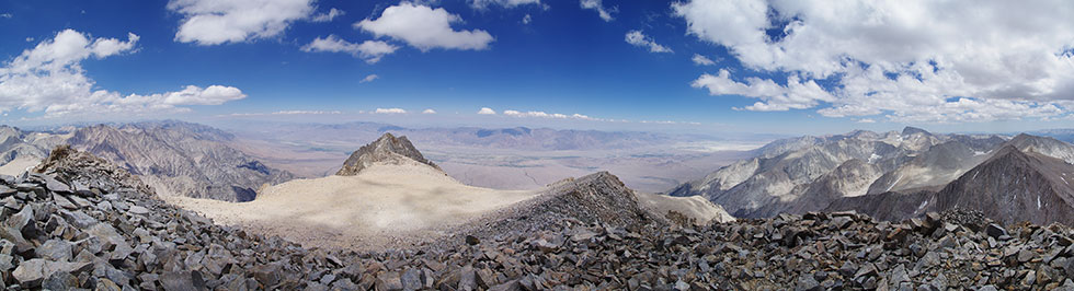
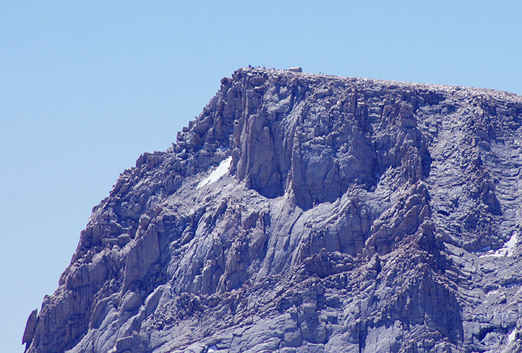
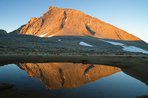
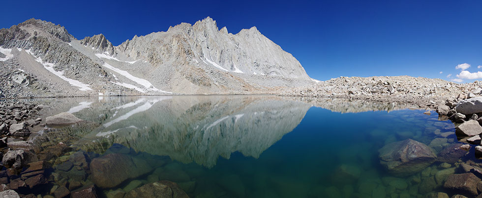
The next morning I packed up my stuff and moved camp into the Williamson Bowl. It was slow going picking my way through the talus with my full pack. I dropped my pack near the southernmost lake in the bowl and headed up towards Mount Williamson. From here it wasn't clear what gully the route went, but I headed up on the right side and once I passed the rocks with water streaks it was pretty obvious. I continued on up to the the left into the gully. It was slow going alternating between scrambling on the rocks and up the loose talus. Finally I made it up to the chimney at the top. This wasn't too bad and the route finding was obvious. Once past the chimney it was an easy scramble up another talus pile to the summit. I spent over an hour on the summit as the conditions were quite nice and the views were spectacular. At 14375 ft / 4382 m Mount Williamson is the second highest peak in California.
Another 2 parties came up after me and then shortly started back down. I debated heading to the East to climb the little horns there, but took the lazy way and didn't. I passed the other party while they were setting up a belay for the chimney. When I got back down to my big pack they were still high on the route. I set up camp and considered jumping in the lake. I settled for scrubbing off some dust and rinsing my clothes. There was enough time to dry most of the stuff off before the sun went away. One party descended in decent time, but the other didn't pass my tent until 7:30 or so. They had a long way to get to Anvil camp.
 |
|---|
The 3rd day was a "rest" day. I stayed in my bag for a while reading on the kindle and then lounged about some more before breaking my rest by hiking up to Lake Helen of Troy to see if there were better campsites there (no) and then scrambling up the NE ridge of Versteeg peak. This was mostly nice, but there was some very loose scree that was unpleasant. Still there were nice views from the 13470 ft / 4106 m summit. I descended to the north and a little west down more talus and scree and a little snow back to the lake and camp. I stretched a bit, talked to some people coming down from Williamson, and read some more.
 |
|---|
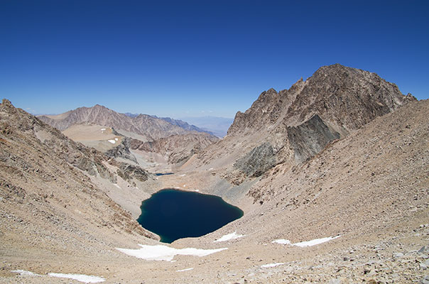
The 4th day I got a pretty early start and skirted Lake Helen to the east and up to Trojan peak 13947 ft / 4251 m. From there I headed south to Mount Barnard. At 13990 it is nearly another 14er, but since it was demoted after a survey it is climbed much less often. I considered continueing on to the next peak (with no name on my map), but it looked like a slog. On the way back I went on the west side of Lake Helen of Troy and it was a pain with a lot of scrambling up and down and around rock fins that dropped into the lake. I also didn't know if the route would go - and it would have been pretty frustrating to have to reverse it. I was glad to finally hit the talus on the west side of the lake. I don't think there is an easy way to get past this lake. Maybe by just swimming around the fins - but the water looked very very cold.
 |
|---|
 |
|---|
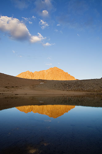
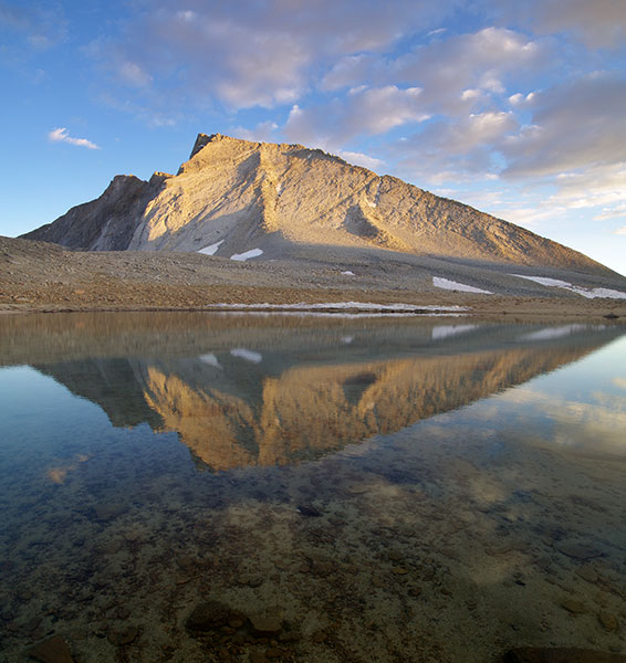
When I got back to camp I packed up and moved to near an ephemeral lake NE of Mount Tyndall. I think on a normal year this area is covered by snow and water for most of the year, but now it was mostly a sandy area.
 |
|---|
 |
|---|
 |
|---|
 |
|---|
 |
|---|
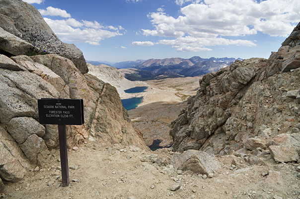
I started out day 5 by climbing up the gray rib on the NE side of Mount Tyndall - this was mostly a fun climb up pretty clean rock to the ridge and then a short way to the 14018 ft / 4273 m peak. The view was spectacular but the wind was cold so I didn't stay long. Next I decided to head towards Junction peak - this involved a fair bit of cross country travel up onto Diamond mesa - and then a fun ridge traverse to the S side of Junction and up to the top. Then I traversed up and over a number of false summits along the ridge to the actual 13888 ft / 4233 m summit. From there I wanted to drop down to the north and east to get to another peak, but I couldn't see an obvious way (maybe a 5.7? climb) so I dropped down to the west to Forester pass. From there I followed the JMT south for a bit before cutting cross country around the toe of the Diamond and back up to camp. It was a long day.
 |
|---|
I climbed 2 more California fourteeners on this trip - so I wondered how many I have done now. It depends on how you slice them - what is a sub-peak and what is a different peak? Going from the list of 15 on "summitpost" this trip I climbed my 9th and 10th (out of 15) 14ers. Other lists have 12 or 16, so who knows. Anyway, it is a good excuse to get out and into some beautiful country.
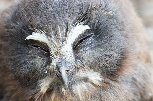
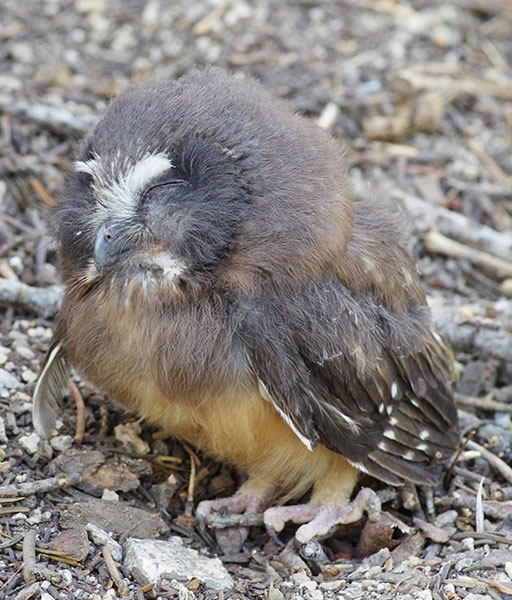
The mission for day 6 was to hike out. This wasn't too hard, but it was long and hot for the lower sections. I soaked my shirt in the last creek before the long sandy uphill bit. I saw a juvenile (I think) owl on the hike out - if anyone knows what kind this is I would like to know. When I was finished I headed north to the Keough hot ditch for a much needed wash off and soak.
 |
|---|
 |
|---|
 |
|---|