After the madness of the OR show and Salt Lake City, as John Muir said, "the mountains are calling, and I must go". So off I went to the Uintas. I had summited Kings peak in the Uintas years ago, but this time I'd be going to a different section with a lot less info about where I was going. I took a picture of the map at the trailhead, but the trails themselves had faded to invisibility, so I was still somewhat on my own. I didn't start hiking until 4:45, so it was getting pretty dark by the time I got to naturalist basin. There were mosquitos, but as long as I didn't stop and the wind kept blowing it wasn't bad. I camped near the shore of Blue Lake at around 10,800 feet, eyeing Agassiz peak for the next day.
| |
|---|
 |
|---|
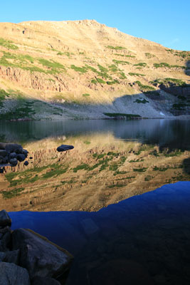
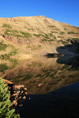
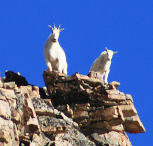
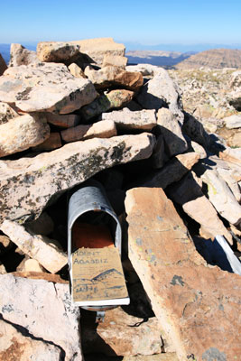
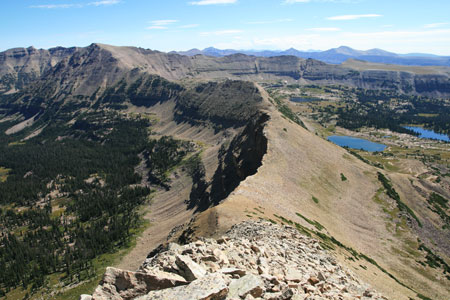
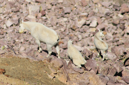
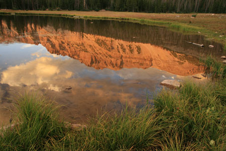
The wind continued to blow all night, which meant that I didn't get nice mirror-like reflections off of Blue Lake the next morning (although they look pretty good at web resolution). I headed up a shallow ramp onto the south buttress of Agassiz making my way up the mostly solid talus and dirt. I stopped to put on my telephoto lens to take some mountain goat photos even though they were still pretty far away. One of my worries for the days jaunt was that I didn't have a lot of water carrying capacity, only about 50 ounces worth. When I got up to the south buttress, there was a small snowpatch, so I refilled my partly finished small water bottle with snow. If nothing else, this would slightly extend my water supply and give me something nice and cold to drink (goji berry and green tea U (U = a vitamin and electrolyte natural flavored water tablet)). From the south buttress it was a straightforward solid relatively low angled talus walk up to the summit broken only by another stop to put on the telephoto for the mountain goats (that managed to hide after I got it on). The summit is 12,428 ft, and was complete with a nice cairn and rural style mailbox as register and a steep north face.
 |
|---|
 |
|---|
 |
|---|
 |
|---|
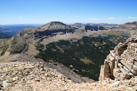
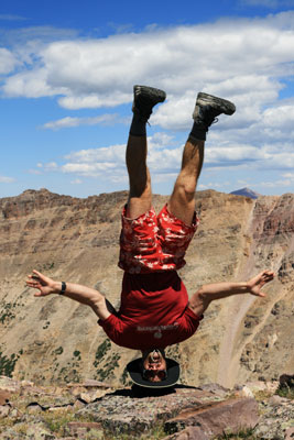
The north face of this ridge often was vertical or even overhanging, while the south was a more manageable 40 degrees or so. It went on up and down for ages before starting up towards Spread Eagle Peak. Of course the views down into the alpine basins on either side were spectacular. Lots and lots of walking on rocks, and finally I was got to the rounded summit. I couldn't find any register, although there was a small cairn and a wind shelter constructed of rocks. I took some pictures trying to do a headstand at 12,540 ft. Yogaslackers represent (nice yogaslackers wool shirt that is barely visible in the photo, very comfy and it didn't stink much either - I did have a problem with the sleeves - more on that later). I folded up my fleece pants as a cushion for my head, but then I left them there as I hiked down. Luckily my pack straps were digging into my collarbone, and I wanted some fleece for padding. This made me remember that I had left my pants, only a few minutes from the summit. For some reason I got quite out of breath running back for them.
 |
|---|
 |
|---|
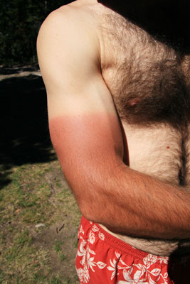
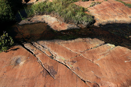
I was somewhat worried about my water levels at this point, but I wanted to keep enough water on hand that if I found some snow, I would have enough water to start it melting. The other thing that was bothering me was that the sleeves of my shirt were shorter than the t-shirts I had been wearing. As I hiked around this huge basin, the sun was always on my right, crisping the few inches of white tender skin above my usual farmer's tan. I also forgot to bring sunscreen. I put some lip stuff on, but it was too little too late by that point. As I headed down the southeastern ridge of Spread Eagle Peak, I was keeping an eye out for snowpatches over the steep NE side, but without luck. Instead I found talus and lots of it. There was also a mother mountain goat with 2 kids. Finally I found a snowpatch and stuffed it into both my water bottles. Then there was one more bit of heroic talus along the ridge, and a large herd of mountain goats that ran away before I could get the telephoto out and I was onto a large flat plateau. That didn't last, as I needed to take a right turn and head east back to camp. That meant more steep talus down into Naturalist Basin. Then it was fairly easy walking across the basin past glacially polished and gouged bedrock and clear lakes back to camp some 11.5 hours after I left.
 |
|---|
 |
|---|
 |
|---|
 |
|---|
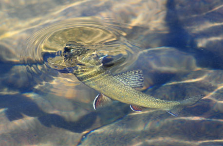
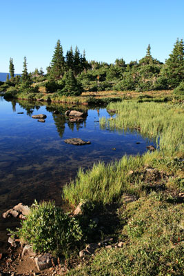
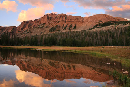
The next morning I searched for sheltered water, and took pictures of trout, then it was time to move on... I debated about heading over the ridge into the basin to the north, but I didn't know if I could get out of it back towards the trailhead (I later learned I could have), so instead I headed back to the highline trail and further east to four lakes basin. The trail cut back quite close to where I had hiked the previous day, and I should probably have just cut southeast from my camp. At the last turn to four lakes basin I ran into some fisherman who were heading there and they kindly gave me one of their printed out map copies. At the basin I first went to Dale Lake, and relaxed there a bit before checking out Dayne lake, and finally ending up camping near the narrow divider between Dean Lake and Jean Lake. Once again the wind refused to die down and provide nice mirror reflections, although the wind did help to keep the mosquitos at bay. It was warmer that night, and I slept with a lot less clothes at first, which meant waking up cold and having to put my pillow back on sometime during the night.
When I got up, the wind was still blowing thus frustrating my reflection photo hopes although I still tried to get some reflections in a somewhat sheltered bay. Then I packed up and started hiking back the highline trail to the trailhead. Pretty soon I started passing people hiking the other way. Lots of people. It was Friday and it seemed everyone and their horses were hiking out into the wilderness (not really all that many people, but compared to the few I had seen, it was a lot).
After I got back to the car, I went to a campground a few hundred yards down the road to get water, it turned out their pipes were rusting and I got lots of bits of rust in my water bottles. I decided to stick with the half gallon or so I still had in various other water bottles for drinking. Then I searched for the "dispersed" camping which turned out to be practically next to the trailhead. I leveled up my truck and washed some of my clothes in the little creek before relaxing and reading some magazines I had picked up at the OR show.
At a nice craggy 12,479 feet and relatively close to the road, Mount Hayden is a pretty popular peak to scramble. I didn't know the route, so I scoped it with my binoculars and thought I found a path through the rock bands and avoiding the worse of the loose talus. It was on for Saturday the 23rd. I woke up around 6:30 and took a few pics of the dramatic clouds and then started up before 7 am. About 20 minutes into the hike up (across a field, through the woods and up some talus past some cliff bands) I found a bit of a trail. This skirted some large talus most of the way up to a cliff that I was unsure if I would be able to pass it at this point. Luckily there was a nice break where I thought one was, and I headed on up the talus to the south ridge of Mount Hayden. The clouds and rain to the west was heading north into Wyoming and I was making good time. As I headed up the south ridge, I heard some rocks falling, and looking down I saw a small group of mountain goats dislodging rocks as they ran along. They quickly ran around a corner, but I also saw some hikers way down starting up the west side of what looked to me to be a horrendous loose talus gully up a fault line. I continued on up the south ridge thinking I'd be able to make the summit in under 2 hours from the car, but as I scrambled up what I thought was the final peak, I saw the real peak was a ways further and protected by one last cliff band. This looked vertical, but there were cairns leading around to the east side of the peak and an easy 4th class chimney up to the summit. Evidently traversing further led to an easier way, and from the top there were many cairns marking possible descent routes. Every time it looked like the way would be particularly difficult or unpleasant, there was some little stairsteps or other way up.
I got to the summit in just over 2 hours from the car and spent a lot of time enjoying the view and taking pictures. It was a very nice peak, although it didn't convince me that the Book of Mormon was true as someone in the summit register alleged. I kept thinking I heard voices f someone else coming up, but I think it was the birds. Finally I headed back down the ridge. This time I saw hikers starting up the talus from the east side. I tried to follow the "trail" all the way back down, but it sort of spread out at the end and I ended up half bushwhacking anyway. Then it was time for more relaxings and some repacking and sorting of gear. Of course by the time I got everything spread out a few raindrops fell, and later there was some thunder which made me glad I was off the mountain. That evening there were some nice clouds over Mount Hayden, and the wind was fairly light, but there were so many little trout in the small pond I was trying to get reflection pictures in, the water still wasn't mirror smooth. I also got more mosquito bites without the wind.
 |
|---|
 |
|---|
I still need to put in some panoramic images and some more pictures, but that will do for now.