Tom Grundy's Grand Tetons 2009 Travels Page
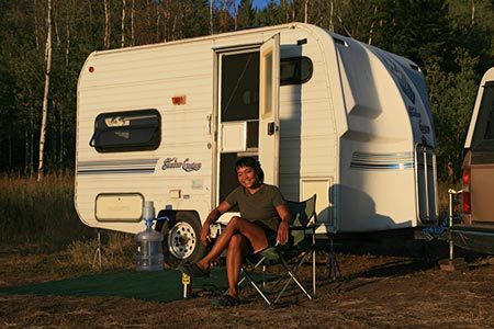
In August we met up in Jackson Wyoming to sample the alpine splendor of the Grand Teton National Park. We mostly camped in the National Forest just outside the park. We had a wonderful view, although I had to walk a bit to eliminate the power lines from the sunrise photo. Still, it was really nice to look out across the valley and see the Teton Range. Unfortunately eventually we exceeded the 2 day limit and were given notice that we had to move on. Almost every time we drove somewhere we passed a herd of bison. Often they were meandering across the road clogging traffic. They were just in the way when you were in a car, but on a bicycle they were large, noisy, and scary.
Julie and mini-trailer enjoy the view
 |
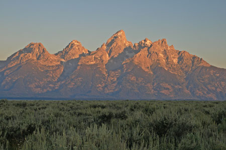
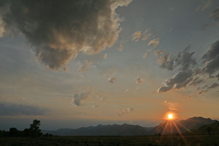
Teton Sunrise
 |
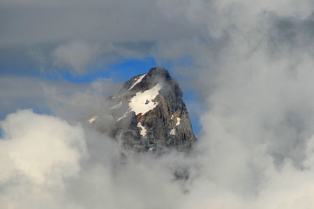
Grand Teton summit glimpse
 |
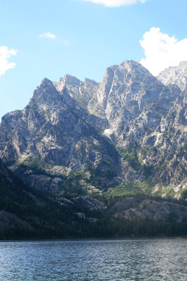
Symmetry Spire - SW ridge
Symmetry Spire across Jenny Lake
 |
crop of Symmetry Spire
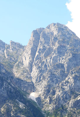 |
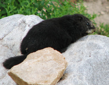
The SW ridge of Symmetry Spire is a 5 or 6 pitch 5.7+ rock climb in the Cathedral group of the Tetons. It involved a hike around Jenny lake and then a long steep hike up a gully followed by some fun climbing and finally some scrambling up to the summit at 10,560 ft (3,219 m). We did some simul-climbing, some scrambling, and some pitching it out. Our rack was pretty sparse, 8 nuts, about 7 cams between blue alien and #2 Camalot, and some slings, but it was enough. As usual, there were lots of nice views, especially from the summit. We also saw the rare and elusive black marmot.
the elusive black marmot
 |
Spot tracker page from Symmetry Spire
Teewinot - East Face
The route up the east face of Teewinot is not particularly hard when the conditions are good (like we had), but it is a long ways, with around 5550 feet of elevation gain in about 5 miles. The summit is at 12,325 ft (3,757 m). On August 27, we had to cross one small snow patch that was fairly steep, but had decent steps. I had my light weight snow axe, but didn't bother to take it out of the pack. (I did have my treking pole though). There was some rock scrambling above, but mostly it was just steep walking. The summit is quite impressive, with a small pointy bit as the actual top and a nice flat spot to sit a few feet lower. The views were spectacular, much nicer than when I hiked this years ago and it was mostly cloudy. We started around 7 am and finished around 3:50.
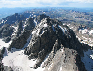
Teewinot from the Grand
 |
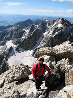
Tom on the summit of Teewinot
 |
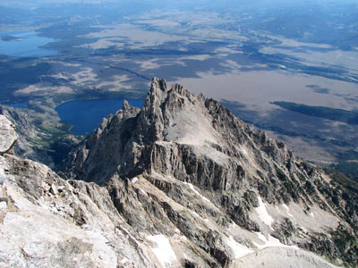
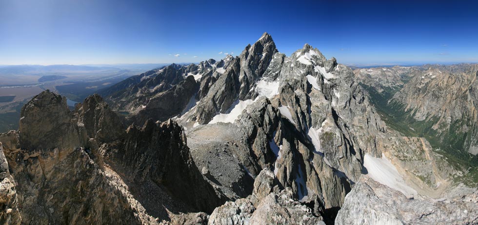
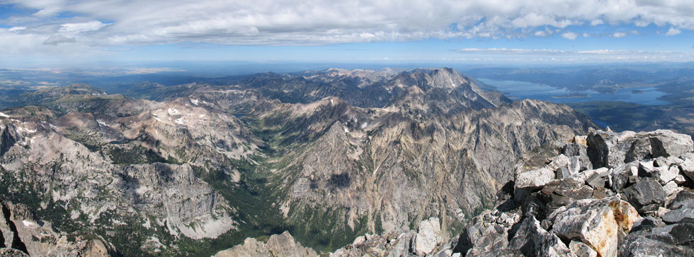
Panorama from the summit looking at the Grand and Mt Owen
 |
Spot tracker page of Teewinot Peak trip
page for my 2000 climb of Teewinot
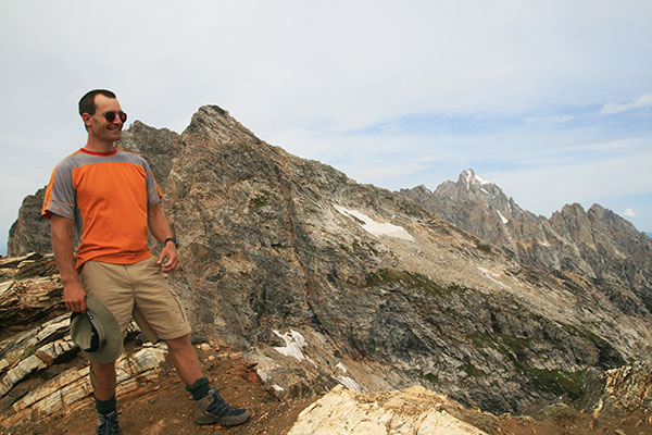
Buck Mountain and Static Peak
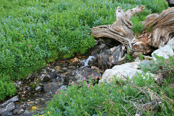
This was more of a hiking scrambling day. Julie was tired from Teewinot, so I went solo. An early start got me going around sunrise, but the uphill hiking kept me warm. For a while I was hiking along a loud mouth brook that was pretty scenic. Eventually I lost the trail in the talus and scrambled up to the E ridge, which was a fun 4th class scramble with a lot of exposure. There were a few others on the 11938 ft (3639 m) summit, and they had the idea of joining a trail down into Death Canyon for the return... It sounded good to me. I headed down the SE face and had to pass a few easy 5th class moves to get onto the talus below. This saved me a lot of elevation loss and gain up to the col between Buck Mountain and Static Peak. It didn't look too hard to get up Static, so up I went. The rock quality was pretty bad, but the scrambling was easy and soon I got to the summit. Imagine my surprise to see 7 others there. It turns out it is an easy walk up from the trail on the other side though. One guy even had a radio control glider with a video camera. Unfortunately he was having electrical difficulties and the wind was pretty steady, so he decided not to fly it. From here it was a pretty easy walk down to the trail and then a long downhill into Death Canyon and back to the truck. Once again the elevation gain for the day was easily over 5,000 feet.
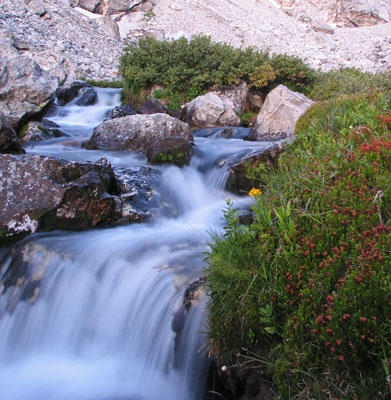
Stream on the way up Buck Mtn
 |
On the summit of Buck Mountain
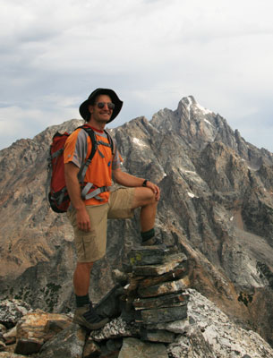 |
On the summit of Static Peak (Buck Mountain is the rounded peak to the right of me)
 |
Spot tracker page of the Buck Mtn trip
The Grand Teton - Upper Exum ridge
On Sept 1, we got up at 3 am and headed for the park, shortly after 4 we were hiking in the dark. We were able to turn off our headlamps about when we entered Garnet Canyon. Then we slogged on up to the cold and windy Lower Saddle before heading up towards the Grand. It was a lot colder than we expected, and we were wearing all of our clothes for a lot of it. I missed the "Eye of the Needle" but Julie saw a cairn so we didn't miss "Wall Street". We belayed the very cold step across, but soloed the remainder of the super fun Upper Exum route to the 13,770 foot summit. As usual the views were most excellent. We teamed up with a group from Lake Tahoe for the double rope rappel descent with just a few flakes of snow to show us we couldn't take the weather for granted. Then we had lots and lots of down to make it back to the truck by 6:30 with some tired legs and sore feet. The total mileage was over 14, but the real kicker was the elevation gain - about 7000 feet. Luckily we had some good long days leading up to this so we were somewhat prepared.
The creek in Garnet Canyon
 |
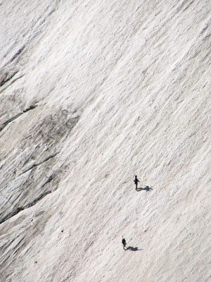
people hiking up to ski and snowboard
 |
Julie on the Upper Exum
 |
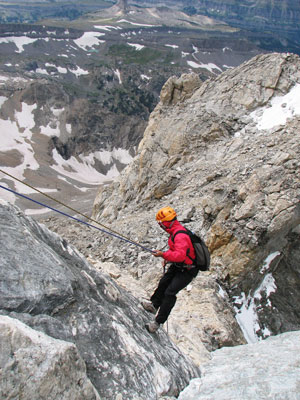
Julie rapping down
 |
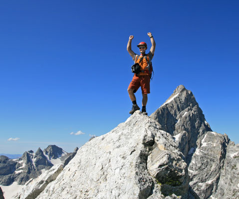
Tom and Julie on the GT summit
 |
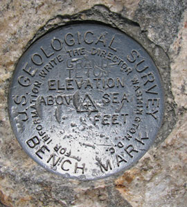
summit benchmark
 |
looking south towards Middle Teton
 |
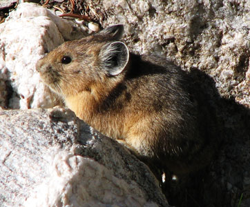
Pika - one of my favorite high country creatures
 |
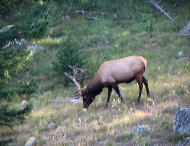
Elk - too far away
 |
Panorama from the summit looking W through NE
 |
Spot tracker page of the Grand Teton trip
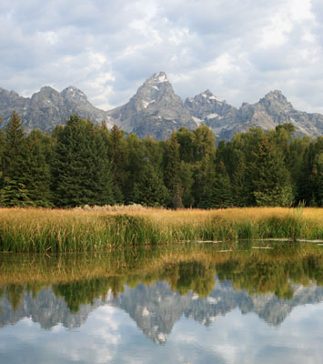
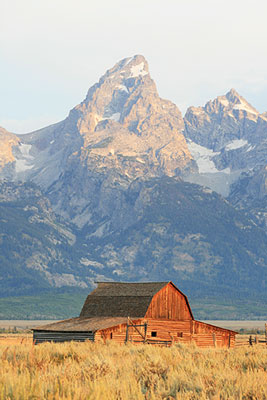
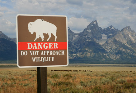
More gratuitous pictures
reflection in a pool
 |
Moulton barn and GT
 |
beware of the killer bison
 |
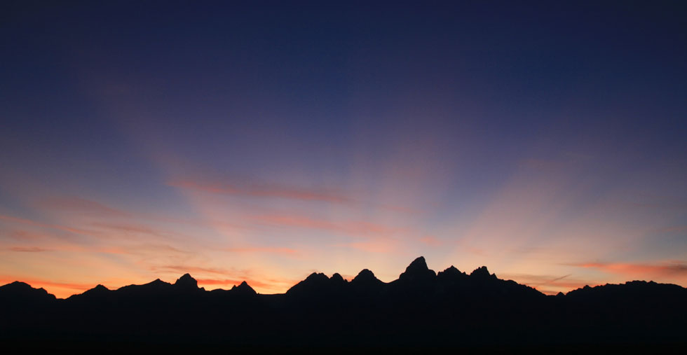
Playing with sunset pics
 |
Most evenings we were treated to a most excellent view of the Tetons, although we never got a really really spectacular sunset.
Teton Sunset - in the middle half are: Buck mtn, Mt Wister?, S Teton, Middle Teton, Grand Teton, Mt Owen, Teewinot, and Crooked Thumb
 |