Pip-squeek, Hourglass Couloir, Mount Dade, and Mount Abbot
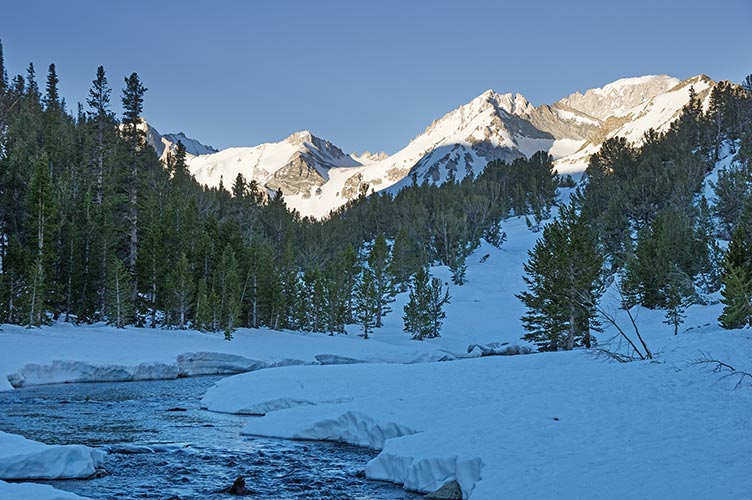
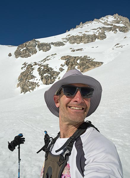
5-23-17 I had been planning to get into the mountains more this spring but I managed to mostly avoid it, finally it was time and I stopped making excuses even though it took me ages to find my map and put together my equipment. I got up at the entirely too early time of 4 am and threw some food down my throat and the rest of my stuff into the truck and headed up to Rock Creek. The road was cleared as far as the pack station at around 9,900 ft and a little over a mile from the trailhead. The snow was hard so I just strapped my skis to my pack and set off walking up the road on top of the snow. I was able to Legolas along like this for most of the morning.
| |
|---|
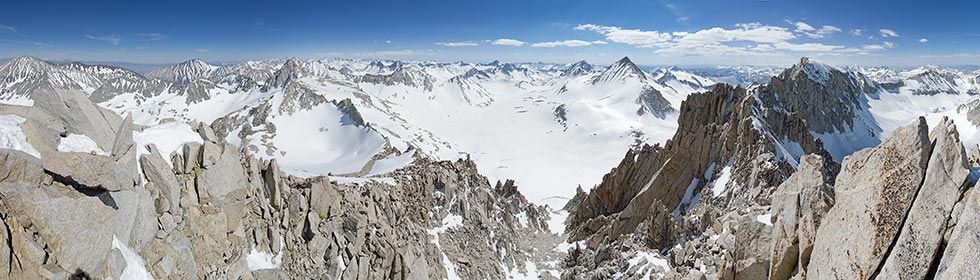
I wasn't sure exactly what the best way to go was although I wanted to avoid the potentially hazardous edges of lakes and too much up and down. I mostly followed tracks or went where it looked the easiest. Parts of Rock Creek were running but parts were completely under the snow too. It was probably quite safe with the frozen snow but might get worse as things warmed up. As I got into the Treasure Lakes Valley I had a better view of my planned destination - Mount Dade via the Hourglass Couloir. Luckily the hourglass was more Ursula than Jessica Rabbit so I didn't have to worry about tight turns between rock walls on the descent.
 |
|---|
 |
|---|
 |
|---|
 |
|---|
 |
|---|
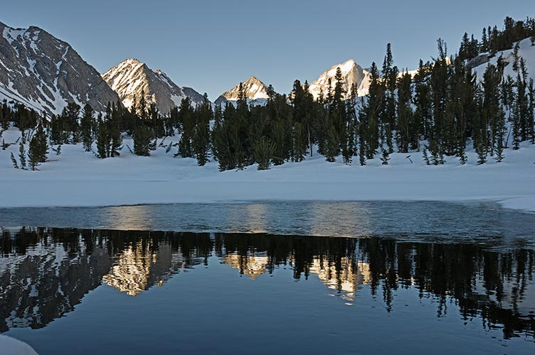
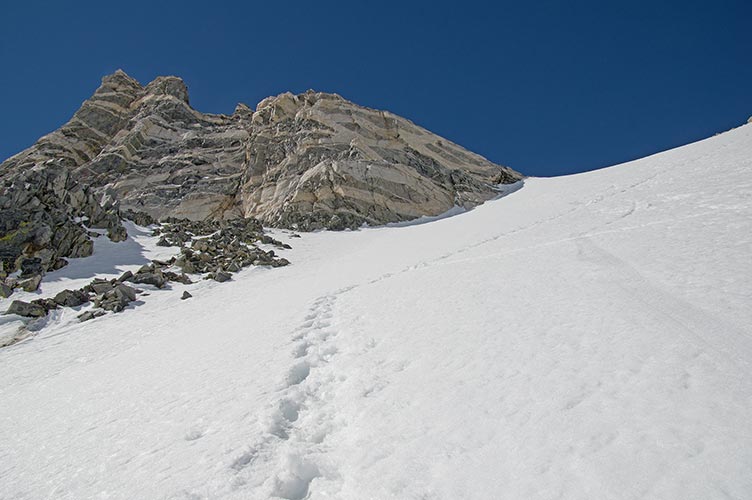
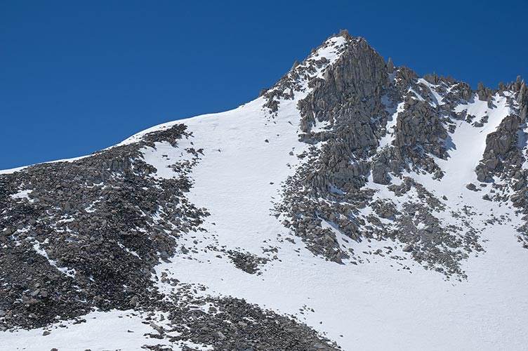
By the time I got to the base of the Couloir the snow was starting to get softer. The sky was nearly completely clear and with the white snow it was very bright. I was wearing long sleeves and a hat and plastered my face and neck with sunscreen. This soft snow was nice as far as kicking steps and making a slip and fall less likely and far safer (I probably would have been able to stop without sliding very far and it would have been on soft snow rather than icy hard snow). I strapped on my crampons and headed up. I was wearing my new Altra waterproof high top Lone Peaks. These are a good bit wider at the toe (like the shape of a foot instead of elf shoes). My crampons are narrow at the toe though, so they were sort of stuck on the inside 3 toes. This was fine most of the time but was a little odd on the downhill foot when cutting across a slope. I kicked my way up mostly following a number of boot tracks trying to stick to the tracks up. It got pretty steep for a while - maybe 35 degrees, but the snow was in pretty good shape. I wasn't moving so very fast anymore and had to stop fairly frequently. At the top of the couloir I dropped off my ski gear and then went up the peak to the south. Evidently this is called Pip-squeek Spire and is 13,268 feet tall and class 3 up the east ridge. It was more trouble than I expected, especially with a mix of snow quality and rock. It also supposedly has a 15 foot 5th class summit spire which I didn't notice at all - there was a bit of a move to get onto the summit, but it wasn't that bad. The view to the west side revealed an awful lot of snow filling up the basins and plastering the mountains.
 |
|---|
 |
|---|
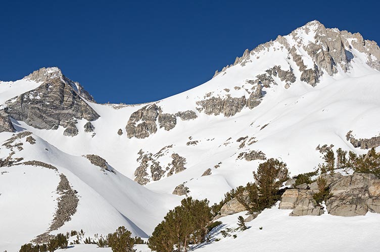
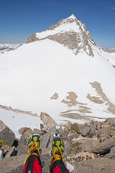
The descent was even more of a pain - I had to take things really slowly and used my ice axe. Then back to load up the ski gear and crampon up towards Mt Dade. This probably would have been easier with the skis and skins, but I didn't want to switch boots and put on the skins only to switch back to my hiking boots for the top of the peak. The snow was a little squishy though and my feet got wet. I think this was from snow forced up under the gaiters and coming in the top of the boot rather than through the waterproof sides. With the soft snow and my tired legs combined with the fact that I wasn't feeling very well I went fairly slowly. I did make it up though. The 13,600 foot summit had more spectacular views of a lot of snow and peaks. The descent back to the skis went much faster. Then I switched to ski mode - ski boots, helmet, and skis on, camera and hiking boots in my pack, and off I went. Fortunately there was a less steep south facing slope before the steep couloir. I did get a little lax and fell over once before the couloir. I was quite a bit more tentative there, it was more survival skiing than fun, but near the bottom where the angle decreased things got more fun. I made it down just as it was going into the shade, but the snow was still soft. From there I had a long way to go and the main goal was to not fall into any water and to try to avoid any uphill or long level sections. I managed to avoid the water but I did have to shuffle along a bunch of level sections and take the skis off and carry them uphill a few times. This sort of terrain is where it would be nice to have tele skills and gear with fish-scales underfoot for going up gentle hills.
 |
|---|
I made it back to the truck around 7:30 pm- nearly 14 hours after I left. Even if I wasn't always moving fast, it was a successful mission and a good bit of training. It was around 11 miles and around 4,000 ft of elevation gain.
 |
|---|