Tom Grundy's Mount Goddard in a day Page
Mount Goddard has been on my radar as a peak I want to climb since I backpacked below it in 2014. It is way back there and I always assumed it would be part of a backpacking trip. Then JD and Robert were going to dayhike it and I decided I needed to go big too, so I joined in.
Friday Sept. 25 I packed and then drove up to N lake after dinner and talked with JD for a while before going to bed. You really don't get a whole lot of sleep when the alarm is set for 1:25 am. I got up and ate some food and prepared to go. It turned out there were 5 of us on this mission, JD, Robert, Gil, Summer, and myself. We left at 2:08 am. Curiously there were a number of people and a bright lantern burning in one of the campground sites as we went by.
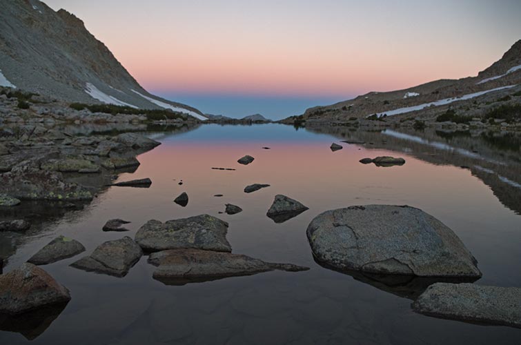
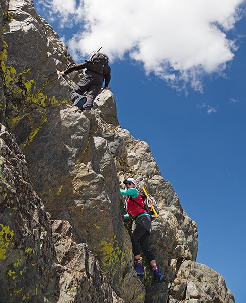
We made pretty good time in the dark up the trail and made it to Lamarck Col in about 3 hours. There was a lot of snow on the final approach and just below the col but it was either avoidable or had good steps in it. It was still dark at the col. The descent down to the lakes wasn't the smoothest, but we did ok. Once there it started to get light and the sun was hitting the tops of peaks before we got out of Darwin Bench. One advantage of ridiculously early starts is that you usually are somewhere scenic by the time sunrise rolls around. I took a smaller lighter camera (the Pentax K-01 with kit 18-50mm instead of the K-3 with 16-50mm 2.8) to try to go faster this day. At times I regretted that (when taking pictures) and was glad at other times (when hiking).
one nice thing about stupid early starts is scenic sunrises
 |
We sort of followed the trail down out of the bench and I cut cross country along a ledge system towards Evolution Basin while JD followed the trail that descended to meet the PCT/JMT and the others either followed me or took another variation. Gil dropped down in between and got ahead of me, and JD might except he waited for a while before running to catch up. We followed the trail up through Evolution Basin along with a number of campers and hikers. It really is spectacular country. The Evolution traverse looked pretty intimidating but someday I'll get around to it.
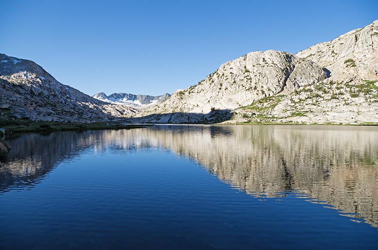
Evolution Lake
 |
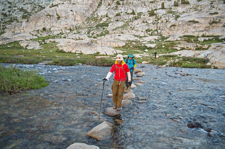
JD and Robert walk across the creek
 |
Before Wanda Lake we cut cross country over the ridge to get into the Davis Lake basin. There were some people coming from there and they said something cryptic about steep snow along the lake. They didn't have crampons or ice axes so we figured we'd see when we got there. (we never did see a lake and snow on the way). We did have to hike across a lot of talus and drop back down to the toe of the ridge we would take to get up onto Goddard. We crossed the snow down low and then headed up rocks and talus to gain the ridge. From there we went up with at least a little interesting scrambling until we were able to access a ramp which cut up and left to the S side of Goddard. Then we had more talus and snow dodging across the slope and then up onto the summit. We got there around 12:35 - just under 10.5 hours from when we left. On the summit we ate, took photos, caught our breath, enjoyed the scenic views in all directions, and relaxed. I put on my raincoat to block the wind and a little bee flew up my sleeve. I tried to brush it out and it stung me on the wrist. It was a little sting, but we joked about if it was enough to call for a rescue. A few days later it is a bit puffy and itchy. Some of us investigated a second summit that appeared that it might be higher (it obviously wasn't once we were there). It did have good views too. Then we just had to reverse everything. oof.
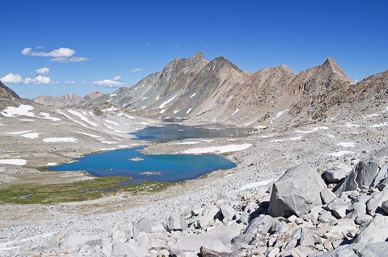
Mt McGee and Davis Lake
 |
scrambling up a steep part
 |
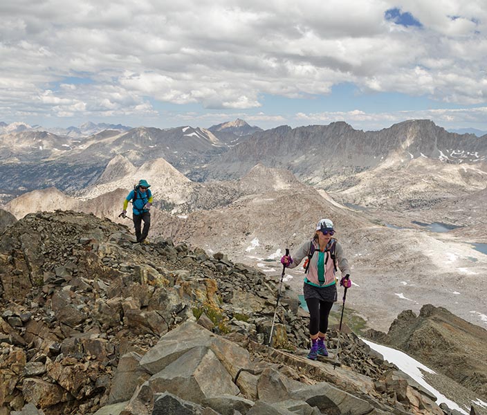
Summer and Robert approach the summit of Goddard
 |
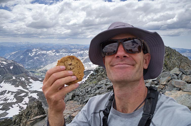
out of focus summit cookie time - thanks Iris
 |
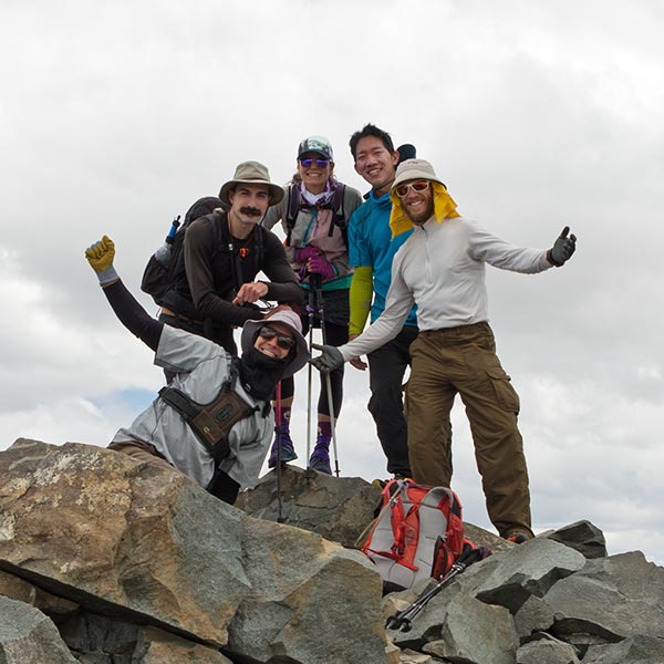
Gil, Summer, Robert, JD, and myself on the summit
 |
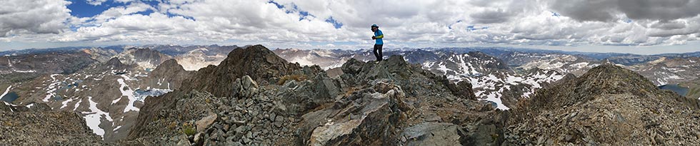
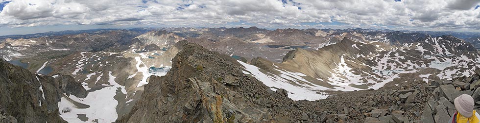
360 degree Goddard summit panorama from the lower West Pk - the actual summit is middle left
 |
We had considered climbing Mount McGee while we were back there, but wisely decided enough was more than enough and just headed back. I gained some time sliding sketchily down some of the snow slope at the base of the ridge, but most of the time I was a little bit behind the group since I lost a bit of ground every time I took a picture (I wasn't the only one toting a big camera back there, and obviously stopping for photos slowed the others down too). We got a few drops of rain but it was never enough to consider putting on the raincoat. There were some somewhat threatening clouds around us, but the threat never materialized.
I didn't feel great, in fact I suspect we all had our moments on this trip, but when we got back to the turnoff from the PCT to go up to Darwin Bench I was starting to feel distinctly unpleasant inside. I was feeling a bit wombly and all was not well internally. I was also quite tired and since this is where the trail started back uphill I was not doing so well. We did take a bit of a break there and I ate some real food and drank some water and nuun and felt a little better when I next caught up with the group. I did ok hiking past the lakes and enjoyed the scenic sunset (an advantage of really long trips is you are often in a scenic place for sunset).
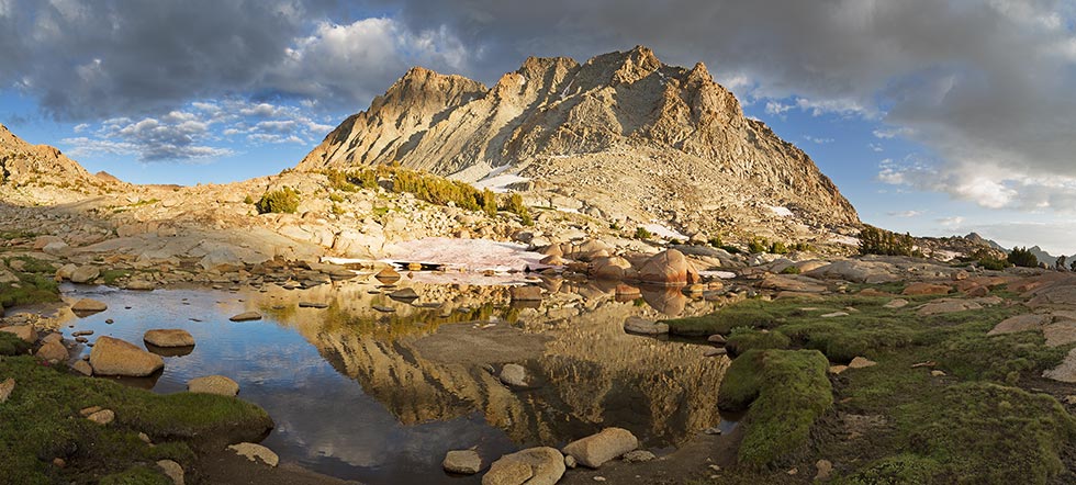
reflection of S J Gould pk on Darwin Bench
 |
JD skirting one of the Darwin Canyon Lakes
 |
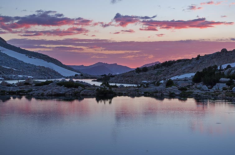
one nice thing about stupid long days is scenic sunsets
 |
It got pretty much dark by the time we left the last lake and headed up towards Lamarck Col. This was the hour of my discontent. Perhaps I should say 2 hours, since it took nearly that long for me to make it up to the col. I was really hurting and not only did I not have much energy but if I expended much I got really nauseous and had to stop for a bit to suppress the urge to vomit. Maybe it would have been better to just do it and get it over with, but I figured I needed to absorb all the nutrients and fluids I had. I also ran out of water. Luckily there was a little rill I could refill from, but that took time too. I was unable to go fast enough to generate enough heat to stay warm despite wearing long pants, arm warmers, and a balaclava. I also wasn't doing a particularly good job of finding the discontinuous use trail. As I got higher I was able to yell with the rest of the group at the top and told them to go on so at least I wasn't holding them up any more. I actually was able to complete the last few switchbacks up to the col without stopping. There I sheltered behind a rock and put on the last of my layers (long underwear top and raincoat). I also ate a few bites of my second summit cookie and drank some more nuun. Then I carefully stepped in the steps down and across the steep snow and headed down. I ended up at the top of another snowfield and could see Robert and Summer's headlights at the bottom. I was able to follow a suncup runnel down the snow and avoid having to put on my crampons (I was still tired even if I didn't feel like puking anymore). For the most part we did a pretty good job of navigating the rest of the seemingly endless way down. The mile and a half after the last creek crossing seemed to take forever but finally we went past the campground (the same site had people up and a lantern burning) and back to the parking lot at 12:56 am 22 hours and 48 minutes after we started. There I talked to JD a bit and mixed a protein shake and then slowly carefully drove back to Bishop for a shower and bed. The balls of my feet felt bruised and I had a blister between 2 toes and was really tired, but otherwise I felt pretty good considering how bad I felt earlier.
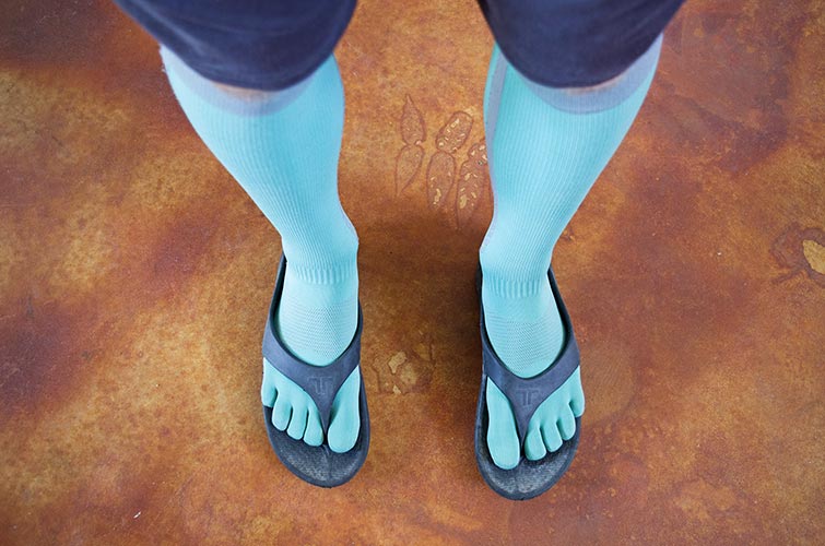
trying to recover with compression ToeSox and squishy flip flops
 |
Goddard summit panorama- north is to the middle left
 |
No material on this page may be copied or used without permission.