Tom Grundy's Evolution Traverse Trip Page
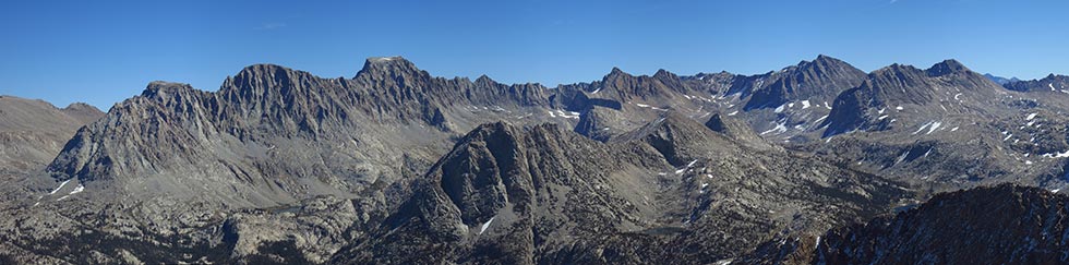
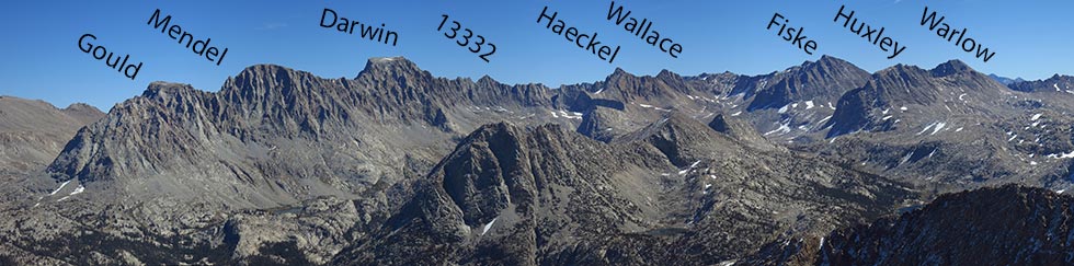
The Evolution Traverse (or Evo) is an 8 mile section of ridge connecting 9 peaks in a sort of "J" shape from Mt Stephen J Gould through Mendel, Darwin, Pk 13332, Haeckel, Wallace, Fiske, Warlow, to Huxley. Most of the ridge is over 12,000 feet with many of the peaks over 13,000. Although all the peaks were climbed earlier the traverse was conceived and pioneered by Peter Croft and Galen Rowell. Peter did the first solo in 1999. Since then there have been numerous ascents especially recently including multi-day trips, winter trips, car to car and as fast as under 18 hours car to car.
I was part of a half hearted car to car "reconnaissance in force" attempt in 2012 with Sean and Kim but we bailed after Darwin because we were unwilling to go for the guaranteed suffering. Sean later went on to do a sub 18 hour c2c send in 2016. After looking down at the ridge from Darwin I knew that there was some sketchy terrain and I have been wary of this goal for years. This year I decided to give it a try with Robert Wu. He suggested a car to car attempt but I knew I'd have a better chance if I camped at the start. I was still scared of it and looking at the AAC "Accidents in N American Mountaineering" didn't help. A period of unsettled weather set our start back a few days but we hiked in on Friday Sept 15th hitting the start of what was supposed to be a cooler dry spell.
panorama from Emerald Peak looking east to the Evolution Traverse taken by JD - thanks for letting me use it
 |
labeled panorama from Emerald Peak looking east to the Evolution Traverse taken by JD
 |
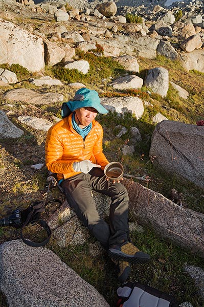
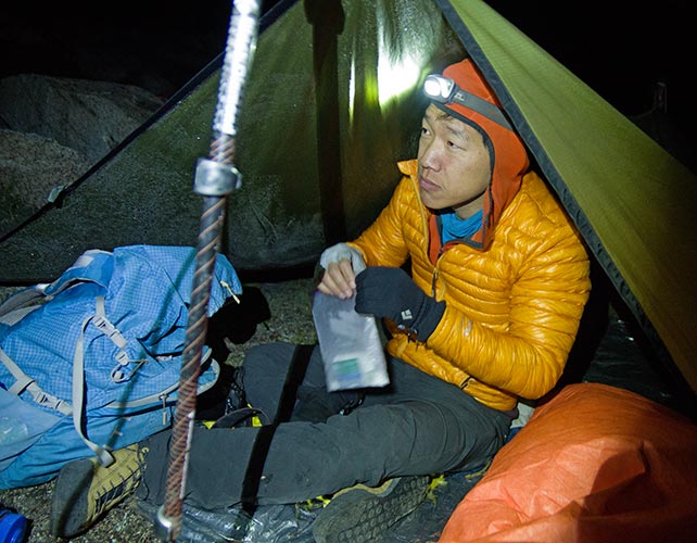
We had been up over Lamarck Col in the dark earlier this year on our Goddard day hike and Robert had come over during the Sierra Challenge. It was a bit slower with overnight packs, but we were still traveling pretty light. We set up camp near the toe of the ridge and ate dinner as the sun set and the temperature plunged. Our dinners were pretty uninspiring, especially Robert's barely cooked quinoa and beans. I was very glad I opted for my warmer down bag. We went to bed early because it was cold and we were going to get up soon to start in the dark.
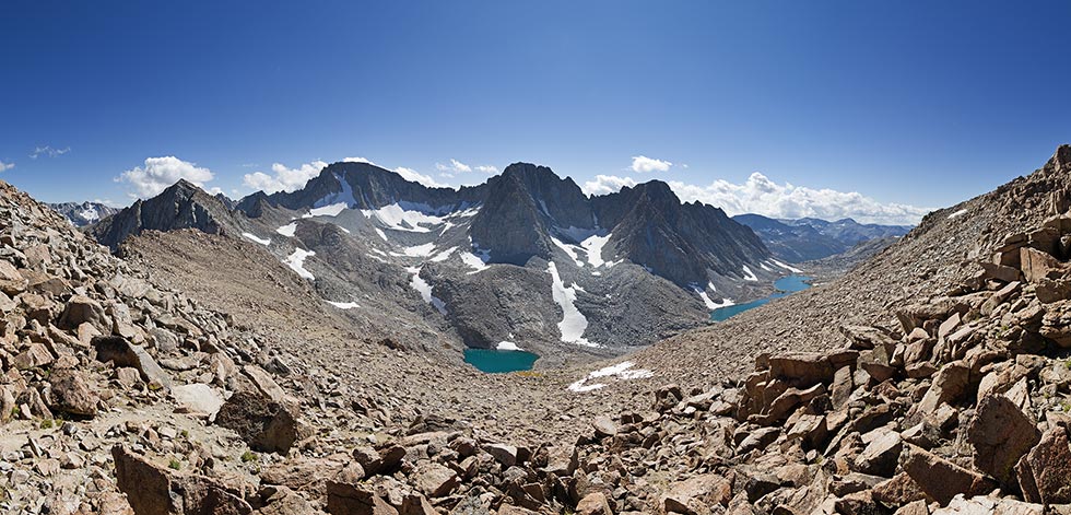
panorama from Lamarck Col looking across Darwin Canyon to Mt Darwin, Mt Mendel, and Mt S J Gould
 |
Robert and his less than inspiring dinner
 |
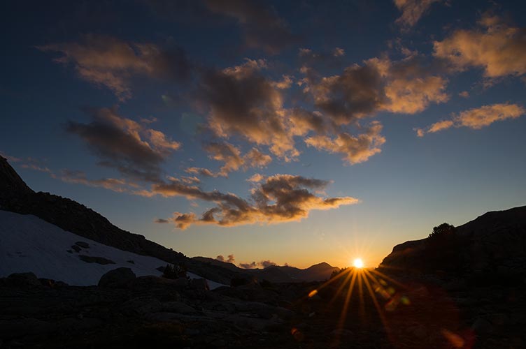
sunset from Darwin Bench
 |
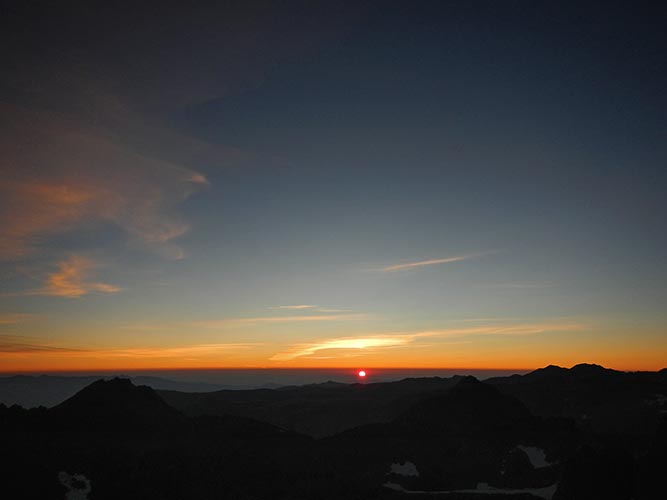
The alarm went off at 3 am and we started getting ready in the frosty dark. There was no moon. The stove died before the water boiled so my oatmeal was lukewarm. It might have helped speed up our departure though. We left at 3:45. It was cold and dark but we started warming up as soon as we began moving uphill. We didn't really know the best route and we started up a ramp system to the left of the cleft and had to zig-zag a bit across the face to avoid seriously difficult or dangerous climbing. It took a long time to get up onto the ridge and then we had to go up and down over a series of notches along the way up to Stephen J Gould (an informal name for the first peak). It was starting to get light before we made it and I saw the sunrise at 6:35 from the summit. One down 8 to go.
Robert getting ready to go
 |
sunrise from Mt S J Gould
 |
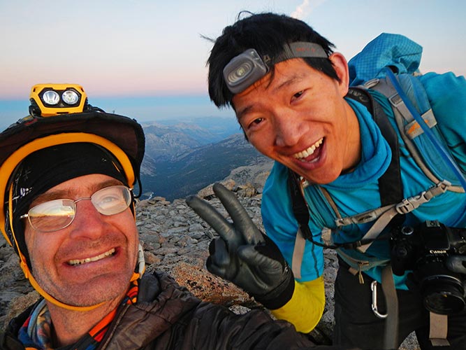
Mt S J Gould summit posing
 |
view on to Mendel with Darwin barely visible in the notch and Fiske, Warlow, and Huxley off to the right
 |
I had done this section before in 2012, but I didn't remember many details. We dropped down to the notch and then had to climb back up towards Mendel. There were a few bits of real climbing but it was mostly easier scrambling. We got to the summit of Mendel around 8:40.
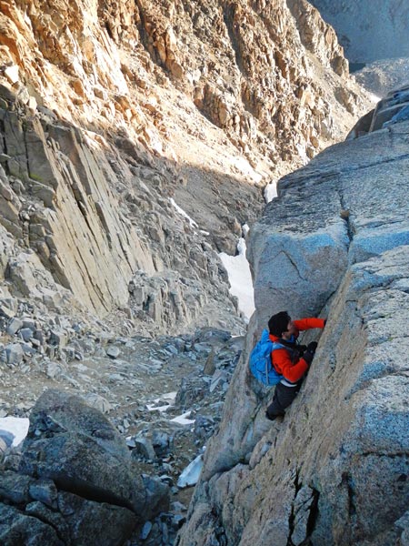
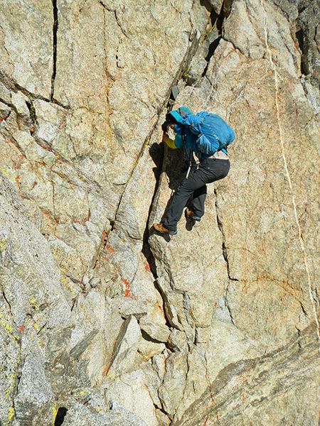
Robert climbs up one of the handcrack sections
 |
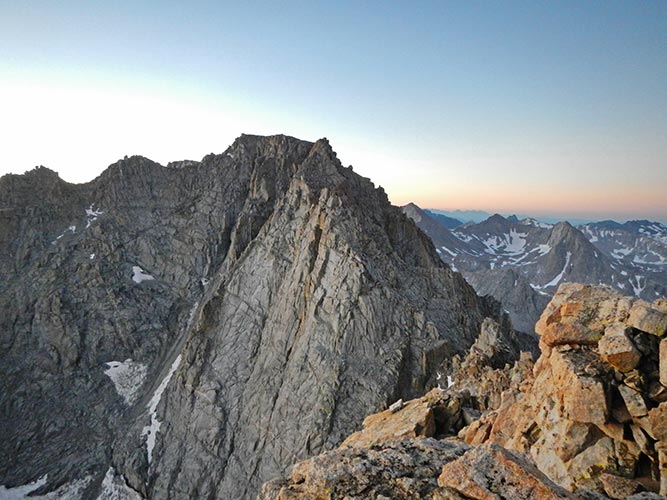
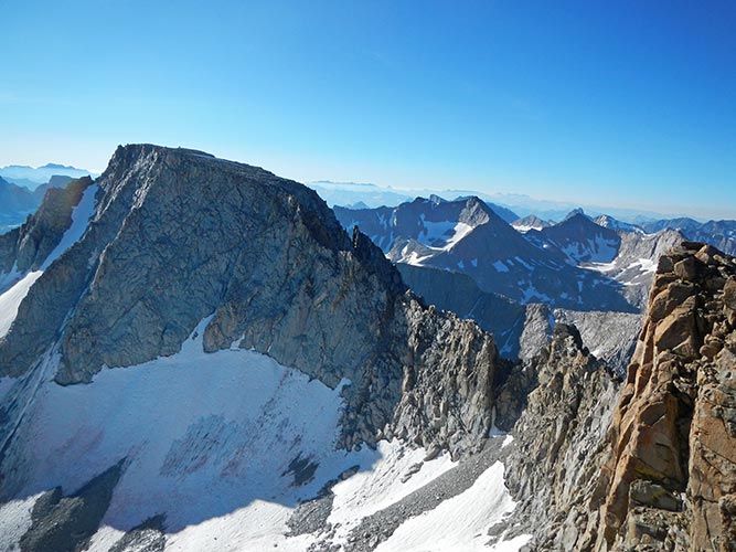
view of the ridge from Mendel to Darwin
 |
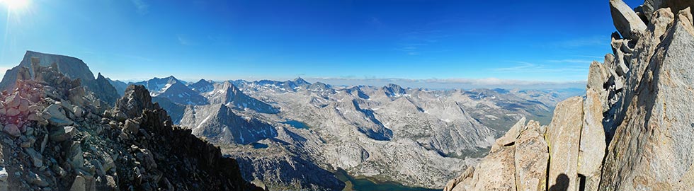
panorama on the way to Darwin. Mt Goddard is in the middle left.
 |
The traverse to Darwin had a number of teeth along the way. We were able to skirt around some of them but others required climbing up and over or down and then back up. After the last deep notch we began to follow a series of cairns that took us on the west side of the ridge up to the Darwin Plateau. We crossed that to the final summit blocks around 11:15. That was the end of the terrain I had been on before except for the summit of Mt Wallace. The ridge dropping off to the south was a scary looking maze of spires and loose chossy rocks.
Robert down climbs along the ridge
 |
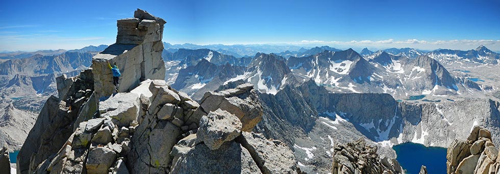
panorama climbing up on the Darwin summit block
 |
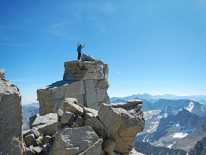
Robert on the summit of Darwin
 |
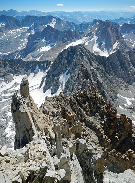
looking down the ridge from Darwin
 |
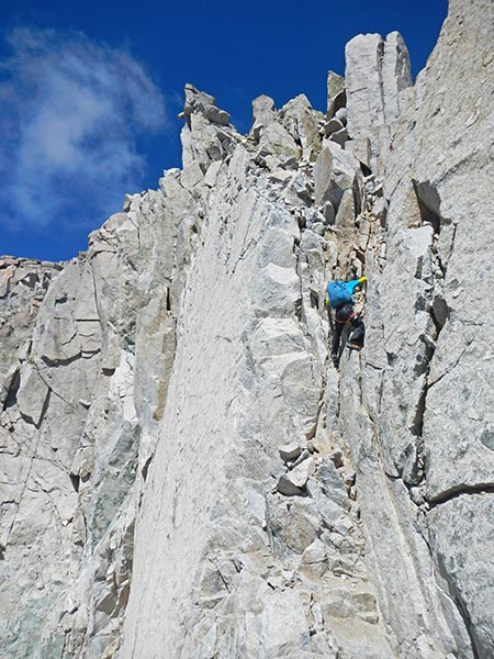
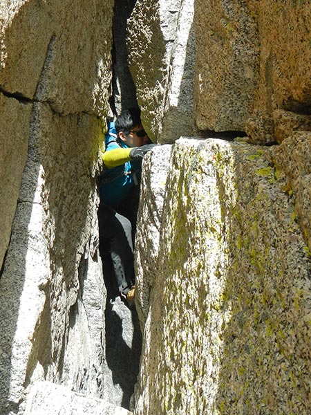
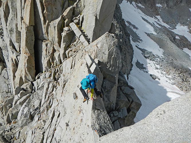
We worked our way down the ridge to a rappel anchor where we started downclimbing. We took turns climbing so that any dislodged rocks wouldn't hit the climber below. This did slow things down a bit. We climbed down past 3 anchors and then traversed up and over to a section that looked particularly steep and sketchy. I looked around a corner and saw another anchor there and we were able to get to it by squeezing through a chimney. Robert rapped down on a single strand of our about 80 ft. rope. Then I doubled it over and he said it was still barely long enough so I came down. That was the only rappel I did all day although Robert did one more later when we were separated on the ridge. From there we were able to traverse back up to the ridge proper and then drop down a little on the east side and drop down to the so called Golden Triangle. This was a steep and blessedly solid section of rock and we took a few pictures climbing over it. That was the end of the worst of the choss although we still had a lot of scrambling up and over and down and around to get to Peak 13,332. At one point I dropped down too low on the east side and had to do some climbing back up to the ridge. Robert didn't like the look of where I went up and chose another path behind me. He slipped and dropped a few feet slightly injuring his ankle but that didn't seem to slow him down much. We didn't make it to 13,332 until around 3:30. This didn't bode well for our hope to finish Huxley before sunset, but I was still relieved to get through the part I was most concerned about. It seemed like we were both suffering from a bit of adrenaline poisoning and the easier terrain ahead would be a welcome change.
Robert climbing down
 |
Robert coming through the chimney
 |
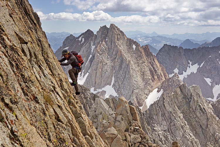
climbing on the "golden triangle" - Robert photo
the dark peak with 2 snow patches behind me is Wallace
to the right of Wallace is the lighter Haeckel with a higher right summit
the dark sawtooth ridge to the right is the ridge to the Fiske east summit
 |
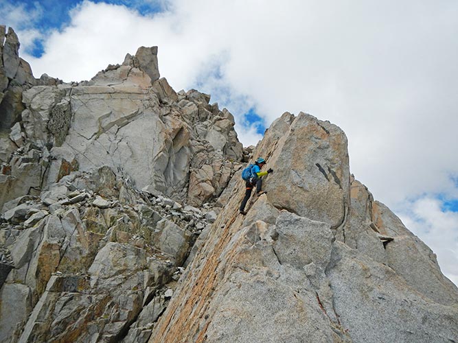
Robert climbing on the "golden triangle"
 |
Robert climbing "au cheval" below me on the ridge
 |
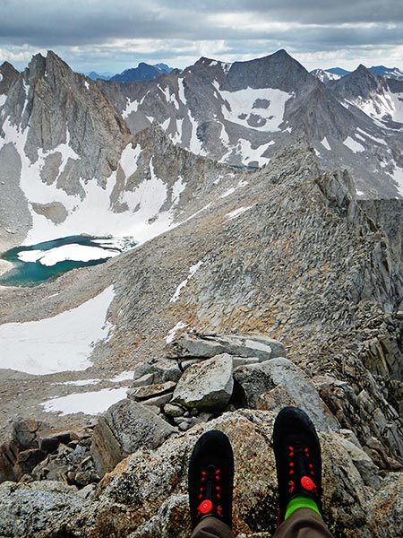
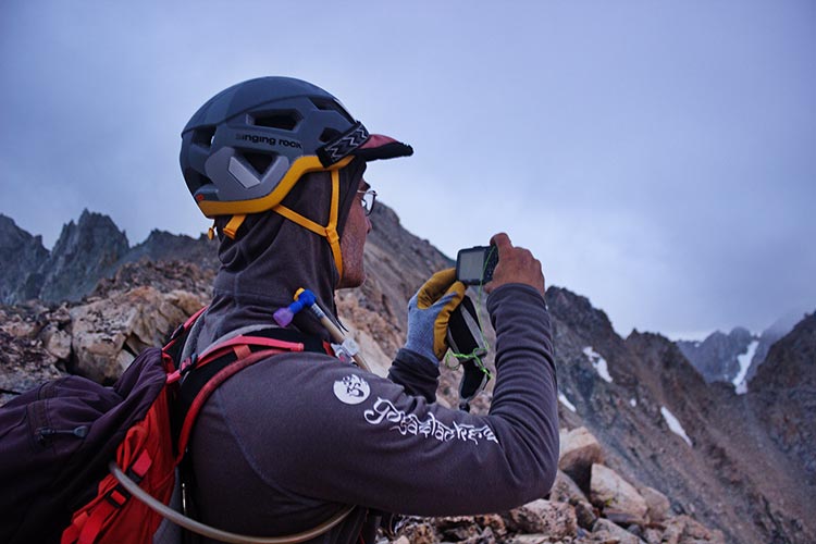
view with shoes looking south towards Haeckel on the left with Wallace on the far left behind it and Fiske on the right and Warlow just clearing the horizon on the far right
 |
The next section went much faster and at some point I made a long slightly dropping traverse across the talus to a snowfield. I was low on water and hadn't seen any nearby snow since Darwin (where I should have collected some but it was hard and I expected to see more). I put some snow in my water bladder and filled a second water bladder I brought for snow melting. I hung this between my back and my pack. Although it wasn't fast, this actually melted the snow and gave me a slow but small supply of water for the rest of the traverse. I still had less than I would have liked, but some is better than none. The hike from the low point up to Haeckel was fairly easy but we definitely weren't going as fast as we would if we were fresh. We also opted to take the mostly blocky talus route instead of up the exciting looking north ridge. This lack of speed did not help at all, but we made it up to the summit by about 5:45. By now things were nearly completely cloudy and the summits of some of the peaks were obscured by clouds.
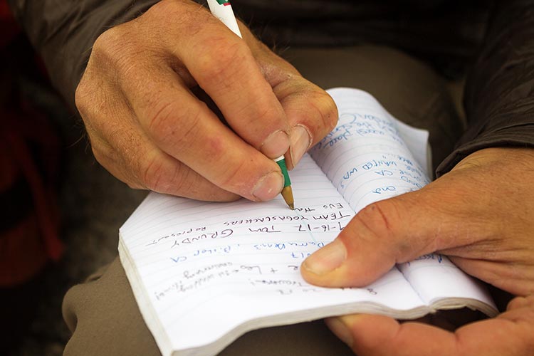
signing the Haeckel summit register - Robert photo
 |
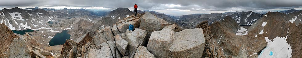
panorama on the summit of Mt Haeckel, Darwin is just left of Robert, Wallace is on the right, Fiske on the left
 |
The traverse to Wallace was probably the shortest and easiest section although there was some loose scrambling on the final ridge to the summit. Spurred by the impending sunset or caffeine or maybe some water I had a brief resurgence of energy up to the summit. It was definitely starting to get darker when we got there about 6:45.
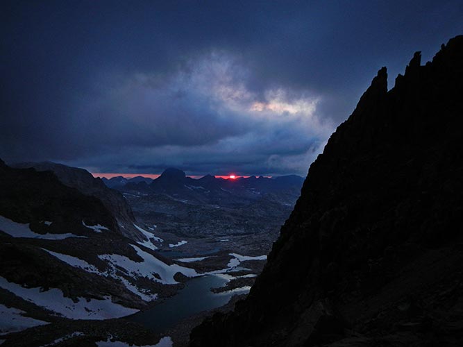
We dropped down to the saddle where we got to witness the sun dropping through the narrow gap between the clouds and the horizon. It was a pretty cool sunset and I would have liked my SLR. I did the best I could with the point and shoot. It was cool to witness this, but I knew we would miss the light soon and there was still a long long way to go. Robert had been on this section a few weeks earlier with JD so I let him take over the navigation and sort of tuned out. At first this was fine as we were actually just walking along the wide rounded ridge. After we dug out the headlamps and turned west towards Fiske the terrain got more interesting and I had to pay more attention. It was fully dark as we began to traverse across the S face of the steep ridge heading up towards the Fiske summit plateau. It got too steep for our comfort and we tried to find a better way. My fenix headlamp has a very bright spotlight, but that didn't do much good as the cloud level dropped so all it did was light up the mist. At the worst visibility was down to maybe 30 feet or so. We headed backup to the right and then traversed left finally making it back up to the summit ridge. There we had to climb up and down along the ridge but at least we were making progress again. We skirted to the north of the lower east summit on to the plateau and finally up some more talus to the actual summit around 10:10. There were cold swirling clouds and the occasional snowflake would blow through the headlamp light and we were both tired. Tired from being awake for so long, tired from hiking and scrambling for so long, and tired from the constant stress of travel and navigating in steep mountain terrain where one mistake could be your last. I think we both thought about bailing or at least was worried the other was thinking about it. If it was warmer or we had the gear for it I think we would have probably bivied. As it was we had to keep moving and we opted to just keep going along the traverse. It was cold - not bad while we kept moving but we were wearing a lot of clothes and gloves and as soon as we stopped the cold began to seep in. There was frost on the top of my helmet and on our backpacks.
taking a picture of the sun slipping away - Robert photo
 |
goodbye sun, we will miss you
 |
We were making the big drop down to the notch to Warlow when we made a pretty bad navigational error. I was in the lead and Robert kept saying more left, more left. This didn't seem correct to me, but I just assumed he knew this section so I went more left. Then he looked at the gps track on his phone and realized we had made a nearly 180 degree turn and we were heading nearly back to the summit plateau of Fiske. oops. I tried to get a compass bearing where we needed to go and headed back off down the slope in mostly the correct direction. When the clouds lifted a bit if I turned off my headlamp I could see the massive dark bulk of Warlow to the SW too. We headed that way down the steep slope and finally came to the saddle. From there we headed up. We passed a big false summit and headed on up sticking mostly to the north side. I thought we had made it but then could see a much larger dark mass looming ahead. We passed this false summit and then scrambled around on the north face for a while and eventually I got back up to the ridge. I didn't like the looks of that and dropped back down but traversing west just brought us to more steep cliffs. Supposedly there is some sort of way to traverse right for a while and then take an easier gully up to the summit but we never found it. We would either have to drop way down or do some pretty scary looking traversing. I decided to give the ridge another try. There were a few not so great moves on the ridge but at least we were making progress and nothing stopped us. Finally we made it up to the actual summit after about 2 am. I'm not sure of the exact time since we couldn't find a summit register and neither of us bothered to take any photos. From time to time here and on the way up to Huxley we would see a headlamp down below (along the JMT). We wondered what anyone was doing up that late.
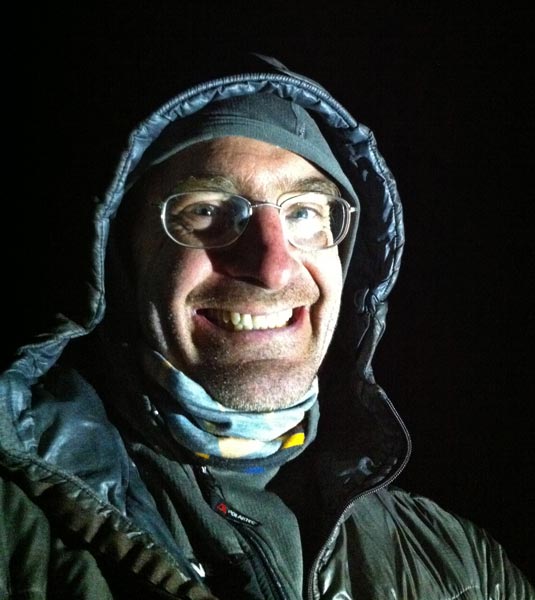
phone selfie on Warlow - I took off the helmet to point the headlamp at myself
 |
I made a navigational error on the descent from here. I tried to follow a compass bearing but headed too far north and missed the ridge towards Huxley. When the clouds cleared a bit I could see it off to the west with my spotlight. I wanted to traverse straight back to it but there were steep cliffs in the way. We were still higher than the low spot so a lower traverse might save elevation gain and loss but was a very unknown risk with the possibility of getting completely shut down along the way. I opted for the safer but immediately painful option of heading back up and over. Luckily the fog illusion was in effect and we really didn't have to backtrack very far to get back on track on the ridge. We had a brief moment of easy relatively flat walking before things got steep again. There might have been easier options off to the sides, but often it was easier just to follow the ridge. After the low point things got quite steep. We headed up the ridge for a while with some hand cracks and Au Cheval sharp ridge scrambling. I presume there was a lot of exposure but we were just climbing in the headlamp bubble of light. When things got too hard we were able to traverse right before climbing back up onto the ridge. We cut left around the next gendarme and then cut right at the next hard part and finally up to the summit around 5 am. We spent a bit too much time on the summit because we were tired and the register was more interesting. When we went to go I was cold and my butt and foot had fallen asleep (and I was pretty groggy - evidently I do ok as long as I keep moving but once I sit down I start to shut down).
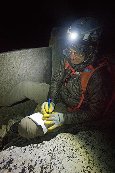
signing the Huxley register - Robert photo
 |
We traversed north a bit looking for the "second gully" on the left. We headed towards what we thought was that, but it looked awfully steep at the top, instead we went a bit farther north and dropped down a slight ridge and then into a gully. It looked like others had gone this way too. As we headed down this steep but not technical slope it began to get light. The going was tedious but not difficult although I did slip on some pea gravel on slab. The sandy slopes seemed to be frozen but you could scree-ski the gravel. Finally we got off the slope and traversed across the drainage towards the JMT. We stopped to take pics as the sun lit the peaks. Once we hit the trail we just had to walk back to camp, but it was still a ways and we didn't get there until about 9:30. There were a number of hikers along the trail including one who had seen our lights up on the mountain the night before. We had been on the move for nearly 30 hours and were mighty glad to get off our feet. I managed to get the stove restarted so could have a greatly appreciated hot Good to Go Thai Curry. Then we took naps.
Robert gets a pic of the Mt Goddard reflection and our second sunrise of the "day"
 |
After our nap we packed up and slowly trudged up over Lamarck Col and back down to the North Lake parking area about 7 pm. Robert was kind enough (and I had the truck keys) to not leave me in the dust on the hike back.
Gear, Logistics, and Navigation
I got a lot of ideas about what to bring and navigation from other people's trip reports online, so I'll try to add my 2 cents here. We brought a skinny (7 something mm?) rope that was about 80 ft. I'd have preferred a few more feet, but that was what we had. It was just long enough for the one rappel I did coming off of Darwin (off a somewhat extended sling anchor). I didn't bring any cams but had a handful of nuts. I wouldn't bother with them if I do this again. I mainly brought them for bail options, but I think creativity and slings would be more useful. I also brought some slings and tat but didn't use them. I'd probably bring some to leave if the stations had been cleaned or I needed to bail. we also had harnesses and belay/rappel devices. Mine wasn't very lightweight, but the ultra-lightweight one I have is a little scary light (and tight). For water I brought about 2.5 liters in a bladder. I should have had a bit more or else added some snow on Darwin. My second bladder to melt snow between my back and the pack actually worked fairly well once I started using it. It worked a lot better than expecting the sun to do this since it got cloudy and then cold and dark. I brought a helmet and wore it most of the time. Robert brought a helmet and didn't wear it at all. I was mostly downclimbing first and a few rocks whizzed by but I mostly did the loose parts while Robert waited and then traversed or stood out of the way while he came down. Headlamps were essential for us, both for the early start and the all night push. I had a Fenix HP-25 with a wide area light and a bright spotlight. It was pretty great but a bit heavy with 4 AA batteries. I had a second set and switched them out on the summit of Warlow, but the old ones still had a lot of power left and I probably could have made it with just one set (and the light was on when I pulled it out after sunset). Robert had a rechargeable one that only lasted an hour or 2 and a Petzl Tikka that went the rest of the night. For shoes I wore Evolv Psyche Cruzers that I had seam-gripped a bit along the outside edge for durability and Robert had 5.10 approach shoes. They both seemed to climb well enough although the 5.10s were a bit heavy and clunky and I could have used a bit more padding under the ball of the Cruzers. I would have worn my more durable Zender but they are a bit looser and I was concerned they wouldn't climb as well. We both wore long pants (Prana stretch Zion for me, plus I wore Ibex thin long underwear up to Darwin and after Fiske). On top we had technical T shirts plus arm warmers as well as mid-layers with hoods and puffy jackets (primaloft for me and down for Robert). I had a lightweight raincoat I never wore, Robert wore his wind-shell a few times. For food we had a mix of things. I had a bunch of bars plus some gels and 2 pb&j sandwiches. I didn't eat it all although I probably should have. Robert had similar plus a big bag of mixed candy. We both wore rubber palm and fingered work gloves. In addition I had liner gloves that I didn't end up using and Robert had some warmer gloves he wore at least a little. The gloves saved my fingers and palms from getting abused, especially on the extended down-scrambling. I did a lot of climbing in them but pulled them off for the hardest moves. I didn't bring my dslr on the traverse. I would have loved to have it for some pictures, but the weight and awkwardness of carrying it would have slowed me down. I did bring my Nikon point and shoot and did take some pics, mostly when waiting for Robert or on summits. The photo quality is ok for trip reports but is nowhere near as good as the Pentax K-3. Robert brought his lighter Canon slr.
Although it would be nice to have detailed navigation for the whole traverse this isn't really possible (although I guess at some point someone who has it dialed could upload an accurate GPS track). Depending on how you choose to do this you need to be able to move fast on easy scrambling through 5th class climbing as well as able to move quickly up and downhill on talus. In general it was both possible and a good idea to stay on or nearly on the crest for almost the entire traverse. Bob Burd's navigational wisdom ("if in doubt, go up") usually applied. If things get harder than you are comfortable, then look around for other options. For the descent off of Darwin we went down the ridge to a rappel station - there we were able to downclimb past 2 more stations. Then I traversed up and to a spot where I could look down to a ratty looking station as well as around the corner to another in a chimney. I was able to get to that station by backtracking and squeezing through to it. I didn't see any obvious easy downclimbs here so we rapped. Then a rising scramble traverse brought us back to the ridge and a fairly obvious scramble down to the "golden triangle". I feel fairly certain that we could have done a better job of navigating and moved more quickly for the last few peaks but the limited visibility really hurt. In general stick to the ridge unless you can see or know of an easier option.
If you are fast - car to car is an option, but for most I'd say go camp to camp or even plan a bivy or 2 along the traverse. It would be a pain to carry bivy gear but there were plenty of bivy sites and as long as you had enough insulation, food, and fuel it would be a pretty civilized way to do this - plus the sunrises and sunsets would be most excellent. This is a long traverse with a lot of serious terrain. If you aren't comfortable moving quickly over a lot of solid 4th class without a rope then you either need to be an ace with rope tricks or this traverse is probably not for you.
In a way it was a bit like an adventure race minus the speed (which is why it took so long) for me. You either need to be able go fast, to stop (bivy), keep moving, or else bail. We went with the keep moving option.
Elevation and times:
- Start at camp, ~11,550 ft, 3:45 am
- Mount Stephen J Gould, 13,385 ft, 6:35 am
- Mount Mendel, 13,691 ft, 8:40 am
- Mount Darwin, 13,830 ft, 11:15 am
- Mount 13,332, 3:30 pm
- Mount Haeckel, 13,435 ft, 5:50 pm
- Mount Wallace, 13,377 ft, 6:50 pm
- Mount Fiske, 13,524 ft, 10:10 pm
- Mount Warlow, 13,300 ft, ~2 am
- Mount Huxley, 13,117 ft, 5 am
- back to camp, ~9 am
We mostly spent 10-20 minutes on each summit adjusting clothing, eating and drinking, taking photos, signing and reading the summit register, and taking pics of the registers. I feel fairly certain we could have saved a few hours with shorter stops, less standing around, more continuous movement, less photos, plus greater effeciencies. All in all it was a most excellent adventure.
No material on this page may be copied or used without permission.