last edited 6-1-2021 to include a few more links, final race results, and a few more pics
Since I am friends with the organizers and a bunch of people racing in Expedition Oregon 2021, I was aware that this adventure race (or AR) was coming up, but about 2.5 weeks before the start I got a message from Jameson that 2 teammates had dropped out of the race and could I do it? Yikes. I was both excited and terrified. Fortunately in the previous month and a half mostly in Yorba Linda I had started jogging nearly daily and had pushed through the weeks of mostly being sore and slowly started to up the distance and maybe even the pace. Iris was also on board, and said I needed to up the training (as I did), fortunately she was much more mobile now than she had been in the first month after knee surgery. I had a flurry of communications to see what was needed and to line up a bicycle (thanks Jason), and then I was committed. I immediately ramped up my training with some big bicycle rides and longer jogs. going from maybe 3 to 6 mile jogs to 8 to 12 miles with a lot of elevation gain and bicycling 20, 30, and then 76 miles with a few thousand up to 10,500 feet of elevation gain. After one of these runs I was pretty dehydrated and weighed 150 lbs, a weight I might not have been since the end of wrestling season my senior year of high school.
Strava page for the training ride up SantiagoI had most of the gear I needed, although it wasn't always exactly what I would choose for an adventure race. One thing I definitely needed was a bicycle box. I got caught up in the goal of making one that would fold into a fairly compact size when not in use and spent a lot of time and brainpower mostly successfully constructing this box (I hope to eventually have a page on making this box). Then it was time to head back to Bishop, somewhat hectically and chaotically find and pack up all the gear and food, and drive to Oregon. This was somewhat complicated by the fact that Sam and Raquel were doing about the same thing in the Church of Grundy - Sam was going to be filming the race. They left Saturday morning around 2 am and I left at a more reasonably 10 or 11. I managed to make it to Bend late that evening to meet up with the team and discuss strategy a bit before going to sleep.
Sunday - T minus 3, we went to Jason's and picked up the bike and chatted a little, then we bicycled with packrafts to the Deschutes River and put the bikes on the rafts and paddled downriver a bit before taking out. I realized how much I needed to get the bike out of the way of a full paddle stroke if I wanted to go very fast. Then we did an REI run (bike water bottle cage and inner tube for me) and back to the hotel to work on food while the others went on a grocery store run. I had mostly sorted food by the time they returned to sort their food. I aimed for about 200 calories per hour for each stage, I think Andy went for 250/hour). That evening we soaked in the hot tub and talked with Darren (the guy I replaced because his knee was preventing him from doing long bike rides - he was also going to be filming and photographing the race). Then we watched some Adventure Race how-to videos and went to sleep.
| |
|---|
 |
|---|
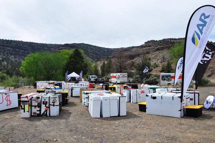
Monday - T minus 2, I had to go to REI to get the pedals off my bike to put it in my bike box. Then we loaded the boxed bikes into Darren's van and drove to Prineville. I stopped at Home Depot to get the gear bins that we would use to store gear during the race (the race would have the gear bins, bike boxes, and paddle gear bags at the appropriate Transition Areas (TAs) so we didn't have to carry everything with us the entire time. One concern was we didn't know what the weight limit was for these, since we were having a hard time keeping them under 50 lbs (later we learned that the limit was 25 kg - about 55 lbs). In Prineville we moved into the hotel there, filling up our rooms with bike boxes, bikes, gear, and food. We also threw a static rope over a tree branch and played around with how we would do a bike rappell. That afternoon the teams checked in and there was a first meeting for the race giving us a basic overview of what we were getting into (a long way to go).
 |
|---|
 |
|---|
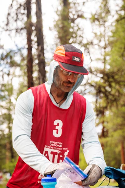
Tuesday - T minus 1 We had mandatory gear check and skills tests in the morning - basically we had to show we had the required gear (and that the gear we thought met the requirements did in fact do so) and show that we knew how to set up a rappel and move through a via - ferrata situation (for one of us - in this case, me - to get the "scariest checkpoint in AR history"). Our flashing LED was not sufficient to count as a strobe, luckily I had an actual strobe that unfortunately weighed a lot more. Then we spent the rest of the day doing last minute things - like making sandwiches and bean burritos and trying to resolve my fashion crisis (what clothes would I wear). Then we packed up the bike boxes and bins and paddle bags. We had another meeting and then we got our maps. We went back to the hotel room to pore over them and try to decide what route we would take - we also noticed we didn't have the last map, so I went back to get that. Then we finished our packing and staring at the maps, Jameson went to the captain's meeting and we stared at the maps some more. This was our chance to pick the best route and look at the maps without sleep deprived minds. That night we took our last showers for a while and tried to get as much sleep as possible.
 |
|---|
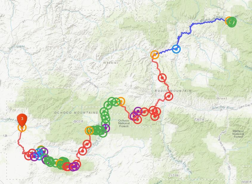
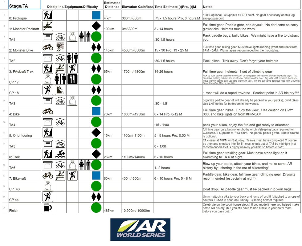
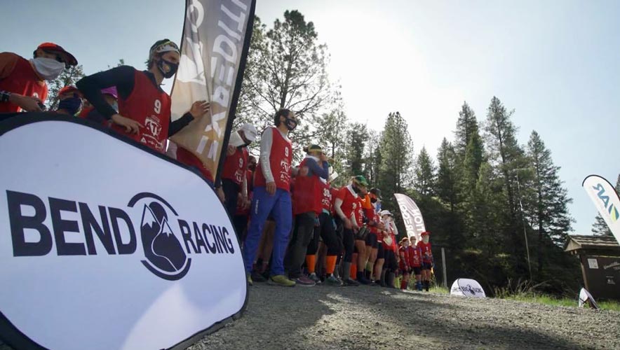
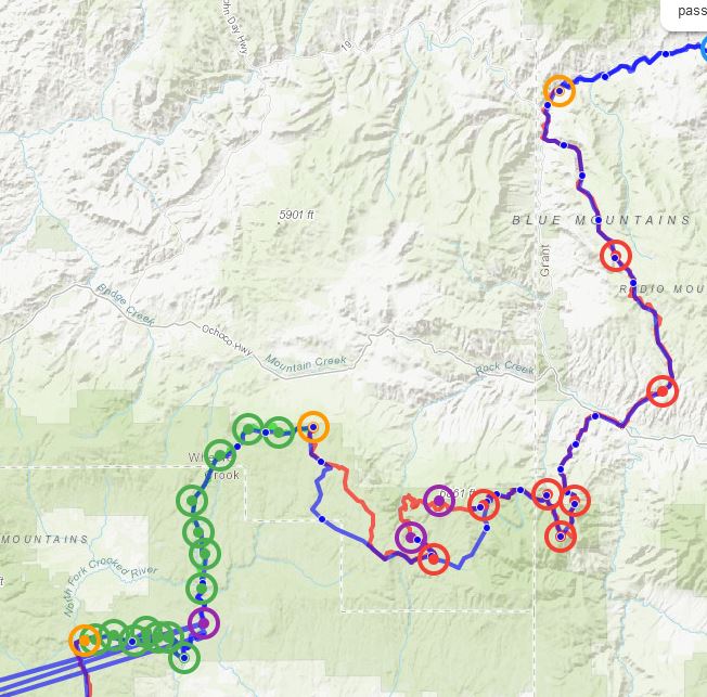
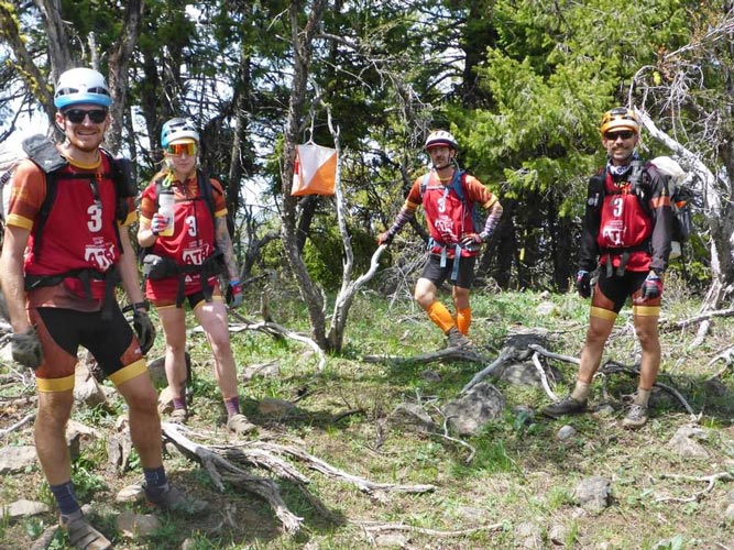
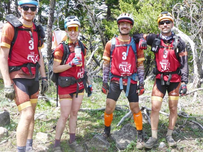
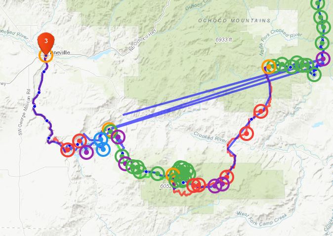
Wednesday May 12, 2021 - Race Start. We got up about 4:45 and threw on our race clothes and grabbed some food. Then we parked the vehicles where they said to - the old Sears? parking lot - and headed to the buses. On the buses most of us tried to sleep some more as well as eat some breakfast. It was over 3 hours to where the race would start. I might have slept a bit (I certainly tried to), but then I finished my breakfast as well as a bagged breakfast from the hotel. When we arrived around 9 am we moved our paddle bags to the bridge, and then assembled at the starting line. After a few words of encouragement - or maybe discouragement from Jason, there was a countdown and we were off. We had decided to do the 3 prologue points, so we jogged on up the road in the middle of the pack - probably about as fast as I would want to jog, I was a bit worried if the pace picked up at all I would really be hurting. We did the points in reverse order - C, B, A, so before the end of the road we headed left up the steep slope and our jog slowed to a brisk walk. I would have used trekking poles if I had them with me. The first point came quickly in a little draw, but then the next one was a lot higher up the slope. Then we headed downhill towards the last one. I had a little scare when my sock caught on a strand of barbed wire on the ground and I almost hung from it down the slope, but it didn't even rip the sock and I was able to extricate myself. Then we headed down down to the last of the prologue points. These were orienteering points so equivalent to the upcoming "O" course where you got one pro point for each 3 locations you got. There were a total of 13 of these points over the course, so skipping one of them didn't hurt you. We decided we could skip one of the O course points later. Then we side-hilled back to the road to our packrafts.
 |
|---|
 |
|---|
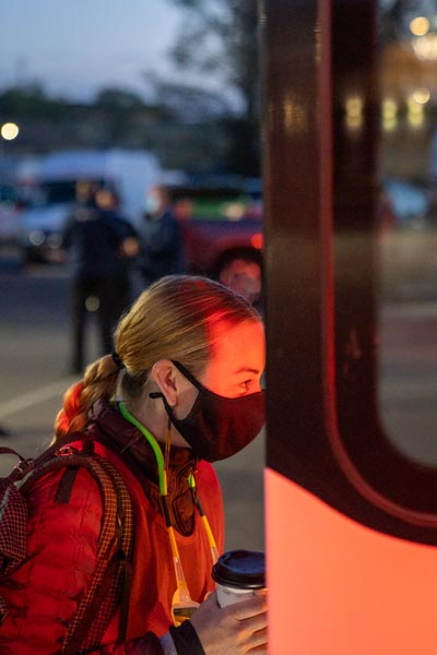
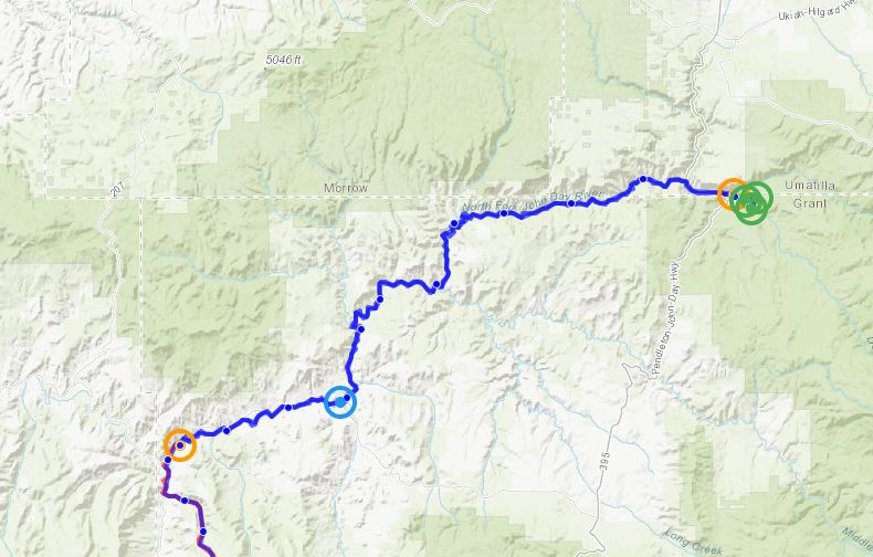
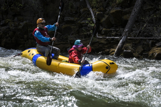
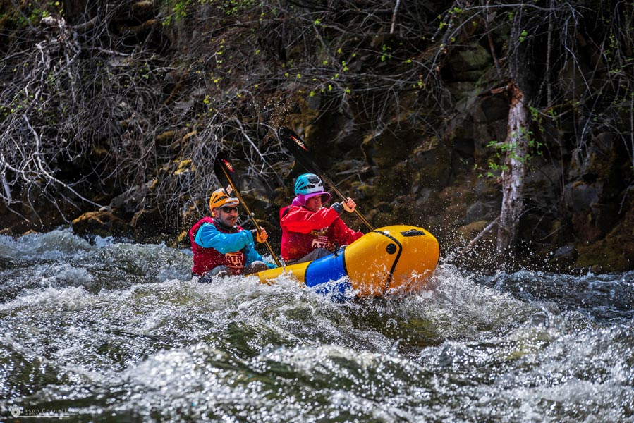
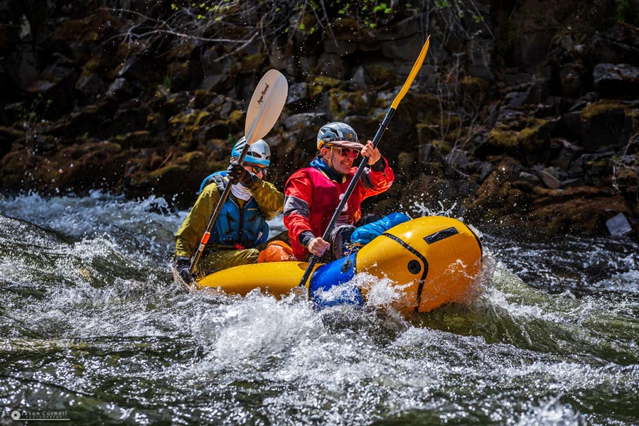
We were unsure about if we wanted to wear drysuits for the paddle - an advantage is that if we ended up flipping it would make it easy to just jump back in the boat and keep going. A downside is that they are slow to put on and take off and a bit of a pain to deal with and it was possibly going to be too hot wearing them. We opted to wear them, and I think that was the correct choice, especially for those in he front of the boats who were more likely to get lapfulls of cold water. We started inflating rafts and putting gear together. I was a little slow with the transitions, which unfortunately continued through the race - not horribly so, but I didn't do my full share of group things - like inflating the boat. Sometimes it was little goofs, like not having the race shirt on the top layer, sometimes bigger things like forgetting spare batteries. Fortunately Andy was on top of things so by the time I had my drysuit on and was ready to go, our boat was ready too. We were paddling 2 Alpacka Gnu 2 person packrafts. This was maybe a little less good for rapids, but would be much better for smooth water plus it allowed one person to do something like get food or sunscreen while the other kept the boat moving forward. We carried our boats down to the water and tempered them a bit - put them in the cold water so that the air inside would cool and shrink - then blow more in so they don't get floppy when we went through the first rapid. We launched off down the N Fork of the John Day River. This was a nearly perfect packraft river with mostly class II rapids with perhaps a few class III bits (or maybe I am just getting soft). Our goal was to stay in the boats and moving as much as possible. After the first rapid the center of the boat was pretty soft and I was sitting low on it - these boats are a little like a hot dog with the bun on the outside and a center "hot dog" tube in the middle that I sat on (I was in the front). When we were out of direct rapids, I tried to get off the center tube and inflate it more (via a mouth tube). After doing this a few times I was no longer low-riding and my knees and hips felt better. I still needed to take a break and stand up or do something to relieve my cramped body every once in a while, but it was much better.
 |
|---|
 |
|---|
 |
|---|
Our plan to stay in the boats as much as possible seemed to pay off and we passed a number of teams, mostly when they stopped to dump water out of their boats or for some other reason. We also were able to partially bail the boat out with nalgene bottles which allowed us to keep moving better. Eventually when we pulled over for a few minutes - mostly because we needed to go to the bathroom - which is a hard feat in a drysuit, especially if they don't have a relief zipper. A few teams passed us while we were on the bank, but I think we caught most of them later on the river. We were counting bridges (the checkpoint or CP was after the 5th bridge), but they were very far apart. We ended up taking another break before the checkpoint when our (or at least my) bladder couldn't take it any more. After the checkpoint we were definitely getting tired - especially those of us without "man shoulders", but we kept in the somewhat slowing current and continued on into the glare of the setting sun. I was very glad to have sunglasses as well as a visor on my helmet. We reached the takout just as it was starting to get dim - about 8:30. I think at this point we might have been at 9th place - about as good as we ever were on the race.
 |
|---|
 |
|---|
 |
|---|
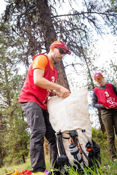
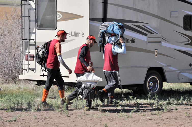
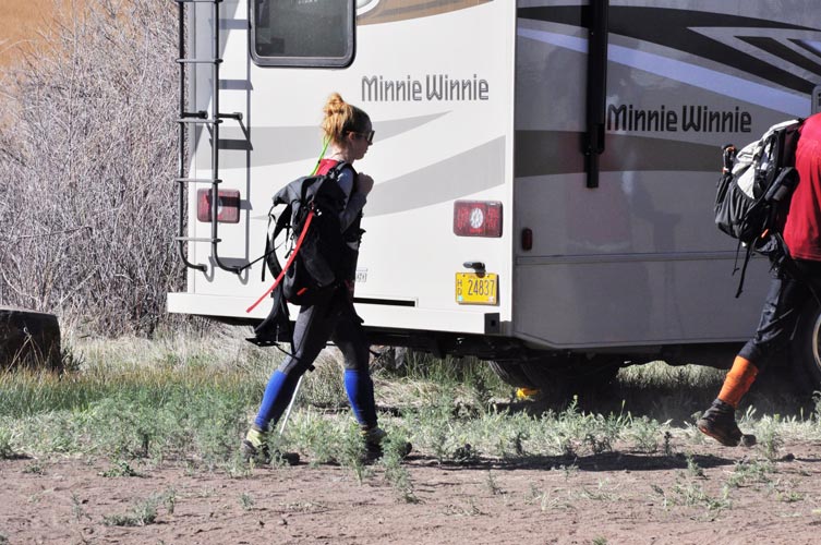
We transitioned to the next leg - a huge bike section. This meant taking off the paddle gear, putting on bike gear, rolling up our boats etc and putting them in the paddle bags - sadly packing them wet, and taking the bikes out of the boxes and assembling them - putting on the wheels, pedals, and handlebars. We also had to have food for the next leg - estimated to take from 15 to 30 hours. We were planning to not sleep on this section so we took only the minumum space blanket and bivy sacks instead of larger heavier sleeping bags that would have made for more comfortable sleep. Then we headed off up the road. Before we even left the TA (Transition Area) I realized I had failed to bring my spare batteries, oh well, my spare headlamp had spare batteries - but wasn't as heavy or as bright. For the rest of the night I kept my headlamp on low for the uphills and only went to a brighter mode for bushwhacking and downhill riding. Fortunately my batteries did last all night.
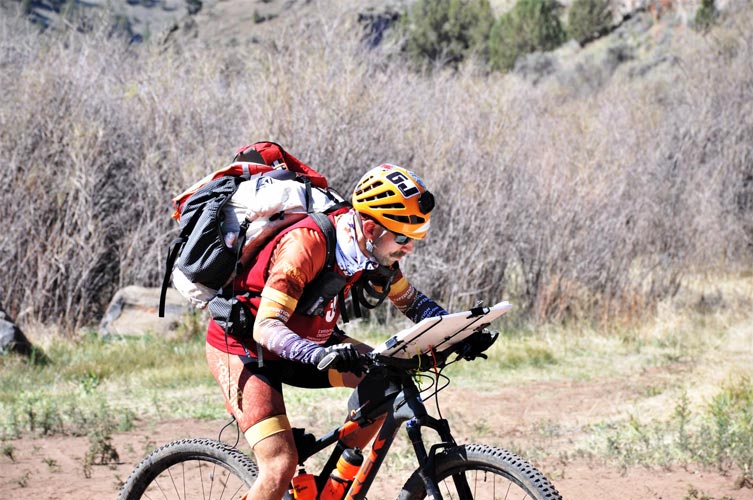
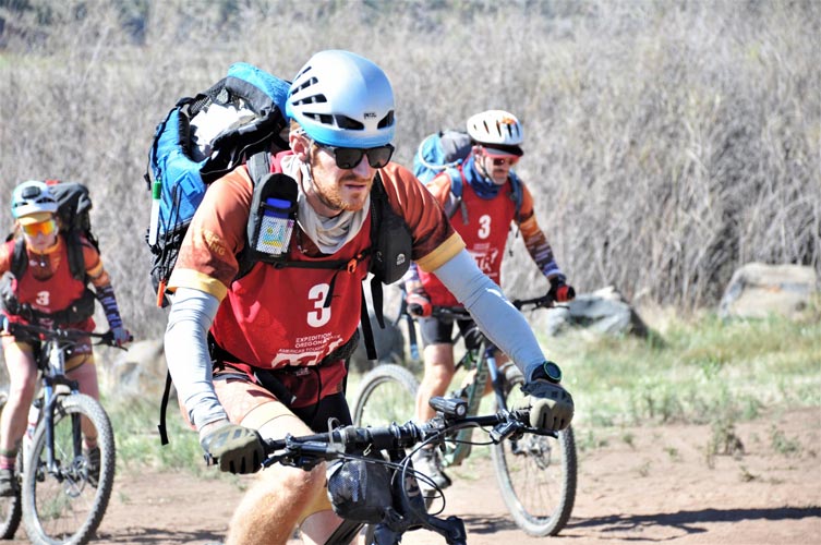
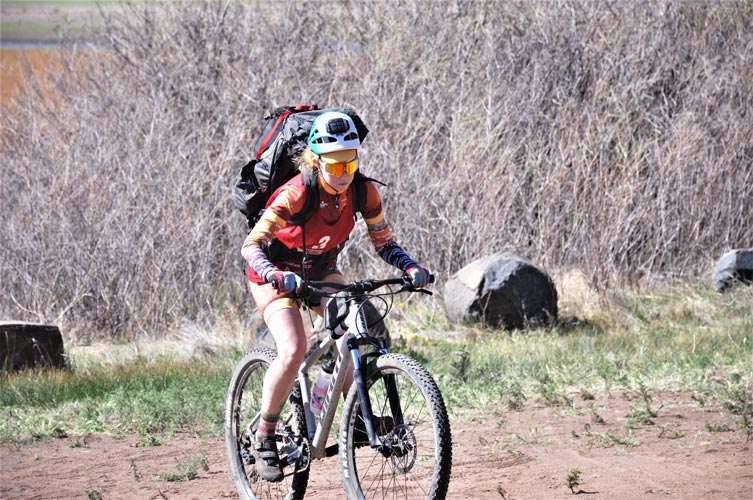
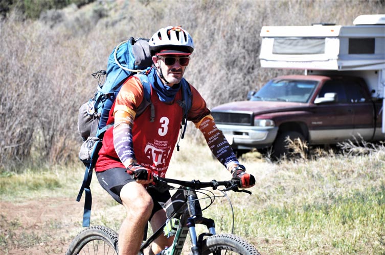
Soon we turned off the paved road and started up a long relentless uphill dirt road. It was rideable the whole way, but sometimes got so steep that it was nearly the same speed to walk it and that allowed us to use different muscles. We were in a group of 3 or 4 teams taking turns passing and being passed as we worked our way up the mountain. It was getting cold, but as long as we were working our way uphill we were not cold. As soon as things leveled off and we started through the woods to avoid some private property we needed more layers. After the first CP we headed down a hill and needed even more insulation. We all got a little cold on our first big descent and I was definitely glad to have my warm gloves and balaclava. We continued on through the night going up and down various roads. At the worst I could barely keep up, and at the best I felt pretty solid just rolling along. The bike I was using was full suspension 29er - so a little heavier on the uphill, but probably a little more stable on the downhill, especially when going over washboards or potholes (as long as I remembered to unlock the suspension). It was also a 1X9 I think, so didn't have as low a low gear or as high a high gear as I am used to with a 3X7 or whatever my usual bicycles are. The hydraulic disk brakes were very welcome though. It also had flat pedals so I could just wear my running shoes - maybe a little less efficient for the riding, but a lot nicer for the hike-a-bike and truly terrifying downhill (of which there was very little and was mostly walked).
Things continued like this through sunrise (with a little break on a paved road just before sunrise), but then after another CP we started up through the woods pushing the bikes. It was a very steep trail. That was the theme for much of the rest of the day - pushing the bikes up steep hills. I don't think the distance pushed was all that much compared to the distance we were able to ride, but it was a whole lot slower so we seemed to spend most of our time doing it. There was one fun singletrack descent marred somewhat by a fair number of logs to lift the bicycles over. I probably would have descended a lot faster than we did - with perhaps disastrous consequences. After the next CP in the valley we got to walk our bikes up the next mountain. We passed and were passed by a number of teams as we leap-frogged our way up to CP7. That was brutal enough that we decided not to go for CP8 and 9 which were pro points and would have involved a fair bit of up and down and snow. We decided to head down a road marked on the map, but it didn't seem to exist, neither did the next 2 we tried to find. So we backtracked to a saddle and tried to head down the slope through the woods but we lost our nerve and weren't sure where we were or if there would be a road below us, so we backtracked down the trail we came up to a road we knew it crossed and followed that down to CP10 - which didn't seem that far from CP9, so we went to that and back to CP10 before a long road ride to TA2.We were getting mighty tired which made the downhills scary, so we took a 5 minute nap in the ditch. It was rocky uncomfortable ground but after moving some rocks out from under my hip and sticking my glove there I managed to be dreaming in under 5 minutes. At TA2 we pulled out our sleeping bags and took a 3 hour nap.
 |
|---|
 |
|---|
When the alarm went off it was still dark, but we got up and put our bicycles away and packed for the next leg - treking and packrafting. Fortunately we didn't have to start out carrying all our paddle gear. We got water at the spring right outside of the TA and then headed off down the trail at about 5 am as it started to get light. We overshot the turn onto a mostly non-existent trail but realized the mistake at the next intersection and were able to back track to our route and get the next CP, then we just started heading cross country. Somewhere along this trek we spotted a large bird (sooty grouse?) sitting on a nest. It fled, but we could see 13 brown chicken sized eggs sitting there. We crossed a few logging roads of various qualities along the way, and then dropped down another steep slope to a stream for the next CP. Then we worked our way up onto some old lava flows that were smooth enough that they looked like flowered meadows from a steep angle but more like gravel lots with sparse plants looking straight down on them. In any case they were easy to travel on and quite scenic. We picked up a few more CPs and then ended up following the wrong ridge to the wrong road (it was on the wrong side of the stream, so we knew something was wrong, plus there were lots of mosquitos). Fortunately there was a road junction here so we could identify our location accurately and we were able to cross country to the next CP without too much effort. Then we headed down the road. We had a moment of panic when we realized we had lost our passport where we kept track of what CPs we had been to. We backtracked and found it after a few frustrating and worried minutes. Then we continued down the road to CP17.
 |
|---|
 |
|---|
 |
|---|
At CP17 we picked up our packrafts and got a warm meal. We also were trying to hurry to get through the paddling section before it got dark. We inflated the boats and got on the much smaller river and headed downstream. Almost immediately we were grounded on rocks. This was the theme of the river for the rest of the way to CP18. We were in and out of the boats and walking along the shore and back in the boats. At one point I slipped on a rock and landed on my back on another rock, luckily the pfd took the blow. We tried some different strategies like stacking the boats and having one person wade with them, or having one person push each boat and the other 2 walk - I think that was mostly the fastest. There were a number of other teams ahead of us that we passed on the way. Most decided to pack up their boats and just hike, which might have been a smart move, but we got to CP18 before them. This was the "scariest CP in AR history" according to Jason and involved scrambling down a steep ridge above the river. Only one person on each team had to do it and since it involved scrambling that was my job. We decided before I headed up to the CP to pack up our boats and hike. While I was getting the CP which was on some scary loose rock but not so scary because were were on 2 safety lines, one on autobloc and one clipped with a 'biner. Then we headed off walking down the river, which was probably mostly paddleable at this stage. We had to wade back and forth across to avoid the cliffs on the outside of each meander, but it was rarely more than upper calf deep where we crossed. As it got dark navigation became more of a pain, and also where we were was less clear as the large looping meanders ended. We continued on downstream crossing back and forth across the river as needed - or bushwhacking through the brush on the side. Finally we got to the takeout point and CP19. There we put on what dry clothes we could - or at least squeezed as much water out of our wet socks and filled up on water before setting out up the road.
This was another long night of trekking and looking for CPs in the dark. We did a pretty good job of finding the first one, but got completely confused on the next one. What should have been an easy case of finding a creek and following it to a junction turned into a weird wander on a moonscape with only a shallow drainage. Finally we figured out where we were on the map and got back on track. The next CP wasn't that hard to find although it was farther than we thought it would be. Then another hike following a bearing up over a hill and to a road. This trek was probably where I had the most "sleepmonsters" during the race - hallucinations of things caused mostly be exhaustion and lack of sleep. These mostly consisted of things in the corner of my vision - seeming to jump out of the way when I looked at them - possibly weird shadows from the headlamps that my mind interpreted to be creatures. The most confusing for me was auditory things - I thought someone called my name, but nobody had said anything. We took a 10 minute nap before leaving the road to find the next CP. This one was in a gravel pit - full of water. With the temperature close to freezing, Jameson put on his drysuit and swam out to it at sunrise while Kellee slept on the angular cobbles. The next CP involved another bearing cross country and we miraculously were within about 50 feet of it when we got there. Then we had a little confusion about where the road down to TA3 was, but we figured it out and made it to the cow and calf infested area without incident (the ranchers had just moved their cattle up to the high country and the calves and cows were making a ruckus trying to find each other). There we took another 3 hour nap. This segment was the hardest on my feet - traditionally a vulnerable point for AR - since I had basically hiked all night on wet feet. My feet were not too bad though, and were able to dry out while I was sleeping.
 |
|---|
When I woke up (cooked awake by the sun) the others were up as well and we were informed that we couldn't leave (the race was a bit spread out and running behind for most teams). As we prepared for the next segment - biking, we were informed of a few options - continue as before but skip the O course (what we had already planned to do), bike ahead on the course skipping a portion, or bike straight to Prineville and end. We opted for the first option, and by the time we were ready we were cleared to go. We biked off and got water at a stream before heading uphill for a bit. We got a short break when a truck pulled up and asked where TA3 was. This bike seemed a lot easier than the previous one although it still had some long uphills and was in the heat of the day, maybe we were just going more slowly, or had a tailwind, or were just hitting our stride. We kept moving fairly steadily but not all that fast on dirt roads with a few little hike-a-bike sections to get to CPs or connect dirt roads until we failed to find a trail on the map we planned to take down to the next TA. (later we found out this trail was never built, no wonder we couldn't find it). After that frustration we headed down a different way on a road to the TA4/5 (this was the TA before and after the O course, but since we were skipping that we packed up our bikes and went straight into the next stage, a long trek to the Crooked River).
It got dark shortly after we left and unfortunately our route took us up over a brushy bushwhacky mountain. Once we got up and over that we reached a road and managed to get to the CP fairly easily, then we headed over another recently burned ridge to another road and up that and up a drainage to the next CP at a spring. We weren't moving all that fast, but we were moving steadily past the next CPs taking us through a designated route through private property where we took another 10 minute nap - this time on comfy pine needles - but I was getting cold when I woke up so I don't think it would have been good to sleep a whole lot longer without at least using the bivy sacks. Then we had a long slog down to follow another road and then across a plain to a dropoff and windy point, CP37. Our plan from here was to drop down into the canyon and follow that downstream - sadly when we got there it was choked with nearly impenetrable brush. It was still dark so it wasn't obvious if this was a short term arrangement or something that would last for miles. We cut back up and across the hills trying to find an alternatate path. We took another short nap (10 minutes) as it got light and then we were able to see - we had a long way to go, so we got going. In hindsight we should have just slept on windy point until it got light even though there was frost on the ground (but we didn't know then what we knew after hiking to the valley bottom). The scale of the distance we had to go was larger than we at first thought. We also started seeing other teams looking for the 4wd road on the map. Eventually we found it and much later after some confusion and casting about we realized where we were and got to work getting to where we needed to be. We skipped CP38 - a pro point, but maybe it wasn't that far out of the way from here. We ended up side-hilling around a few peaks and on to CP39 on top of Skeleton Rock. Shortly after we arrived 4 or 5 other teams converged on this point from all directions it seemed. Then we dropped down to the east and across the lower reservoir to wade across the inlet river at mid belly deep and up to TA6. From the top of Skeleton Rock I could see a shallower crossing point that would have been nice had we been here in the middle of the frosty night, but then again we couldn't have seen it in that case.
 |
|---|
 |
|---|
 |
|---|
 |
|---|
 |
|---|
 |
|---|
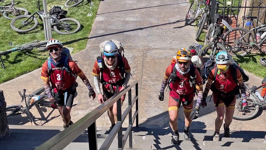
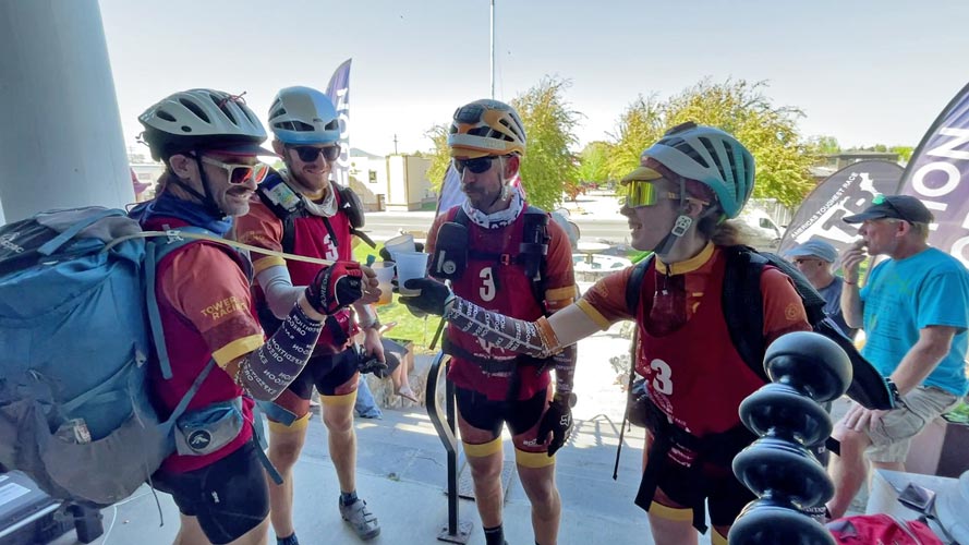
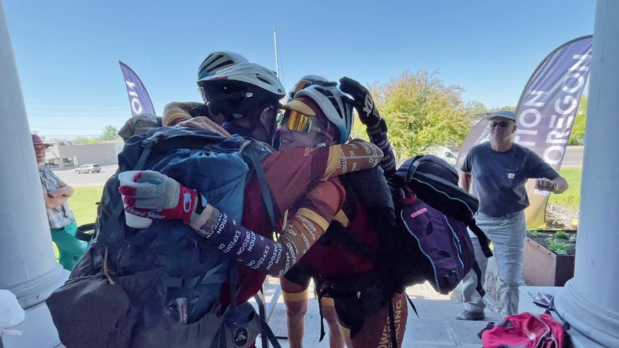
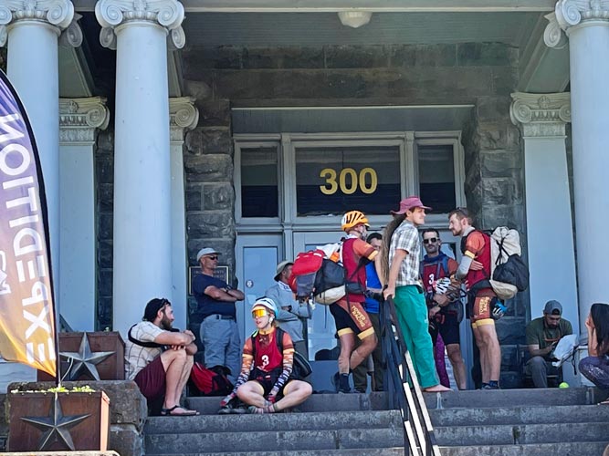
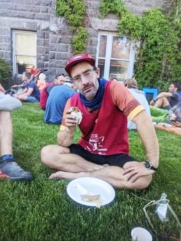
We realized that we could not paddle fast enough to complete the next section as planned and for some reason thought we could maybe bike to the shore to get the CPs along the paddle and then swim across the reservoir to get the one on the far side (perhaps being completely sleep deprived does impact your rationality). I had my doubts but didn't voice them that loudly. Then we headed off - the bike route was off limits according to the map, but we were going off-spec at this point anyway. When we got to a point where we would go down to the reservoir to get CP40 we realized that there was no way we could swim across, we also discussed that we had to get to CP44 and the rappel by noon - a little over an hour away. So we headed there, stopping at CP43 where we would have left the boating gear. Then we headed up onto the mesa where the rappel was. This was a long grueling uphill and soon we were walking the bikes - and then it got steep, ridiculously steep. It turns out we had gone up a not so great way, and when we got to the top we didn't really realize that and so we went to the wrong point, and then to another wrong point - but at least we could see the right point from here. By now it was well after noon, so we took a dirt road that ended up passing right below the rap and down a heinously steep ridge (for bicycling). I was bouncing my way slowly down it and crashed. That encouraged me to walk the rest. Then we were on pavement with a little over 2 hours to make it back to Prineville - it would be close for us to make the 25 miles in time. Sadly one of the first things we had to do was stop for water and doing mental math (hard on so little sleep) I thought it would be close but that we wouldn't make it by the 4 pm cutoff. I was pretty bummed but we would continue on as best we could - and we needed to get to Prineville anyway. I still had enough water, so while I was sitting on a picnic table the tiredness finally hit me. It never left. Especially when trying to draft - which meant following the bicycle in front of me as closely as I could to stay out of the wind. There was something about staring at a back tire that was not conducive to alertness. Jameson decided that doing intervals would help keep us awake - which may have been true, but could also be pretty tiring - depending on how far back in the draft order you were. I was in the back for a while, but then moved up to block the rather solid headwind for a bit. I think the final pavement was more like 20 miles instead of 25 miles. In any case we rolled into town around 3:30 and I realized with relief we actually were going to make it by 4. Soon we made it to the turn and then to the courthouse. We dropped the bikes and went up the courthouse steps to be greeted with a shot of whiskey (I passed). Then back down to rest in the grass and talk to others (and find ticks on me). Then we were fed burritos.
 |
|---|
 |
|---|
 |
|---|
 |
|---|
After hanging around at the courthouse for a while we went to the hotel and I pulled the wet gear off of me and out of the paddling and bike boxes and bins. Then we soaked in the hot tub a bit and showered and got some much needed sleep. Unfortunately for Andy he needed to pack up a bit before he could go to sleep.
 |
|---|
The next morning I woke up much refreshed and continued packing things away. Fortunately things were mostly dry by now. I returned some borrowed gear and then after lunch headed to Bend. There I returned the bicycle and hung out with Jason and Chelsey and Sam and Raquel into the evening, It had been a while since we had all been together. Then I headed south for a few hours before going to sleep in the back of my truck under a soft drizzle.
The final drive back to Bishop was pretty uneventful but I was feeling more tired than I was the day before (probably because I was more active on Monday than Tuesday when I just drove). I drank a fair bit of tea and ate junk food and listened to an audiobook. Finally I made it.
So, what are my final thoughts on doing this race - first, I am pleased that I personally and the team did not have any race ending blunders, accidents, or injuries, and we were able to just keep moving. I felt like I had the skills going in, but I was a little unsure of my fitness, and having lived an eventful 53 years, I never know if something might stop working. We did have some mistakes in strategy, route selection, and navigation, but we managed to recover from them and keep going. In hindsight we should have skipped all the pro points and just tried to finish the mandatory race points. I don't know if that would have been enough to let us do it, but maybe. Our original goal was to finish all the pro points, and then we downgraded to just completing the mandatory points. We still completed the race, but were unable to do the bikerafting points after TA6. With 3 people that could navigate we probably should have traded off more often (before the navigator started to lose focus) and kept slightly better track of where we were. Many of our delays were due to things on the map not actually existing in the real world. I guess we should expect that from an Expedition Oregon race Jason puts on, but it does make the navigation harder. I was surprised how well I was able to function on not nearly enough sleep - as long as deep thinking wasn't required and I had a physical task to do. Maybe being tired also made me less likely to be curious or care about the navigating or strategizing. I don't know if sleeping more would have let us move enough faster the rest of the time to make up the difference, but quite possibly. I think in general my food and water intake was adequate. I got mildly dehydrated a few times but I never felt like I was very hungry or bonked. More easy to eat food would be good, also maybe a bit more savory food and less sweet stuff. It certainly would be worth getting the transitions a bit more dialed if I do this again. After the first 15 minutes or so I felt that I probably could have gone a little faster most of the time, - but only a very little. I guess that means I probably should have taken a little more weight and encouraged the others and myself to push the pace. I don't think I had enough extra energy to tow anyone for long. I also was trying to save some energy in case I faded later in the race. Even for really long races the fact that I am not all that fast (compared to the people that are really fast) takes a toll. I can keep moving, I can paddle, trek, bike, scramble, and bushwhack at a decent pace, but my default speed is not fast enough - especially if there will be a few errors and some rest needed too. I guess if I am going to keep at it I need to either train to be faster or resign myself to middle of the pack position (and/or suffer more).
As I type this the final results are still being calculated - my current best guess is closer to 15th now, but I am not sure what penalty they are applying for using the roads N of the reservoir and skipping those CPs and if it would have been better to actually completely skip CP43 and 44 and just bike straight to Prineville. Hopefully we will someday get the final results as well as the recipe that created them.
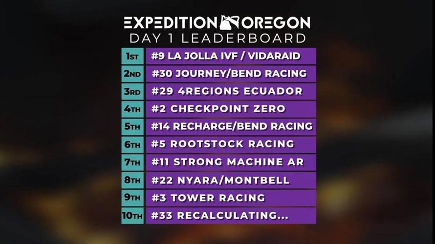
It looks like they have now finished ranking the teams - the top 5 are obvious - they did the whole race and it is ranked by time (although some teams got a time penalty for crossing through some private property), then things get a little more confusing. Basically teams were scored by how far they got through the race before they deviated combined with how many other points they got - pro points plus other checkpoints after where they deviated, so we ended up in 14th by going to TA6 with 4 extra points (the first 3 prologue points count as 1, pro points CP9 and CP18, and then CP43 after we deviated. We also got a time penalty for going onto the roads North of the reservoir between TA6 and CP43. On the tracking page it said we also got CP38, 40, and 44, but we just went close enough to them that the tracker registered them. The team closest ahead of us got to TA6 plus 6 points - although I think some of them might have also been registered by the tracker when they went close to them - eg CP40. There were 36 teams that started, and 28 finished in some fashion, the remaining teams either dropped out, had a team member drop out for some reason, or finished after the time cutoff.
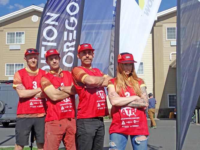
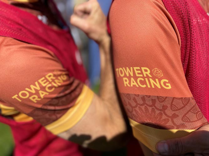
Thanks Tower Racing and Jameson for the opportunity to do this race and my teammates for making it such a good experience, thanks Jason and Bend Racing and all the volunteers for putting on a pretty amazing event, thanks to the media team for getting photos and video - of course I'd like to see more of our team, but just getting anything is pretty amazing. Finally thanks to the sponsors for the goodies.