This trip report of the 2014 Sierra Challenge is continued from 2014 Sierra Challenge Part 1.
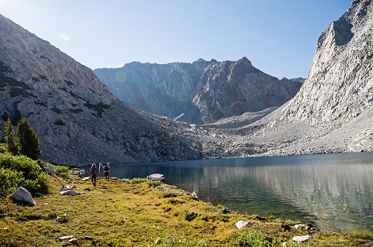
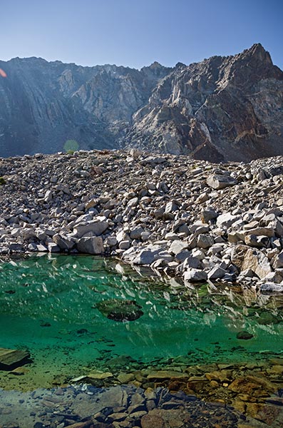
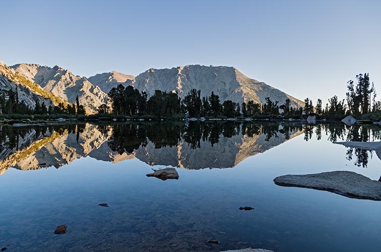
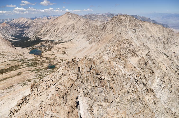
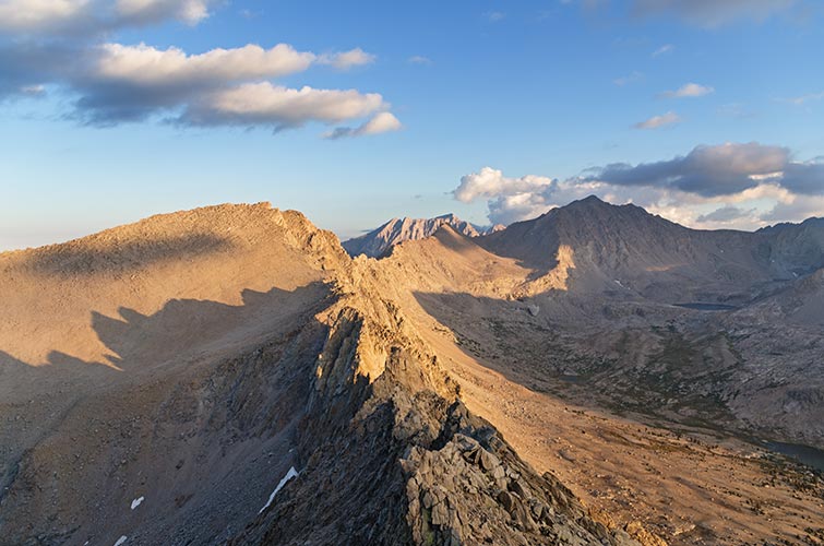
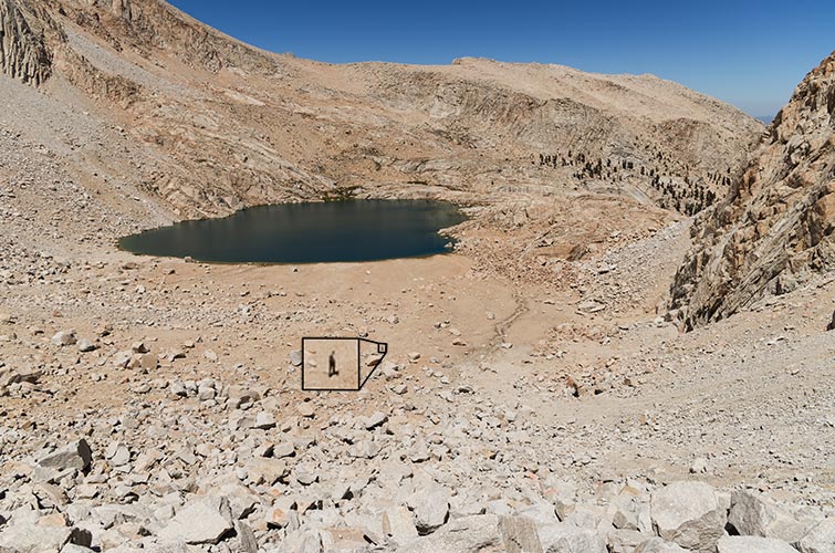
Taboose pass is always a bit of an undertaking. I was scared I wasn't going to make it to the trailhead on time, but I did. The 5 am start meant I got up pretty early though. My attempts to lead the pack and keep things at a reasonable pace didn't last long. I fell quite a bit behind but managed to rejoin the lead pack before they left the pass. We traversed around the west and south side of Striped Mountain and then past some gorgeous blue lakes into the basin below Striped South. It didn't look like any way up was very good. I ended up following Bob and others up a mostly solid bedrock chute for a while and then at the top cutting over into a lot of talus up to the ridge which was easily followed to the summit. Once again I was lagging on the upper ascent but made it there before the leaders left. I followed Eric towards Striped Mountain. This was mostly decent but loose ridge traversing but I couldn't tell how hard it was going to get. Others dropped down to the east and west of this ridge. The route I picked (Eric was soon out of sight ahead of me) worked out ok, and I met Mason on the summit. We descended back towards the trail from the pass and met up with Alex who is a sheep researcher and was tracking them with radio gear. We all descended to the trailhead.
| |
|---|
 |
|---|
 |
|---|
 |
|---|
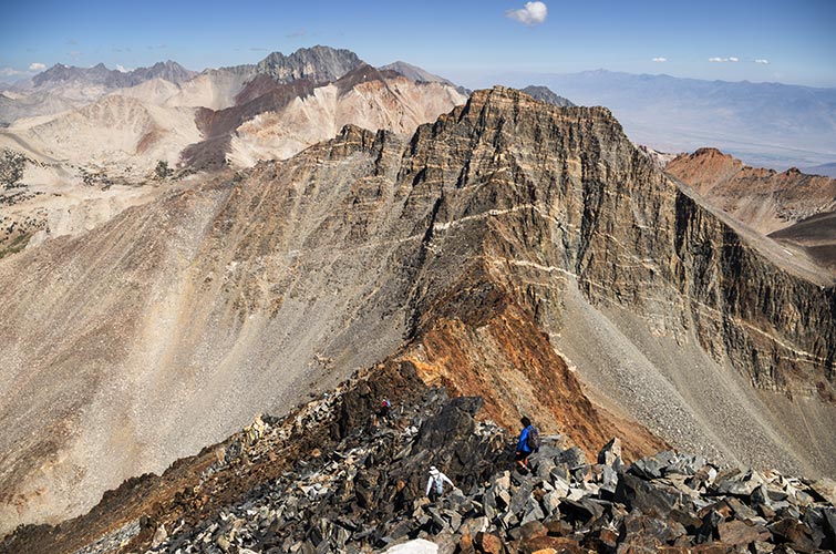
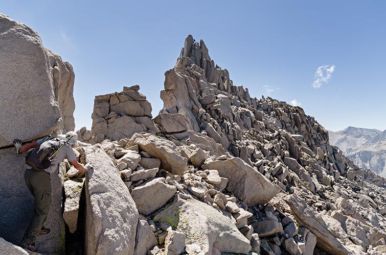
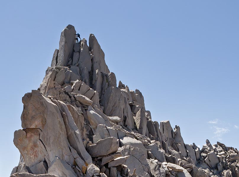
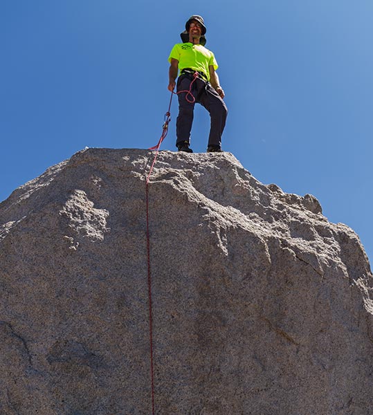
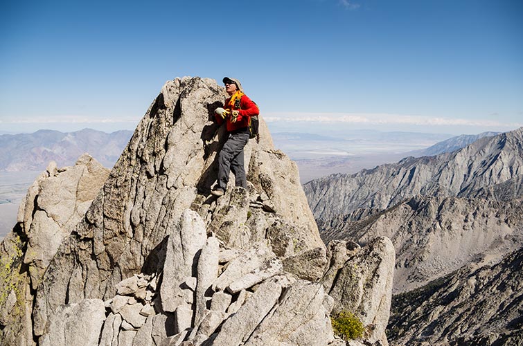
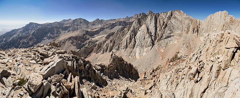
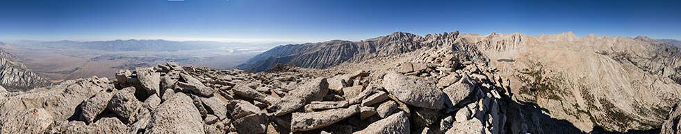
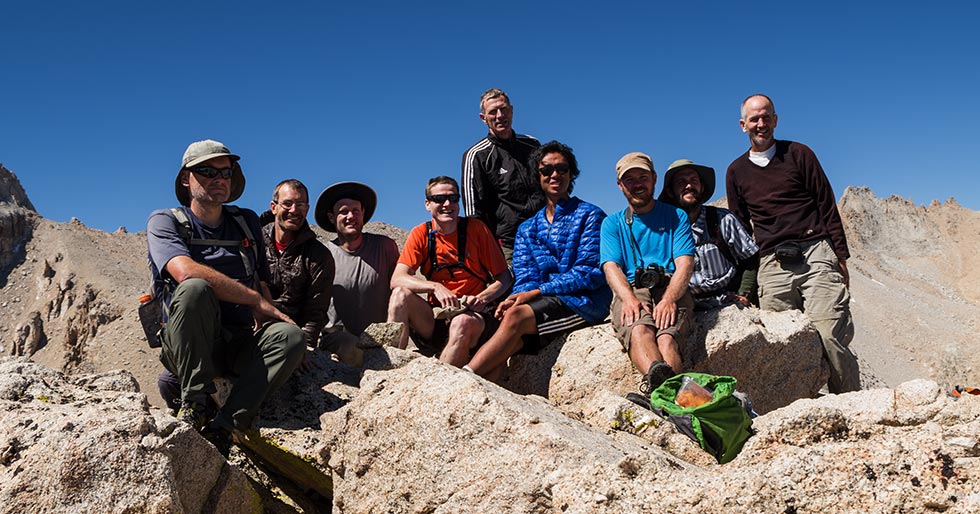
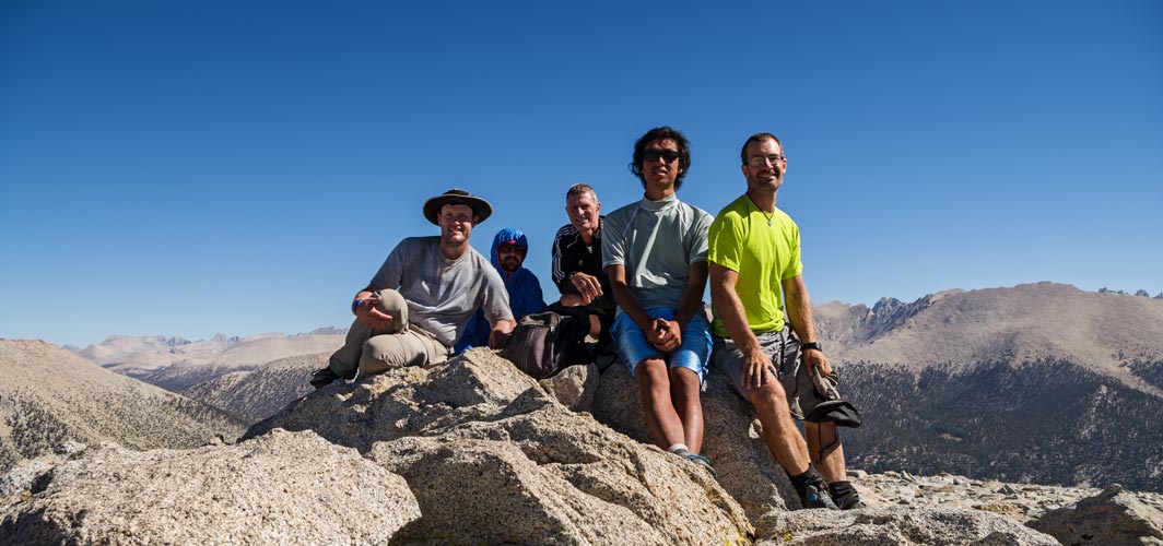
There was a little confusion about this days destination, but it all cleared up eventually. After a 6 am start from Onion Valley we powered up over University Pass. Mostly that wasn't too bad, but the descent to the south was pretty loose. That was ok for descending and we spread out to avoid knocking rocks down on each other. Then there was a very scenic and pleasant jaunt through center basin and then a long talus slog up towards the destination. Originally we thought the bat pinnacle was separate from the peak, but they were actually the same point. I hit the ridge too far north and had to follow it a bit up to the summit. This featured a little 5th class to get to the actual top. Bob was going to do some fancy ropework to get up, but I said I'd try to climb up from the south side. This involved a lot of exposure, but didn't look all that hard. He set up a belay that would probably have saved me from dying if I fell, but I would probably get hurt. I scrambled on up easily, it was maybe 5.6 R but the exposure on the east side was immense. Then I clipped into the somewhat old anchor on the top and belayed up whoever wanted to make it. I should have put on more layers before I went up because with the wind I was getting pretty cold. I then downclimbed and we all went about our way. For me that meant traversing north along a long ridge to Bradley Peak with Jeff Moffat. From there we continued along the ridge but had to drop down into the wrong drainage and then ascend the other side to an un-named and not even a bonus peak (that was quite nice - lit up with the last rays of the sun). From there it was a short traverse to University Pass and we descended that before it got truly dark. Then we had a long bit of talus and the descent to Robinson Lake before we got to the trail. We weren't exactly lost - but we also didn't really know the best way to go. At one point we came upon 2 lawn chairs on a rock, so we sat down for a short break (then we saw the tent of the people that brought them up). Then on down to the lake and the trail back to Onion Valley. I actually felt pretty good for most of this day, but with the descent and gain from Mt Bradley and finishing well after dark it was still exhausting.
 |
|---|
 |
|---|
 |
|---|
 |
|---|
 |
|---|
 |
|---|
 |
|---|
 |
|---|
 |
|---|
We powered up the trail towards Mount Whitney before cutting off towards Boy Scout Lake and then up to Gamblers Special. The valley leading up towards Carillon was very scenic. Someday I'll have more time and energy and head up there. There was some nice scrambling up the SW side of Gambler's Special. It was far enough down to the plane wreckage that I didn't want to make the descent to check it out. Then Some lovely scree skiing and what started as a pleasant descent down the Carillon Creek drainage that turned quite unpleasant with lots of brush some of which was covered with rust colored powder that completely covered me. Eventually I got down to the climber's use trail and descended that to the main trail and back to the truck. This did make what could have been a quite short day a bit longer and more tiring though.
 |
|---|
 |
|---|
 |
|---|
 |
|---|
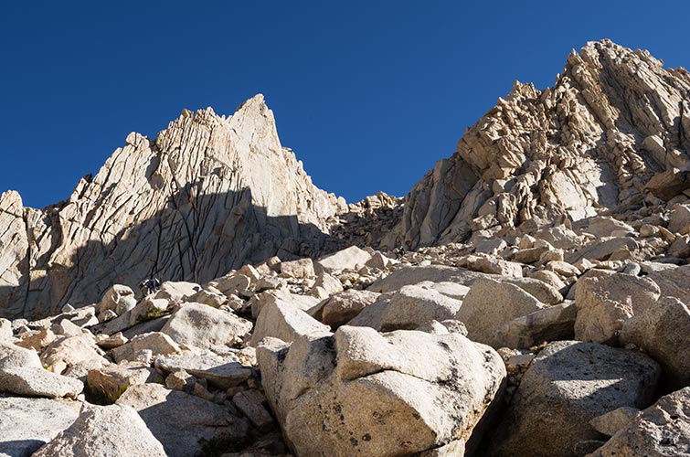
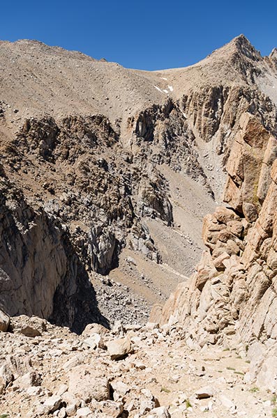
This was the last 6 am start, this time we headed up from the Meysan Lakes TH to the lower lakes before cutting up between the target peak and Lone Pine Peak. I fell behind in the interminable talus and also cut up farther west than I should have because I decided to follow everyone up Lone Pine Peak first. I didn't tarry long on the summit though and headed back across the plateau and towards the target peak. There was a little interesting scrambling on the way but it wasn't too bad. Then I decided to follow Bob and Jonathan who both headed down to the west separately. This proved a little interesting because as I descended I couldn't see what was below me (it kept getting steeper and so was out of view). I don't particularly like descending long ways not knowing if I'll have to go back up, but I only had to backtrack a little bit in the end. Then I just descended a lot of talus to Meysan Lake. I took a brief, cold, and refreshing dip in the lake and then headed down. Somehow the descent trails always seem a lot longer than going up, but I made it down in time to join the crew for pizza for dinner in Lone Pine.
 |
|---|
 |
|---|
 |
|---|
 |
|---|
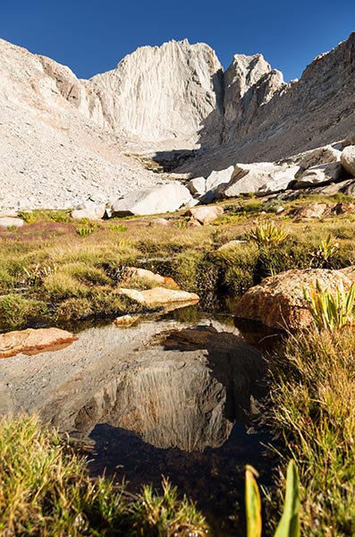
This was the final day and it was another long one. We started at 4 am in the dark. I had never hiked out of this trailhead before, and as it turns out I still have never been there in the daylight. Mostly this day was about distance, although there was still some 5,800 feet of elevation gain, it was spread out over 27 miles. I wasn't feeling 100% inside, and it turns out Bob was unable to even make it to the trailhead due to severe gastro-intestinal distress. Almost all of us were in a group 'til the final slope where I fell behind. I still made it up to the summit before anyone left. It was on the return that I just started feeling really lousy. So bad that at the base I was wracked with stomach spasms and projectile vomiting. Luckily I had my Leki treking poles which both held me up while vomiting and kept me moving all the way back. The other thing that was a little distressing was that there wasn't much water on this hike, combined with the relatively warm temps and vomiting, I was a bit concerned.
 |
|---|
 |
|---|
 |
|---|
 |
|---|